
First day that Yosemite National Park had reopened and I was ready to hike. The Park had been closed September 17 due to wildfires that had created terrible off the charts unhealthy air quality and on this first day back in, I had a perfect smoke free day to hike the Tioga Pass area, visiting 4 beautiful lakes.
Where: Yosemite National Park, Inyo National Forest
Distance: 8.57 Miles (about 4.6 miles if you only go to Lower Gaylor Lake)
Difficulty: Moderate
Elevation Range: 9,244′ – 10,433′
Date: September 25, 2020
Map: Falls Ridge Quad
Dog Hike? No
Day Use Entry Pass are still required for day use visitors from June 11th through October 31st and each private vehicle entering the park requires a reservation. I had mine and I could feel fall in the air as I drove across Big Oak Flat and Tioga Roads, with a few dogwoods sporting some red leaves. Yellow hues had replaced green leaves on other bushes and trees.
The trailhead (8,441′ elevation) to Lower Gaylor Lake is a bit of a challenge to find if you haven’t been there. I was driving east from Tuolumne Meadows and captured some mileage to hopefully help. Near the Tuolumne Meadows Stables, there is a crosswalk and the trailhead will be about 2 miles from that point on your left. About 1 mile later you will see some curves with a 35 mpg sign and you are now 1 mile away.
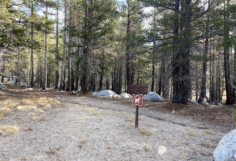
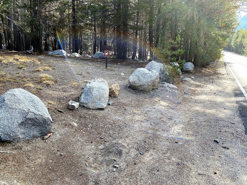 You won’t see a Trailhead sign along Tioga Road but you will see that the “No Dogs Allowed” sign at the trailhead. A small pullout at the trailhead can only fit two cars but there are other small small turnouts along the road in the area. If you look closely, you will also see how the trail extends across and below the road. You can also park at Tuolumne Meadows Lodge at the large parking areas there and take the trail from that point, adding a couple of miles to your hike.
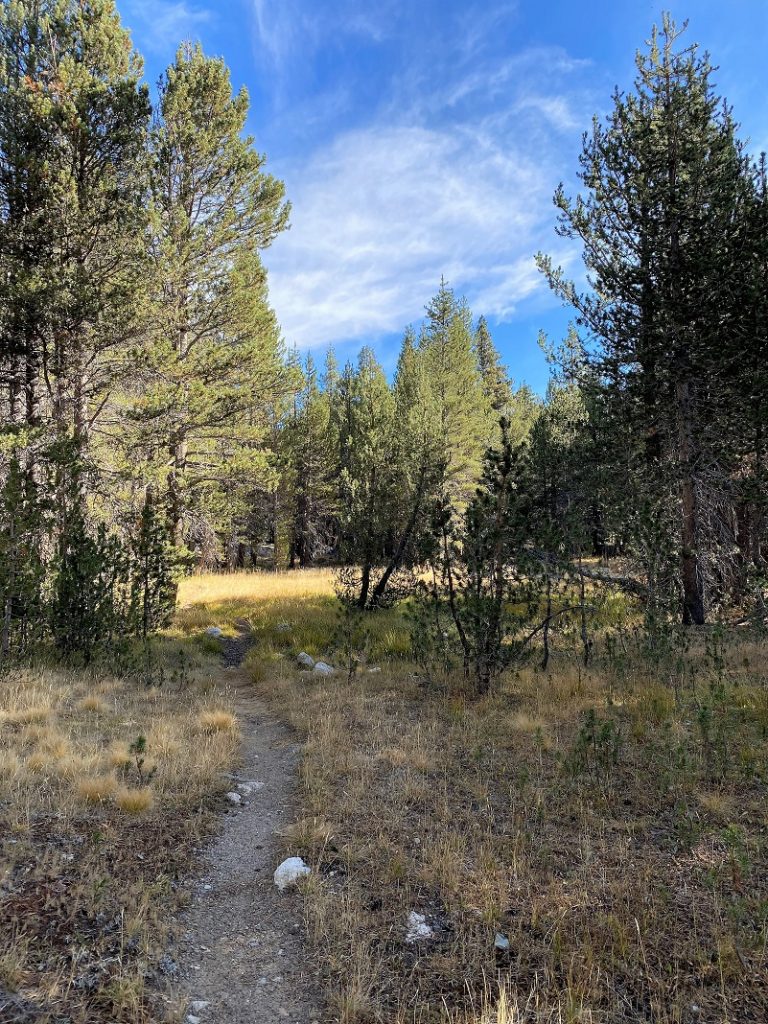
I headed up the trail.
As I walked, I imagined that Park Ranger Andrew Jack Gaylor must have made this ride on horseback up this trail from Tuolumne Meadows. The “trail” may have deviated a bit since that time but it was the same country that he rode and patrolled. He served in Yosemite from 1907 to 1921, dying of a heart attack while on patrol at Merced Lake. Gaylor Lakes were named after him.
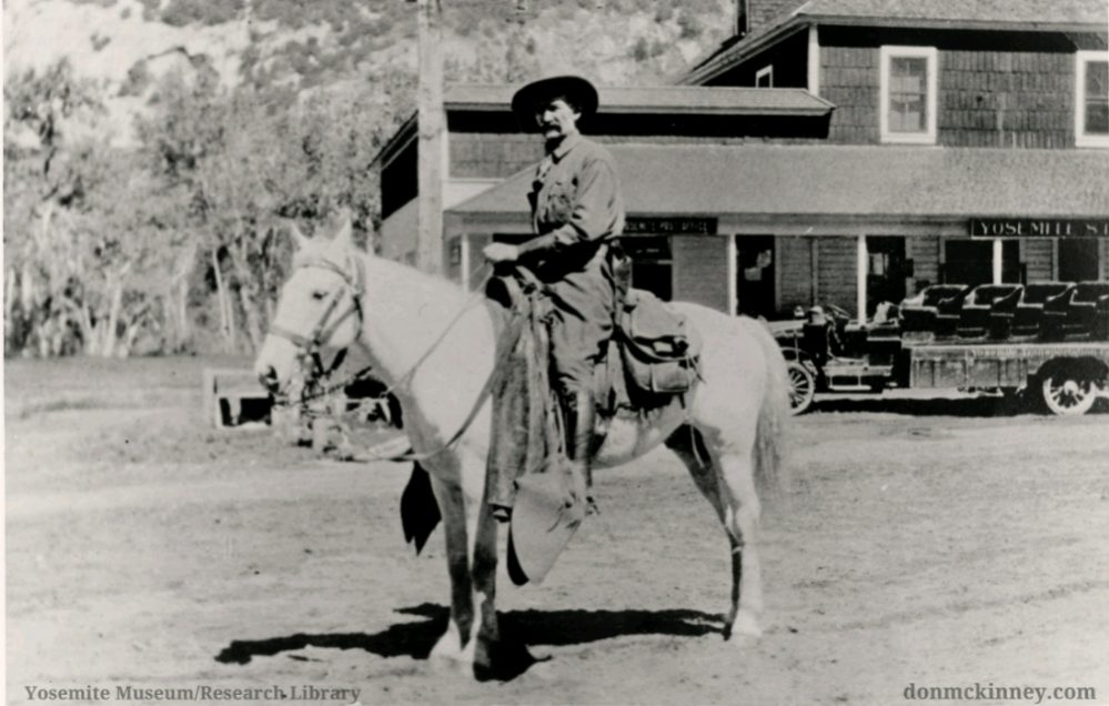
Jack Gaylor (Picture Courtesy of Yosemite Research Library)
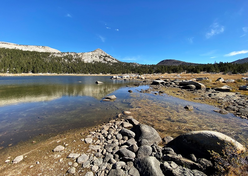
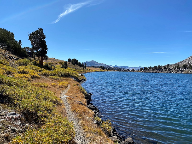
I soon reached Lower Gaylor Lake (10,056′ elevation) and explored the reflections. If you want to make this your final destination, you will have hiked about 2.3 miles and gained about 742′ in elevation. Of course, you will need to get back to your car so double that distance for your total hike mileage.
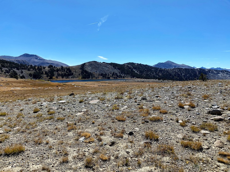
The day was young so I decided to head cross country uphill toward Granite Lakes. The small creek that flows out of these lakes was bone dry but once I reach the outlet (10,400′ elevation), beautiful reflections welcomed me.
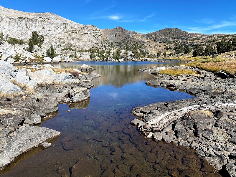
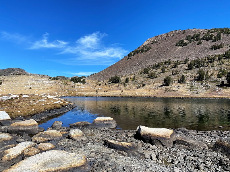
I followed the edge of the Lower Granite Lake until I hit the trail, then followed it up. Small trout, startled by my presence, would dart out in the crystal clear water to safety.

When I reached the upper end, I took a look back.
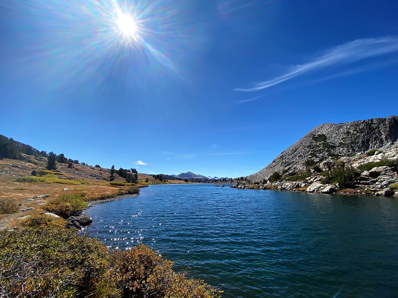
It was a short walk up to Upper Granite Lake (10,440′ elevation). No reflections, but very majestic with that rim along the northeast side.


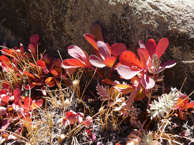
I started heading back down when I spotted some bright red, almost fluorescent color next to the rocks.

Following the trail along the lake, I then took off cross country toward Middle Gaylor Lake.
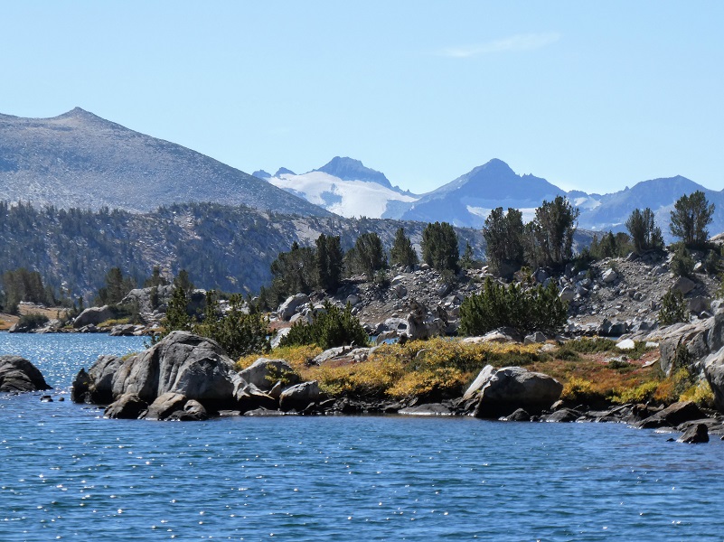
Middle Gaylor Lake (10,335′ elevation) is framed by the red colored Gaylor Peak (10,994′ elevation).

As I walked along the lake, I could see Mount Lyell (13,114 feet), the highest point in Yosemite. The peak had one of the last remaining glaciers in Yosemite, Lyell Glacier. The Lyell Glacier is currently considered to be a permanent ice field, not a living glacier. Mount Lyell divides the Tuolumne River watershed to the north, the Merced to the west, and the Rush Creek drainage in the Mono Lake Basin to the southeast.
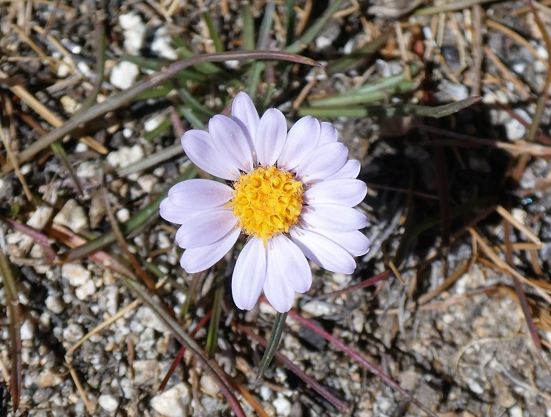
I headed cross country back toward toward Lower Gaylor Lake and the trail that I had taken in. Although the grass in the Gaylor Basin had turned brown, there were still a few small flowers blooming.

I didn’t see any other people on my hike but when the Tuolumne Meadows campground is open, this trail will get more use by both people and stock. Stock are allowed up to the Lower Gaylor Lake but not past that point. You can also access this area from the trailhead at the Tioga Pass entrance and prior Blogs linked below can give more information.
Dog Hike?
No, dogs are not allowed on this trail in Yosemite National Park.
Doarama:
What is a Doarama? It is a video playback of the GPS track overlaid on a 3 dimensional interactive map. If you “grab” the map, you can tilt it or spin it and look at it from different viewing angles. With the rabbit and turtle buttons, you can also speed it up, slow it down or pause it.
Lower, Middle Gaylor Lakes, Granite Lakes Doarama
Map and Profile:
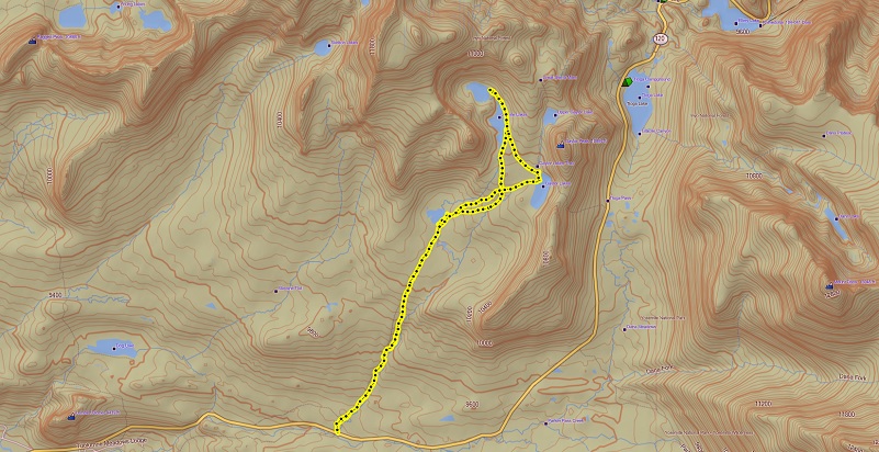
Lower, Middle Gaylor and Granite Lakes Topographic Map
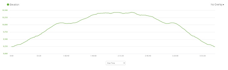
Lower, Middle Gaylor and Granite Lakes Profile
Sources:
Lower Gaylor Lake Yosemite National Park
Yosemite National Park Ticketed Entry
Yosemite: the Park and its Resources (1987) by Linda W. Greene
Prior Blogs in the Area:
Hiking From Tioga Pass to Gaylor Lakes, Dana City and Gaylor Peak June 30, 2020
Hiking From Tioga Road To Gaylor, Granite Lakes & the Old Mining Town Of Dana City October 8, 2019
Hiking Through July Snow To Gaylor, Granite Lakes & The Old Mining Town Of Dana City July 1, 2019
Hiking to Gaylor and Granite Lakes then up to the Old Mining Town of Dana May 29, 2018
Snowshoeing up to Gaylor, Granite Lakes and Dana City in July! July 5, 2017
June Snowshoeing up to Gaylor and Granite Lakes June 2, 2016
Hiking up to Gaylor & Granite Lakes and the Ghost Town of Dana City May 31, 2015
Cloudy Hike to Gaylor & Granite Lakes and the Ghost Town of Dana City August 11, 2014
Gaylor & Granite Lakes Snowshoe Hike May 8, 2014
Tuolumne Meadow to Lower Gaylor Lake Horseback July 19, 2013
Gaylor Lakes & Great Sierra Mine Hike: Part 1 October 12, 2012

