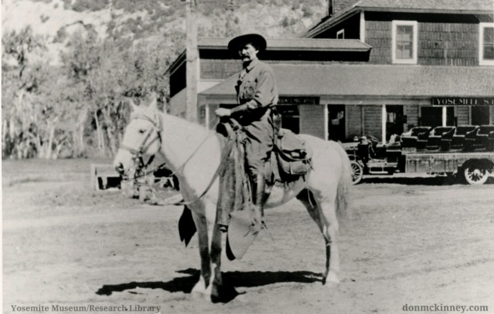
I hiked alone but I wasn’t by myself. I walked in the footprints of miners dreaming of hitting a huge ledge of silver, building a town in the Tioga Pass area at 10,760′ elevation to support their mining operations but that town was only there for about 4 years. Oh, and that part about not being by myself? Besides the ghosts of those miners, some of the local wildlife came out to pose for me along the trail.
A huge ledge of silver is said to run along the Tioga Crest, enticing many to search the area, hoping to strike it rich with their mine. The Sheepherder Mine was one of those mines, discovered and rediscovered. The community of Dana was one of those towns, said to have had up to 1,000 people living in it at the height of its short life of 4 years or so. Remains of a few stone buildings, a mine and lifting winch can be found as you walk in the footprints of miners long ago.
 Where: Yosemite National Park, Inyo National Forest
Distance: 5.6 Miles
Difficulty: Moderate to Strenuous
Elevation Range: 9,950′ – 10,983′
Date: June 30, 2020
Map: Falls Ridge Quad
Dog Hike? No
I had my passes and parked my car at the parking lot at the Tioga Pass East Entrance to Yosemite, which only had another car in it at 8:30 am. That is very different from past years but with the Day Use Entry Pass Reservation system, traffic and use are much lighter. Reservations are required for day use visitors from June 11th through October 31st and each private vehicle entering the park requires a reservation. The trailhead is right off of the parking lot and I headed up.
This trail is well used and gains about 500 feet in elevation in 6/10th of a mile. Much of the trail consists of granite stairs which are important elements protecting the trail when the snow is melting.
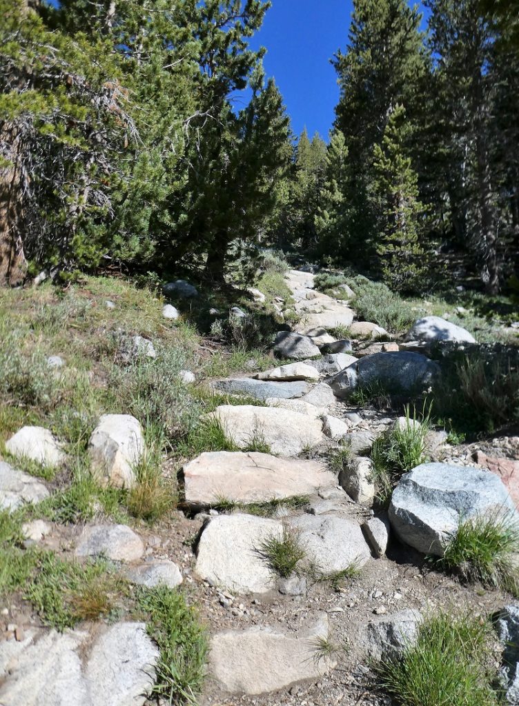
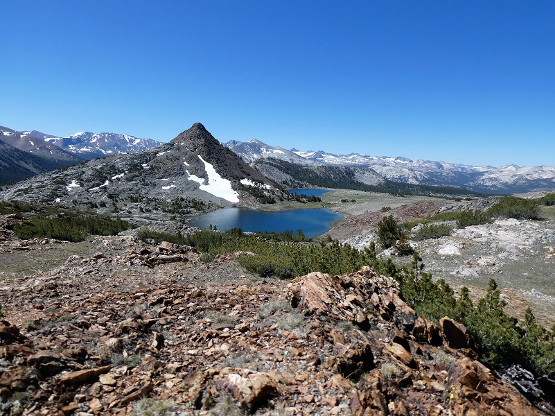
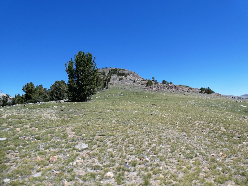
Ascending those granite steps soon brought me to the saddle below Gaylor Peak, chock full of views in all directions.
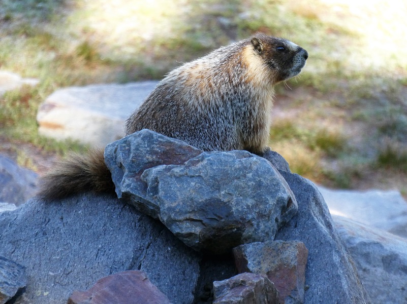
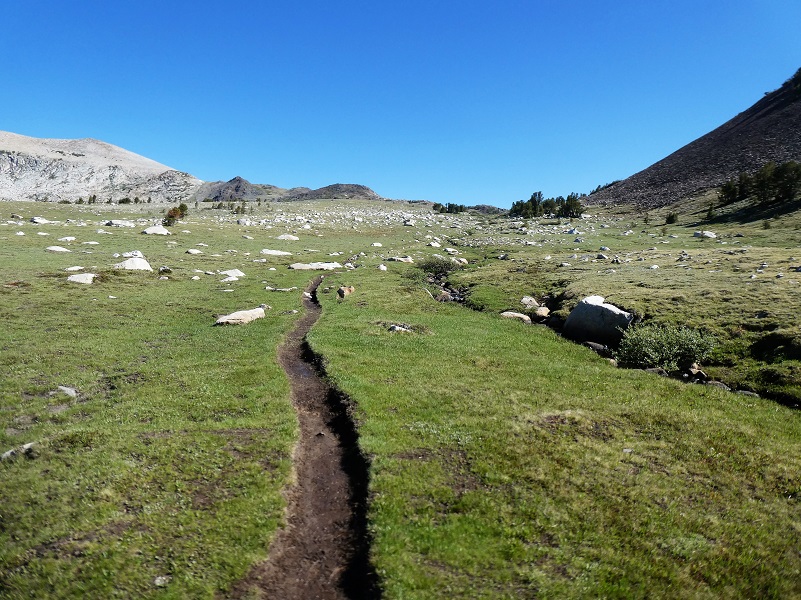
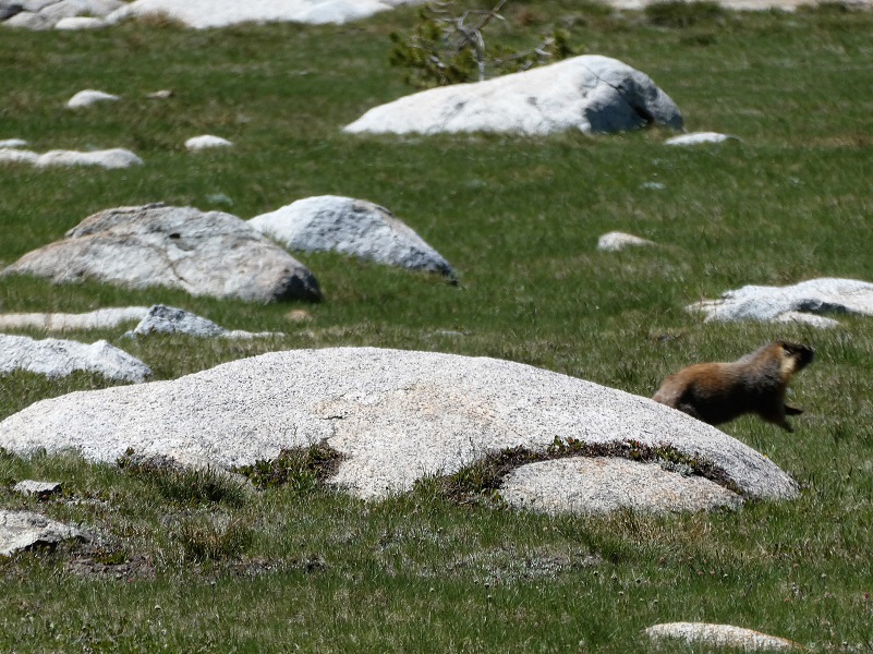
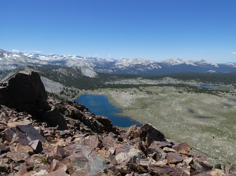
I followed the trail down toward Middle Gaylor Lake (10,335′ elevation), admiring the view of the lake then noticed that I was not alone in taking in that view. A Yellow-bellied Marmot was sitting on a rock looking toward the lake. They are rodents and usually inhabit open territory, such as steppes, alpine meadows, fields or pastures. They use talus and rocky areas for cover, and if possible they will usually build burrows under rocky areas. They can live in colonies, or as single or paired animals. Their basic social structure is one male with two or three females. Male marmots are territorial, and will aggressively defend their harem. The females are not agonistic, and will share the raising of offspring within the harem. Marmots are herbivores (folivores and granivores) and eat a wide range of plants, including grasses, forbs and flowers, as well as large numbers of seeds in late summer.
- short-sighted, but they have an excellent sense of hearing and smell, which enable it to find food and avoid predators.
- Yellow-bellied marmots are also called “whistle pigs” because they produce high-pitched sounds to warn other group members about a predator. Are you curious what they sound like? Well, here are a couple of nice videos with their chirping and screaming.

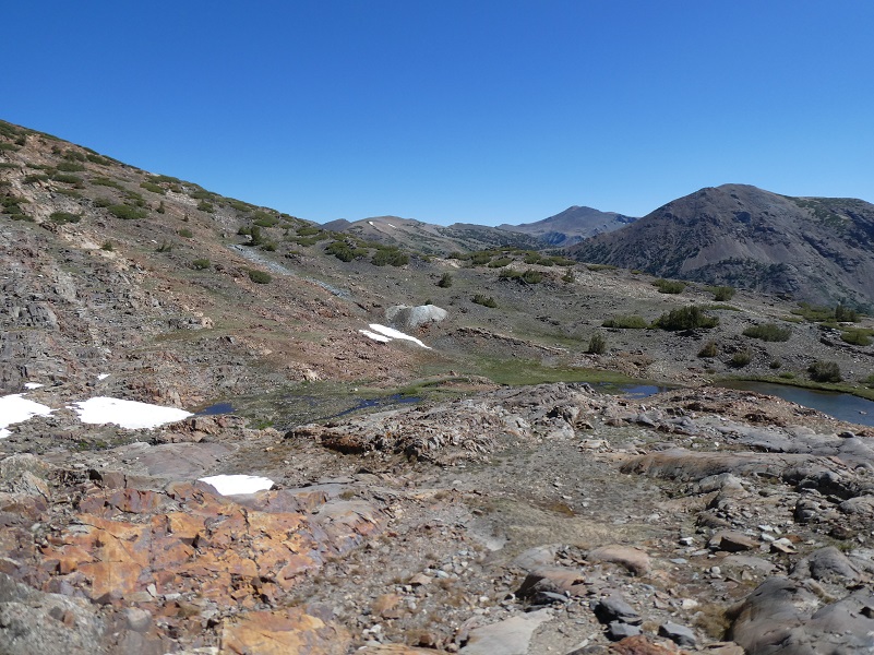
I followed the trail along Middle Gaylor Lake. Gaylor Lakes were named after Park Ranger Andrew Jack Gaylor who served in Yosemite from 1907 to 1921, dying of a heart attack while on patrol at Merced Lake. You can read more about him in my blog.

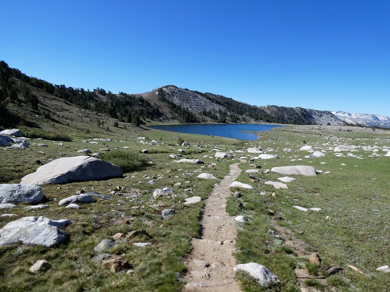
When I reached the inlet to Middle Gaylor Lake, I followed the trail up to Upper Gaylor Lake.

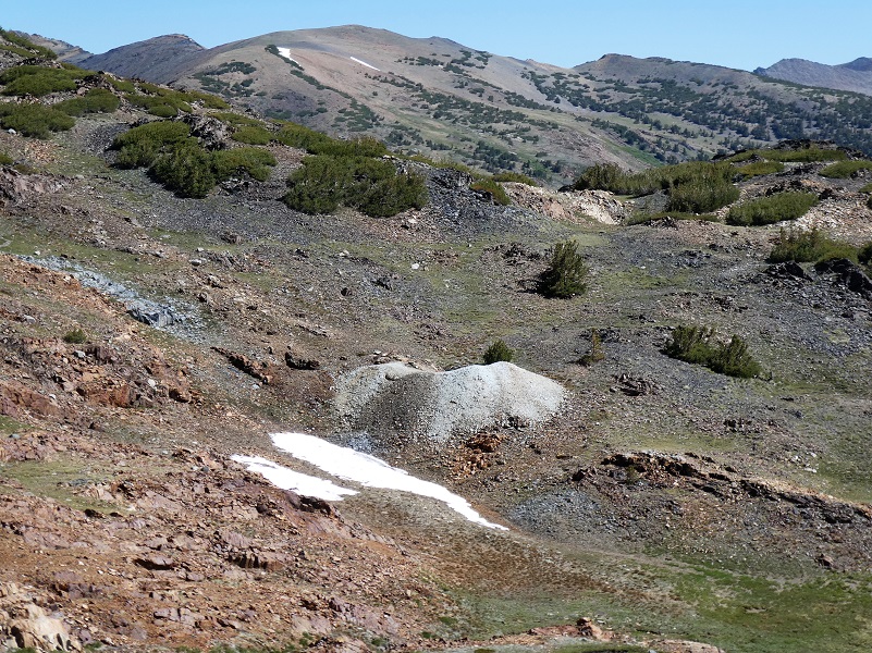
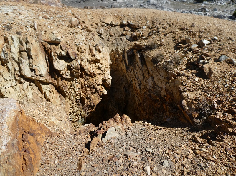
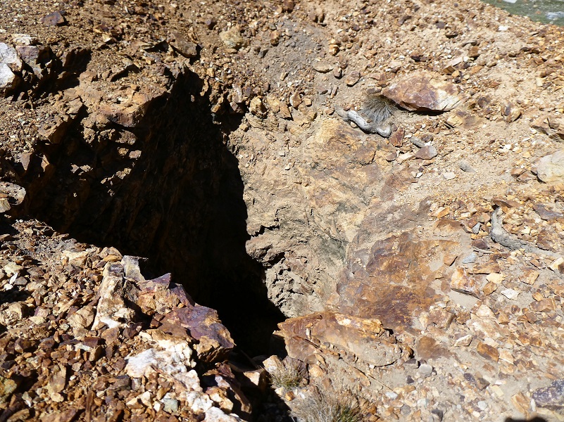
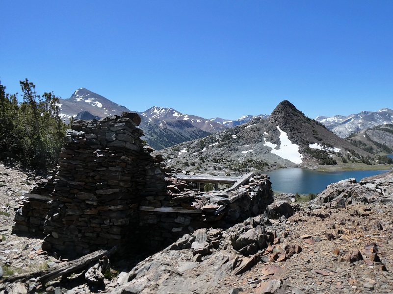
Each time I come up to the old mining town of Dana City, I take a little different route or circle around the town, always discovering new things about it. I find old diggings, mine shafts or building foundations and sometimes when I get lucky and part of an old tin can. The old mining town was known as Dana, (10,769′ elevation). As I looked at the remains of the stone structures and diggings, I thought of how this was a bustling place back in 1880 when it received a post office and is said to have had up to 1,000 people living in it at heyday. The post office was rescinded in 1882 and the focus on mining moved over to Bennettville and its growing town there. For about 4 short years the village of Dana rose up and then abruptly ended.
There are several tales told about the discovery of The Sheepherder Mine and this one is my favorite. I have previously shared this story from the 1958 book Ghost Mines of Yosemite by Douglass Hubbard about how the area got its mining start before but am doing it again because it is important to my route on this hike.
Early in 1860 Michael Magee, justice of the peace at Big Oak Flat during flush times in that camp, Captain A. S. Crocker, of Crocker’s Station, L. A. Brown, a surveyor, “Doc” George W. Chase, a dentist, and Professor Joshua E. Clayton of Mariposa were prospecting in the vicinity of Bloody Canyon. They camped near Tioga Pass to rest their animals and to look around. Clayton and Chase had been to the Mono Diggings the year before, and in returning home Chase crossed Tioga Hill and discovered the Sheepherder Lode.
He may have been the first human to see its immense proportions. He kept mum about his discovery except perhaps to Clayton, who assayed his ore. While the 1860 party was camped at Lake Jessie (called Tioga Lake today) at the eastern base of Tioga Hill, Doc Chase remarked that if they could spend one day more there, he would locate and claim “the biggest silver ledge ever discovered.” Next day, while the others remained in camp, Chase, armed with a pick and shovel and a small tin can, struck out northward at daylight and ascended Tioga Hill by about the same course as the trail which now leads from the Great Sierra tunnel to the old works of the company on the hill.
Reaching the Sheepherder Lode where it crosses a shallow ravine under a small lake, Chase unsoldered the can, straightened it out, and on the inner side scratched out his location notice with his knife. This he placed between two rocks on the massive croppings. Carrying as much ore as he could, he returned to camp. Next morning the party separated; Magee and Crocker returned to their homes, while Brown, Chase and Clayton swung around by Bloody Canyon to Monoville, where Clayton had his assaying outfit. Had they crossed Mount Warren Divide and come down Lake Canyon they may well have discovered the rich croppings which later became the May Lundy Mine.
At Monoville they were to test the Tioga ore and Clayton was to devise a plan for a smelting furnace. But simultaneously with their arrival at Monoville there came in some men who had struck rich rock at what later became Aurora, Nevada. They had come over to get Clayton to make some assays. These ran so high that forgetting “the biggest silver ledge ever discovered” Clayton packed up his assaying outfit and the three started for Aurora. All made money as they followed new strikes. None returned, yet they never ceased telling their mining friends about the “thundering big silver ledge” on Tioga Hill.
The news of a big silver ledge at the summit of the Sierra spread through Tuolumne and Mariposa counties in a short time, but soon passed into tradition amidst the excitement incident to the opening of the rich mines at Virginia City and Aurora.
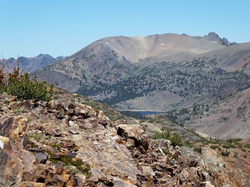
I believe this is that small lake above the shallow ravine that Doc Chase came up.

Last year, I explored the area near Tioga Lake and possible route that Doc Chase had taken as he traveled up toward Tioga Hill but it got a little wet and boggy along the small creek in a ravine and I quit the trail. This year, I explored from the top down. I think this is the shallow ravine that Doc Chase had followed up.

So what kind of information could I dig up on Dr. George W. Chase? Well, I think I found him on the 1850 census living in Mariposa, born about 1824 Maine. He listed his occupation as “Trader.” He is listed on the 1852 California Census, living in Mariposa, giving his birthplace as Summit County, Maine and a “Carpenter.” Other than that, I can’t locate him. I searched Ancestry, graves and California newspapers, including the Mariposa Gazette. He could have gotten married 1876 in Santa Barbara County. There was a George W. Chase killed by a Tuolumne County Sheriff’s Deputy in 1859. There was a George Chase that died in Napa County about 1875. There was a George W. Chase who filed homestead papers in 1892 San Bernardino. There was a George W. Chase, a manufacturer of vinegar, who was on the delinquent tax list after 1862. But the only two of these I have a warm fuzzy feeling is the George W. Chase on the 1850 and 1852 censuses. Maybe I will eventually find him, maybe not.
And here is how the Sheepherder Mine was rediscovered:
In 1874, as the story goes, 14 years after Chase’s discovery, the Sheepherder Lode was rediscovered by William Brusky, Jr., a boy from Sonora, Tuolumne County, who was tending a large band of sheep on Tioga Hill for his father. A rusty pick and broken shovel and the tin notice of location were found just as Dr. Chase had left them, except that the shovel had been almost destroyed by rust, and the location notice was illegible except the words, “Notice, we the undersigned” and the date 1860.
Young Brusky had heard of the tradition and had been keeping on eye open for the ledge. Elated as he was when he made his discovery, he was disappointed when he returned home with samples of the ore. This his father pulverized in a mortar, panned, and pronounced worthless. The following summer, 1875, Brusky sank a small hole in the ledge and procured some better-looking ore. But still no one in Sonora would take any interest in it until the winter of 1877 when someone assayed the rock and found it to be rich in silver. Then everyone wanted to be in on the find.
In 1878 Brusky again returned to Tioga Hill and on the second day of August located four claims of 1500 feet each along the Sheep herder Lode, naming them the Tiptop, Lake Sonora, and Summit. All of them were subsequently purchased by the Great Sierra Consolidated Silver Company. Young Brusky committed suicide on August 28, 1881.
Paralleling the Sheepherder Lode some 800 feet to the south is the ledge known as The Great Sierra. Among its mining claims are the Bevan, Ah Waga, Hancock, Atherton, and the High Rock. Perhaps the most important of these is the latter, site of the old village of Dana. Located originally by W. W. Rockfellow in October 1878 as the High Rock, it was later called the Mount Dana and finally the Great Sierra. Here, amidst unrivalled Sierran grandeur, stands a beautiful old stone cabin. Constructed of loose slate by an unknown craftsman, it is a masterpiece of dry-rock masonry. Its dirt-filled walls and heavy hand-made wooden door provided protection for many a miner when biting winds whistled across Tioga Hill. A few yards to the north of the cabin are other buildings, now in ruins, nestled around two shafts—on inclined prospect shaft or the white mother lode, and a double compartment shaft which had been sunk 100 feet when summit work was abandoned.”
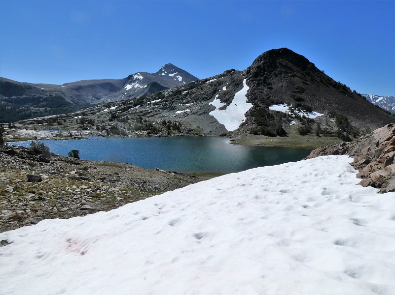
Many claims were staked around this area, bought up and consolidated. I spotted this mine across the lake but a snow bank made me getting over to it a bit tricky so I didn’t get there. I will return to explore it one of these days. I think I know what early claim it was part of but will save that for another blog. Just a hint, there are Gregory’s involved.
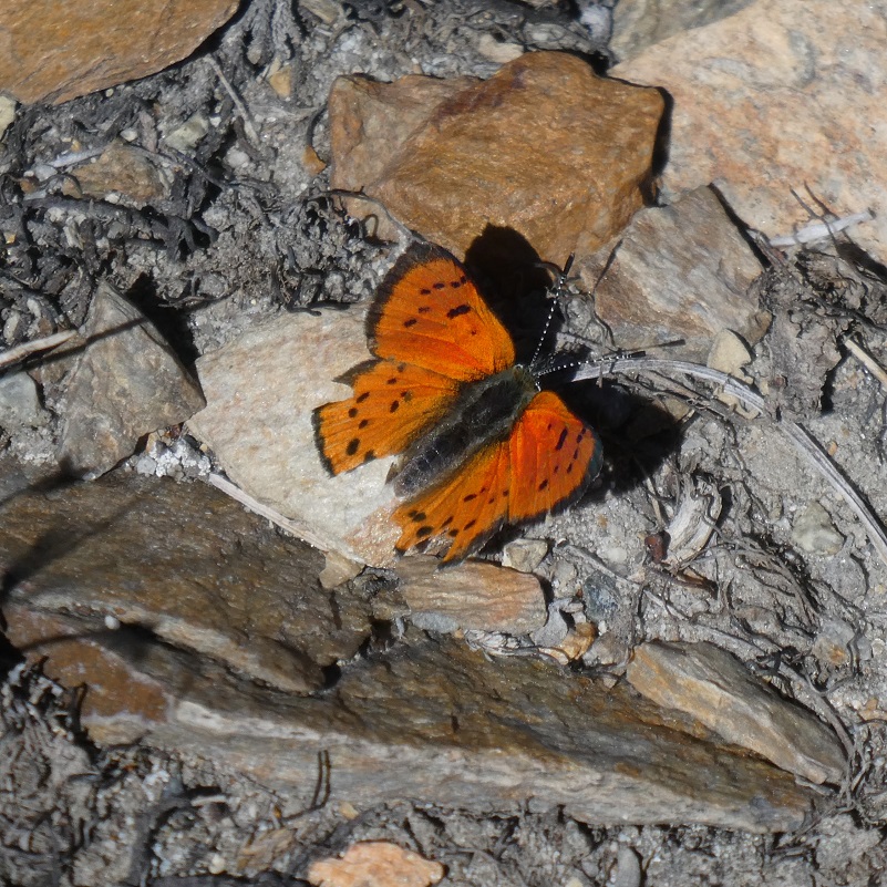
I wandered back toward the “main street” of Dana City and scads of these small butterflies had lit on the ground along the way.
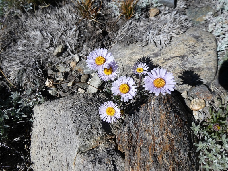
Small asters were also tucked in the rocks.
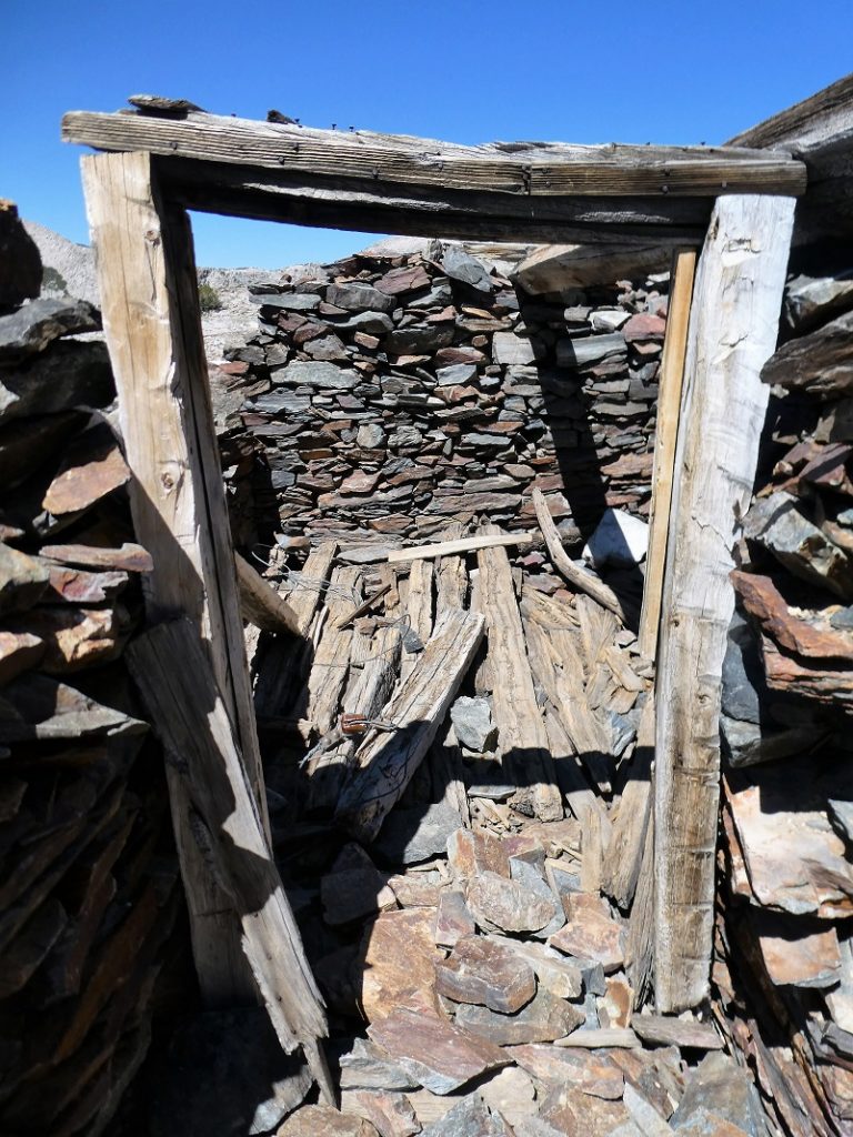
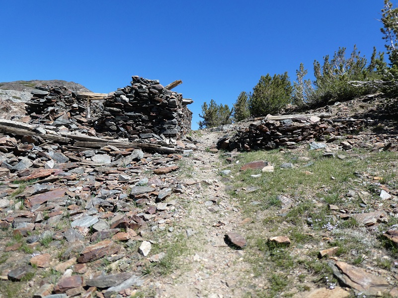
I swung wide and wandered along the sides of Dana City to explore old mines and diggings along the way. If you come up to check out these mines, please be extra careful. They go straight down and there would be no way to get yourself out of them. The ground near the edge is crumbly and could easily give way on you. Some even have old timbers lining the top parts of them.

I always need to stop by this old miner’s cabin.
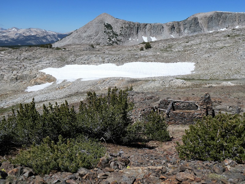


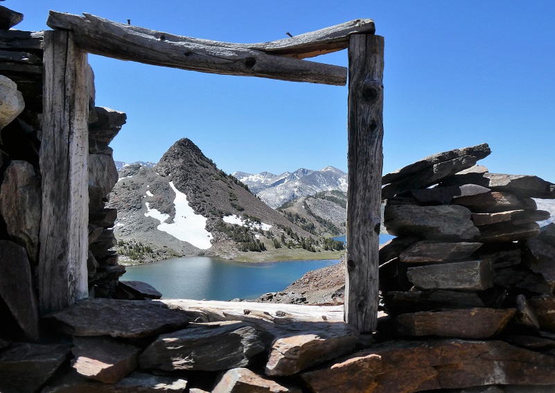
It doesn’t take much imagination to see why they put a window in this cabin with an incredible view of Gaylor Peak and Upper Gaylor Lake.

As I headed back down, I took a looked back up the trail that some miners might have come in on. Seeing that familiar view after climbing up the hill with their supplies must have been a welcome sight.
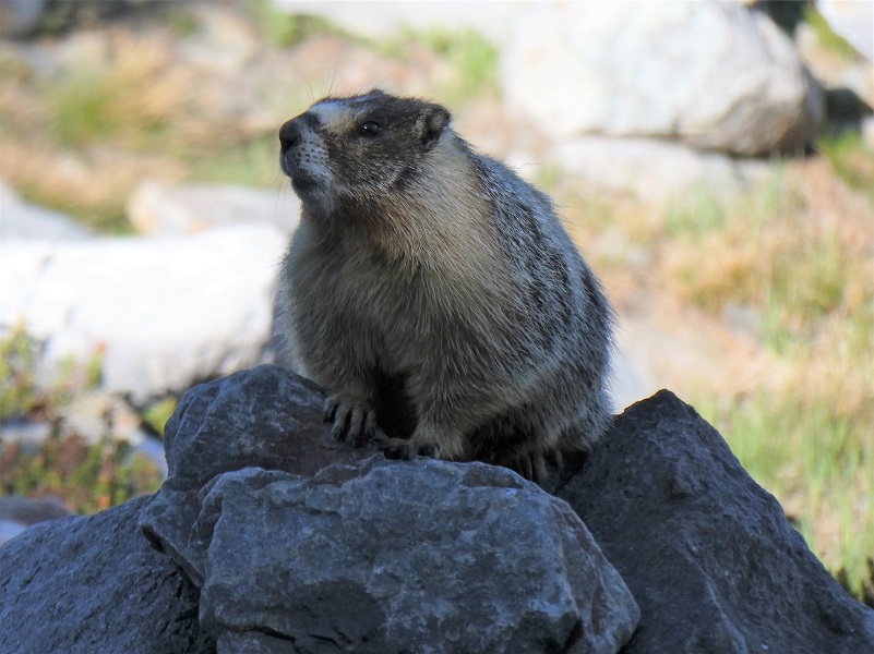
I followed the trail back down toward Middle Gaylor Lake, coming across another Marmot but this one wasn’t interested in posing for me.
Looking out the window of the old mining cabin at Gaylor Peak, I had an idea of where I would head next but wanted to gauge how I felt when I reached the saddle of Gaylor Peak. I was going to go for it and head up to the Gaylor Peak (11,004′ elevation). There isn’t an official trail to the top but if you head up there you can pick your way up on use trails or hug the trees when you can to make it easier through the rocks.
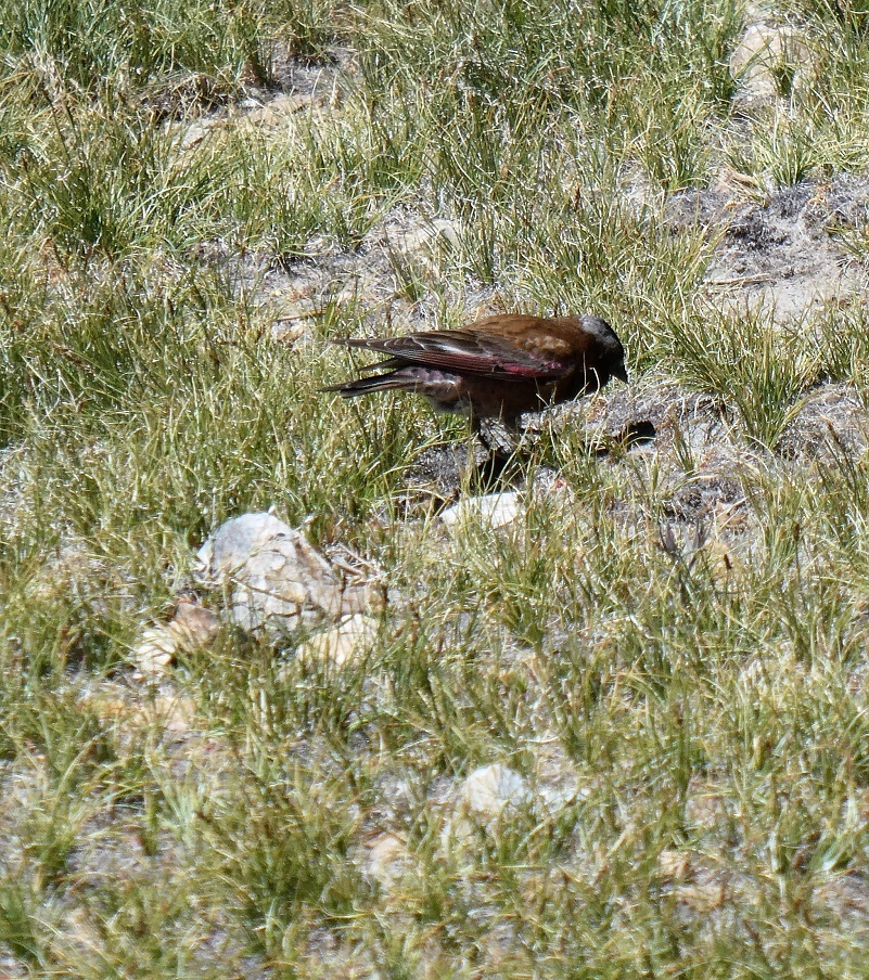
As I headed up I watched a black rosy finch feeding in the grass. They are found above treeline and are native to alpine areas in the western United States.
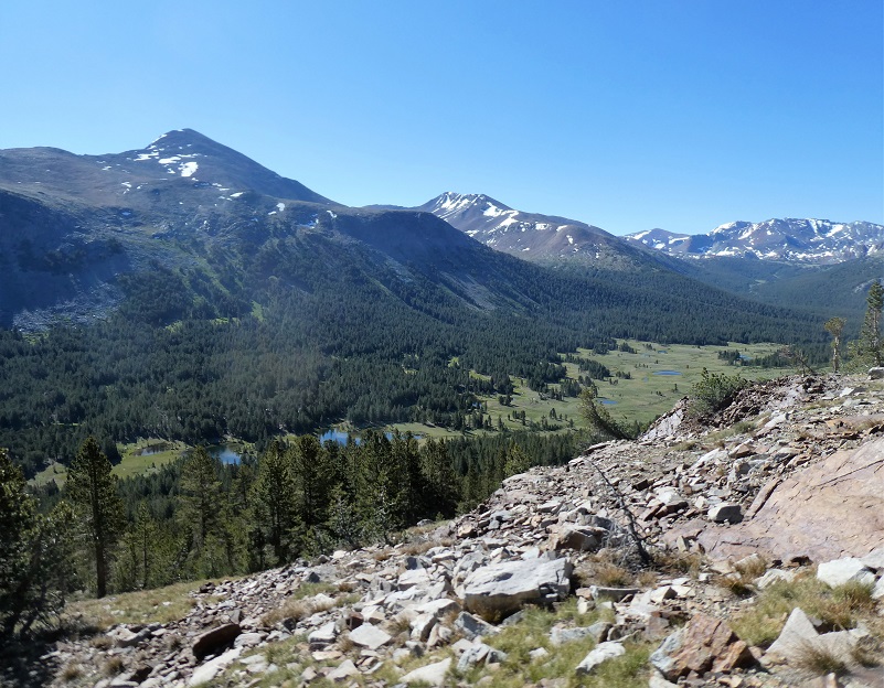
I reached the top and there were plenty of incredible views to be seen.
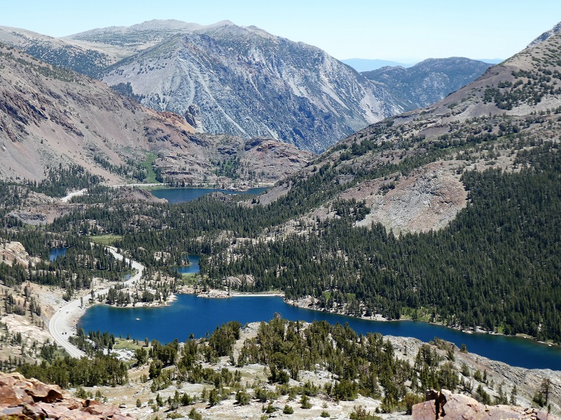
Tioga and Ellery Lakes

Granite Lakes
Middle and Lower Gaylor Lakes
Saddlebag Lake
After a good workout and visit to Dana City, I was ready to head down the trail and back home, reflecting on how I walked in the footsteps of Doc Chase and those miners with dreams of hitting the big silver ledge known as the Sheepherder.
Dog Hike?
No, dogs are not allowed on this trail in Yosemite National Park.
Doarama:
What is a Doarama? It is a video playback of the GPS track overlaid on a 3 dimensional interactive map. If you “grab” the map, you can tilt it or spin it and look at it from different viewing angles. With the rabbit and turtle buttons, you can also speed it up, slow it down or pause it.
Gaylor Lakes, Dana City, Gaylor Peak Doarama
Map and Profile:
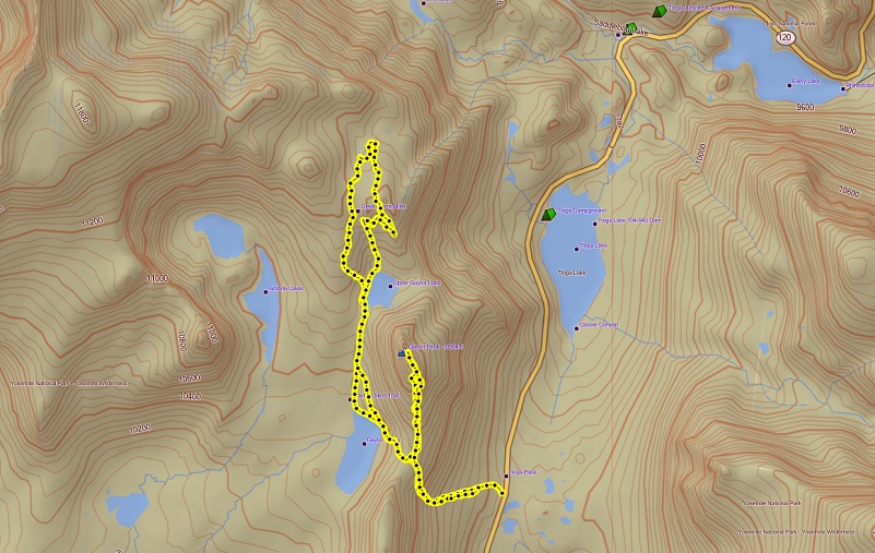
Tioga Pass to Gaylor Lakes, Dana City & Gaylor Peak Topographic Map
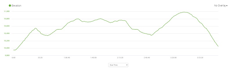
Tioga Pass to Gaylor Lakes, Dana City & Gaylor Peak Profile
Sources:
Yosemite National Park Ticketed Entry
Yellow-Bellied Marmot Animalia
Yosemite: the Park and its Resources (1987) by Linda W. Greene
Hubbard, D. H.,Ghost Mines of Yosemite, 1958, Awani Press, Fresno.
Patera, Alan H., Bennettville and the Tioga Mining District, 2003, Western Places, Lake Grove, OR
Prior Blogs in the Area:
Hiking From Tioga Road To Gaylor, Granite Lakes & the Old Mining Town Of Dana City October 8, 2019
Hiking Through July Snow To Gaylor, Granite Lakes & The Old Mining Town Of Dana City July 1, 2019
Hiking to Gaylor and Granite Lakes then up to the Old Mining Town of Dana May 29, 2018
Snowshoeing up to Gaylor, Granite Lakes and Dana City in July! July 5, 2017
June Snowshoeing up to Gaylor and Granite Lakes June 2, 2016
Hiking up to Gaylor & Granite Lakes and the Ghost Town of Dana City May 31, 2015
Cloudy Hike to Gaylor & Granite Lakes and the Ghost Town of Dana City August 11, 2014
Gaylor & Granite Lakes Snowshoe Hike May 8, 2014
Gaylor Lakes & Great Sierra Mine Hike: Part 1 October 12, 2012
Gaylor Lakes & Great Sierra Mine Hike: Part 2 October 12, 2012