A huge ledge of silver is said to run along the Tioga Crest, enticing many to search the area, hoping to strike it rich with their mine. The Sheepherder Mine was one of those mines, discovered and rediscovered. The community of Dana was one of those towns, said to have had up to 1,000 people living in it at the height of its short life of 4 years or so. Remains of a few stone buildings, a mine and lifting winch can be found as you walk in the footprints of miners long ago.
Where: Yosemite National Park, Inyo National Forest
Distance: 5.78 Miles
Difficulty: Moderate to Strenuous
Elevation Range: 9,949′ – 10,814′
Date: October 8, 2019
Map: Falls Ridge Quad
Dog Hike? No
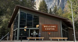
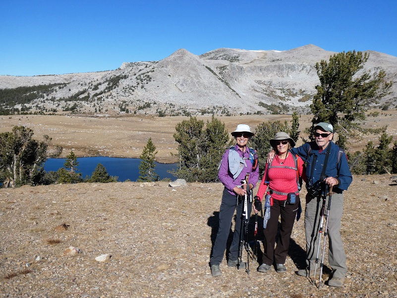
 We parked our car at the parking lot at the Tioga Pass East Entrance to Yosemite, utilized the nice clean restroom and headed up the trail.
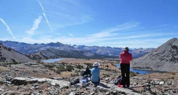
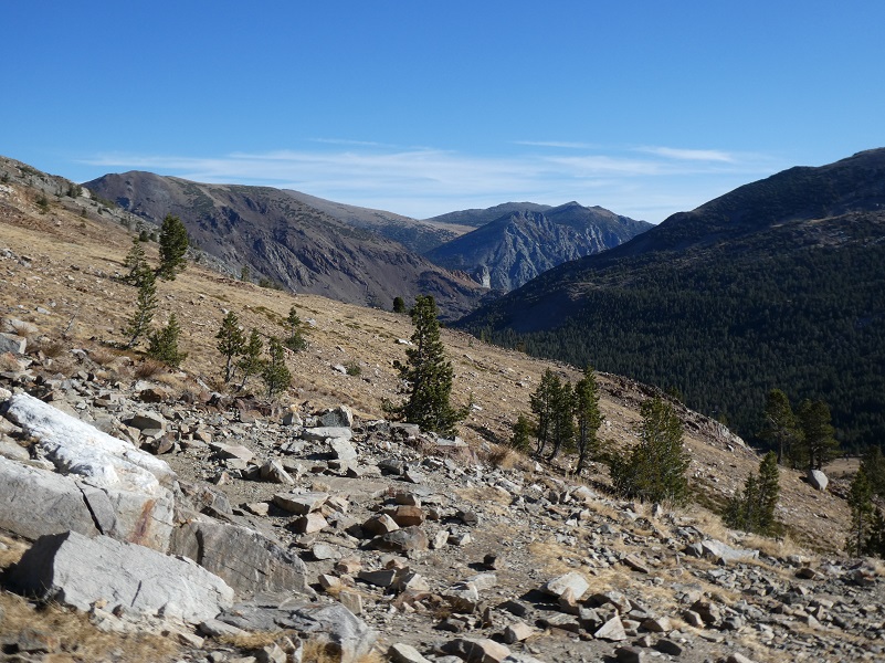
Just shy of a mile, we reached the saddle of Gaylor Peak, chock full of views in all directions.
We had a clear view of the routes that many people took to discover, rediscover and search for the silver. I could see the old mining area referred to as Tioga Hill, located about one mile northwest of Tioga Pass on the eastern boundary of Yosemite National Park. A band of white quartz runs along its crest and is known as “The Great Silver Belt.” This is the setting for the mining boom in the 1870s and 1880s that occurred in the area of Dana City. I have shared this story from the 1958 book Ghost Mines of Yosemite by Douglass Hubbard about how the area got its mining start before but am doing it again.
Here is how the Sheepherder Mine was first discovered.
There are several tales told about the discovery of The Sheepherder, most famous of these lodes. One goes like this: Early in 1860 Michael Magee, justice of the peace at Big Oak Flat during flush times in that camp, Captain A. S. Crocker, of Crocker’s Station, L. A. Brown, a surveyor, “Doc” George W. Chase, a dentist, and Professor Joshua E. Clayton of Mariposa were prospecting in the vicinity of Bloody Canyon. They camped near Tioga Pass to rest their animals and to look around. Clayton and Chase had been to the Mono Diggings the year before, and in returning home Chase crossed Tioga Hill and discovered the Sheepherder Lode.
He may have been the first human to see its immense proportions. He kept mum about his discovery except perhaps to Clayton, who assayed his ore. While the 1860 party was camped at Lake Jessie (called Tioga Lake today) at the eastern base of Tioga Hill, Doc Chase remarked that if they could spend one day more there, he would locate and claim “the biggest silver ledge ever discovered”. Next day, while the others remained in camp, Chase, armed with a pick and shovel and a small tin can, struck out northward at daylight and ascended Tioga Hill by about the same course as the trail which now leads from the Great Sierra tunnel to the old works of the company on the hill.
Reaching the Sheepherder Lode where it crosses a shallow ravine under a small lake, Chase unsoldered the can, straightened it out, and on the inner side scratched out his location notice with his knife. This he placed between two rocks on the massive croppings. Carrying as much ore as he could, he returned to camp. Next morning the party separated; Magee and Crocker returned to their homes, while Brown, Chase and Clayton swung around by Bloody Canyon to Monoville, where Clayton had his assaying outfit. Had they crossed Mount Warren Divide and come down Lake Canyon they may well have discovered the rich croppings which later became the May Lundy Mine.
At Monoville they were to test the Tioga ore and Clayton was to devise a plan for a smelting furnace. But simultaneously with their arrival at Monoville there came in some men who had struck rich rock at what later became Aurora, Nevada. They had come over to get Clayton to make some assays. These ran so high that forgetting “the biggest silver ledge ever discovered” Clayton packed up his assaying outfit and the three started for Aurora. All made money as they followed new strikes. None returned, yet they never ceased telling their mining friends about the “thundering big silver ledge” on Tioga Hill.
The news of a big silver ledge at the summit of the Sierra spread through Tuolumne and Mariposa counties in a short time, but soon passed into tradition amidst the excitement incident to the opening of the rich mines at Virginia City and Aurora.
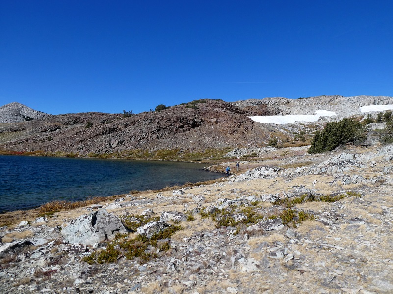
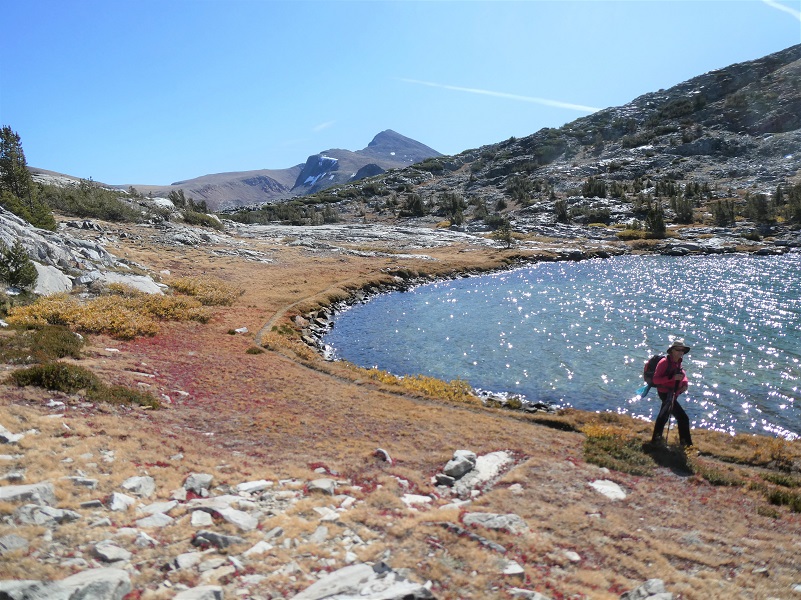
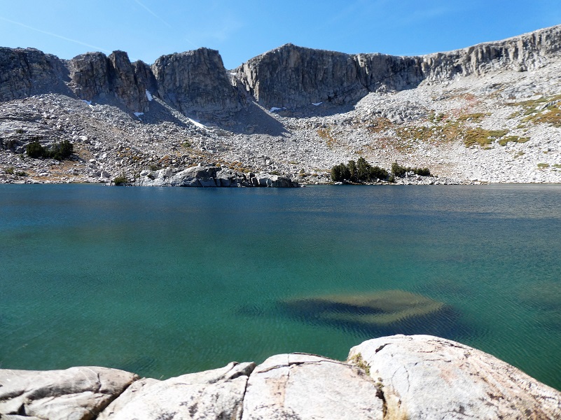
We descended on the trail and soon reached the shore of middle Gaylor Lake (10,335′ elevation), but the wind was up a bit so we didn’t have those killer reflections but it was mighty pretty.


Gaylor Lakes were named after Park Ranger Andrew Jack Gaylor who served in Yosemite from 1907 to 1921, dying of a heart attack while on patrol at Merced Lake. You can read more about him in my blog.
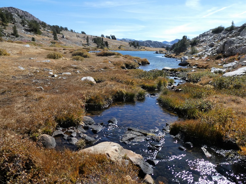
We walked along, taking it all in.

We headed to upper Gaylor Lake and walked around it counter clockwise. That is until we encountered an unexpected solid snow bank. We could have gone back a bit and down to the lake but decided it was better to slide down a crevice between it and the rocks. That snow field was much larger than I remember seeing for this time of the year and solid ice.


And it was a good spot to sit for a while and have a snack.

Photo by Debra Kincade
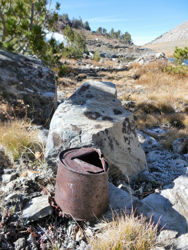
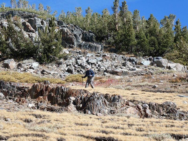
When we reached upper Gaylor Lake (10,512′ elevation), I wandered a bit high above that lake, exploring and trying to find old signs of mining activity. I found a old can.
We continued around the lake, the rest of my party hitting the trail up to the old mining town of Dana City.
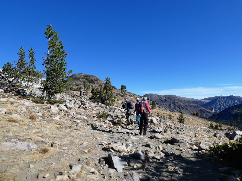
I decided to skirt south of the trail, swinging wide again to see if I might come across something I had missed on previous trips. I discovered some new views.

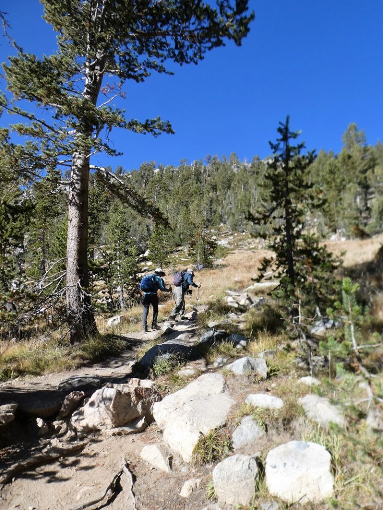
My hiking gang heading up the trail below Dana City.
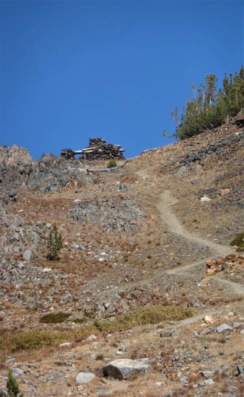
Photo by Debra Kincade

Photo by Debra Kincade
We reached the old mining town known as Dana, (10,769′ elevation). As I looked at the remains of the stone structures and diggings, I thought of how this was a bustling place back in 1880 when it received a post office and is said to have had up to 1,000 people living in it at heyday. The post office was rescinded in 1882 and the focus on mining was in Bennettville with its growing town there. For about 4 short years the village of Dana rose up and then abruptly ended.

And here is how the Sheepherder Mine was rediscovered:
In 1874, as the story goes, 14 years after Chase’s discovery, the Sheepherder Lode was rediscovered by William Brusky, Jr., a boy from Sonora, Tuolumne County, who was tending a large band of sheep on Tioga Hill for his father. A rusty pick and broken shovel and the tin notice of location were found just as Dr. Chase had left them, except that the shovel had been almost destroyed by rust, and the location notice was illegible except the words, “Notice, we the undersigned” and the date 1860.
Young Brusky had heard of the tradition and had been keeping on eye open for the ledge. Elated as he was when he made his discovery, he was disappointed when he returned home with samples of the ore. This his father pulverized in a mortar, panned, and pronounced worthless. The following summer, 1875, Brusky sank a small hole in the ledge and procured some better-looking ore. But still no one in Sonora would take any interest in it until the winter of 1877 when someone assayed the rock and found it to be rich in silver. Then everyone wanted to be in on the find.
In 1878 Brusky again returned to Tioga Hill and on the second day of August located four claims of 1500 feet each along the Sheep herder Lode, naming them the Tiptop, Lake Sonora, and Summit. All of them were subsequently purchased by the Great Sierra Consolidated Silver Company. Young Brusky committed suicide on August 28, 1881.
Paralleling the Sheepherder Lode some 800 feet to the south is the ledge known as The Great Sierra. Among its mining claims are the Bevan, Ah Waga, Hancock, Atherton, and the High Rock. Perhaps the most important of these is the latter, site of the old village of Dana. Located originally by W. W. Rockfellow in October 1878 as the High Rock, it was later called the Mount Dana and finally the Great Sierra. Here, amidst unrivalled Sierran grandeur, stands a beautiful old stone cabin. Constructed of loose slate by an unknown craftsman, it is a masterpiece of dry-rock masonry. Its dirt-filled walls and heavy hand-made wooden door provided protection for many a miner when biting winds whistled across Tioga Hill. A few yards to the north of the cabin are other buildings, now in ruins, nestled around two shafts—on inclined prospect shaft or the white mother lode, and a double compartment shaft which had been sunk 100 feet when summit work was abandoned.”
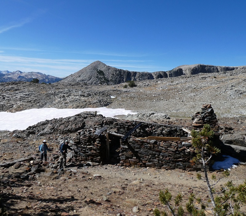
We wandered and explored the old rock buildings.

We decided to head cross country over to Granite Lakes but find a good view spot for lunch.

Time to head to upper Granite Lake.

It took a bit of working down through the rocks and shrubby trees.
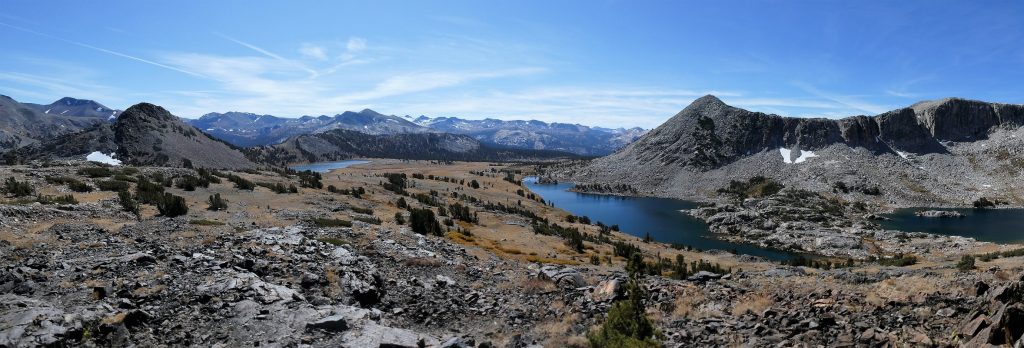
Upper Granite Lake (10,427′ elevation) was just beautiful.
I am not naming names, but one of us decided to take a quick dip in the icy cold lake.

We headed back down the trail that followed along middle Granite Lake.
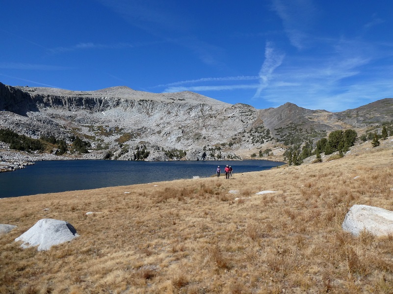
Then cross country back over to middle Gaylor Lake. What a view as I looked back to my hiking party.
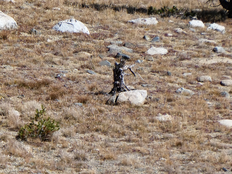
As I was waiting for my hiking buddies to reach me, I spotted something in the distance on a rock. Was it a marmot? Or maybe a coyote? I zoomed way in with my camera to discover a dead stump. Sorry, no cute critter pictures today.
This was a special hike because our friend Keith Sauer hiked with us. Although he has moved away from the area, he introduced all of us to amazing trails and country over the decades. We have had wonderful adventures with him and look forward to more.

Photo by Debra Kincade’s Camera
Dog Hike?
No, dogs are not allowed on this trail in Yosemite National Park.
Doarama:
What is a Doarama? It is a video playback of the GPS track overlaid on a 3 dimensional interactive map. If you “grab” the map, you can tilt it or spin it and look at it from different viewing angles. With the rabbit and turtle buttons, you can also speed it up, slow it down or pause it.
Map and Profile:
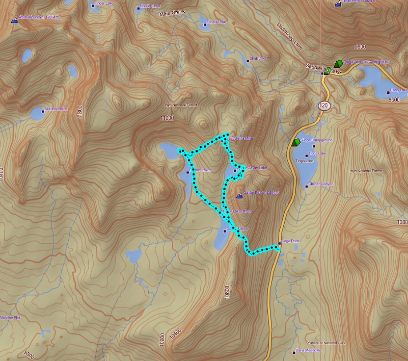
Gaylor, Granite Lakes & The Old Mining Town Of Dana City Topographic Map
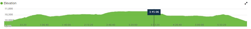
Gaylor, Granite Lakes & The Old Mining Town Of Dana City Profile
Sources:
Yosemite: the Park and its Resources (1987) by Linda W. Greene
Hubbard, D. H.,Ghost Mines of Yosemite, 1958, Awani Press, Fresno.
Patera, Alan H., Bennettville and the Tioga Mining District, 2003, Western Places, Lake Grove, OR
Prior Blogs in the Area:
Hiking Through July Snow To Gaylor, Granite Lakes & The Old Mining Town Of Dana City July 1, 2019
Hiking to Gaylor and Granite Lakes then up to the Old Mining Town of Dana May 29, 2018
Snowshoeing up to Gaylor, Granite Lakes and Dana City in July! July 5, 2017
June Snowshoeing up to Gaylor and Granite Lakes June 2, 2016
Hiking up to Gaylor & Granite Lakes and the Ghost Town of Dana City May 31, 2015
Cloudy Hike to Gaylor & Granite Lakes and the Ghost Town of Dana City August 11, 2014
Gaylor & Granite Lakes Snowshoe Hike May 8, 2014
Gaylor Lakes & Great Sierra Mine Hike: Part 1 October 12, 2012
Gaylor Lakes & Great Sierra Mine Hike: Part 2 October 12, 2012