Snowshoeing in the Tioga Pass area in July? Yes indeed! How else could we travel across the solid snowfields full of suncups to some beautiful lakes and the old mining town of Dana City?
Where: Yosemite National Park, Inyo National Forest
Distance: 5.3 Miles
Difficulty: Moderate
Elevation Range: 9,945′ – 11,025′
Date: July 5, 2017
Map: Falls Ridge Quad
Dog Hike? No
We parked our car at the parking lot at the Tioga Pass East Entrance to Yosemite, utilized the nice clean restroom and headed up the trail. Well, the trail was covered in water running down it and snow drifts, so we followed it as close as we could. When we reached the saddle at the 10,536′ elevation below Gaylor Peak, we took a few minutes to admire the view to the south that took in Mount Dana, Kuna Crest and Cathedral Peak.
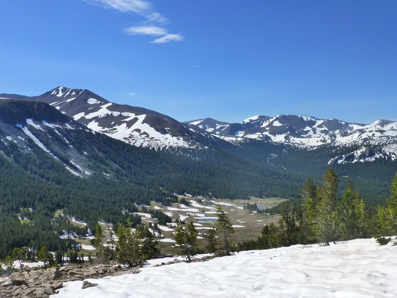
View from the Saddle Below Gaylor Peak
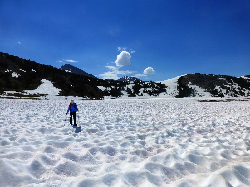
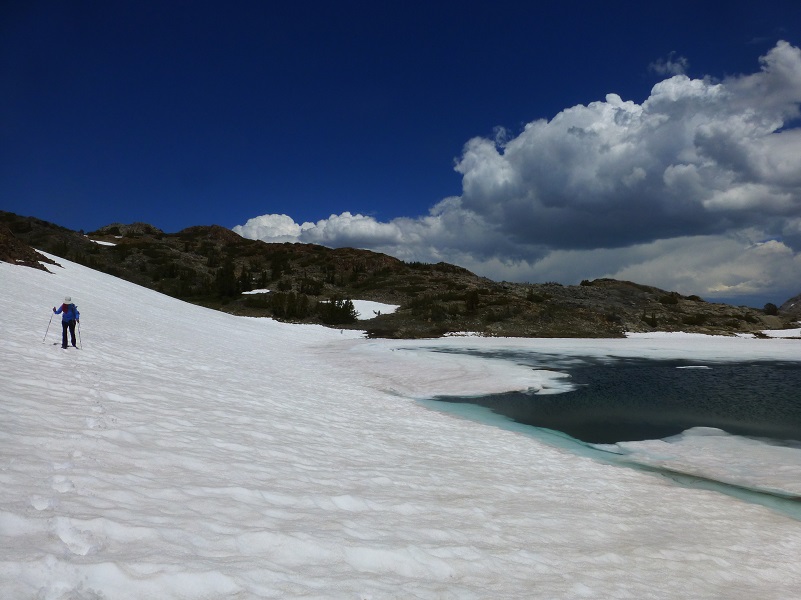
We put on our snowshoes and headed down to the middle of the 3 Gaylor Lakes. The snow was solid suncups up to 3 feet deep and made walking a challenge. You might be asking “what are suncups” and “how are the created?” Good questions and here is what Wikipedia says:
Suncups are bowl-shaped open depressions into a snow surface, normally wider than they are deep. They form closely packed, honeycomb, often hexagonal patterns with sharp narrow ridges separating smoothly concave hollows. Suncups form during the melting away of snowy surfaces. It is thought they can form in a number of different ways. These include melting of clean snow by incident solar radiation in bright sunny conditions, but also during melting away of dirty snow under windy or overcast conditions, during which particles in the snow accumulate on the crests between hollows, insulating them.

Approaching Gaylor Lake on Suncups (Photo by Gail Gilbert)
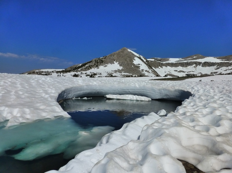
When we reached the middle of the Gaylor Lakes (10,335′ elevation), it was still frozen over. It looked like it had melted areas along the shore but this was just clear ice. The Gaylor Lakes were named after Park Ranger Andrew Gaylor who served in Yosemite from 1907 to 1921, dying of a heart attack while on patrol at Merced Lake.
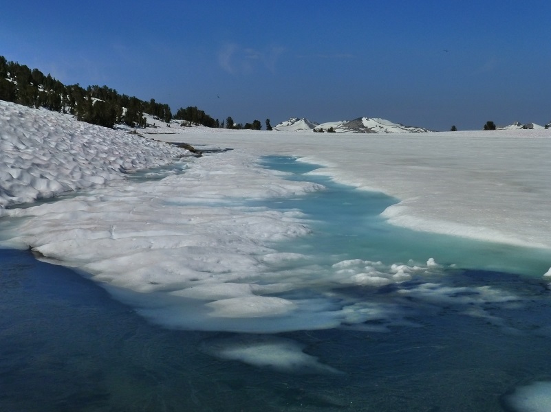
Middle Gaylor Lake
Inlet to Middle Gaylor Lake
We kept the snowshoes on and headed over to the Granite Lakes. Yup, more suncups.
Snowshoeing through the Suncups to Granite Lakes
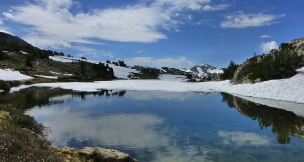
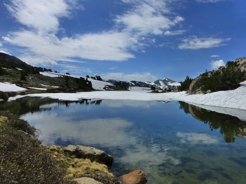
When we reached the lower of the Granite Lakes, we had really nice reflections for a while until the wind came up.

We followed the shore up along the lake, which was still mostly iced over but opened up in a couple of places to treat us to a reflection.
We topped over to the upper of the Granite Lakes (10,428′ elevation), which was mostly still iced over. We made our way to our usual flat rock for lunch.
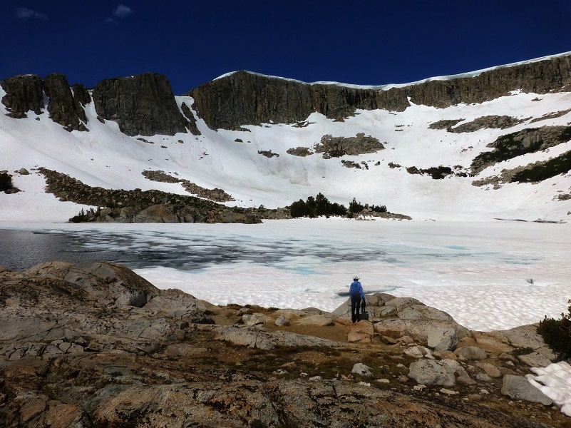
Upper Granite Lake
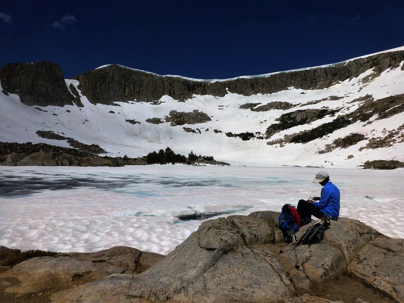
Upper Granite Lake Lunch Spot
We could see some thunderheads building and decided that if we were going to reach the high point of our planned adventure, Dana City, we better get moving and decided to go it without our snowshoes. A strange rainbow hung between the clouds as we headed cross country.

Our route was mostly dirt but there were some pretty large snow fields along the way and since we weren’t wearing our snowshoes, we did our best to skirt the snow (and suncups). As a result we ended up far higher than we had planned when we made our final approach to the old mining town of Dana City (10,769′ elevation). But we did come across some diggings that we hadn’t seen before so that was pretty exciting.
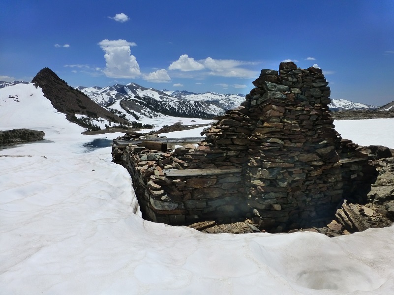
Prospecting efforts were made in the Tioga area as early as 1860, it was not until 1878 when claims were made and the Tioga Mining District was formed. The City of “Dana” received a Post Office in 1880. In 1881, the Great Sierra Consolidated Silver Company bought up all of the claims in the Tioga Hill area and started drilling tunnels but never produced pay dirt. Not much remains today of Dana City but if you look around, you can still see remains of some of the old buildings.
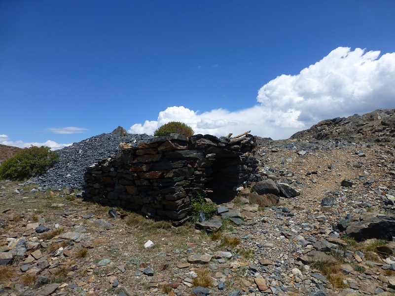
I love this old cabin and always wonder about the people who built it because they put a window with an amazing view in the stone structure. We visit it every year but this year, the winter was a little rough on it and the window frame isn’t as “plumb” as it was last year.
We headed down along the side of the upper of the Gaylor Lakes, crossed the outlet, then cross country up Gaylor Peak to the saddle, avoiding the snow (and suncups).

Photo of Me by Gail Gilbert
When we reached the saddle below Gaylor Peak, we could really tell that the suncups had melted down. The top ridges had flattened out and the “cup” portions weren’t as deep. If you would like to learn more about the history related to the Gaylor Lakes or Dana City, check out my prior blogs below, which are full of interesting tidbits of the people involved in the history.
Dog Hike?
No, dogs not allowed in Yosemite National Park Wilderness.
Map and Profile:
Tioga Pass to Gaylor Granite Lakes Dana City Snowshoe Doarama
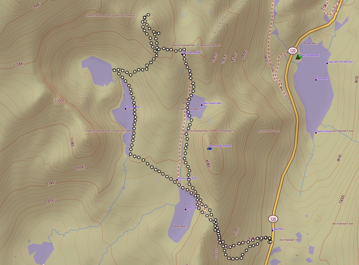
Tioga Pass to Gaylor, Granite Lakes, Dana City Snowshoe Topographic Map
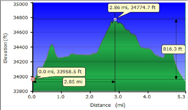
Tioga Pass to Gaylor, Granite Lakes, Dana City Snowshoe Profile
Sources:
Prior Blogs in the Area:
June Snowshoeing up to Gaylor and Granite Lakes June 2, 2016
Hiking up to Gaylor & Granite Lakes and the Ghost Town of Dana City May 31, 2015
Cloudy Hike to Gaylor & Granite Lakes and the Ghost Town of Dana City August 11, 2014
Gaylor & Granite Lakes Snowshoe Hike May 8, 2014
Gaylor Lakes & Great Sierra Mine Hike: Part 1 October 12, 2012
Gaylor Lakes & Great Sierra Mine Hike: Part 2 October 12, 2012