First day that Tioga Road was fully open and we headed to lakes that we hoped would still be iced over, even in July. Lots of history in this area and I can’t help thinking of the people who made that history. As we know, most miners did not strike it rich and some do not have happy endings. I share one of those stories that took place on top of Tioga Hill circa 1874 where the Sheepherder Mine and the town of Dana City would rise.
Where: Yosemite National Park, Inyo National Forest
Distance: 5.04 Miles
Difficulty: Moderate to Strenuous
Elevation Range: 9,947′ – 10,804′
Date: July 1, 2019
Map: Falls Ridge Quad
Dog Hike? No
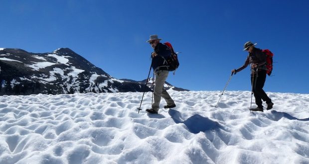
 We celebrated the first day that Tioga had reopened since winter with a hike from Tioga Pass. We parked our car at the parking lot at the Tioga Pass East Entrance to Yosemite, utilized the nice clean restroom and headed up the trail.We didn’t know what to expect as far as snow depth. Should we pack our snowshoes or traction devices? I had checked out the snow situation at Tioga Pass on June 5 and 6 but how much had changed in 3 weeks? Once we arrived, we pondered the situation a bit more and decided to carry those snowshoes just in case.
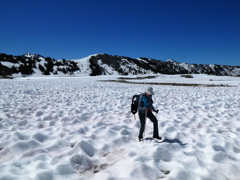
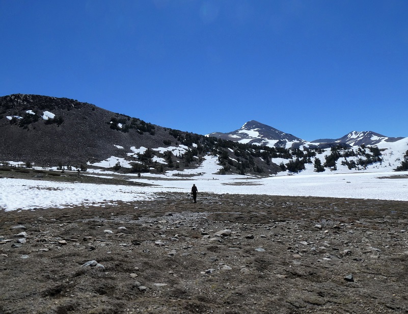
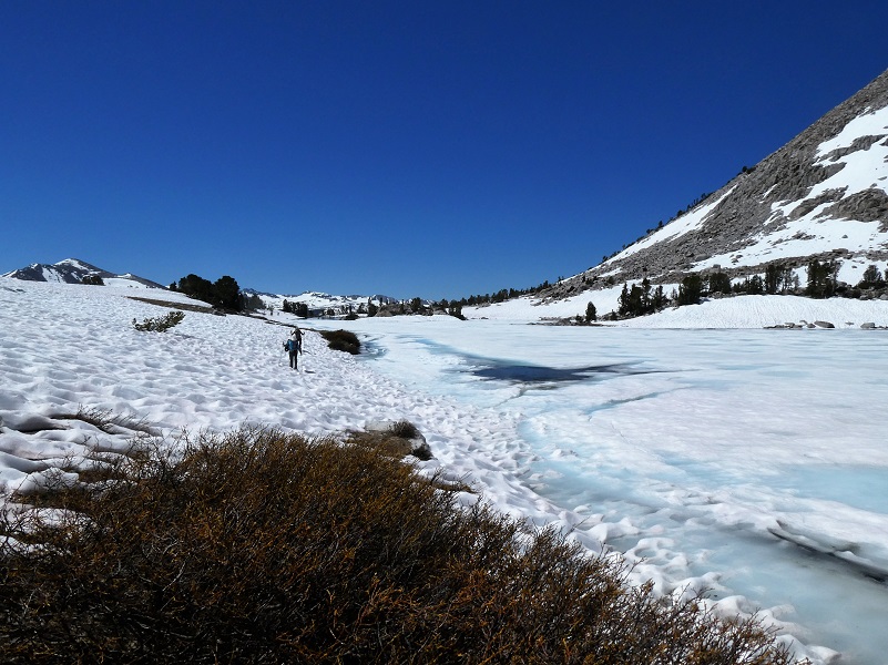
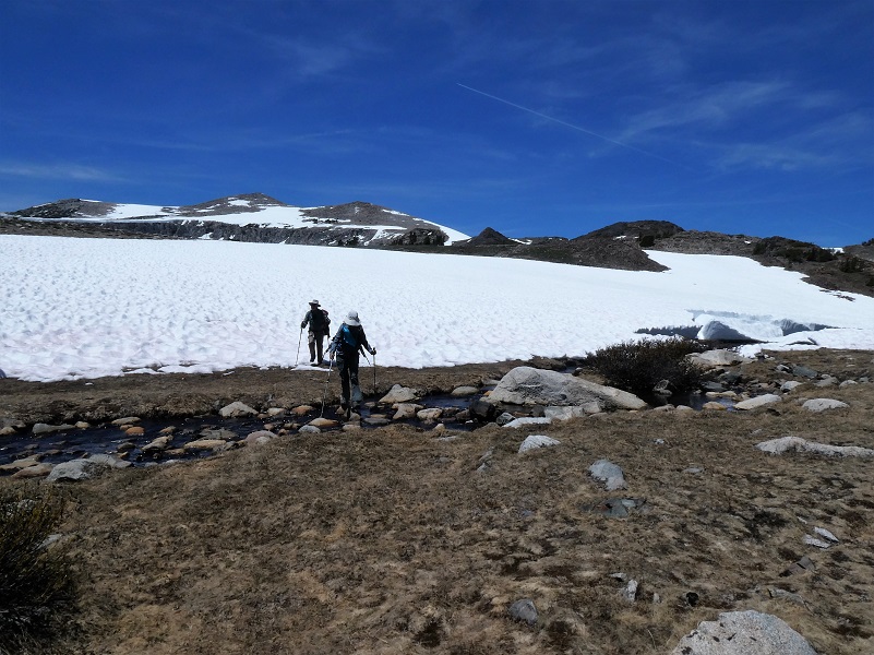
Although there was a bit of snow at the bottom the trail, it was free of snow until we reached the Gaylor Peak saddle at 10,536′. We took a few minutes to admire the view to the south that took in Mount Dana, Kuna Crest and Cathedral Peak then headed over through suncup snow. Suncups are bowl-shaped open depressions into a snow surface, normally wider than they are deep. They form closely packed, honeycomb, often hexagonal patterns with sharp narrow ridges separating smoothly concave hollows. The snow was solid in the morning and not icy.
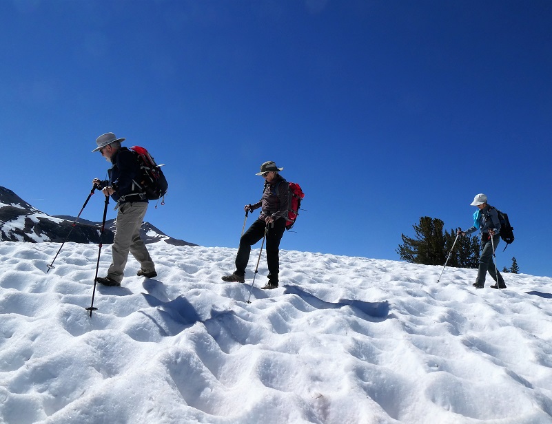
 Those suncups weren’t quite as fun or easy to walk in as we thought so we headed for the rocks, which also weren’t the easiest as there were many wobblers along the way. Perhaps you wonder why we didn’t take the trail down to the lake. Well, it was covered in snow and suncups.
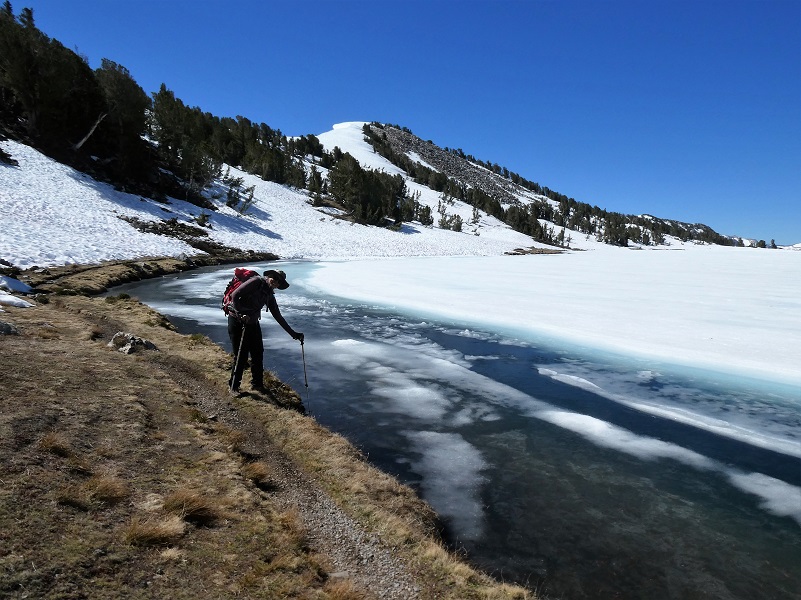
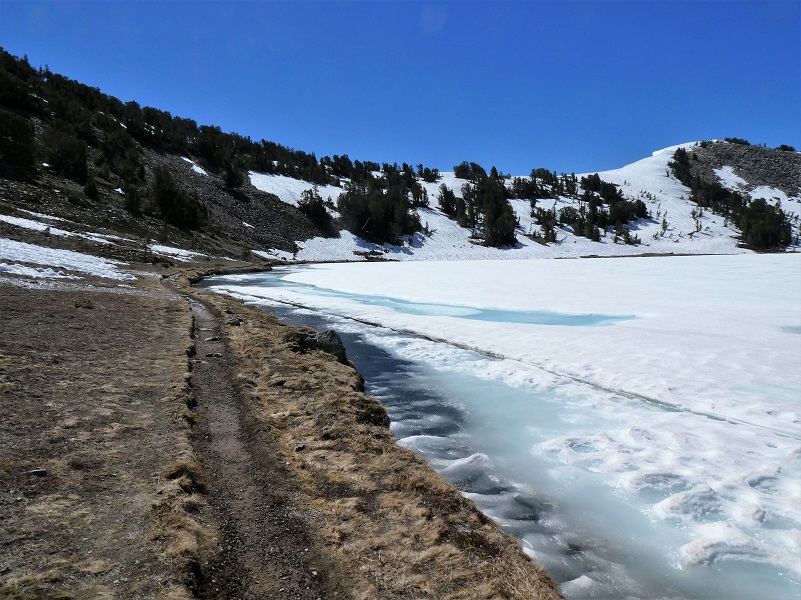
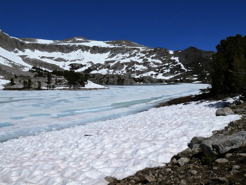
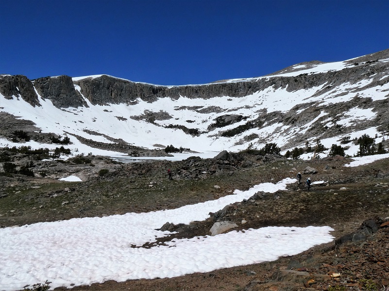
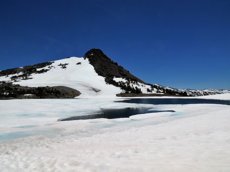
We really didn’t know what we would see as far as ice coverage on Middle Gaylor Lake (10,335′ elevation). Last year we had hiked it May 29. We were delighted to find plenty of ice!
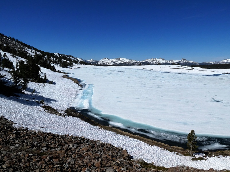
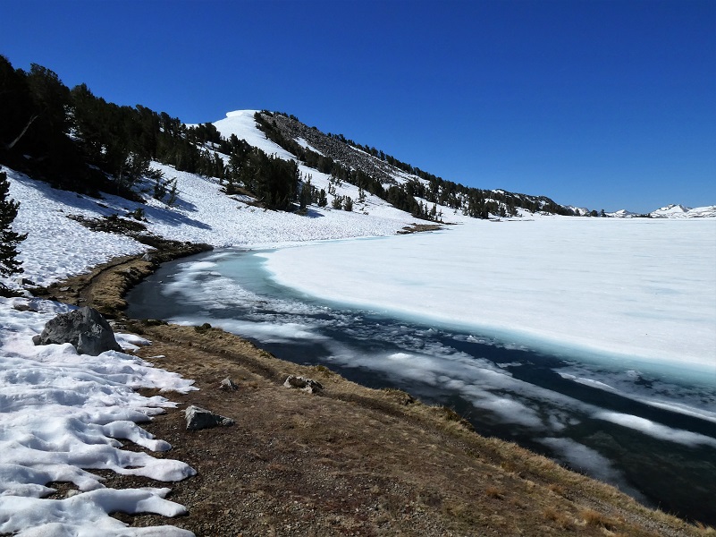

The blue colored band along the edge of the lake was frozen solid in the morning when we passed along the shore.

Andrew “Jack” Gaylor (Picture Courtesy of Yosemite Research Library)
Gaylor Lakes were named after Park Ranger Andrew Jack Gaylor who served in Yosemite from 1907 to 1921, dying of a heart attack while on patrol at Merced Lake. You can read more about him in my blog.
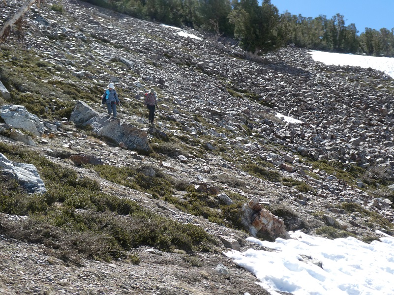
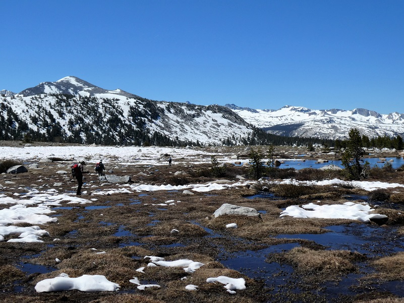
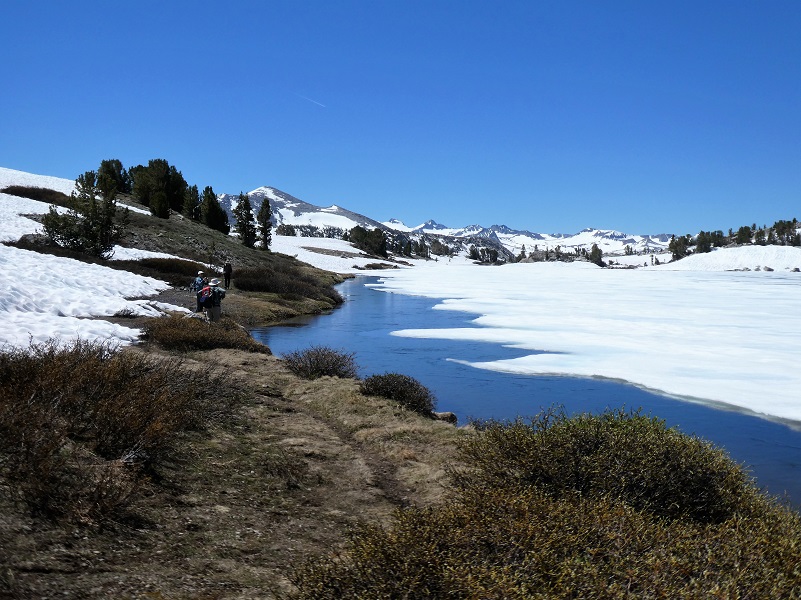
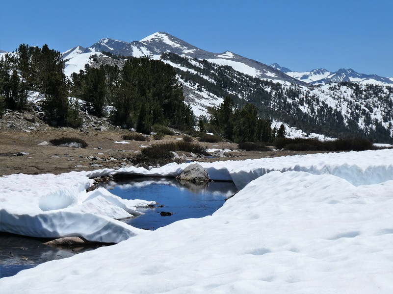
At the inlet, we headed cross country to intersect the outlet from Granite Lakes. And we had plenty of suncups to head through.
But we had patches of bare ground where we could stop to catch our breath and admire the view.

You sure get the feeling that you are pretty tiny in this big country.
Some of our group headed down the creek from Granite Lakes to check out another small lake.
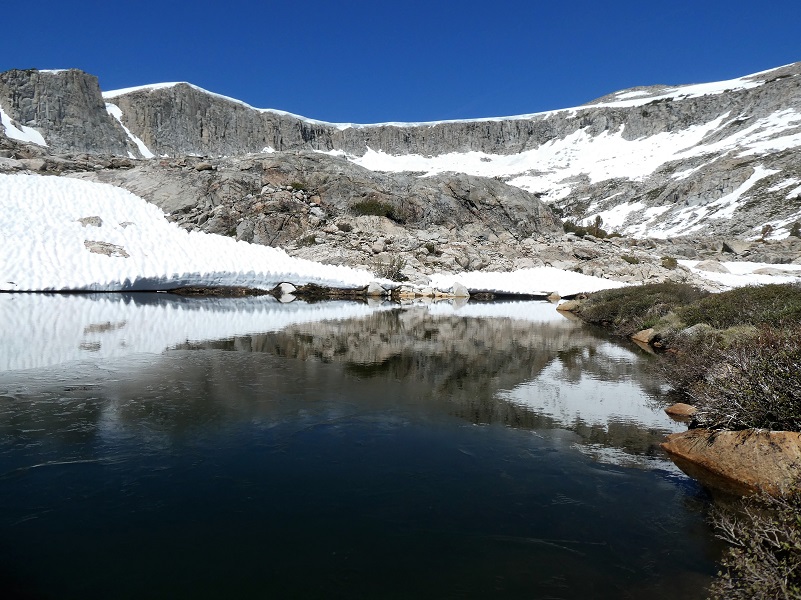
We then walked upstream along that creek and the middle Granite Lake (10,384′ elevation).
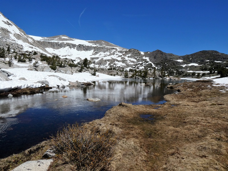
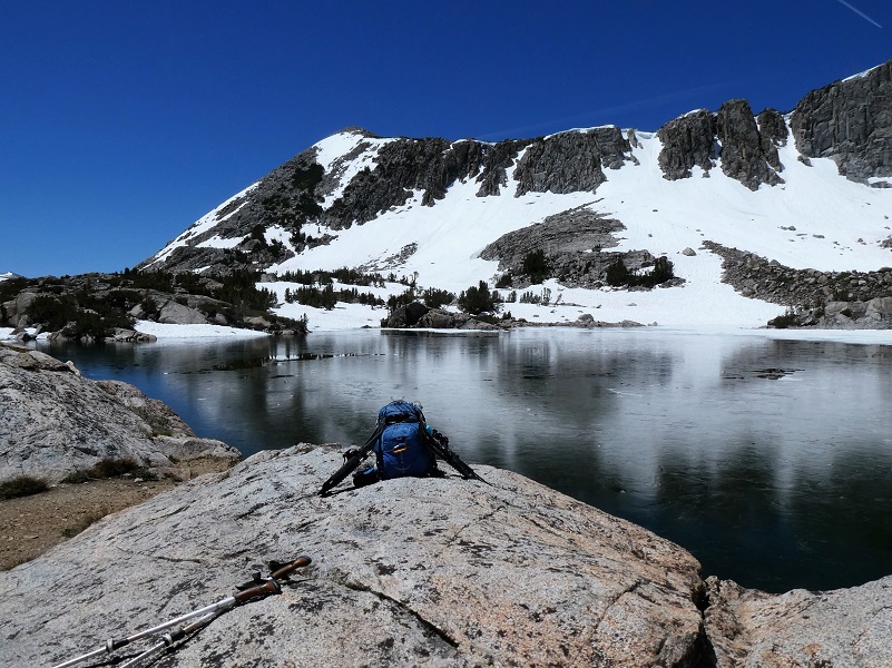
We could soon spot where we would cross over the slabby rocks to Upper Granite Lake (10,427′ elevation) and our lunch spot.
Pretty darn nice lunch spot.

As we got our gear on, we noticed wildflowers blooming right next to the snow.
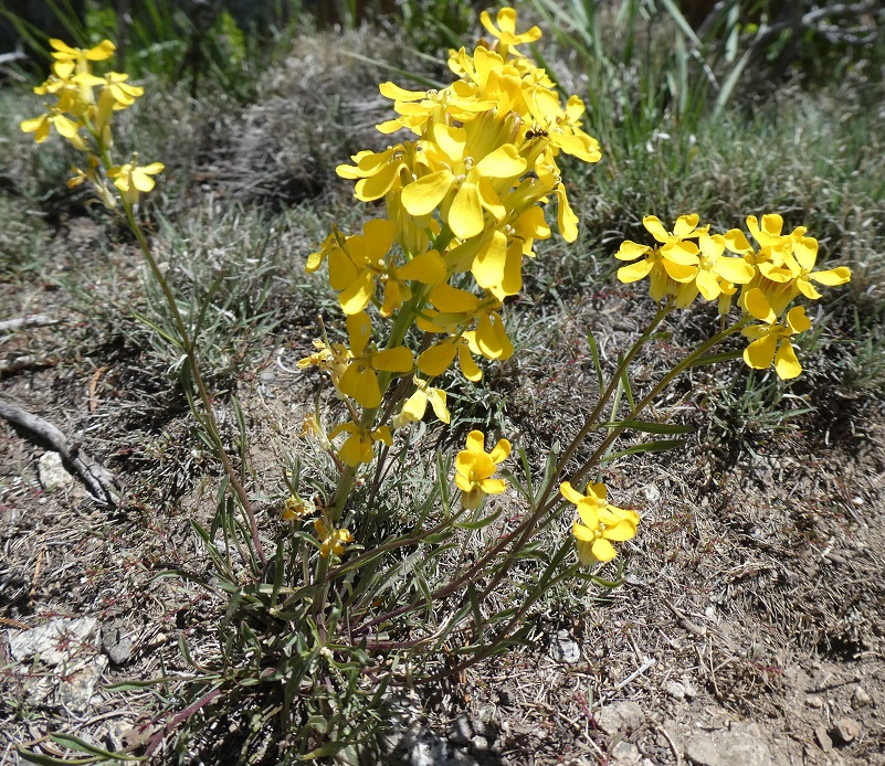
Wallflower
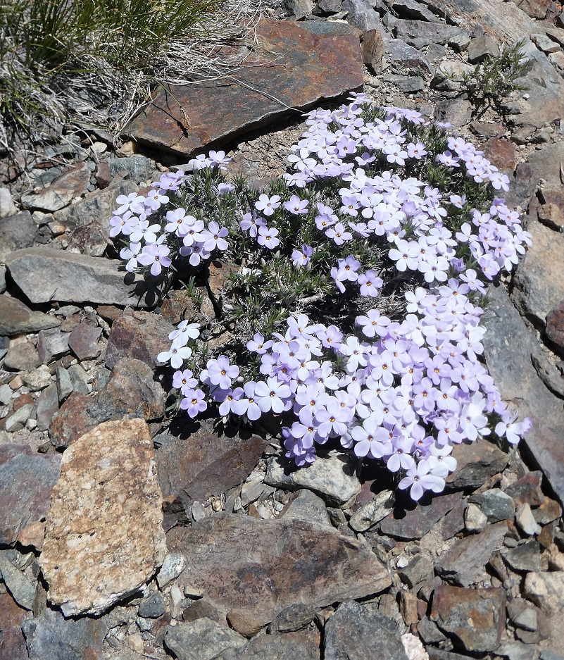
Phlox
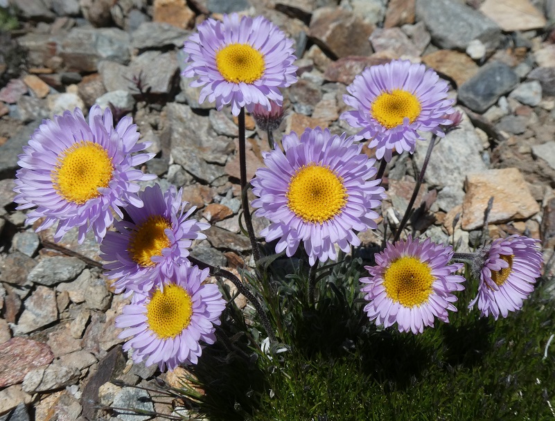
Mountain Aster
Time to head to Dana City and we headed cross country to it, avoiding snow fields and brush patches.
Looking Back at Upper Granite Lake
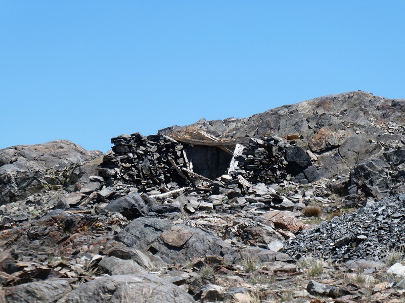
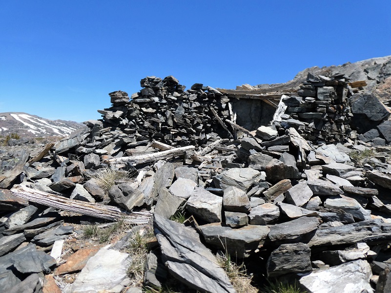
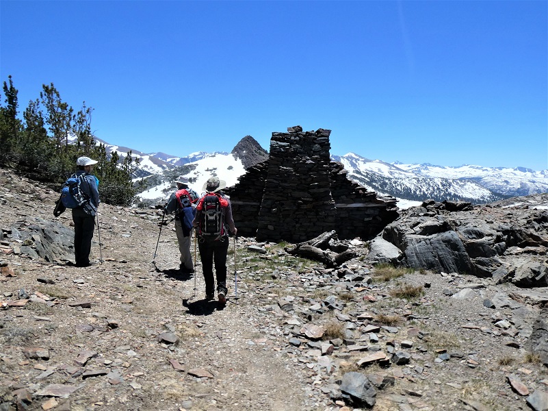
We reached the old mining town known as Dana, elevation 10,769′. As I looked at the remains of the stone structures and diggings, I thought of how this was a bustling place back in 1880 when it received a post office and is said to have had up to 1,000 people living in it at heyday.
There was an old mining area referred to as Tioga Hill, located about one mile northwest of Tioga Pass on the eastern boundary of Yosemite National Park. A band of white quartz runs along its crest and is known as “The Great Silver Belt.” This is the setting for the mining boom in the 1870s and 1880s that occurred in the area of Dana City. I have shared this story from the 1958 book Ghost Mines of Yosemite by Douglass Hubbard about how the area got its mining start before but am doing it again because I am going to build on it and add a little more to the story.
There are several tales told about the discovery of The Sheepherder, most famous of these lodes. One goes like this: Early in 1860 Michael Magee, justice of the peace at Big Oak Flat during flush times in that camp, Captain A. S. Crocker, of Crocker’s Station, L. A. Brown, a surveyor, “Doc” George W. Chase, a dentist, and Professor Joshua E. Clayton of Mariposa were prospecting in the vicinity of Bloody Canyon. They camped near Tioga Pass to rest their animals and to look around. Clayton and Chase had been to the Mono Diggings the year before, and in returning home Chase crossed Tioga Hill and discovered the Sheepherder Lode.
He may have been the first human to see its immense proportions. He kept mum about his discovery except perhaps to Clayton, who assayed his ore. While the 1860 party was camped at Lake Jessie (called Tioga Lake today) at the eastern base of Tioga Hill, Doc Chase remarked that if they could spend one day more there, he would locate and claim “the biggest silver ledge ever discovered”. Next day, while the others remained in camp, Chase, armed with a pick and shovel and a small tin can, struck out northward at daylight and ascended Tioga Hill by about the same course as the trail which now leads from the Great Sierra tunnel to the old works of the company on the hill.
Reaching the Sheepherder Lode where it crosses a shallow ravine under a small lake, Chase unsoldered the can, straightened it out, and on the inner side scratched out his location notice with his knife. This he placed between two rocks on the massive croppings. Carrying as much ore as he could, he returned to camp. Next morning the party separated; Magee and Crocker returned to their homes, while Brown, Chase and Clayton swung around by Bloody Canyon to Monoville, where Clayton had his assaying outfit. Had they crossed Mount Warren Divide and come down Lake Canyon they may well have discovered the rich croppings which later became the May Lundy Mine.
At Monoville they were to test the Tioga ore and Clayton was to devise a plan for a smelting furnace. But simultaneously with their arrival at Monoville there came in some men who had struck rich rock at what later became Aurora, Nevada. They had come over to get Clayton to make some assays. These ran so high that forgetting “the biggest silver ledge ever discovered” Clayton packed up his assaying outfit and the three started for Aurora. All made money as they followed new strikes. None returned, yet they never ceased telling their mining friends about the “thundering big silver ledge” on Tioga Hill.
The news of a big silver ledge at the summit of the Sierra spread through Tuolumne and Mariposa counties in a short time, but soon passed into tradition amidst the excitement incident to the opening of the rich mines at Virginia City and Aurora. In 1874, as the story goes, 14 years after Chase’s discovery, the Sheepherder Lode was rediscovered by William Brusky, Jr., a boy from Sonora, Tuolumne County, who was tending a large band of sheep on Tioga Hill for his father. A rusty pick and broken shovel and the tin notice of location were found just as Dr. Chase had left them, except that the shovel had been almost destroyed by rust, and the location notice was illegible except the words, “Notice, we the undersigned” and the date 1860.
Young Brusky had heard of the tradition and had been keeping on eye open for the ledge. Elated as he was when he made his discovery, he was disappointed when he returned home with samples of the ore. This his father pulverized in a mortar, panned, and pronounced worthless. The following summer, 1875, Brusky sank a small hole in the ledge and procured some better-looking ore. But still no one in Sonora would take any interest in it until the winter of 1877 when someone assayed the rock and found it to be rich in silver. Then everyone wanted to be in on the find.
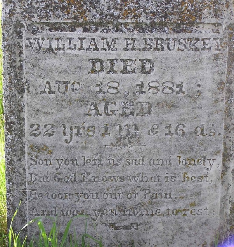
In 1878 Brusky again returned to Tioga Hill and on the second day of August located four claims of 1500 feet each along the Sheep herder Lode, naming them the Tiptop, Lake Sonora, and Summit. All of them were subsequently purchased by the Great Sierra Consolidated Silver Company. Young Brusky committed suicide on August 28, 1881.
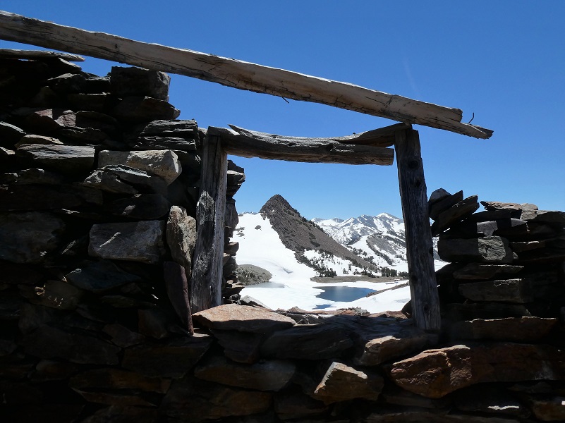
Paralleling the Sheepherder Lode some 800 feet to the south is the ledge known as The Great Sierra. Among its mining claims are the Bevan, Ah Waga, Hancock, Atherton, and the High Rock. Perhaps the most important of these is the latter, site of the old village of Dana. Located originally by W. W. Rockfellow in October 1878 as the High Rock, it was later called the Mount Dana and finally the Great Sierra. Here, amidst unrivalled Sierran grandeur, stands a beautiful old stone cabin. Constructed of loose slate by an unknown craftsman, it is a masterpiece of dry-rock masonry. Its dirt-filled walls and heavy hand-made wooden door provided protection for many a miner when biting winds whistled across Tioga Hill.A few yards to the north of the cabin are other buildings, now in ruins, nestled around two shafts—on inclined prospect shaft or the white mother lode, and a double compartment shaft which had been sunk 100 feet when summit work was abandoned.”
As I wandered on what would have been the main street, I thought of William H. Brusky who rediscovered the Sheepherder Mine, wondering what his background was. There are quite a few variations on the spelling of his last name and I found Bruskin, Brisky, Brusky, Bruskey, Brascke and Bruskay. But I found him and tracked he and his family. His father was William Bruskey, born in Hamburg, Germany 1831, naturalized 1867 in Tuolumne County but I could not find his immigration date. His mother was Rose M. Donnelly, born in Ireland 1829, immigrated to the United States 1856. The lived in Tuolumne and Calaveras Counties. On the 1870 census, William Sr. is listed as a Miner but after that he is listed as a Rancher or Cattle Raiser. He registered to vote which helps show that he was 5’6 1/4″ tall, brown eyes and grey hair and his little finger on his right hand was missing. He started purchasing land in the Tuolumne/Calaveras County area around 1867, mostly in and near to the Peoria Mountains close to today’s southwest end of where New Melones Lake is and where the intersections of Highways 49 and 108 are. He is listed on various voter registration living in Copporopolis and Chinese Camp. William Sr. and Rose had six children with our William H. Bruskey being the second to the oldest.
 We know that our William H. Bruskey was born in 1861 and on the 1880 census, William Sr. and Rose were listed as living in Jamestown, Tuolumne County, raising stock. William H. is listed on the 1870 census in Township 3, Tuolumne County with his family, living at home. According to the story, in 1874 he was tending to sheep in the Tioga Hill area (Dana City) where he rediscovered the location of the first claim and brought some ore out but his father had said it was worthless. He returned in 1875 to dig a hole in the ledge and it sounds like ore from that dig was finally assayed in 1878 to be “rich in silver” and as a result he returned that year to file 4 claims in that area.
The article said that William H. committed suicide in 1881 and the claims were purchased by the Great Sierra Consolidated Silver Company. I located his grave at Chinese Camp Cemetery, Chinese Camp, Tuolumne County but his tombstone death date varies a bit from the story’s date of August 28, 1881. His grave says he died August 18, 1881.
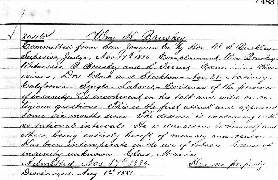 I located a sad piece of information that helped explain William H. a little better. I debated including this piece of information and decided to do it since it was widely known that he committed suicide. He was committed to Stockton State Hospital on November 17, 1880 and discharged on August 1, 1881. If you wish to read more detail, you can click on the picture to the right.
We continued wandering by the remains of old stone buildings and back through time. Our favorite building by far is the stone remains of what must have been a grand building, complete with a big fireplace and a window with an incredible view.
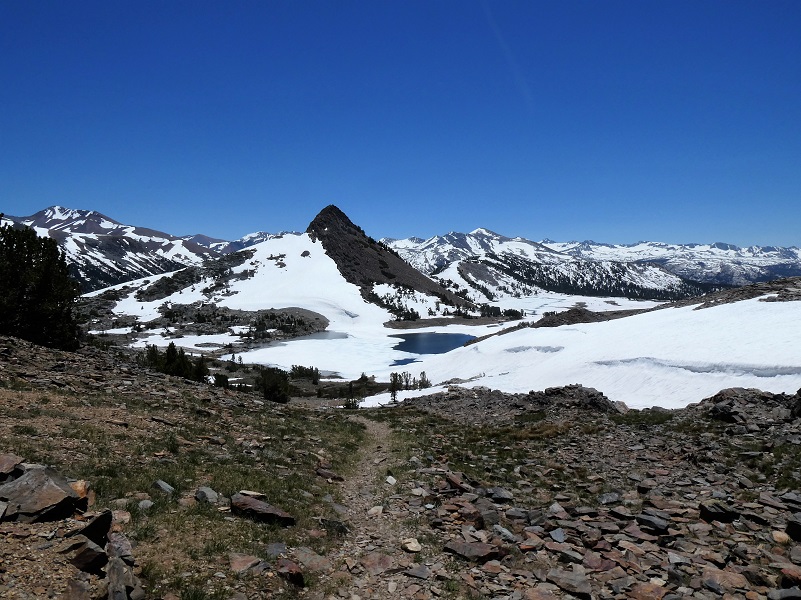
We walked in William H. Bruskey’s footsteps as we headed down the trail with Upper Gaylor Lake (10,512′ elevation) and Gaylor Peak (11,000′ elevation) in sight.
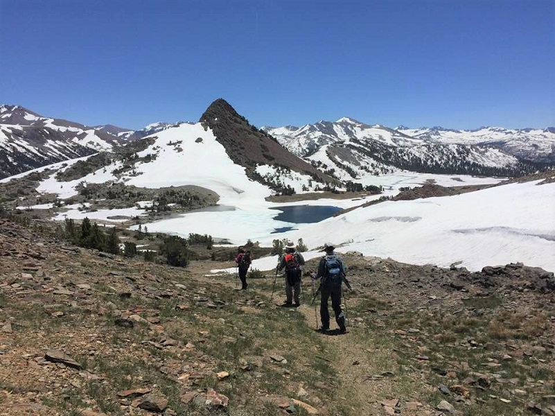
Photo by Betsy Bloom

We knew we needed to get across the creek that flows out of Upper Gaylor Lake to hit our return line that we planned on Gaylor and initially, this looked like it could be a challenge.
But we found a much easier crossing with some rock hopping and were soon tackling those wobbly rocks again.
Well, we never put on our snowshoes. They added weight to our packs for our first hike above 10,000′ elevation this year so we all chocked it up as bonus conditioning. I love visiting this area as soon as I can after Tioga Road reopens in the spring. I just love seeing the frozen lakes begin to thaw but if you want to avoid that wet, spring snow, it is still beautiful after it has melted. I have written several blogs on this area and the links are at the end. Each has a different take on the rich history of this area with stories about some of the characters who lived here.
I was recently asked about the temperature on the hikes and this hike is a tough one to help on that. The National Weather Service had forecasted the morning low as 32 and high of 58. When we got out of the car at Tioga Pass, it was 50 degrees, a long ways away from 32. When we returned to the car in the afternoon it was around 55 or so. There are so many unique thermal areas that occur on the hills and low spots, the temperatures probably ran the gamut between 32 and 55. I would have been comfortable in shorts but since this was my first hike above 10,000′ this year and it was a sunny day on snow, I didn’t want to burn my white legs too bad so opted for long sleeves and pants. Hope that helps some.
Dog Hike?
No, dogs are not allowed on this trail in Yosemite National Park.
Doarama:
What is a Doarama? It is a video playback of the GPS track overlaid on a 3 dimensional interactive map. If you “grab” the map, you can tilt it or spin it and look at it from different viewing angles. With the rabbit and turtle buttons, you can also speed it up, slow it down or pause it.
Gaylor, Granite Lakes, Dana City Doarama
Map and Profile:
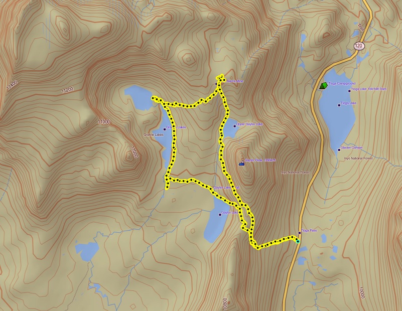
Tioga Pass to Gaylor, Granite Lakes, Dana City Topographic Map
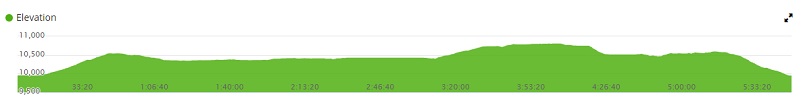
Tioga Pass to Gaylor, Granite Lakes, Dana City
Sources:
Yosemite: the Park and its Resources (1987) by Linda W. Greene
Hubbard, D. H.,Ghost Mines of Yosemite, 1958, Awani Press, Fresno.
Prior Blogs in the Area:
Hiking to Gaylor and Granite Lakes then up to the Old Mining Town of Dana May 29, 2018
Snowshoeing up to Gaylor, Granite Lakes and Dana City in July! July 5, 2017
June Snowshoeing up to Gaylor and Granite Lakes June 2, 2016
Hiking up to Gaylor & Granite Lakes and the Ghost Town of Dana City May 31, 2015
Cloudy Hike to Gaylor & Granite Lakes and the Ghost Town of Dana City August 11, 2014
Gaylor & Granite Lakes Snowshoe Hike May 8, 2014
Gaylor Lakes & Great Sierra Mine Hike: Part 1 October 12, 2012
Gaylor Lakes & Great Sierra Mine Hike: Part 2 October 12, 2012
