1 trail with 4 incredible waterfalls! That is exactly what the Panorama Trail off of Glacier Point delivered, along with a Sooty Grouse looking for love.
Where: Yosemite National Park
Distance: 13.49 Miles
Difficulty: Moderate to Strenuous
Elevation Range: 5,782′ to 7,276′
Date: May 3, 2021
CALTOPO: Glacier Point to Illilouette and Nevada Falls
Dog Hike? No
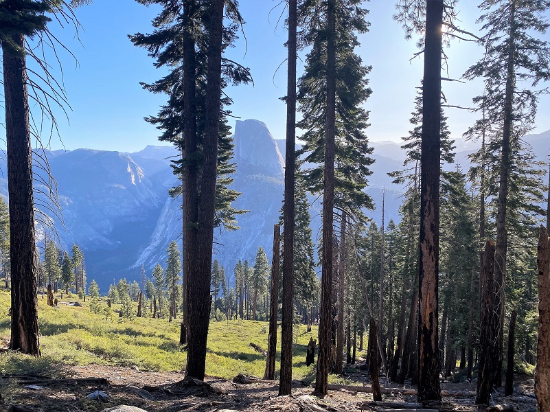
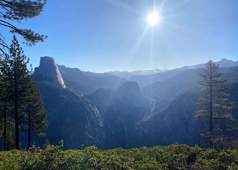
I headed up Highway 41 through the South Entrance to Yosemite near Mariposa Grove, then to Glacier Point Road. I parked in the upper parking lot, stashed my ice chest in the bear box and headed toward Glacier Point’s amphitheater. What a beautiful site unfolded as I walked.

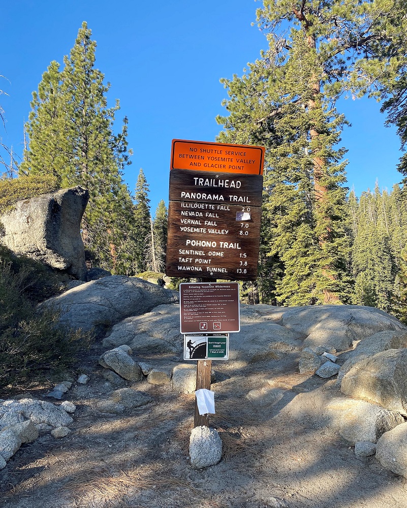
The well signed trail started near the southern end of the Glacier Point Amphitheater.
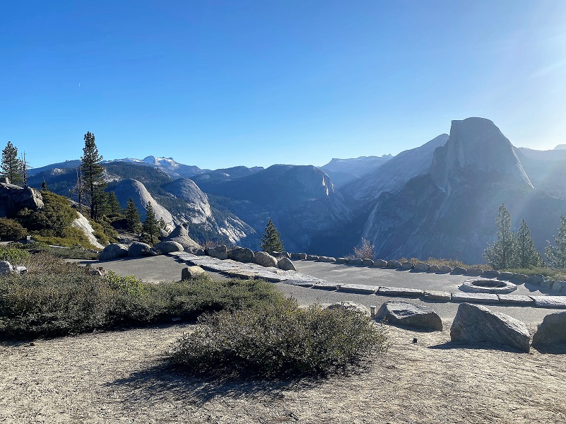
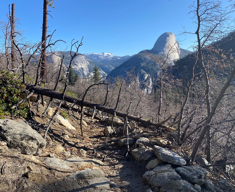
Half Dome peeked through the trees, showing off many different angles of it’s profile.
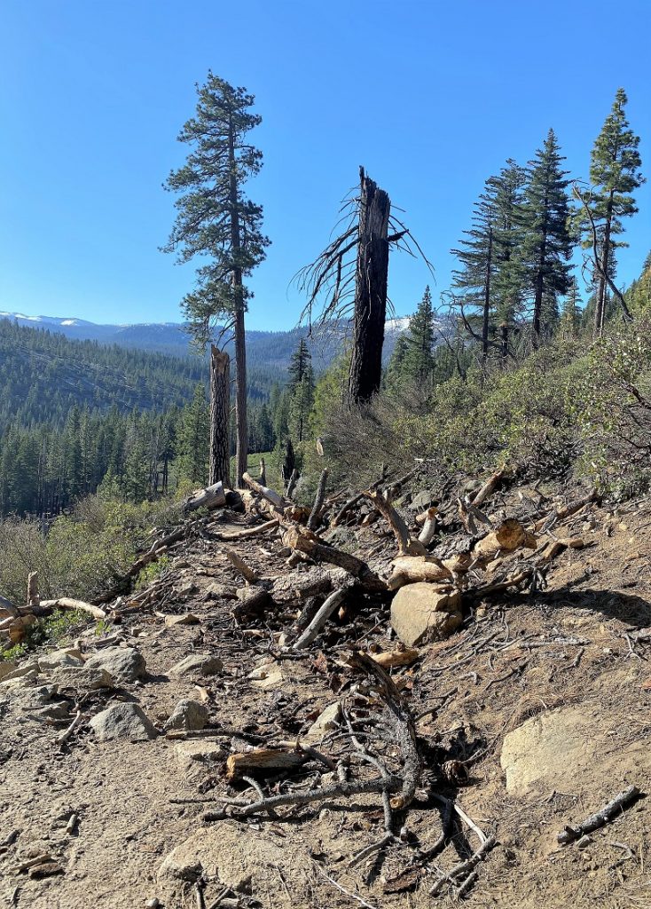
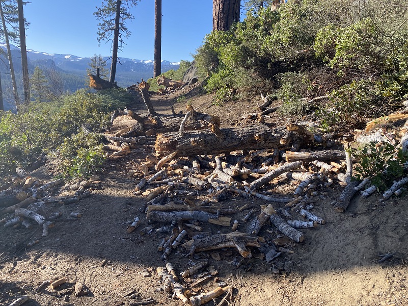
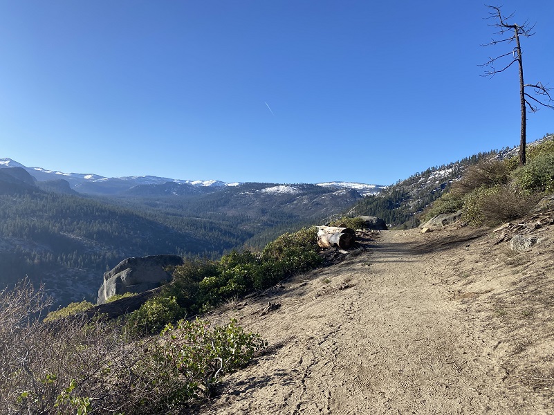
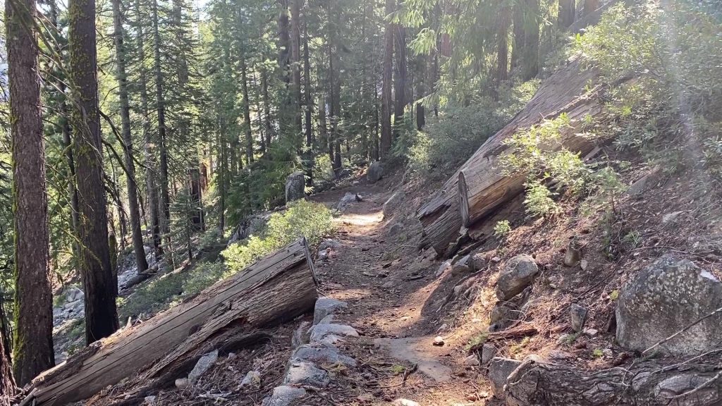
There were a few down trees on the trail but nothing that couldn’t be walked around or over. Here is just a sampling.
That morning sun was low in the sky and not the best for picture taking but still very pretty.
The trail led me on.
I soon got a sneak peek at Illilouette Fall.

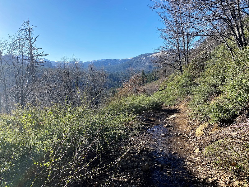
There were a few spots with water running down the trail but nothing I couldn’t step on strategic rocks or pieces of wood to get over.
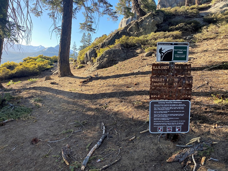
 I followed the sign to Illilouette Fall.
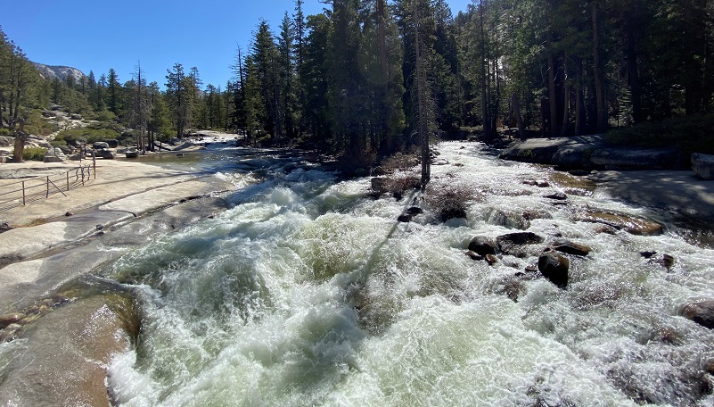
And I could hear the roar of Illilouette Fall long before I reached a spot off of a short side trail with the best view of Illilouette Fall. When you actually reach the fall, you can’t see any of the drop, so the best views are from a ways back.
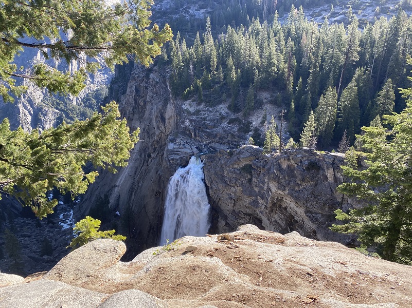
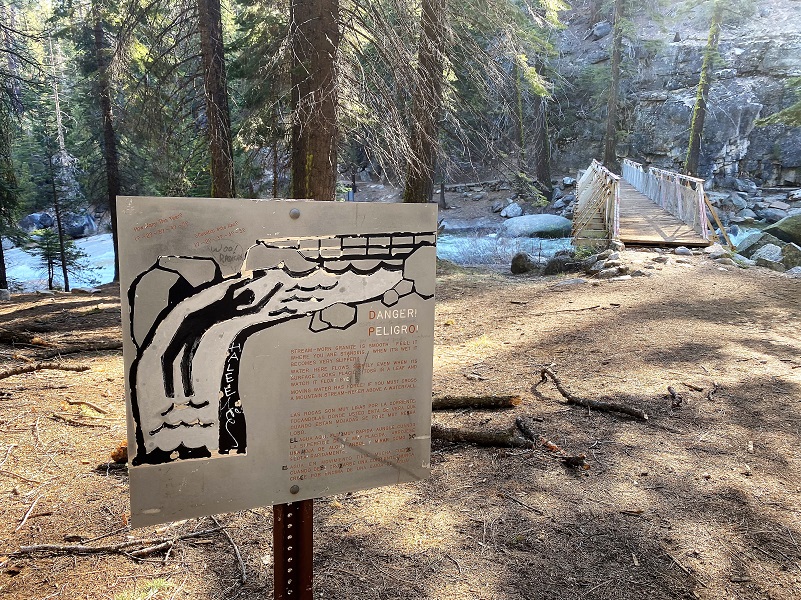
I soon arrived at Illilouette Fall where signs warned of the danger of this fast moving water and quick dropoff. These signs are here for very good reasons so not ignore these warnings. If you fall into the water up here there is zero chance of surviving.
A picture just doesn’t do justice to the sound of this waterfall so here is a short video.
Here is what Wikipedia says about Illilouette Fall:
381-foot (116 m) waterfall on the Illilouette Creek tributary of the Merced River in Yosemite National Park. It is located in a small canyon that cuts into the south wall of Yosemite Valley directly across from Vernal Fall. The origin and meaning of the waterfall’s name has been lost to time.
The fall is prominently visible to the south from both Mist Trail and John Muir Trail near Vernal Fall. However, during low-flow months, the fall can disappear entirely from this perspective. The best vantage point for viewing the waterfall is from the Panorama Trail as it descends from Glacier Point. There is no trail to the base of the fall as the narrow canyon is craggy and inundated with rapids during the wet season. It is possible – though not encouraged – to reach the base of the fall during low-flow months.
The meaning of the name “Illilouette” is not known. According to Lafayette Bunnell, the Ahwahneechee name of the waterfall was “Too-lool-lo-we-ak”. It was suggested by Bunnell that its literal translation was not appropriate for everyday use; what that translation was has been lost to time. “Illilouette” may have been a perversion of the waterfall’s Ahwahneechee name, though this is not known with any certainty.
And here is what Illilouette Fall looked like in 1958 and according to the title of the picture, apparently “1958 was the year for Yosemite’s Waterfalls.”
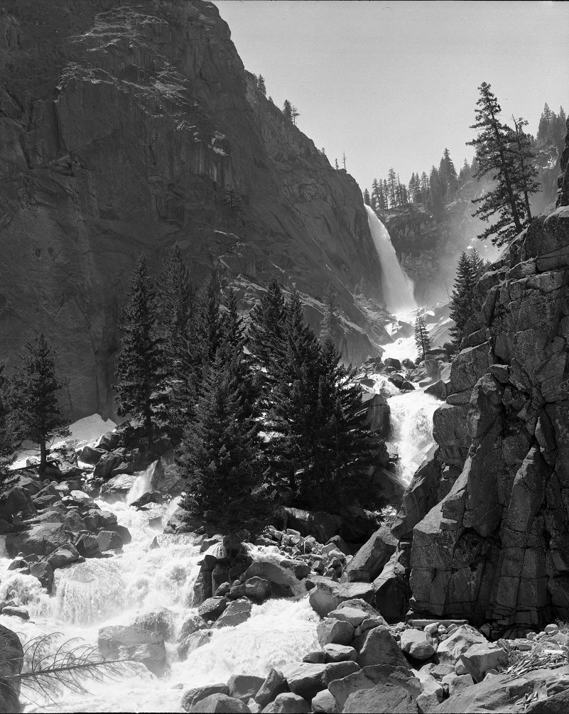
Illilouette Fall, 1958 was the year for Yosemite’s Waterfalls (Dunmire) https://npgallery.nps.gov/YOSE/AssetDetail/6ef65d7ec9794d6fbcb3e8c06d423370 (Yosemite National Park Digital Archives)
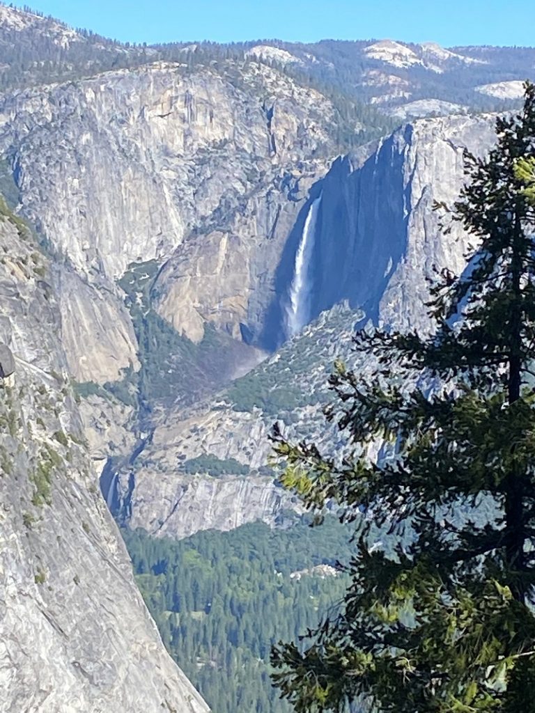
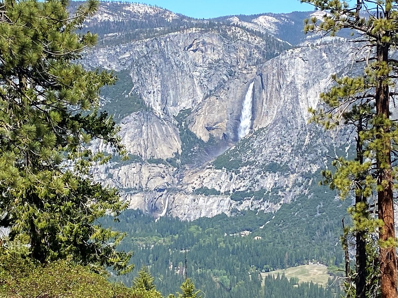
As I traveled on the trail below Panorama Point, I also got peeks of Yosemite Falls and the Yosemite Valley.
From Wikipedia:
Yosemite Falls is the highest waterfall in Yosemite National Park, dropping a total of 2,425 feet (739 m) from the top of the upper fall to the base of the lower fall. The falls consist of three sections:
Upper Yosemite Fall as viewed from the trail leading to the top
-
-
- Upper Yosemite Fall: The 1,430-foot (440 m) plunge comprises over half the total drop. Trails from the valley floor and down from other park areas outside the valley lead to both the top and base of Upper Yosemite Fall. The upper fall is formed by the swift waters of Yosemite Creek, which, after meandering through Eagle Creek Meadow, drop over the edge of a hanging valley in a spectacular and deafening show of force.
-
The Middle Cascades, other than the last drop, are not visible from the Valley
-
-
- Middle Cascades: Between the two obvious main plunges there are a series of four smaller plunges collectively referred to as the Middle Cascades. Taken together these account for a total drop of 675 feet (206 m), more than twice the height of the Lower Fall. Because of the narrow, constricted shape of the gorge in which these drops occur and the lack of public access, they are rarely noted. Most viewpoints in the valley miss them entirely. Several vantage points for the cascades are found along the Yosemite Falls trail. Several hikers climbing down from the trail towards the cascades have required an expensive helicopter rescue due to steep and slippery terrain and features.
-
Lower Fall as viewed from trail
-
-
- Lower Yosemite Fall: The final 320-foot (98 m) drop adjacent to an accessible viewing area, provides the most-used viewing point for the waterfalls. Yosemite Creek emerges from the base of the Lower Fall and flows into the Merced River nearby. Like many areas of Yosemite the plunge pool at the base of the Lower Fall is surrounded by dangerous jumbles of talus made even more treacherous by the high humidity and resulting slippery surfaces.
-
The main village of the native people of Yosemite Valley, the Ahwahneechee, was located at the base of the falls. The Ahwahneechee people called the waterfall “Cholock” (“the fall”) and believed that the plunge pool at its base was inhabited by the spirits of several witches, called the Poloti. An Ahwaneechee folktale describes a woman going to fetch a pail of water from the pool, and drawing it out full of snakes. Later that night, after the woman had trespassed into their territory, the spirits caused the woman’s house to be sucked into the pool by a powerful wind, taking the woman and her newborn baby with it.
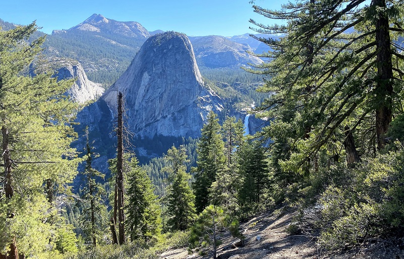
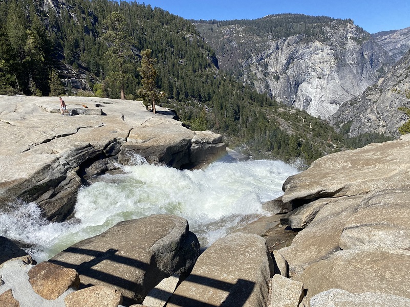
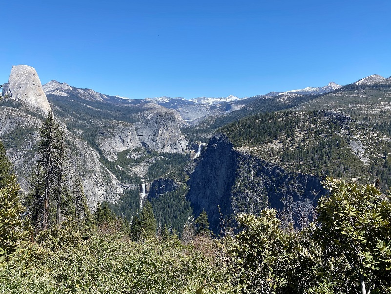
As I got closer to Nevada Fall, I caught glimpses of Vernal Fall with its 317 foot drop.
Swimming above Vernal Fall is incredibly dangerous. The rocks are slippery, the river has strong undercurrents that may not be visible from the surface, and tourists have been swept over the fall to their deaths. Though swimming there is illegal and warnings to stay out of the water are clearly posted, several deaths have occurred when visitors entered the water above the fall in the vicinity of the Silver Apron and Emerald Pool. Three people died in a single day, on July 19, 2011, after being swept over Vernal Fall in this manner.
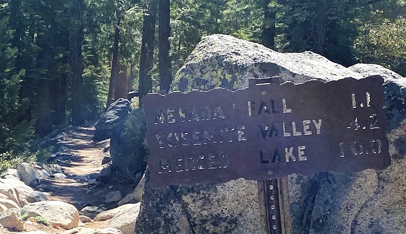
The signs led me on when I reached a trail junction.
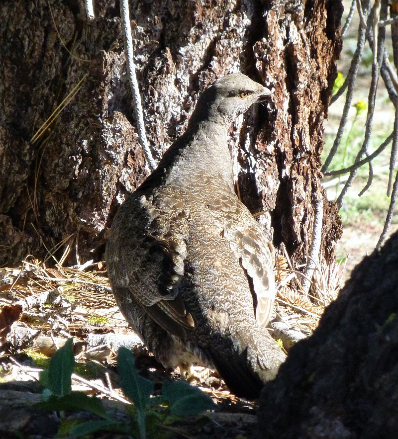
I soon spotted something way up on the trail so I stopped to see what it was. Can you see it?
It was a male Sooty Grouse.


They sure blend in well and I had been hearing males singing their love song throughout my hike. Males advertise their territory with a low-pitched, loud hoot or series of them. They give this vocalization to mark territory and to attract females, so some authors refer to this as “song.” This is not my video but it is a wonderful picture with that sound.
Females give a quavering cackle or whinny to show interest to advertising males. Here are a couple of pictures of females from my prior blogs:


After watching the grouse for a while, I continued the short distance toward Nevada Fall.
I soon arrived at 594 foot Nevada Fall. The Indian name was Yo-wy-we, signifying the twist or squirm of the falling water. Lafayette Bunnell suggested the name “Nevada” for the waterfall. He wrote, “The Nevada Fall was so called because it was the nearest to the Sierra Nevada, and because the name was sufficiently indicative of a wintry companion for our spring (Vernal Fall)… The white, foaming water, as it dashed down Yo-wy-we from the snowy mountains, represented to my mind a vast avalanche of snow.”
The Emerald Pool forms on the “step” between Nevada Fall and Vernal Fall downstream. They form a cascade in which the Merced River flows down to Yosemite Valley. This cascade is sometimes called the giant staircase, which is evident when viewed from above, at Glacier Point.
Again, pictures just do not capture the sounds like a video does.
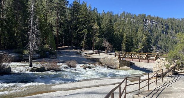
The view of the bridge above the fast moving water is impressive.
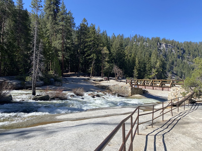
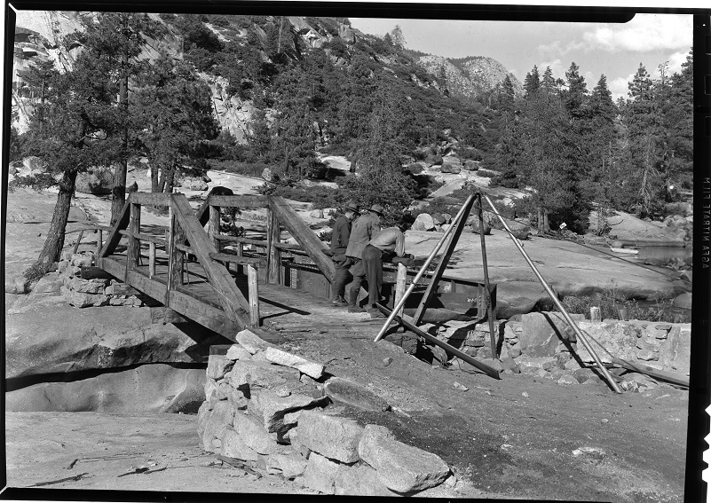
So that got me thinking about this and obvious predecessors to the current bridge. When the Yosemite Grant was established, only two improved trails existed in the park: the “Vernal Fall Trail” to Nevada Fall, and the “Mirror Lake Trail.” It wasn’t too long before a trail to Nevada Falls was built by the Mann brothers, approaching Nevada Fall from the southwest, then it went downriver to Vernal Fall. In 1866, a bridge was built to enable easier access to the top of Nevada Fall and to entice more sightseers. I was unable to locate better history of the various bridges over Nevada Falls over the years but here are some old pictures from Yosemite National Park Digital Archives.
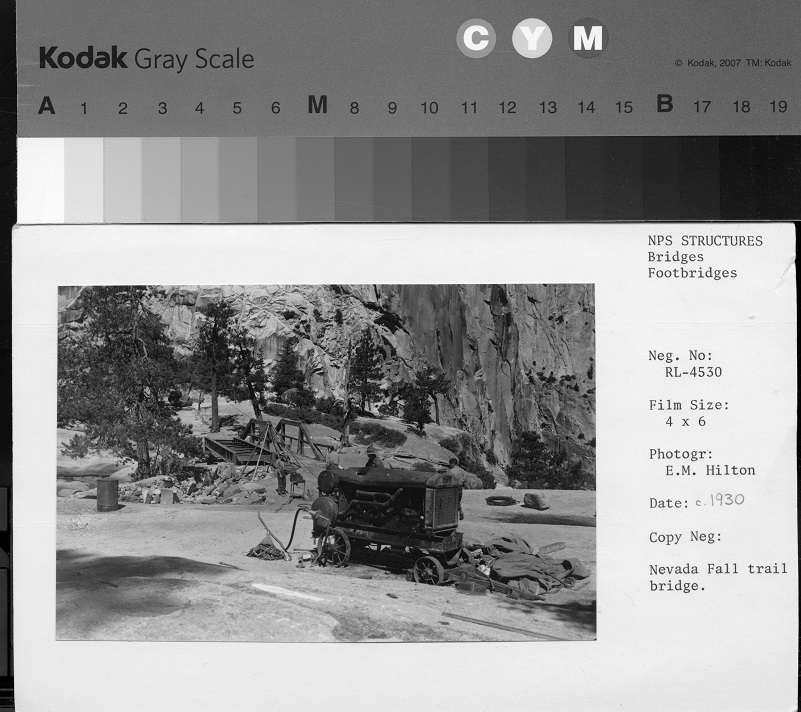
Nevada Fall Bridge 1930 https://npgallery.nps.gov/YOSE/AssetDetail/d2d75195fcb14e3bbaeeb3a213b59382 (Yosemite National Park Digital Archives)
Nevada Fall Bridge 1940 https://npgallery.nps.gov/YOSE/AssetDetail/d38739696b044f10a788487483607fa7 (Yosemite National Park Digital Archives)
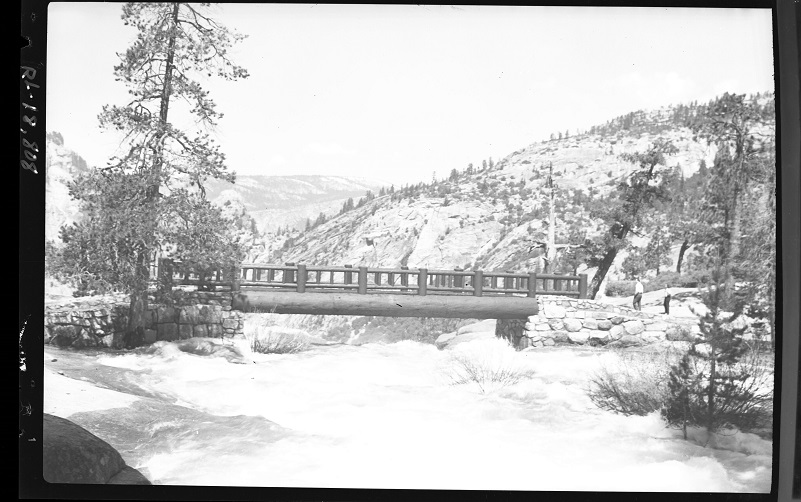
Nevada Fall Bridge July 1, 1941 https://npgallery.nps.gov/YOSE/AssetDetail/ebc821444dc44fee8bcf28235aed1bbd (Yosemite National Park Digital Archives)
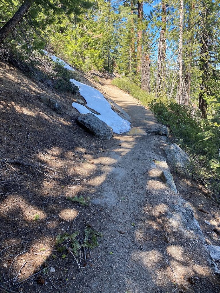
I headed back the same way I had come in, past a couple of small snow patches that won’t be around much longer.
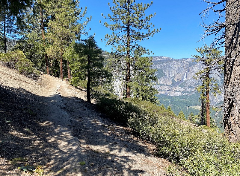
How about another look at Yosemite Falls from the trail?
And with the sun cooperating a bit better, one last look at Vernal and Nevada Falls.
I think this is a great hike to take when Glacier Point Road first opens up, when the waterfalls are putting on their best show and before it gets too warm. In the afternoon, that haul out of Illilouette Creek to Glacier Point can feel hotter than all get-out. If you are lucky, you will have a breeze and if you aren’t lucky, you will need to take some breaks, but what a view you will have as you take in all of that beauty! Also, be sure and drink plenty of water and keep fuel in your fuel tank. You can also loop this hike down to the valley via the Mist Trial or the John Muir Trail and back up via the 4 Mile Trail.
Day Use Reservations are Required in Yosemite Beginning Monday, May 21, 2021.
Most visitors will need a day-use entry pass to enter Yosemite starting May 21.
Those passes aren’t required for people with overnight reservations in Yosemite, a bus ticket in, or who just want to visit Hetch Hetchy or drive through the park to the other side.
The $2 day-use entry passes are already on sale at recreation.gov for arrivals through July 31, needed in addition to normal park entrance fees. The new reservation system will be in place at least through Sept. 31, “or until local health conditions improve” due to the COVID-19 pandemic.
Dog Hike? No, dogs not allowed on this trail.
Doarama:
What is a Doarama? It is a video playback of the GPS track overlaid on a 3 dimensional interactive map. If you “grab” the map, you can tilt it or spin it and look at it from different viewing angles. With the rabbit and turtle buttons, you can also speed it up, slow it down or pause it.
Glacier Point to Illilouette and Nevada Falls Doarama
Map and Profile:
CALTOPO has some free options for mapping and here is a link to my hike this week overlayed on the 1883 Topographic Map: CALTOPO: Glacier Point to Illilouette and Nevada Falls
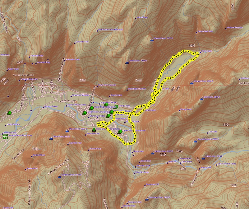
Hiking From Glacier Point to Illilouette and Nevada Falls Topographic Map
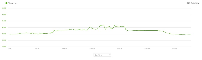
Hiking From Glacier Point to Illilouette and Nevada Falls Profile
Sources:
Browning, Peter, Yosemite Place Names: The Historic Background of Geographic Names in Yosemite National Park, Great West Books, 2005
Illilouette Fall World of Waterfalls
Cornell Lab All About Birds Sooty Grouse
Yosemite National Park Digital Archives
NEVADA FALL CORRIDOR: A CULTURAL LANDSCAPE REPORT by MARTI M. GERDES
Prior Blogs in this Area:
First Day Yosemite Reopened: Hiking From Glacier Point to Illilouette and Nevada Falls June 11, 2020
Hiking From Glacier Point to Illilouette and Nevada Falls May 25, 2017
Hiking up to Vernal and Nevada Falls May 3, 2017
Glacier Point to Illilouette and Nevada Falls April 20, 2016
Nevada Falls and Vernal Falls Looped Hike April 26, 2013


