We hiked up and up 600 plus steps on the Mist Trail to check out two of Yosemite’s famous waterfalls, Vernal and Nevada Falls.
Where:Yosemite National Park
Distance: 8.59 Miles
Difficulty: Moderate to Strenuous
Elevation Range: 3,983′ – 6,056′
Date: May 3, 2017
Maps: El Capitan Topographic Quad
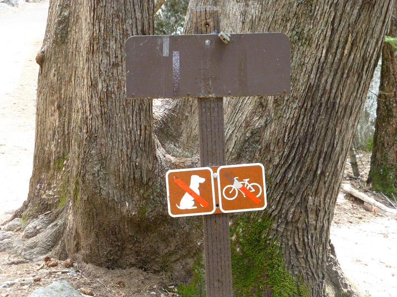
Dog Hike? No dogs allowed on this trail
 We had planned on parking at the Backpacker Parking Lot but the sign on the road said it was full so we headed back to Half Dome Village aka Curry Village to park. I had a friend that was staying in the Pines Campground, so we wandered through there to try and find them with no luck. We then met up with the trail adjacent to the bridge that crosses the Merced River and headed up the John Muir Trail toward Vernal Fall.
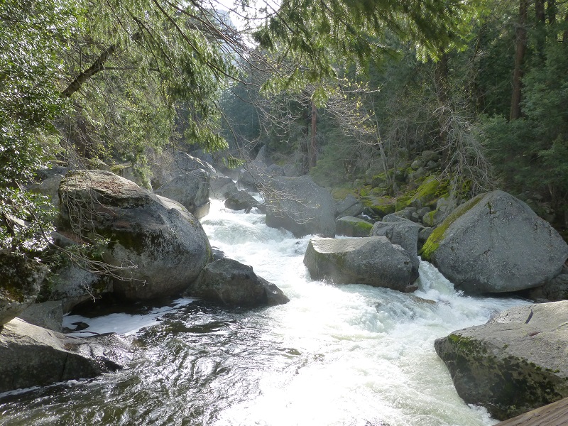
The trail crossed the Merced River where a sign was posted about the dangers and power of the waters below. The sign uses quotes such as “We weren’t swimming,” “We were only wading” from a mother whose two young children died at this exact location on August 15, 2012. It was a very sad and sobering site. Those waters were moving very fast on our day of the hike. If you are hiking near these waters and falls, please follow the directions on the signs. They are there for a reason.


Mist & John Muir Trail Comparison (Courtesy Yosemite National Park)
Drinking fountains and bathrooms were located on the south side of the bridge. As we continued up the trail, we reached the junction of the Mist Trail and the John Muir Trail. You can hike to both waterfalls all year. However, in winter, there is a specific route that remains open while some sections of trail are closed. The lower portion of the Mist Trail along Vernal Fall closes in winter due to risk of falling ice and rock. The upper portion of the John Muir Trail between Clark Point and the top of Nevada Fall are closed in winter due to very dangerous, icy conditions. Keep in mind that the sections of trail that remain open in the winter may be very icy and/or snowy.
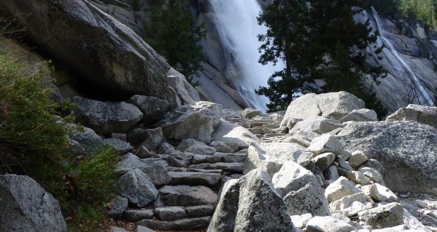
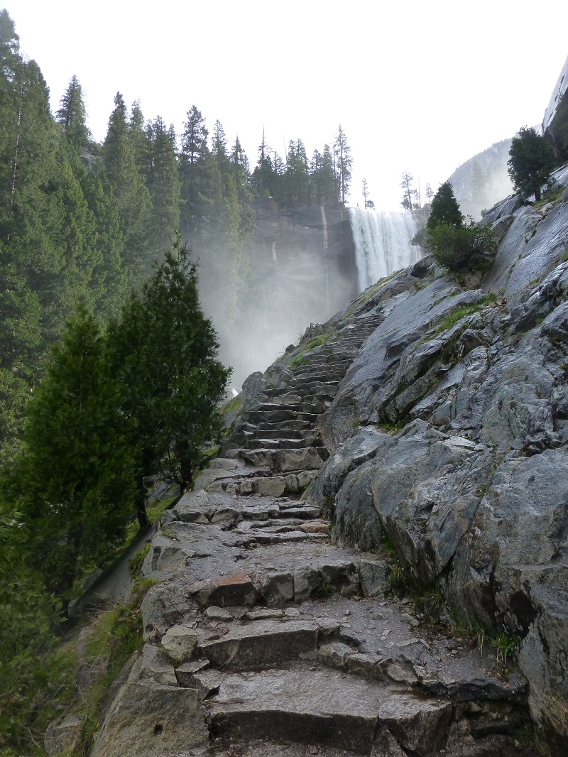
Although the Mist Trail is shorter, it is steep, heading up a steep granite stairway of over 600 steps. The Mist Trail can also be very slippery because the mist from Vernal Falls reaches this area and many people come prepared to put on a raincoat for the wetter stretch. Sometimes this spray is more of a drench and some days it is a light mist. I think that this mist feels really good on warm days and it didn’t look to be too heavy of a mist on this day for I just headed on up without raingear. Gail did put on her rain jacket though.
Many of the trails in Yosemite were utilized by the Native Americans long before records capture their history. Many of those routes are still used today such as the Mono Trail. Two years after the Yosemite Grant was created in 1864, Yosemite Valley and the Mariposa Grove were later ceded to California as a state park, and a board of commissioners that were called the Yosemite Valley Commissioners were created. When this occurred, it was noted that there were two improved trails in the Valley; the Vernal Falls Trail and the Mirror Lake Trail, both of which have unknown builders and construction dates. It was the policy of the Commissioners to grant toll privileges for trail construction. The Commissioners wanted to the develop the Valley but had limited funds. They gave charters for the construction of toll trails, under which the Four Mile Glacier Trail, the Snow Trail, and the Eagle Peak Trail were built. In 1870, Albert Snow constructed a horse trail from “Register Rock”, at the start of Mist Trail, over the rugged shoulder on which Clark Point is located, to the flat between Vernal and Nevada Falls. Here he constructed a hotel known as “La Casa Nevada”. The following year John Conway built a trail which ascended from the La Casa Nevada to the top of Nevada Falls and Little Yosemite Valley. In 1882 the Commission purchased the Mist and Glacier trails and soon after bought the rest. They did little trail building themselves before the Army took over in 1891. The trail was improved during the WPA (Works Progress Administration) projects of the 1930s and many others have worked hard to maintain and improve it through the years.
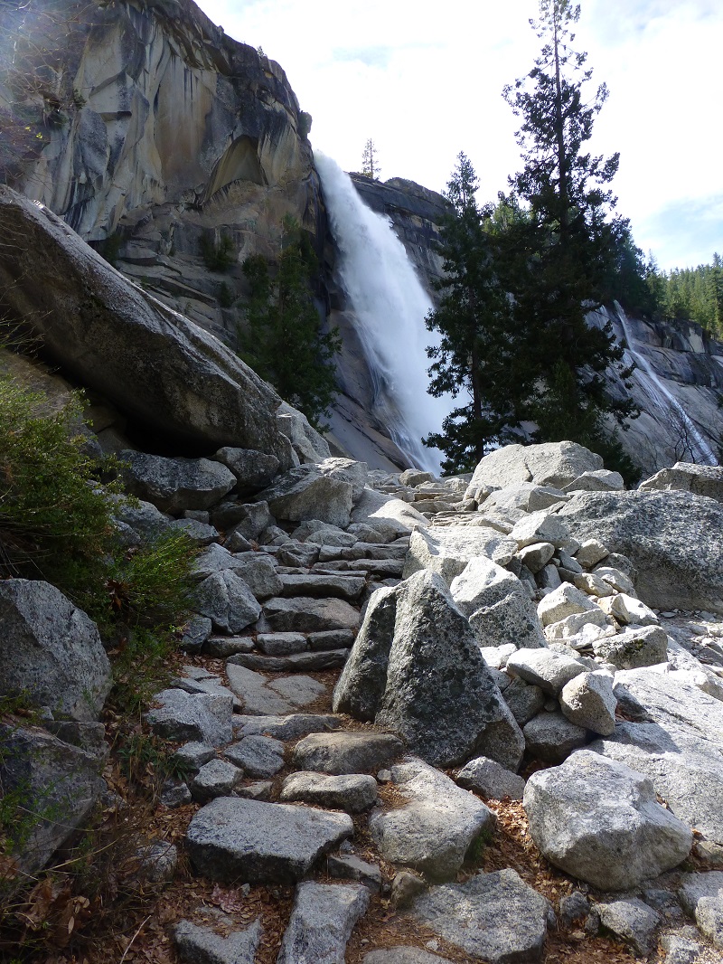
It wasn’t long before we got out first peeks of Vernal Fall.
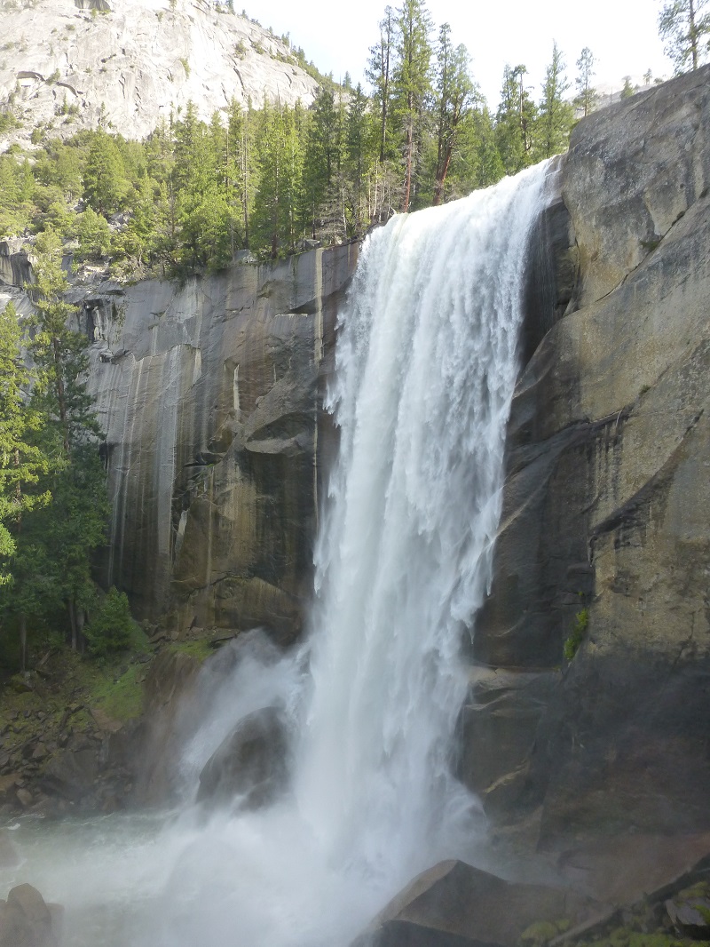
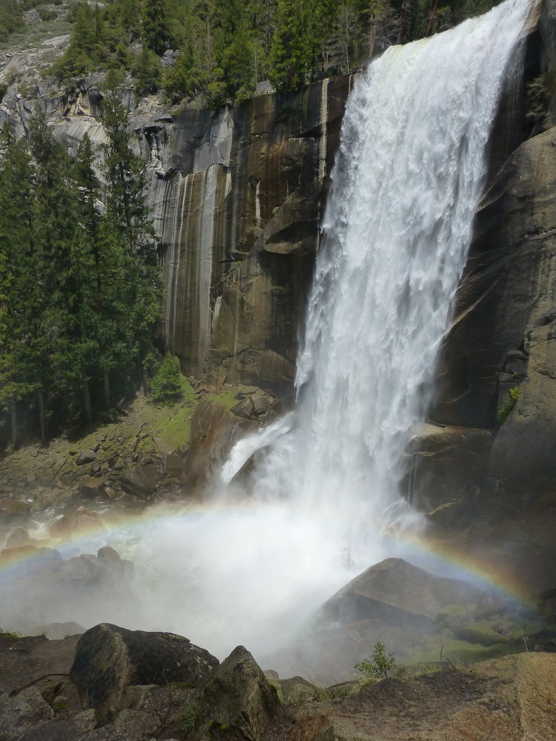
We reached the top of Vernal Fall, which has a drop of 317 feet. From John Hittell’s 1868 “Yosemite: Its Wonders and Its Beauties”, it was named Vernal because the water near the top is very green and to distinguish it from another fall farther up that was very white.

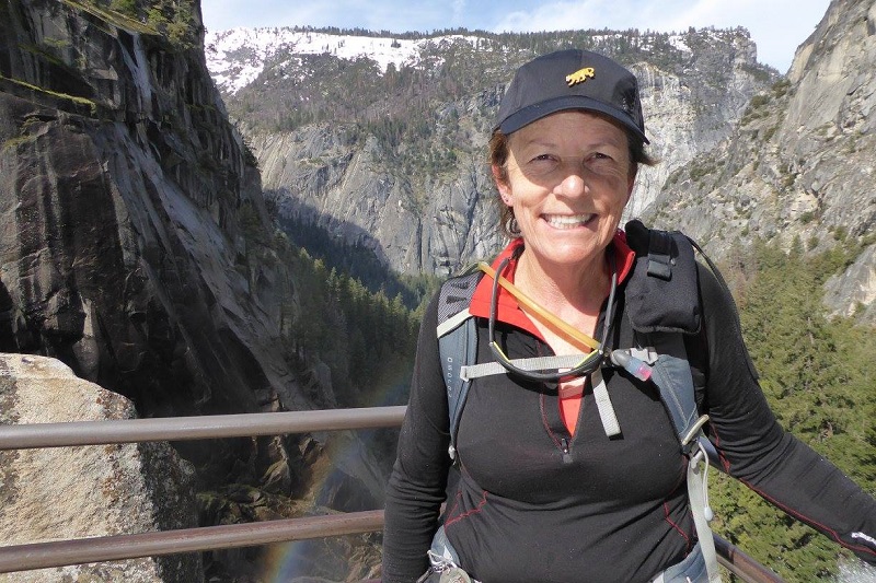
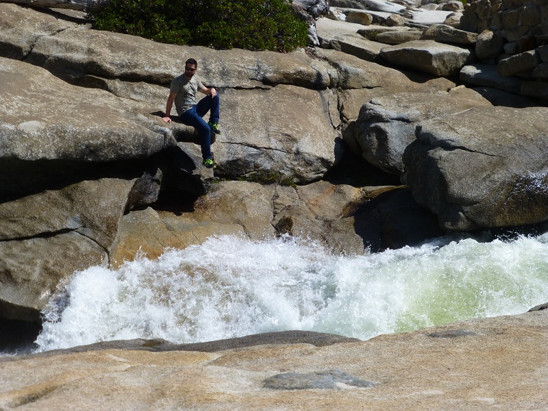
Photo of Me by Gail Gilbert

There were many signs to show the dangers of getting too close to these fast moving waters.

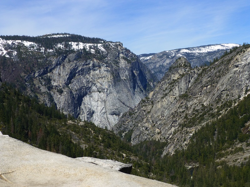
We continued onward and upward toward Nevada Fall, through several rocky switchbacks. It wasn’t long before we had it in our view. . .and what a view it was!
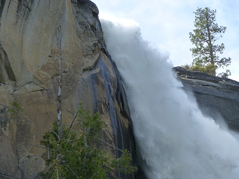

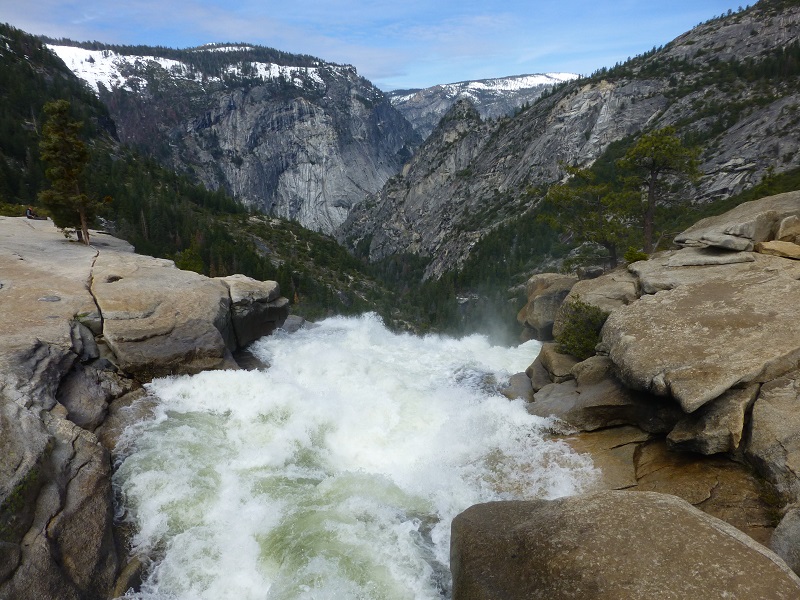
When we reached the top of Nevada Fall, we made a short stop at the restrooms then headed over to the bridge. There wasn’t as much water flowing over the top as we have seen but there was alot and it was moving fast.

The view from the bridge gave us a really nice view of the 594 foot plunge that the water takes over Nevada Fall. The waterfall free-falls for roughly the first third of its length to a steep slick-rock slope, which creates a whitewater appearance in the falls and produces a great deal of mist which covers a wide radius, which led to its current name (Nevada is an old Spanish word meaning “snowy”).
From Wikipedia, “The Indian name was Yo-wy-we, signifying the twist or squirm of the falling water. Lafayette Bunnell suggested the name “Nevada” for the waterfall. He wrote, “The Nevada Fall was so called because it was the nearest to the Sierra Nevada, and because the name was sufficiently indicative of a wintry companion for our spring (Vernal Fall)… The white, foaming water, as it dashed down Yo-wy-we from the snowy mountains, represented to my mind a vast avalanche of snow”
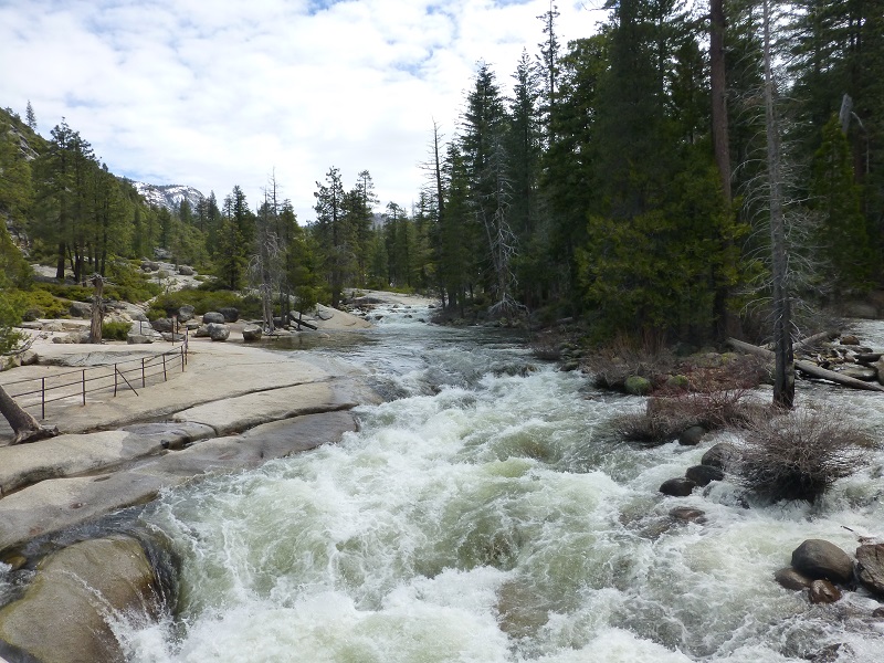
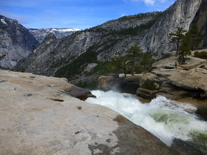
Looking upstream.
Looking over the top of Nevada Fall.
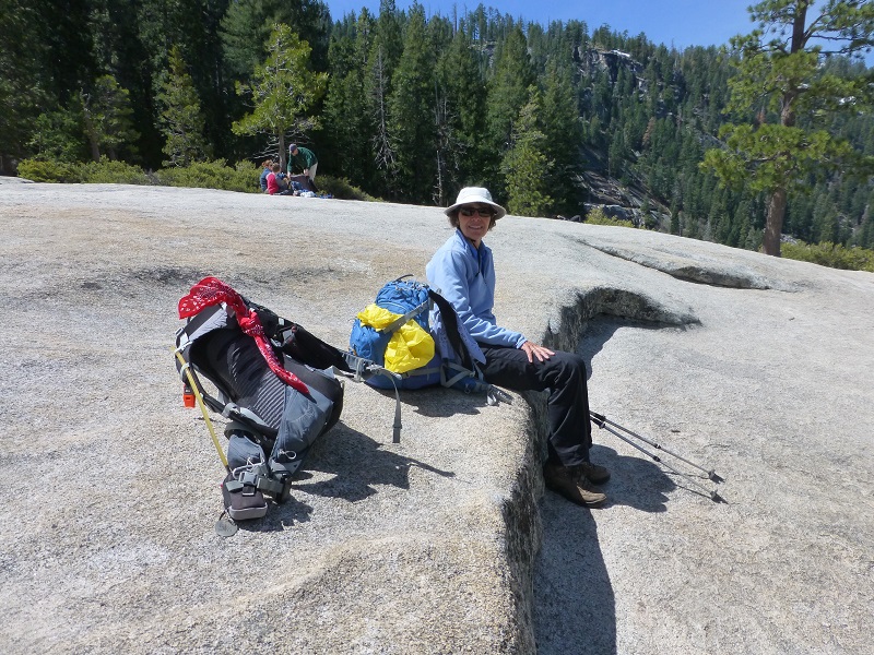
We headed over to our favorite lunch spot with a view.
It wasn’t too long before we saw people climbing over and beyond the fencing to get a better view or getting their pictures taken at the top of Nevada Fall. All that I can say is that this is more than stupid.
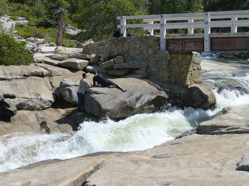
Backpacker Magazine rates the Mist Trail as one of the 10 most dangerous hikes. Fatigue, altitude sickness, and dehydration contribute to the danger, but many times hikers ignore warnings of staying away from the swift flowing water of the Merced River, deliberately climbing over barriers to get a better view, slipping and falling into the River.
There are so many signs warning people of the dangers of the Merced River in this area but for some reason some people ignore them. When in any doubt, stay out of the water and use good common sense. Fast moving water can be a killer and is the cause of most deaths in the park. I cannot emphasize enough that you should follow what the signs say and keep close control of your little ones.
We had hoped to make this a looped hike, continuing on the John Muir Trail back down, but it was closed to rocks falling. We headed back down the way that we had come up on the Mist Trail. When we reached the steps alongside Vernal Falls, the light spray was perfect for rainbows. Sometimes you can even see a complete circular rainbow here.
As we walked down, we had glimpses of Illillouette Falls, many smaller ones and even Yosemite Falls.

As we walked back to our vehicle through Yosemite Valley, the dogwoods were starting their beautiful blooms. Most of them were just getting started but in another week or so, they will really be blooming nicely.
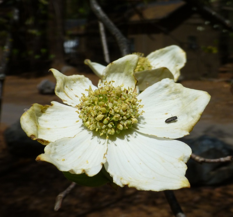
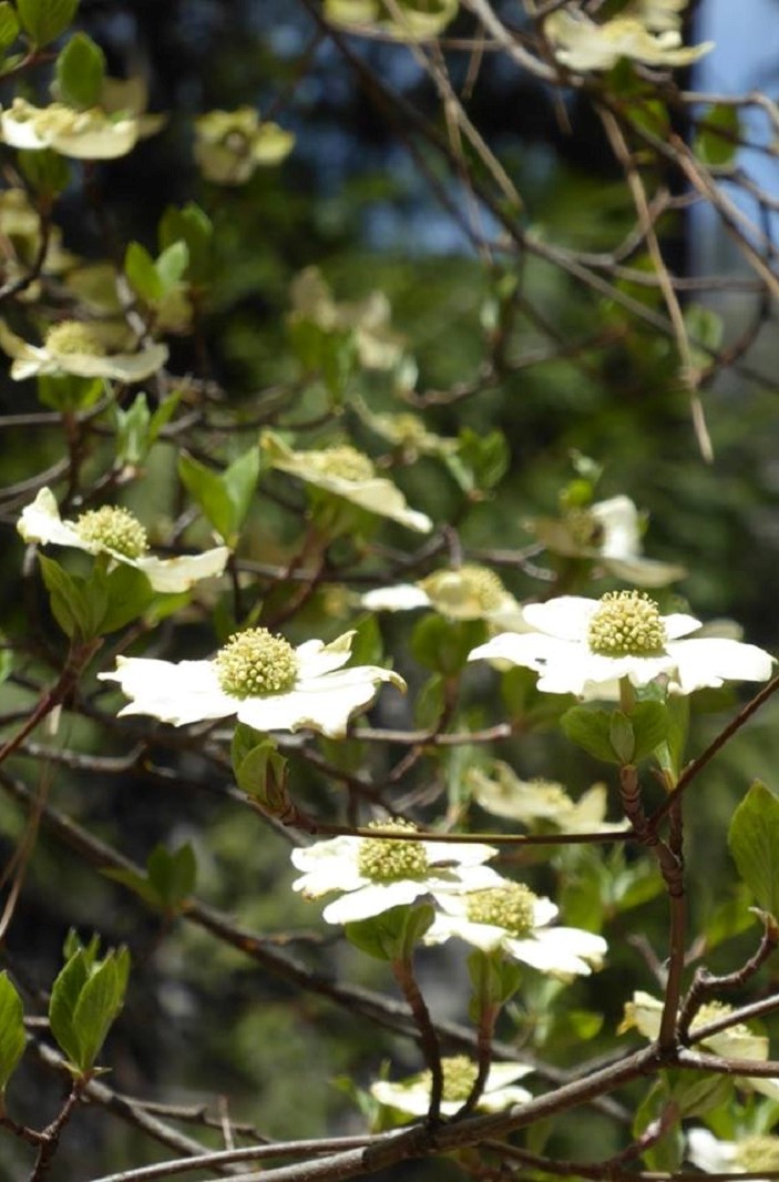
Photo by Gail Gilbert
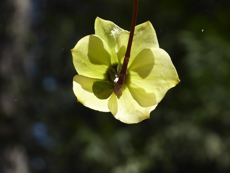
Photo by Gail Gilbert
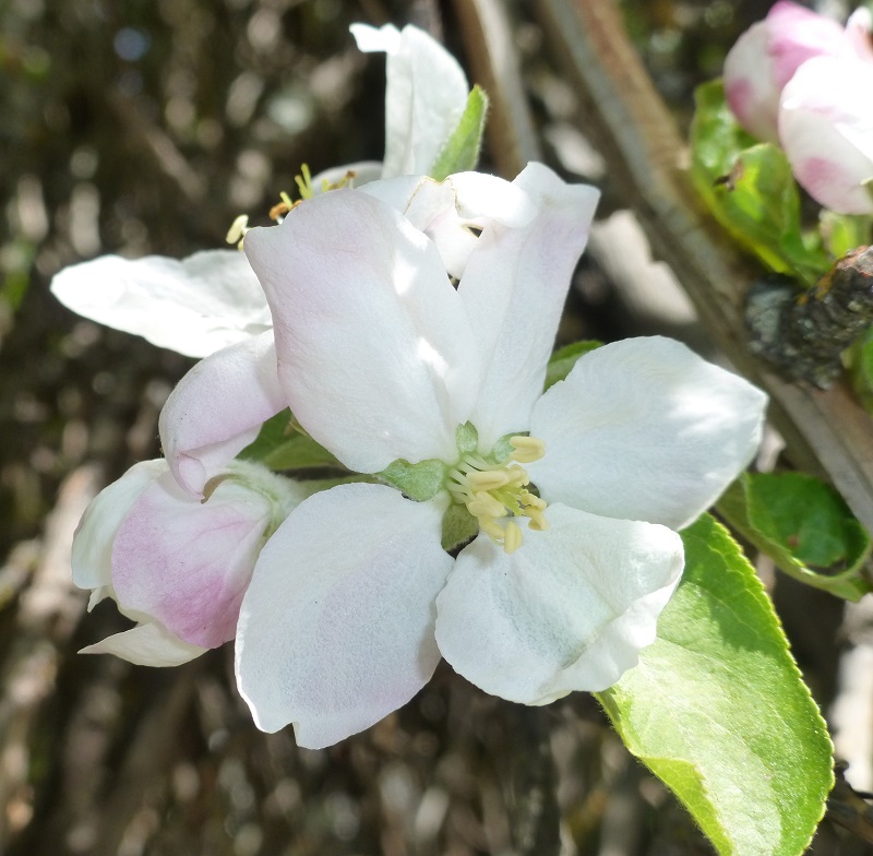
Even the apple trees were in bloom!
If you decide to hike up the Mist Trail, be prepared for those steep steps. As you head up, remember that you also need to come back down. There are many places to pull off to the side of the trail to take a rest if you need to. This trail is heavily visited so don’t expect a pristine wilderness on this hike. But if you haven’t done this one before and it sounds like something within your abilities, you might consider packing a light rain jacket in addition to your usual items in your pack.
Dog Hike?
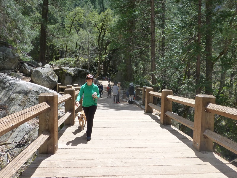
No, dogs are not allowed on this trail in Yosemite National Park and the trail is clearly signed as such at the beginning of the trail. We did see one person about 2 1/2 miles above the trailhead walking her dog. I don’t know why she wasn’t following the rules.
Map and Profile:
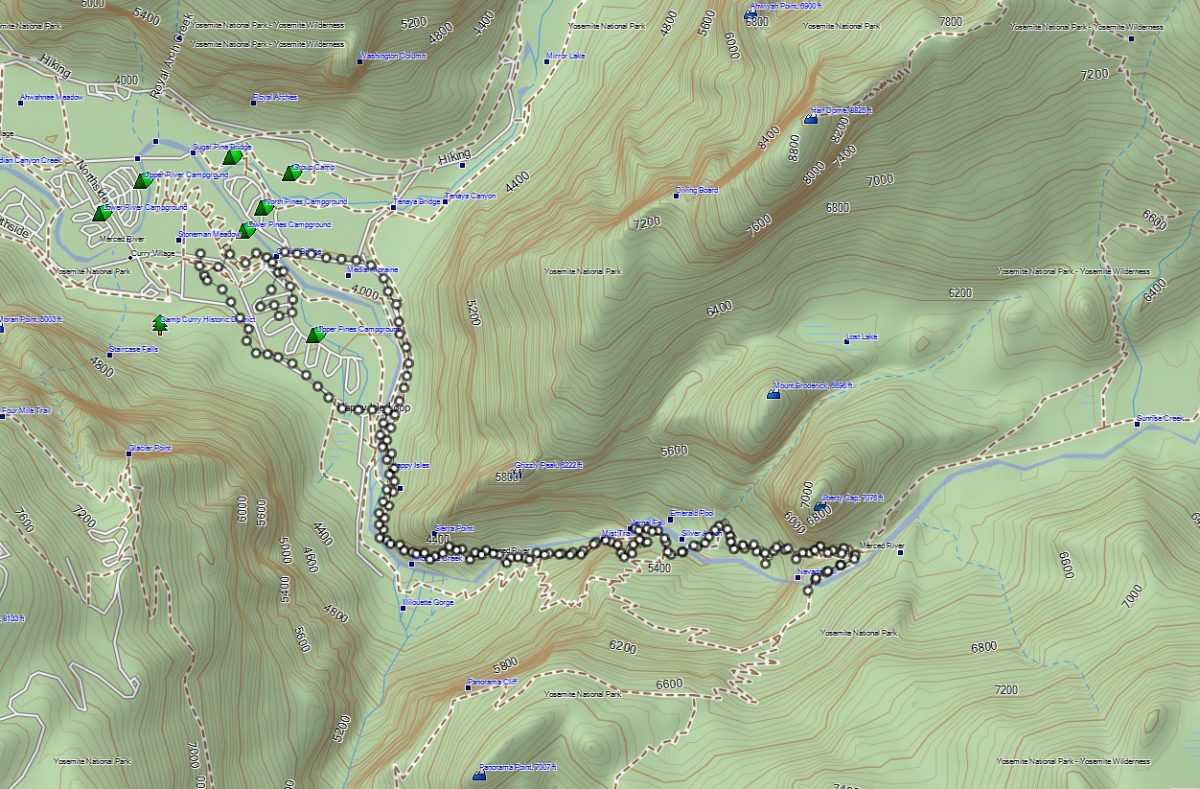
Curry Village (aka Half Dome Village) to Vernal and Nevada Falls Topographic Map
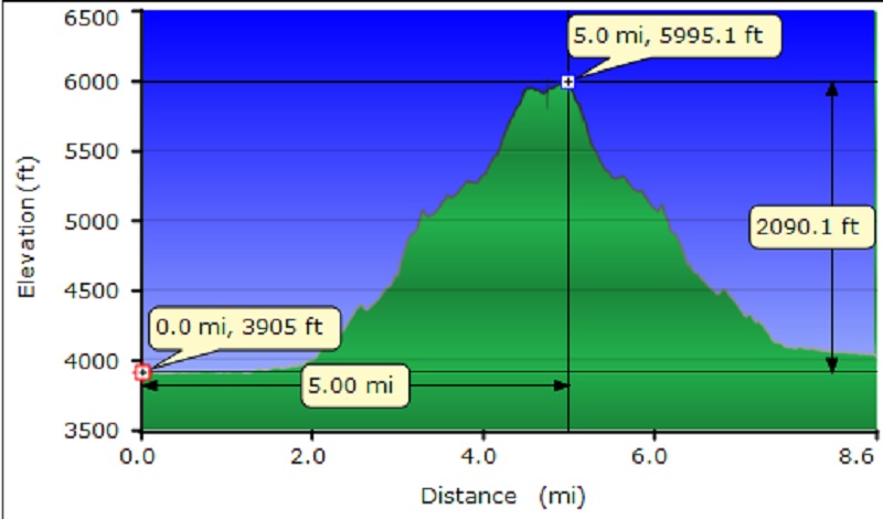
Curry Village (aka Half Dome Village) to Vernal and Nevada Falls Profile
Prior Blogs in the Area:
Hiking Up Through The Meadow Fire To Bunnell Cascade January 23, 2015
Nevada Falls and Vernal Falls Looped Hike April 26, 2013
Sources:
Vernal Fall and Nevada Fall Trails Yosemite National Park
Pathways: A Story of Trails and Men (1968), by John W. Bingaman
Where Pets are Allowed Yosemite National Park
Bunnell, Lafayette H. (1892) Discovery of the Yosemite. Chapter 13, p. 205
Wikipedia
Hittell, John S. (1868) Yosemite: Its Wonders and Its Beauties