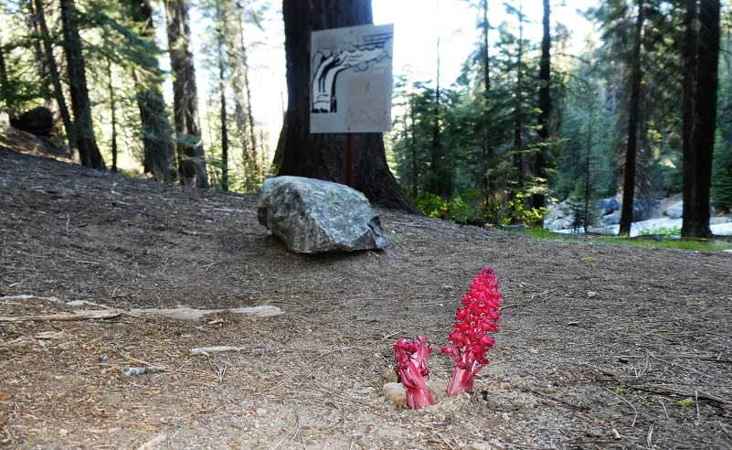
It was the first day that Yosemite National Park had reopened after the COVID-19 shutdown, a new Day Use Entry system was in place and I was determined to cross through the gate as soon as I could to check out the waterfalls. My adventures always have a surprise or two and this one delivered some.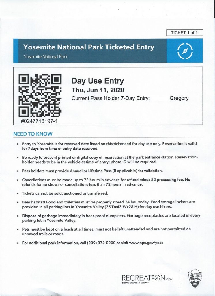 Where: Yosemite National Park
Distance: 10.92 Miles
Difficulty: Moderate
Elevation Range: 5,889′ to 7,272′
Date: June 11, 2020
Maps: El Capitan Topographic Quads
Dog Hike? No
Yosemite National Park had started to reopen after being closed due to COVID-19, implementing a temporary day use reservation system. The initial online opening Day Use Entry Passes could be purchased at 7:00 a.m. on Tuesday, June 9, 2020, offering 1700 vehicle passes each day. Passes are validated at the park entrance gate on the reservation date and can be used for 7 days of entry. These day use vehicle reservations went on sale through Recreation.gov and it was a challenge to get through to make the required reservation due to overloaded systems but I was eventually successful. I printed out my pass and my plan was to be at the Wawona gate ready with my pass which was effective 5:00 am.
I headed up Highway 41 through the South Entrance to Yosemite near Mariposa Grove, then to Glacier Point Road, arriving at the gate at 5:08 am and there was a little line up.

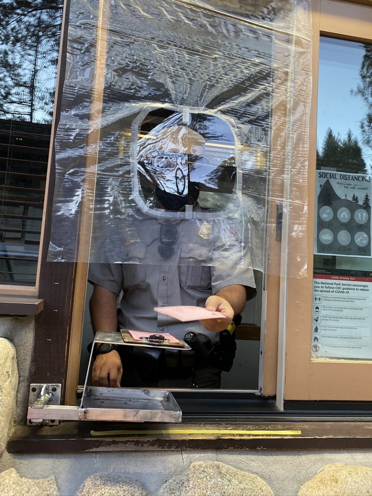
It took me 30 minutes to make it to the gate where my printed pass, picture ID and Day Use Entry Pass were compared with a list that they had. I passed muster and was given a pink piece of paper with some information to be placed on my dashboard.
So for my first visit to Yosemite in quite a while, I decided to head for Glacier Point to see some waterfalls. There were only a couple of people there when I arrived. Picture taking wasn’t ideal, shooting into the sun, but it felt very special to see Glacier Point so empty of people.

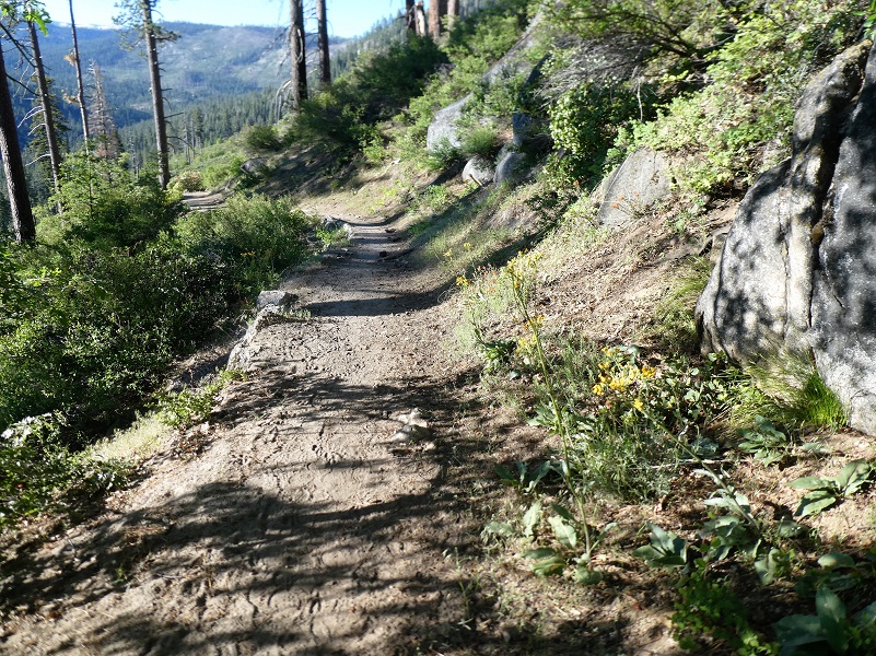
I headed out on the Panarama Trail. Note the changes this year with no shuttle service between Yosemite Valley and Glacier Point, along with messages on social distancing.

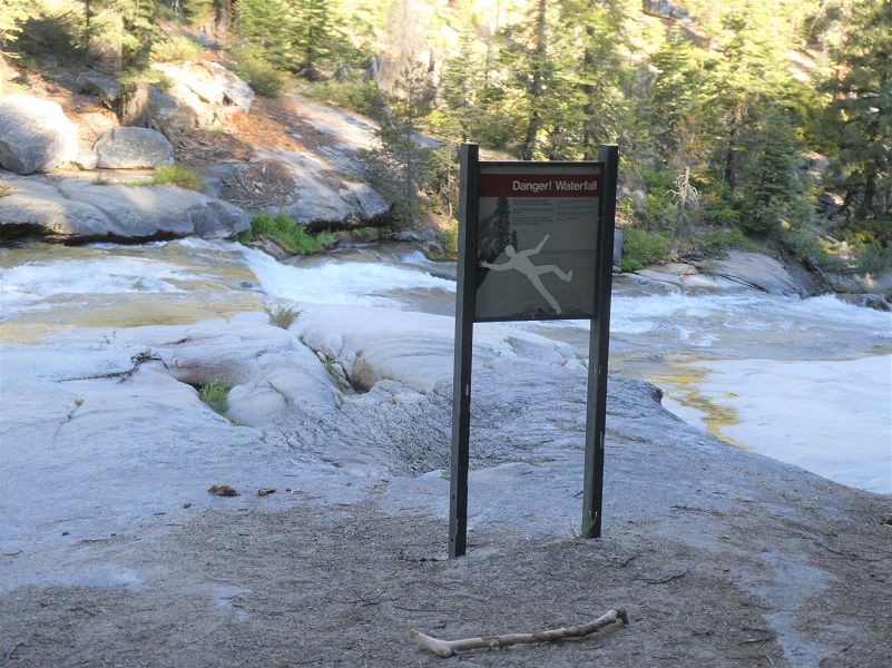
Before the trail reached Illilouette Fall, there was a junction which headed toward Mono Meadow. I stayed on the trail that was signed for Illilouette Falls. Speaking of signs, there were several that pointed out the danger of getting too close to this set of falls yet people ignore these signs and sadly meet their death here. If you fall into the water here, there is no saving you.
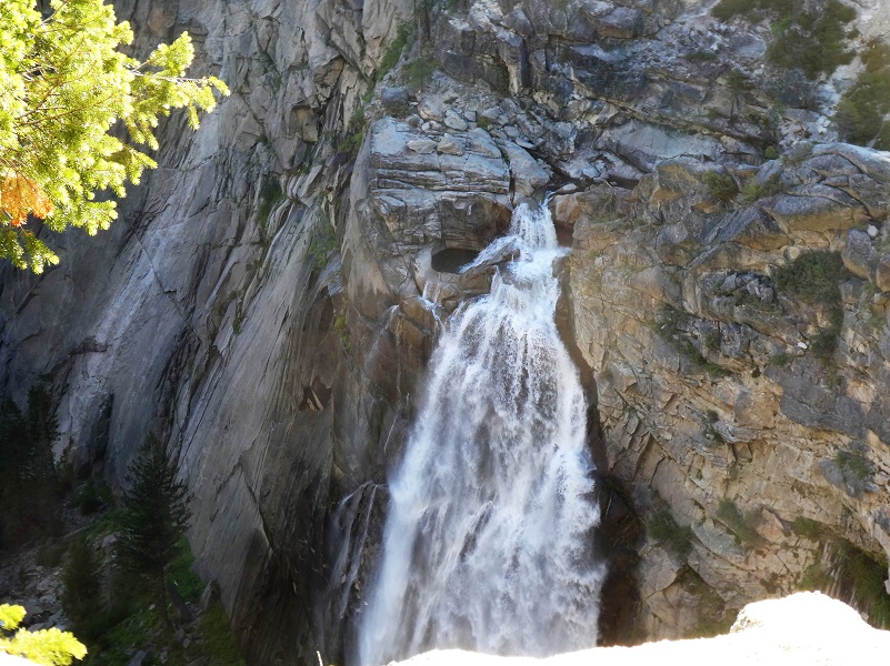
I could hear Illilouette Fall roaring long before I reached it. The best vantage point to get a picture of Illilouette Falls is before you reach the bridge. There is a view point along the trail where I caught my first glimpse of Illilouette Fall and boy, was it flowing! This waterfall is fed by Illilouette Creek and was called Tululowehack in the California Geological Report in 1870, supposedly an Indian name. They pronounced it Too-lool-a-we-ack or Too-lool-we-ack and was inpreted as “the place beyond which was the great rendezvous of the Yos-Semite Indians for hunting deer.” The name was a difficult one for people to pronounce and the name of Illilouette started showing up as early as a 1896 map. The name of Illilouette Ridge was recommended in 1907 and the gorge was first named on the fourth edition of the USGS map of the valley in 1927. The World of Waterfalls says that it is said that this fall is said to be 370 feet tall.
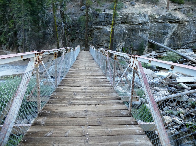
I continued across the bridge, crossing Illilouette Creek and continued up the trail.
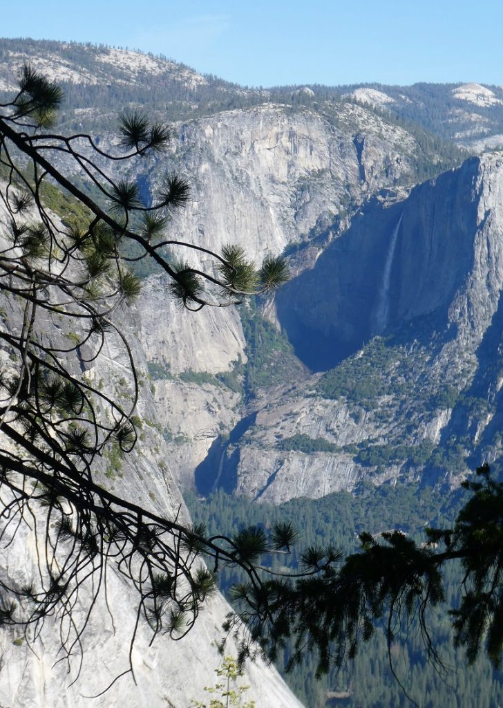
There are several spots along this trail where you have amazing views of Yosemite Falls and I couldn’t resist taking in those views. Yosemite Falls is the highest of the waterfalls in Yosemite National Park, with a drop of 2,425 feet over three sections. Yosemite Creek flows over the Upper Yosemite Fall, dropping 1,420 feet. There are then 5 smaller plunges called the Middle Cascades, together dropping 675 feet. Lower Yosemite Fall drops 320 feet.
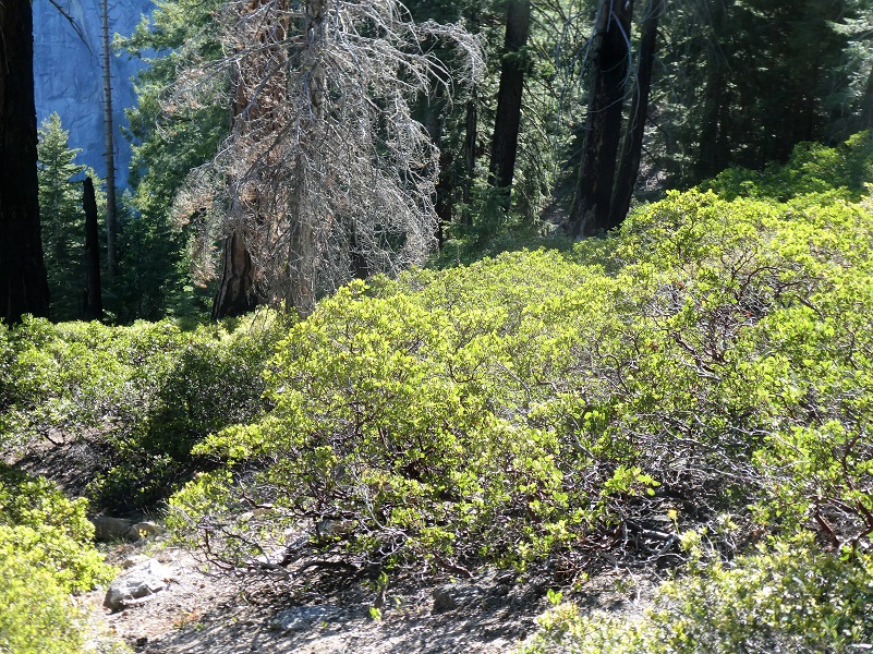
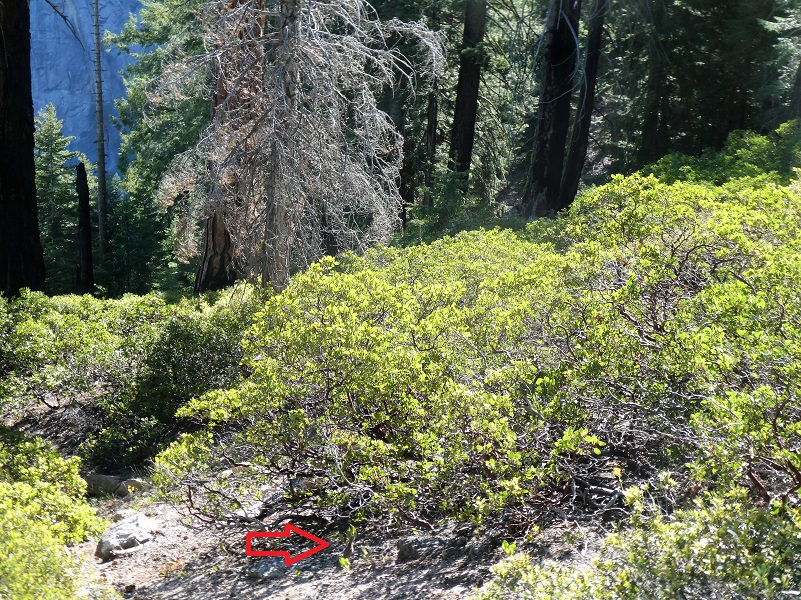
As I was walking up the trail, I noticed a Sooty Grouse right on the trail ahead of me and froze. I figured that her babies might be nearby and that is why she was trying to get me interested in her. I froze for a while where I was to see if I could spot any of her chicks? If you can’t spot it, the picture below it might help.
They were beautiful to watch as they slowly moved off, then I continued on.


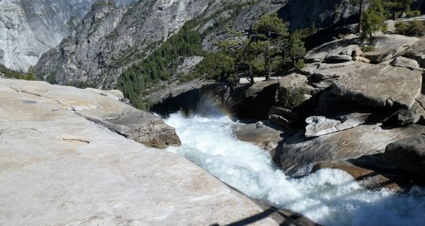
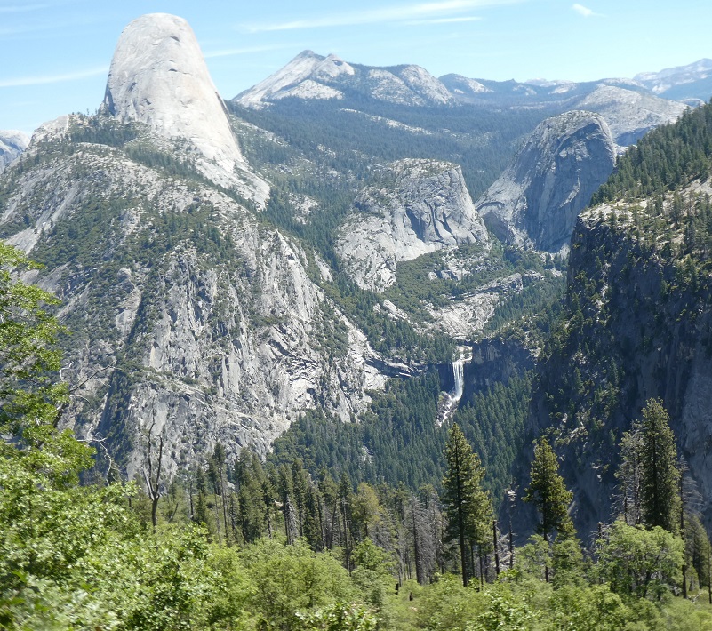
There is a short stretch where you can get a glimpse of the Merced River flowing over Vernal Falls, dropping for 317 feet.

As I was headed down the switchbacks to Nevada Falls, I caught the wonderful smell of wild azaelas and soon spotted the first ones in this area starting to bloom.

When I reached Nevada Fall, there were a few people who came and went. For a short while, I had the place to myself. Nevada Fall has a drop of 594 feet.
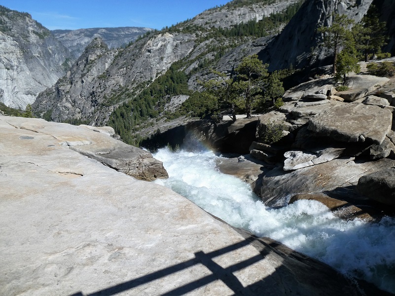
Looking at a picture of the water moving below the bridge really doesn’t do justice to it, so here is a video:
I sat down in a good spot to admire the views and have a snack.
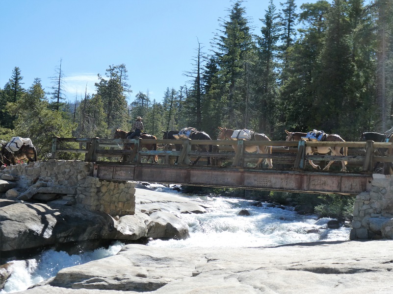
And this happened. A string of mules passed over the bridge carrying a good load. I love that when I see these beautiful animals.
As I headed back up toward the trail, I thought I would take a picture of the river flowing above the bridge and again, there are plenty of signs warning people to not get close to the water and the dangers of being slept away. This person chose to ignore those warnings.

I headed back the same way I came in although you can loop this hike in several other ways. There is a good uphill haul out of Illilouette Creek on the way out and I dread it on a warm days such as this. If you are lucky you will have a breeze and if you aren’t lucky, you will want to take some breaks, but what a view you will have as you take in all of that beauty! Also, be sure and drink plenty of water and keep fuel in your fuel tank. You can also loop this hike down to the valley via the Mist Trial or the John Muir Trail and back up via the 4 Mile Trail.
I think this is a great hike to take when Glacier Point Road opens up, when the waterfalls are putting on their best show and before it gets too warm. Social distancing wasn’t an issue on my hike because there were so few people on the trail. Although we greeted each, other, we maintained plenty of distance.
Dog Hike? No, dogs not allowed on this trail.
Doarama:
What is a Doarama? It is a video playback of the GPS track overlaid on a 3 dimensional interactive map. If you “grab” the map, you can tilt it or spin it and look at it from different viewing angles. With the rabbit and turtle buttons, you can also speed it up, slow it down or pause it.
Glacier Point to Nevada Falls Doarama
Map and Profile:

Glacier Point to Nevada Falls Topographic Map
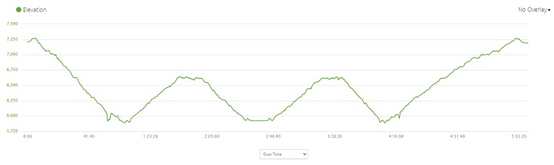
Glacier Point to Nevada Falls Profile
Sources:
Browning, Peter, Yosemite Place Names: The Historic Background of Geographic Names in Yosemite National Park, Great West Books, 2005
Illilouette Falls World of Waterfalls
Prior Blogs in this Area:
Hiking From Glacier Point to Illilouette and Nevada Falls May 25, 2017
Hiking up to Vernal and Nevada Falls May 3, 2017
Glacier Point to Illilouette and Nevada Falls April 20, 2016

