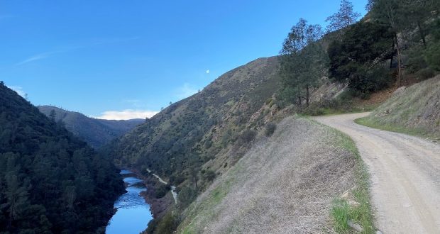
I love walking the same road each week in the spring, admiring the changing wildflower colors, butterflies, bugs and occasional critter. Snake tracks on the road also told me that the rattlesnakes were waking up. Last week I had spotted a few old mines on the map not far from my path and you know me, I had to check them out. Hiking up the Burma Grade with views of the Merced River and hills makes this workout pass by quickly, well almost . . .
Where: Bureau of Land Management (BLM), Merced River Recreation Management Area
Distance: About 12 miles roundtrip but you can go shorter or longer
Difficulty: Moderate to Strenuous
Elevation Range: 1,138′ – 2,836′
Date: March 2, 2021
CALTOPO: Hiking From Briceburg Up the Burma Grade to Explore Old Mining Activity
Dog Hike? Maybe
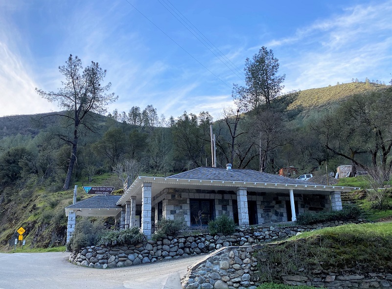 To reach Briceburg, I drove up Hwy 140 north about 15 miles from Mariposa to the Briceburg Visitor Center at the Merced Wild & Scenic River. You can’t miss the beautiful old stone building that William M. Brice, who Briceburg was named after, built in 1926 as Highway 140 into Yosemite was being built. Originally it was a general store for locals and tourist. Gasoline pumps were later added, and it also provided lodging and had a soda fountain over the years. The BLM acquired the property in the 1980’s and refurbished the building to its near-original condition to be used as a Visitor Center. The Visitor Center is currently closed and expected to reopen the first weekend of May. For more history about William Brice, check out my prior Briceburg Blog.
After driving by the Visitor Center, I parked in the parking area along the Merced River where the restroom is located and it was a brisk 35 degrees. I like to park in this area because I can check out the views of the Merced River as I walk across the suspension bridge, but that parking area was a bit crowded this morning with construction vehicles that were working above the Visitor Center. The 160 foot suspension bridge was built by the United States Forest Service in 1937 and constructed by 30 Civilian Conservation Corps enrollees. Trailers over 18 feet and large RV’s are not recommended to cross this bridge.
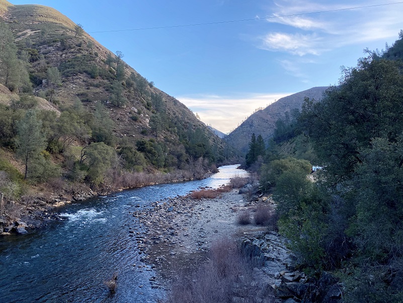
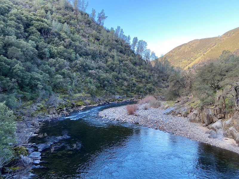
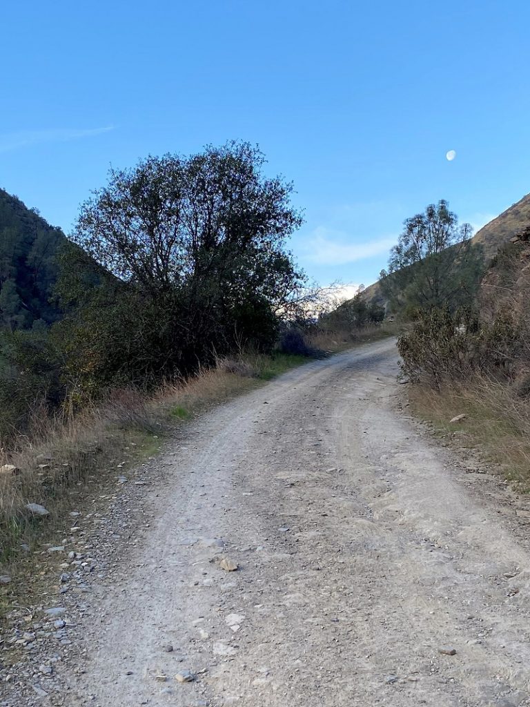
After the bridge, the Burma Grade starts to the right where there is a small parking area that is perfect if you are going to follow the Merced River Trail upriver on the historic Yosemite Valley Railroad bed. Or you can follow the Merced River Trail downriver, which is especially pretty in the spring when the wildflowers are blooming. The waning moon was still hanging in the sky, leading me up the road.

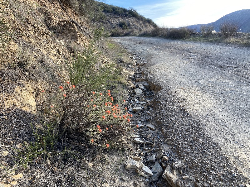
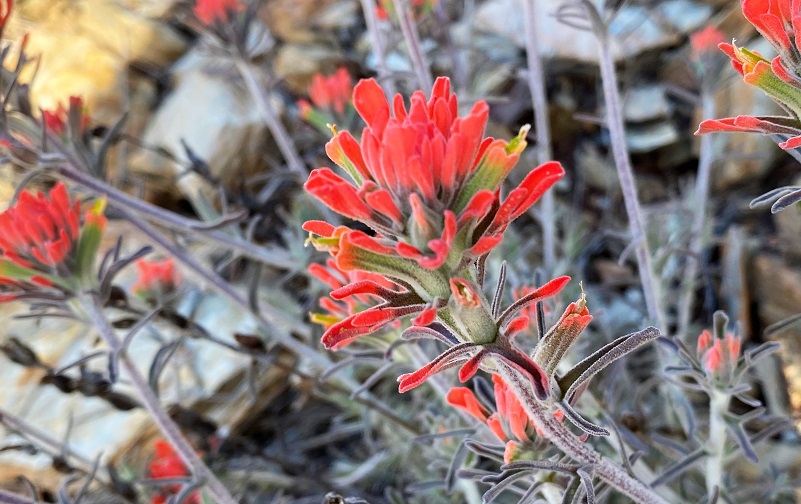
Quite a few more paintbrush were blooming since I hiked this road a week ago.
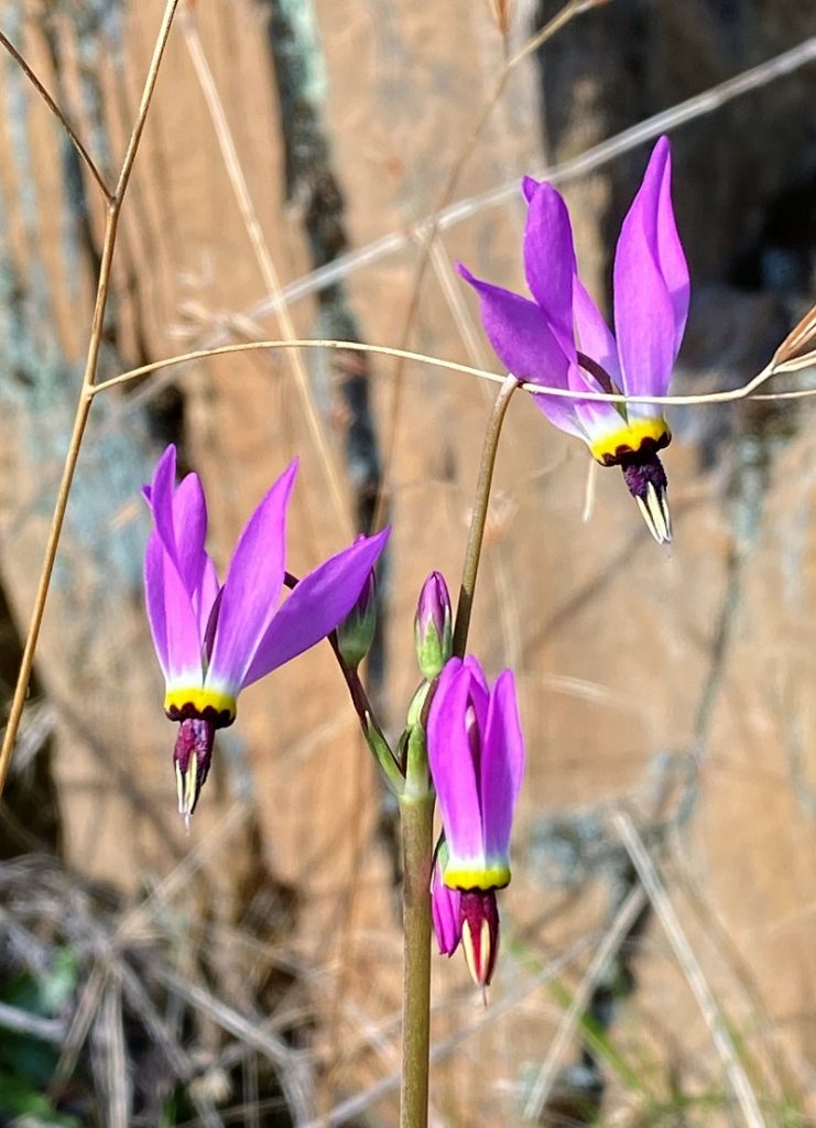
As I rounded a corner, I was surprised to see a group of shooting stars. Their flowers put a smile on my face because they are so colorful.
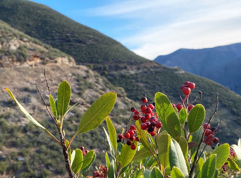
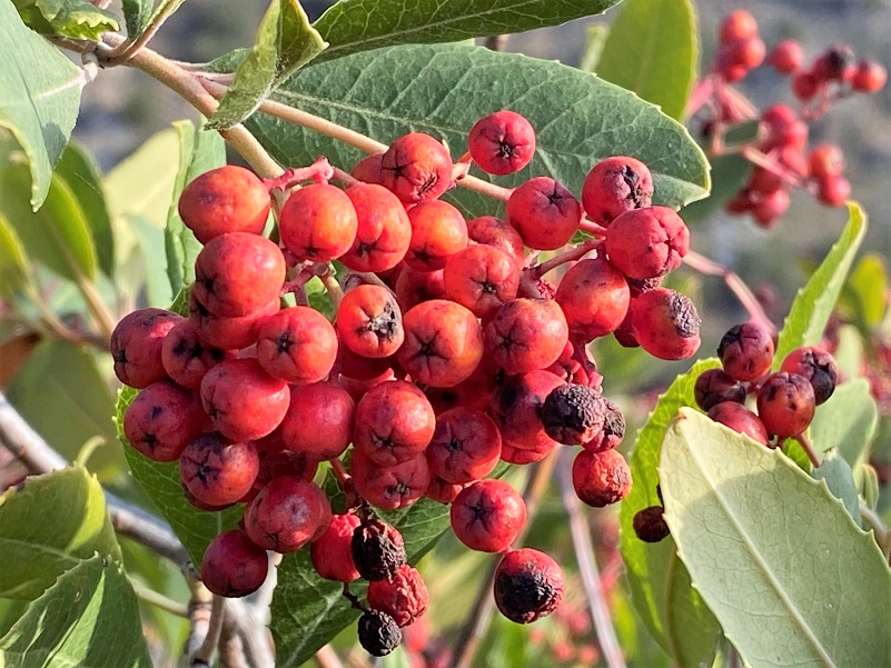
Toyon berries were still on some of the bushes. They are an important food for wildlife in the area. Birds, bears and even coyote eat them. for people, these berries can be toxic if enough are eaten.
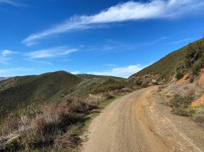
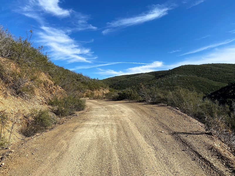
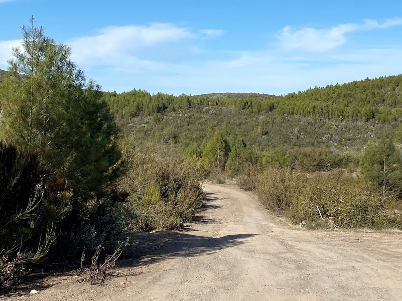
The Burma Road is also known as the Briceburg or Bull Creek Road and immediately starts to climb along a steep road that is basically one lane wide with switchbacks that takes you up the hill. It is also called the Burma Grade. As you climb, you have incredible views of the Merced River, Briceburg, the suspension bridge, and Hwy 140. Besides hikers, high clearance 4 wheelers, motorcycles and mountain bikers also use this road. The road can have washouts, slides and deep ruts, closing it some years but when it is open, I understand you can get to Greeley Hill or Buck Meadows from Briceburg.

I continued up the road, taking in the changing views as I climbed. I noticed more snake tracks on the road than I did the previous week and kept my eyes open for rattlesnakes but didn’t see any. I bet they saw me though.

 I continued up the road and past the gate, which is at about 4.5 mile mark, and I could really see the impacts that the Telegraph Fire made on this area. The first report on the Telegraph Fire was at 3:15 pm on July 25, 2008, reported in the area of Mosher and Telegraph Roads. By the time it was contained on August 6, it had burned 30 homes, over 100 other structures, over 34,000 acres, cost over $37 million to fight and resulted in millions of dollars of property damage. A December 4, 2008 Merced Sun-Star article stated that a 29-year-old man convicted of starting the 34,000-acre Telegraph Fire was sentenced to three years summary probation and 60 hours community service. Davin Craig Mosher of Merced told investigators he was target shooting in a Bureau of Land Management area along the Merced River where target shooting is legal. A steel-jacketed bullet Mosher fired hit a rock and sparked flames, which rapidly spread through dry grass.
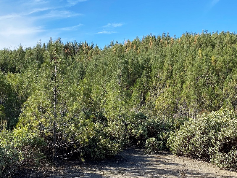
The Telegraph Fire had burned through this entire area that I was walking through and almost 13 years later, the growth included a dense knobcone pine stand, a species that has adapted to fire. Its cones stay closed for many years until a fire opens them, then they can reseed themselves. On older trees, you can see the cones embedded in the trunk as the tree grows.
Last week I had taken the road that branched to the right and on this day, I stayed on the main road that veers to the left and turns into Ponderosa Way.

Standing skeletons of trees ere still standing, giving hints to what the vegetation was like before the fire ripped through.

Last week while I was playing with maps of the area, I came across some mining information that made my ears perk right up. One of those maps was found on TheDiggings.com. If I overlayed the area where I had been hiking out of Briceburg, I discovered that darn near every inch of that area had at one time had a mining claim on it. I took a look at Mindat.org to see if I could discover more detail on some of the closer mines.If you click on the maps, they will magically get larger.
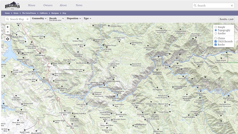

If just went a little farther up the road, I would be close to two old gold mines. Well, no one had to ask me twice if this was someone thing I was going to do. I placed points of interest on my GPS but these locations from these sites isn’t always exact. It would need some “ground truthing” to locate the mines and figuring out the travel route to the mines might reveal additional workings or buildings associated with it.
The first mine was the Leach Gold Mine, discovered in 1900. The last years of production were from 1900-1905, operated by M. Van De Carr, and also mined Copper. From Minedat.org:
Mineralization is a vein deposit with a vein 1 to 3 feet thick. The ore body strikes N25W and dips 75-80E at a thickness of 0.91 meter. The ore occurs partly in ribboned quartz, partly in altered dike material, and partly in altered wall rock next to the vein. The vein is accompanied over much of its strike length by a fine-grained, light green granitic dike. Local rocks include Paleozoic marine rocks, undivided, unit 4 (Western Sierra Nevada).
Workings include underground openings witha total length of 106.68 meters and an overall depth of 15.24 meters. They are comprised of an inclined shaft about 50 feet deep with drifts and stopes aggregating 300-350 feet. An older crosscut tunnel, about 60 feet long, has extensive drifts at the end, which apparently connect with the main workings from the shaft.
The morning was still on the cooler side and I bushwhacked a bit but ended up in a wrong, but close spot. I located tailings from nearby diggings but didn’t make it up to the actual mine. I would have loved to explore more but I pictured rattlesnakes in that denser vegetation.

I got to thinking about the operator of this mine and when I got home, I did some research but not sure I found the right person.
Robert William Carr, born 1875 California, was living at Bullion in Mariposa County on the 1910 census where he was working as a miner in a gold mine. His father was born Kentucky and his mother Michigan. He was single and could read and write.
On the 1900 census, he is living in Hornitos with his family. His mother is head of house but shows that she is married. He is second oldest child in the household and 9 children are shown. His mother states that she had 10 children, 10 are living.
On the 1920 census, Robert is single, living in Madera County and working on a farm as a laborer.
On the 1930 census, he is listed as single, living in Merced County and working at a lumber mill.
On the 1940 census, he had been married and was a widower, occupation still listed as a miner. I think the marriage information could be error because I could not locate any records. Robert registered to vote throughout his life, his party listed as a Socialist and Democrat through the years.
Robert died in 1944 and is buried in the Snelling District Cemetery. The cemetery information shows that his father died in 1894 and is buried at Saint Catherines Catholic Church Cemetery in Hornitos. Information on Robert’s father’s Find a Grave shows that his family had been living in the Hornitos area for quite a while.
March 17, 1894 Mariposa Gazette
Samuel W. Carr
This old pioneer, died on the 13th instant, at his home in Hornitos, after a brief illness. Mr. Carr has been a resident of Mariposa County since the early fifties, and has always been known as a man of sterling integrity. He has occupied public positions, in his town, many years, and has always been a upright peaceable citizen. A widow and a large family of children are left to mourn the loss of a devoted husband and father. The deceased was a member of the Masonic fraternity, and was buried on Thursday their auspices. Quite a number of the Order, In Mariposa, attended the funeral.
Updated information from Russ Marks: The Van der Karrs lived on their claim until the early 70’s. The next mine was off of a small, overgrown road that I followed.

It wasn’t long before I located a couple of old rock structures and associated items.
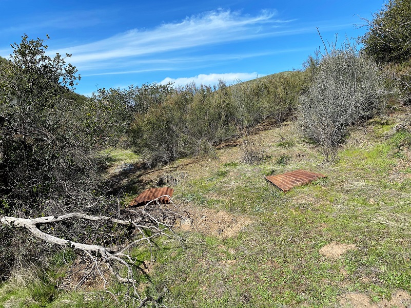
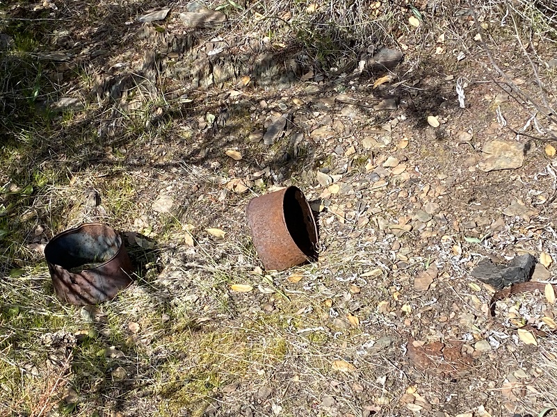
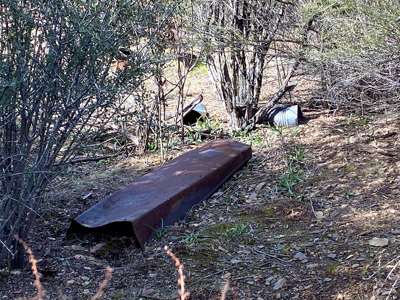

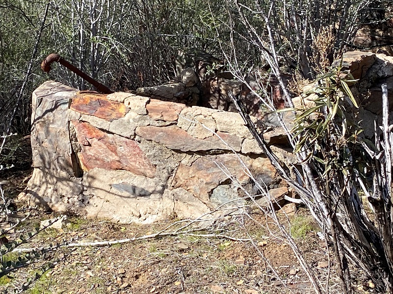

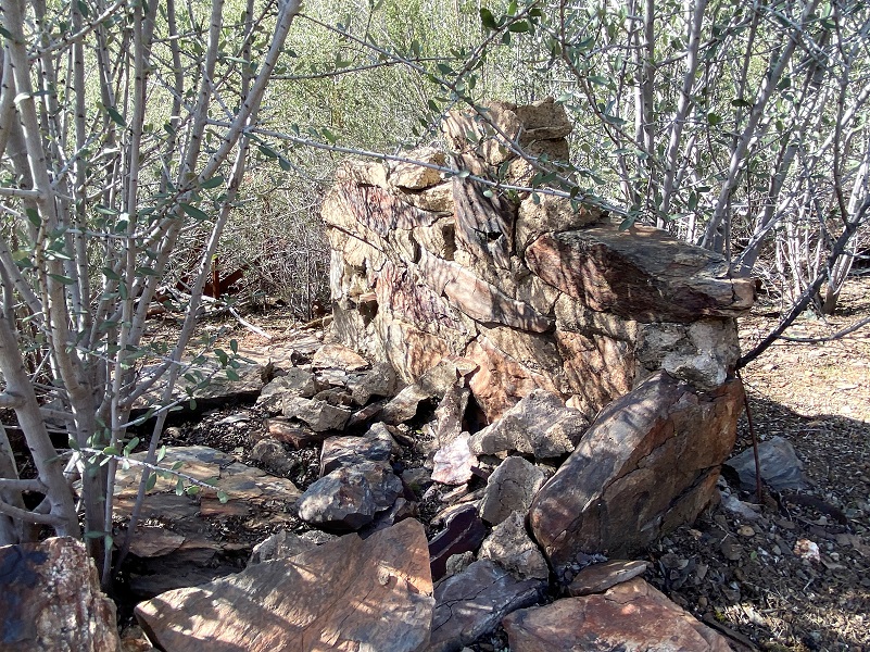
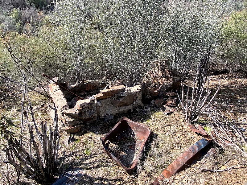
These “improvements” are closer to the Leach Mine that the Losch Mine. They are close to the creek and it looks like a spring might have been channeled along the side, so there was probably good water. I got to wondering. Could this structure have belonged to Robert William Carr? Or perhaps it belonged to another person mining in this area whose name has been lost to history mining?
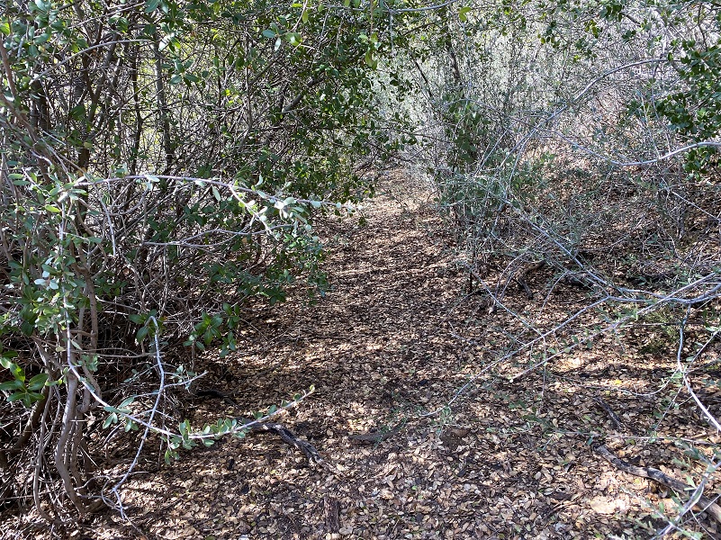
I headed down the road that I thought led to the mine and a structure that an early Topographic Map showed but hit a bunch of overgrown vegetation that I would have needed to crawl through to get to the other side. The day was warming up and I was afraid of crawling through that area with snakes by my side, so I turned around. I did locate another way to get around that mess but it was time for me to turn back.
If I had continued on, I had hoped to locate the Losch Gold Mine or Occurrence. Very little information was found on this mine and another source showed it on the south side of the creek. The only specific information I could find was that its workings included unspecified underground openings. So, it could actually be on both sides of the creek.
Updated information from Russ Marks: The second claim you visited was the Jack Martin claim, 3 generations worked that claim from 1930’s to the mid 80’s, the cabin was still standing until the Telegraph fire.
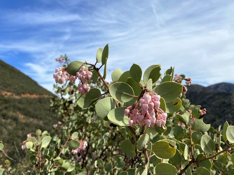
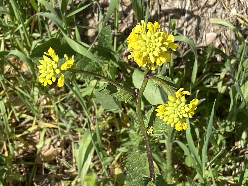
I headed back down the road the same way I had come in, paying more attention to the flowers. Manzanita had just started to bloom.
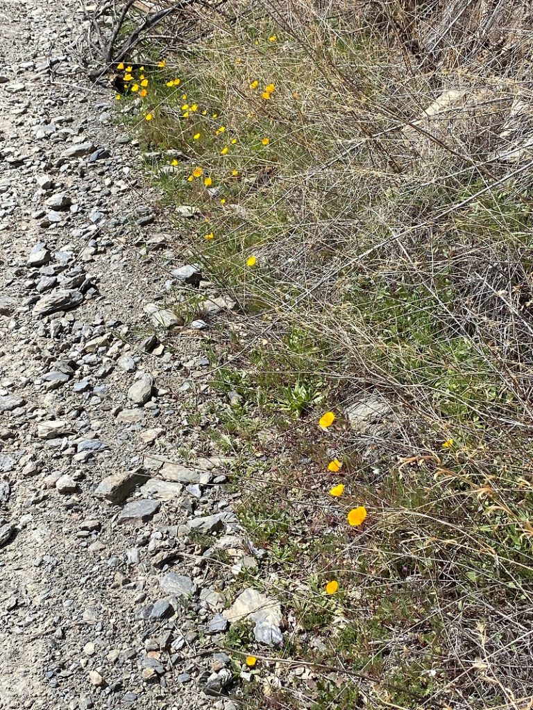
It was a challenge to take pictures of the poppies, blue dick and popcorn flowers along the road because the wind was blowing a bit.
So I took a video instead!
I had a good workout and saw something new along the way. Those mines were very interesting and I would love to explore and learn more about the many mines in the area, but the warm weather was starting up and I have no desire to be bushwhacking with the rattlesnakes. They are definitely out on this warm days and they have been sighted on the Burma Grade. For that reason I wouldn’t recommend venturing off the roads and even with that, you may find a snake sunning itself on the side of the road in a clump of pretty wildflowers that you are admiring.
Hiking up the Burma Grade is always a good workout but I prefer to do it on a cooler day. Early morning can reveal tracks and scat from coyote, bear, mountain lion and other critters along the way. The road is rutted and can have slides and rocks on it. To me, it is a high clearance 4WD road and that is what they recommend. I cannot share good intel on driving or biking this road and if this something you are interested in, there are blogs and websites that include detailed information related to this. I bet that once the Visitor Center is open, they can also help on that.
Dog Hike?
I did not bring Sally on this hike but she has hiked along the Merced River before the rattlesnakes had woken up. There isn’t much water along this road and you would need to pack dog water. Dog rules in this area include the following:
- Dogs must be on leash at all times.
- No dogs allowed at McCabe Flat swimming beach.
Doarama:
What is a Doarama? It is a video playback of the GPS track overlaid on a 3 dimensional interactive map. If you “grab” the map, you can tilt it or spin it and look at it from different viewing angles. With the rabbit and turtle buttons, you can also speed it up, slow it down or pause it.
Briceburg up the Burma Road Hike Exploring Old Mining Activity Doarama
Maps and Profile:
CALTOPO has some free options for mapping and here is a link to my hike this week: CALTOPO: Hiking From Briceburg Up the Burma Grade to Explore Old Mining Activity

Hiking From Briceburg Up The Burma Grade To Explore Old Mining Activity Topographic Map
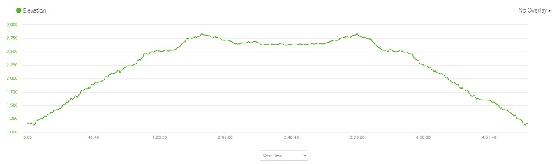
Hiking From Briceburg Up The Burma Grade To Explore Old Mining Activity Profile
Sources:
Merced Sun-Star December 4, 2008
Mariposa Gazette California Digital Newspaper Collection
Mariposa Genealogy & Historical Research Home Page
Mariposa Museum & History Center Gallery
Merced River Recreation Management Area
Prior Blogs in This Area:
Hiking From Briceburg Up The Burma Grade To A High Spot With Views February 22, 2021
Hiking up Briceburg’s Burma Road January 30, 2020
Hiking up the Burma Road with Wildflowery Views April 15, 2019
Discovering Wildflowers Along the Merced River Trail Near Briceburg April 3, 2019
Discovering Wildflowers Along The Moss Creek Trail April 3, 2019
Hiking Along the Merced Wild and Scenic River with Mom February 21, 2016


