Please don’t tell my dogs that I left them home for this easy hike along the Wild and Scenic Merced River on an old Railroad Bed. It would have been a perfect hike for them.
Where: Bureau of Land Management (BLM), Merced River Recreation Management Area, United States Forest Service, Sierra National Forest
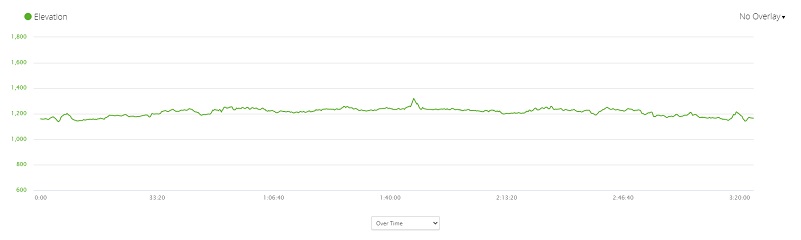
Distance: 8.93 miles round trip but you can go shorter or longer
Difficulty: Easy
Elevation Range: 1,138′ – 1,321′
Date: December 15, 2020
Maps: Buckingham Mountain Topographic Quad
Dog Hike? Yes
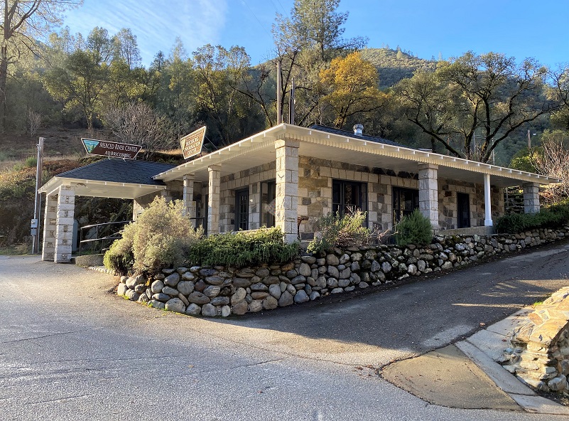 To reach Briceburg and the Merced River Trail, I drove up Hwy 140 north about 15 miles from Mariposa to the Briceburg Visitor Center. You can’t miss the beautiful old stone building that William M. Brice, who Briceburg was named after, built in 1926 as Highway 140 into Yosemite was being built. Originally it was a general store for locals and tourist. Gasoline pumps were later added, and it also provided lodging and had a soda fountain over the years. The BLM acquired the property in the 1980’s and refurbished the building to its near-original condition to be used as a visitor center. The Visitor Center is currently closed and expected to reopen the first weekend of May. For more history about William Brice, check out my prior Briceburg Blog.
 After driving by the Visitor Center, I parked in the parking area along the Merced River where the restroom is located. BTW, the restroom was very clean.
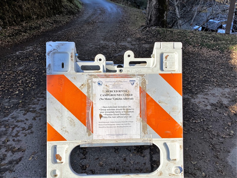
It was 34 degrees when I started out up the road, with signs indicating that the campground and traffic to them were closed.
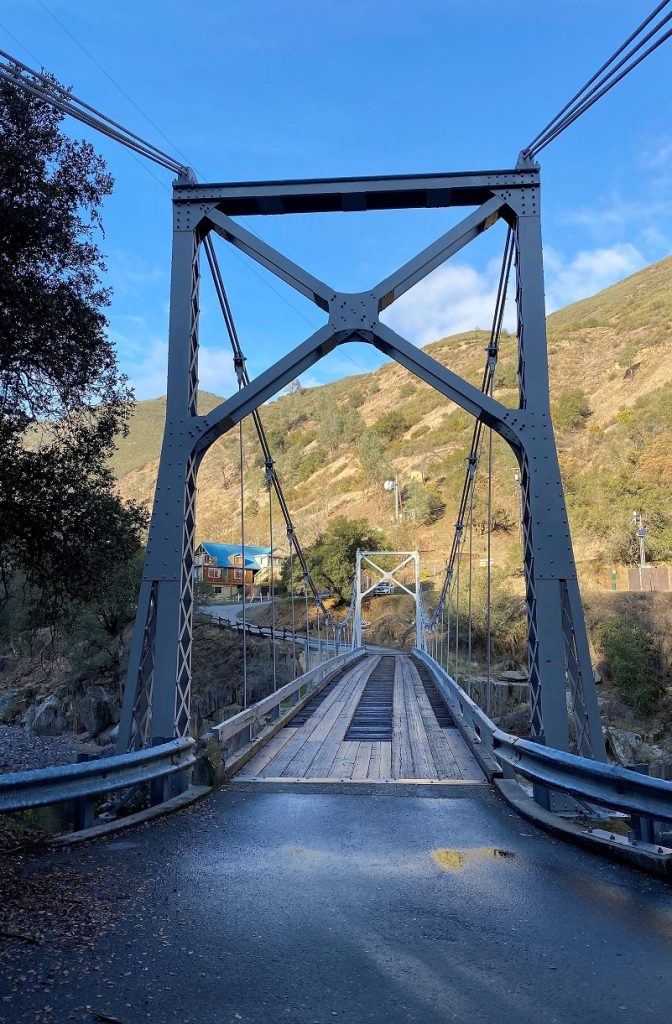
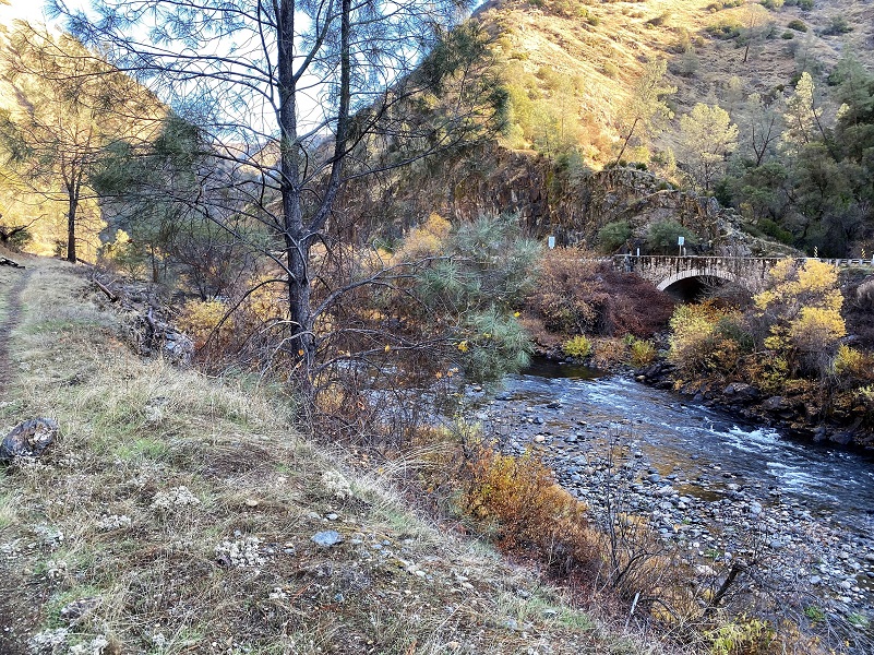
I could have driven across the bridge and parked at the trailhead just to the right after the bridge, but I wanted to check out the views from the bridge on my way, walking over the 160-foot suspension bridge built by the US Forest Service in 1937 and constructed by 30 Civilian Conservation Corps enrollees. They don’t recommend that trailers over 18 feet and large RV’s cross the suspension bridge.
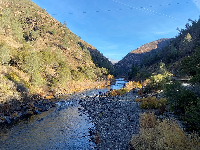
And here is that view from the bridge looking up river.

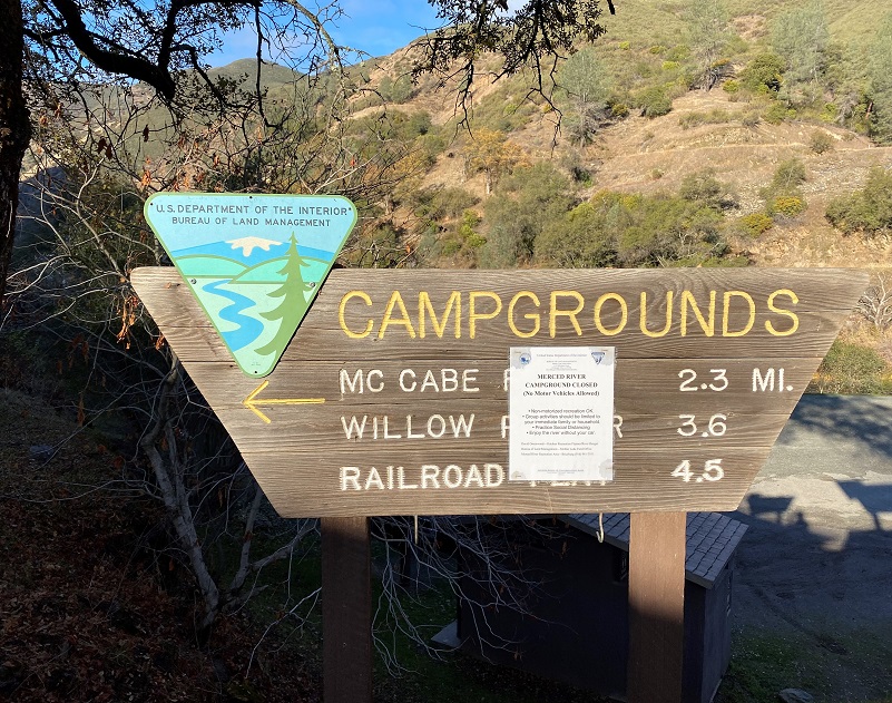
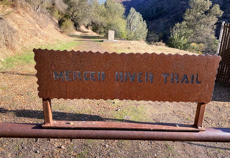
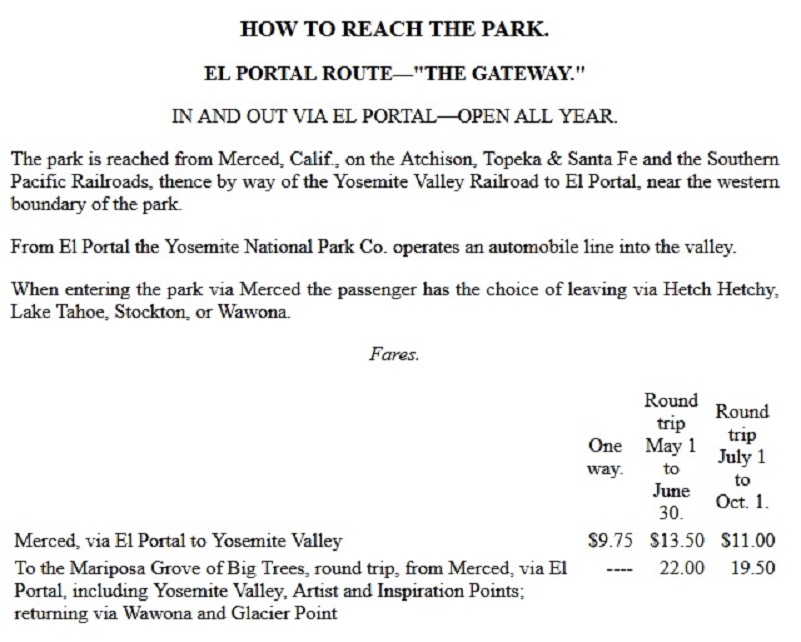
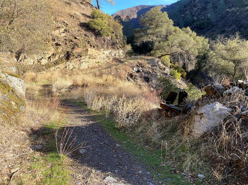
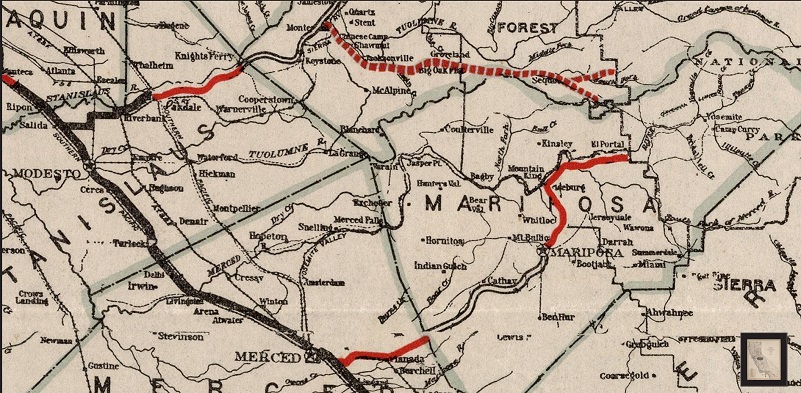
There is a small parking lot just after you cross the bridge on your right and that is where the trail starts. The trail is also what remains of the Yosemite Valley Railroad’s (YVRR) bed.
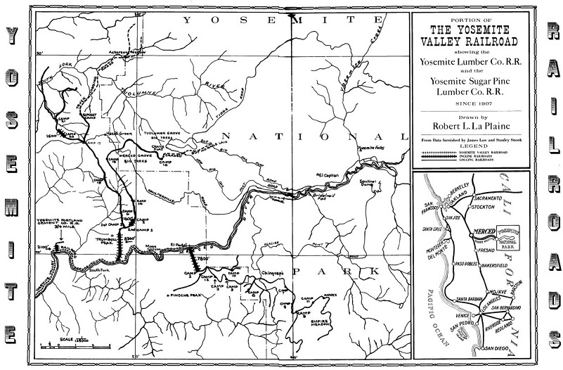
 But before I talk about the YVRR, we need to go a little farther back in time. Back in the 1870’s stage roads brought the tourists in by wagons and it took about a week or so. In 1872, the Central Pacific Railroad reached Merced and this shortened the wagon trip to 2 days. Another railroad line, the San Francisco and San Joaquin Valley Railroad opened through Merced in 1896. Bay Area financiers created the Yosemite Valley Railroad, incorporating in 1902. In 1905, surveying began with the completed railroad connecting with both mainlines in Merced through El Portal. The first regularly scheduled train arrived in El Portal from Merced on May 15, 1907.
The 150 room Hotel Del Portal was built that same year and passengers could spend the night there before heading up to Yosemite on the road via wagons. On October 26, 1917, that original hotel was destroyed by fire. A smaller 20 room hotel, the El Portal Inn, was constructed to replace the Hotel Del Portal, located on the site of the original tent structure hotel. In 1921, the El Portal Inn was destroyed by fire and that same year the El Portal Motor Inn was built along the new All-Weather Highway. El Portal Motor Inn and cabins were converted to use as employee housing and office space for NPS and Yosemite Institute. Remnants of foundations and a possible fountain still exist, buried under existing houses around Rocky Road above Foresta Road.
So what was the YVRR’s route?
From the Yosemite Valley Railroad’s website:
The projected route headed north from Merced to Snelling and then east to Merced Falls, the site of an old woolen mill operation. From there, the route followed the Merced River to Crane Creek and the boundary of the National Park. This terminus was named El Portal by the railroad. But it also hauled freight and lumber.
In 1910, the Yosemite Lumber Company was formed and purchased 10,000 acres of timber on the south side of the Merced River opposite El Portal. Access to that timber was accomplished by the construction of a bridge over the river and an “incline” up the mountain toward the timber.
A significant change occurred to the railroad in the early twenties by the construction of a large dam on the Merced River at Exchequer east of Merced Falls by the Merced Irrigation District. When originally constructed, the railroad closely followed the Merced River from Merced Falls to El Portal. The planned dam was to be built directly over the railroad and thus required that the tracks be relocated. Ultimately, 17 miles of new track were required to replace the original tracks along the river to allow the dam to be built. The relocated route required the construction of five large bridges and four concrete-lined tunnels. One of these bridges was the 1,600-foot-long Barrett Bridge over the reservoir itself. That bridge was 236 feet above low water and was the longest steel railroad bridge in the West at the time.
http://npshistory.com/brochures/yose/1920/sec4.htm
Passenger business on the railroad peaked in the mid-twenties, dropping thereafter due to the increased use of private automobiles to go to Yosemite, accelerated by the completion of the new All-Year Highway (now State Route 140) in 1926. The new highway also allowed the extension of bus service from Briceburg to El Portal (there was already bus service from Merced to Briceburg before the completion of the highway route). The new bus operation forced the railroad to lower prices to match those offered by the owner of the bus company, the Yosemite Park and Curry Company. The YP&CC had argued that lower fares for both the bus line and the railroad would result in increased traffic on both lines. However, that increase in traffic never happened for the railroad and passenger traffic on the railroad continued to decrease.
The Great Depression should have had major impacts on the Yosemite Valley Railroad since some of their most important freight shipments (finished lumber and limestone used to produce Portland cement which in turn was used in concrete) were both directly related to new construction. However, the railroad was able to remain in operation. However, costs to pay off the original construction costs continued to impact the railroad for decades after completion of that construction. In response, the directors of the railroad incorporated a new company, the Yosemite Valley Railway, which acquired all of the property of the Yosemite Valley Railroad in December 1935.
The new company (in name only) managed to continue to persevere until the Depression was eventually mitigated by the nation’s entry into World War II. However, the start of the war ended Pullman traffic to Yosemite Valley as personal train travel was discouraged due to the need to move military personnel. The Yosemite Sugar Pine Lumber Company (which had taken over the Yosemite Lumber Company in 1935) closed down in late 1942. The railroad leased some of their locomotives to the Southern Pacific RR and substituted mixed trains in lieu of the regular passenger trains. (Mixed trains used a passenger car instead of a caboose to provide passenger accommodations.) While the mixed trains ran every day, the slow and unpredictable service created complaints about mail delivery. That problem resulted in the loss of the lucrative mail contract with the US Postal Service. The YV continued to hold on until June 1944 when Henry Kaiser purchased the Yosemite Portland Cement Company. The limestone traffic was extremely critical to the YV since it covered day-to-day expenses. The loss of that freight business was the beginning of end. The railroad petitioned for abandonment and the last scheduled run came on August 24, 1945; scrapping operations commenced shortly thereafter.
If the railroad had been able to stay profitable for a few more years, it might have experienced a dramatic increase in passenger business as vacationers and Park visitors rediscovered the romance of rail travel in the early 1950s much like the success of the Durango and Silverton Railroad at that time and, later, the Grand Canyon Railroad. However, the original YVRR right-of-way was located much too close to the unpredictable Merced River and floods, such as those in 1955 and 1997, would have resulted in miles and miles of lost track and roadbed. So, even if the railroad had been able to stay afloat after the loss of the Yosemite Portland Cement business, the railroad probably would not have been able to recover from the 1955 flood.
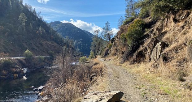
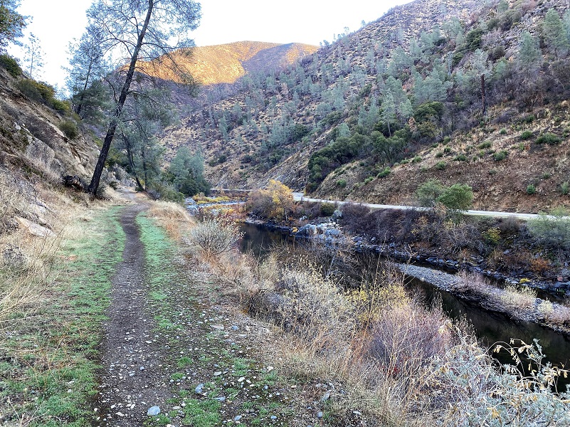
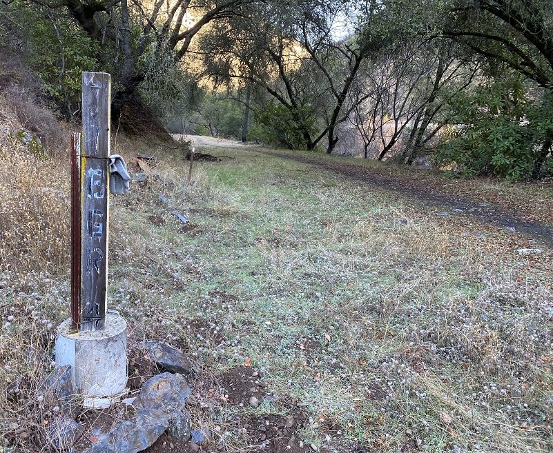
Onward on my hike. The old railbed was pretty level but washed out trestles required a little up and down.
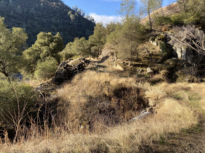
Hwy 140 runs along the south side of the Merced River.
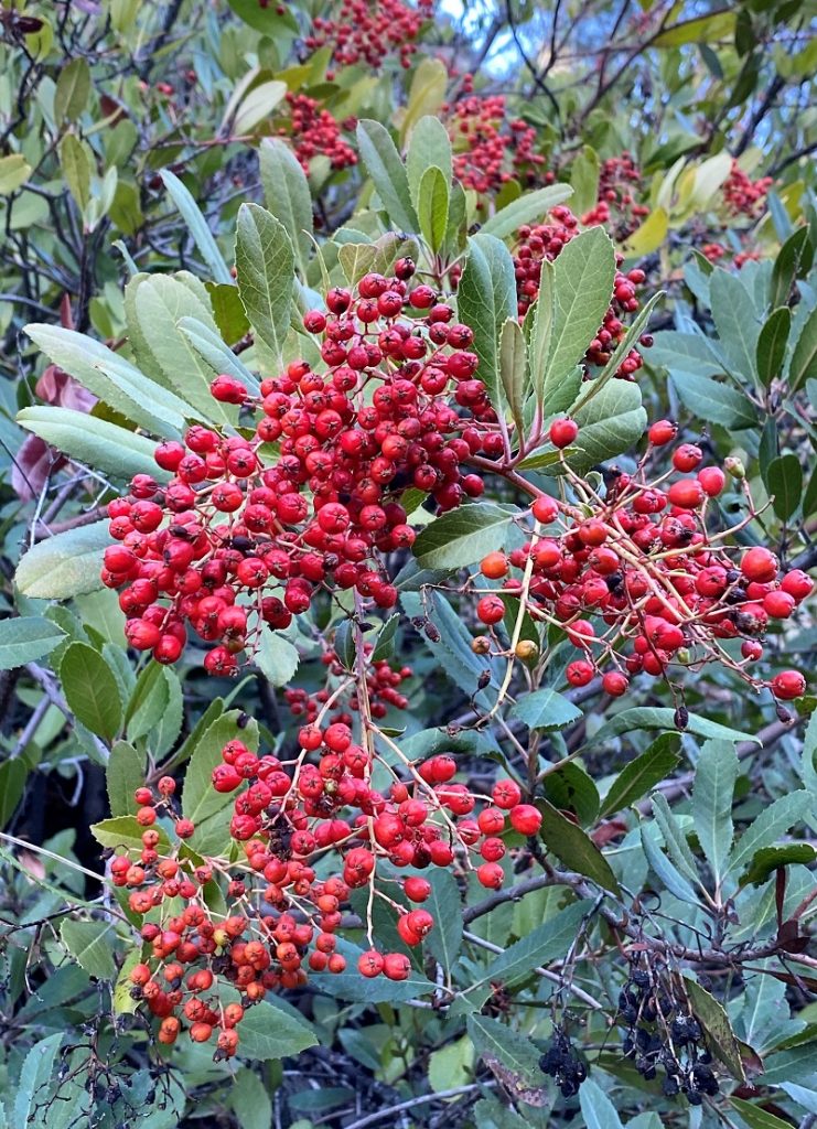
Bright red Toyon berries sure looked festive.
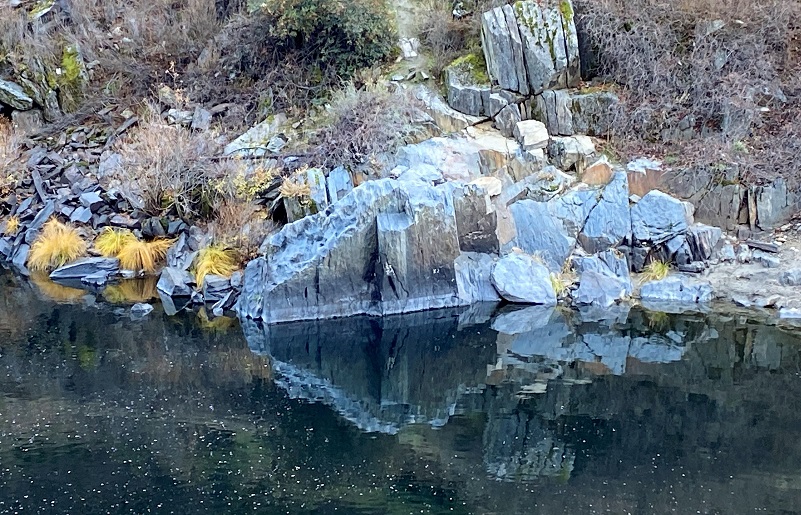
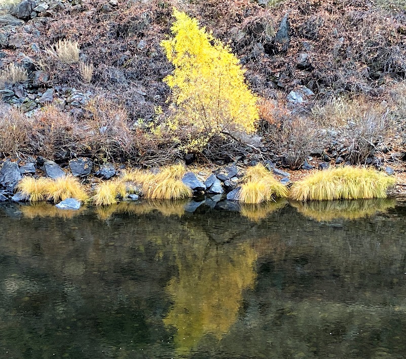
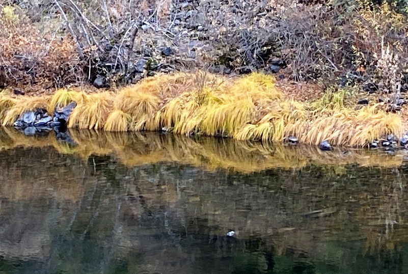
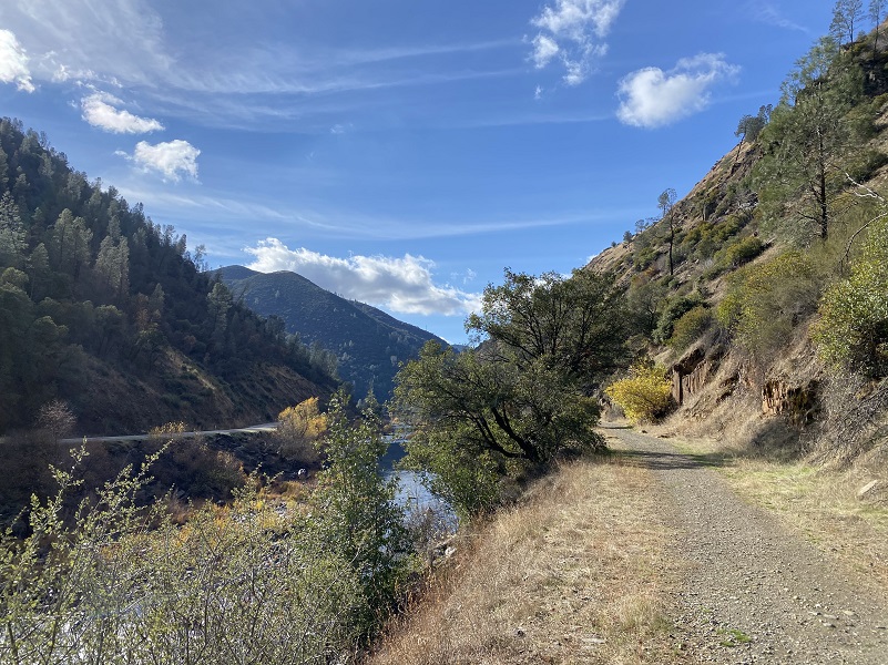
And I could see reflections in the river.
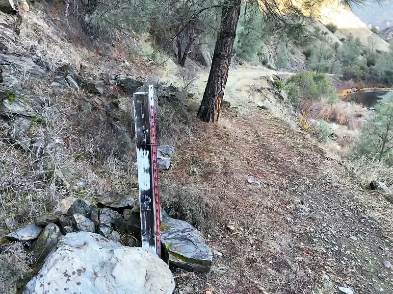
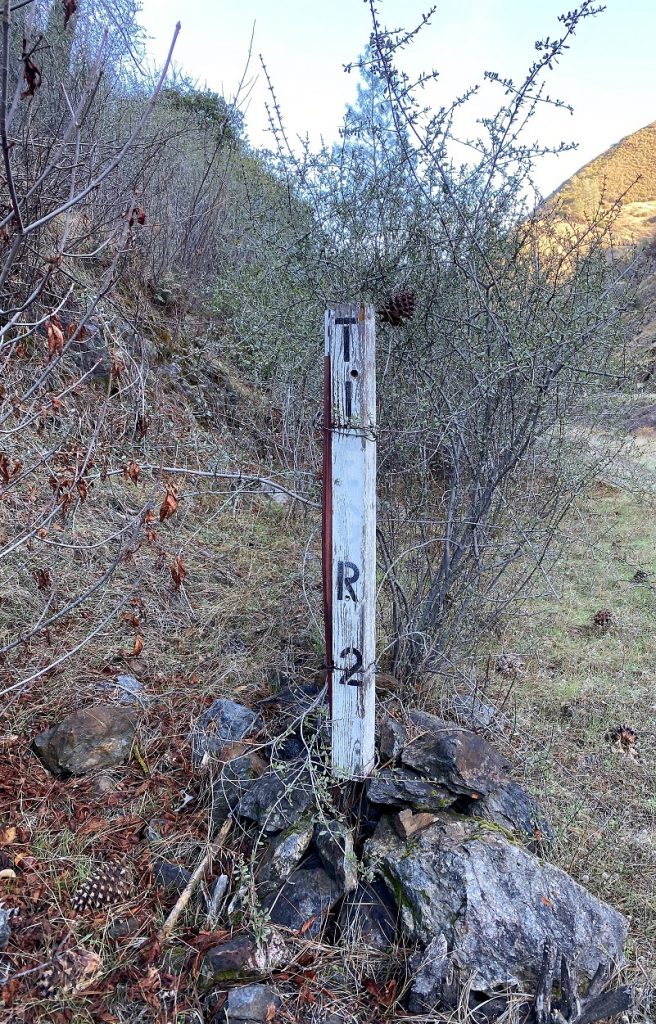
Old railroad mile markers still stood along the trail.
I had a whole different view of the beautiful bridges that Hwy 140 utilizes. This one is referred to as the Slate Creek Bridge but is actually over Feliciana Creek. This bridge was built in 1926, spans 48.9 feet and is eligible for the National Register of Historic Places.
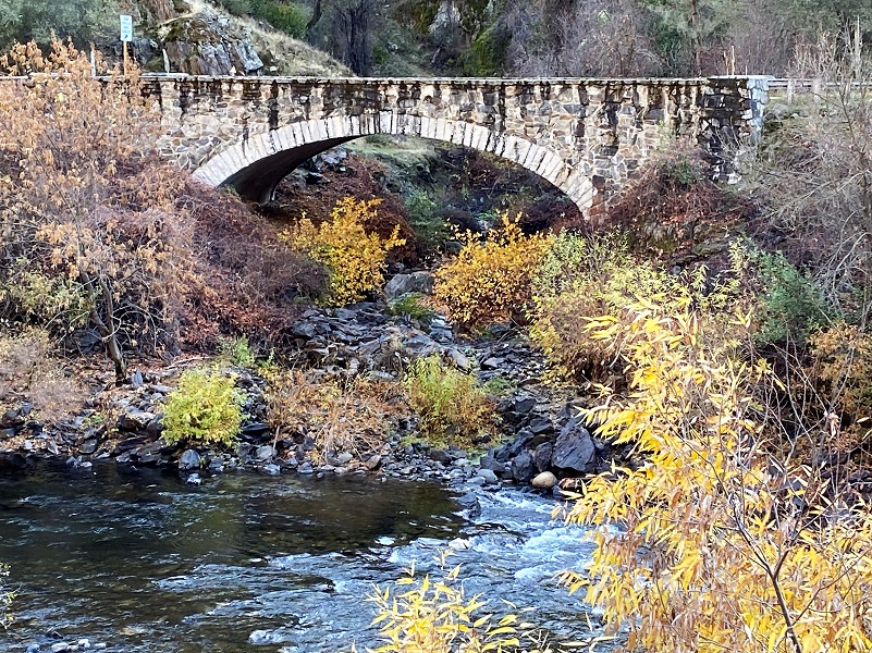
The Sweetwater Bridge, also built in 1926, spans 41 feet and is eligible for the National Register of Historic Places.
When you can see the Sierra National Forest sign along the highway, this is usually the turn around spot, but I wanted to go a bit farther.

Asphalt patches started showing up on the trail.
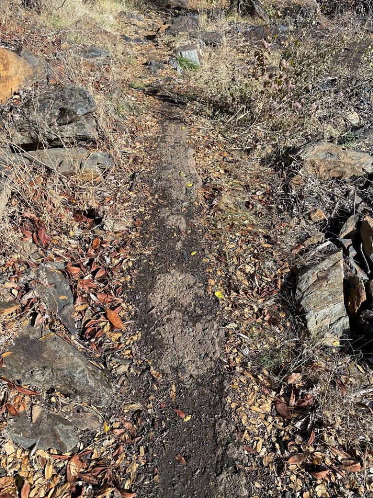
Those asphalt patches got me thinking about their use. Where did the original highway run in relationship to the railroad? Did it partially travel on the north side of the current Hwy 140 back then? The 1918 Division of Highways State Map shows then named Legislative Route 18 on the south side of the Merced River, same side as the current Highway. So, maybe the asphalt was just used to help hold the tracks. BTW, if you want to learn more about this history of Highway 140, GRIBBLENATION is a great resource.
1918 Division of Highways State Map
Rockfalls had taken back some of the trail.

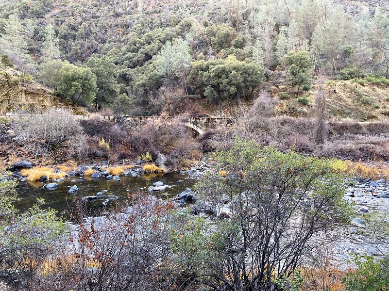
I turned around and headed back down, looking for the first glimpse of the Briceburg Bridge and that would tell me that I was almost back to the car.
After your hike, you may want to drive up to El Portal where the terminus of the YVRR was located and check out the Yosemite Conservancy funded restoration of the Bagby Turntable and caboose. The turntable is fully functional and a small group of people can even move it by hand.

El Portal showing eligible sites for the National Register in pink, and existing sites in red (Yosemite National Park)
Dog Hike? Yes
I did not bring Sally or Fannie on this hike but Sally has hiked along the Merced River before. There are some places where you can get your dog down to the river for a drink but be very careful because that river can run fast and cold. One slip into the river could be disastrous and deadly. Also when the weather warms up, the rattlesnakes are out and about. Dog rules in this area include the following:
- Dogs must be on leash at all times.
- No dogs allowed at McCabe Flat swimming beach.
Doarama:
What is a Doarama? It is a video playback of the GPS track overlaid on a 3 dimensional interactive map. If you “grab” the map, you can tilt it or spin it and look at it from different viewing angles. With the rabbit and turtle buttons, you can also speed it up, slow it down or pause it.
Maps and Profile:

Sources:
Johnston, Hank, Railroads of Yosemite Valley (Yosemite National Park, Yosemite Association, 1995)
Tracing the Yosemite Valley Railroad
San Francisco and San Joaquin Valley Railroad Wikipedia
1924 Yosemite National Park Brochure
Yosemite: the Park and its Resources (1987) by Linda W. Greene
Bridge Reports Mariposa county
Briceburg Hike Toward Yosemite
Mariposa Gazette California Digital Newspaper Collection
Mariposa Genealogy & Historical Research Home Page
Mariposa Museum & History Center Gallery
HOTEL AT EL PORTAL DESTROYED BY FIRE Memorable Places
Yosemite Railroad Turntable and Caboose Restoration Yosemite Conservancy
Caifornia State Route 140 and El Portal Road GRIBBLENATION
Merced River Recreation Management Area
Prior Blogs in This Area:
Hiking up Briceburg’s Burma Road January 30, 2020
Hiking up the Burma Road with Wildflowery Views April 15, 2019
Discovering Wildflowers Along the Merced River Trail Near Briceburg April 3, 2019
Discovering Wildflowers Along The Moss Creek Trail April 3, 2019
Hiking Along the Merced Wild and Scenic River with Mom February 21, 2016


