Sure wasn’t an easy hike up to the top of 13,061′ Mount Dana with 3,000′ gain in elevation over 2 1/2 miles, full of rocks of every size, shape and slipperiness on switchbacks too many to count. All of my hard work was richly rewarded with many Pikas and Marmots paying visits along the route.
Where: Yosemite National Park
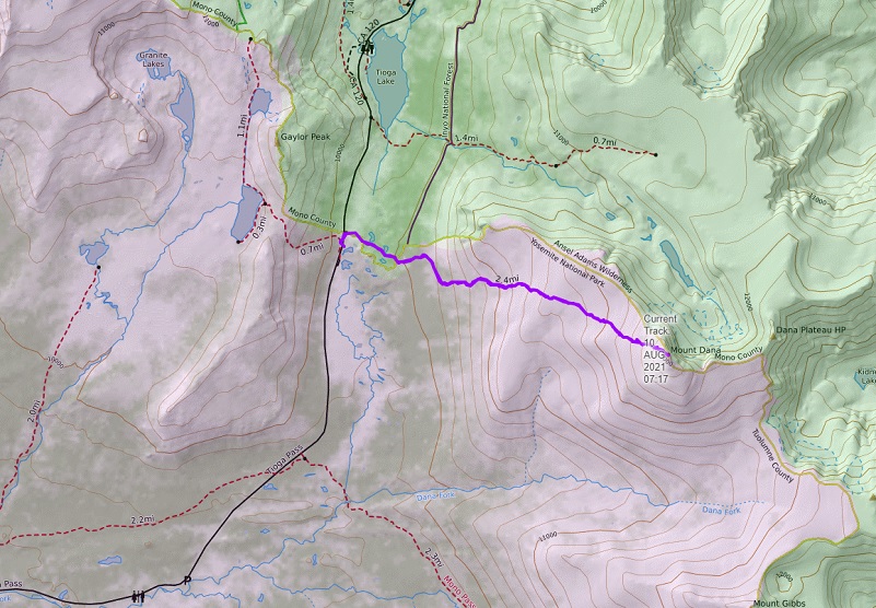
Distance: 5.41 Miles
Difficulty: Strenuous
Elevation Range: 9,926′ – 13,046′
Date: August 10, 2021
CALTOPO: Mount Dana Hike
Dog Hike? No, not allowed in Wilderness Areas within Yosemite National Park I left my house extra early to try and beat road construction delays and it was a successful strategy on this day. Heading into Yosemite National Park via the El Portal Entrance Gate, I passed through the gate before it was staffed. I had already printed out my Day Use Entry Pass and since the gate wasn’t staffed this early, picked up one of the temporary white slips at the Entrance Station to fill out and place on my dashboard. If you aren’t aware, Yosemite National Park has implemented a Temporary Day Use Reservation system. Day Use Entry Passes are validated at the park entrance gate on the reservation date and can be used for 3 days of entry. There are some exceptions but reservations are required to enter Yosemite for day and overnight trips and you get them through Recreation.gov. If you have questions about those exceptions or changes, you can also check out Yosemite’s How will COVID-19 affect my visit?
I parked my car at the parking lot at the Tioga Pass East Entrance to Yosemite, then walked across the road to the south side right at the entrance station where the trailhead is located. There is no sign for this trailhead but it is close to this “Authorized Vehicle Only” sign for the staff parking area.
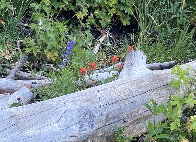
The first half mile or so of the trail is a fairly level trail, leading me alongside some pretty little lakes and tarns.

The trail also led me by wildflowers.

That level trail soon started to climb.
But that climb shared some pretty views.
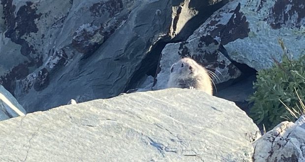
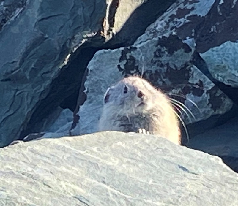
And then this happened. I had stopped on the trail to look for pika and I saw one come up to the side of the trail, about a foot away from me. Now, that had never happened before. Should I dare reach in my pocket to get my camera and take a picture, risking scaring it away? Well, I watched it (him or her, I can’t know) for a little bit and went for the camera and it moved over to a rock a little farther away.
The American pika (Ochontona princeps) is considered an indicator species for detecting the ecological effects of a changing climate in mountainous regions. Results from recent studies suggest that in some areas, pikas are being lost from lower elevations in response to increased warming and less suitable habitat.
They are distantly related to rabbits and prefer rocky slopes. They graze on a range of plants, mostly grasses, flowers and young stems. In the autumn, they pull hay, soft twigs and other stores of food into their burrows to eat during the long cold winter but they do not hibernate.
American Pikas are small mammals, with short limbs and rounded ears. They are about 6 to 8 inches long and weigh about 6 ounces. They have small litters of 2 to 5 with the young born after a gestation period of about 30 days. Sometimes the females will have a second litter.
Since this pika obviously wanted to be a movie star, I ran a short video. I am guessing that it thought the movie star status would have been more fun than it actually was so it said enough with this nonsense.
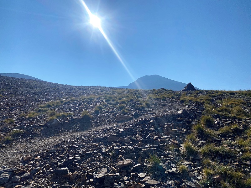
I headed on up the trail with Mount Dana in my view.
I took a look back at a slightly smokey view way out to Saddlebag Lake.
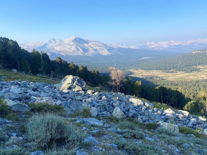
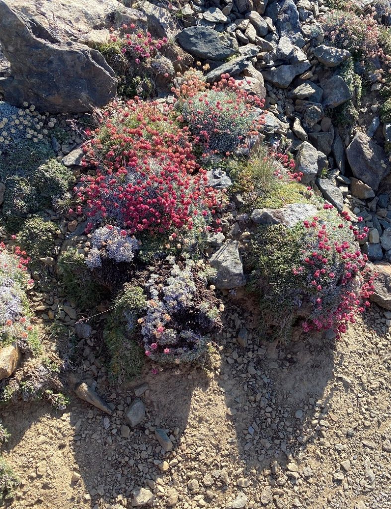
Then I took closer look around me. Although the rocky landscape looks baron, it is full of life. Small plants were tucked in between rocky, protected area.
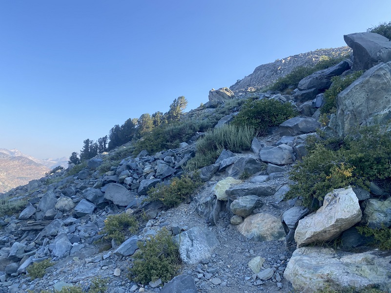
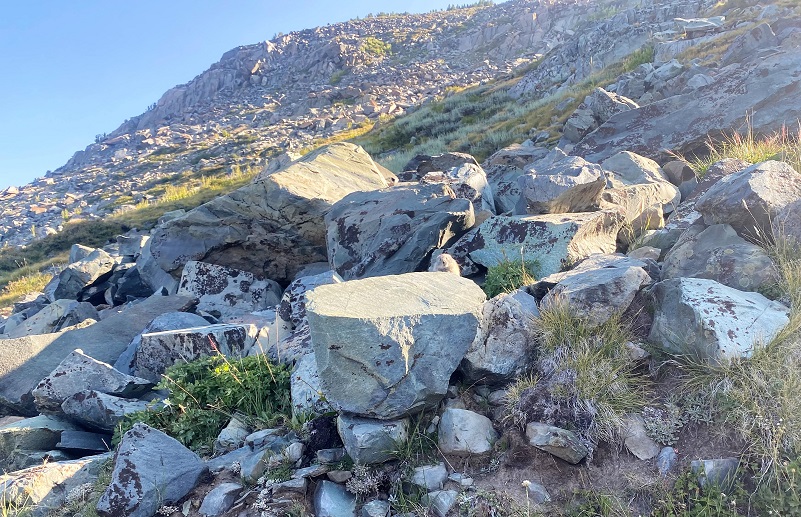
The trail started headed up at a steeper angle with many switchbacks through the rocks. Big cairns were located along the way to help guide you. I only have a bad picture to show the trail conditions but if you are thinking of doing this hike, I think it is helpful to understand it better. Some years, rockfalls obliterate parts of this trail and even some of the giant cairns, but this year it is in good shape but you need to pay close attention or you may lose the trail. And the trail conditions will change since when I hiked it and took this picture.

And you are probably wondered why I would pick a smokey day to climb Mount Dana, famous for its views at the top. Well, there is a beautiful plant that is unique to Mount Dana and only blooms for a short period of time. I had missed the prime blooms but I was hoping to catch a few late bloomers before that show was over for this year. Sky Pilots were tucked in among the rocks, and when they are blooming it is almost like that color spills down that section of the mountain like a waterfall. But they were past their blooms on my hike this year.
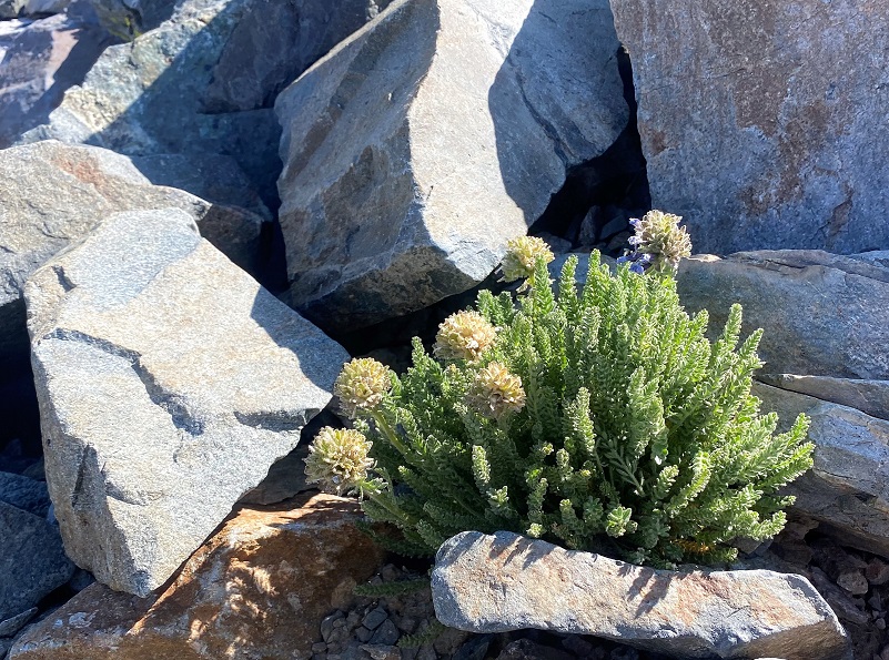
And I did locate a couple of flowers.
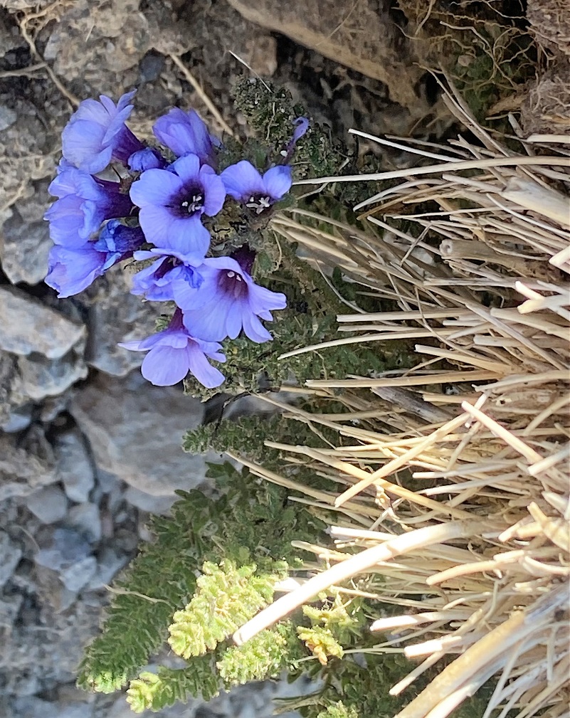
Here is a picture from my hike last year that shows how beautiful they are when they are in full bloom.

Sky Pilots Blooming on Mt. Dana (Picture taken July 28, 2020)
Sky Pilot (Polemonium eximium) is a member of the Phlox Family, growing at high altitudes (mostly above 10,000 feet). survive intense sunlight, drying winds and freezing nights, the 6-inch-high sky pilot grows in rocky crevices. It mostly occurs in colonies in stark surroundings, above 10,000 feet (3,000 m), in rocky areas that appear mostly devoid of soil, and rarely in association with other plants. In addition to the summit of Mount Dana, it can be found at the upper reaches of Mount Whitney as well as the southern flanks of Mount Langley in the Inyo National Forest. The plant has a strong scent reminiscent of urine and that helps attracts pollinators to its short-lived flowers that bloom from June to August.

James Dwight Dana (Photo courtesy Wikipedia)
I reached the top of Mount Dana, named after James Dwight Dana, who was a professor of geology at Yale College. He was born February 12, 1813 in Utica, Oneida Co., New York to James Dana and Harriet Dwight. James was the oldest child out of at least 10 children. James Dwight’s father, James, was a Merchant on the 1855 New York State Census.
His recognition of the linear pattern formed by the volcanic island chains was the first step toward the later theory of plate tectonics. Dana published over 200 papers and books on mineralogy, geology, zoology and volcanic studies, including his “Manual of Mineralogy” in 1848, which has been consistently reprinted and is still a standard college text today.
James Dwight Dana married Henrietta Frances Silliman, daughter of the Professor that he had worked for, June 5, 1844 in New Haven, Connecticut and they had at least 6 children, 2 of them dying young. James Dwight Dana died January 18, 1895 and is buried beside his wife at the Grove Street Cemetery in New Haven, Connecticut.
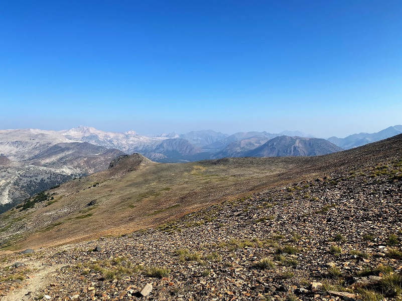
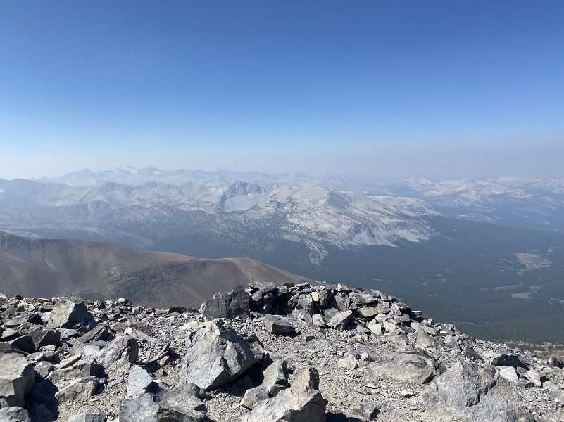
Mount Dana is the second highest mountain in Yosemite (after Mount Lyell at 13,120 feet). Mt. Dana’s 13,061 foot summit provided smokey views that were still incredible.

Looking Toward Dana Plateau
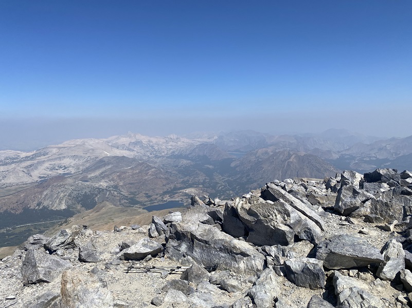
Looking Toward Saddlebag Lake
And I could see the Kuna Crest with Kuna Lake nestled below it.
It was time to start heading down and the walk down just might be harder than the way up because the rocks are covered in sand and small pebbles, making them slippery so I took my time. Once I got out of the big rocks, I did some pika and marmot watching. I had a couple more curious pika come up closer to me but they weren’t wanting to become movie stars like my morning pika. I did have a marmot that was a real poser and The Marmot Song popped into my head for a good chunk of the remaining hike.
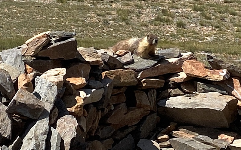
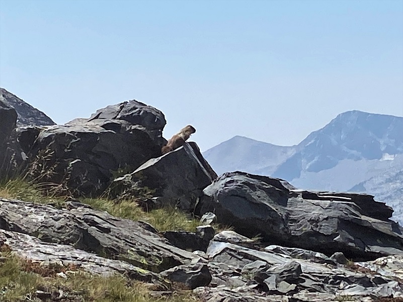
These are Yosemite’s largest rodents and they like to live above 6,500′ elevation and take refuge from predators such as eagles and mountain lions in the safety of granite talus slopes by burrowing under piles of rock. Marmots often live in small colonies, so if you see one, you should stop hiking, remain quiet, and wait to see some more! When a marmot senses a predator nearby, it will warn others by emitting a shrill whistle or chirp. That is how they got the name of a “whistle pig!” Wonder what they sound like? Here is a 2 minute YouTube video with more information and their chirping sounds.
When I do this hike, I do some planning to pick a good day because not every day is ideal for hiking up to the top of Mount Dana. I want no chance of thunderstorms because once you are on top, it is not easy or fast to get off of that mountain and the threat of getting struck by lightening is very real. I check the weather carefully for that location and surrounding high places, but even with that, I have shown up to hike Mount Dana and seen a small cloud or clouds around it that threaten a storm and changed my mind about hiking it that day. I do not think that Mount Dana reads the National Weather Service’s forecasts. I have a bookmarked location for many of my hiking areas for the National Weather Service forecasts that include the Reno, Las Vegas and Hanford offices. Here is the link to Mount Dana National Weather Service forecast, but if you don’t have the link, go to the map on the forecast page, zoom in and locate where you are visiting, then click to get more detailed information on the forecasted information. That is just a tool or suggestion on what to expect on the weather, not a guaranteed promise.
This is a tough hike but how could it not be with 3,000′ elevational gain in 2 1/2 miles. Plus, remember that you also need to come down the mountain on that same amount of elevational loss. Mount Dana’s summit is 13,061′ and that means that if you are not conditioned to hiking at this high of an elevation, you could suffer altitude sickness. Proper preparation for a hike at high altitude is required. You should also be able to recognize the symptoms of altitude sickness. This is very serious and you can die from it. I am not able to write enough about the dangers of this within my blog but here is a link to more information: Altitude Sickness
Dog Hike? No. Dogs not allowed on this trail in Yosemite Wilderness.
Doarama:
What is a Doarama? It is a video playback of the GPS track overlaid on a 3 dimensional interactive map. If you “grab” the map, you can tilt it or spin it and look at it from different viewing angles. With the rabbit and turtle buttons, you can also speed it up, slow it down or pause it.
Hiking Up To Mount Dana Doarama
Map and Profile:
CALTOPO has some free options for mapping and here is a link to my hike this week, which you can view or download: CALTOPO: Mount Dana Hike
Hiking to Mt. Dana Topographic Map

Hiking to Mt. Dana Profile
Prior Blogs in this Area:
Hiking up to Mount Dana with Sky Pilots, Marmots and Pika July 28, 2020
Hiking to the Top of Mount Dana September 15, 2016
Hiking up to the Dana Plateau August 13, 2016
Hiking up to Dana Lakes July 16, 2016
Hike Up To The Dana Glacier July 15, 2015
Hiking to Dana Lakes with Cloud Reflections and a Closer Look at Dana Glacier July 21 2014
Hiking Up To The Dana Lakes July 8, 2014
Tioga Lake to Upper Dana Lakes and Dana Glacier Hike October 21, 2013
Tioga Lake to Lower Dana Lake Hike October 14, 2013
A Breezy Hike Up To Dana Plateau
Dana Plateau Hike September 20, 2012
Sources:
Yosemite National Park Dog Rules
Day Hikes in the Tioga Pass Region, John Carroll O’Neill & Elizabeth Stone O’Neill, 2002


