It had been a few years since I had climbed to the top of Mount Dana and I was hearing reports that those beautiful sky pilots were blooming so now was the time to make it happen! It seemed like there were about one million switchbacks to reach the top of the second highest mountain in Yosemite (after Mount Lyell), reaching 13,061 feet tall, but I didn’t count them and could be off a bit. I do know that there was 3,000′ gain in elevation over 2 1/2 miles which gave me a good workout and it was fun to spend some time with the Marmots and Pika.
 Where: Yosemite National Park
Distance: 5.45 Miles
Difficulty: Strenuous
Elevation Range: 9,069′ – 13,061′
Date: July 28, 2020
Maps: Falls Ridge and June Lake Topographic Quads
Dog Hike? No, not allowed in Wilderness Areas within Yosemite National Park
I parked my car at the parking lot at the Tioga Pass East Entrance to Yosemite, then walked across the road to the south side right at the entrance station where the trailhead is. There is no sign for this trailhead but it is close to this sign for the staff parking area.
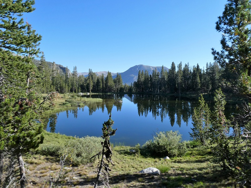
The trail led me along side some pretty little lakes.
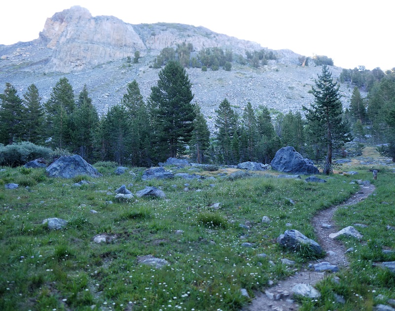
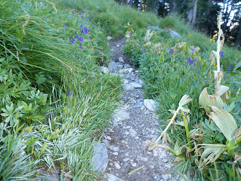
Then the trail started heading up.
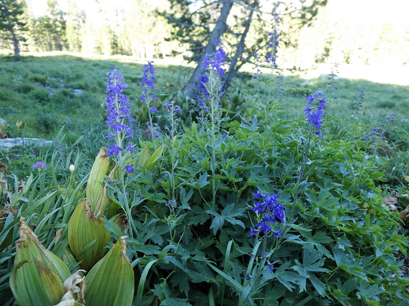
Larkspur, lupine and asters were dotted along the trail.
It was kind of funny that I hadn’t really noticed that the trail was climbing a bit until I looked behind me at where I had started.
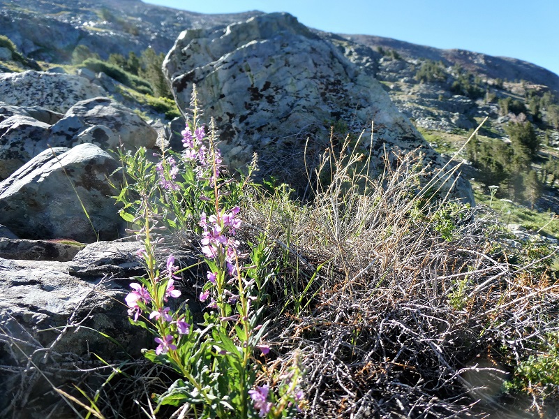
After I got above timberline, I saw a few fireweed.
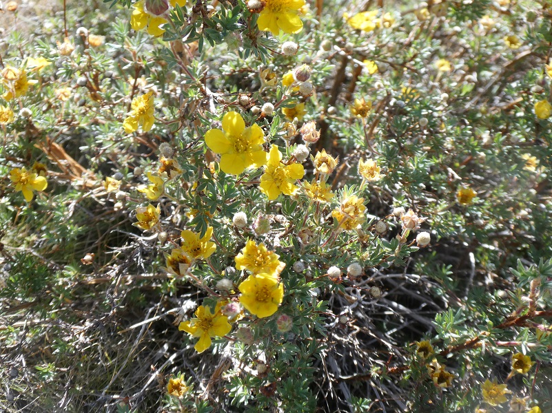
And this yellow bush, maybe a Cinquefoil?
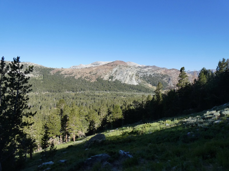
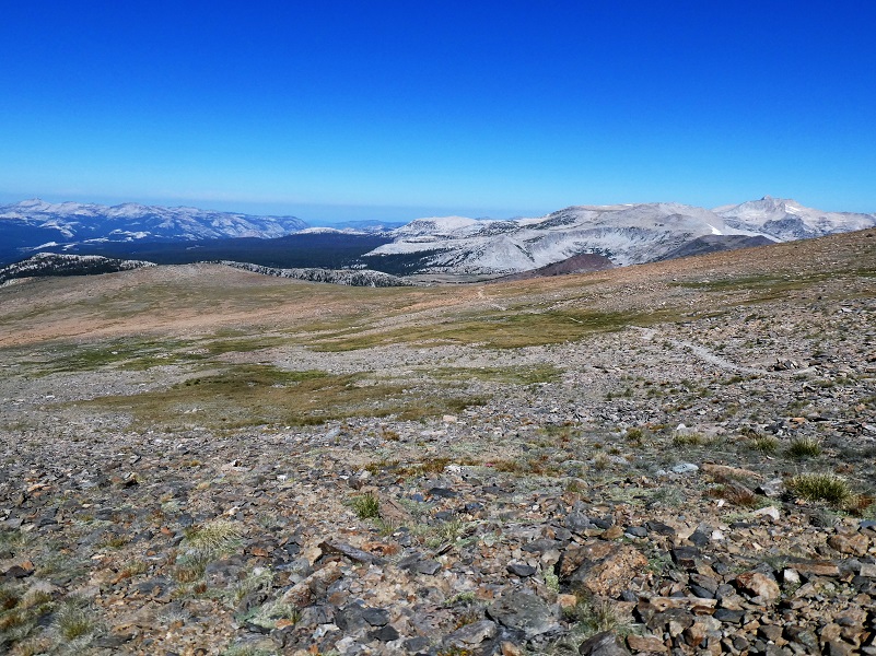
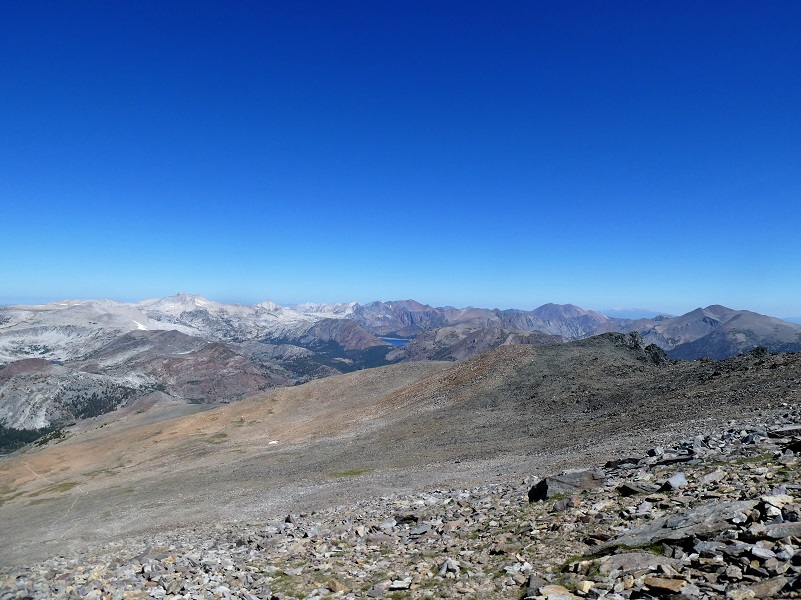
I was soon on the plateau portion below Mount Dana and took a look back.
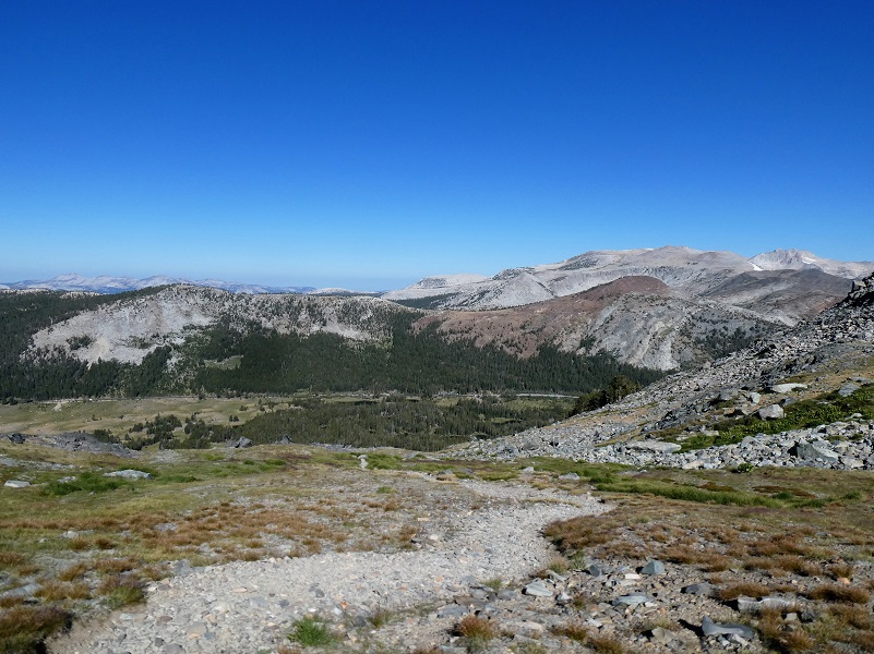

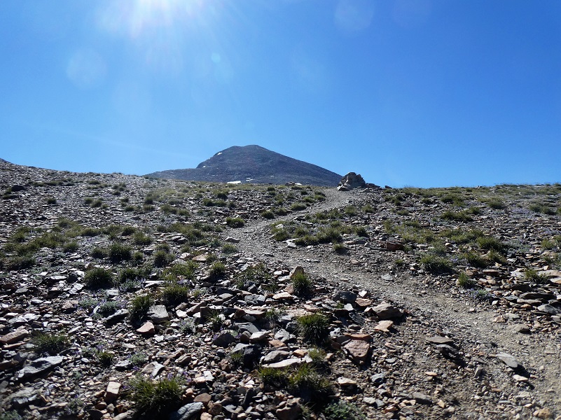
Then I looked where I needed to go and the summit wasn’t even in sight yet.
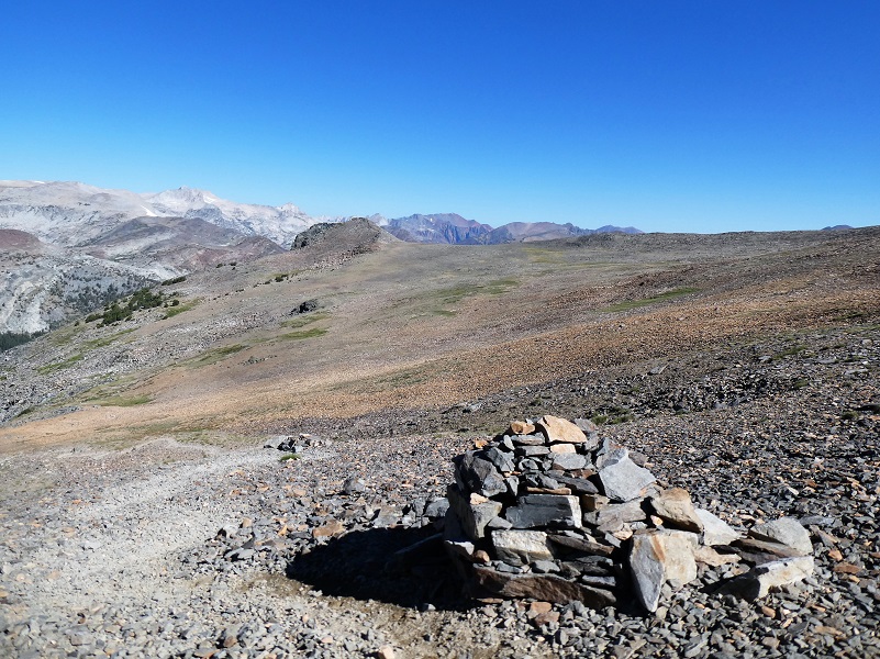
The trail passed by several huge cairns marking the trail.
And the summit was in sight now.
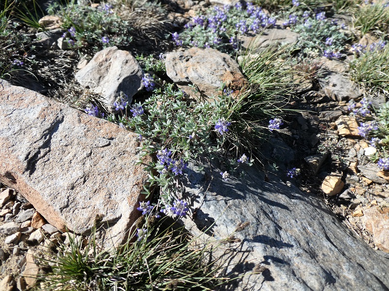
Tiny lupine hugged the ground in between rocky spots.
And I continued up the trail.

Looking back.
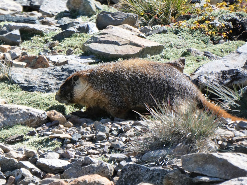
I spotted a large Yellow-bellied marmot, Yosemite’s largest rodents, but couldn’t get my camera in the correct mode to get his picture. Operator error! Another smaller marmot was near him and I assume it was one of his harem. They like to live above 6,500′ elevation and take refuge from predators such as eagles and mountain lions in the safety of granite talus slopes by burrowing under piles of rock. Marmots often live in small colonies, so if you see one, you should stop hiking, remain quiet, and wait to see some more! When a marmot senses a predator nearby, it will warn others by emitting a shrill whistle or chirp. That is how they got the name of a “whistle pig!” Wonder what they sound like? Here is a 2 minute YouTube video with more information and their chirping sounds.
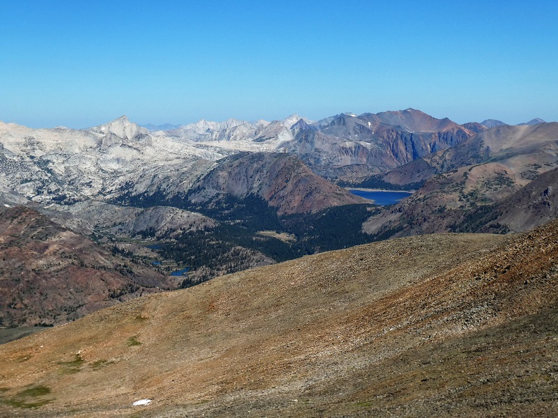
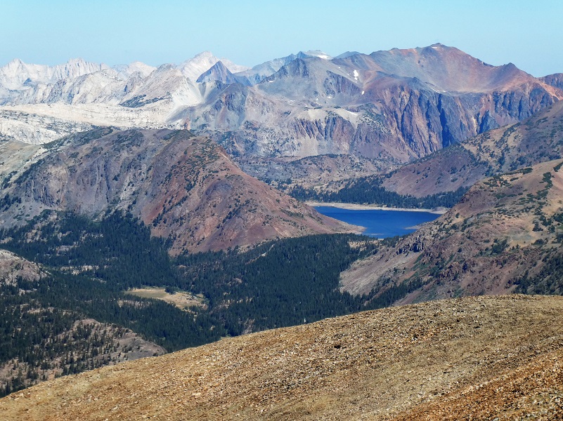
Before I headed up the rocky approach, I took a look back. I could see Saddlebag Lake and the small lakes along Mine Creek.
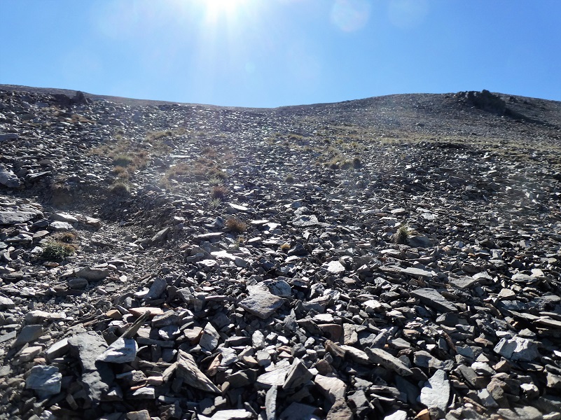
It was soon time to start up through the rocks, which look devoid of any life. But if you listen and look closer you may see a pika. I saw 2 different ones on this hike and heard some more.
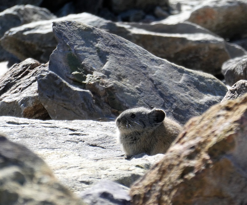
The American pika (Ochontona princeps) is considered an indicator species for detecting the ecological effects of a changing climate in mountainous regions. Results from recent studies suggest that in some areas, pikas are being lost from lower elevations in response to increased warming and less suitable habitat.
They are distantly related to rabbits and prefer rocky slopes. They graze on a range of plants, mostly grasses, flowers and young stems. In the autumn, they pull hay, soft twigs and other stores of food into their burrows to eat during the long cold winter but they do not hibernate.
American Pikas are small mammals, with short limbs and rounded ears. They are about 6 to 8 inches long and weigh about 6 ounces. They have small litters of 2 to 5 with the young born after a gestation period of about 30 days. Sometimes the females will have a second litter.
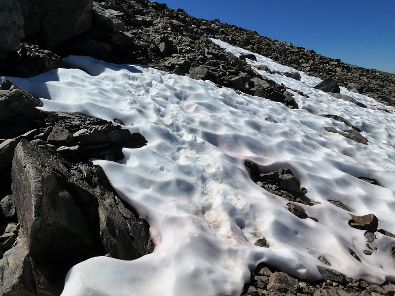
The trail crossed a small patch of snow then started winding it’s way up rocky switchbacks. I had to stop a few times to spot the next stretch of the trail because in a few spots, rocks had slid down and kind of hid that portion of the trail.
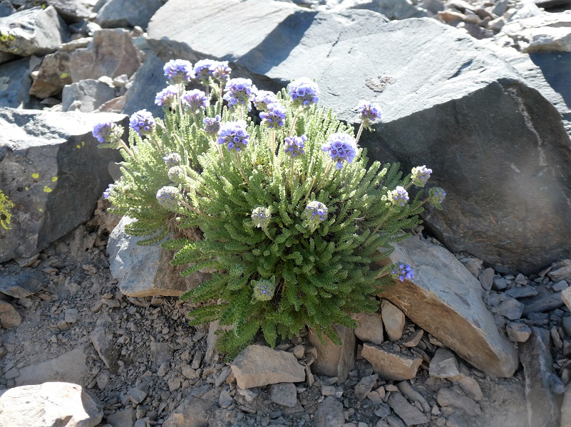
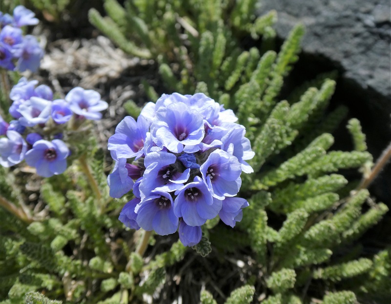
Then suddenly, tucked in the rocks, I started seeing those gorgeous Sky Pilots blooming! This is the only place that I have seen Sky Pilots in Yosemite but there could be some at the other very highest spots.
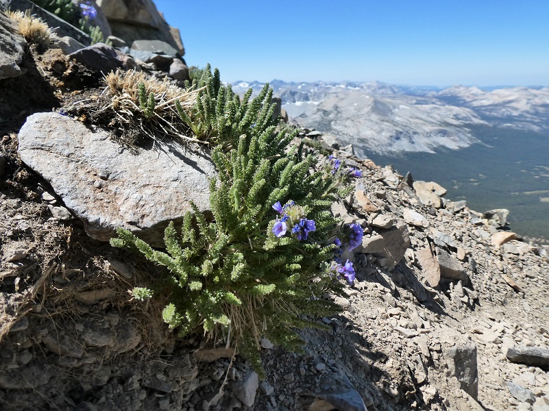
Sky Pilot (Polemonium eximium) is a member of the Phlox Family, growing at high altitudes (mostly above 10,000 feet). survive intense sunlight, drying winds and freezing nights, the 6-inch-high sky pilot grows in rocky crevices. It mostly occurs in colonies in stark surroundings, above 10,000 feet (3,000 m), in rocky areas that appear mostly devoid of soil, and rarely in association with other plants. In addition to the summit of Mount Dana, it can be found at the upper reaches of Mt. Whitney as well as the southern flanks of Mt Langley in the Inyo National Forest. The plant has a strong scent reminiscent of urine and that helps attracts pollinators to its short-lived flowers that bloom from June to August.
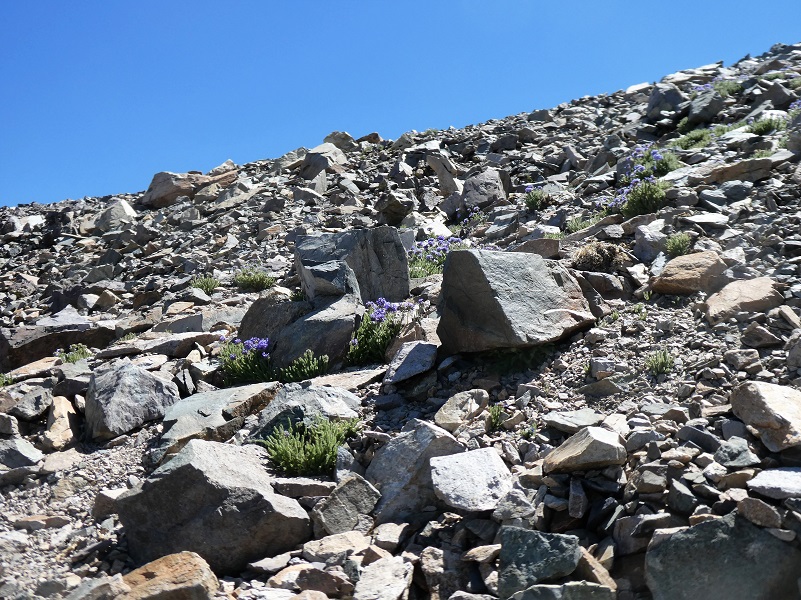
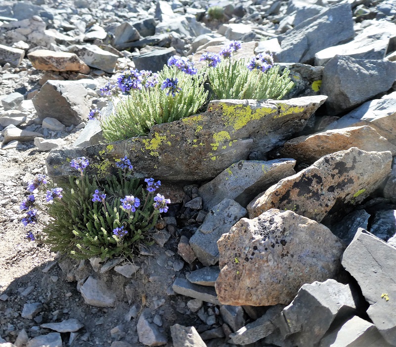
Sky Pilots were tucked in among the rocks, almost like a waterfall of color spilling down the harsh looking rocky terrain.


 I reached the top of Mount Dana, named after James Dwight Dana, who was a professor of geology at Yale College. He was born February 12, 1813 in Utica, Oneida Co., New York to James Dana and Harriet Dwight. James was the oldest child out of at least 10 children. James Dwight’s father, James, was a Merchant on the 1855 New York State Census.
His recognition of the linear pattern formed by the volcanic island chains was the first step toward the later theory of plate tectonics. Dana published over 200 papers and books on mineralogy, geology, zoology and volcanic studies, including his “Manual of Mineralogy” in 1848, which has been consistently reprinted and is still a standard college text today.
James Dwight Dana married Henrietta Frances Silliman, daughter of the Professor that he had worked for, June 5, 1844 in New Haven, Connecticut and they had at least 6 children, 2 of them dying young. James Dwight Dana died January 18, 1895 and is buried beside his wife at the Grove Street Cemetery in New Haven, Connecticut.
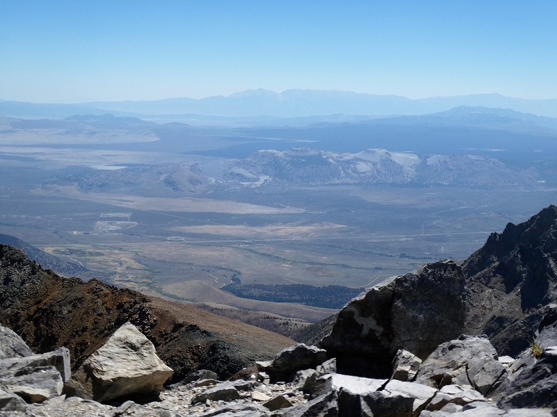
At 13,061 feet above sea level, the views were incredible. Mono Lake and Dana Plateau were to the east.

I looked to the west to see the Kuna Crest.

I could also see Spillway and Helen Lakes where I had hiked up through snow a few weeks ago.
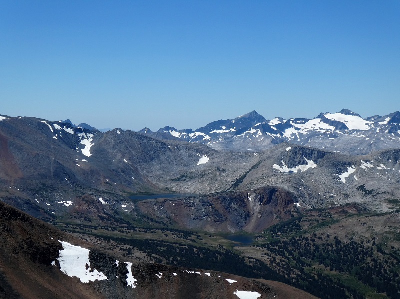
I also could look down at the Kuna Crest and Bingaman Lake where I had fished a few weeks before.

I could even look down to see Hwy 395 running along the Sierra.
After eating my lunch on top, I headed back down the trail. I didn’t see many people on this hike but did encounter about 4 sets of people during the day.
When I do this hike, I do some planning to pick a good day because not every day is ideal for hiking up to the top of Mount Dana. I want no chance of thunderstorms because once you are on top, it is not easy or fast to get off of that mountain and the threat of getting struck by lightening is very real. I check the weather carefully for that location and surrounding high places, but even with that, I have shown up to hike Mount Dana and seen a small cloud or clouds around it that threaten a storm and changed my mind about hiking it that day. I do not think that Mount Dana reads the National Weather Service’s forecasts. I have a bookmarked location for many of my hiking areas for the National Weather Service forecasts that include the Reno, Las Vegas and Hanford offices. Here is the link to Mount Dana National Weather Service forecast, but if you don’t have the link, go to the map on the forecast page, zoom in and locate where you are visiting, then click to get more detailed information on the forecasted information. That is just a tool or suggestion on what to expect on the weather, not a guaranteed promise.
This is a tough hike but how could it not be with 3,000′ elevational gain in 2 1/2 miles. Plus, remember that you also need to come down the mountain on that same amount of elevational loss. Mount Dana’s summit is 13,061′ and that means that if you are not conditioned to hiking at this high of an elevation, you could suffer altitude sickness. Proper preparation for a hike at high altitude is required. You should also be able to recognize the symptoms of altitude sickness. This is very serious and you can die from it. I am not able to write enough about the dangers of this within my blog but here is a link to more information: Altitude Sickness
Dog Hike? No. Dogs not allowed on this trail in Yosemite Wilderness.
Doarama:
What is a Doarama? It is a video playback of the GPS track overlaid on a 3 dimensional interactive map. If you “grab” the map, you can tilt it or spin it and look at it from different viewing angles. With the rabbit and turtle buttons, you can also speed it up, slow it down or pause it.
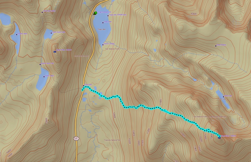
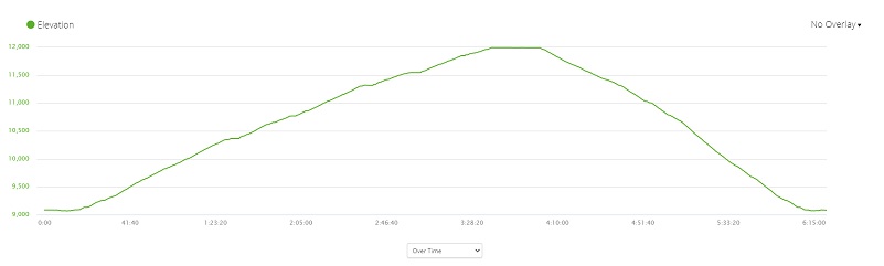
Map and Profile:
Prior Blogs in this Area:
Hiking to the Top of Mount Dana September 15, 2016
Hiking up to the Dana Plateau August 13, 2016
Hiking up to Dana Lakes July 16, 2016
Hike Up To The Dana Glacier July 15, 2015
Hiking to Dana Lakes with Cloud Reflections and a Closer Look at Dana Glacier July 21 2014
Hiking Up To The Dana Lakes July 8, 2014
Tioga Lake to Upper Dana Lakes and Dana Glacier Hike October 21, 2013
Tioga Lake to Lower Dana Lake Hike October 14, 2013
A Breezy Hike Up To Dana Plateau
Dana Plateau Hike September 20, 2012
Sources:
Yosemite National Park Dog Rules
Day Hikes in the Tioga Pass Region, John Carroll O’Neill & Elizabeth Stone O’Neill, 2002