Home » Blogs » Adventures with Candace » A Breezy Hike Up To Dana Plateau

A Breezy Hike Up To Dana Plateau

Hiking up to Dana Plateau gave us the opportunity to view some of the complex geologic events that helped form Yosemite. We could see where Glaciers had moved massive amounts of rocks, yet left other areas alone. Fast moving clouds created great views, whether they were from the tops of mountains or creating reflections in small water features.

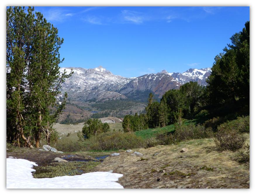
Where: Yosemite National Park and Ansel Adams Wilderness Area, Inyo National Forest
Distance: 6.44 Miles
Difficulty: Strenuous
Elevation Range: 9,649′ – 11,653′
Date: June 11, 2013

Highlights: Although we closely followed the weather predictions before we did this hike, we definitely experienced what the National Weather Service calls “breezy” up at the higher elevations on Dana Plateau. With the winds, came all different kinds of rapidly changing cloud formations though, creating fantastic views whether looking toward Mono Lake, the surrounding high mountains, or reflecting in small ponds.

We were able to view some of the complex geologic events that helped shape Yosemite National Park. We saw where glacial activities had left their mark, polishing and carrying massive amounts of rocks. We also saw evidence of peaks that had poked out above the glacial fields and older volcanic activity.

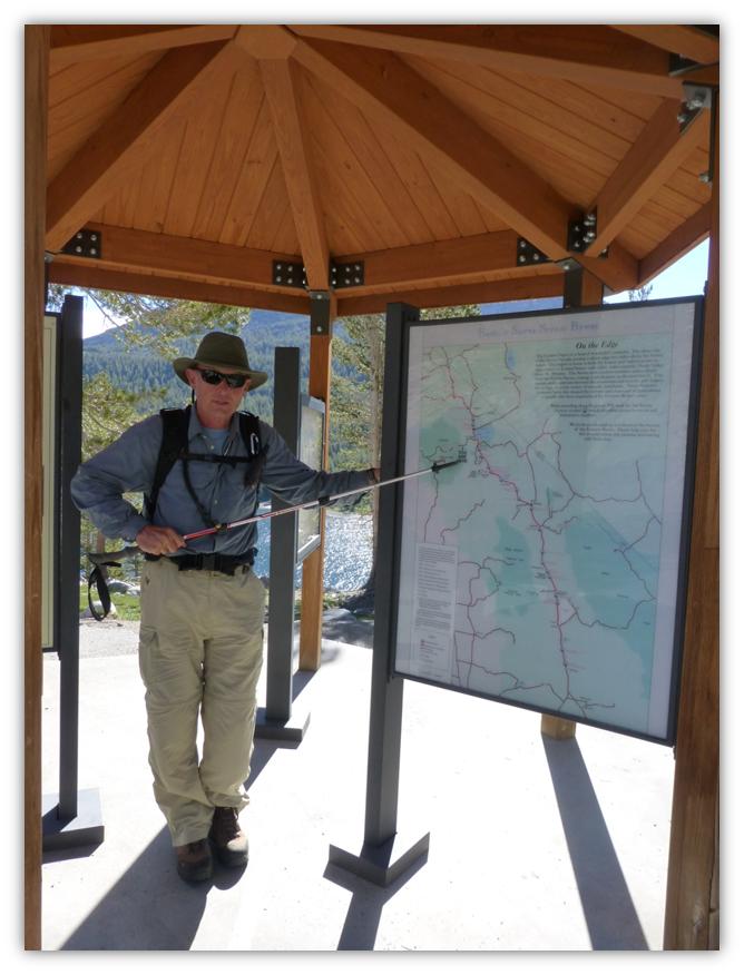
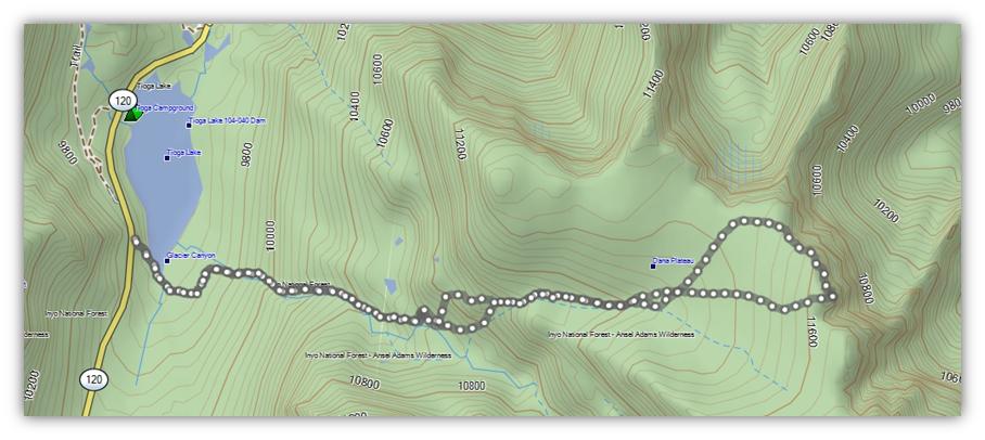
We started our hike just outside the eastern Yosemite entrance at Tioga Pass at the parking area that overlooks Tioga Lake with restrooms and displays. It is reassuring when your hiking buddy for the day can accurately place themselves on such a detailed map. I could be wrong but I think the “you are here” on the map may have helped.

A Breezy Hike 2

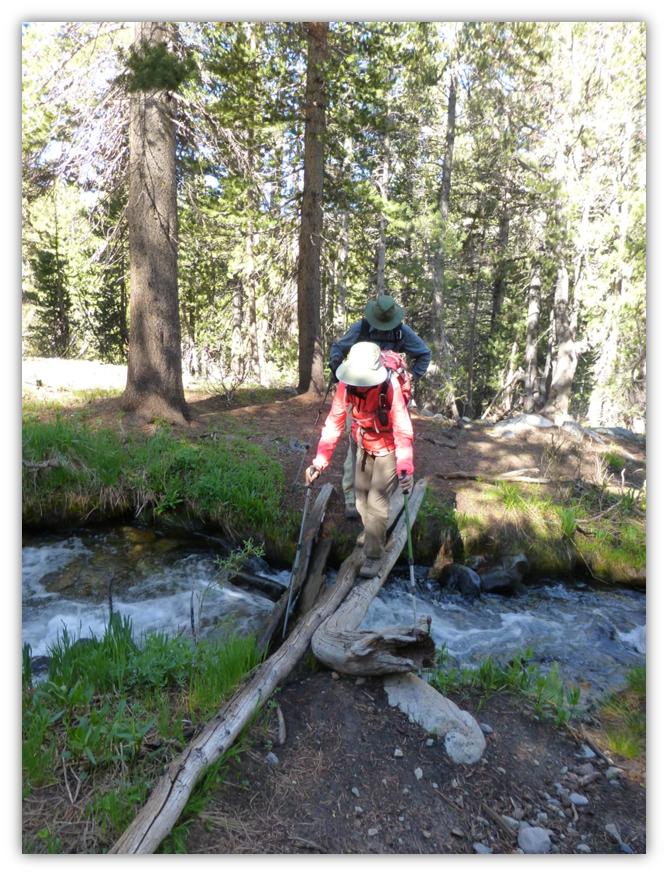
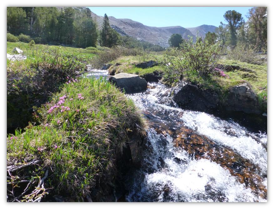
We knew that we had one water crossing early on and had brought our water shoes with us just in case but we lucked out. The two small logs that were across this creek last year were still here and with the help of our trekking poles, we got across it just fine.

A Breezy Hike 3

After crossing the creek, the trail parallels the stream then heads uphill, where we started seeing our first flowers of the day. I also could smell my favorite plant, pennyroyal, along the path. Joanna Clines, the Forest Botanist for the Sierra National Forest was a huge help in identifying these flowers. I can’t thank her enough.

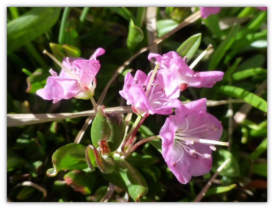
Although this plant has a beautiful flower, it is a very poisonous plant. It is bog kalmia, Kalmia polifolia, in the Ericaceae or Heather Family.

A Breezy Hike 4

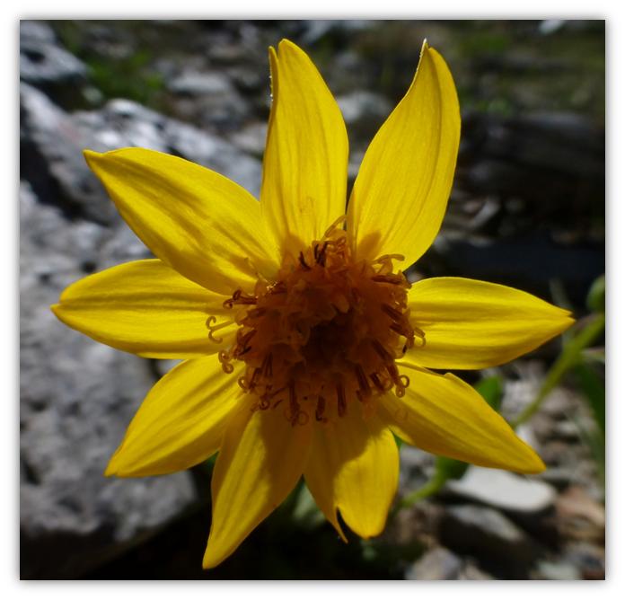
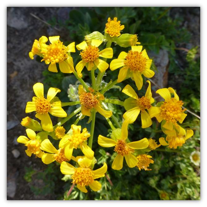
I think this is deltoid balsamroot, Balsamorhiza deltoidea (Asteraceae, sunflower family)

A Breezy Hike 5

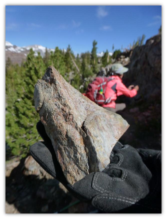
One of our missions on this hike was to better understand the volcanic and glacial activity that occurred in this area. In Glazner and Stock’s book, Geology Underfoot In Yosemite National Park, they discuss the most recent glaciation that occurred between 26,000 and 18,000 years ago known as the Tioga glaciation. These glaciers deposited a whole bunch of rocks and debris, also carving out the majority of glacial features that we see today.

A huge ice field formed over and around the Tuolumne Meadows, up to 2,000 feet thick in places. These glaciers smoothed the landscape under the ice, forming the domes and slabs in the Tuolumne Meadows area. A few peaks and ridges poked up above this sea of ice and they were called “nunataks.” They were a kind of bedrock island and some examples include Cathedral Peak and Unicorn Peak. Dana Plateau became a nunatak for short periods as the Tioga glaciers formed around them. These nunataks were sanctuaries for many plants and animals. It was an area that was free of ice where they could live and as the glaciers retreated, these species expanded outward from their nunataks to colonize the freshly deglaciated landscape.

As the trail started to move uphill and away from the lush vegetation along Dana Creek, we could see a different type of rock that we examined. Was it volcanic in nature?

A Breezy Hike 6

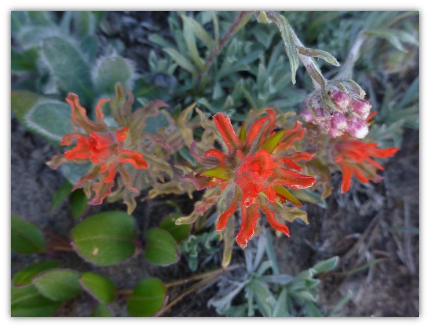
We continued up the trail, still seeing flowers along the trail.

A Breezy Hike 7

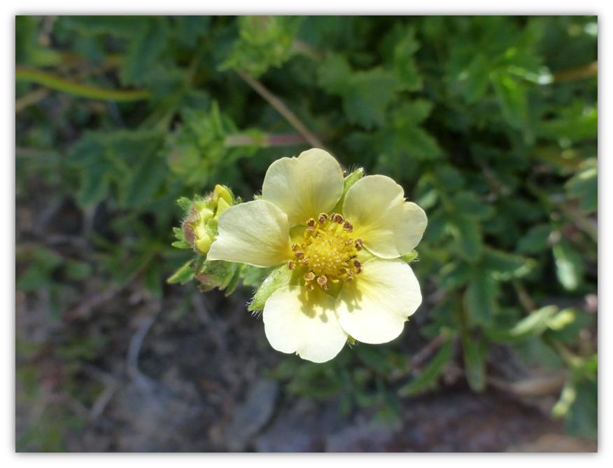
Sierran woodbeauty (Drymocallis lactea var. lacteal)

A Breezy Hike 8

A Breezy Hike 9

A Breezy Hike 10

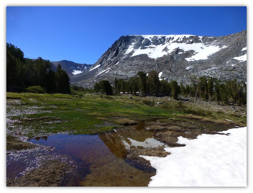
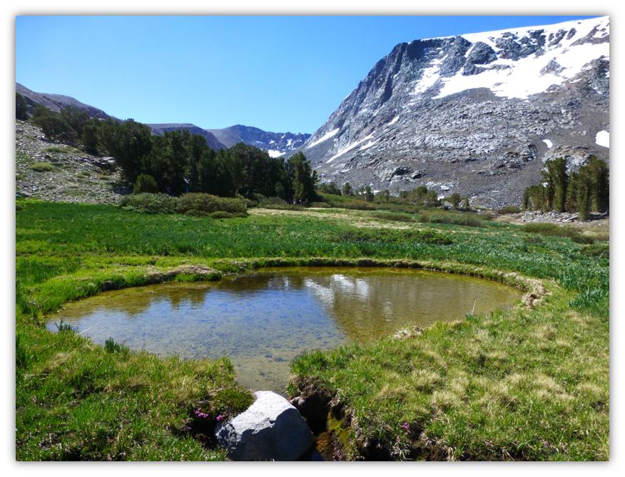
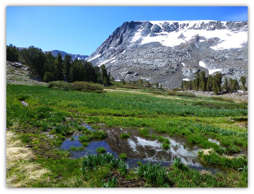
Just above the area where were examining the rocks, we came to an area with small tarns with wonderful reflections and great views toward the Saddlebag Lake area.

A Breezy Hike 11

A Breezy Hike 12

A Breezy Hike 13

Heading up the trail a little farther, we stopped at a couple of small tarns with more wonderful reflections in them. Different tarns, same mountain but different looks.

A Breezy Hike 14

A Breezy Hike 15

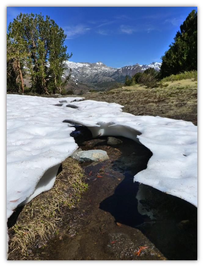
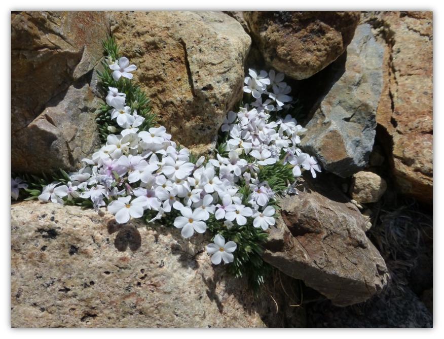
We left the gurgling creek and started heading up in elevation to Dana Plateau. The entire landscape looked pretty barren but if we looked close enough, was saw beauty. In the most barren looking spots, we found small white blooming phlox flowers tucked into the rocks.

A Breezy Hike 16

Some areas on the climb up still had snow, which reflected beautifully in a tarn.

A Breezy Hike 17

A Breezy Hike 18

Taking a look back at where we hiked up and the beginning of the approach to Dana Plateau, the plateau opened up for us.

A Breezy Hike 19

Looking to where we are headed.

A Breezy Hike 20

A Breezy Hike 21

A Breezy Hike 22

A Breezy Hike 23

There is beauty in the plateau. You just need to look for it. The brightly colored lichen and small plants sure caught my eye.

A Breezy Hike 24

A Breezy Hike 25

A Breezy Hike 26

At the very summit of Dana Plateau, you can look out to Mono Lake and at the sharp dropoff of the crest. It is always a great place to have lunch . . .except this trip we just couldn’t linger too long. 25 mph winds with higher gusts, which the National Weather Service had predicted A Breezy Hike 28and called “breezy” made it feel like the 30s and when a good gust hit you, it was a little difficult to not get knocked over.

A Breezy Hike 27

It was so “breezy” that one of my hiking partners lost their hat, even though it was fastened down. The last we saw of the hat, it was heading toward Nevada. I am not going to name names though. . . .

A Breezy Hike 29

From up on top, Rick pointed out where glaciers had carved out areas along the Tioga Road. You could clearly see their from up this high. (Photo by Gail Gilbert)

A Breezy Hike 30

We walked north along the crest to take in those awesome views. The cloud formations continued to give us an ever changing view of the landscape as they changed the light and shading on the mountains.

A Breezy Hike 31

A Breezy Hike 32

A Breezy Hike 33

A Breezy Hike 34

A Breezy Hike 35

The winds seemed to pick up even more, so we decided to head down the hill, wandering our way down, taking closer looks at the rocks along the way.

A Breezy Hike 36

We made our way down to Dana Creek, where the wild onions (Allium sp) smelled so good.

A Breezy Hike 37

Two different kinds of lupine (Lupinus sp.) were located fairly close together. One was very short and clung to the rock and the other quite tall.

A Breezy Hike 38

A Breezy Hike 39

Plantathera leucostachys (Sierra Rein Orchid)?

A Breezy Hike 40

Although I had hiked to Dana Plateau a few times before, this trip really help show a different element of why the Yosemite area is so special. Learning more about the geology of the area by being able to see in person how the glaciers moved was incredible!

I don’t want to make this hike seem too easy. Although it is short in length, there is a lot of elevation gain here and it is above 10,000′ elevation. It is important to be acclimated to hiking at this elevation and recognize the symptoms of altitude sickness when doing so. People do die of altitude sickness every year and this is a very real issue that people should be more aware of.

Altitude sickness occurs when you cannot get enough oxygen from the air at high altitudes. This causes symptoms such as a headache, loss of appetite, and trouble sleeping. It happens most often when people who are not used to high altitudes go quickly from lower altitudes to 8000 feet or higher, but it can occur to even a seasoned and conditioned hiker at times.

You can be adversely affected by the higher altitudes because the air is “thinner” at these high altitudes. When you go too high too fast, your body cannot get as much oxygen as it needs. This causes the headache and other symptoms of altitude sickness. As your body gets used to the altitude, the symptoms can go away.

These symptoms can include:
• A headache, usually throbbing, that gets worse during the night and when you wake up.
• Not feeling like eating.
• Feeling sick to your stomach. You may vomit.
• Feeling weak and lazy. In severe cases, you do not have the energy to eat, dress yourself, or do anything.
• Waking up in the night and not sleeping well.
• Feeling dizzy.

Your symptoms may be mild to severe. They may not start until a day after you have been at a high altitude. Some people say that having altitude sickness feels like having a hangover.

Altitude sickness can affect your lungs and your brain. When this happens, symptoms include being confused, not being able to walk straight, feeling faint, and having blue or gray lips or fingernails. When you breathe, you may hear a sound like a paper bag being crumpled. These symptoms mean the conditions are severe enough that they can be deadly.

Usually the best immediate treatment for altitude sickness is to go to a lower altitude. If your symptoms are mild, you may be able to stay at the elevation, take it easy, rest and make sure you keep yourself well hydrated.

If you are going to go on a hike at high altitude, learn about altitude sickness, the symptoms and how to treat it. It is very important that you look out for the other people in your group also. I have only briefly touched the subject of altitude sickness but felt it was important that it was on your radar should you decide to attempt a hike at elevations that are higher than you are used to. Altitude.org is a site where physicians who are knowledgeable about altitude sickness and associated illnesses have collected some information to share with the public. It has cautionary tales, a calculator where you can enter you’re your elevation to determine your percent oxygen that you will be breathing, along with detailed recommendations on the site. I used their calculator for our Dana Plateau hike and it showed that at our summit of 11,640′ elevation, we had 66% of normal oxygen at sea level. It even has a link that you can email them with questions if you have them. You can find them at http://www.altitude.org/altitude_sickness.php

A Breezy Hike 41

Sources:

Geology Underfoot in Yosemite National Park by Allen F. Glazner and Greg M. Stock, 2010.

http://home.comcast.net/~e.hartouni/botany/hikes/080803/DanaPlateau.html

http://www.altitude.org/home.php

http://www.webmd.com/a-to-z-guides/altitude-sickness-topic-overview

One comment

  1. Beautiful Blog and beautiful photographs. Really enjoy it!!!

Leave a Reply

Sierra News Online

Sierra News Online