A good post-holiday workout hike took us up a dirt road on the north side of Redinger Lake. Checking out the wildlife tracks along the way kept our minds occupied while we gained about 2,000 feet in 4.5 miles.
Where: Sierra National Forest
Distance: 9.19 Miles
Difficulty: Moderate
Elevation Range: 1,424′ to 3,314′
Date: January 4, 2019
Maps: Auberry Topographic Quad, Sierra National Forest
Dog Hike? Maybe
From North Fork, we drove down Road 225 and followed the road as it traveled above Redinger Lake, parking on the Madera side of the bridge that crosses Redinger Lake. There was a wide spot on the west side of the road with room for several vehicles. Redinger Lake is named after David H. Redinger who helped plan and execute the Big Creek Hydroelectric project.
We had wanted to get a hike in before it started raining and could use a good workout after the holidays. We considered hiking to Fresno Dome, Central Camp Road, or Little Nellie Fall but landed on this one because it was close and achieved the goal of the good workout. This hike is a good one for a conditioning hike, just in case you are looking for one of these! But, this south facing slope will be get mighty warm when the weather heats up. Personally, this is not a hike I would want to do in warmer weather.
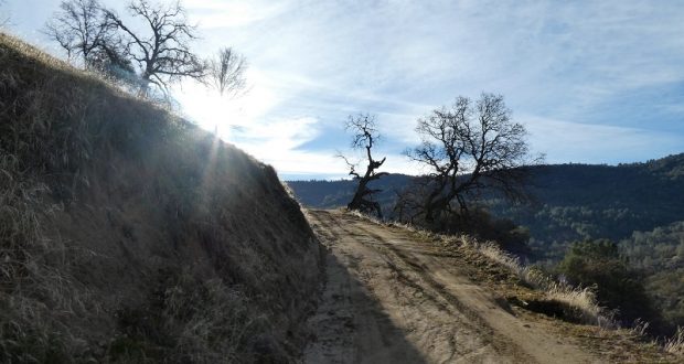
There are a couple of ways to get up to the dirt road that we hiked. We took the trail directly across from where we parked and it angled up to the road. There is a post that marks the trail that you can see in the first picture but that is really it for marking. This trail leads up to the dirt road which we followed up.
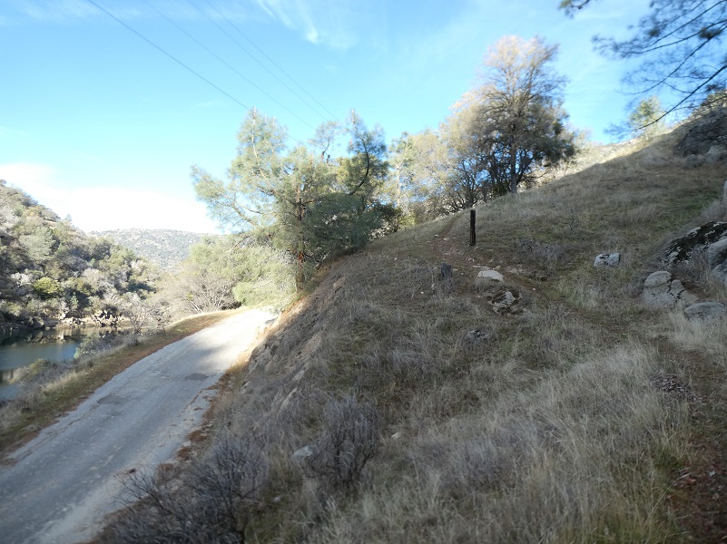
The other way to get up to the dirt road is is to walk back up the road the way that you drove in about 200 feet or so to where the dirt road intersects with Road 225 where there is a trail marker. This dirt road is called by some different names. Some references show this as “Transmission No. 1,” “San Joaquin River Trail” or it is just not named. It winds uphill and had several junctions with spur roads to facilitate servicing the transmission line. As it makes its way uphill, it leads up to Mammoth Pool Road and Dam Six Lake. It is a good dirt road that is gated at the bottom, vehicles not being allowed.
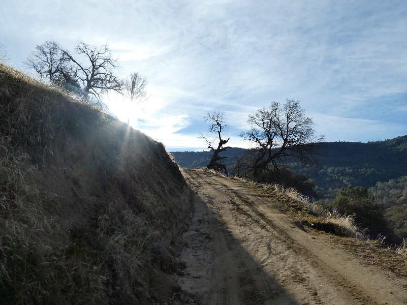
From the get-go, the dirt road started gradually climbing. We picked out and identified animal tracks as we walked. There were lots of deer tracks but we also identified racoon, bear and perhaps a mountain lion along the way.

We looked back across the upper end of Redinger Lake at the Big Creek No. 3 Complex that includes a penstock and powerhouse which was completed in 1923 which uses the combined flows of Big Creek and the San Joaquin River. Back when it came online, it was known as the “electrical giant of the West” because it was the largest hydroelectric plant in the West, capable of generating 75 megawatts, a huge amount at the time.

The Big Creek Hydroelectric Project is owned and operated by Southern California Edison (SCE). The use and reuse of the waters of the San Joaquin River, its South Fork, and the namesake of the project, Big Creek – over a vertical drop of 6,200 ft – have over the years inspired a nickname, “The Hardest Working Water in the World”.
The primary purpose of the project was to provide electric power for the fast-growing city of Los Angeles. The Big Creek Project was the vision of California engineer John S. Eastwood, who first surveyed the upper San Joaquin River system in the late 1880s and mapped potential sites for reservoirs and hydroelectric plants. The system was initially funded and built by Henry E. Huntington’s Pacific Light and Power Company (PL&P). Construction of the system’s facilities started in 1911, and the first power was transmitted to Los Angeles in 1913. After SCE acquired PL&P in 1917, the system was gradually expanded to its present size, with the last powerhouse coming on line in 1987. Today, these facilities include 27 dams, miles of underground tunnels, and 24 generating units in nine powerhouses with a total installed capacity of more than 1,000 megawatts. Its six major reservoirs have a combined storage capacity of more than 560,000 acre feet. The project’s facilities were listed on the National Register of Historic Places in 2016.
Today, the Big Creek project generates nearly 4 billion kilowatt hours per year, about 90 percent of SCE’s total hydroelectric power, or about 20 percent of SCE’s total generating capacity. Big Creek accounts for 12 percent of all the hydroelectric power produced in California. The Big Creek reservoirs also provide irrigation and flood control benefits for the Central Valley, and are popular recreation areas. The project has had various environmental and social impacts, including the disruption of fish and animal migration, and the flooding of historical sites and traditional Native American lands.
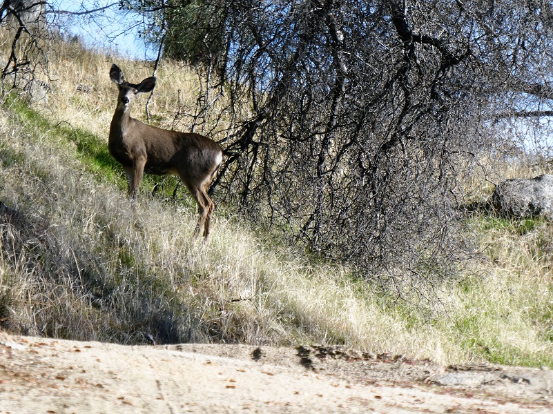
We continued up the road and we stopped when we spotted something on the upper left side of the road. Can you see it?

Just in case you couldn’t spot it, here is a closer look. That doe sure blended in and stood close to where she was to keep an eye on us as we walked by.
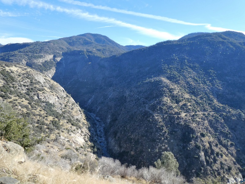
As we gained elevation, we reached spots where we could look down at the San Joaquin River and across at what little was flowing at Stevenson Creek Falls.
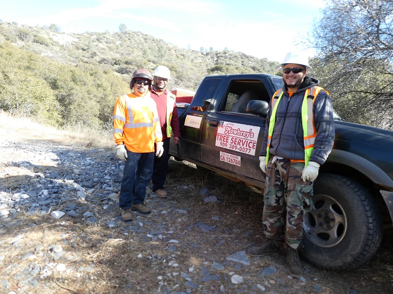
We could here some noise up the canyon and figured that someone was doing some sort of work up there. When we rounded a bend, this crew and their pick up unveiled the secret. They were doing brush clearing under the high transmission power lines. We talked with them a couple of minutes and didn’t want to be in their way but they told us we could continue up.
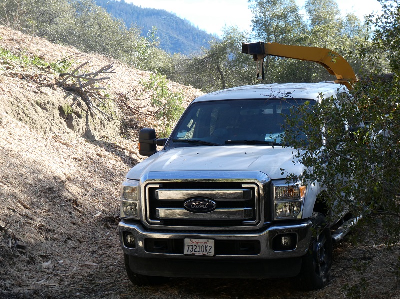
We went around the next bend to see a chipping operation which was loud and not really the quality outdoors experience that we were shooting for on our hike. We looked at our GPS and had gone 4.5 miles which would make a 9 mile hike for the day. We had kind of hoped for 10 miles or so but we decided to turn around.
We headed down and found some good flat rocks to take a lunch break. Our view was of Big Creek 3, along with the penstock pipes.
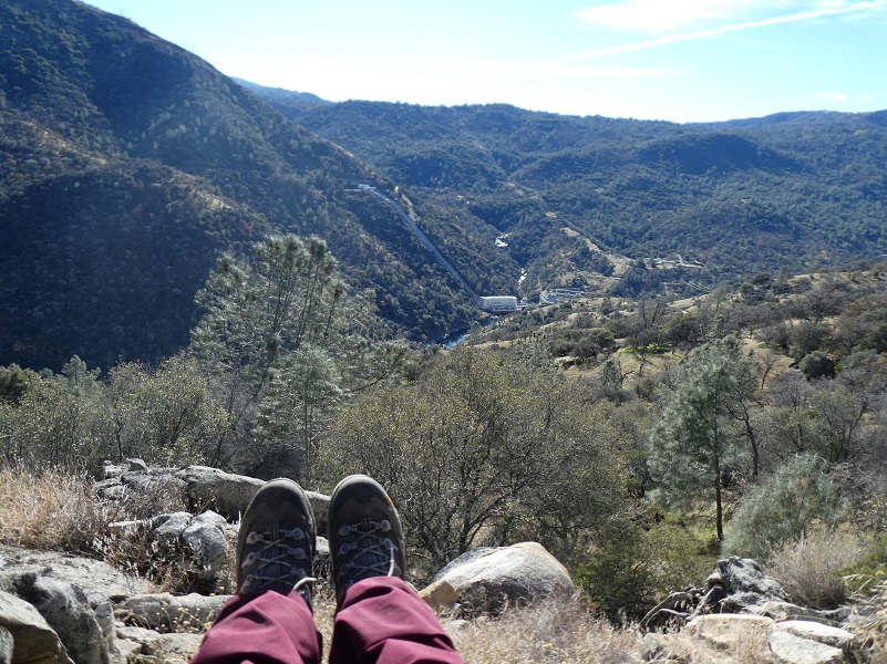
As we headed back and almost to the car, we had some beautiful views down into Redinger Lake.
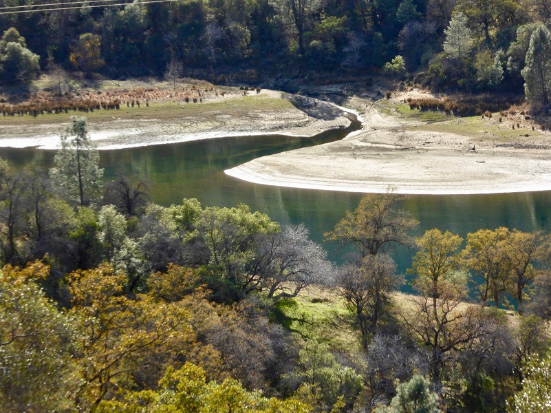
Redinger Lake (Photo by Gail Gilbert)
Not a bad end to the day with a good workout before the weather turned bad for a while. Well, I don’t really like that term “turned bad” because I am hoping for lots of beautiful snow to fall for some fun snowshoeing adventures ahead.

Redinger Lake Reflections
Dog Hike? Maybe
I didn’t bring Sally on this hike, but she would have been welcome on it. This hike could potentially be a good hike to take with your dog, if they are the type of dog that stays with you on the road. There is plenty of wildlife in this area. We saw bear, coyote and perhaps mountain lion tracks on the road. Cows graze in this area and this is also rattlesnake haven. There is no water for your dog so you will need to pack your own dog water.
Here are the Sierra National Forest rules for pets from their website:
Domestic pets are allowed in wilderness areas. You are responsible for their actions as well as their welfare. Pets should either be leashed or under direct voice control. When camping in areas with other visitors, pets should be kept on a leash. Wilderness visitor’s who plan to travel into an adjacent National Park should be aware that National Parks do not permit pets.
We ask the public to remember these rules when taking pets into the wilderness.
- Bury feces.
- Do not tie up dogs and leave them unattended.
- Do not allow dogs to chase wildlife.
- Leave unfriendly or loud dogs at home.
For additional information from Sierra National Forest regarding pets, please click the following link: Canine Camper
Map, Profile and Doarama:
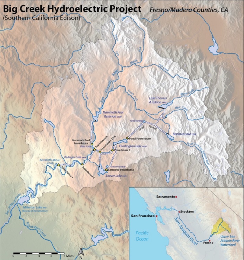
Big Creek Hydroelectric Project Map (Wikipedia)
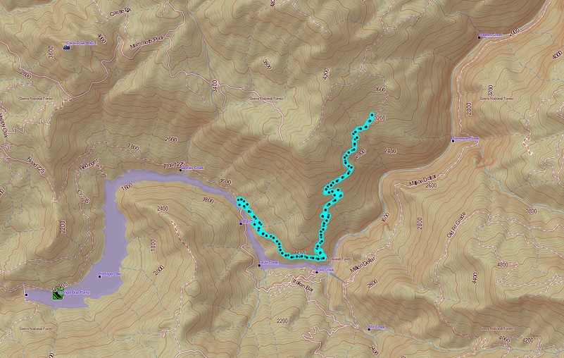
Above Redinger Lake Topographic Map
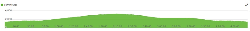
Above Redinger Lake Profile
Sources:
Big Creek Hydroelectric Project Wikipedia
Big Creek Hydroelectric System Library of Congress
Prior Blogs in the Area:
Hiking to Stevenson Fall through Recent Road Washouts February 13, 2017
Hiking to Stevenson Falls February 3, 2016
Hiking up the San Joaquin River to Stevenson Falls and Dam Six February 25, 2014
Stevenson Falls Hike February 27, 2013


