We hiked with cows, sometimes sharing the same trail. We also had a traffic jam on the trail but we were more than happy to wait for our turn while we checked out the early spring blooms and gorgeous reflections along the San Joaquin River.
Where: Bureau of Land Management, San Joaquin River Gorge Special Management Area, Millerton Lake State Recreation Area
Distance: 12.44 Miles
Difficulty: Easy to Moderate
Elevation Range: 564′ – 1,076′
Date: March 23, 2017
Maps: Millerton Lake East Topog
Dog Hike? Maybe
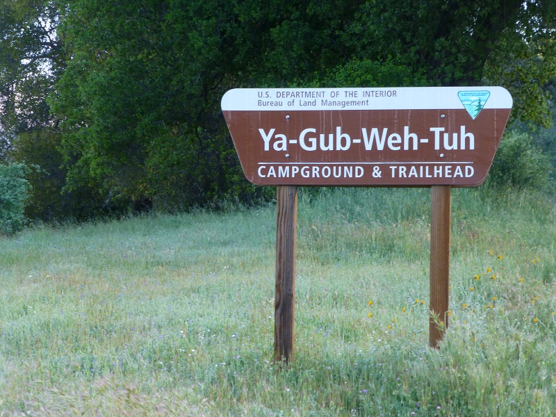
From North Fork, we drove past Kerckhoff Lake, which was full to the brim, then to Smalley Road where we turned right at the BLM San Joaquin River Gorge Sign. We headed down Smalley Road to the Ya-Gub-Weh-Tuh Trailhead and Campground. There is a well maintained outhouse here and picnic tables. There is also a $5 for day use with a self service payment system. If you have a Pass from The National Parks and Federal Recreational Lands Pass Series such as an America the Beautiful Pass or a Senior Pass, you may be able to utilize your pass for this area.
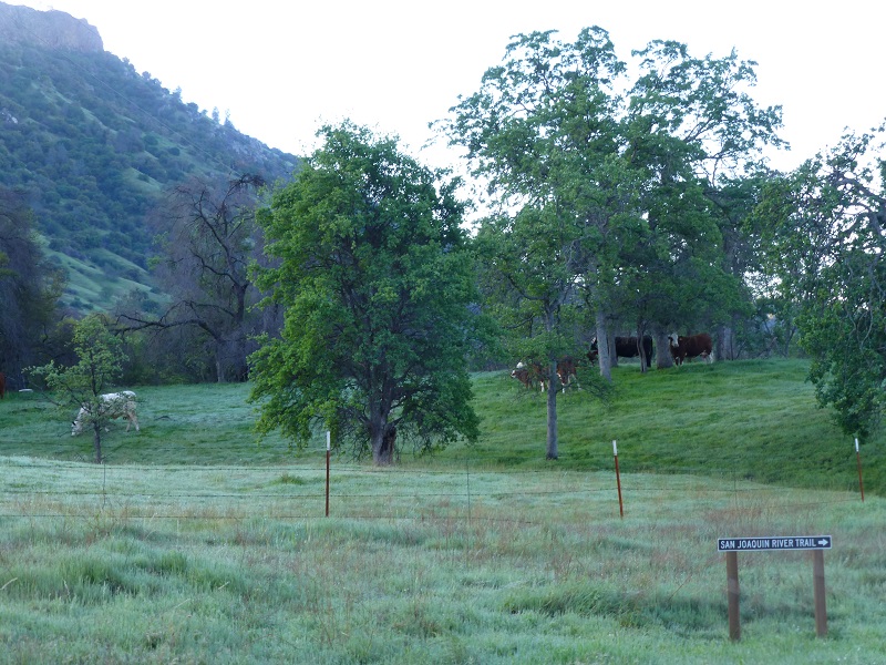
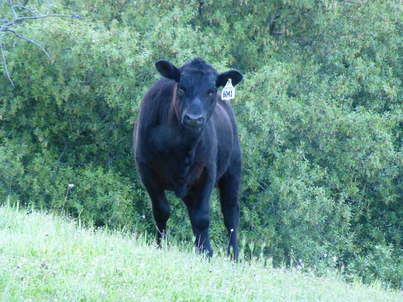
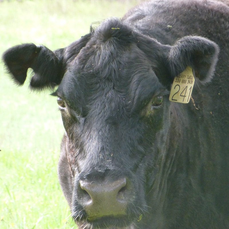
We walked across the road from the parking area and headed down the San Joaquin River Trail through a gate where a greeting party of cows and their calves met us.
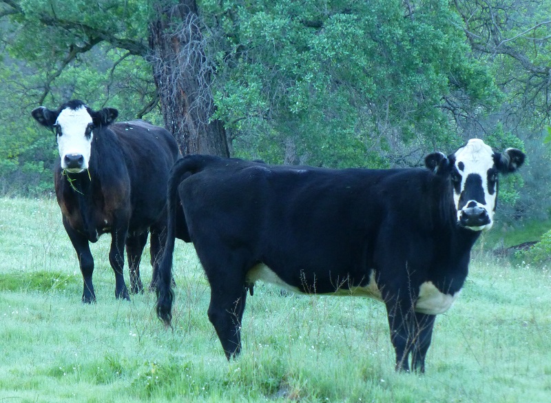
Cows were busy chowing down on the green grass but took short breaks to check us out. I wonder what they were thinking and saying to each other.
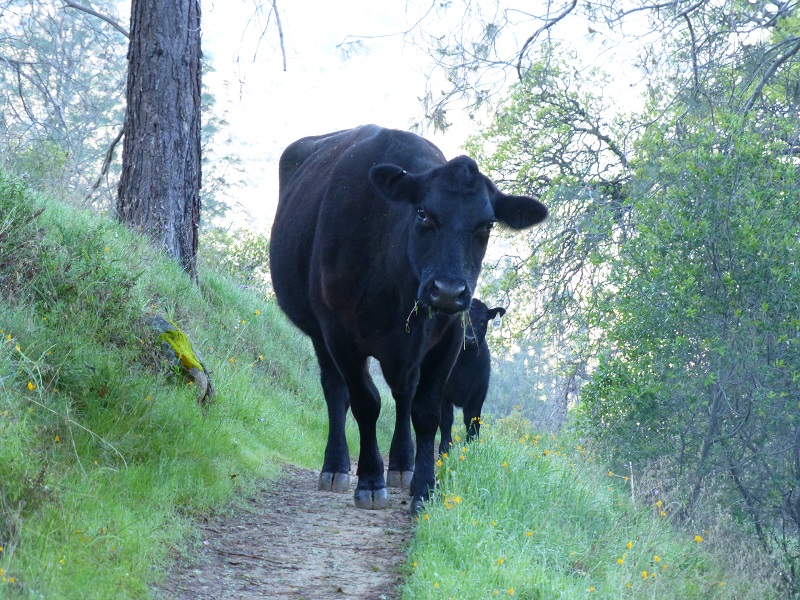
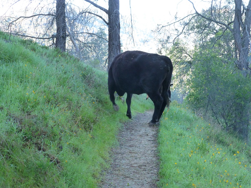
We had gone about a mile when it happened. It was a traffic jam on the trail. Momma cow and her calf were heading our way on the trail. We stopped and they clearly saw us and kept on coming. I began wondering if they would yield the right away or if we would need to step off the trail to let them pass on by. After a short standoff, Momma decided to turn around and headed downhill. Both Momma and baby started kicking up their heels, running through the grass. I wonder what they were thinking?

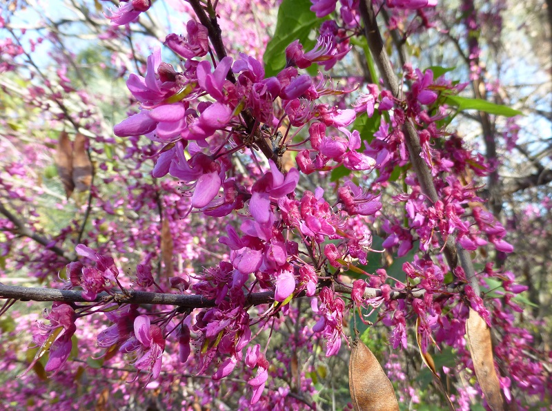
California Redbud was at the peak of its vibrant red bloom.

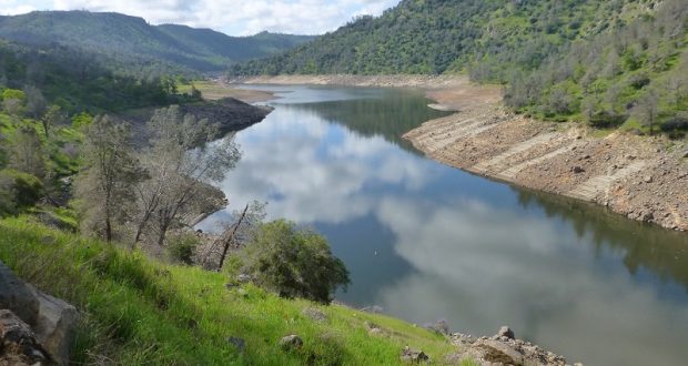
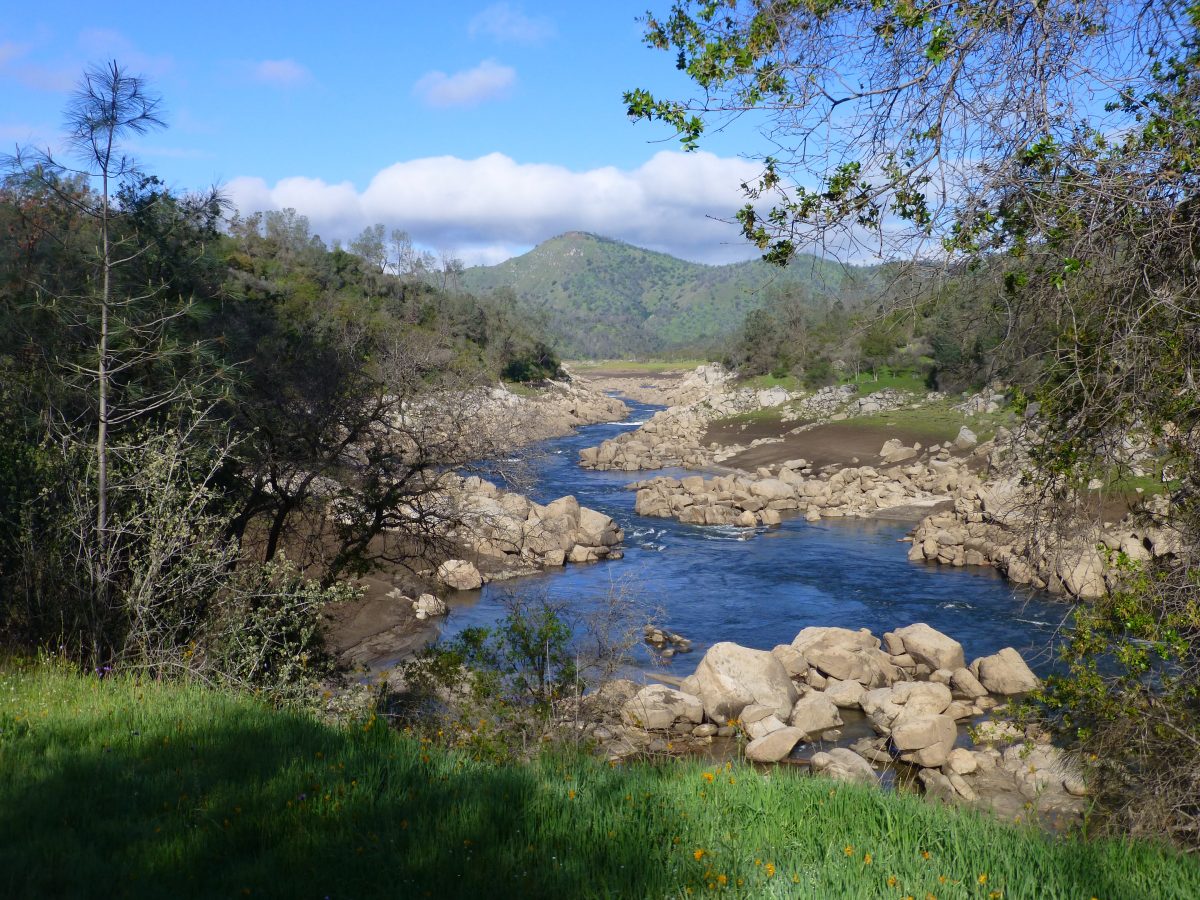
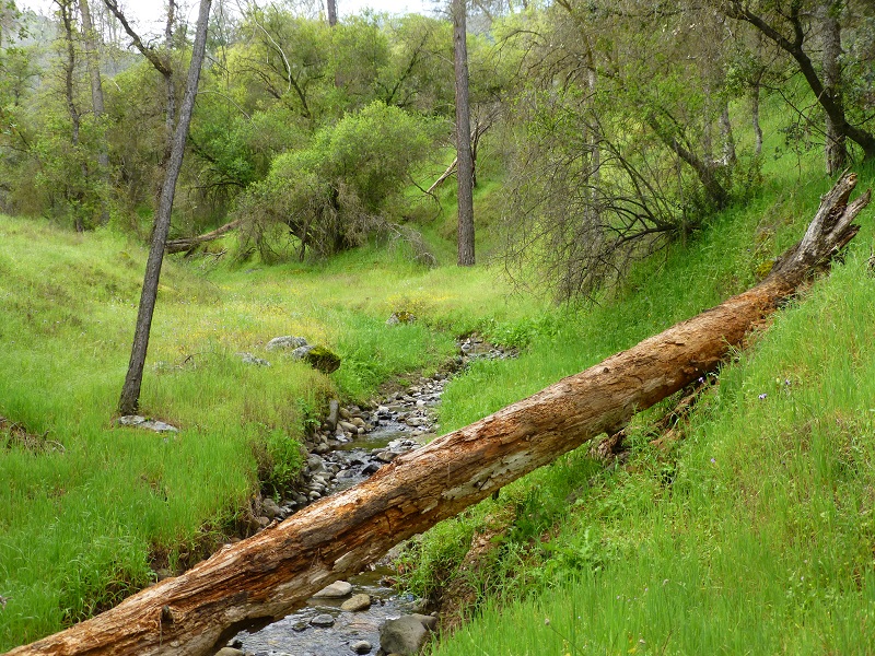
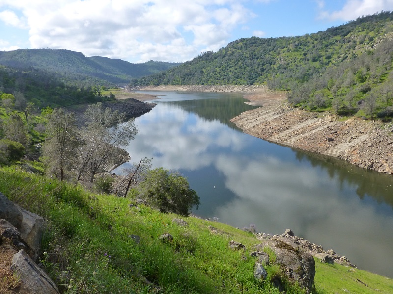
We reached a spot where we had a wonderful view of the San Joaquin River.
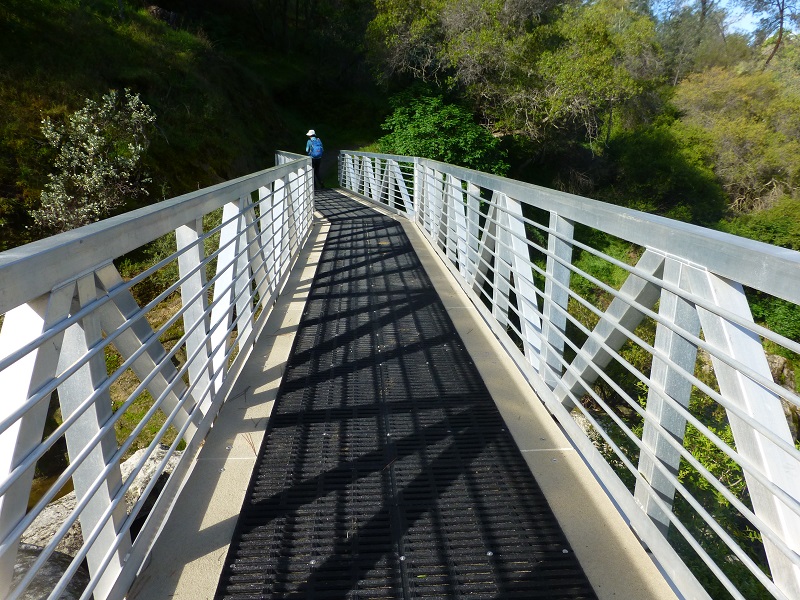
After about 2.5 miles, we reached the steel bridge that crosses over Big Sandy Creek and we were really surprised to see the remodel that it had gotten since our hike last year. The wooden planks had been replaced and rubber decking had been installed over the top of the new decking. Really nice!!
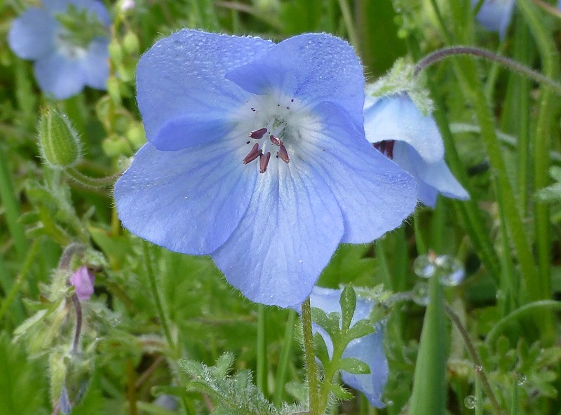
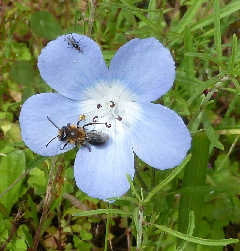
We started seeing many baby blue eyes.


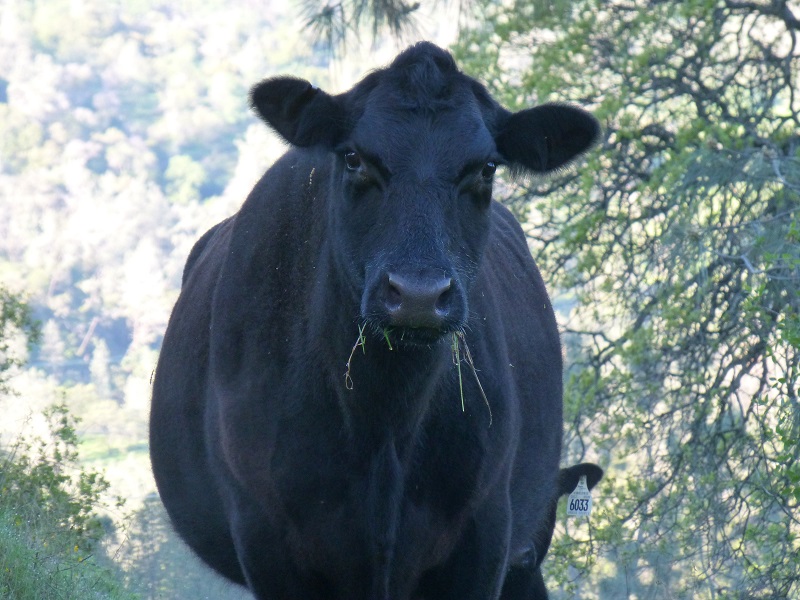
We came across another group of cows busy eating. Another Mamma cow and her calf were very curious about what we were up to but they didn’t move from their location.

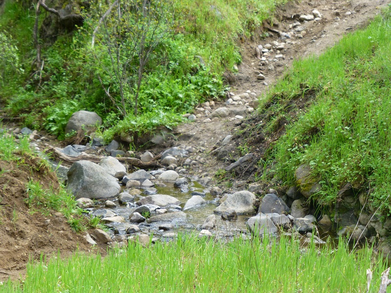
There were more seasonal creeks with water in them than we remember seeing.
It was still early in the morning so we continued about 2.5 miles past were we normally stop for lunch near Temperance Flat, admiring the white, puffy clouds and their reflections in the river.
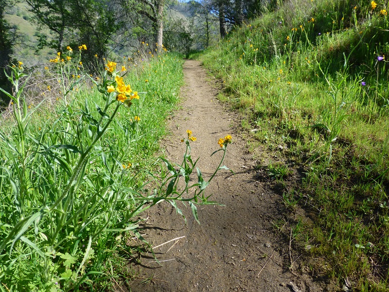
Fiddleneck lined the trail in the sunny spots.
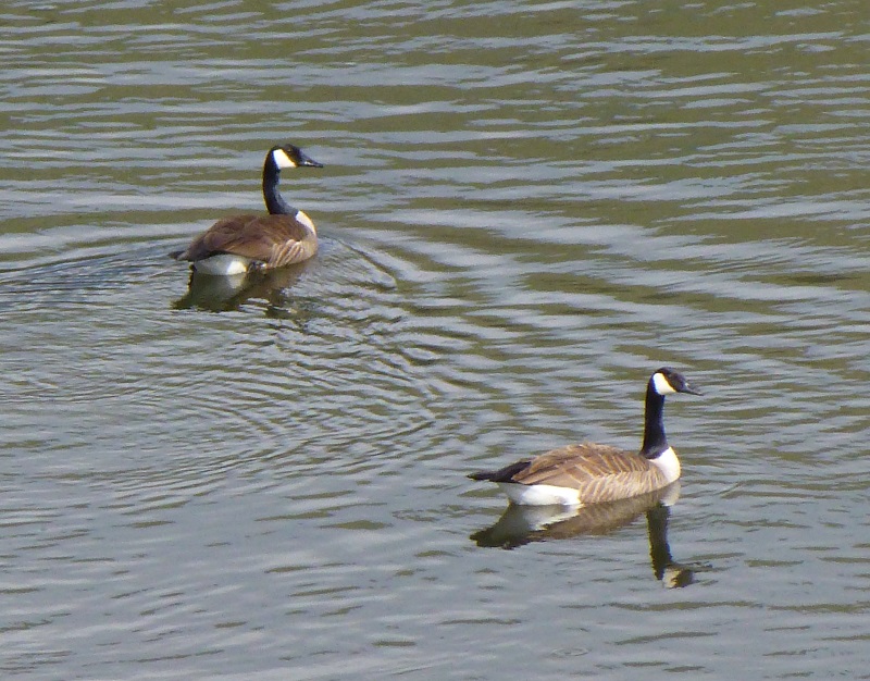
We headed to our lunch spot, a rocky knob that overlooked the river. Geese provided the entertainment while we ate our lunch, watching those white, puffy clouds float by.

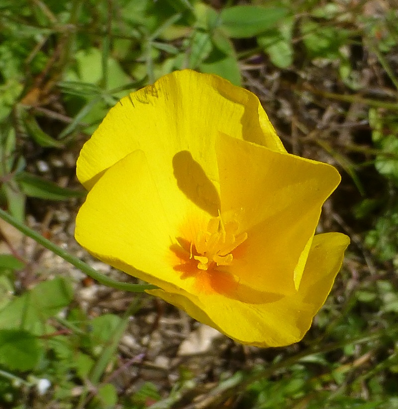
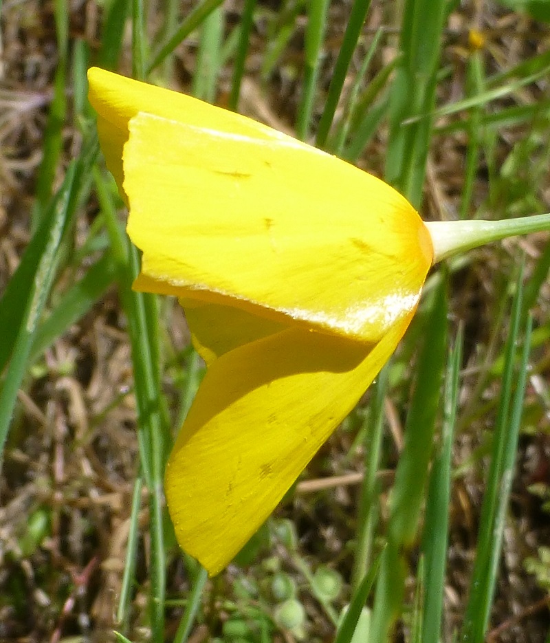
There were a few areas along the trail closer to the parking lot that usually have poppies. It was a bit early to see very many of them this year but we did find a few. Even though it was a sunny afternoon, some were still closed up.
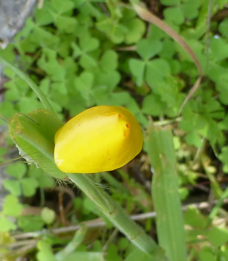
Those poppies sure were beautiful when opened up.
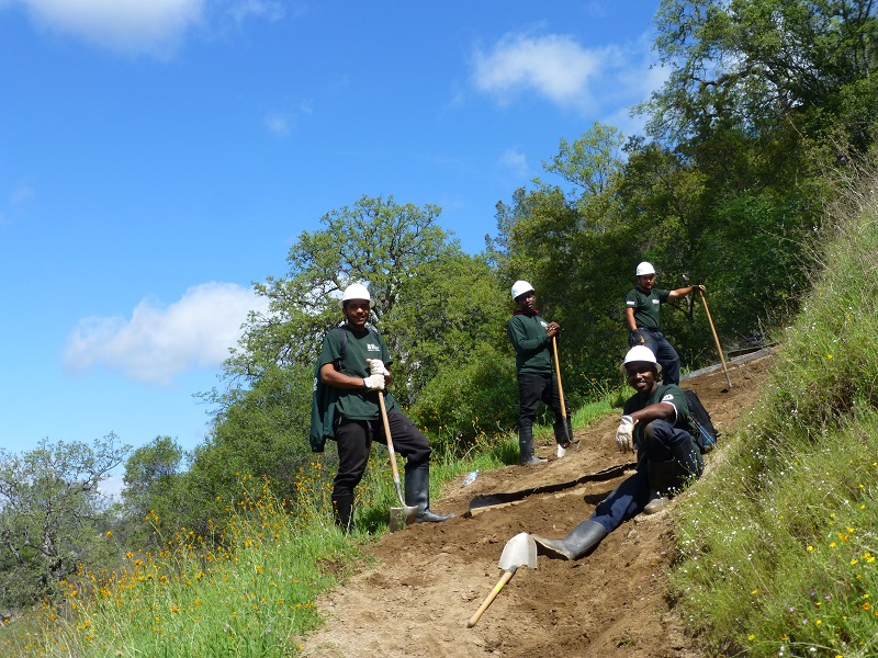
We passed by a trail crew working on the many eroded areas of the trail that resulted from this winter’s rains. They stopped their work to pose for my picture. I didn’t want you to know that they were goofing off because they had been working hard on this day for a big stretch of the trail. This was an Americorps crew out of Fresno. AmeriCorps is one of many national service programs administered by the Corporation for National and Community Service (CNCS). Thank you for your hard work to keep this trail in hiking shape.
 We had a great hike and were happy to see wildflowers but it is a bit early to see the amount and diversity of wildflowers that we usually see on this trail. Although we we did this hike about this same time of the year, the flowers are a bit behind. But it is a strange weather year, so it will be very interesting to see what kind of a flower year it will be here. I bet the best is yet to come!
Dog Hike? Maybe. I have brought Sally on this hike before but didn’t for several reasons. There are cows, so you want to keep control of your dog and not let them chase them. I have seen many critters on this hike that include snakes, coyotes and bobats. I felt that I would need to keep Sally on leash the entire time and since this was a longer hike, preferred to concentrate on me moving rather than controlling Sally. But you may feel that this hike would be a great one for your dog.
I talked with Somer Sanders from The San Joaquin River Gorge to get more detailed information on the rules related to dogs on this trail. She said that they love pets here but just want to keep them safe. She also shared with me that they are quite a few pets that have visited, including an African Grey Parrot, dogs of all types, goats packing equipment, horses and llamas. She also added that if in the area please stop by the visitor center and say hello and that the office phone number for the Gorge is (559) 855-3492 if you have questions. Here is what she shared for pet owners:
The Gorge is a pet friendly recreation destination. We do ask that dogs are leashed in developed areas (campgrounds, parking lots, visitor center, nature trail, learning center, and tunobi or cedar bark house area) and under voice command elsewhere for the safety of your pet.
Over 22 miles of hiking, biking, and equestrian trails are available at the Gorge. The area is home to wildlife including rattlesnakes, bobcats and mountain lions, ticks and other insects, as well as poison oak and thistles. Also, cattle do graze on site throughout the management area. Of special note: the cows located along the San Joaquin River Trail are especially sensitive to the presence of dogs. It is recommended that dogs are leashed on the BLM section of the SJRT for this reason during grazing periods. Hunting and fishing are permitted at the Gorge (state licences are required and Fish and Wildlife regulations do apply). However, in the interest of public safety the entire management area is closed to target shooting. Elevations range from 600 to 2,200 feet above sea level and temperatures at the Gorge can soar to 115 degrees Fahrenheit during summer months. Please plan ahead, be prepared and enjoy your visit to the Gorge.
You will share this trail with horses, cows, bike riders, runners and who knows what else. You need to stay alert that you could encounter any of these around the bend.
Map and Profile:
San Joaquin River Trail Doarama

San Joaquin River Trail Topographic Map
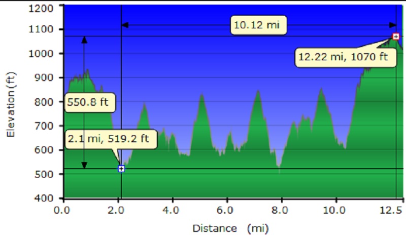
San Joaquin River Trail Topographic Profile
Sources:
Goals and Objectives of the Millerton Area Watershed Assessment
BLM San Joaquin River Gorge Special Recreation Management Area
Prior Blogs in the Area:
Hiking the San Joaquin River Trail March 31, 2016
Hiking the Pa’san Ridge Trail February 21, 2016
San Joaquin River Gorge Hike April 17, 2014


