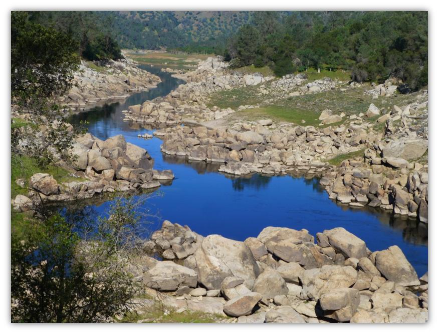
We enjoyed a beautiful walk along the San Joaquin River where we saw the bluest water with reflections, spectacular wildflowers, wildlife that included Ground Squirrels, turkeys, quail, geese, butterflies and yes. . . a snake!
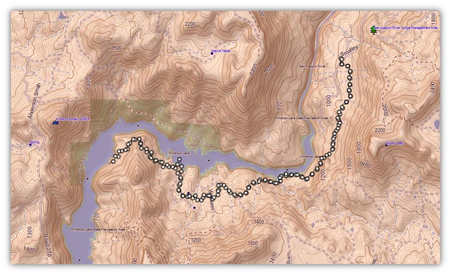
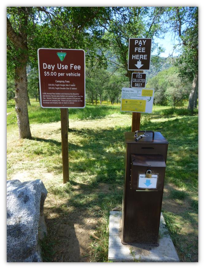
Where: Bureau of Land Management, San Joaquin River Gorge Management Area From North Fork, we drove past Kerckhoff Lake then to Smalley Road where we turned right at the BLM San Joaquin River Gorge Sign. We headed down Smalley Rd to the Ya-Gub-Weh-Tuh Trailhead and Campground. There is a well maintained outhouse here (not smelly) and picnic tables. There is a $5 for day use with a self service payment system.
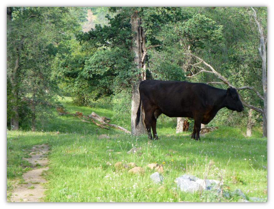
We headed on the San Joaquin River Trail, the trail that heads downstream but there are other trails that you can choose to explore. We were aware of the hazards on this hike of poison oak, rattlesnakes and the need to stay hydrated in the warmer weather but probably didn’t fully recognize the potential hazard related to the cattle that we encountered along the trail. More to come on that issue. . .
Many different names have been given to the San Joaquin River and different sections of the river were even known by different names in the past. In 1826, Jedediah Smith wrote in his journals that an unknown group of Native Americans called the river the “Peticutry”. Other names included Rio de San Francisco by Father Juan Crespi in 1772 and Rio San Juan Bautista. The Mono language name is “typici-h-huu'”, meaning “important or great river.”
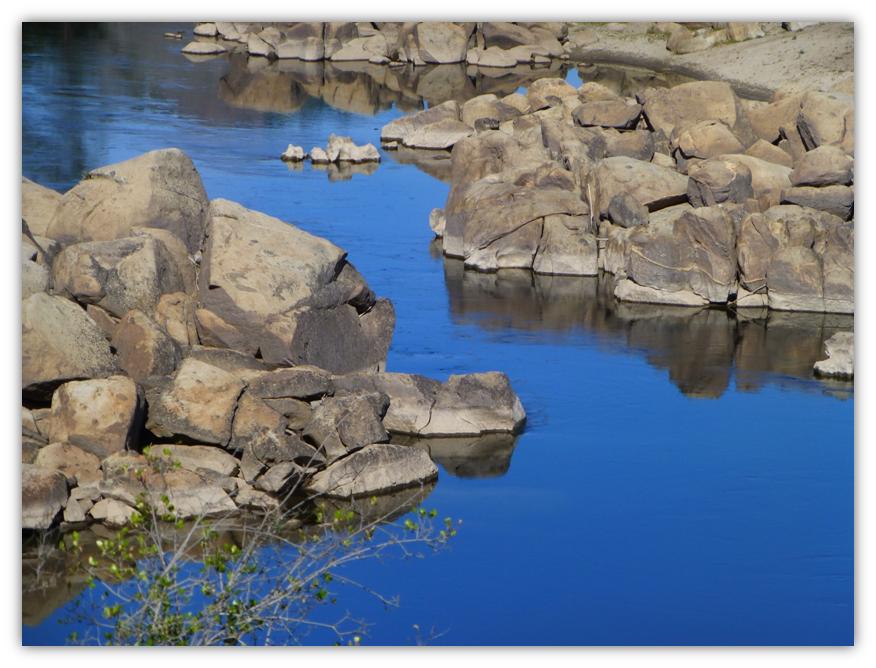
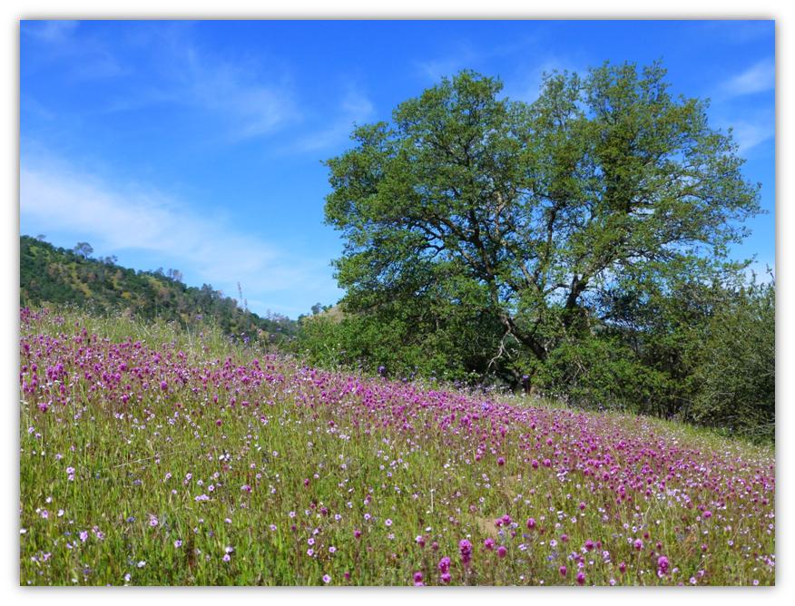
As we walked in the early morning, we were treated to the most amazingly blue color of the water of the San Joaquin River lined with boulders and their reflections.
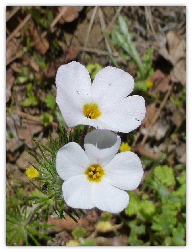
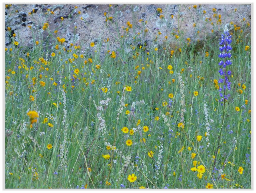
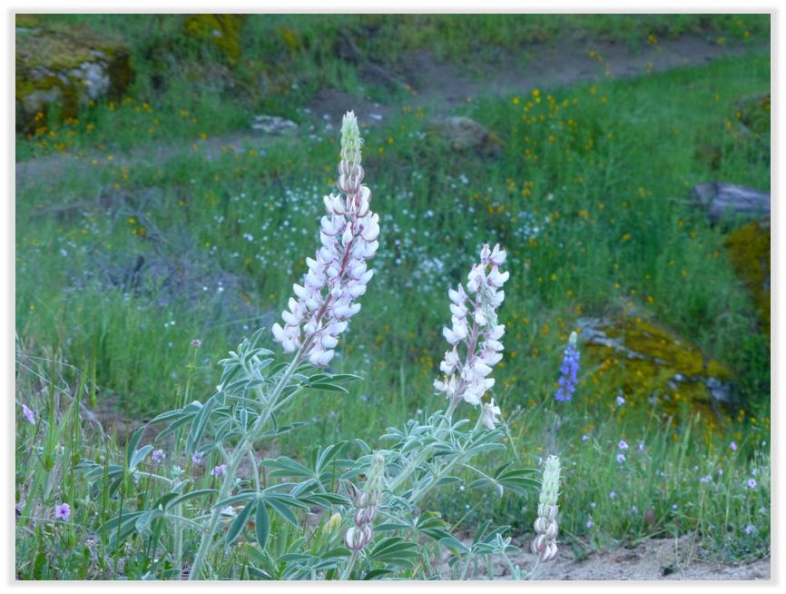
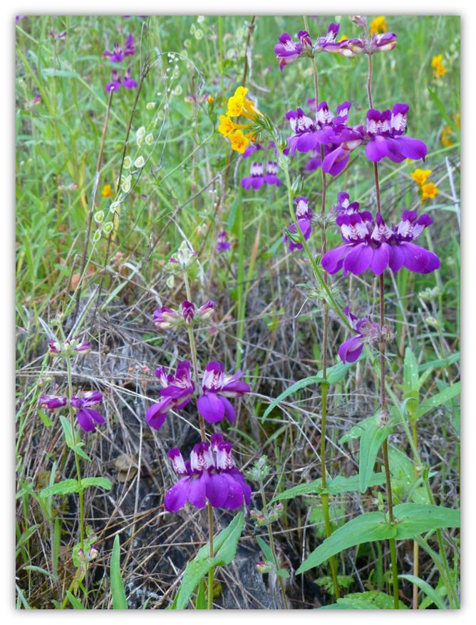
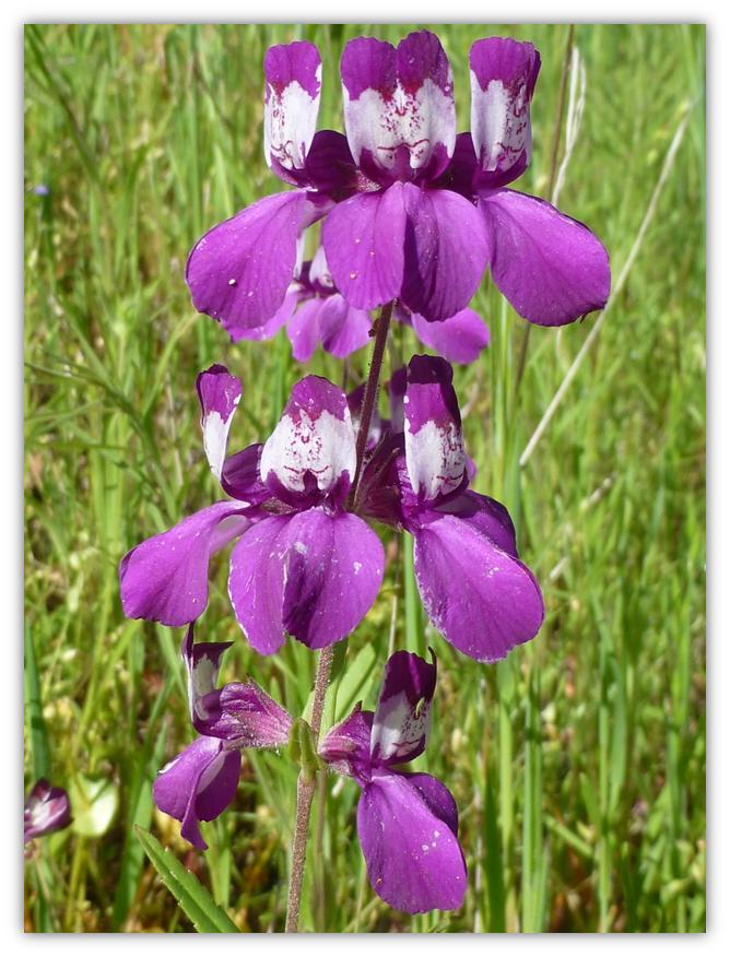
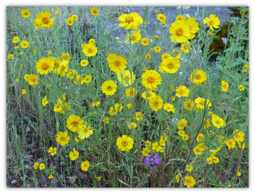
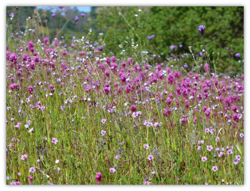
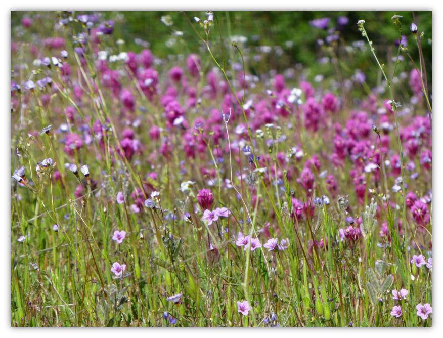
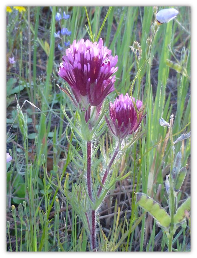
We didn’t need to stray from the trail to see many different types of wildflowers.
Mustang Clover:
There are several different varieties of Lupine. We see a lot of the taller purple Lupine, but we were treated to a large, lighter color of Lupine along the trail.
Chinese Houses:
Yellow Coreopsis:
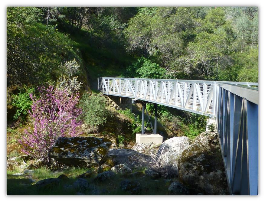
A very nice bridge takes the trail above a drainage.
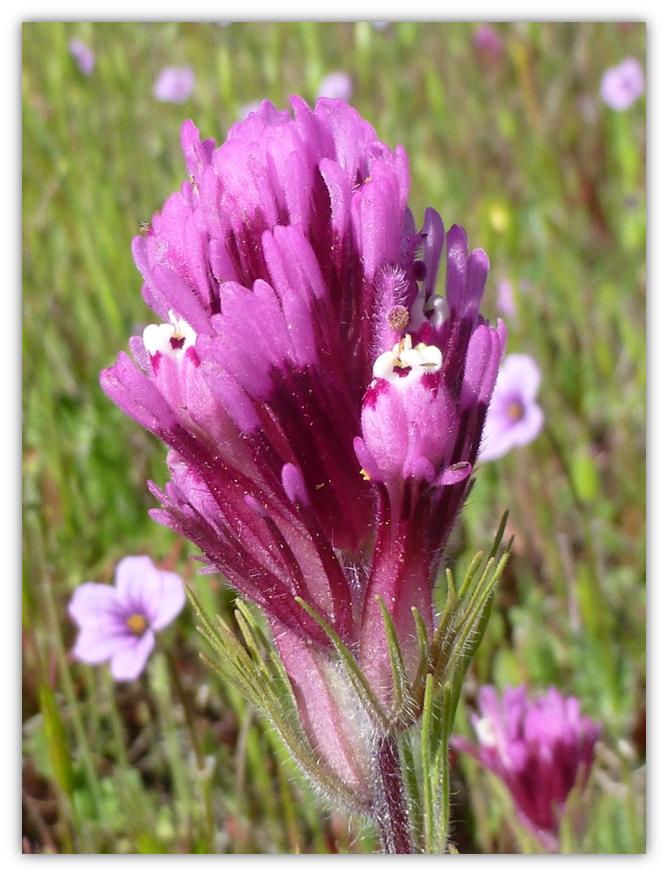
Owl’s Clover:
Distance: 12 Miles (you can go shorter or farther, your choice!)
Difficulty: Moderate
Elevation Range: 563′ – 1,079′
Date: April 3, 2013
Highlights: Diversity in the type and colors of wildflowers, along with gorgeous reflections in the San Joaquin River.
 The Dumna and Kechayi Native Americans people once occupied the Management Area and surrounding lands. It is from their language that the names of the trails contained within the Management Area are named. Plans for the San Joaquin River Trail call for a continuous 100 miles of trail from Highway 99 to the headwaters of the river at Devils Postpile. The trail would incorporate the 57 mile route developed by John French in 1879, which follows the natural terrain used by the Native Americans to cross the Sierra Nevada Mountain Range.
 The present name of the river dates back to between 1805 and 1808 when Spanish explorer Gabriel Moraga was surveying in the area for potential mission sites. He came across a tributary of the river and named it for San Joachim, husband of Saint Anne and father of Mary the mother of Jesus. The name was later applied to the entire river and was in common use by 1810.