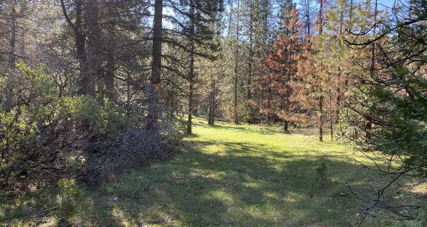
I walked up the same dirt road, but a different spur road, to a beautiful meadow. Interesting history with hard working men who had a vision for this country but not all of these stories have a happy ending.
 Distance: 6.77 Miles (but you can go shorter or longer)
Difficulty: Moderate
Elevation Range: 3,418′ to 4,840′
Date: April 15, 2020
Maps: Ben Hur and Daulton Topographic Maps
Dog Hike: Maybe
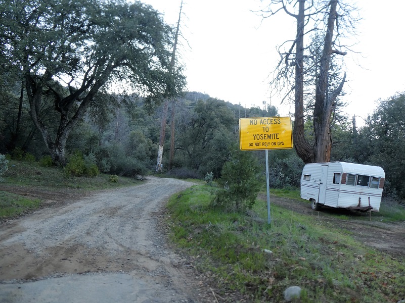
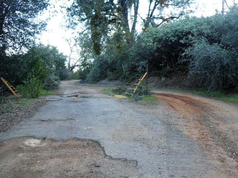
There is more than 1 way to get to O’Neals Meadow and I chose the way I went because it was the shortest distance for me. Also, in case you think I misspelled the name of the meadow, I used the spelling on the maps: O’Neals Meadow, not O’Neal’s Meadow. I started my walk across from Worman’s Mill, parking off the road in a wide spot at the intersection of Road 601 and Worman Road, making sure I wasn’t blocking anyone and I headed up the road.
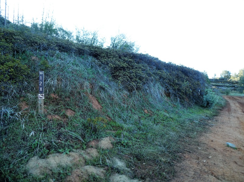
I hadn’t walked too far until I came to the first road that branched off from the road, 5S16, and I took it to the left.

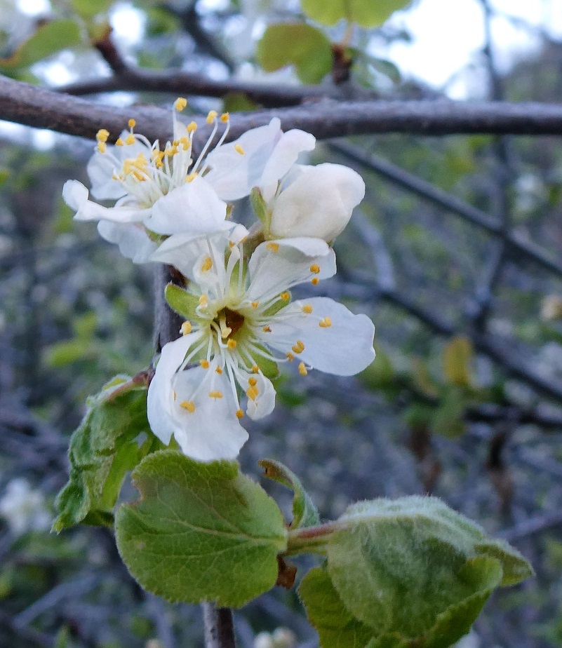
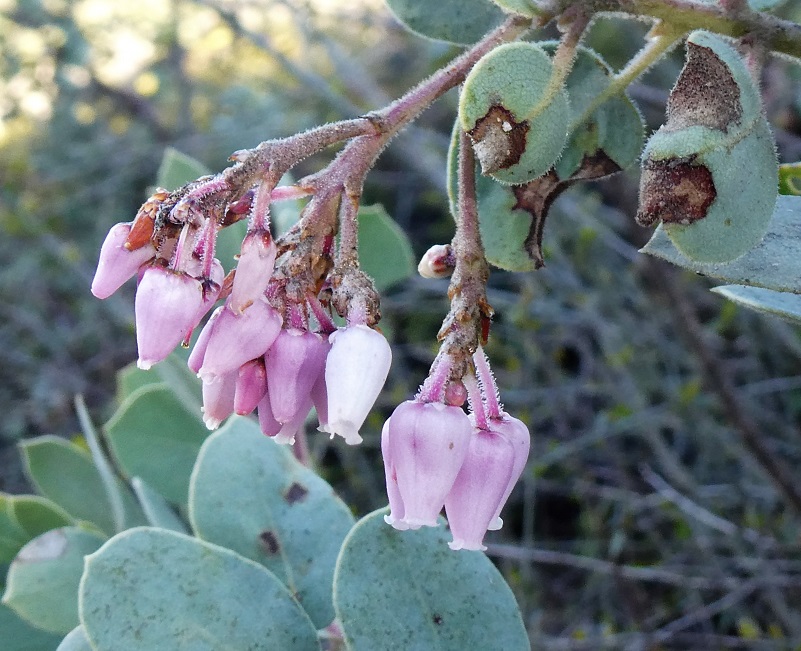
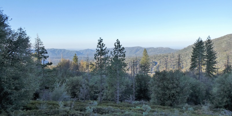
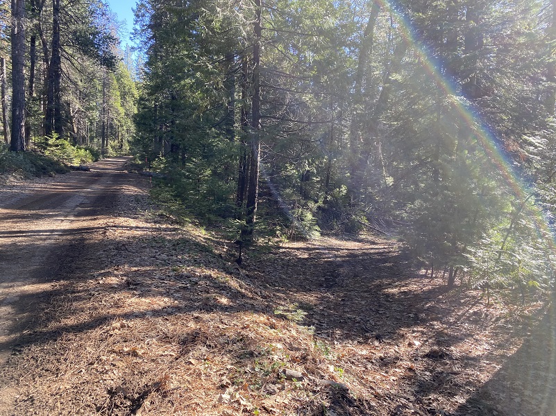
I noticed many lizard and snake tracks wiggling their way down and across the dusty road. I don’t now what type of snakes they were but it was a strong reminder that this is rattlesnake country. A few more shrubs were blooming along the road as I walked uphill. As the road climbed, a few openings between the trees gave me some views along the way.
The road went past an old cattle guard, then I started getting more openings in the trees to catch those views.
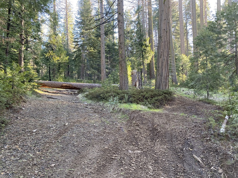
I took the road marked 5S12X on the right. The marker indicated that cars were not allowed and there is a reason for that. They would not get too far up that road and if they did venture up, there is no turn around where they would get into trouble. Quads and motorcycles had traveled the road though.
The first stretch of the road didn’t look bad.
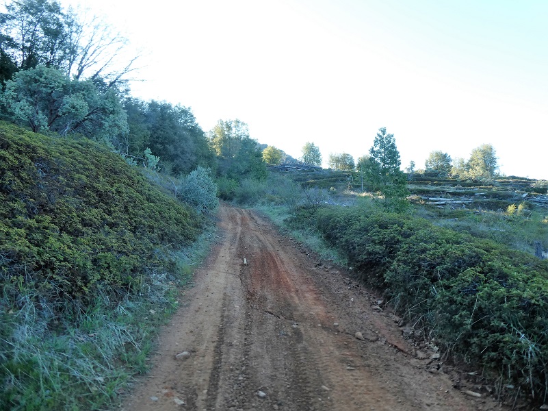
Those views into the Ahwahnee area and valley were very pretty.

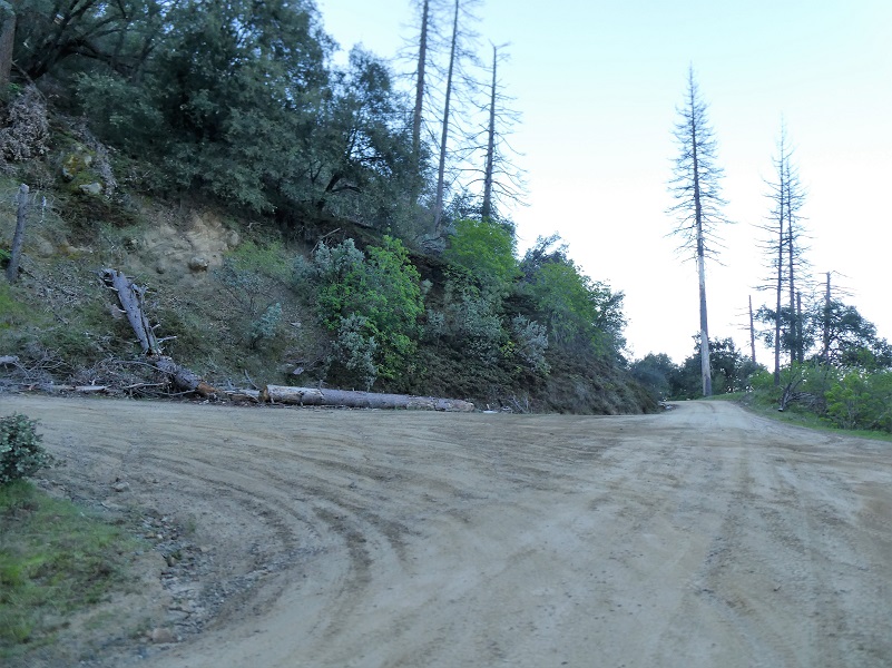
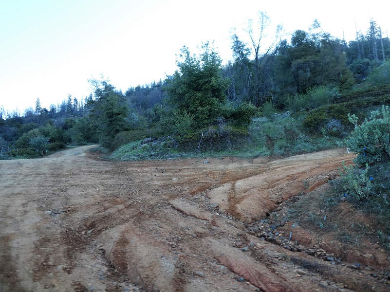
Then the road condition changed. Water ran down the road and it was a muddy mess in some stretches, with some serious ruts.
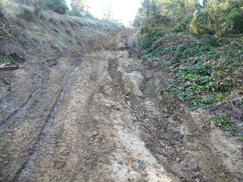
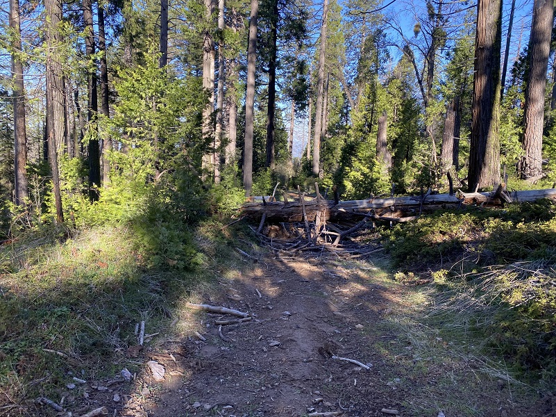
And there were areas with large trees down across the road. There were work arounds for these areas for motorcycles, some quads and horses. As I looked up, I could also see many standing dead trees, a reminder that this area would not be a good one to hike when there is some wind and attention is needed just in case one of those trees decided to come down with no wind.
After I topped off on this road and started heading slightly downhill, I reached the junction of 5S12 and turned left. I wanted to approach the meadow from the uphill side and could soon spot it, taking an informal spur road down into it.
There is an outstanding book by Zelda Garey Dubel on the history of our area called To Yosemite by Stage: Raymond to Wawona and Remembering Cedarbrook Inn. It is full of interesting history that I often reference and it has a section on O’Neals Meadow. That is where most of my information comes from for this blog.
O’Neals Meadow was named after John Ruffin “Ruff” O’Neal, bc1836 Tennessee or Mississippi. He filed for his first homestead of 160 acres at what became known as O’Neals Meadow in 1883. There isn’t a connection that is known with the O’Neal families of the town of O’Neal, just in case you were wondering. When he registered to vote in 1867, he was a miner living in Buchanan City near Raymond. When he first settled his homestead, there were already 3 log cabins and a barn on the property that had previously been owned by Ephraim Cutter Carter. Ruff ONeal owned stock, had a 1 acre apple orchard where he picked two tons of apples in good years. He also raised 3-4 tons of potatoes and harvested 6-7 tons of hay each year.
When the 1880 census was taken, O’Neal was neighbors with John E. LaTouche and they were both shake makers.
I couldn’t locate land records for Ephraim Cutter Carter but did locate them for Ruff O’Neal. If you want to do some searching for yourself, the BLM General Land Office Records is a great site for that.
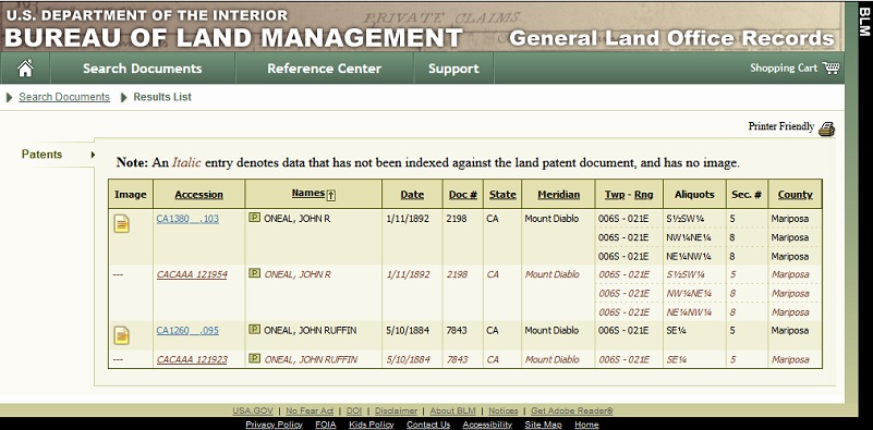
John Ruffin O’Neal Mariposa County Land Records (BLM General Land Office Records)
The earliest land record for him was dated May 10, 1884 when he received his land patent.
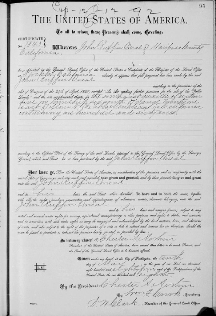
John Ruffin O’Neal 1884 Land Patent (BLM General Land Office Records)
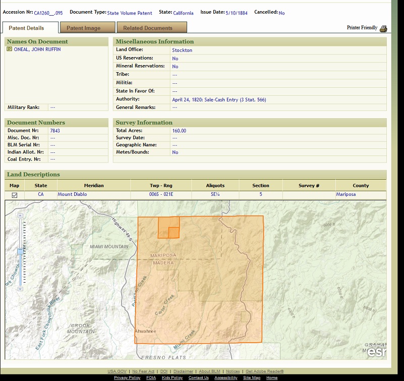
John Ruffin O’Neal 1884 Patent Map (BLM General Land Office Records)
O’Neal made another homestead application for property adjoining his first homestead. This property had good timber and he thought it would make good farming land once that timber was cleared. O’Neal settled on this parcel May 10, 1883 and with the help of his neighbors, built a log cabin about 12 by 18 feet worth $50 and built a road 3/4 of a mile to the cabin at the cost of $150. He cleared off 3 acres of the land, cultivated it and brought water onto the land in a flume. He owned a spade, a shovel, 2 potato hooks, 1 mattock and 3 axes. He raised crops 4 seasons of the year that included musk melons, water melons, turnips, potatoes, corn ,beans, beets, peas, lettuce and cabbage.
It must have gotten kind of lonely up there because the Mariposa Gazette printed the following article in 1883:
“John Ruffin Oneal, who resides on the south-eastern border of this county and is pretty well known to the people here and of that section, where he has established and built himself a comfortable home, and is likely to grow to wealth and independence as he grows older, has recently proved up and paid up on his land, and expects within a few short years to have at least 150 or 200 acres under cultivation. Some fifteen or twenty years ago, Ruffin Oneal, who was at that time quite a young man, was passing away his time here during the winter seasons teaching school. He has not yet forgot the rudiments and first principles of the art. If his Spencerian ability is in any manner doubted, just let some lady who would like a good home, write and exchange photographs with him and see what an autograph he can cut. He is a clever bachelor and capable of supporting a worthy assistant. He has recently canvassed the foot-hills among several acquaintances, where he says it was reported that several of the married men were sick and likely to die soon; but he says, upon investigation, he finds them all convalescent, and he has gone home to wait another year. From what we infer, he would like a tree that has already borne fruit. Applicants will now take notice and be governed accordingly.”
In 1889, he built a larger house valued at $300 with some help of a carpenter. That house was constructed of sawed lumber and measured 14 by 16 feet, with a shake roof and double plank floor. The 2 room house’s kitchen was sealed with tongue and groove lumber. He also had a barn. In 1888, he was listed on the Delinquent Tax List of the County of Mariposa. He filed his Notice of Intention to Make Final Proof on his Homestead on May 3, 1890.
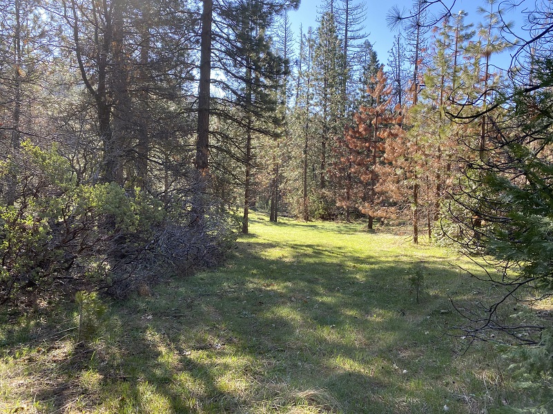
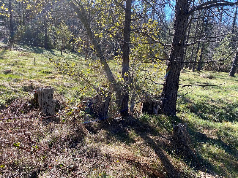
I wandered around the meadow that was being taken back by the trees. I wondered if I could find one of his apple trees or signs of improvements. I spent some time exploring the upper end of the meadow where old maps showed buildings were located but that area was very overgrown. I could make out old use roads that led through those thick trees and knew that O’Neal’s buildings had long burned but other buildings were built after that by other occupants, probably in the same spots. It was interesting to walk through but I didn’t find anything of substance.

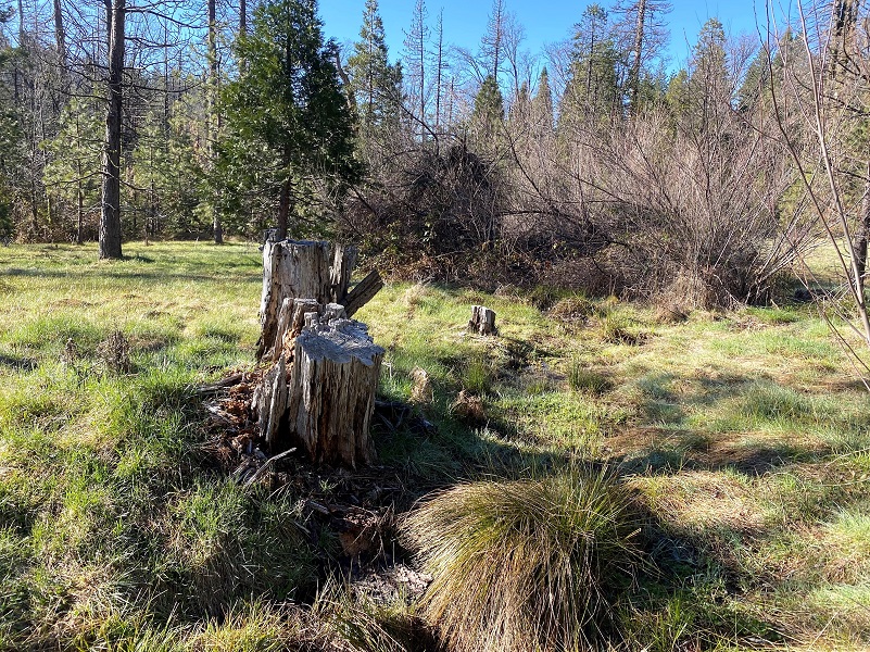
I located old cut stumps but I don’t think they were quite old enough to have been O’Neal’s. I could tell that the small streams that flowed through the meadow had been diverted at some time, probably to help with irrigating the crops and trees.
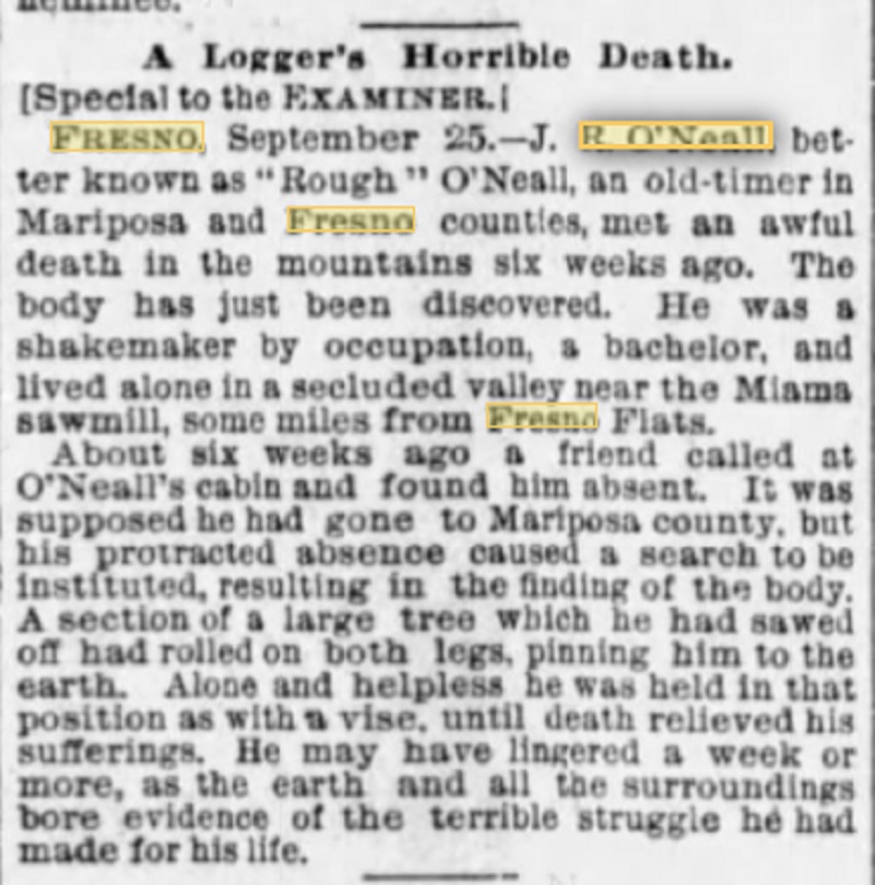 Now we come to the sad part. John Ruffin O’Neal’s death in 1891 was widely reported in local newspapers and even the San Francisco Examiner.
“Oneal, John R. A Horrible Fate/ John R. Oneal, an old settler in the neighborhood of Twin Springs, and well-known throughout that portion of the county, was found dead, on Thursday of last week in the woods two miles east of his place. Mr. Oneal had a good mountain ranch, and had lived alone many years. He employed most of his spare time in splitting shakes for sale. He was last seen about a month ago, when he was at the Post Office at Grant’s Springs. some three weeks ago, Albert Reynolds called at his house, but found no one at home, but noticed that things looked as if Oneal had been gone some time, as food which had been left on the table was moldy. Last Tuesday Reynolds again went to the house and found things exactly as they were, at his former visit, and also saw that his ax and saw were gone. A searching party was organized and every tree on Oneal’s land where shakes had been made was visited, but no trace of him could be found. They the began to look elsewhere as he was known to have bought trees on other land and on Thursday his body was found. A tree in falling had caught one leg in such a manner that the poor man could not extricate himself and there he had suffered and starved to death, almost within sight and hearing distance of some men who were cutting logs on a ridge near him. There were signs of the awful struggle he had made in trying to dig himself out but his leg was badly crushed, and he was too feeble to extricate himself. The body was badly decomposed showing that he had been dead a long time. He was in the habit of marking his calendar every day and the last entry was on August 8th, but it is not certain whether that was the date, on which his terrible fate overtook him. Mr. Oneal was an inoffensive kind hearted man and had no enemies. He was unmarried and was a native of Tennessee. His age was 55 years.”
They buried him where they found him because it was mountainous terrain and it was have been difficult to move the body. John E. LaTouche had found him and 2 years later he met a similar fate. They are buried next to each other at the Westfall Burial Ground.
From “As We Were Told,” (1990, Coarsegold Hist. Soc.), page 75, interview of Lewis Kinser Duncan 25 Oct 1983. O’Neals Meadow.
“The other grave was George LaToush’s. He had a cabin in the timber by Miami Lodge, above Miami Road. The Madera Sugar Pine Company owned all timber except this little place he had–ten or fifteen acres. Timber was being cut around his house. The loggers told him to get out because they were going to fall the timber and if he didn’t leave, they might fall a tree through his house. He owned the land and didn’t think they had a right, so he didn’t leave. The loggers cut a great tree which did fall through the cabin and killed him. Those are the two people who are buried in the little cemetery alongside the road. My grandmother told this story.”
John O’Neil’s estate was probated in Mariposa County and the Sheriff was ordered to sell the property for $795.80. The purchaser was Nathan Cathey who made the highest big of $922. At a future point, this land became owned by the U.S. Forest Service and it is believed that all of his structures burned sometime before 1922.
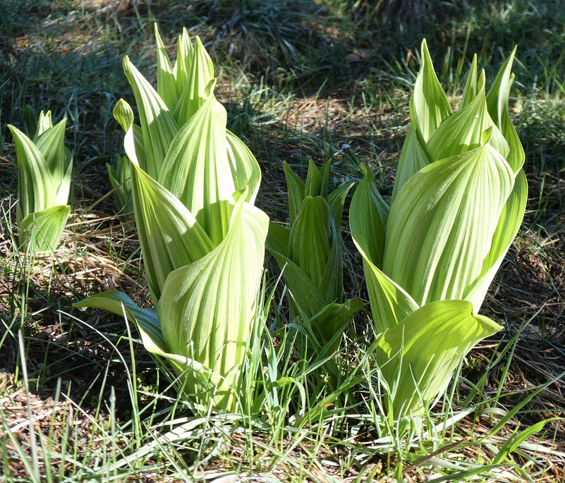
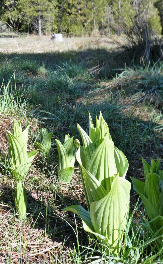
As I walked through the meadow, corn lilies were popping their way up through the grass and although there were no wildflowers on my visit, I could see many plants that would be producing wildflowers in the meadow. It was clear that John Ruffin O’Neal had a dream and worked so had to fulfill that vision in this beautiful location. That hard work that he did clearing the trees, preparing the ground for crops, splitting shakes and picking up other jobs to finance his farming operation was something I pondered on this hike. I tried to focus on that instead of the sad story behind his death.
I reached the road I came in on and wondered if this was the road that John O’Neal had constructed over 100 years ago. I just may have walked in his footsteps on my way back.

I soon could spot the squiggles of Hwy 49.

As I got closer to my car, a bicyclist was heading up the road and a pick up drove up. Not too crowded and just the way I prefer it as I practice social distancing, get some exercise and an adventure close to the house. I plan on continuing to walk in the footsteps of our local people who occupied this area long before we entered the picture, learning more about their lives.
Dog Hike? Maybe
This could be a good dog hike if your dog is a good fit. The road is lightly traveled by vehicles so you would need to keep an eye open for a vehicle coming around one of the curves. I would imagine in the summer that you could run into a rattlesnake out here also. This is mountain lion country, along with other wildlife that you could encounter. There were a couple of areas with running water on my hike but it probably dries up in summer, so you would probably need to pack dog water.
Doarama:
What is a Doarama? It is a video playback of the GPS track overlaid on a 3 dimensional interactive map. If you “grab” the map, you can tilt it or spin it and look at it from different viewing angles. With the rabbit and turtle buttons, you can also speed it up, slow it down or pause it.
Map and Profile:
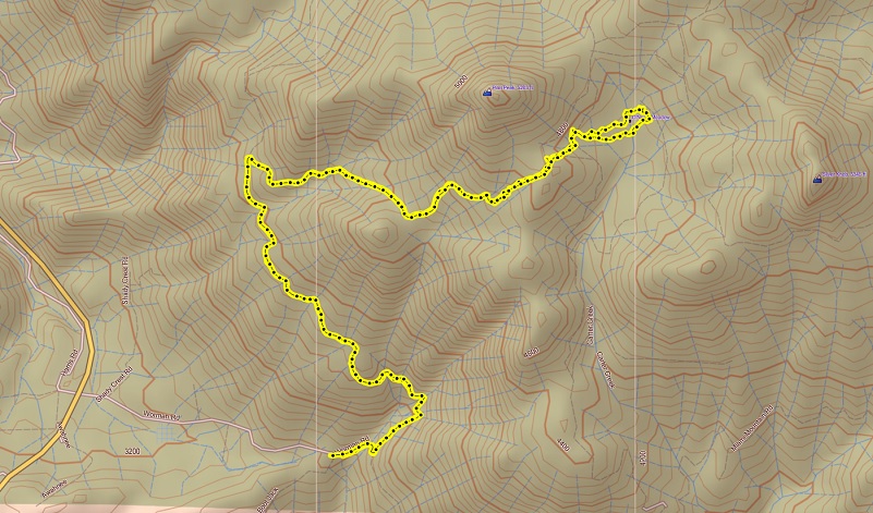
Worman’s Mill to O’Neal’s Meadow Topographic Map
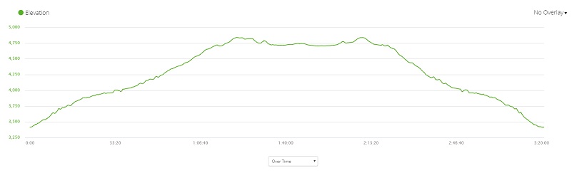
Worman’s Mill to O’Neal’s Meadow Profile
Sources:
Dubel, Zelda Garey, To Yosemite by Stage, Zulu.com, Third Edition, 2011.
Greene, Linda, YOSEMITE: THE PARK AND ITS RESOURCES; A History of the Discovery, Management, and Physical Development of Yosemite National Park, California, U.S. Dept. of the Interior, National Park Service, September 1987
Mariposa Gazette, 13 January 1883
As We Were Told, (1990, Coarsegold Hist. Soc.), page 75
John Ruffin O’Neal Patent Details BLM
Prior Blogs in this Area:
Walking up a Dirt Road: Worman’s Mill and Beyond
Walking up a Dirt Road: Worman’s Mill to Sunny Meadows April 10, 2020


