Lots of history on those dirt roads where I live and one of those dirt roads took me on a historic wagon road that Galen Clark’s company built to help connect Mariposa to Wawona.
 Distance: 5.61 Miles (but you can go shorter or longer)
Difficulty: Easy
Elevation Range: 3,418′ to 4,388′
Date: April 10, 2020
Maps: Ben Hur and Daulton Topographic Maps
Dog Hike: Maybe
I started my walk across from the Worman’s Mill, parking off the road in a wide spot at the intersection of Road 601 and Worman Road, making sure I wasn’t blocking anyone and I headed up the road.
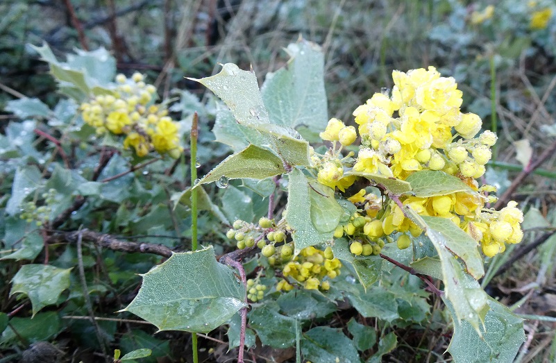
Along the road, a small dewy oak was blooming beautiful yellow flowers.
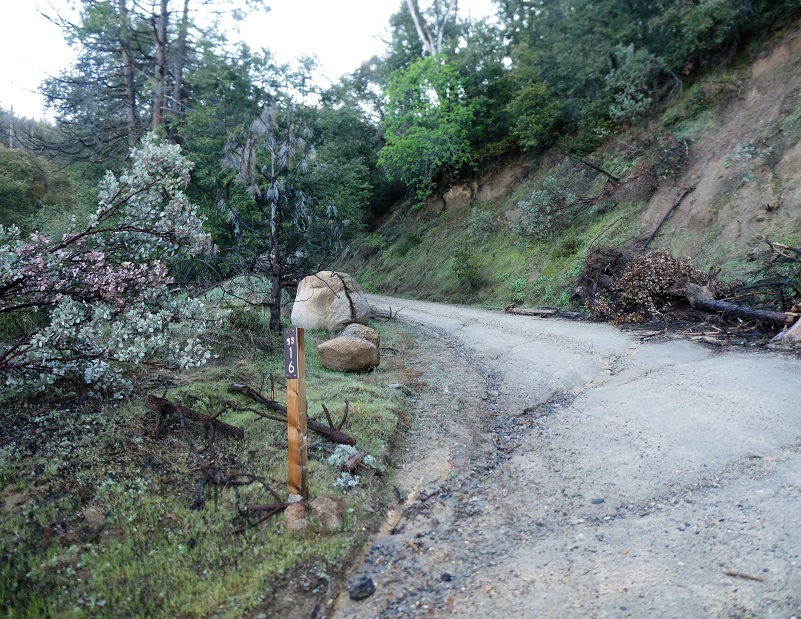
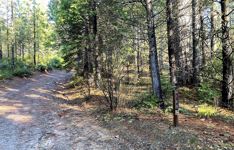
I hadn’t walked too far until I came to the first road that branched off from the road, 5S16, and I took it to the left.
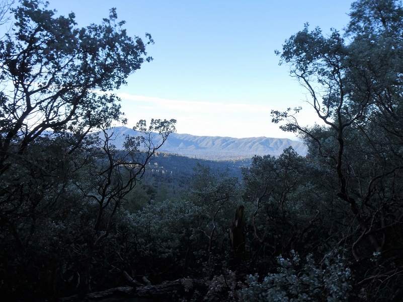
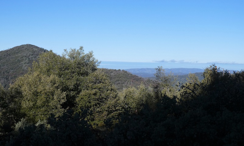
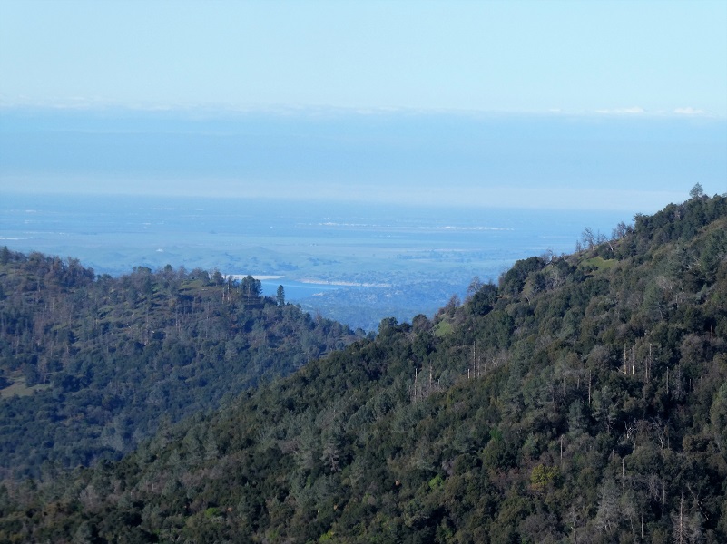
The road started gaining elevation from the beginning and I was treated to peeks of views along the way.
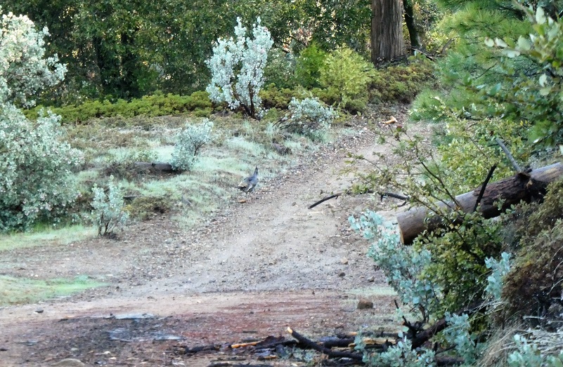
A hen turkey came out of the brush along the side of the road and led me up the road for a while, then she flew back to the direction that she had started to lead me. I assume she was nesting in that area. Can you spot her up the road on the left? She sure blends in.

I was surprised that I could look right into Ahwahnee Hills Region Park to see that the pond was really full.

And I could look across to Miami Mountain where the lookout was easy to spot.
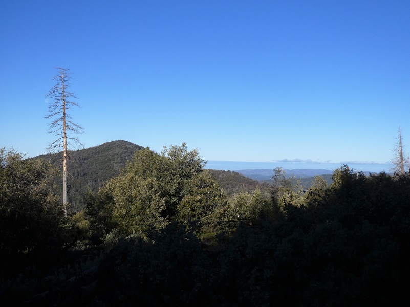

I could look north of Miami Mountain into Mariposa and Merced Counties.
I could even see Hensley Lake!
The road wrapped around the north side of the terrain where I crossed a creek, then 5S16A was on the right. This road was part of the old wagon road that Galen Clark’s company, “Mariposa Big Trees and Yo Semite Turnpike Company,” built to tie in Mariposa and Wawona. There were actually several ways that visitors reached the Wawona area by stage. Before the Raymond Road was the preferred route, this upper road that went over the mountain into what was then called Hogan Meadow, renamed Sonny/Sunny Meadows in 1947, then followed Miami Creek into Miami Lodge.
In August 1869 a traveler noted two available routes to the valley, one via Mariposa and the other via Big Oak Flat and Harding’s mill. The latter was the cheapest, steepest, and most uncomfortable. The Mariposa route was somewhat longer but easier to travel in comparison.
I tried to locate an older map that could have this route but the oldest one that I could locate was the 1912 USGS Mariposa Topographic Quadrangle, showing the dirt road, along with many places that were populated back in the day. If you ever want to hunt for old maps, the USGS Historical Topographic Map Explorer is a great site. It is a bit difficult to see the detail in the picture but if you click on the section of that map picture below, it will get a little larger for you.
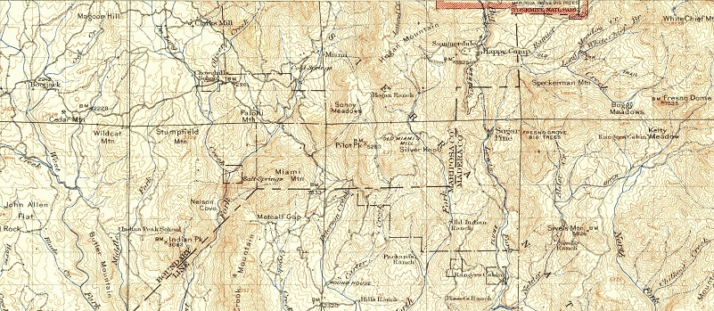
1912 USGS Mariposa Topographic Quadrangle
I walked up 5S16A, the old wagon road, and it wasn’t in the best of shape. A muddy slide narrowed the road to a single motorcycle wide track and there were some small down trees across the road. Another short spur paralleled this road to the south and I returned that route.
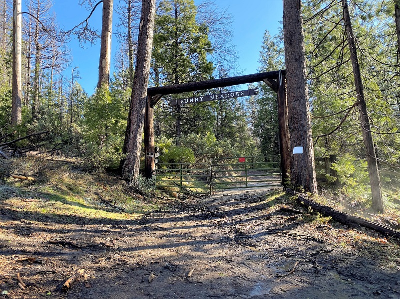
Sunny Meadows was originally homesteaded back in 1850 and is on private property, so I didn’t go any further than the gate.
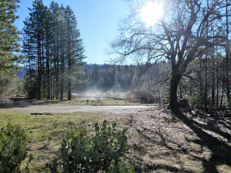
I did see a big tree that had fallen and stood up on it to take a quick and poor picture of the first lake.
I remembered that a while back Sunny Meadows was listed for sale but didn’t know if it had sold so did some snooping when I got home. It doesn’t appear to be on the market but I did locate an older real estate listing with the following information:
One of the largest parcels for sale in California and one of the only left of this caliber. A rare 443+ acre Trophy Private Ranch completely surrounded by National Forest with 7 bodies of water, including 6 Pure Mountain Spring Water lakes that produce 2500 gallons per day, and 150+/- gorgeous acres of meadow/wetland. This property is appropriately named Sunny Meadows for its endless pastures and never-ending adventure. Pictures definitely do no justice to this spectacular piece of heaven.
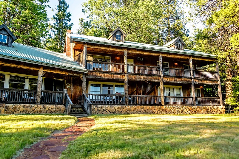
If you are wondering what it looks like behind the gate, here are a few pictures from that prior Realitor.com listing but there are several more if you check out the link.


Back to the older name of Hogan Meadows, I wanted to see if I could locate that older 1850 homestead but couldn’t. I did find a homestead patent for this area for Samuel L. Hogan dated 1877 though.
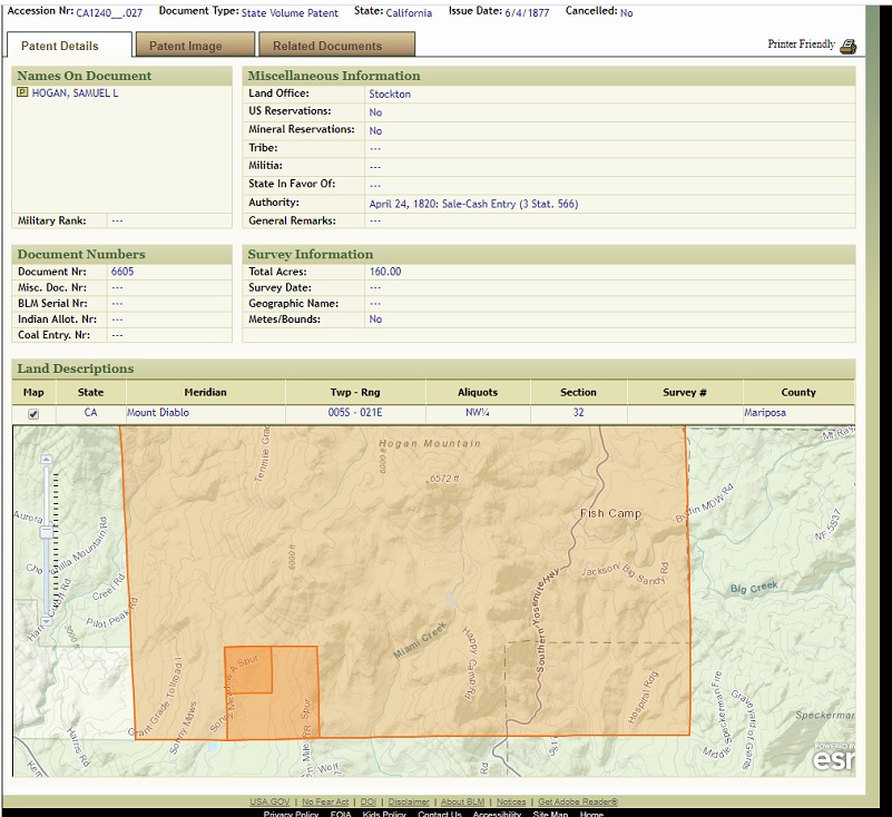
Samuel L. Hogan 1877 Patent (BLM General Land Records Office)
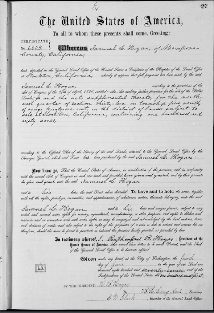
Samuel L. Hogan Patent Image (BLM General Land OFfice Records)
From this information I was able to learn that his full name was Samuel Lane Hogan, born 1832 Johnson County, Missouri and died 1921 Mariposa County. He is first shown in this area on the 1860 census, living Mariposa, single and a farmer. On the 1870 census, he is a farmer, shown living with a Native American woman Nichola, born 1844 California and 4 children. On the 1880 census, he is a farmer, single and living with Mary Ann born 1840 California and 8 children. 3 of the children from the 1870 census are in the household on the 1880 census. On the 1900 census, Samuel is shown as widowed, a farmer and living with 5 of his children and their families in the household. He is shown on the 1910 and 1920 census, living with family, in Mariposa County. Samuel died in 1921 Mariposa County and is buried at Hogan Cemetery, Mariposa County. I located the obituary on Find a Grave contributed by Alma Stone.
Samuel Lane Hogan
Dies After Long Illness
After an illness covering a period of more than a year, the last few months of which he was unable to leave his home. Samuel Lane Hogan, pioneer resident of Mariposa county and respected citizen, closed his earthly career at his home a few miles from Mariposa, last Saturday morning.
Mr. Hogan was a native of Missouri and aged 89 years, 3 months, 10 days at the time of his death.
He came to California and Mariposa county from his native state in 1852, and made this county his home during all these years. He first settled on a ranch in the mountains, now known as the Grove ranch, later moving to the Pea Ridge section, where he lived for many years. In 1905 he sold his holdings in that district and moved to his late home near Buckeye.
Deceased was a man given to much study and considered one of the best read men in this portion of the county. Firm in his convictions and known for his honesty and integrity, he leaves many friends to regret his demise.
He leaves to mourn a family of eight children, three daughters, Mrs. Joseph Seaton, Mrs. Mary Ellen Griswold and Mrs. B. Smith; five sons, Andrew J., William M., James G., Samuel B. and Henry W. Hogan. A brother David Hogan, resides in Missouri, two sisters, Mrs. Mattie Minton of Oklahoma and Mrs. Fannie Wright of Texas. A nephew residing in San Francisco, and a niece of Benecia, Cal.
The funeral services were held at his late home last Sunday afternoon at 2 o’clock p.m. interment being in the old burying ground at Mariposita, near the McCoy ranch, and was attended by many relatives and friends.
~Mariposa Gazette, April 30, 1921~
contributed by Alma Stone
After turning around at the gate, I headed back down and pondered other future destinations off of these dirt roads that are close to home.

Dog Hike? Maybe
This could be a good dog hike if your dog is a good fit. The road is lightly traveled by vehicles so you would need to keep an eye open for a vehicle coming around one of the curves. I would imagine in the summer that you could run into a rattlesnake out here also. This is mountain lion country, along with other wildlife that you could encounter. There were a couple of areas with running water on my hike but it probably dries up in summer, so you would probably need to pack dog water.
Doarama:
What is a Doarama? It is a video playback of the GPS track overlaid on a 3 dimensional interactive map. If you “grab” the map, you can tilt it or spin it and look at it from different viewing angles. With the rabbit and turtle buttons, you can also speed it up, slow it down or pause it.
Map and Profile:
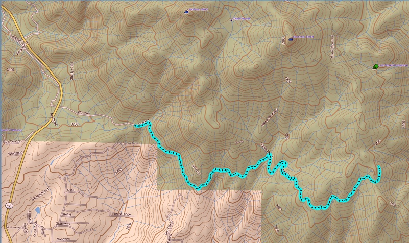
Worman’s Mill to Sunny Meadows Hike Topographic Map
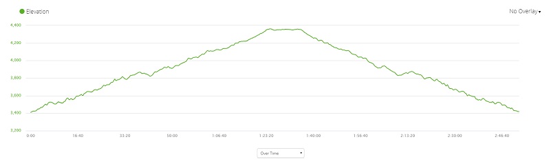
Worman’s Mill to Sunny Meadows Hike Profile
Sources:
Dubel, Zelda Garey, To Yosemite by Stage, Zulu.com, Third Edition, 2011.
USGS Historical Topographic Map Explorer
BLM General Land Office Records
Mariposa Gazette, April 30, 1921
Prior Blogs in this Area:
Walking up a Dirt Road: Worman’s Mill and Beyond March 31, 2020