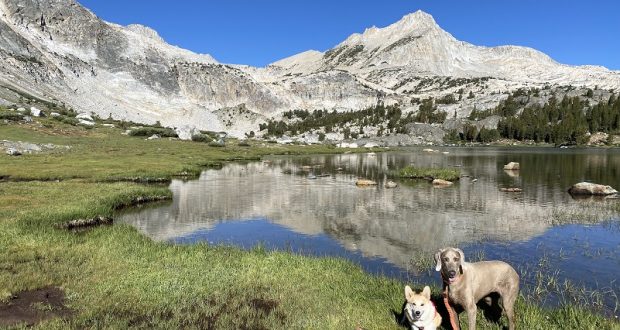
Sally the Weimaraner, Fannie the Corgi and I headed up to the glacial-fed Conness Lakes in the Tioga Pass area. I have no doubt they enjoyed their adventure but I especially love to visit these magical lakes that change color before my eyes.
Where: Harvey Monroe Hall Research Natural Area, Hoover Wilderness, Inyo National Forest
Distance: 9.95 Miles (includes about 2.6 miles via water taxi)
Difficulty: Moderate to Strenuous
Elevation Range: 10,066′ – 10,791′
Date: July 20, 2021
CALTOPO: Hiking to Conness Lakes
Dog Hike? Maybe
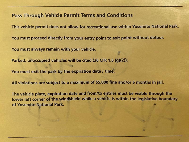
I just returned from a few days of camping at the Saddlebag Lake area with thunder, lightening, hiking and a little fishing. I left early in the morning to avoid at least some of the road delays, reaching the El Portal Entrance Station around 7:15 and it wasn’t staffed so I filled out one of the white “Self Certified Entry” slips in the box, checking the box that said “I am just passing through the park via the most direct route, without stopping, and will exit in less than 3 hours from the time of entry listed above.” When I returned back through the Tioga Entrance Station, the gate was staffed and they filled out the below yellow slip.

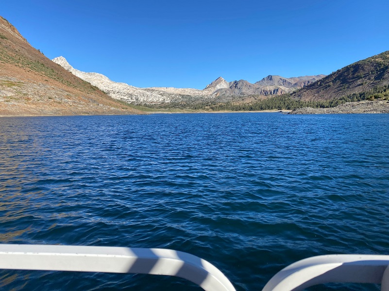
To get to Saddlebag Lake, I exited the east entrance to Yosemite National Park at Tioga Pass where they waved me through without looking at my white entry slip. I then drove east on Hwy 120 about 2 miles to Saddlebag Road. Heading up the mostly dirt road to Saddlebag Lake, I stayed at the Saddlebag Lake Campground in the Inyo National Forest above the resort. If you are daytripping it, there is parking at the resort or at the adjacent backpacker parking lot.
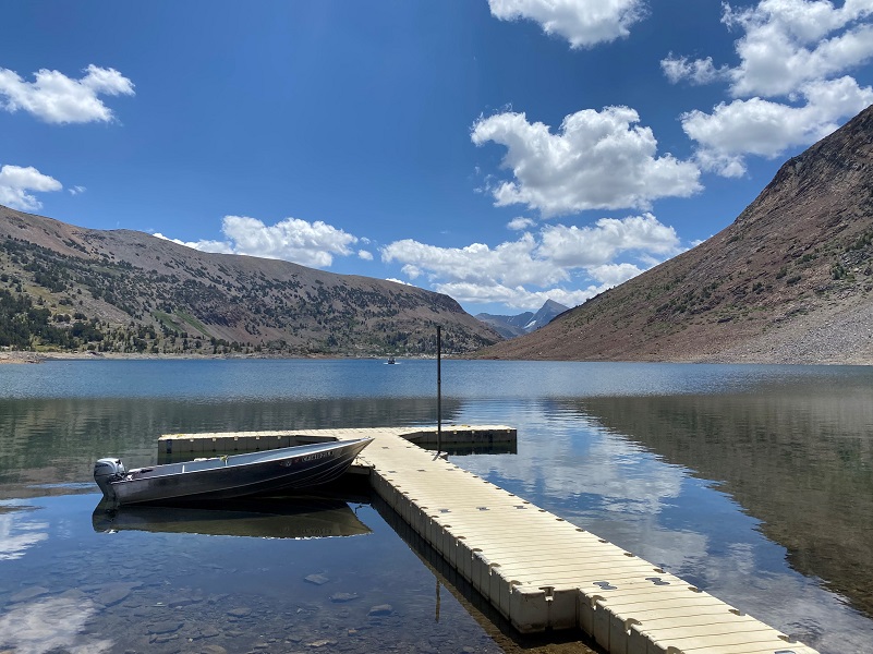
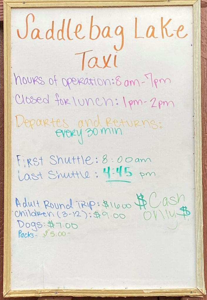 I camped for a few days with Sally the Weimaraner and Fannie the Corgi. We hunkered down while a strong thunderstorm roared and flashed its way through but the next day, we headed for Conness Lakes. I had a few days of hiking and fishing planned for the week and although I brought the boots for the dogs, I wanted to take it easy on their paws and not take a risk that they would receive a sliced paw on their first day out. Those rocks up there can be brutal. So, we took Saddlebag Lake’s water taxi across the lake both ways. It is a cash only operation this summer as they get ramped up after heavy snow damage and new ownership.
You can also take the Saddlebag Lake Trail that goes around Saddlebag Lake (10,066′ elevation), starting from either side of the lake. The west side is rockier but a little shorter and the east side trail is on an old road that was utilized by the Hess Mine. Those rocky parts on the west side are tough on a dog’s feet so I usually take the east side when I hike with the dogs and I always pack dog boots when we are on these trails.
Sally has been on the water taxi several times but this was Fannie’s first time. The whole process of walking up on the dock that wobbled with the waves was not an issue but I had to use Fannie’s handle on her harness to get her up in the boat where she sat by my side for the trip. She thought it was too high for her to make that jump. We were up front and Sally kept an eye out for where we were headed.
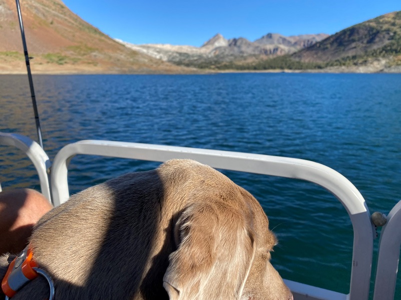
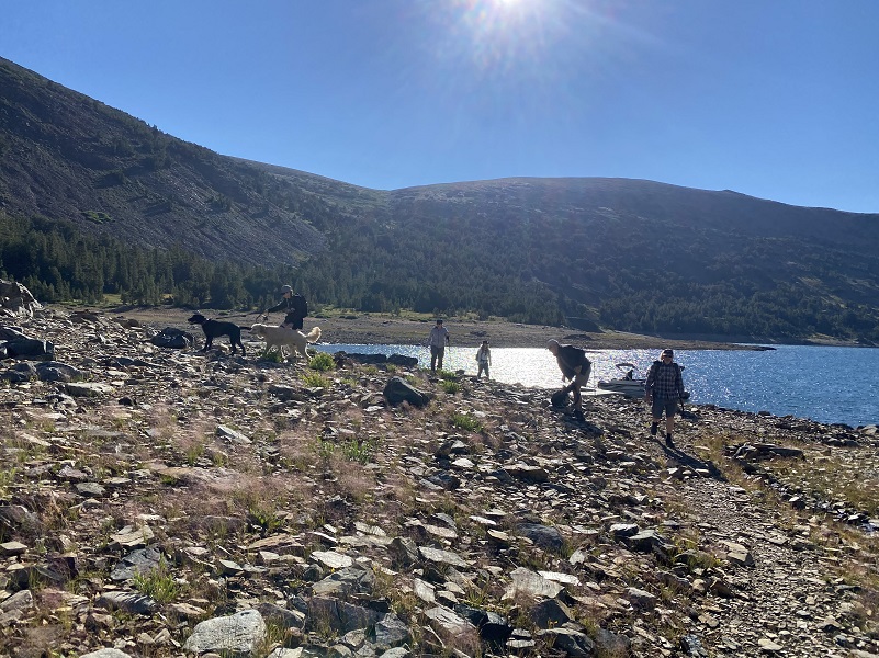
It took us less than 15 minutes to make it to the north side of the lake where we all unloaded and headed our different ways.
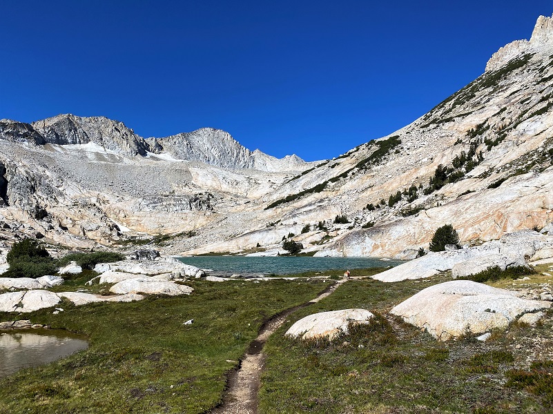
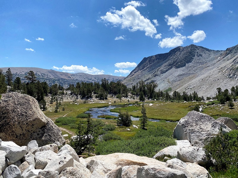
Sally, Fannie and I headed for the south side of Greenstone Lake (10,144′ elevation).


After crossing the inlet to Greenstone Lake, we followed the trail along the creek and entered Harvey Monroe Hall Research Natural Area. This research area consists of 3,383 acres, set aside in 1933 to conduct research related to the soil and vegetation. Harvey Monroe Hall was a professor of Botany at UC Berkley, helping to establish methods for conducting reciprocal transplant experiments, whereas plants were moved and studied in the habitats of similar taxonomic species. One of the specific things that they studied is how plants adapted to various soils and elevations. Climate change is just one of the things that they are capturing data on.
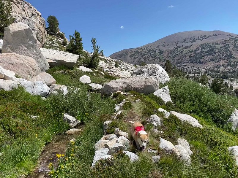
As I headed up that rocky slab, I let the dogs off leash because it was just too much of a challenge for me to keep my footing on the narrow switchback trail with them on leash.
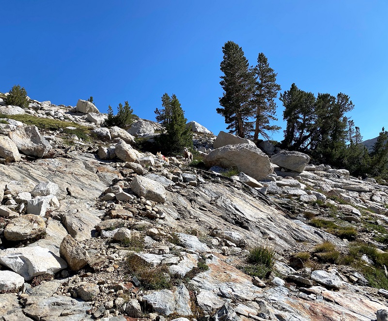
I followed the trail up to the lower of the Conness Lakes, keeping Sally on leash for most of the hike because she would want to run around. Fannie was happy to stay close by and on the trail.
These lakes are bordered by Mount Conness and the Conness Glacier, named for John Conness (1821–1909), a native of Galway, Ireland who immigrated to the United States in 1833. He arrived in California via Panama on the ship Sylph in 1849, engaging in mining and mercantile pursuits in El Dorado County, but by 1853, he was a member of the California Legislature. He served from 1853 to 1854 and from 1860 to 1861, and then was the United States Senator from California from 1863 to 1869. He was married twice and had at least 12 children by my count. On the 1860 census, he was living in Georgetown, El Dorado County and listed his occupation as a Miner.
On March 28, 1864, Conness introduced Senate Bill 203, known as The Yosemite Valley Grant Act. The legislation would by federal action, grant to the State of California the Yosemite Valley and the Mariposa Grove of Big Trees. The purpose of the bill was that the property “shall be inalienable forever, and preserved and improved as a place of public resort.”
No money was appropriated in support of the bill and no supporting legislation provided for federal administration of the areas. It did not establish the National Park, which came later in 1890. The Yosemite Valley Grant Act passed on June 30, 1864 and was signed by President Abraham Lincoln.
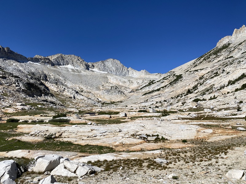
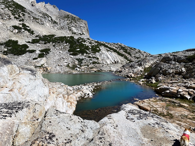
 The lower Conness Lake (10,561′ elevation) has three lake sections. Earlier in the season, the lake parts are one lake but we were able to walk across the rocks to get to the other side. This was a new skill for Fannie but once she figured it out, she was a natural.
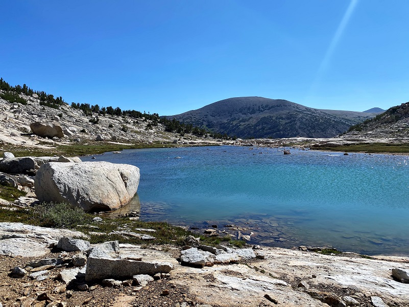
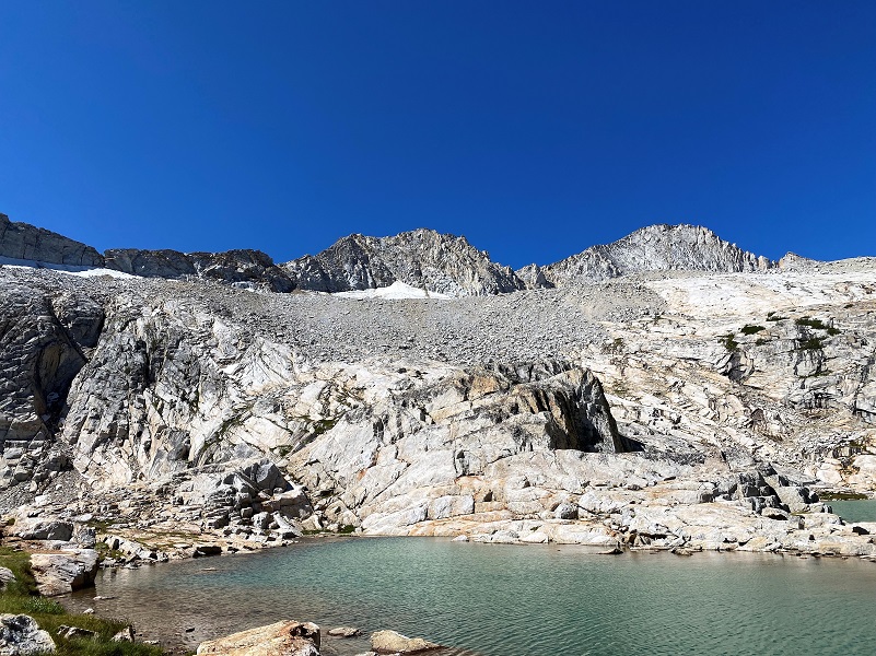
It was only about 3/4 of a mile up to the middle Conness Lake (10,679′ elevation). There was a slight breeze and the lake was not sharing the beautiful reflections that we can sometimes get.

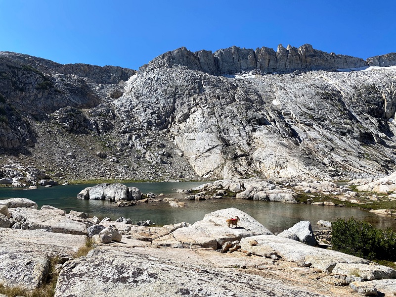

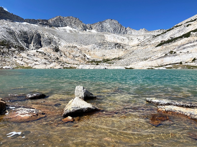
I walked along the edge and then took one of the rocky slabs up to the upper Conness Lake (10,761′ elevation).

I headed into the lake a little more to the west than I usually head in. I wanted to try to come in on a rocky slab that I have pondered sitting on and it worked out as planned. I watched the lake turn colors from emerald green to muddy blue colors. There weren’t any clouds in the sky, so I can’t explain how this lake can dramatically change the color so quickly.
I wandered down to the east side of the lake. Mount Conness towers over this upper lake at 12,649′ elevation and its knife edge ridge borders the lake on the west and southwest sides. North Peak, 12,231′ elevation, borders the lake on the north side. I could also spot where the Conness Glacier lies, which they say is the largest glacier in the Sierra Nevada north of Tioga Pass.
It was the perfect place to stop for lunch.

And it was the perfect place to get a group photo, which is not as easy as it may sound.

We headed back up on the rocky slab.

I worked my way down, sometimes following the same way I had come up and sometimes taking a slightly different path but with views of Lower Conness Lake along the way.
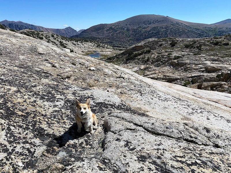
What a wonderful view of Greenstone and Saddlebag Lakes below me!


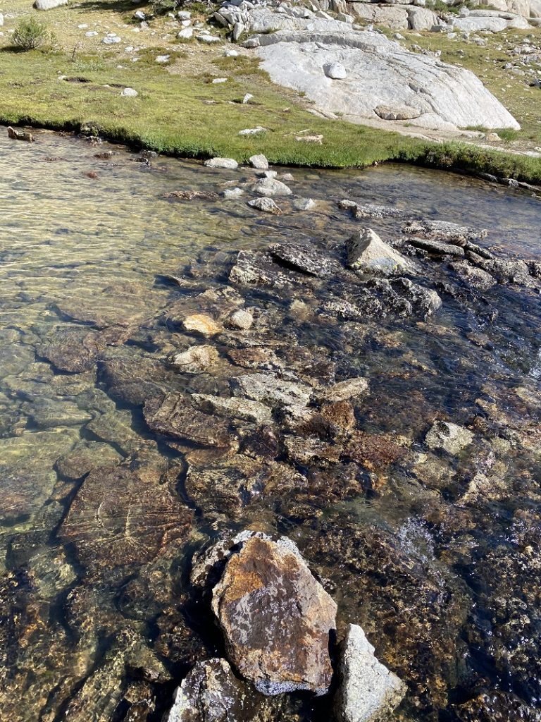
I headed down the outlet of the Lower Conness Lake along the old flume associated with the Hess Mine, a Tungsten Mining operation above Steelhead Lake. From the ditch, the flume ran the water through a boarded section, then into a ditch section again. If you look closely, you will find old timbers and nails that are remnants of that old flume.
We followed the creek down.
I spotted some movement and I could see far ahead of me some waterfowl. Actually Sally had spotted it first and after I zoomed in, I could tell there was a group of young chicks together. Can you spot them to the left of the rock along the creek bank?
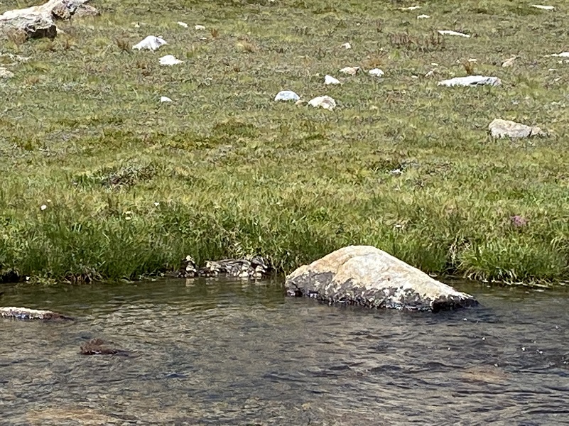
The dogs had lost sight or scent of them and we hurried on so the birds could relax and go along their day. We made it back down to the boatdock early and Fannie ran up on it, almost to say “I remember this and how it works.”
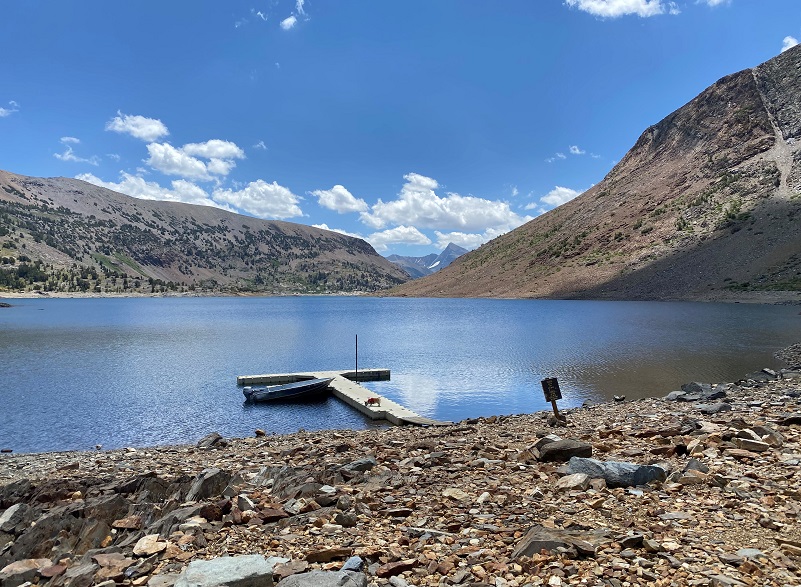
I sat, enjoying watching those white puffy clouds float by, reflecting in Saddlebag Lake, until the water taxi returned right on schedule
I had checked the dogs feet during the day and they were no worse for wear on this hike. Once we made it back to our campsite, they didn’t have any problems resting up for their next adventure.

I met plenty of road work and delays along my route, so if you plan on heading this way be sure and allow extra time.
Dog Hike?
This hike can be a good dog hike if your dog is up to it. The rocky terrain is very rough on a dog’s feet and I packed Sally’s boots just in case she got a sore spot on her paw or sliced her foot on one of those sharp rocks. Even if you think your dog’s feet are toughened up enough for this hike, you can have surprises so please be prepared. This is a good hike for Sally. It is above tree line so I can keep a good eye on her and let her run a little. There aren’t any rattlesnakes or poison oak and there is plenty of good, fresh drinking water for her all along the way. That means I don’t have to pack her water and that is a good thing! Sally has never had any problems drinking the water out of these higher elevations but some dogs may not be as easy as Sally on this issue. I think you need to know your dog and you may need to carry some water for them. This area also has bubonic plague and if you dog gets a hold of a critter such as a squirrel or mouse, this could be something to watch for after a trip in this area.
Here is some information from Inyo National Forest regarding their dog rules:
Traditionally, National Forests have welcomed dogs. However there are a few rules that apply to assure that you and other National Forest visitors have an enjoyable outdoor recreation experience. If you are camping with your pet, please practice the following:
- Leave vicious or unusually noisy dogs at home.
- During the day keep your dog on a leash no more than 6 feet long, or otherwise restrict its freedom to roam at will.
- At night keep your dogs and other pets inside an enclosed vehicle or in a tent.
- Developed campgrounds are for people, not animals. Please do not bring more than two dogs or other pet to any one campsite.
General rules for dogs within the Inyo National Forest:
- Dogs are allowed for trips staying in the National Forest. Pet food must be stored the same as required for your food.
- Dogs are prohibited, as are any other pets, on trips visiting the wilderness of Yosemite, Sequoia and Kings Canyon National Parks.
- Pets need to be on leash or under verbal command. Do not allow pets to chase or harass wildlife.
Doarama:
What is a Doarama? It is a video playback of the GPS track overlaid on a 3 dimensional interactive map. If you “grab” the map, you can tilt it or spin it and look at it from different viewing angles. With the rabbit and turtle buttons, you can also speed it up, slow it down or pause it.
Saddlebag Lake to Conness Lakes Doarama
Maps and Profiles:
CALTOPO has some free options for mapping and here is a link to my hike this week, which you can view or download: CALTOPO: Hiking to Conness Lakes

Saddlebag Lake to Conness Lakes Topographic Map
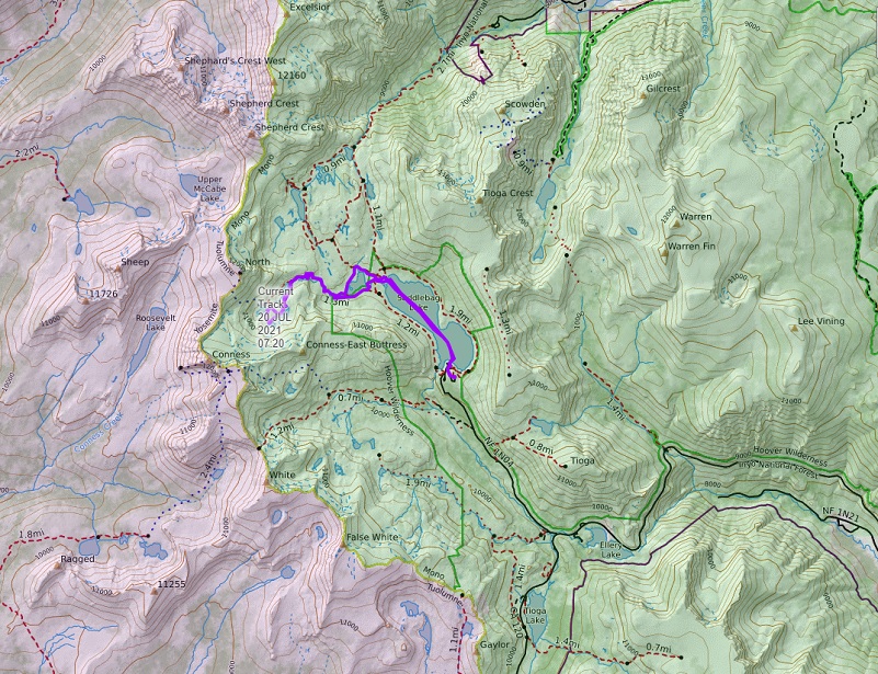
Saddlebag Lake to Conness Lakes Topographic Map Larger View
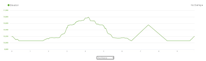
Saddlebag Lake to Conness Lakes Profile
Prior Blogs in this Area:
Hiking to Conness Lakes Before Tioga Road Closed November 2, 2020
Hiking with Sally to Conness Lakes June 27, 2018
Hiking to Conness Lakes September 8, 2017
Hiking with Sally and Raven from Saddlebag Lake to Conness Lakes July 6, 2016
Hiking with Sally up to the Hess Mine in the Tioga Pass Area October 26, 2015
Backpack to Mount Conness August 26, 2014
Hiking with Sally and Raven to Conness Lakes July 3, 2014
Sources:
Saddlebag Lake Resort Home Page


