A storm was on the way that would close Tioga Road but would it close for a short period or for the season? I wasn’t about to miss the opportunity to visit some of the higher country in the Tioga Pass area while I could get there so I headed up to the glacial fed Conness Lakes as they were starting to ice over. These magical lakes have the ability to change color before your eyes.
 Where: Harvey Monroe Hall Research Natural Area, Hoover Wilderness, Inyo National Forest
Distance: About 7.1 Miles
Difficulty: Moderate to Strenuous
Elevation Range: 10,064′ – 10,804′
Date: November 2, 2020
Maps: Falls Ridge and Buckeye Topogs
Dog Hike? Maybe
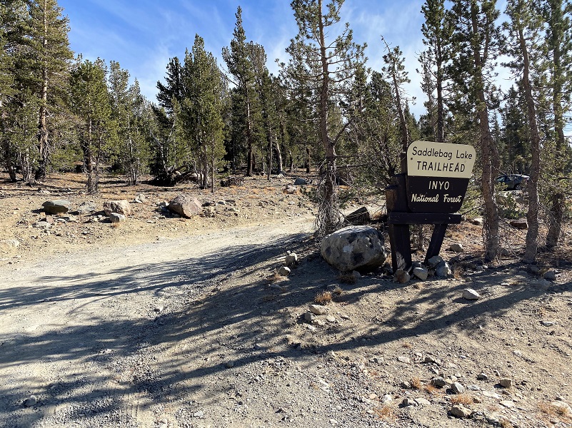
Saddlebag Lake Campground had closed early and the Hoover Wilderness had been closed due to the fires and fire danger but it finally reopened but how long would I be able to get to some of my favorite areas before Tioga Road closed? I needed to take advantage of the good weather window and get up there while I could so drove to Saddlebag Lake Road, just east of the Yosemite National Park Tioga Pass entrance. The temperature was about 32 degrees when I parked my car at the Saddlebag Lake Trailhead Parking area. The restrooms were closed but I was able to stash a few things in the bear locker for after my hike. Saddlebag Lake Resort had also closed for the season so there was no water taxi to take me across which was fine with me.
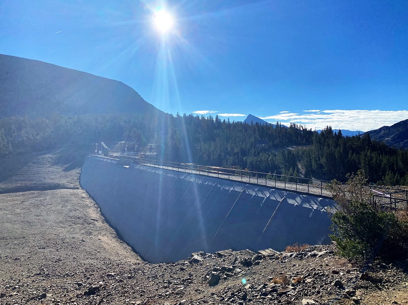
The Saddlebag Lake Trail goes around Saddlebag Lake (10,066′ elevation) and you can start from either side of the lake. The west side is rockier but a little shorter and the east side trail is on an old road that was utilized by the Hess Mine. Those rocky parts on the west side are tough on a dog’s feet and since I didn’t have the dogs with me on this hike, I walked across the dam and took that rockier trail on the west side of the lake.
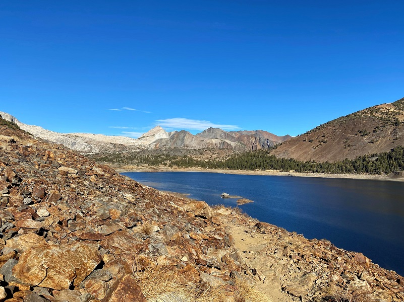
As I reached the north side of Saddlebag Lake, I stayed on the upper trail that led along the south side of Greenstone Lake (10,144′ elevation).

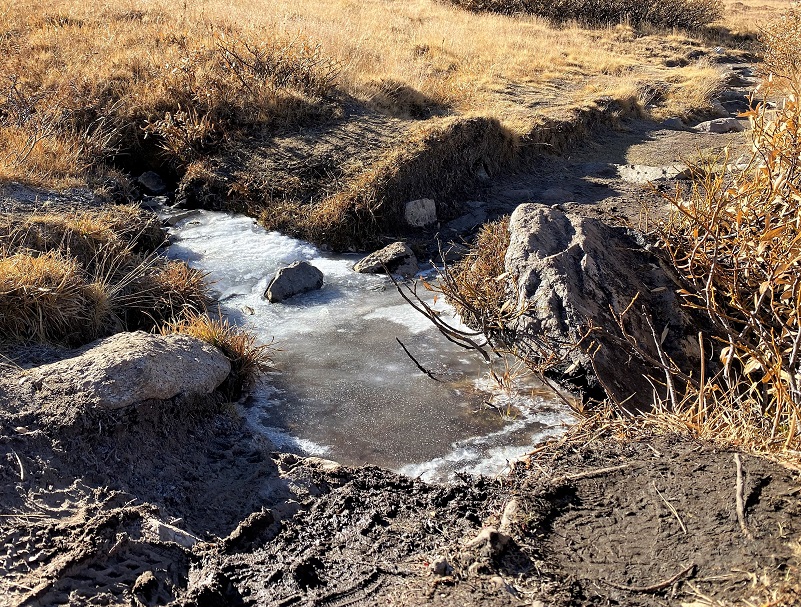
The trail crossed some icy puddles, pretty with their unique patterns.
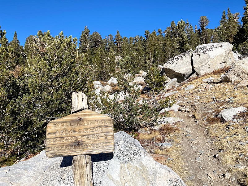
After crossing the inlet to Greenstone Lake, I followed the trail along the creek and entered Harvey Monroe Hall Research Natural Area. This research area consists of 3,383 acres, set aside in 1933 to conduct research related to the soil and vegetation. Harvey Monroe Hall was a professor of Botany at UC Berkley, helping to establish methods for conducting reciprocal transplant experiments, whereas plants were moved and studied in the habitats of similar taxonomic species. One of the specific things that they studied is how plants adapted to various soils and elevations. Climate change is just one of the things that they are capturing data on.

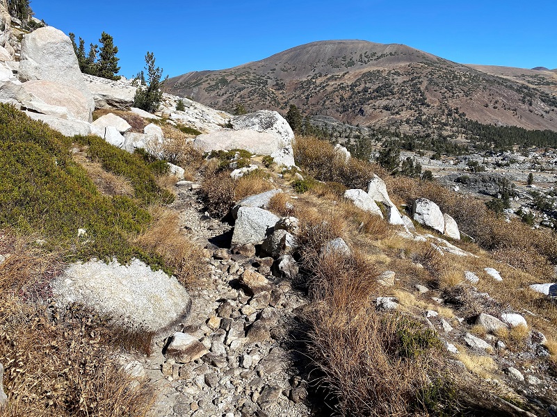
The trail soon headed up across the granite slab.
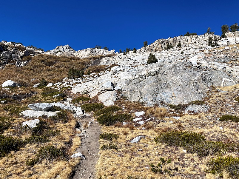
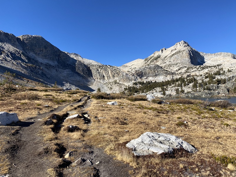
As I headed up that rocky slab I was rewarded with a nice view of Greenstone and Saddlebag Lakes below me.
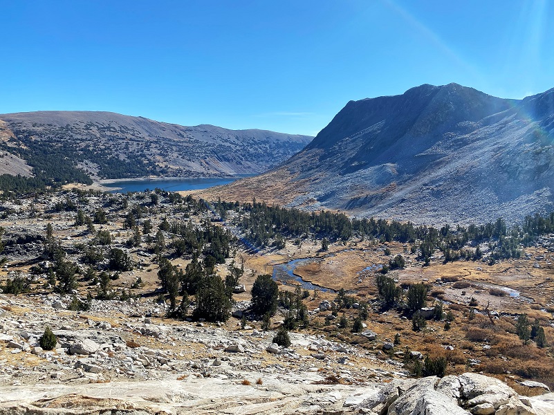
I followed the trail up to the lower of the Conness Lakes. These lakes are bordered by Mount Conness and the Conness Glacier, named for John Conness (1821–1909), a native of Galway, Ireland who immigrated to the United States in 1833. He arrived in California via Panama on the ship Sylph in 1849, engaging in mining and mercantile pursuits in El Dorado County, but by 1853, he was a member of the California Legislature. He served from 1853 to 1854 and from 1860 to 1861, and then was the United States Senator from California from 1863 to 1869. He was married twice and had at least 12 children by my count. On the 1860 census, he is living in Georgetown, El Dorado County and lists his occupation as a Miner.
On March 28, 1864, Conness introduced Senate Bill 203, known as The Yosemite Valley Grant Act. The legislation would by federal action, grant to the State of California the Yosemite Valley and the Mariposa Grove of Big Trees. The purpose of the bill was that the property “shall be inalienable forever, and preserved and improved as a place of public resort.”
No money was appropriated in support of the bill and no supporting legislation provided for federal administration of the areas. It did not establish the National Park, which came later in 1890. The Yosemite Valley Grant Act passed on June 30, 1864 and was signed by President Abraham Lincoln.
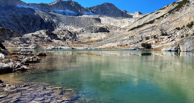
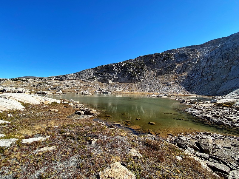
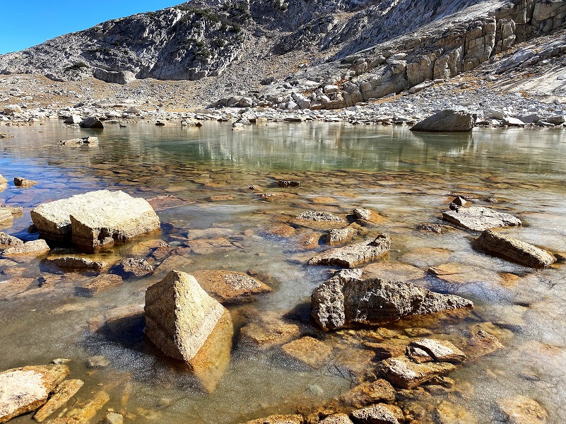
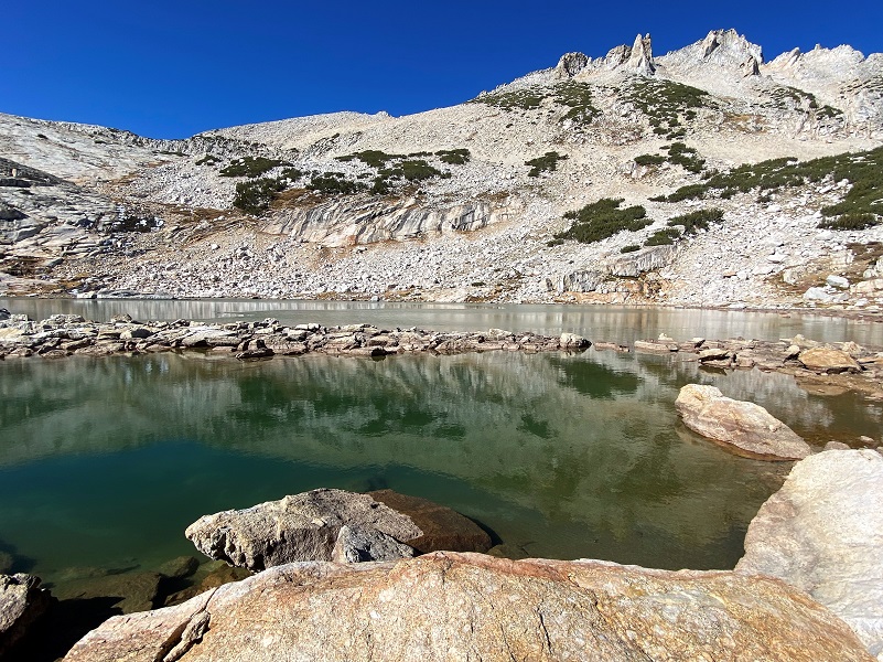
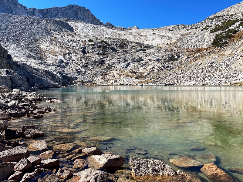
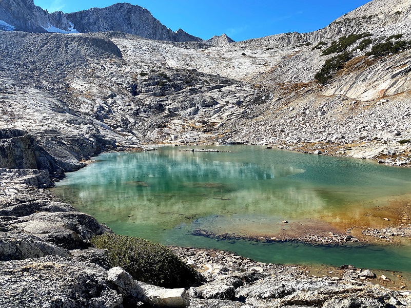
The lower Conness Lake (10,561′ elevation) is made of three lake sections. Earlier in the season, the lake parts are one lake but this late in the year, land and rocks between them were high and dry, making it easy to cross over between them. A thin layer of ice coated the lake in a few places, giving me peeks of reflections.
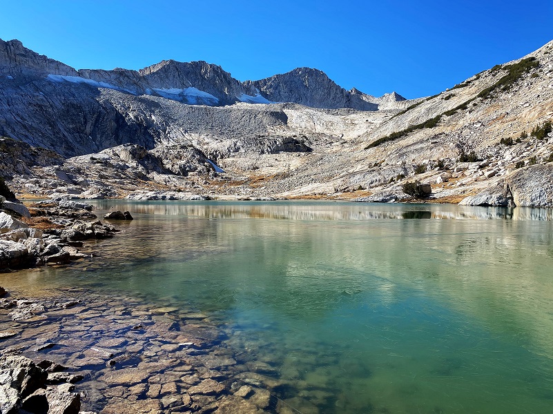
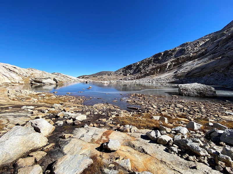
It was only about 3/4 of a mile up to the middle Conness Lake (10,679′ elevation) and this lake had thicker ice at the upper end.

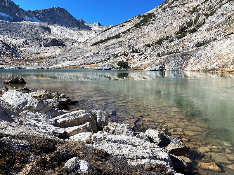
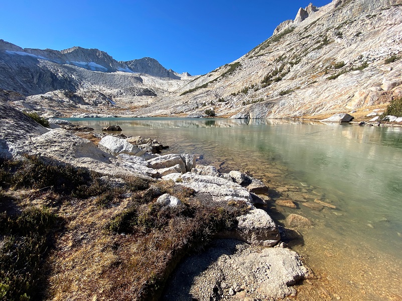
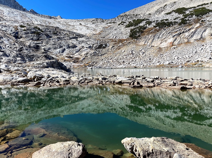
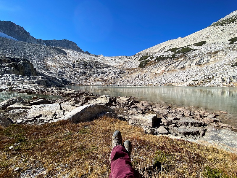
I usually take to the rocky slab to get to the upper lake but the middle lake was low enough that I could walk along the edge and then took one of the “chutes” up to the upper Conness Lake (10,761′ elevation). This lake was a special lake because it turned colors before my eyes. If you have clouds in the sky, it can dramatically change the color but on this visit I didn’t have clouds. But those colors still changed from a beautiful turquoise color to a muddy green to blue. How that happens, I can not explain.
Mount Conness towers over this upper lake at 12,649′ elevation, and its knife edge ridge borders the lake on the west and southwest sides. North Peak, 12,231′ elevation, borders the lake on the north side. I could also spot where the Conness Glacier lies, which they say is the largest glacier in the Sierra Nevada north of Tioga Pass.


What a perfect lunch spot!
I headed out a little different way than I had come in, working my way up to the highest point I could get to on the east side of the lake.
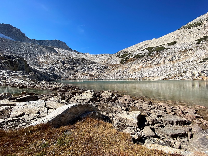
As I climbed I took a look back at that magical upper lake.

I worked my way down, sometimes following the same way I had come up and sometimes taking a slightly different path. One of the deviations I took landed me at the spot where an old flume associated with the Hess Mine, a Tungsten Mining operation above Steelhead Lake, left the outlet from the lower lake. I had followed the length of the flume several times but wondered if there was any evidence of it at it’s highest elevation. I did find one small remainder but rockfalls had obliterated it’s path to the ditch portion. From the ditch, the flume ran the water through a boarded section, then into a ditch section again. If you look closely, you will find old timbers and nails that are remnants of that old flume.
I was very happy to get this hike in before Tioga Road closed for the season. I love going up to these lakes as soon as I can access them in the spring and watching them unthaw is truly beautiful. But I had never visited them this late in the year and it was awesome to watch their winterization begin.
Dog Hike?
This hike can be a good dog hike if your dog is up to it. The rocky terrain is very rough on a dog’s feet and I packed Sally’s boots just in case she got a sore spot on her paw or sliced her foot on one of those sharp rocks. Even if you think your dog’s feet are toughened up enough for this hike, you can have surprises so please be prepared. This is a good hike for Sally. It is above tree line so I can keep a good eye on her and let her run a little. There aren’t any rattlesnakes or poison oak and there is plenty of good, fresh drinking water for her all along the way. That means I don’t have to pack her water and that is a good thing! Sally has never had any problems drinking the water out of these higher elevations but some dogs may not be as easy as Sally on this issue. I think you need to know your dog and you may need to carry some water for them. This area also has bubonic plague and if you dog gets a hold of a critter such as a squirrel or mouse, this could be something to watch for after a trip in this area.
Here is some information from Inyo National Forest regarding their dog rules:
Traditionally, National Forests have welcomed dogs. However there are a few rules that apply to assure that you and other National Forest visitors have an enjoyable outdoor recreation experience. If you are camping with your pet, please practice the following:
- Leave vicious or unusually noisy dogs at home.
- During the day keep your dog on a leash no more than 6 feet long, or otherwise restrict its freedom to roam at will.
- At night keep your dogs and other pets inside an enclosed vehicle or in a tent.
- Developed campgrounds are for people, not animals. Please do not bring more than two dogs or other pet to any one campsite.
General rules for dogs within the Inyo National Forest:
- Dogs are allowed for trips staying in the National Forest. Pet food must be stored the same as required for your food.
- Dogs are prohibited, as are any other pets, on trips visiting the wilderness of Yosemite, Sequoia and Kings Canyon National Parks.
- Pets need to be on leash or under verbal command. Do not allow pets to chase or harass wildlife.
Doarama:
What is a Doarama? It is a video playback of the GPS track overlaid on a 3 dimensional interactive map. If you “grab” the map, you can tilt it or spin it and look at it from different viewing angles. With the rabbit and turtle buttons, you can also speed it up, slow it down or pause it.
Saddlebag Lake to Conness Lakes Doarama
Maps and Profiles:

Saddlebag Lake to Conness Lakes Partial Track Topographic Map
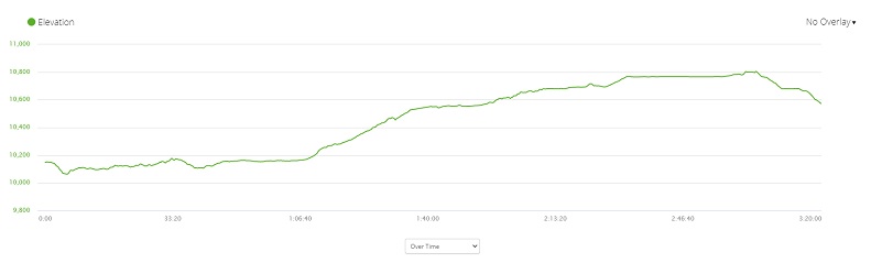
Saddlebag Lake to Conness Lakes Partial Track Profile
Prior Blogs in this Area:
Hiking with Sally to Conness Lakes June 27, 2018
Hiking to Conness Lakes September 8, 2017
Hiking with Sally and Raven from Saddlebag Lake to Conness Lakes July 6, 2016
Hiking with Sally up to the Hess Mine in the Tioga Pass Area October 26, 2015
Backpack to Mount Conness August 26, 2014
Hiking with Sally and Raven to Conness Lakes July 3, 2014
Sources:
Saddlebag Lake Resort Home Page


