My adventure this week was full of beautiful green foothills with small streams and lovely waterfalls. A historic railroad bed, gold mining, and the Sierra Newt all played a prominent role!
Where: Sierra Foothill Conservancy, McKenzie Preserve
Distance: 8.36 Miles
Difficulty: Moderate
Elevation Range: 629′ – 1,501′
Date: February 5, 2017
Maps: Academy, Millerton East Topographic Quads
Dog Hike? No, dogs are not allowed
From the junction of Millerton and Auberry Road, I headed up Auberry Road about 3 miles, driving in the gated entrance on the left to the conservancy property. These Preserves are only available to be accessed through their scheduled hikes, classes and open preserve days. They are very special places with sensitive environments, some set aside for specific endangered species, while some are donated by landowners who want to see the land cared for and protected forever. A link to their website with their Event Calendar is at the end of this Blog.
The Sierra Foothill Conservancy is the proud owner of eight nature preserves, totaling 6,481 acres. My hike today was on the 2960 acre Ruth McKenzie Table Mountain Preserve. The McKenzie Preserve was acquired in trust from The Nature Conservancy in 1998. The property had previously been placed in a trust by its owner, Ruth Bea McKenzie, who wanted it to remain in ranching and open space after her death. The McKenzie Preserve is primarily grassland and oak woodland that slopes upward toward the basalt lava table lands that give the preserve its name.
Sierra Foothill Conservancy hikes are led by a very dedicated group of volunteers who are passionate about sharing the wonder of nature with visiting hikers. As they lead groups on the various properties, they share aspects of cultural history, habitat features, and facts associated with the specific property visited. Each of these dedicated hiking docents have varying backgrounds, lending expertise in a variety of areas.
We started walking up the dirt road where we could see heavy damage from the recent storms.

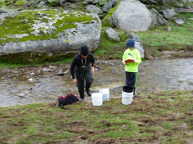
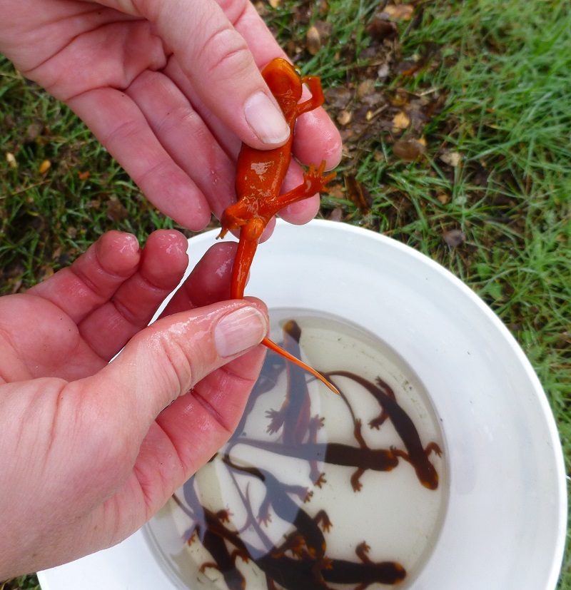
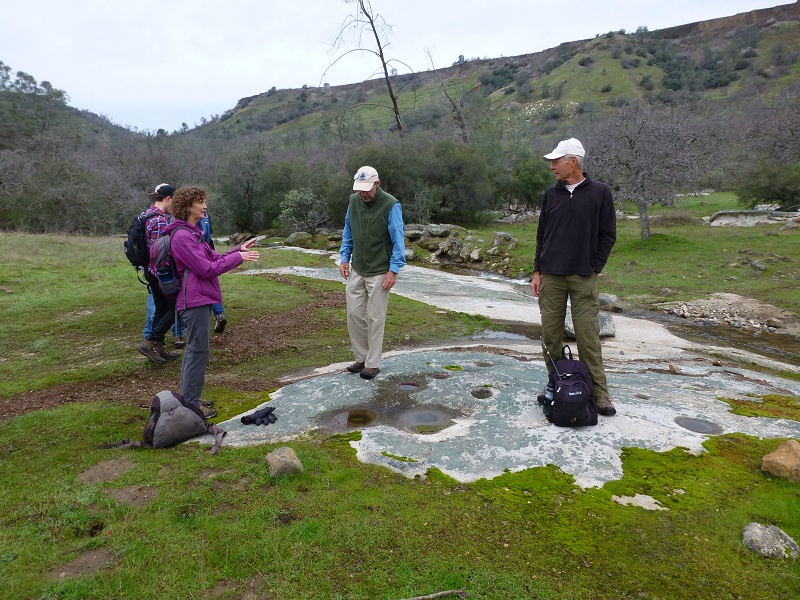
As we walked up the road, our docent spotted “The Newt Lady” and we were told that she had been studying the Sierra Newt in this area for several years. We wandered down to talk with her and boy, did I learn some new things about those newts. I had written a Blog about them back in 2014 that you can access here. I learned several different ways to distinguish between male and female Sierra Newts. She shared with us that she had microchipped many of them in this area, weighing and measuring them through the years. I was very surprised when she told us that she thinks that they may live as long as 30 years.
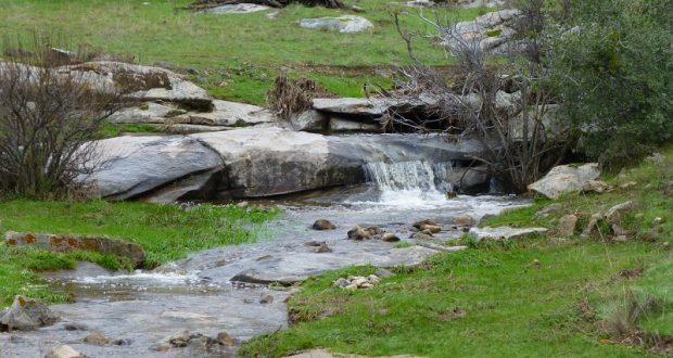
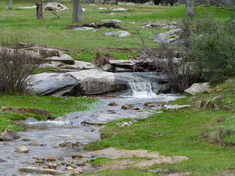
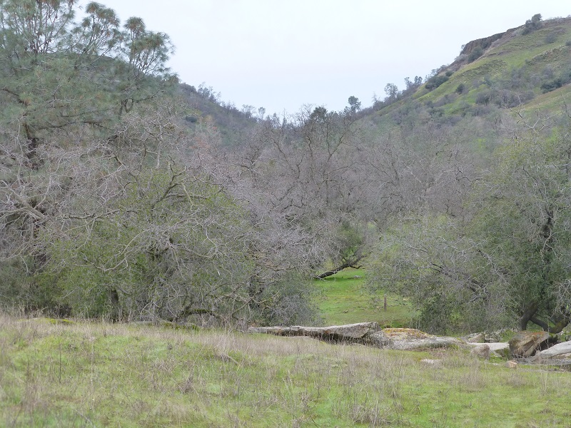
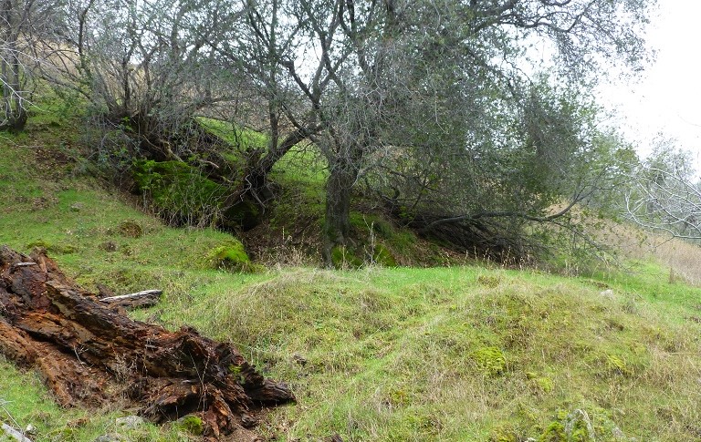
The water from the recent storms was still flowing off of the hills. Seasonal creeks were flowing, creating beautiful small waterfalls as they meandered over the rocks.
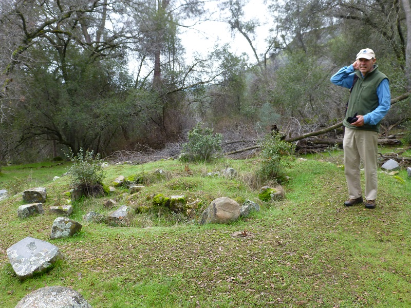
We stopped at a site that Native Americans had utilized. Grinding holes of various sizes and indentations in the land helped illustrate where they had occupied this site.
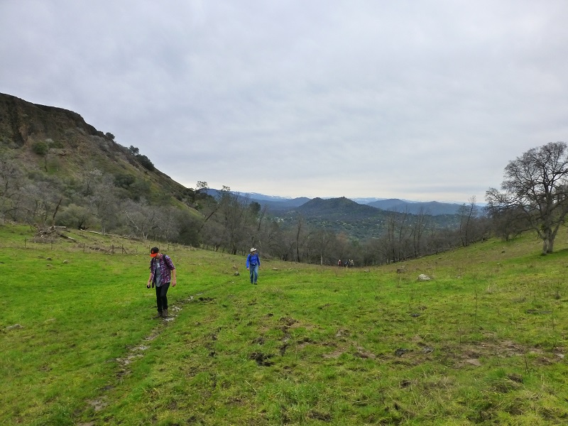
From this point I could look up to Boling Gap and where we were headed for our hike.
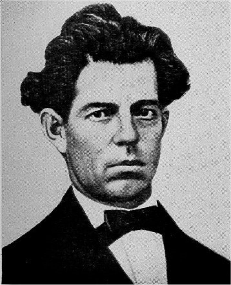
Captain John Boling (Photo from One Hundred Years in Yosemite (1947) by Carl P. Russell)
Boling Gap is named after John Boling who was associated with the Mariposa Battalion and Yosemite. In early records, his name is spelled Bowling but in the marriage, census and death records that I located, his name is spelled Boling.
In March, 1851 Major James Savage of the newly commissioned Mariposa Battalion led troops after natives who had raided several area mining camps, including three of Savage’s trading posts. John Bowling was a miner who volunteered for the Battalion and was immediately appointed Captain of Company B.
Savage led the battalion into Yosemite Valley in 1851, in pursuit of around 200 Ahwaneechees led by Chief Tenaya. On March 27, 1851, the company of 50 to 60 men reached what is now called Old Inspiration Point, from where Yosemite Valley’s main features are visible. Chief Tenaya and his band were eventually captured and their village burned, fulfilling the prophecy an old and dying medicine man had given Tenaya many years before.The Ahwahnechee were “escorted” by their captor, Captain John Bowling, to the Fresno River Reservation, and the battalion was disbanded on July 1, 1851. It is said that they traveled through this gap between the table tops and that is how Boling Gap received its name. Life on the reservation was unpleasant and the Ahwahneechee longed for their valley. Reservation officials consented and allowed Tenaya and some of his band to return on their own recognizance.
The first record that I was able to locate for John Boling is his marriage to Mary Frances Barnett in Stockton on October 18, 1853. By the time of the 1860 census, he and his wife are living in Township 3, Mariposa County with his 3 children. His occupation is listed as a Teamster and shows that he was born 1825 Kentucky. He died June 18, 1864 in Mariposa, where is is buried.
In the June 18, 1864 Mariposa Free Press, the following article appeared:
In Mariposa, Friday, June 17th, 1864, of Bronchitis, Capt. JOHN BOLING, aged 45 years.
Capt. Boling was a native of Tennesssee, whence he emigrated in early life to the State of Mississippi, and came to California in ’49 or ’50. He was one of the pioneer settlers of Mariposa county, held the office of Sheriff for several years, and commanded a party of volunteers during the Indian difficulties which occurred in this neighborhood at an early day. In whatever position he occupied he showed himself an earnest and true man, always ready to lead wherever honor or duty demanded his presence. His character for integrity was never called into question, while a kinder hearted man never breathed. Many friends who know and appreciate his sterling worth as a friend and good citizen deplore his death.
[The funeral will take place at 3 o’clock P.M., (today), from the Methodist Church South.]
After John Boling’s death, his wife Mary Frances remarried and had 3 more children. Of her children with John Boling, only one lived to adulthood. John Francis Boling married, was a farmer, raising his family and settling in his later years in Madera where he died in 1918.
We continued up toward Boling Gap, stopping at the site of an old arastra. These were used to help break up and grind the rocks that contained gold ore. Drag stones were placed in a circular pit paved with flat stones, and connected to a center post by a long arm. A horse, mule or even a person provided the power at the other end of the arm as the stones were dragged slowly around in a circle, crushing the ore.
We headed up the old railroad bed of the San Joaquin & Eastern Railroad, a standard gauge railroad originally built to get men and supplies to the Big Creek Hydroelectric Project sites.
The track was constructed for $1,055,728 by Stone & Webster Construction Company of Boston, the project’s primary contractor. Grading commenced on February 16, 1912 and construction was completed on December 15, 1912. The 55 mile line started at El Prado near Friant where it interchanged with the Southern Pacific (SP) Railroad. The SP branch continued on to Fresno where it intercepted the SP Mainline. From El Prado the line went east to Auberry and then terminated at Big Creek (Cascade/Cascada). The railroad was known as the “crookedest railroad in the world”, with 1073 curves up to 60 degrees. The railroad had 43 wooden trestles and 255 steep grades with the steepest at 5.3%.
The railroad was built for the sole reason of building the Big Creek hydroelectric project. When that was essentially complete, the need for the railroad ended. Over the years, it had only earned about 22% of what it cost to build and operate, leading to its nickname “Slow, Jerky, and Expensive”. The line was abandoned and dismantled in 1933.
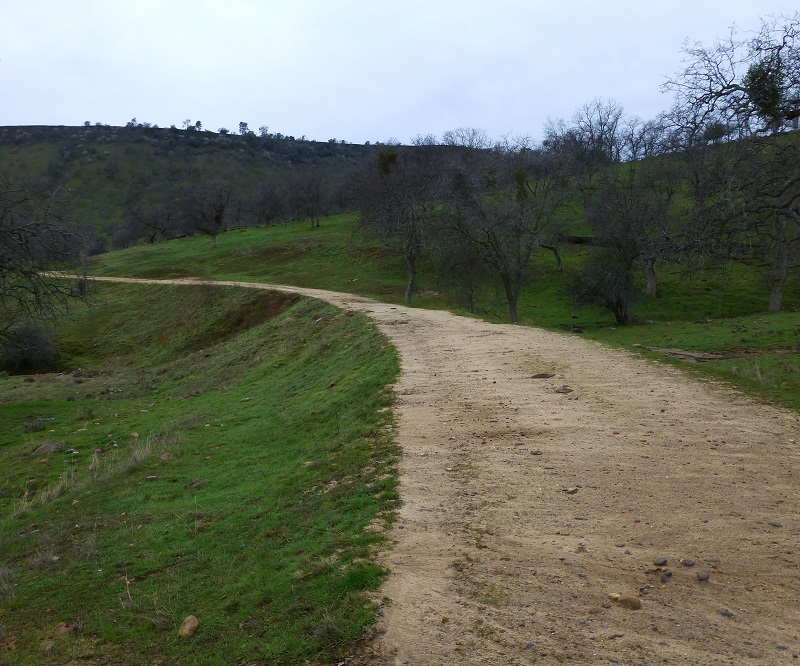
San Joaquin & Eastern Railroad Bed
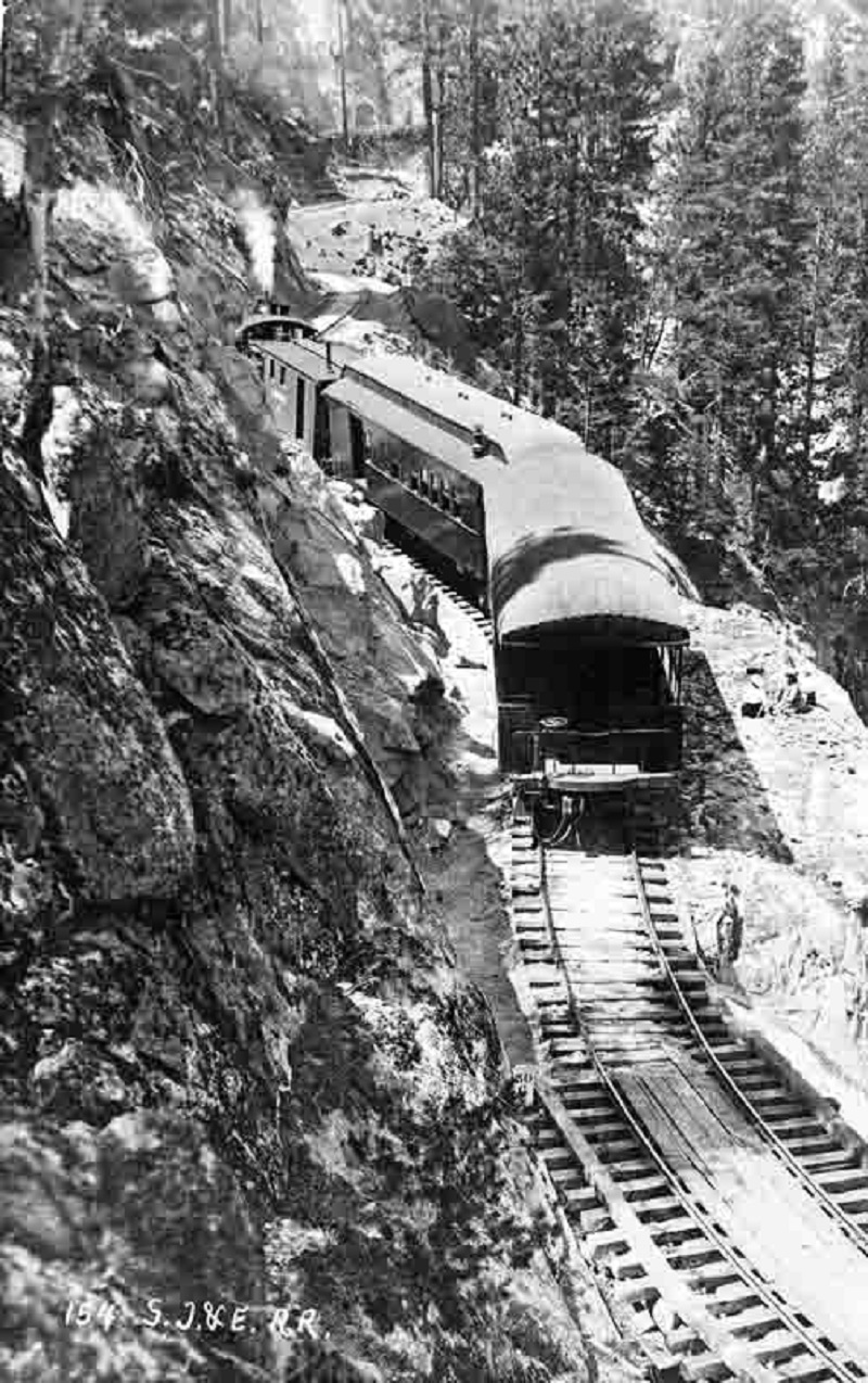
San Joaquin & Eastern Railroad at Huntington Lake circa 1918 (Photo Source Public Domain, https://commons.wikimedia.org/w/index.php?curid=50251128)
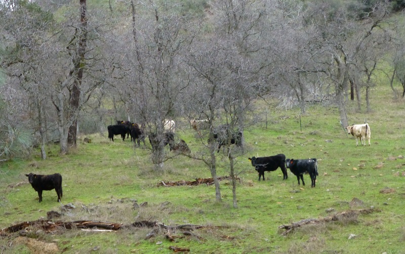
As we walked along, we saw many cows enjoying the lush green grass.
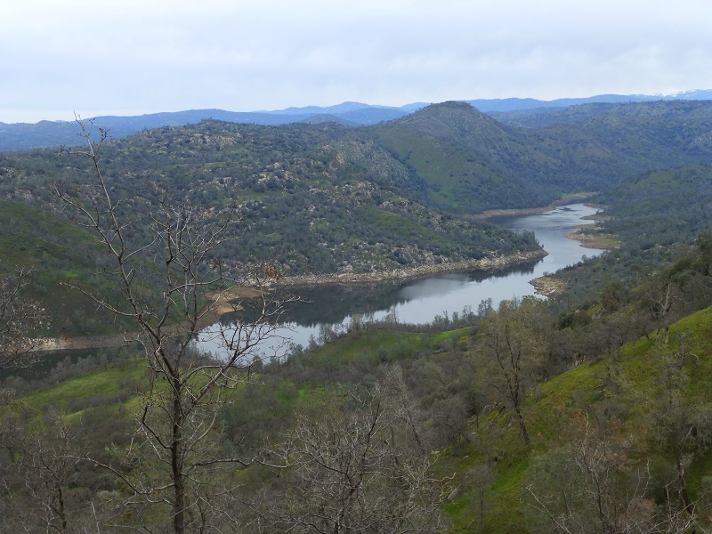
We reached Boling Gap and I looked out to east toward the mountains above the Shaver Lake area.
Boling Gap, Looking East
We headed down the west side and had some terrific views of the San Joaquin River.
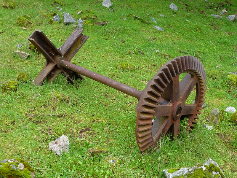
We came across the remains of an old mine, which was fairly easy to pick out from the tailings at its base. Mining equipment was located farther downhill. There were many mines in this area, many with names lost to history. The “One and Two Gold Hill Mine” was the closest recent mine that I could identify to this mine. It was a former gold mine but no data was available on product or value taken.
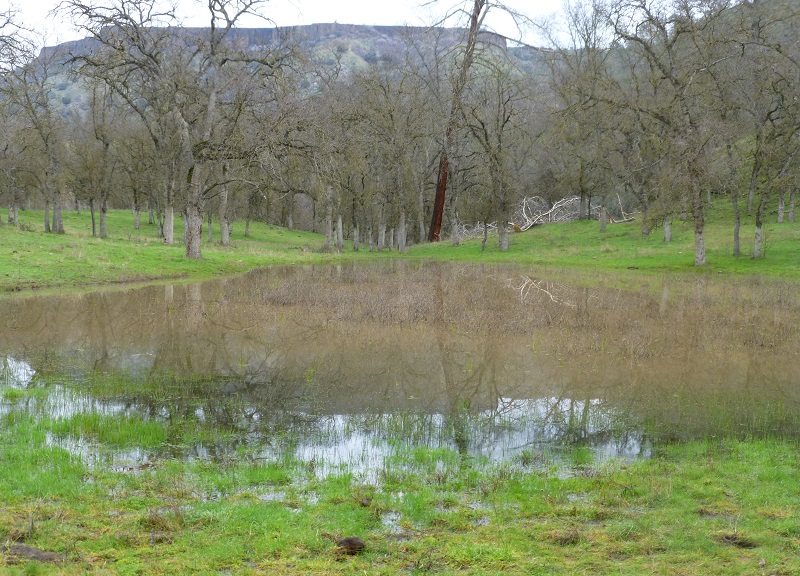
We wandered down cross country toward the San Joaquin River, doing our best to avoid the muddiest areas. Small creeks had backed up in places, creating small ponds with nice reflections.
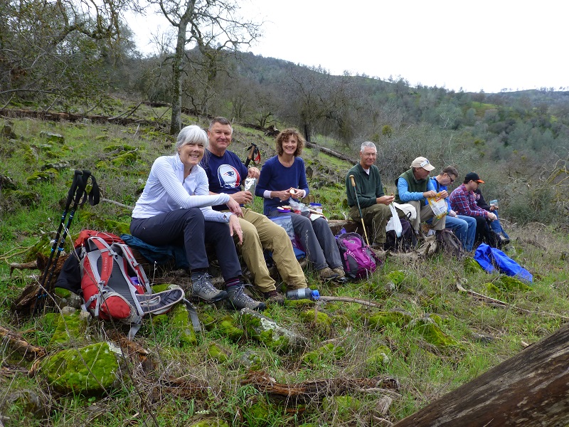
We found some good logs to sit on, eat our lunch and enjoy the view.

I want to thank our docents on this hike for a really fun adventure and loved learning new things about this area. If you are interested in going on one of these guided hikes on the Sierra Conservancy land, there are many choices on their website linked at the end of this blog. You can sign up online and if you are a member, there is no cost. Don’t worry if you are not a member though because the cost is minimal, $5 for this hike. The funds go to a wonderful cause, protecting our foothill lands. They also have some Open Preserve Days which there is no charge to attend.
Update to the Blog: For anyone considering going to the Open Preserve Day that was scheduled March 5, I just received an update from the Sierra Foothill Conservancy: Due to the road conditions and impending storms this weekend and next we are moving the March 5th McKenzie Open Preserve day to April 23rd. We will still hold all the others but hope to use that weekend to work on the road damage.”
The mission of the Sierra Foothill Conservancy is as follows:
- Protects wildlife & preserves native flora
- Provides educational and recreational opportunities for the community
- Promotes scientific study of foothill ecosystems
- Maintains open space and beautiful vistas
The Sierra Foothill Conservancy is a non-profit public benefit corporation under the Internal Revenue Service Code Section 501(c)(3) and California Revenue and Taxation Code Section 23701d. Contributions are deductible for federal income tax purposes.
Map and Profile:
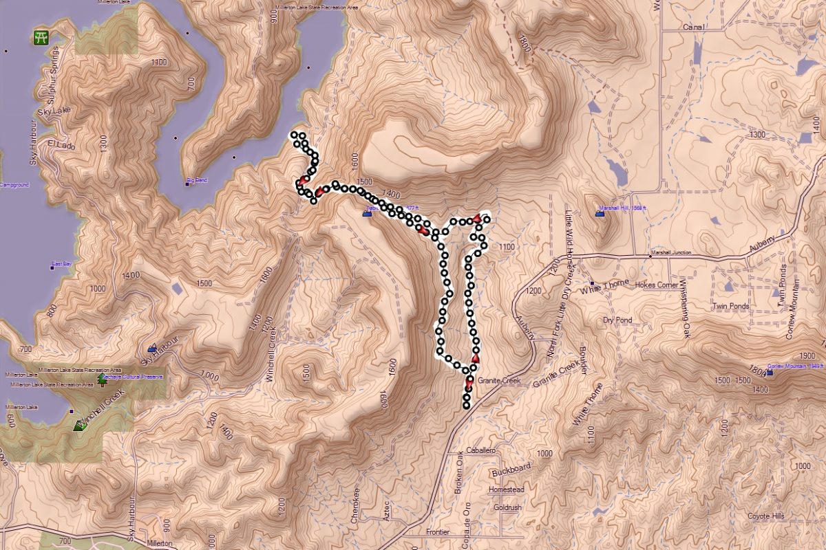
Boling Gap Topographic Map
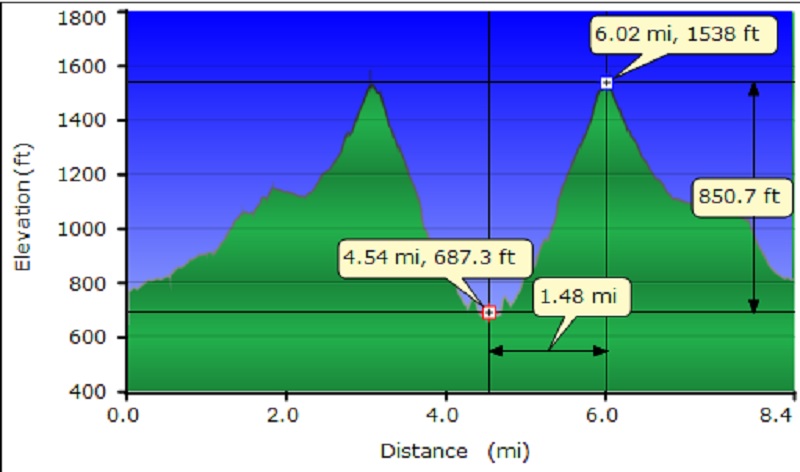
Boling Gap Profile
Sources:
Sierra Foothill Conservancy Home Page
Ruth Mckenzie Table Mountain Preserve
San Joaquin and Eastern Railroad Wikipedia
Lee, Galen D., Walking where We Lived: Memoirs of a Mono Indian Family, University of Oklahoma Press, 1999
Russell, Carl P., One Hundred Years in Yosemite, 1947 http://www.yosemite.ca.us/library/one_hundred_years_in_yosemite/
Mariposa Free Press, June 18, 1864 http://www.mariposaresearch.net/DISVIT1.html
One and Two Gold Hill Mine Min.dat
Prior Blogs in this Area:
Hiking the San Joaquin River Trail March 31, 2016
San Joaquin River Gorge Hike April 17, 2014


