Sally the Weimaraner and Fannie the Corgi loved their adventure on the 20 Lakes Loop Trail, especially the part where they got to play in the snow! Located in the Hoover Wilderness, this trail led us by beautiful lakes, small tarns and mountains still streaked with snow.
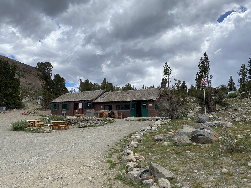
Where: Inyo National Forest, Hoover Wilderness I just returned from a few days of camping at the Saddlebag Lake area, one of my favorite summer hangouts. To get to Saddlebag Lake, I exited the east entrance to Yosemite National Park at Tioga Pass, then drove east on Hwy 120 about 2 miles to Saddlebag Road. Heading up the mostly dirt road to Saddlebag Lake, I stayed at the Saddlebag Lake Campground in the Inyo National Forest above the resort. If you are daytripping it, there is parking at the resort or at the adjacent backpacker parking lot.
One of my adventures was hiking a looped trail around several high lakes. I don’t always stick to the trail in this area but I did this time. If you feel comfortable going off trail, those are also several pretty lakes in the center of the loop that you can head cross country to see such as Z and Twin Lakes, along with many small tarns. Or you can head up to Cascade Lake to the west of Steelhead Lake to see small lakes nestled in the granite.
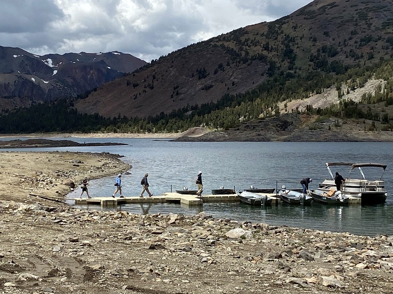
There is a trail that goes around the lake called the Saddlebag Lake Trail and you can start from either side of the lake to head to the trail that leads you to the 20 Lakes Basin. You can also take the water taxi that is operated by Saddlebag Lake Resort because it is up and running! More about that at the end of the blog.
We started our hike on the east side of the lake and the wind was already up some so no reflections to be had in Saddlebag Lake.
Saddlebag Dam (10,090′ elevation) was built in 1921 to enlarge an existing alpine lake for hydropower generation purposes. The dam was raised and a spillway was added in 1925. The reservoir is oversized compared to the volume of water produced in its watershed and the agreement between Southern California Edison (SCE) and the Los Angeles Department of Water & Power (DWP) requires it to be very low every spring. The water from Saddlebag Lake is used to generate power in Lee Vining and the water then flows to Mono Lake or it is diverted to the L.A. Aqueduct System.
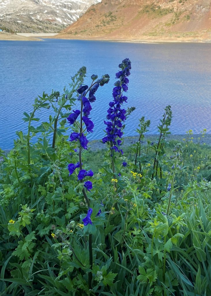
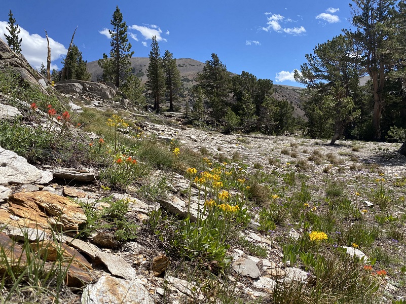
Wildflowers that included monkshod were blooming along the trail.
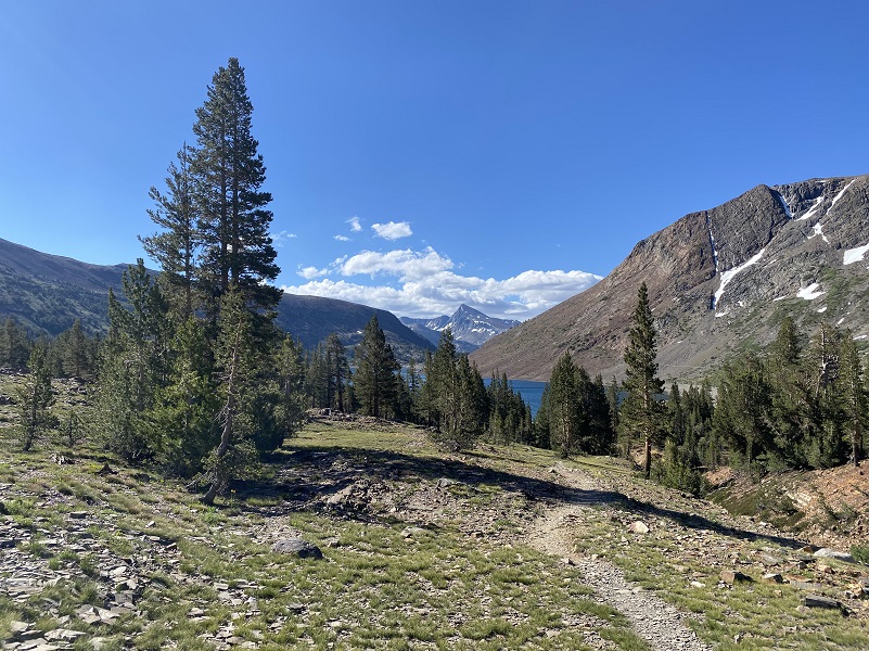
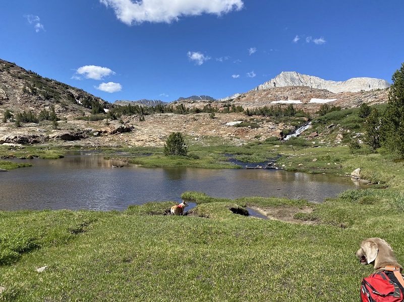
After we made it to the north side of the lake past the Ranger’s Cabin, we entered Hoover Wilderness. I took a look back at Saddlebag Lake, Mount Dana and where we had traveled.
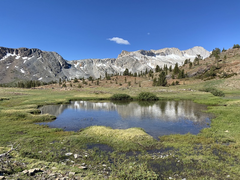
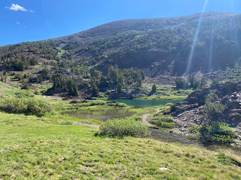
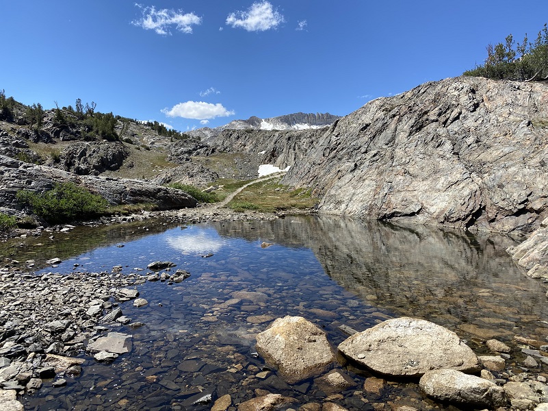
We passed by some small tarns full of reflections.
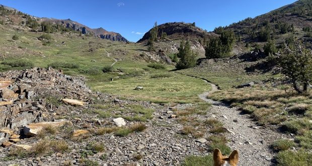
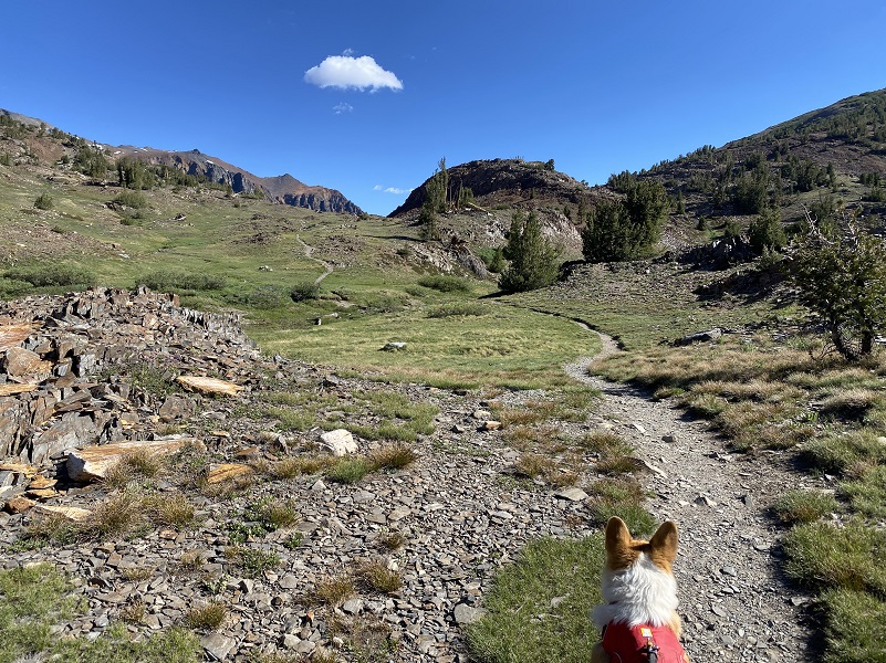
The trail led us onward.
A short spur trail leads to Hummingbird Lake (10,255′ elevation) which we could see from the main trail but we didn’t wander over there.
The next lake was ODell Lake (10,263′ elevation).
The trail headed down a rocky chute to Lake Helen (10,263′ elevation). It was too much to walk down the wobbly rocky trail with the dogs, so I let them off leash to find their own way down the trail. Fannie needed a little help down in one section.
There is a little patch of columbine in this area but it wasn’t quite ready to bloom. When it is ready, it is very pretty.
We crossed the outlet from Lake Helen with the help of strategic rocks that had previously been placed in the creek. After getting over that creek, there is a wall of rock to get up or around. Sally has been this way many times and has a work around but going through the water and around wasn’t going to work for Fannie’s short little legs. I picked her up and lifted her up as high as I could on that rock wall, then climbed up, but not until I caught this look from the dogs as if to say, “what is taking you so dang long?”
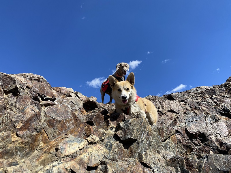
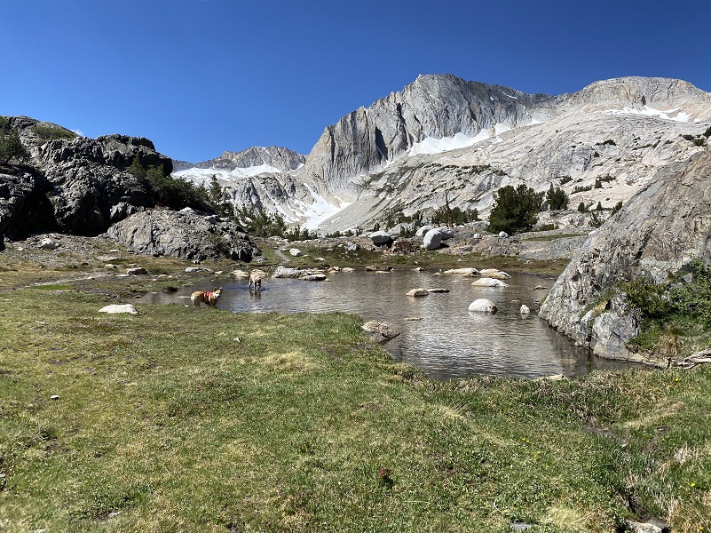
The trail had some rocky sections and I kept the dogs off leash until we got though those spots. I looked across Lake Helen and back at where we had come down that chute with the snow in on the left.
The trail went through and by several small patches of snow which the dogs thoroughly enjoyed.
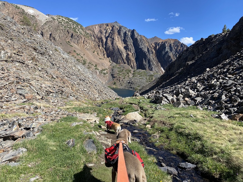
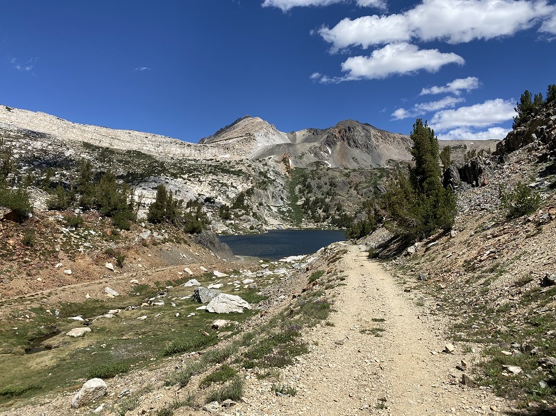
After that break playing in the snow, we followed the trail that led us by tarns and small lakes with no names.
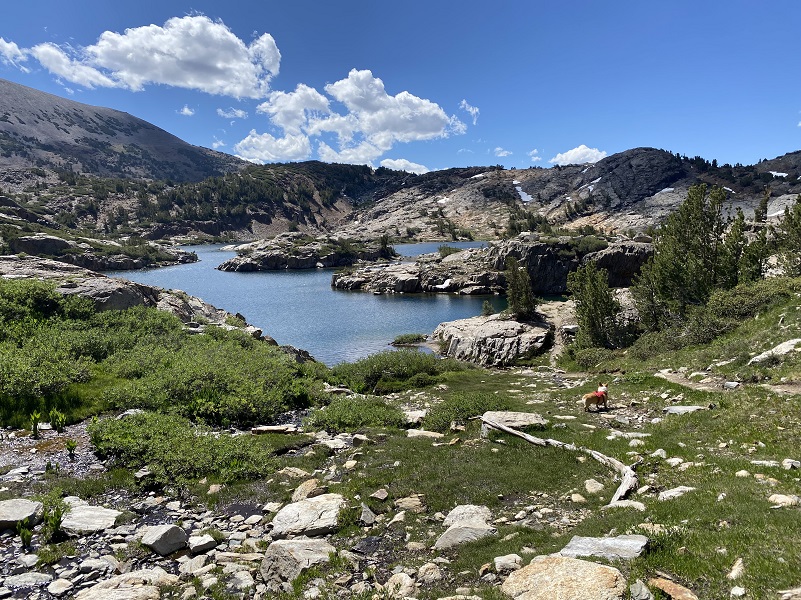
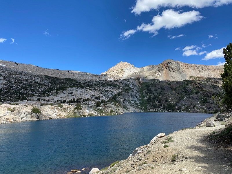
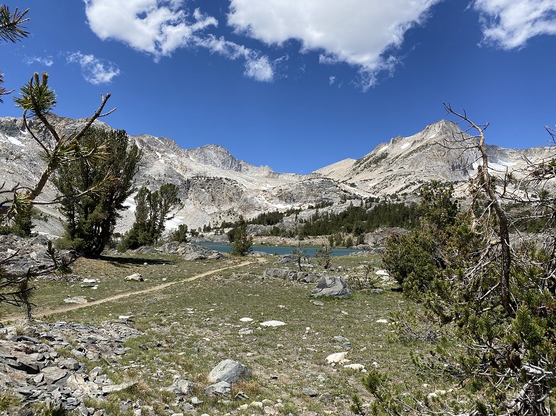
As the trail led us over the top of the hill, we soon had a view of Shamrock Lake (10,266′ elevation).
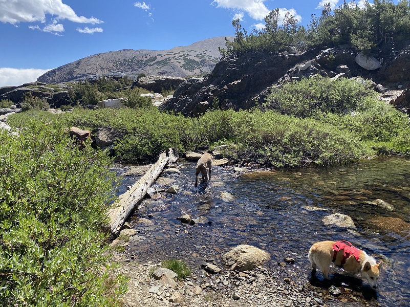
We wandered onward past more beautiful tarns. We were almost to Steelhead Lake when we had another small creek crossing.
Fannie followed me across the log but was stuck and needed a little help to cross that final section. As you can see, it is probably 6 inches from the log end to the rock but must have looked 10 feet to Fannie. That handle on her harness did the trick.
One last tarn.
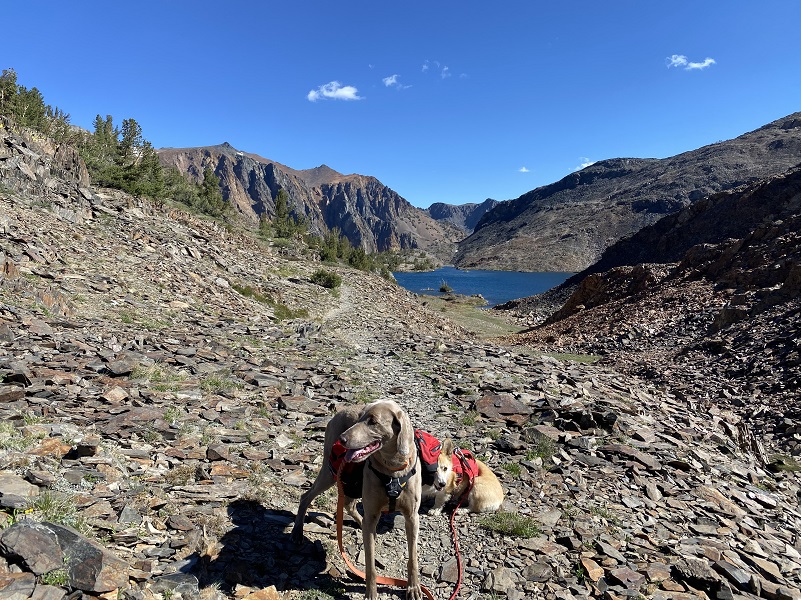
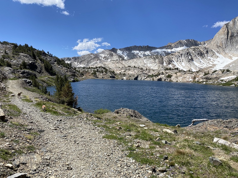
We reached Steelhead Lake (10,279′ elevation), then followed the old mining road from the Hess Mine which is the trail back to the intersection of the trail that I had headed up in the morning.
A last look back at Steelhead Lake and the Hess Mine.
Distance: 8.7 Miles
Difficulty: Moderate
Elevation Range: 10,092′ – 10,359′
Date: June 23, 2021
CALTOPO: Hiking 20 Lakes Loop with Sally & Fannie
Dog Hike? Yes
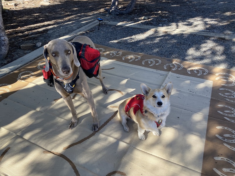 Sally the Weimaraner and I have done this hike many times but it was the first time that Fannie the Corgi did the entire loop. Fannie wears a harness that has a handle on it to help me lift her over a few things along the trail. Sally wore her pack on so she could carry the dog things such as dog first aid kit, booties, poop bags and treats. I carried the people stuff in my pack. Both dogs were kept on leash at the beginning because I didn’t want them to waste energy running around. We had some miles to do and this was their first hike at elevation up here this season. I also didn’t want to risk them wearing their paw pads or slicing them on rocks early in the hike.


The wind was up when we reached Wasco Lakes (10,322′ elevation), enough to cause whitecaps on the water.

Yellow and orange flowers were blooming along the trail, nestled along rocks. If I hadn’t been paying attention, I probably would have missed seeing them.
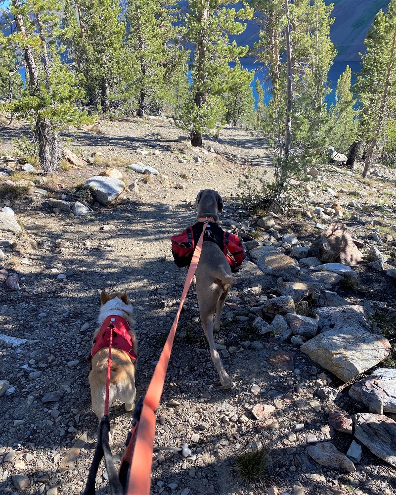
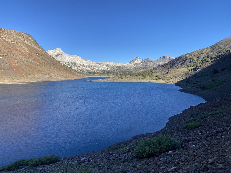
The dogs were back on leash and we kept to the trail, bypassing Greenstone Lake (10,144′ elevation), bordered by Mount Conness (12,549′ elevation) and North Peak (12,231′ elevation). White Mountain (12,054′ elevation) is just out of the first picture to the left.

I mentioned that Saddlebag Lake Resort was open and the water taxi running. A store and small cafe used to also be part of the operation but right now water taxi and boat rental are the only operational parts. I hope I captured the round trip rates correctly: $16 for adults, $9 for children under 13, $5 for a backpack (no charge for daypacks) and $7 for dogs. You can also ride one way. Please correct me if I got it wrong. I don’t have their hours but they did say they hope to continue the water taxi operations through October. The resort had been closed for a couple of years due to snow damage and then COVID happened. I am really excited to see them open back up. They used to have REALLY good pie and hope that can get back going one of these days.
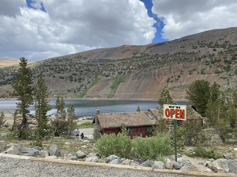
Saddlebag Lake Resort is owned by the same people that own Tioga Pass Resort out on Hwy 120 before you get to Tioga Lake. Snow and flood damage really did a number on that resort and they are hoping to have some cabins back ready to rent in August. The cafe and store are going to take longer though. You can follow their Facebook Page for updates.
We took several breaks during the hike, checking Sally and Fannie’s feet and they were fine fine. No bad wear and no cuts, so that is great. Energy snacks were also handed out during some of our breaks, a combination of Zuke’s Power Bones and a TurboPUP Complete K9 Meal Bar. The dogs expend a ton of energy on our hikes and need to replace those calories. Those dogs were pooped when we got back to our campsite and we took it easy the next day. I don’t like to hike the dogs up in this rocky country for 2 days in a row. This was also their first hike up here this year and just like people, they need to condition to get in shape. But if you were to ask them, they would have said they could have handled another hike.
Dog Hike?
That rocky country can be tough on a dogs feet and I brought Sally’s boots with me but she didn’t need them. Her hiking boots are made by Ruffwear and although they don’t make the model that she is wearing, they have other types. If I am hiking with Sally and don’t have her boots on, I still carry them in case she has a paw injury.
This hike can be a good dog hike if your dog is up to it. The rocky terrain is very rough on a dog’s feet and I packed Sally’s boots just in case she got a sore spot on her paw or sliced her foot on one of those sharp rocks. Even if you think your dog’s feet are toughened up enough for this hike, you can have surprises so please be prepared. Sally hiked for 2 1/2 days on this trip.
I also carry a small first aid kit for Sally in my pack and a dog trauma kit in my car. I bring energy bars for Sally and continually give her some through the hike. She is expending a tremendous amount of her reserve energy in her travels. I am not talking about dog treats but something that will replenish the important nutrients that your dog needs to maintain the high level of energy output on a hike.
This is a good hike for Sally. There aren’t any rattlesnakes or poison oak and there is plenty of good, fresh drinking water for her all along the way. That means I don’t have to pack her water and that is a good thing! Sally has never had any problems drinking the water out of these higher elevations but some dogs may not be as easy as Sally on this issue. There have been recent algae blooms in lower elevation waters and I would use extra caution and not take chances with your dog drinking water out of any sources that you are not sure of. You can check status of California Lakes at this Harmful Algal Blooms site where voluntary reporting is captured but there have been little reporting in the area of this blog. You can read more in this Sierra News Online article. Even if harmful algal blooms are not an issue, I think you need to know your dog and you may need to carry some water for them. This area also has bubonic plague and if you dog gets a hold of a critter such as a squirrel or mouse, this could be something to watch for after a trip in this area.
Here is some information from Inyo National Forest regarding their dog rules:
Traditionally, National Forests have welcomed dogs. However there are a few rules that apply to assure that you and other National Forest visitors have an enjoyable outdoor recreation experience. If you are camping with your pet, please practice the following:
- Leave vicious or unusually noisy dogs at home.
- During the day keep your dog on a leash no more than 6 feet long, or otherwise restrict its freedom to roam at will.
- At night keep your dogs and other pets inside an enclosed vehicle or in a tent.
- Developed campgrounds are for people, not animals. Please do not bring more than two dogs or other pet to any one campsite.
General rules for dogs within the Inyo National Forest:
- Dogs are allowed for trips staying in the National Forest. Pet food must be stored the same as required for your food.
- Dogs are prohibited, as are any other pets, on trips visiting the wilderness of Yosemite, Sequoia and Kings Canyon National Parks.
- Pets need to be on leash or under verbal command. Do not allow pets to chase or harass wildlife.
Doarama:
What is a Doarama? It is a video playback of the GPS track overlaid on a 3 dimensional interactive map. If you “grab” the map, you can tilt it or spin it and look at it from different viewing angles. With the rabbit and turtle buttons, you can also speed it up, slow it down or pause it.
20 Lakes Loop Hike With Sally & Fannie Doarama
Map and Profile:
CALTOPO has some free options for mapping and here is a link to my hike this week, which you can view or download: CALTOPO: Hiking 20 Lakes Loop with Sally & Fannie

Hiking 20 Lakes Loop with Sally & Fannie Topographic Map
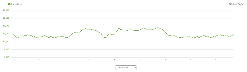
Hiking 20 Lakes Loop with Sally & Fannie Profile
Sources:
Saddlebag Campground Inyo National Forest
Browning, Peter, Yosemite Place Names, Great West Books, Lafayette, CA, 1988
Saddlebag Lake Trail Inyo National Forest
Inyo National Forest Policies and Rules
Inyo National Forest Hiking and Camping with Dogs
Prior Blogs in the Area:
Hiking 20 Lakes Loop with Sally August 6, 2019
Camping & Fishing With Sally in Tioga Pass July 15, 2019
Camping and Fishing with Sally at Saddlebag Lake and Beyond June 26, 2018
Camping and Fishing with Sally at Saddlebag Lake August 7, 2017
Hiking with Sally from Saddlebag Lake through Twenty Lakes Basin August 15, 2017
Hiking with Sally in the 20 Lakes Basin July 12, 2016
Hiking with Sally up to the Hess Mine in the Tioga Pass Area October 26 2016
Hiking with Sally on the 20 Lakes Basin Loop August 22, 2013


