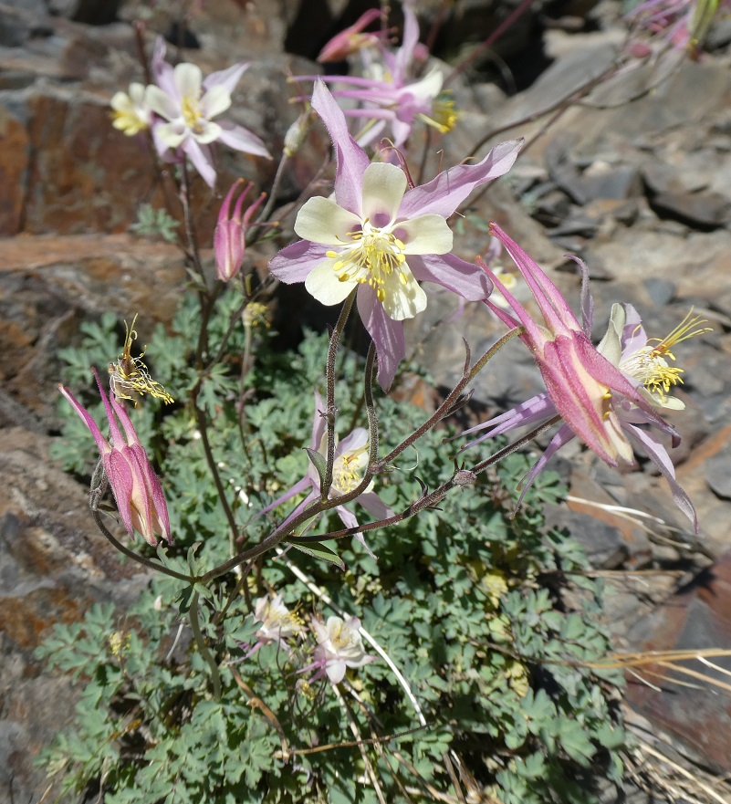
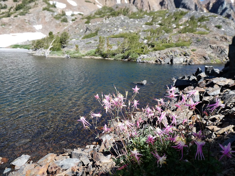
The Twenty Lakes Loop trail led my dog Sally and I along beautiful lakes in the Hoover Wilderness. Lakes and tarns reflected snow covered mountains and those columbine were blooming like crazy!
Where: Inyo National Forest, Hoover Wilderness I love the Saddlebag Lake area and just got back from camping for a week up there. To get to Saddlebag Lake, I exited the east entrance to Yosemite National Park at Tioga Pass, then drove east on Hwy 120 about 2 miles to Saddlebag Road. Heading up the mostly dirt road to Saddlebag Lake, I stayed at the Saddlebag Lake Campground in the Inyo National Forest above the resort. If you are daytripping it, there is parking at the resort or at the adjacent backpacker parking lot.
This one is a looped hike around several high lakes and on this trip I kept to the actual trail this time to help show you the traditional 20 Lakes Loop Hike. Well, pretty much stuck to the trail. There are also several pretty lakes in the center of the loop that you can head cross country to see such as Z and Twin Lakes, along with many small tarns. Or you can head up to Cascade Lake to the west of Steelhead Lake to see these lakes nestled in the granite. If you feel comfortable going off trail, those are some options that you might want to check out.
There is a trail that goes around the lake called the Saddlebag Lake Trail and you can start from either side of the lake to head to the trail that branches off of it, leading you to the 20 Lakes Basin. Taking the water taxi that has been operated by Saddlebag Lake Resort was not an option this year because they are not open this summer. The owners of Tioga Pass Resort recently purchased the Saddlebag Lake Resort. They are still working very hard to restore and renovate Tioga Pass Resort after suffering multiple damage events since 2017 and focusing their efforts there this summer. They are hoping to have both resorts open for the summer of 2020.
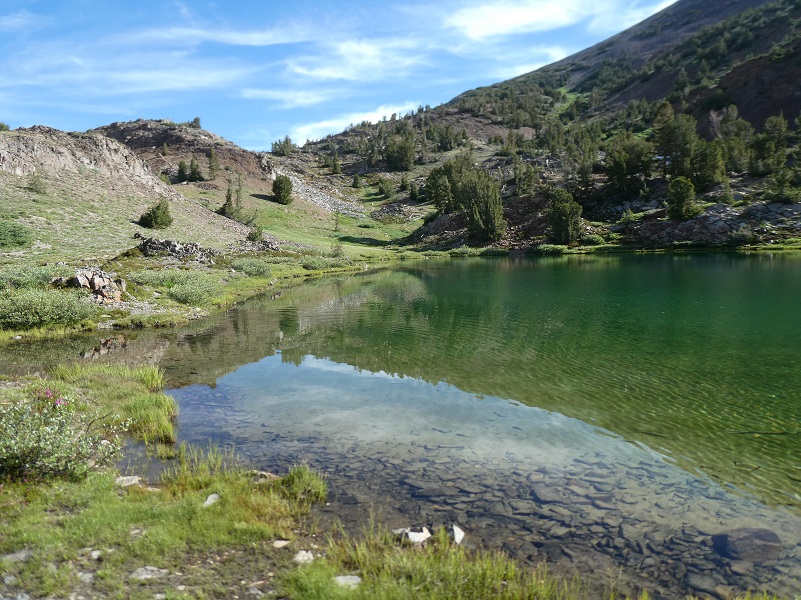
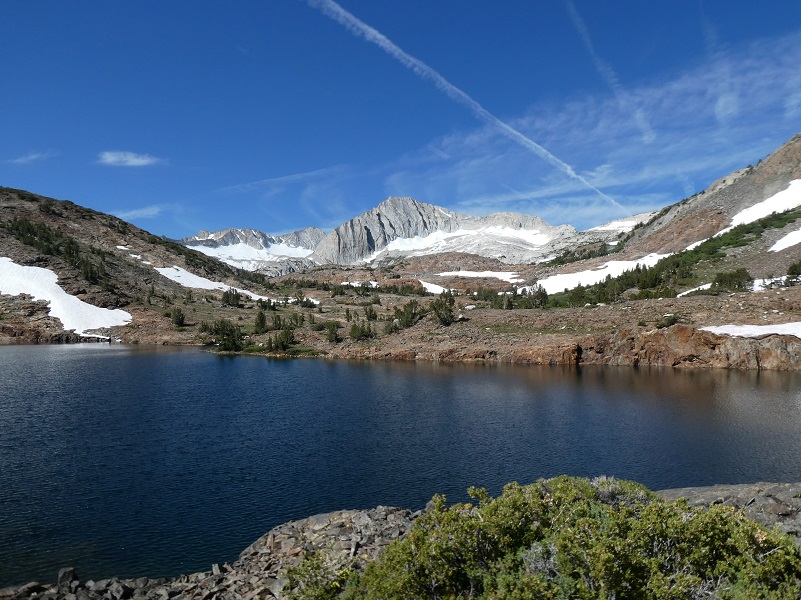
Sally and I started our hike on the east side of the lake and those reflections of snow coated mountains in the morning water were amazing. Saddlebag Dam (10,090′ elevation) was built in 1921 to enlarge an existing alpine lake for hydropower generation purposes. The dam was raised and a spillway was added in 1925. The reservoir is oversized compared to the volume of water produced in its watershed and the agreement between Southern California Edison (SCE) and the Los Angeles Department of Water & Power (DWP) requires it to be very low every spring. The water from Saddlebag Lake is used to generate power in Lee Vining and the water then flows to Mono Lake or it is diverted to the L.A. Aqueduct System.
The trail we took probably had many historical uses but one of the recent uses was as a route to the Hess Mine located on the north end of Steelhead Lake. The mine was primarily a tungsten mine, owned by Gus Hess. So what is tungsten and what was it used for? It is a hard steel-gray material and if it is made very pure, it retains its hardness. Of all metals in its pure form, tungsten has the highest melting point, the lowest vapor pressure and the highest tensile strength. When tungsten is alloyed with steel, it greatly increases its toughness. It is used as a filament in incandescent light bulbs, X-Ray tubes, tungsten carbide, penetrating projectiles and much more. It is said that the mine was closed in 1962 but some of the buildings or parts of these buildings are still in use today. The United States Forest Service Wilderness Headquarters at the north end of Saddlebag Lake was one of the living quarters for the mine. Parts of some of the old buildings are now incorporated into the Saddlebag Lake Resort storage building. If you look closely, you can see the remains of an old flume that went from the Lower Conness Lake to supply the Hess Mine.
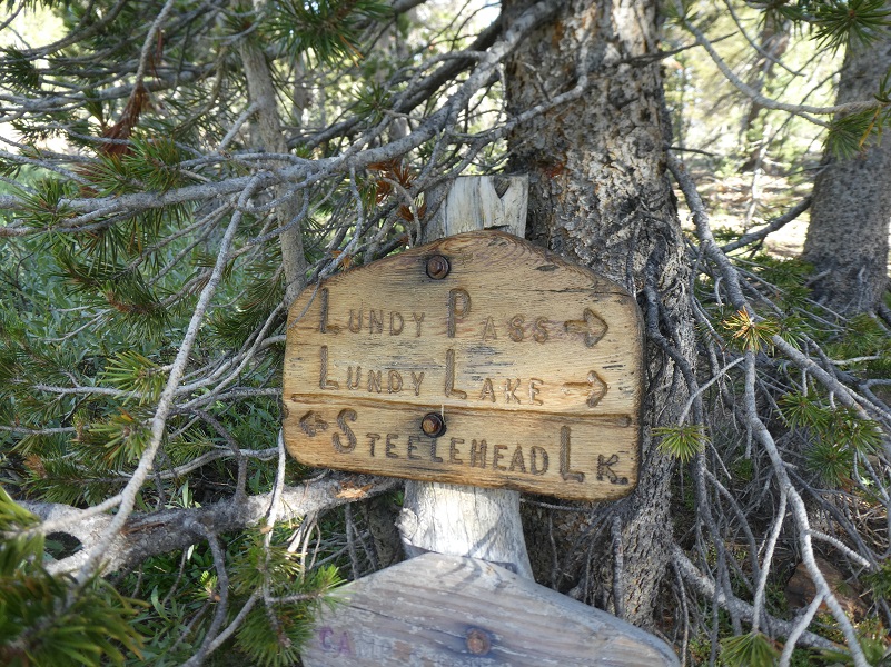
When we reached where the trail splits, I headed toward Lundy Pass. I like to do this hike in a counter clockwise fashion but you can do it the other way if you wish, heading left to Steelhead Lake first.
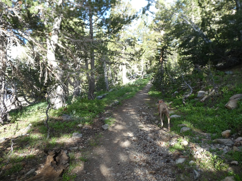
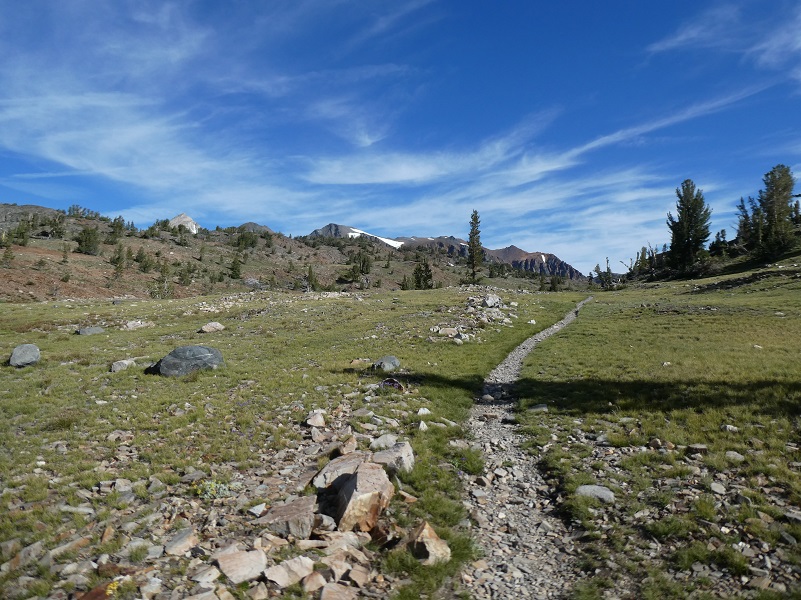
As we hiked we left the trees behind us the the country opened up.
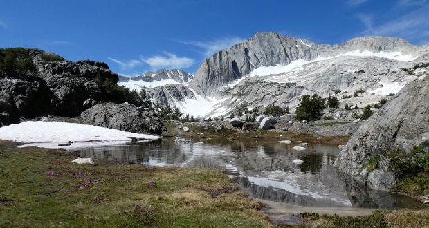
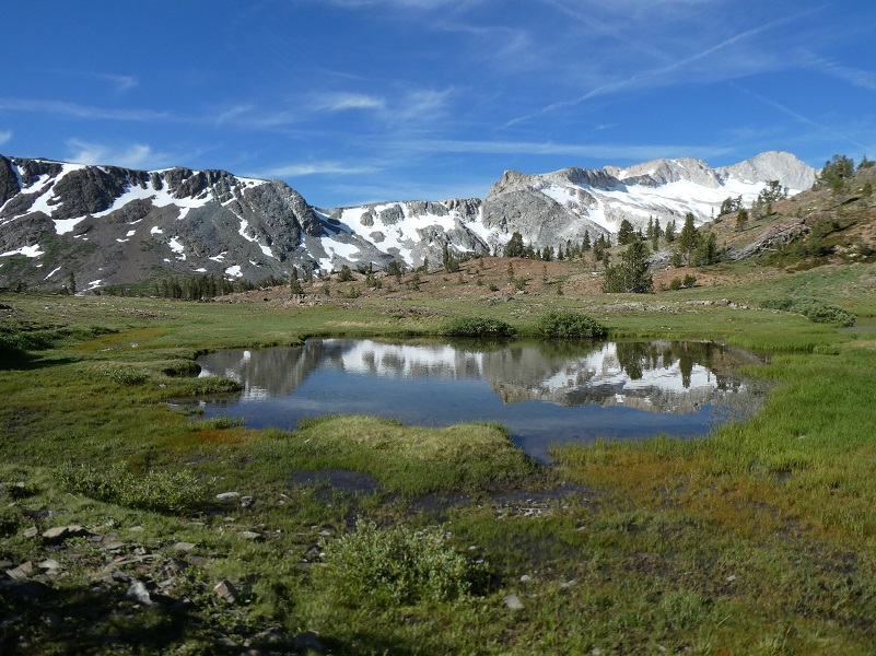
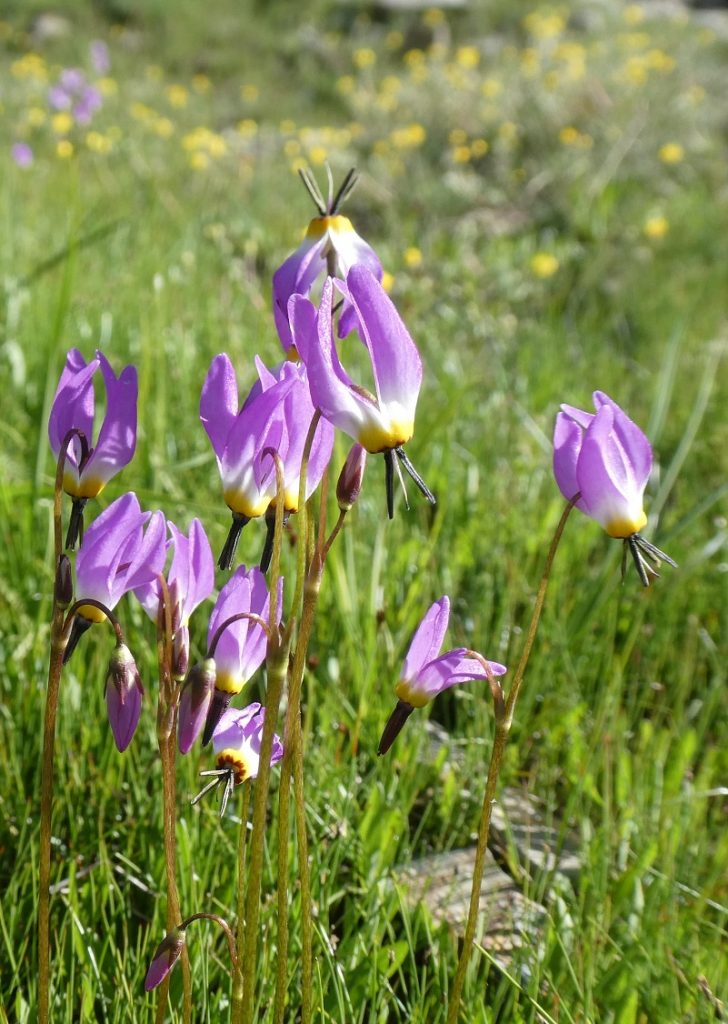
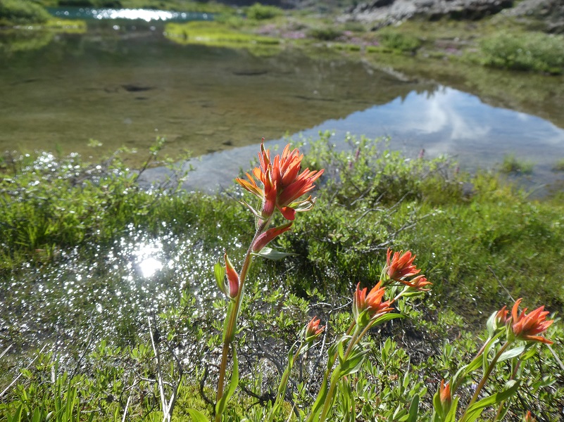
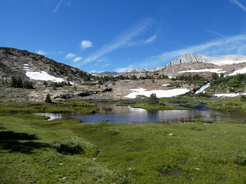
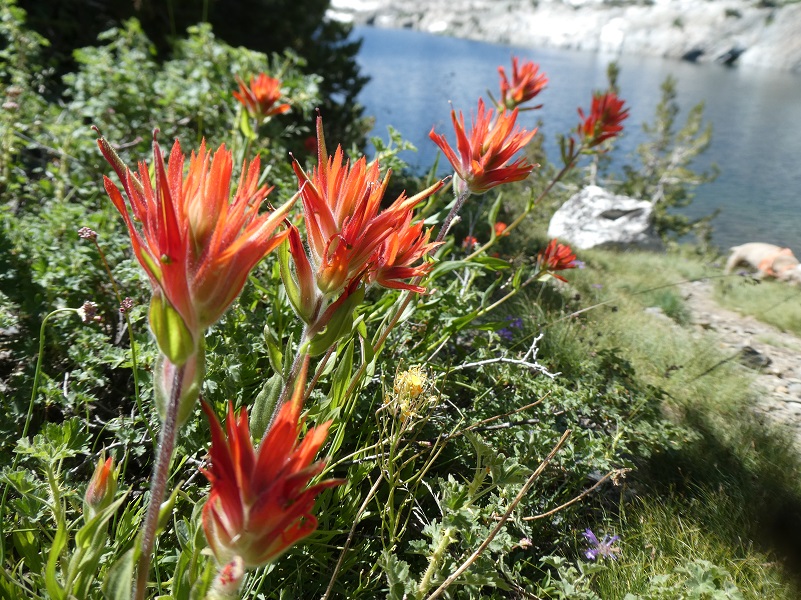
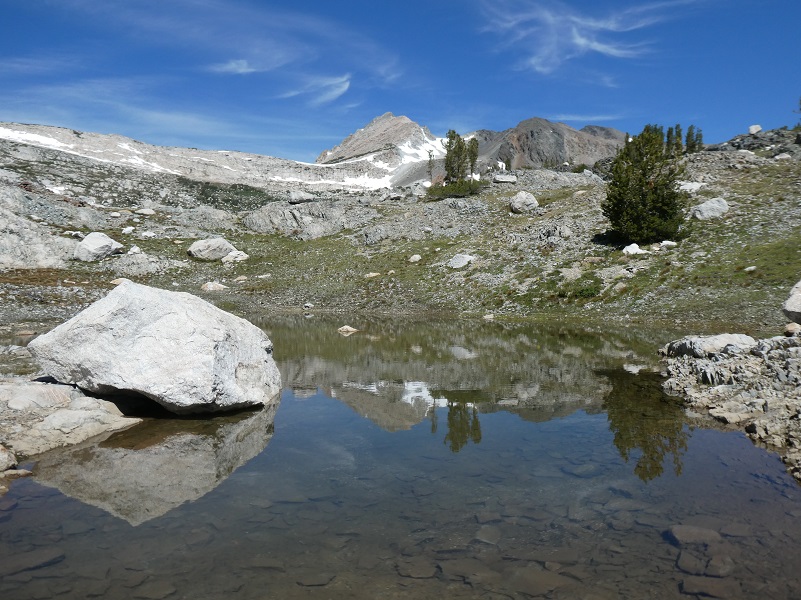
The trail passed by some small tarns, full of reflections from North Peak. These tarns are seasonal, created from snow melt and rain runoff and won’t be around too long. That is one of the reason I love to check them out. A short detour off the trail to the east led to Hummingbird Lake (10,255′ elevation). Patches of purple shooting stars were putting on a show and orange paintbrush lined the lake is areas.
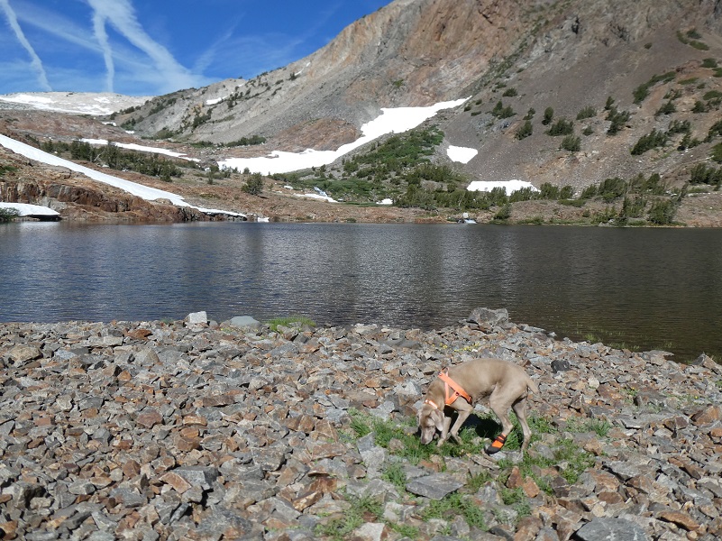
We got back on the main trail and after we headed over Lundy Pass (10,369′ elevation), Sally took advantage of a mouthful of snow along the way.
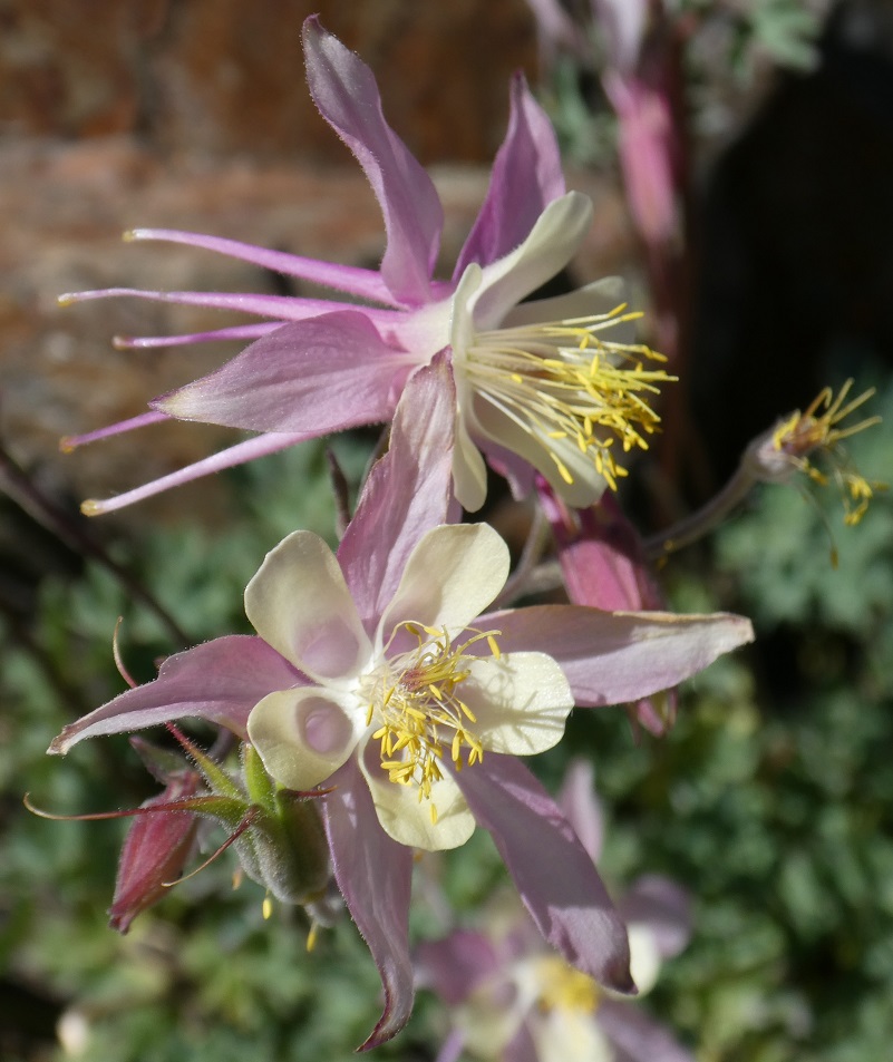
Before we dropped down into ODell Lake (10,263′ elevation), I was surprised to find the rocky hillside along the west side of of the trail full of columbines. I don’t remember seeing them in this area but maybe I wasn’t looking or was there at the wrong time.
Distance: 9 Miles
Difficulty: Moderate
Elevation Range: 10,094′ – 10,360′
Date: August 6, 2019
Maps: Falls Ridge and June Lake Topographic Quads
Dog Hike? Yes

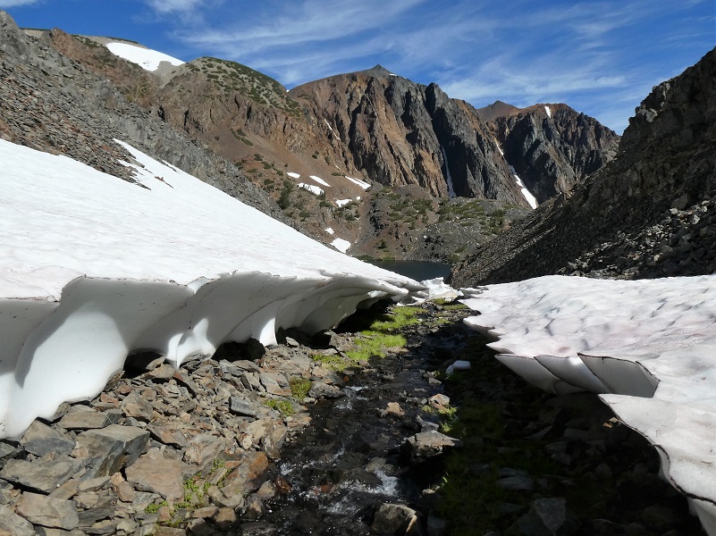
After Odell Lake, we walked down a rocky chute lined with snow. Portions of the actual trail were still covered in snow along the way, so I stuck to the creek bottom. It was a pretty easy route down to Lake Helen in the creek bottom. It was easy except Sally decided to jump on the snow on the right side and before I could get her off, the snow collapsed with her falling through the middle about 4 feet, slicing a rear paw pad on the rocks below.
So Sally got the boot. I carry her dog boots and a small dog first aid kit when we hike and that boot was definitely needed on those sharp rocks. She wasn’t favoring her foot and we were about half way through so I decided to keep on going as long as she was doing ok. More about dog hiking toward the end of the blog.
The rocks along Lake Helen (10,263′ elevation) are usually lined with columbines and when they are blooming, their colors range from creamy whites with a bit of pink to showy orange with yellows. The columbines along Lake Helen were beautiful as always. Note the crossing to get across the outlet. The lake was pretty high and there were some rocks placed where I walked across then climbed that rock wall. I couldn’t easily get upstream or downstream after I had gone across the rock crossing because it is too deep. If you don’t feel comfortable with the rock hop/wall climb, you will need to go downstream to find a place to wade across. There could be rocks or a log but I didn’t check it out. The rock wall is only about 8-10 feet tall that you need to climb up. I sent Sally to the left to go through the water then she made her way back to me. Actually I was still climbing up the wall when she reached the spot above me and was looking down at me as if to say “what’s taking so long?”
Once we got across that outlet, the trail led us along the shore on the north side.
After hiking on the rocky trail, we reached a small, unnamed lake.
This next part was the trickiest of the hike. Snow covered much of this part of the trail and I had to toe kick my way up the icy bank of snow, then work my way across the rocks into Shamrock Lake because portions of the trail were covered by water or snow. I think the conditions will be much better now but I recommend you pay extra attention to where the trail is supposed to go if you aren’t familiar with this area.
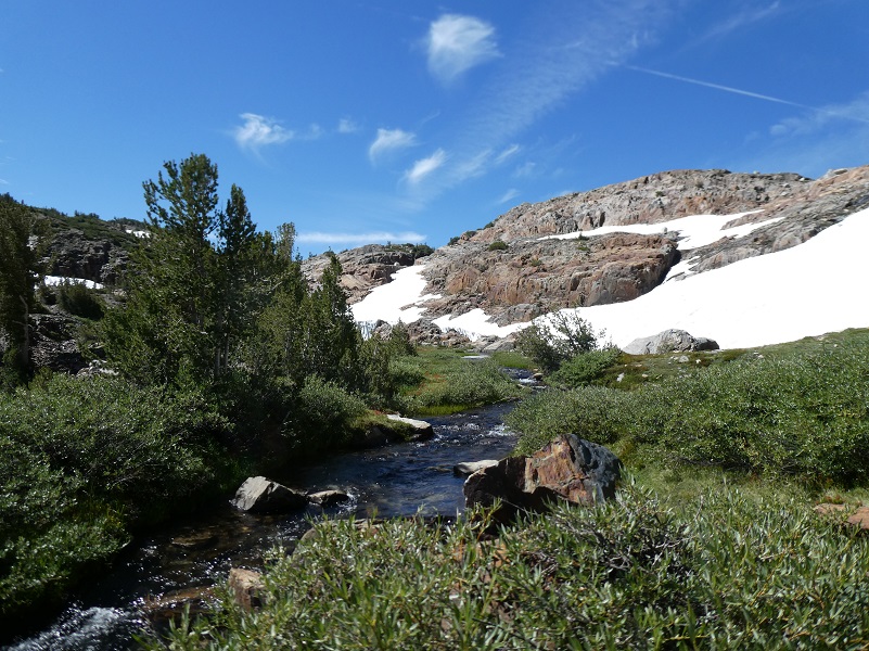
Since I was slightly off the trail, I walked by wide spots in the creek that were beyond beautiful.
After doing a bit of backtracking off the trail and through the rocks, I reached Shamrock Lake (10,266′ elevation).

Colorful wildflowers were waiting along the trail.
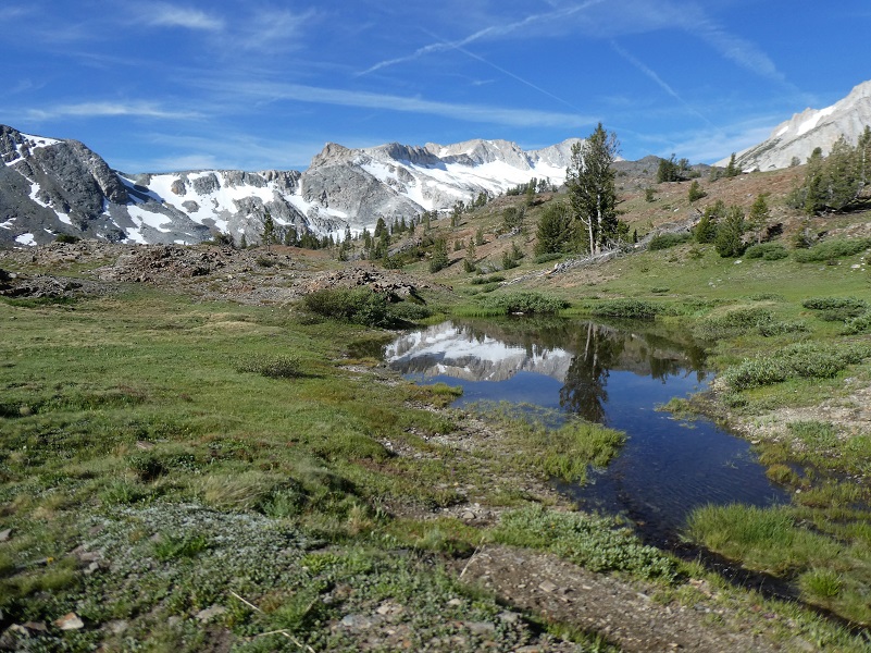
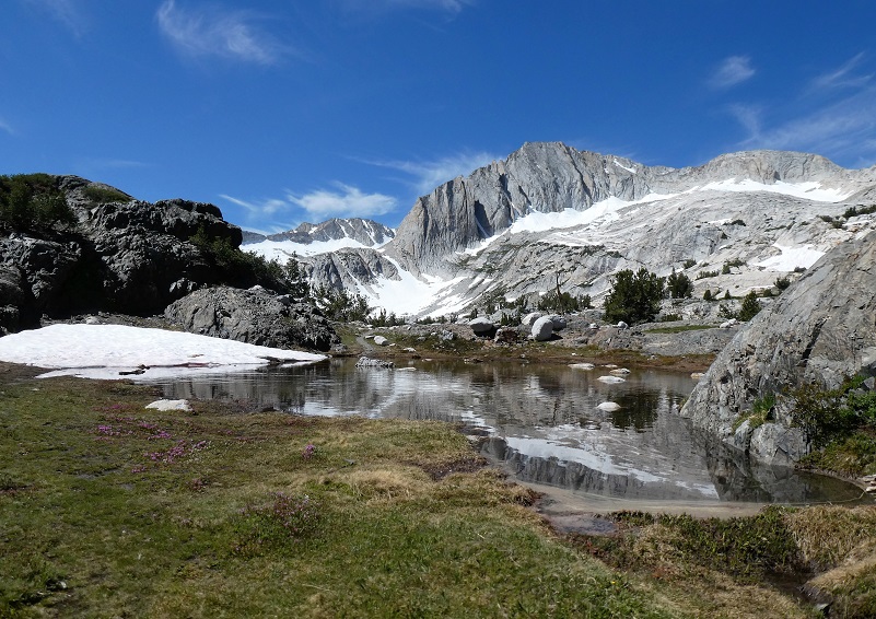
The trail is under water in many places so I worked my way around when I need to. On the plus side, I visited many beautiful tarns with reflections!
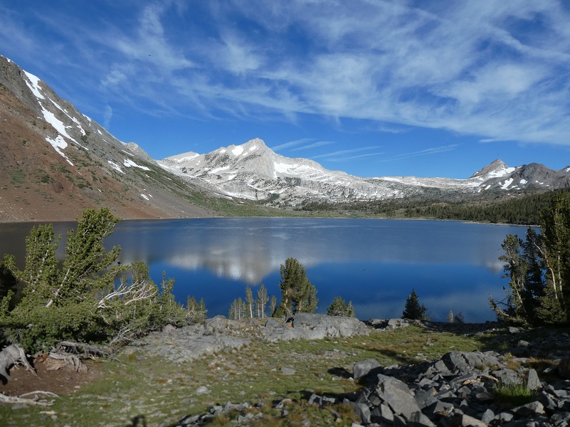
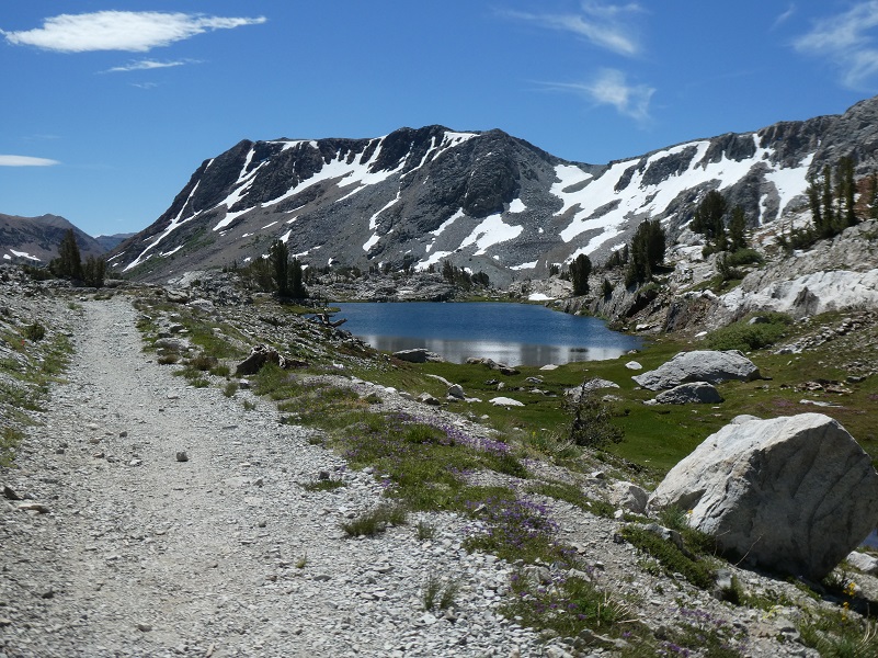
I reached Steelhead Lake (10,279′ elevation), then followed the old road from the Hess Mine which is the trail back to the intersection of the trail that I had headed up in the morning.
I checked Sally’s foot several times during the day and she seemed to be doing fine. When we returned to camp, I removed her boot to help it heal up. The next day, we stayed in camp to let her rest and heal. At that point I couldn’t even see where she had cut herself.
Dog Hike?
That rocky country can be tough on a dogs feet and I brought Sally’s boots with me but she didn’t need them. Her hiking boots are made by Ruffwear and although they don’t make the model that she is wearing, they have other types. If I am hiking with Sally and don’t have her boots on, I still carry them in case she has a paw injury.
This hike can be a good dog hike if your dog is up to it. The rocky terrain is very rough on a dog’s feet and I packed Sally’s boots just in case she got a sore spot on her paw or sliced her foot on one of those sharp rocks. Even if you think your dog’s feet are toughened up enough for this hike, you can have surprises so please be prepared. Sally hiked for 2 1/2 days on this trip.
I also carry a small first aid kit for Sally in my pack and a dog trauma kit in my car. I bring energy bars for Sally and continually give her some through the hike. She is expending a tremendous amount of her reserve energy in her travels. I am not talking about dog treats but something that will replenish the important nutrients that your dog needs to maintain the high level of energy output on a hike.
This is a good hike for Sally. There aren’t any rattlesnakes or poison oak and there is plenty of good, fresh drinking water for her all along the way. That means I don’t have to pack her water and that is a good thing! Sally has never had any problems drinking the water out of these higher elevations but some dogs may not be as easy as Sally on this issue. There have been recent algae blooms in lower elevation waters and I would use extra caution and not take chances with your dog drinking water out of any sources that you are not sure of. You can check status of California Lakes at this Harmful Algal Blooms site where voluntary reporting is captured but there have been little reporting in the area of this blog. You can read more in this Sierra News Online article. Even if harmful algal blooms are not an issue, I think you need to know your dog and you may need to carry some water for them. This area also has bubonic plague and if you dog gets a hold of a critter such as a squirrel or mouse, this could be something to watch for after a trip in this area.
Here is some information from Inyo National Forest regarding their dog rules:
Traditionally, National Forests have welcomed dogs. However there are a few rules that apply to assure that you and other National Forest visitors have an enjoyable outdoor recreation experience. If you are camping with your pet, please practice the following:
- Leave vicious or unusually noisy dogs at home.
- During the day keep your dog on a leash no more than 6 feet long, or otherwise restrict its freedom to roam at will.
- At night keep your dogs and other pets inside an enclosed vehicle or in a tent.
- Developed campgrounds are for people, not animals. Please do not bring more than two dogs or other pet to any one campsite.
General rules for dogs within the Inyo National Forest:
- Dogs are allowed for trips staying in the National Forest. Pet food must be stored the same as required for your food.
- Dogs are prohibited, as are any other pets, on trips visiting the wilderness of Yosemite, Sequoia and Kings Canyon National Parks.
- Pets need to be on leash or under verbal command. Do not allow pets to chase or harass wildlife.
Doarama:
What is a Doarama? It is a video playback of the GPS track overlaid on a 3 dimensional interactive map. If you “grab” the map, you can tilt it or spin it and look at it from different viewing angles. With the rabbit and turtle buttons, you can also speed it up, slow it down or pause it.
Map and Profile:
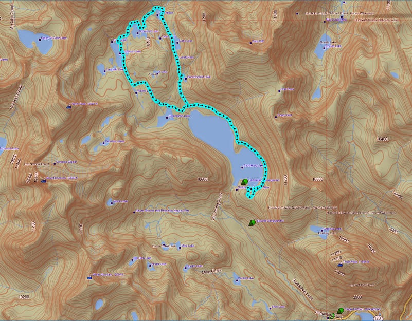
20 Lakes Loop Topographic Map
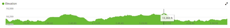
20 Lakes Loop Profile
Sources:
Saddlebag Campground Inyo National Forest
Browning, Peter, Yosemite Place Names, Great West Books, Lafayette, CA, 1988
Saddlebag Lake Trail Inyo National Forest
Inyo National Forest Policies and Rules
Inyo National Forest Hiking and Camping with Dogs
Prior Blogs in the Area:
Camping & Fishing With Sally in Tioga Pass July 15, 2019
Camping and Fishing with Sally at Saddlebag Lake and Beyond June 26, 2018
Camping and Fishing with Sally at Saddlebag Lake August 7, 2017
Hiking with Sally from Saddlebag Lake through Twenty Lakes Basin August 15, 2017
Hiking with Sally in the 20 Lakes Basin July 12, 2016
Hiking with Sally up to the Hess Mine in the Tioga Pass Area October 26 2016
Hiking with Sally on the 20 Lakes Basin Loop August 22, 2013