YOSEMITE NATIONAL PARK–The Washburn Fire is currently burning within the Yosemite National Park (YNP) boundary near the Mariposa Grove area. The Mariposa Grove is closed indefinitely. The community of Wawona has been evacuated including residents, employees and park guests. We will be adding updates to this article , please check back often. Helpful Links are at the bottom of the page.
Update 8:00pm 7.11.2022
The Washburn Fire is 2,720 acres with 22% containment currently. Today, significant activity was observed on the northwest and northeast corners of the fire south of the south fork of the Merced River. All of the spot fires reported earlier have been taken care of.
Fire managers objectives right now are to continue direct handline construction where possible and prepare for indirect line when needed. They plan to utilize offensive firing operations along primary control lines when appropriate. They will also continue to defend Wawona Point and the Community of Wawona, protect the Miraposa Grove and are working on establishing contingency lines through Long Valley to Star Mine.
Concerns over the next few days are that warming and drying will continue to provide active fire behavior and the burn period will extend into the night time hours due to low relative humidity.
Ground and air resources will continue suppression efforts.
Evacuations remain in effect for the Wawona area and Wawona Road (Hwy 41) is still closed to access the park. Highways 140 and 120 are open into the other areas of Yosemite not affected by the fire, however, visitors should expect smoky conditions.
The fire cause is under investigation.
Update 4:00pm 7.11.2022
The Washburn fire has been mapped again and fire managers report it has grown to 2,720 acres. Currently, the fire is producing a large pyrocumulus cloud that can be seen from all over our community. Reports are coming in that the part of this is due to a firing operation taking place in the N/NE section of the fire. There are also reports of the fire spotting ahead of itself in numerous locations including across the south side of the south fork of the Merced River and across Highway 41 (Wawona Road). Fire crews from both the ground and in the air are attacking each spot in a coordinated effort to keep the fire from continuing to expand.
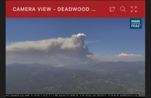
The Washburn Fire pyrocumulus cloud as seen from the Wildfire Alert Deadwood camera on Monday afternoon, 7.11.2022

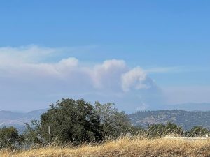
The Washburn Fire pyrocumulus cloud as seen from the Wildfire Alert Buck Rock camera on Monday afternoon, 7.11.2022.
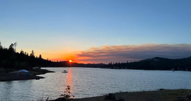
The Washburn Fire as seen from Highway 41 and Road 200 on Monday afternoon, 7.11.2022 Courtesy of Richard B Keg
Update 12:15pm 7.11.2022
Daily Update for the Washburn Fire for July 11, 2022. The Washburn Fire is currently 2,340 acres and is 25% contained. There are currently 545 people assigned to the fire.
Update 11:15am 7.11.2022
Video from this morning near the park’s South Entrance. Watch to see the benefits of using intentional fire on the landscape. Crews on the #WashburnFire used offensive firing to speed up the creation of control line. Process explained by Matt Ahearn, Deputy Operations Chief Team 13.
Update 10:15am 7.11.2022
Today’s video update from the Incident Management Team.
Update 8:00am 7.11.2022
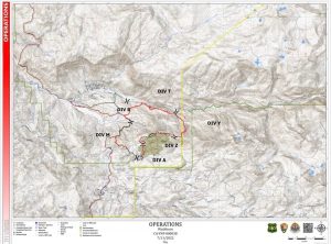
The Washburn Fire Operations Map for Monday, 7.11.2022.
The Washburn Fire has now burned 2,340 acres. Fire managers ultimate goal is full suppression, however they are reporting 0% containment at this time. Their biggest areas of concern include The Mariposa Grove of Giant Sequoias, the community of Wawona and keeping the fire south of the south fork of the Merced River. Yesterday, backfiring operations were successfully completed near the Wawona Road (Highway 41). This week the concern is rising temperatures and changing wind patterns.
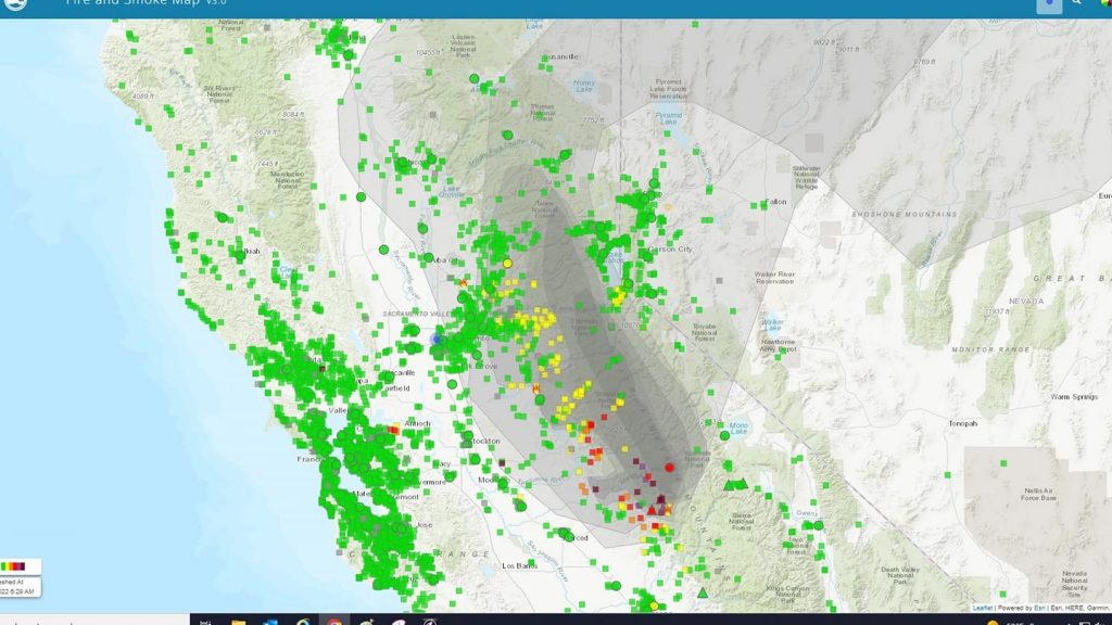
The Washburn Fire smoke impacts from airgov
Evacuations are still in place for Wawona and the south entrance park via Highway 41 is still closed. The rest of Yosemite National Park is open with access available through Highways 140 and 120. Guests can expect smoky conditions.
The Washburn fire incident management team will host a public meeting in Oakhurst, CA, on Monday, July 11, at 7 pm. Representatives from the Incident Management teal will discuss current and expected condition on the fire, and will hold a Question/Answer afterward.
The meeting will take place at the Community Center of Oakhurst at 39800 Fresno Flats Rd.
The meeting will also be livestreamed on Yosemite Fire and Aviation’s Facebook page.
Previous Day
Update 8:00pm 7.10.2022
The Washburn Fire is currently 2,044 acres. There are 545 personnel assigned to the fire. The incidents commander is Josh Boehm from the California Interagency Incident Management Team (IMT) 13. According to the National Interagency Fire Center, an incident management team is dispatched or mobilized during complex emergency incidents to provide a command and control infrastructure in order to manage the operational, logistical, informational, planning, fiscal, community, political, and safety issues associated with complex incidents.
Fire activity was affected by an inversion layer over the fire for most of the day. The inversion layer also kept firefighting aircraft from being able to engage in firefighting efforts due to visibility issues. In the afternoon, however, fixed wing firefighting aircraft were able to continue laying down fire retardant in between the fire and The Mariposa Grove area. Also, water dropping helicopters were able to work on the fire in the late afternoon and will continue to do so until sundown.
Today and tomorrow the fire area will be experiencing a warming trend as high pressure continues to strengthen and hot and dry conditions continue throughout the week. This will cause the fire to continue actively spreading. Once the fire reaches some of the recent fire scars, spread may slow, but fire will continue to burn into the fire scars.
For more information on the fire, the IMT has posted an update video here.
HELPFUL LINKS
Inciweb official incident information
Deadwood Wildfire Alert Camera
Yosemite Fire and Aviation Facebook Page
To submit pictures and videos to Sierra News Online email news@sierranewsonline.com
Previous SNO articles
Yosemite Fire Burns into Day 4
Washburn Fire Continues to Threaten Yosemite


