YOSEMITE NATIONAL PARK–The Washburn Fire is currently burning within the Yosemite National Park (YNP) boundary near the Mariposa Grove area. The Mariposa Grove is closed indefinitely. The community of Wawona has been evacuated including residents, employees and park guests. We will be adding updates to this article, please check back often. Helpful Links are at the bottom of the page.
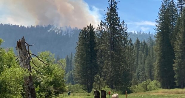
The beginning of Washburn Fire Thursday 7.7.2022 courtesy of James Stevenson.
Update 8:00am 7.10.2022
The Washburn Fire is now covering 1591 acres. The fire is burning in difficult terrain with continuous heavy fuels in and around the fire. Significant tree mortality from 2013 – 2015 has left dead standing and dead fallen fuels. This also presents many safety hazards to firefighters.
Yesterday, despite a very heavy firefighting aircraft presence, the fire continued to move steadily towards the south fork of the Merced River and Highway 41.

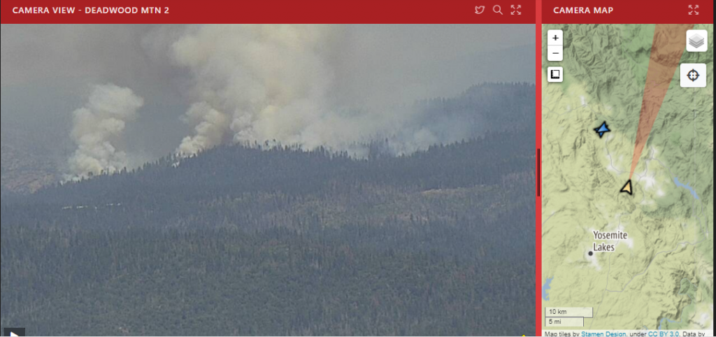
Image captured from the Deadwood Alert Wildfire Camera shows the smoke layer over Oakhurst the morning of 7.10.2022
Heavy smoke from the Washburn Fire is expected to impact the surrounding communities of the Sierra Nevada foothills.
Ground and air resources will continue suppression efforts today. The fire cause is under investigation.
The Federal Aviation Administration (FAA) has issued Temporary Flight Restriction (TFR) and any private aircraft or drone that violates the TFR could face serious criminal charges.
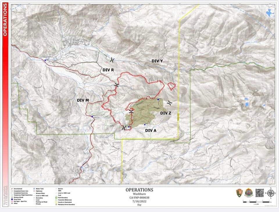
The Washburn Fire operations map for 7.10.2022
Update 8:00pm 7.9.2022
The Washburn Fire was mapped this afternoon at approximately 5:00pm by the FIRIS mapping aircraft and has grown to 1384 acres. According to the Yosemite National Park Facebook page Evacuation of the Wawona community and Wawona Campground remain in place. The Wawona Road (Highway 41) is closed at South Entrance to Henness Ridge Road. Yosemite West remains accessible via Wawona Road from the north (from Yosemite Valley).
Structure assessment and preparation work is on going in the community of Wawona.
The Mariposa Grove of Giant Sequoias is home to over 500 mature trees. Efforts to protect these trees and the historic structures within the Grove include: removing hazard fuels, deploying temporary sprinkler systems, and utilizing protective structure wrap on the base of the trees as well as on the Galen Clark Cabin.

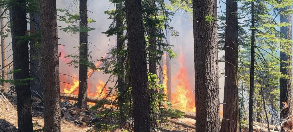
The Washburn Fire from Road 600 near Raymond, CA. 7.9.2022. Courtesy of Susan Larsen
Original Article
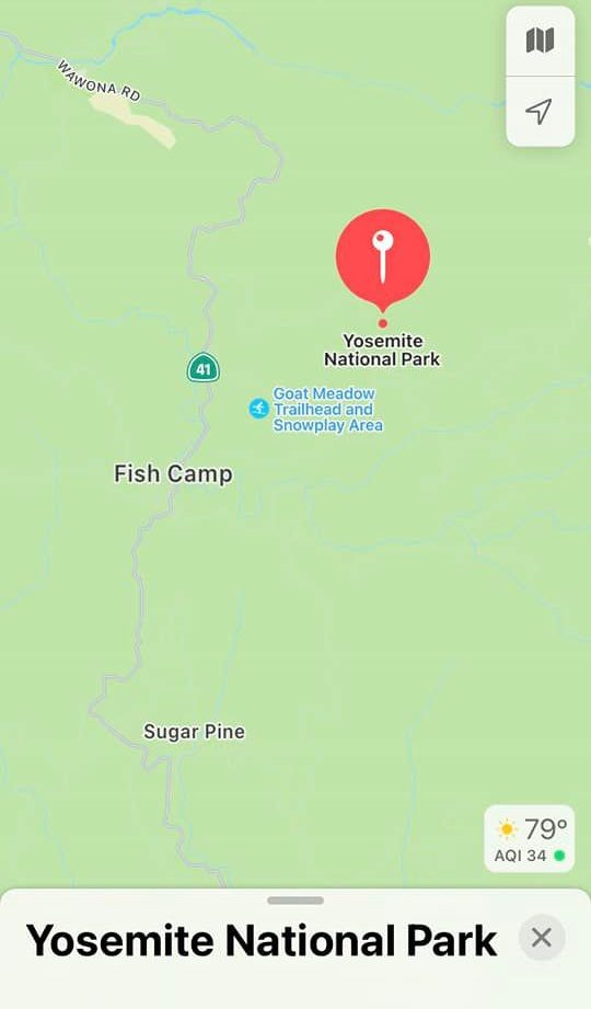
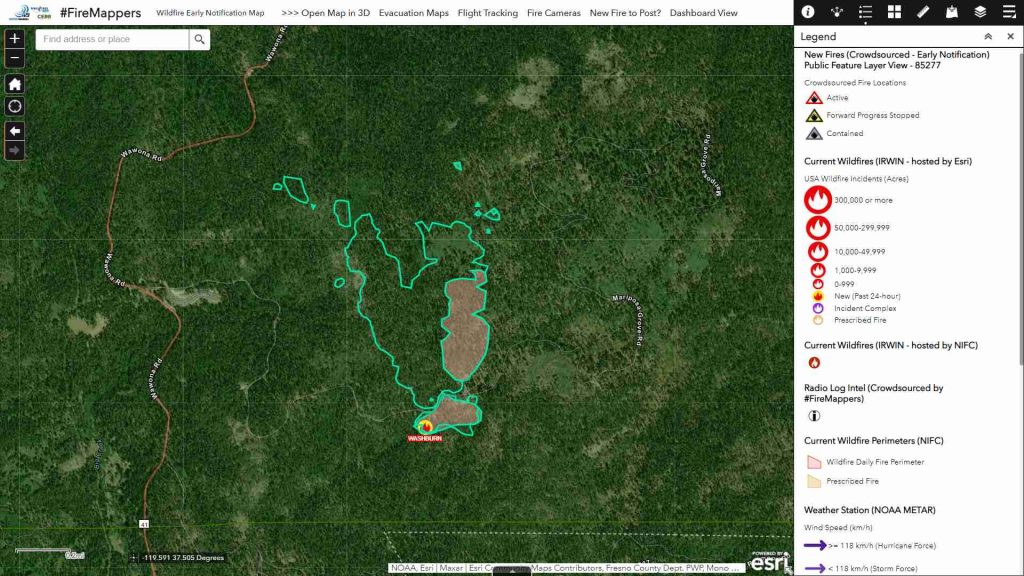
Approximate location of the Washburn Fire
The Washburn Fire started on Wednesday July 7, 2022. At 2:04 pm the Yosemite Emergency Communications Center received multiple 911 telephone calls reporting smoke visible from the lower Mariposa Grove area, near the Washburn trail. A full initial attack response was dispatched including Yosemite Fire resources and cooperators. The Mariposa Grove was evacuated and closed until further notice. It was not long after YNP officials put in a special request to use fire retardant in the park. This is not a common practice due to restrictions about the type of firefighting that can be conducted on National Park lands.
By 5:00pm the fire had progressed to approximately 10 acres and permission was granted to use the retardant. Immediately an order was put in for 4 tankers to begin fighting the fire from the air. As the day came to a close, the fire was mapped at approximately 46 acres and several spot fires were reported.
Overnight into
Day 2
##FireMappers Map of the Washburn Fire perimeter based on the FIRIS mapping aircraft Intel. 7.8.2022
Friday morning, 7.8.2022, brought reports of the fire being extremely active overnight while burning through areas that are drought stricken, bark beetle infested and had been affected by the Mono Winds last year. Original reports estimated the fire was 250 acres. Once the FIRIS, a high tech fire mapping air craft, came on scene the acreage was updated to 166 acres.
Late Friday morning, YNP Officials released an evacuation warning for the residents, guests and employees of Wawona, including the Wawona Campground. Meanwhile the fire continued to grow quickly while people watched from all over the world. Media sources and news outlets were feverishly covering the fire while social media included non stop updates and pictures.
Washburn Fire from the Deadwood Wildfire Alert camera
7.8.2022 1:00pm

The Washburn Fire evacuation area map 12:47pm 7.9.2022
A Long Day
Friday afternoon, at about 4:00pm, YNP officials upgraded the evacuation warning to a mandatory evacuation for Wawona. Wawona Road, including Highway 41 into the park, was closed from the South, and traffic was only allowed to travel northbound into the park. A Red Cross Shelter was opened in Bootjack at New Life Christian Fellowship on Cole Road, near the town of Mariposa.
By the time the sun went down on Friday the fire was mapped again by FIRIS, however their report was not available until the next morning. The fire remained active overnight and crews continued to lead the battle to keep it out of Wawona and The Mariposa Grove.
Saturday (7.9.2022) Morning
As the sun rose on a beautiful Saturday morning, reports started flowing in regarding the Washburn Fire. The FIRIS mapping aircraft report was out and it had mapped the fire the night before at approximately 703 acres. Also maps were finally being released and we got our first clear idea of where the fire had burned.
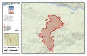
The Washburn Fire FIRIS map from the data collected on Friday evening, 7.8.2022.
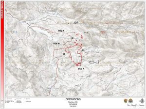
The Washburn Fire Operational Map released Saturday, 7.9.2022.
Later in the morning, the fire was mapped once again and the main fire is 1120 acres with the largest spot fire to the North is 25 acres. Ground and air resources will continue suppression efforts today. The cause of the fire is under investigation. Please continue to follow this article for up to date information.
HELPFUL LINKS
Inciweb official incident information
Deadwood Wildfire Alert Camera
Yosemite Fire and Aviation Facebook Page
To submit pictures and videos to Sierra News Online email news@sierranewsonline.com
Previous SNO articles


