Spectacular views were the big draw for snowshoeing the Merced Crest and we also got in a great workout. But wait, there is more! We followed the footsteps of a man who has 2 graves, a Chinese woman who was auctioned off for $800 back in the 1850’s, a Saloon Keeper and an early Yosemite Ranger.
Where: Yosemite National Park
Distance: 6.97 Miles
Difficulty: Moderate to Difficult
Elevational Range: 7,033′ to 7,838′
Elevation Gain: 1,293′
Date: January 19, 2022
CALTOPO: Snowshoeing Yosemite’s Merced Crest
Dog Hike: No
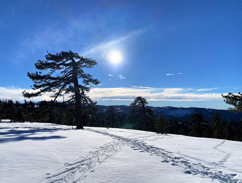
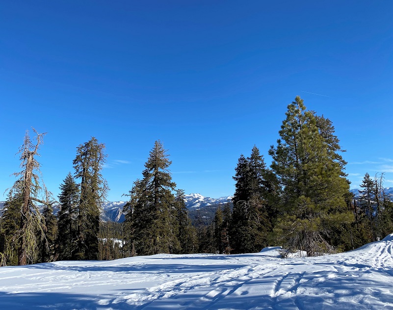
My friend Gail and I decided it was time to snowshoe the Merced Crest since we hadn’t done it since 2019. We drove separate cars and as I drove to Badger Pass the temperature dipped down to 25 degrees so I was on the lookout for sneaky icy spots. The roads were pretty clear and dry with occasional icy spots, none of them really sneaky though, but I needed to pay extra attention. The National Weather Service had forecasted a high of 41 degrees but as you head up and down the crest, I knew we would have a range of temperatures. We parked around 8 am then walked down to where the picnic benches had been between the deck and ski lifts but they weren’t there this year, so we sat on the steps to put on our snowshoes.
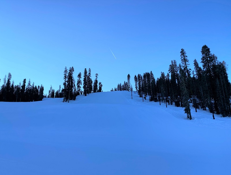
The first part of this snowshoe hike is probably the hardest because you climb up alongside the east side of the “Eagle” chairlift, staying off to the very far side of those really nicely groomed slopes. That climb gained about 600 feet in elevation before the first 3/4 mile was done. I looked up toward the top of the hill and where I would need to climb to then started up.
And so we climbed up that hill. I hadn’t done much hill climbing for a while, especially in showshoes and I had to take lots of breaks. I had some nice views as I took those breaks though.

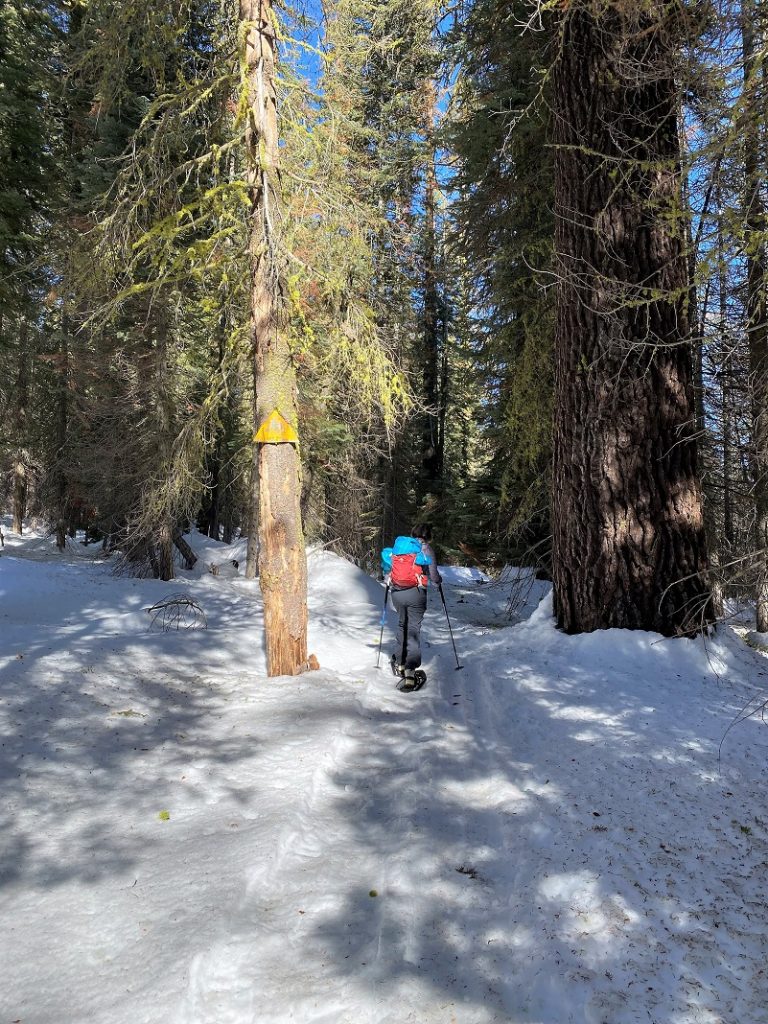
Once we made it to the top of the chair lift and ridge, we took a breather. We then followed the Merced Crest Trail #16, following the yellow trail markers.
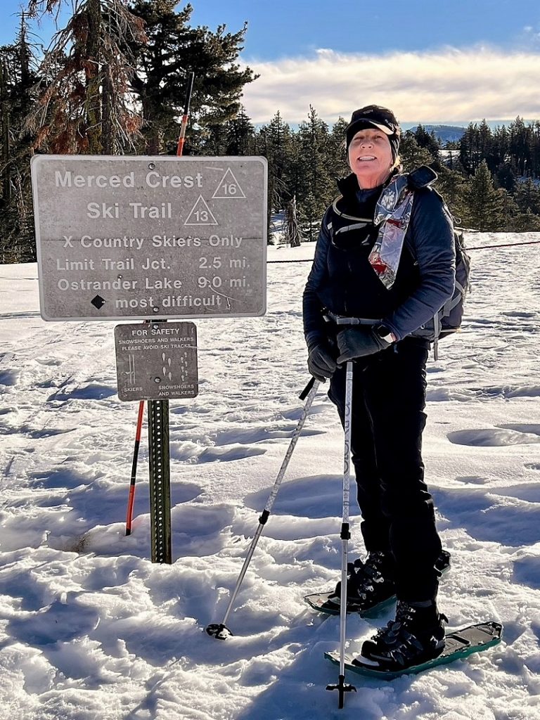
Photo by Gail Gilbert

Photo by Gail Gilbert
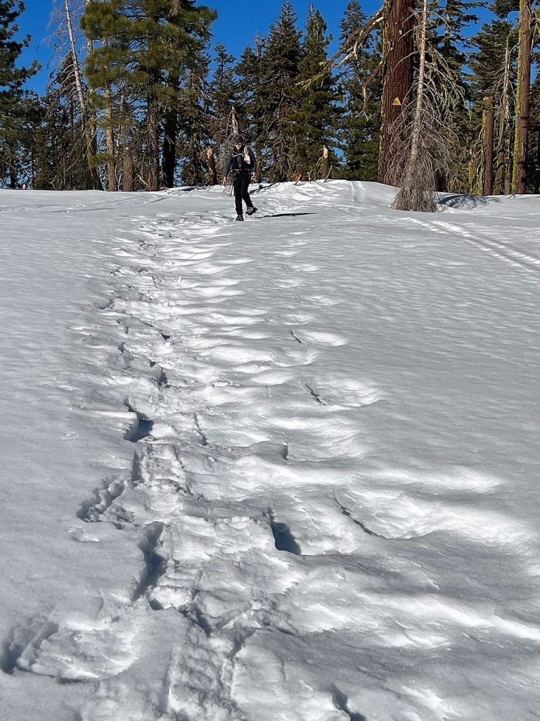
Photo by Gail Gilbert
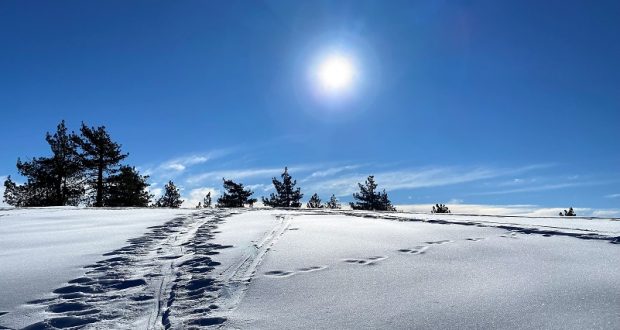
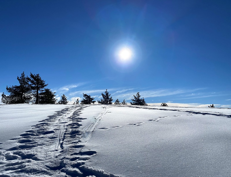
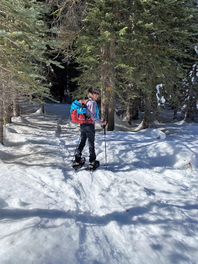
We had a magnificent day to follow the trail along the crest. The snow was still frozen, well packed with no need to break trail. Cross country skiers and snowshoers had left tracks along the way but sometimes those tracks didn’t exactly follow the trail signs so we paid attention to those trail markers along the way.
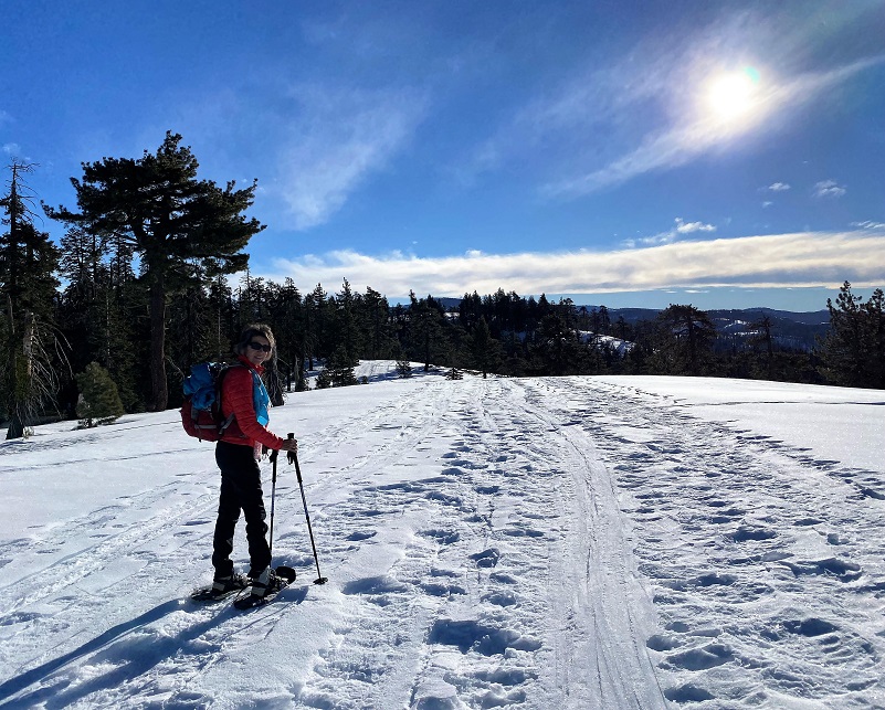
We had peeks of magnificent views of the high country along the trail.


After following up and down over 3 hills, we arrived at the intersection with the trail to Ostrander Lake. We didn’t need to stand on our heads to interpret which direction we needed to go and headed toward the left on the Limit Trail #13 to Westfall Meadows, named after a very distant relative of mine.
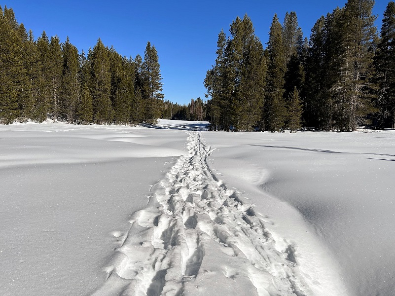
Photo by Gail Gilbert
Here are a couple of excerpts from Yosemite Place Names by Peter Browning:
Westfall’s Meadows is named for Joel J. Westfall, born in Virginia 1819 and came to Mariposa in 1854. He had 160 acres of land on the old trail between Wawona and Yosemite Valley, near the junction with the southern branch of the old Mono Trail. ” . . . follow along Alder Creek to its source in a large meadow known as Westfall’s . . . Here are two houses, Westfall’s and Ostrander’s, sometimes occupied during the summer by herders of sheep, and which have often afforded a kind of shelter, poor, but better than none, to persons overtaken by night, or too much fatigued to go farther. Usuallly, however, this is the lunch place, or half-way house between Clark’s and the valley, as will be easily recognized from the number of empty tin cans lying about.” (Whitney, The Yosemite Book, 53-54.) Hoffmann and Gardiner’s map of 1863-67 has “Westfall’s,” and shows a building. After that the name was not on a map again until publication of the Yosemite Quad in 1956. Westfall had a butcher shop in Yosemite Valley from about 1875 to about 1905. (YRL files)
From Clark’s, the trail to the Yosemite crosses the South Fork of the Merced, and ascends rapidly on to the plateau which lies between the Main Merced and the South Fork. After about six miles travel, pretty steadily up hill, we reach Alder Creek, 1,900 feet above Clark’s, follow this up about a mile to Empire Camp, not now inhabited, attaining here an elevation of 2,018 feet above Clark’s, or about 6,000 feet above the sea-level. We are now nearly on the height of the plateau, and follow along Alder Creek to its source in a large meadow, known as Westfall’s, and 3,100 feet above Clark’s, or 7,100 above the sea. Here are two houses, Westfall’s and Ostrander’s, sometimes occupied, during the summer, by herders of sheep, and which have often afforded a kind of shelter, poor, but better than none, to persons overtaken by night, or too much fatigued to go farther. Usually, however, this is the lunch place, or half-way house between Clark’s and the Valley, as will be easily recognized from the number of empty tin cans lying about. That we are respectably high up in the Sierra is rendered evident by the predominance of the Pinus contorta, a rather small tree, with its leaves short and in pairs, usually called “tamarack” by the settlers. This and the noble firs (Picea grandis and amabilis), form here almost the whole of the forests.
But I wanted to learn more about Joel J. Westfall and decided to do some digging. From census and voter registration, I pieced together the following information for him:
August 24, 1819: Born Buchanan, Ritchie County, Virginia to John Wesley Westfall and Elizabeth Simon.
1850: Living Western District, Ritchie County, Virginia, Farmer, Wife Julia A. born about 1831 Virginia, son James R. 2 years old born Virginia
April 4, 1854: Joel James Westfall left Virginia to head west
1860: Unable to locate Joel James. Note it appears that his son James R. is living in the household of John W. Westfall born about 1798 Virginia and Elizabeth’s family Ritchie County, Virginia. (Researching John W. Westfall, discovered that he was the father of Joel James Westfall and much more). From Find a Grave:
Frederick’s Mill ranks among the oldest landmarks in Ritchie County. It was built by Benjamin Hardman & Benjamin Cunningham. In 1845 it was rented by Joel J. Westfall and the following year bought by Joel J. Wesfall & his father, John Wesley Westfall. When the flood came in 1852 the lumber, grist mill and all except the saw mill was washed away. When this disaster was followed by the loss of his young wife, a disheartened Joel J. left for the west on April 4, 1854. John Wesley Westfall re-built the mill and kept it in motion until it passed into the hands of Joseph B. Frederick. John Wesley married Elizabeth Simon on February 14, 1819. Their children were Joel J. who lived in California until 1906, Jacob White, Margaret, Mary, James Barnes who froze to death after trying to dislodge a log jam, & Jasper Newton Westfall. John Wesley was a son of Joel Westfall & Elizabeth White. His paternal grandparents were Joel Westfall & Mary Houston. His maternal grandparents were William White (scout & Indian fighter who died after being shot & scalped by Indians) & Elizabeth Wallace (who declared she was a relative of Sir William Wallace of Scotland).
Walter Westfall has put together online information on Westfall Genealogy and has slightly different information from his Home Page.
(1a) John Wesley Westfall and Elizabeth (Simon) Westfall’s son Joel J. Westfall was born Aug. 24, 1819 at Buchannon, Ritchie County, Virginia, and died Oct. 29, 1910 Smithville, Ritchie County, West Virginia. Joel J. Westfall at the age of seventeen years, was made lieutenant of Co. D, 133rd Regiment of the Virginia Militia, an office which he held for seven years; and he later was Captain of the Militia. He married Eliza B. Mills January 22, 1843, daughter of W. R. Mills, of Pocahontas County, Virginia. Child of Joel J. Westfall and Eliza B. Mills was J. R. Westfall. Joel J. Westfall’s wife Eliza died while her son J. R. Westfall was still a baby. On April 4, 1854, after his wife’s death, leaving his young son with his parents, Joel J. Westfall started for California – lured there by the gold excitement – where he amassed quite a fortune, and where he rose to prominence in State affairs. At one time, while digging for gold, he unearthed a nugget that weighted nineteen ounces, and was valued at one thousand dollars. He served as Deputy Sheriff at Mariposa, California for four years, at the end of which time he was elected Road Commissioner and Supervisor, an office which he held for sixteen consecutive years. He also escorted William Jennings Bryan, and his distinguished party on their tour Through the “Golden State”, during Mr. Bryan’s first compaign for the Presidency. On October 6, 1906, he bade adieu to his adopted state of California and returned to Smithville, Ritchie County, West Virginia to live with his son J. R. Westfall. Later, he died on October 30, 1910, and was laid away at Smithville, on the homestead of his son.
Note: Joel J. Westfall’s second wife was Julia A Tingler, and they had a son William Henry Westfall who was born Mar. 12, 1853, and died Mar. 21, 1942. Joel married Julia Ann Tingler 23 June 1850 in West Virginia, Julia Ann Tingler was born in 1832, the daughter of Henry Tingler and Mary Ann Perine-Phyrne. Joel J. Westfall married third to Mary Tongere. He married her Nov. 20, 1865 in California. They had no known children together. She is buried in the Mariposa District Cemetery in Mariposa, California. Mary Tongere was from Canton, China. Back in the 1850’s many Cantonese ladies were imported into Calif. These ladies were put up on an auction block to be sold to the highest bidder. Now Mary was very lucky in that she was bought by Joel Westfall for $800 to do work as a domestic up at his Ranch. Most of the ladies in these boats that came over did not have this kind of good luck. Most were bid on and sold to owners of Brothels. But Mary escaped that fate. When Joel came out to Calif. he had just fairly recently been widowed and he gave his son to the care of his parents to be brought up. After awhile the Mason’s to which he belonged to did not think it proper to see Joel being single, living with a single women. So Joel offered Mary enought money to send her back to China but she did not want to go so he married her Nov. 20, 1865 They lived together for many years till she died on April 26,1901. She was well loved by all who knew her and was often referred to as the Angel of the Mountains. She was a hard worker and always welcomed all of the many friends and family of Joels. Joel and Mary never had any known children and she was buried in the Mariposa District Cemetery. Joel was to be buried next to her but later he moved back to West Virginia to live with his son James Rienzie Westfall who was married to Mary Louvina Wass. Mary Louvina and her husband were the first of the Wass family to visit Mariposa in 1875 and spent a total of 15 years off and on during her life. Her nephews Louis and William Wass moved to Mariposa in 1880. Lewis started a large family there and many descendants still live there.
November 6, 1865: Married Mary Tongere per information from Walter Westfall and the 1900 Census.
1870: Living Mariposa County, Born about 1820 West Virginia, Farmer, Wife Mary born about 1830 China
1880: Living Township 3, Mariposa County, born about 1820 Virginia, Stockraiser, Wife Mary born about 1830 China
June 30, 1880: Filed Homestead Patent for 160 acres in the Darrah area, Mariposa County.
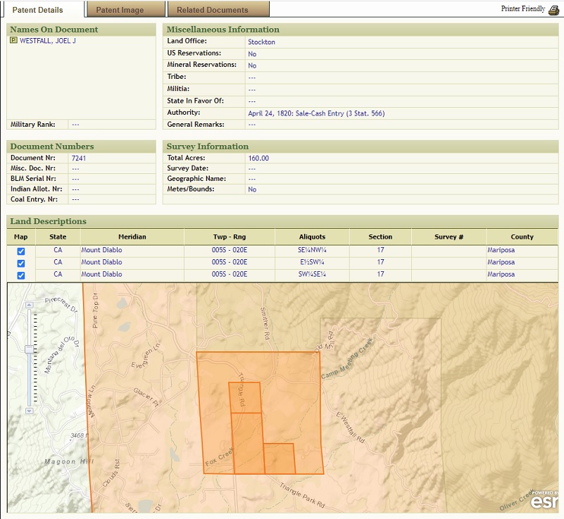
Joel J. Westfall Land Patent (BLM General Land Record Office)
1900: Living Township 5, Mariposa County, born 1819 Virginia, School Teacher, Wife Mary born July 1830 China
October 29, 1910: Joel James Westfall died Smithville, Ritchie County, West Virginia and has 2 gravesites. One is at the Mariposa Masonic Cemtery, Mariposa but is not actually buried there. From his Mariposa Find a Grave:
Joel Westfall died Sunday morning at Smithville, at the home of his son, J. R. Westfall, of diseases incident to old age. He was for a number of years a resident of California. He died at the advanced age of 94 [sic] years. Funeral services were held at the home on Monday at 1 p. m., by Rev. M. McNeil, and interment was made in the Westfall burying ground near Smithville, under the auspices of the Masons.–Ritchie (W. Va.) Standard, Oct 29.
Joel Westfall was for many years a prominent citizen of this county and a resident of Darrah. He served as a member of the Board of Supervisors for about sixteen years, representing the Fifth district. About six years ago he sold his property in this county and left for the home of his son in West Virginia to spend his remaining days. [Mariposa Gazette (California), 26 Nov 1910]
The second gravesite is at the Westfall Cemetery, Smithville, Ritchie County, West Virginia. From his Find a Grave for this cemetery:
At the age of 17, Joel was made lieutenant of Co. D, 133rd Regiment of the Virginia Militia, an office he held for seven years. After the flood of 1852 and the death of his young wife, a disheartened Joel left his only child, James Rienze (J.R.), with relatives and left West Virginia. In a letter written to his nephew, Charles Kuykendall Westfall in 1884, he said he left West Virginia on the 14th of April 1854, driving cattle across the plains from the state of Missouri to the state of California, arriving in Mariposa county, California on the 16th of October 1854. When the town of Mariposa burned on May 8,1858, Joel lost his saddle & harness shop to the flames and “was left to commence life in California again”. Joel served as Deputy Sheriff of Mariposa for four years. At the end of that term he was elected Road Commissioner & Supervisor, an office he held for sixteen years. For a number of years Joel had a 160 acre sheep ranch on the Old Wawona Trail and later opened his own meat market in Yosemite Valley. He was also a gold miner and it is said that one time he unearthed a nugget weighing nineteen ounces. Joel was also quite a hunter. He killed the largest bear on record in California, weighing in at one thousand pounds. Joel married his Chinese cook, Mary Tongere on November 21, 1863 because she didn’t want to go back to China. He and Mary lived in the ranch home he had built at what is now the corners of Triangle & East Westfall Road in Mariposa County. On October 6, 1906, Joel J. left California and returned to his home state of West Virginia where he lived the remaining years of his life with his son, J.R Westfall. This is why his death date is not inscribed on the tombstone in the Mariposa County Cemetery (pictured). Joel is not buried there.
According to the Lewis County West Virginia marriage records, Joel was first married to Eliza B. Mills on January 22, 1843. According to cemetery records for the Westfall Cemetery in Ritchie County West Virginia, Eliza died July 16, 1848. According to the above mentioned letter written to his nephew in 1884, Joel was married a second time to Julia A. Tinsler on June 23, 1850. As he left West Virginia in the spring of 1854, I am thinking that Julia died 1853-54. James Rienze Westfall was his child by Eliza B. Mills.
April 26, 1901: Mary Tongere Westfall died Mariposa County and is buried Mariposa Masonic Cemetery, Mariposa. Here is a wonderful picture of her on her Find a Grave site shared by Mary Carpenter. I tried to research her more but was unable to find much.
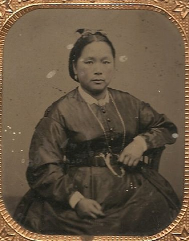
Mary Tongere Westfall (Photo From FindaGrave shared by Mary Carpenter0
And, if you are curious to find out how closely I am related to Joel James Westfall? Here it goes: He is my first cousin 5x removed of husband of 5th great aunt! There are other well known Westfalls in this area. Eldridge Westfall was one of the first rangers in this area. His Grave and WWI Draft Registration Card list his name as Waine Eldridge Westfall. Westfall was born in July 6, 1890 Lisbon, Linn County, Iowa to Charles Kuykendall Westfall and Elizabeth Jane “Jennie” Day. He died May 6, 1953 and is buried in the Mariposa Masonic Cemetery at Mariposa. On the 1900 Mariposa County Census, he was living in the household of his widowed grandmother, parents and siblings. His father’s occupation is listed as Preacher. Eldridge married Maud Gertrude Bonham 1914 and they had 2 children.
Here is a wonderful historic photograph from Yosemite National Park’s Digital Archives of the first Rangers in Yosemite National Park around 1915. Westfall is the 4th from the left.
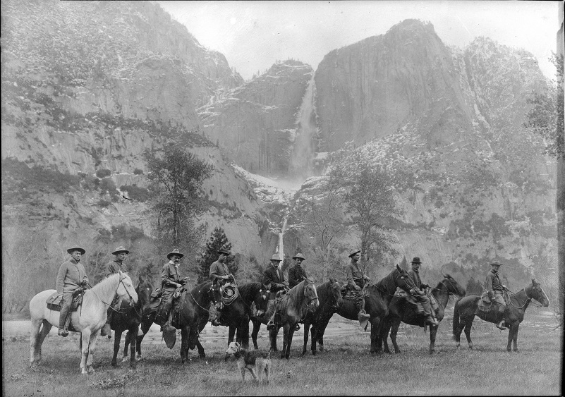
The First Rangers LEFT TO RIGHT: Oliver Prien, Chief Ranger; Charles Bull, Assist. Chief Ranger; Jack Gaylor, 2nd assist. to Chief Ranger; Wayne Westfall; George McNab, Charles Leidig, First Park Ranger in Yosemite; Charles Adair; Archie Leonard; Forest Townsley. (Courtesy Yosemite Nationa Park Digital Archives)
And here is Edridge’s uncle, Sampson Westfall, who patented 160 acres in sec. 26, T. 5 S., R. 21 E. in 1887.
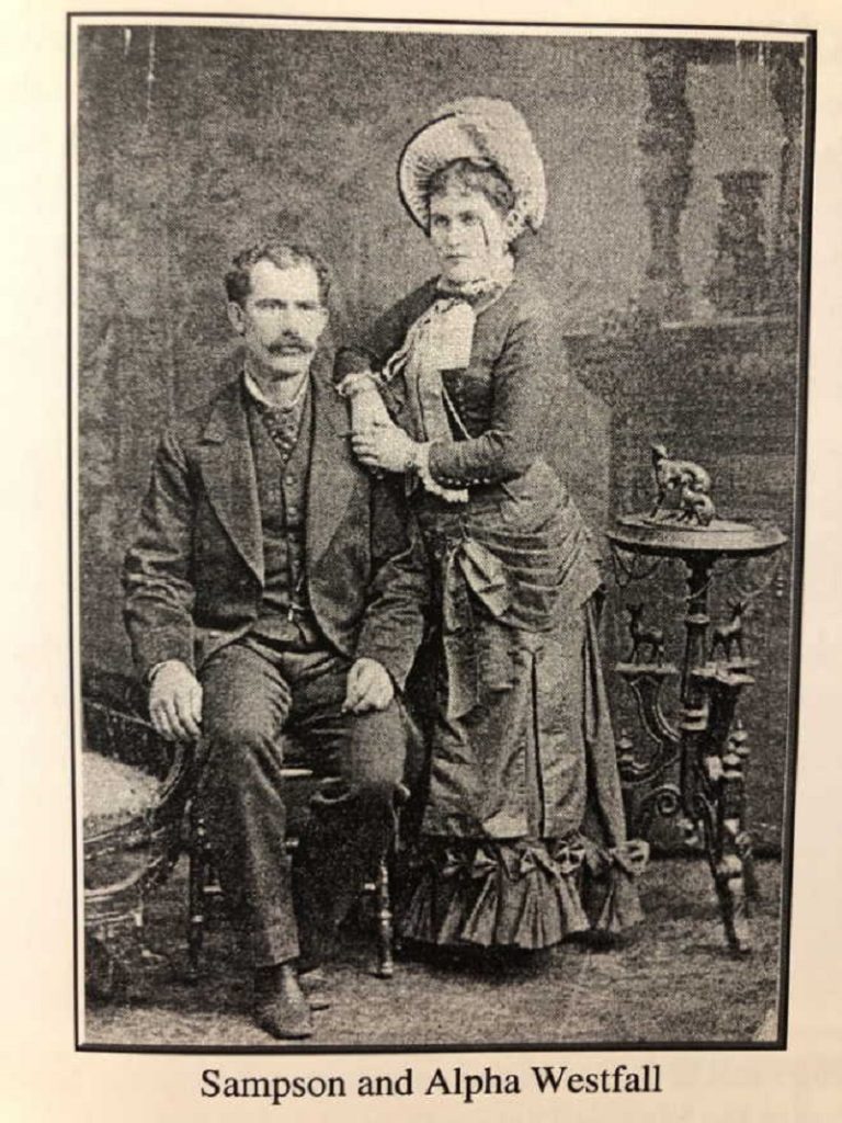
Sampson and Alpha Westfall (Photo Courtesy Jamie Westfall Rodriquez, Ancestry)
The way I figured out that Sampson was the uncle of Eldridge is through the obituary of Eldridge’s father, Reverand Charles Kuykendall “CK” Westfall, linked to his Find a Grave site. I did some digging, finding the information below:
Name: Sampson Wesley Westfall
Born: September 28, 1851 Ritchie, West Virginia
Married: About 1883 to Alpha C. ?
Children: Ethel G. Westfall born 1881 Fresno Flats (now Oakhurst), CA and Eldridge Grant Westfall born 1890 Fresno Flats (now Oakhurst), CA
Parents: James Barnes Westfall and Martha Jane Zickafoose
Died: June 14, 1925 Mariposa, CA
Buried: Mariposa Masonic Cemetery
And here is an interesting tidbit. He is shown on the 1880 Census living Hite Cove, working as a Saloon Keeper with the same occupation on the 1900 Census in Madera. Other Census and Voter Registration show his occupation as a Farmer. And this map shows the location of Sampson’s patent, just below Fish Camp.
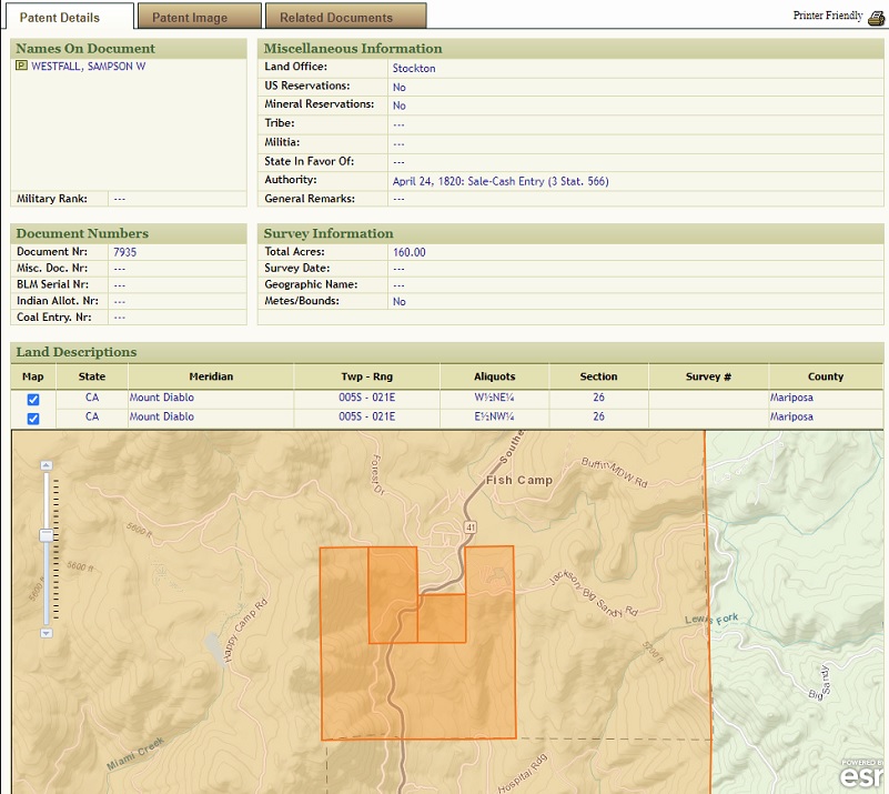
Sampson Westfall Land Patent (BLM General Land Record Office)
There are many Westfall families in this area and they appear to be related. Conflicting information is out there and if I have mistakenly gone down the wrong rabbit hole in my research, please let me know and I am happy to correct things. I tried to note the sources of my information with this research in this blog to help.
Swirling patterns outlined the location of the creeks that flows through the meadows.
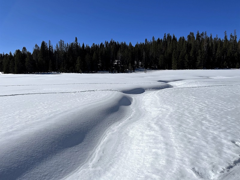
Photo by Gail Gilbert
Gail spotted some frosty pines and we checked out the ice crystals that were still on the trees at 11 am.
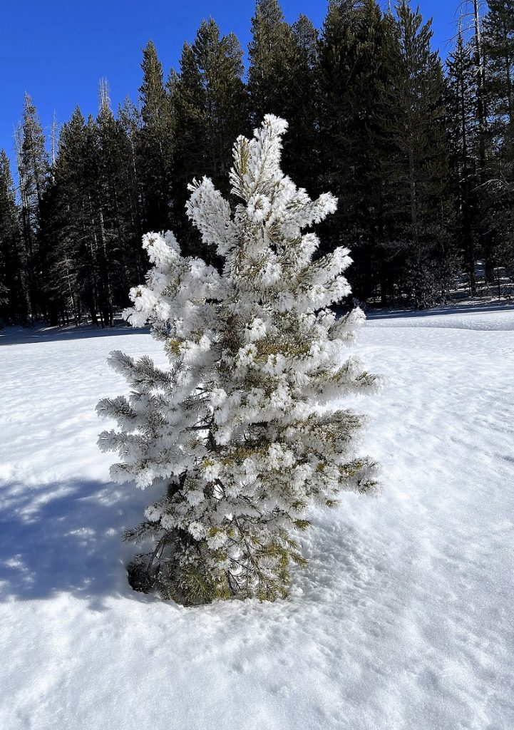
Photo by Gail Gilbert

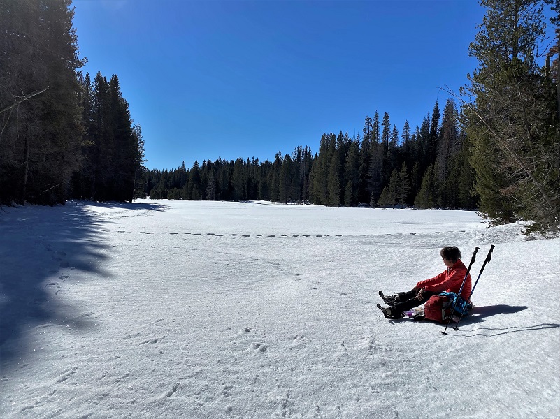
We took a short lunchbreak at the north side of Westfall Meadow, admiring the view.
 We followed the trail as it headed north out of the meadows.
 When we reached the intersection with Old Glacier Point Road, we followed the trail sign directions west on the to Old Glacier Point Road to Badger Pass.
We did not see a single person on the trail. We have taken alternate ways out of Westfall Meadows, heading straight out to Glacier Point Road instead of following Old Glacier Point Road. Sometimes the Old Glacier Road Trail can have debris on it after a good storm and makes it a little more of a challenge to climb over the down trees and limbs. Heading out to the well groomed Glacier Point Road can often be a little quicker. I tend to forget that the way out Old Glacier Point Road is a bit uphill. For some reason I remember it as rolling but in reality all of that rolling is uphill.
If you are interested in snowshowing out of Badger Pass Ski Area, they rent snowshoes and there are even guided snowshoe hikes. They are open through April 1 or as conditions permit. You can also check out their webcam, along with the rental and snowshoe hikes and current conditions at the Badger Pass Ski Area Page here. You can also follow them on Facebook here. Yosemite National Park has some great information on how you can safely enjoy winter sports at the link at the end of the blog. You can also access a PDF of their Glacier Point Road Winter Trails brochure on this link, which includes a map of the trails in the area with safety information.
Dog Hike? No
Dogs are not allowed on this Trail.
Where Pets Are Not Allowed
- On trails, including the trail to Vernal Fall (however, pets are allowed on the Wawona Meadow Loop)
- On unplowed roads covered in snow
- In undeveloped and wilderness areas
- In public buildings
- On shuttle buses
- In lodging areas
- In all walk-in and group campgrounds/campsites, including Camp 4
- In any other areas, as signed
These regulations protect both pets and wildlife from disease and each other. The National Park Service has prohibited pets on trails for many years. In particular, some pets chase wildlife, pollute water sources, and can become defensive and dangerous in unfamiliar surroundings. Pet owners have the burden to assure their pet does not damage the park values for others in those areas where pets are allowed.
Doarama:
What is a Doarama? It is a video playback of the GPS track overlaid on a 3 dimensional interactive map. If you “grab” the map, you can tilt it or spin it and look at it from different viewing angles. With the rabbit and turtle buttons, you can also speed it up, slow it down or pause it.
Snowshoeing Yosemite’s Merced Crest Doarama
Maps and Profile:
CALTOPO has some free options for mapping and here is a link to my hike this week: CALTOPO: Snowshoeing Yosemite’s Merced Crest
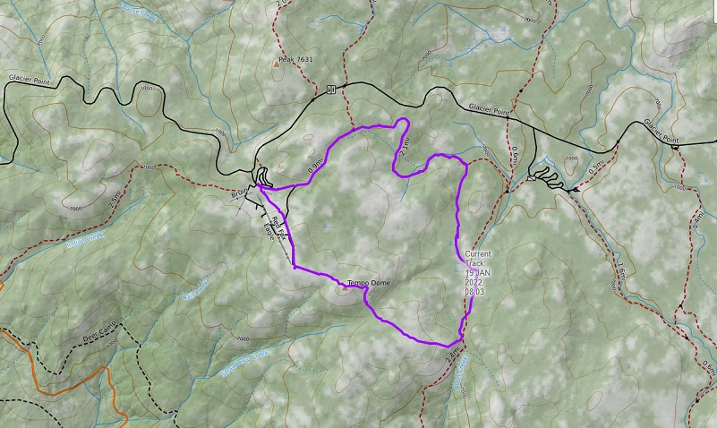
Snowshoeing Yosemite’s Merced Crest Topographic Map
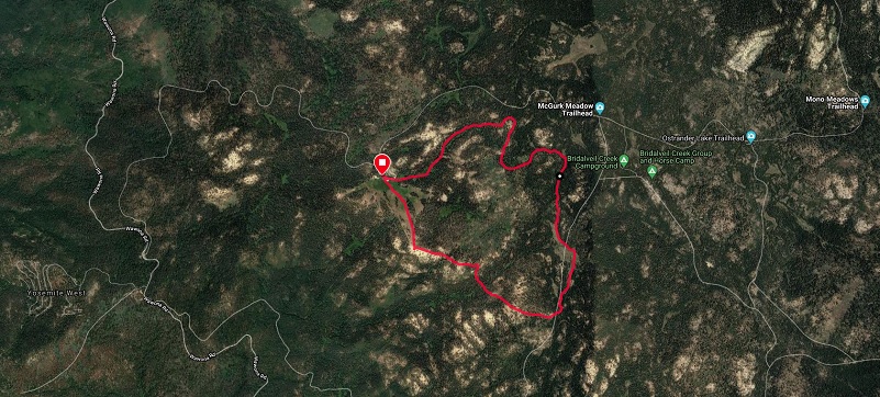
nowshoeing Yosemite’s Merced Crest Google Earth Image

Snowshoeing Yosemite’s Merced Crest Profile
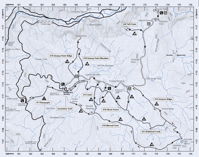
Glacier Point Winter Trails (Yosemite National Park, Yosemite Association, The Yosemite Fund)
Sources:
Yosemite Ski and Snowboard Area
THE YOSEMITE BOOK by Josiah D. Whitney (1869)
Browning, Peter, Yosemite Place Names, Great West Books, Lafayette, California, 1988.
Find a Grave Waine Eldridge Westfall
Find a Grace Rev Charles Kuykendall “C K” Westfall
Jamie Westfall Rodriquez Family Tree Ancestry.com
BLM General Land Office Records Samson Westfall
Glacier Point Winter Trails Map
Prior Blogs in This Area:
Snowshoeing the Merced Crest March 4, 2019
Snowshoe the Merced Crest January 28, 2016


Hey cousin! (My great grandfather (Leonard) was Joel J’s nephew.) I was looking at your family history and thought I would bring you up to date on Joel’s second wife, Mary Tingler. He apparently left her (hopefully divorced) – you can find her still in the WV census of 1860, 1870, possibly 1880 and 1910. 1860 she is living with her son William H. and possibly on the Tingler farm. In 1870 she is living with William and a 4 year old girl named Mary V. Westfall. By 1910 she is in an insane asylum. I love researching this family – there are so any colorful characters! Loved your pictures and article.
Thank you for sharing this family information. Sometimes we just see a name on a page and the information helps us understand more about their lives, some of these very tough.