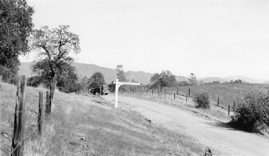
This photograph was taken somewhere very near the town of North Fork, but the exact location is not known, or in what year it was taken. There are a few clues in the photograph that might help you identify where and when it was shot.
One is the vehicle in the picture, and the other is the sign. The sign says “Sierra National Forest Boundary.” If you know the exact location of where this photograph was taken, please describe it so we can find it, and, if you know what make and year the vehicle is, please tell us at the bottom of this page, or send your information to northforkhistorygroup@gmail.com .
It takes a community to solve a History Mystery!


Two guesses. Best guess, Central camp road. Next best, Minarets Hwy aka Sierra Vista Scenic Byway
29 Ford? And I don’t think that’s central camp road, the trees are wrong. Possibly Walker grade? Oaks….
Looks to me like it is on the way into or towards North Fork or Bass Lake as it kind of looks like Peckinpah range is the far mountain range. Looks familiar. I used to drive around a lot when I lived in North Fork. Hehehe
I would say a Ford Model A sedan, the spare tire carrier is on the driver’s side, 1928-1931.
The ridge profile in the background looks like viewing from the old rd 200, perhaps near Duke Rd.
29 ford,and some where near sterns apple orchard,on minarets road
Looks like Road 200 as it curves just past Duke Road. To the right on the other side of the wooden fence is a dirt road that could be the future White Oak Road.