Just a short hike up to a pretty lake with Fannie the Corgi. We made this hike when the very rare plant named Shuteye Peak faun lily was blooming. Although almost a month has gone by since we did this hike, it will still be a nice, short hike but watch for rattlesnakes and bring your bug spray! Oh, and I added a little about Fannie’s Rattlesnake Avoidance Training.
Where: Sierra National Forest
Distance: 5.51 Miles (but shorter if you start at Cold Springs)
Difficulty: Easy
Elevation Range: 7,129′ – 7,493′
Elevation Gain: 440′
Date: May 23, 2022
CALTOPO: Hiking to Chilkoot Lake
Dog Hike? Yes
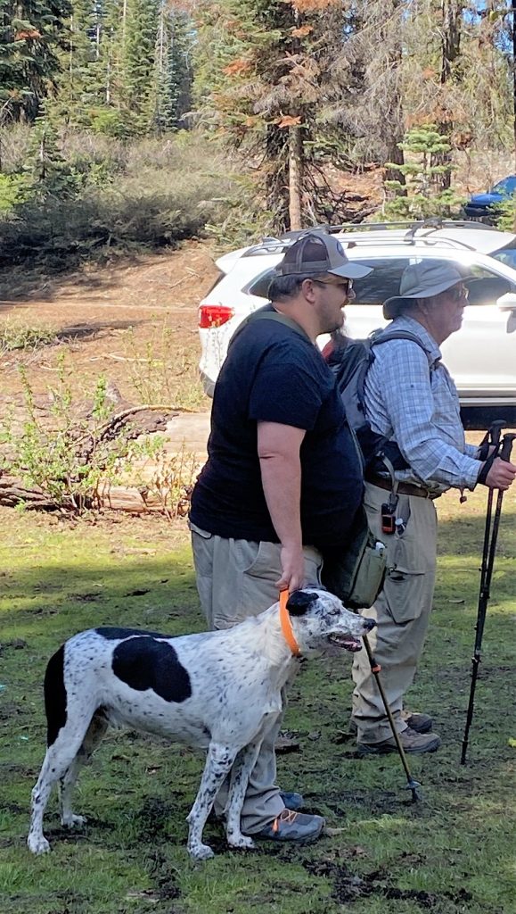
Fannie the Corgi and I joined the Sierra Senior Hikers on an adventure. Two hikes were scheduled from the same trailhead and we all met up at Von’s in Oakhurst to caravan up Beasore Rd. above Bass Lake, our unmarked trailhead about a mile above the intersection of Central Camp Road and about 1/2 mile before the Cold Springs Summit. There was a dirt parking area on the left side of the road but plenty more parking along the right side. We circled around our hike leaders to understand the hiking for the day. One of the group was heading up to Little Shuteye Peak and the group I was with was heading to Chilkoot Lake. Rich Leyden was the leader of our hike, which was basically along USFS roads to and around the lake.

One other dog joined our group to Chilkoot Lake.
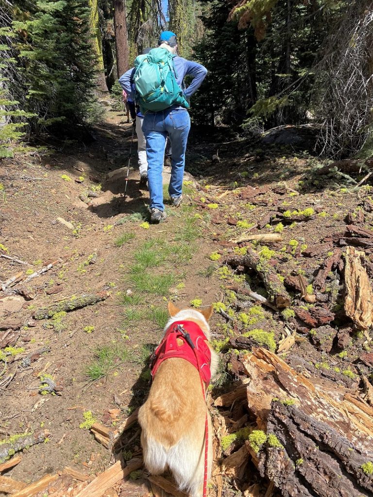
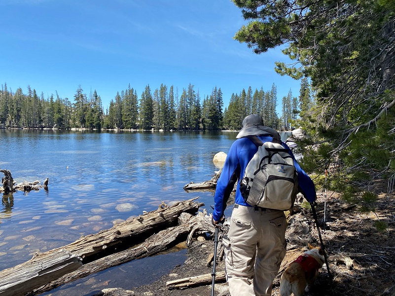
Both groups headed out, our group heading up the trail, which was an old dirt road, toward Chilkoot Lake.
It didn’t take us long to reach Chilkoot Lake, only a couple of miles. If we had parked at Cold Springs, it would have taken us about 1 mile.
The lake is part of PG&E’s Crane Valley Project, constructed between 1895 and 1920 by the San Joaquin Power Company, which later became the San Joaquin Light and Power Corporation. The Crane Valley Project consists of five hydroelectric powerhouses, as well as Bass Lake and Chilkoot Lake dams that form storage reservoirs and seven smaller diversion dams along the north and south forks of Willow Creek. From the California Public Utilities Commission:
Chilkoot Lake is the upper facility of the project, primarily fed by Chilkoot Lake Pick-up Ditch, a rock channel that diverts runoff from Chiquito Creek. The lake has a designed usable capacity of 308 acre-feet (af) at an elevation of 7,497 feet above mean sea level (msl). The Chilkoot Dam is a rock-filled structure at the southwest end of Chilkoot Lake. The lake encompasses 57 acres. The dam includes a concrete-lined, steel outlet pipe that is located three feet below the toe of the dam, and discharges into Chilkoot Creek. In late spring of every year, water is released from Chilkoot Lake to Chilkoot Creek, where it flows into North Fork Willow Creek and eventually into Bass Lake.
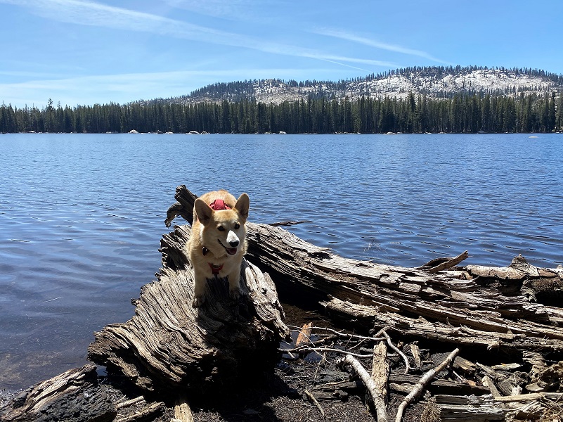
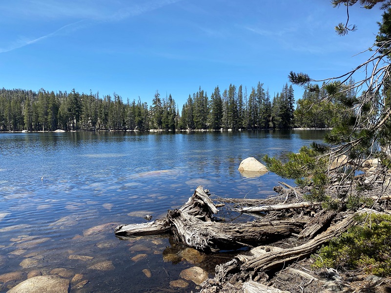
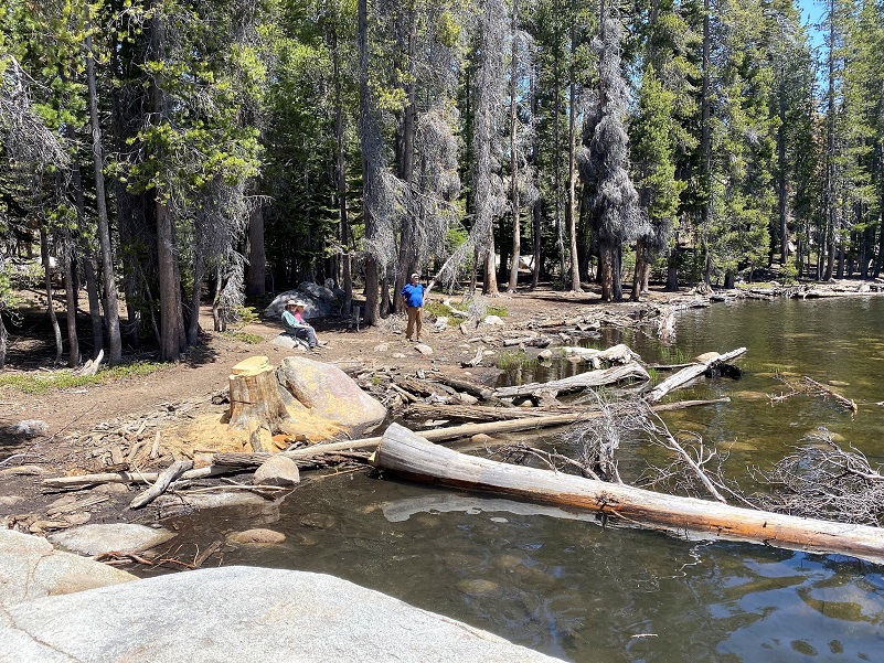
We wandered along the lake, working out way down to the dam.
Then it started getting a bit too brushy and we turned around.

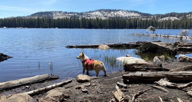
We stopped at the edge of the lake for a while and Fannie and I took in the view.

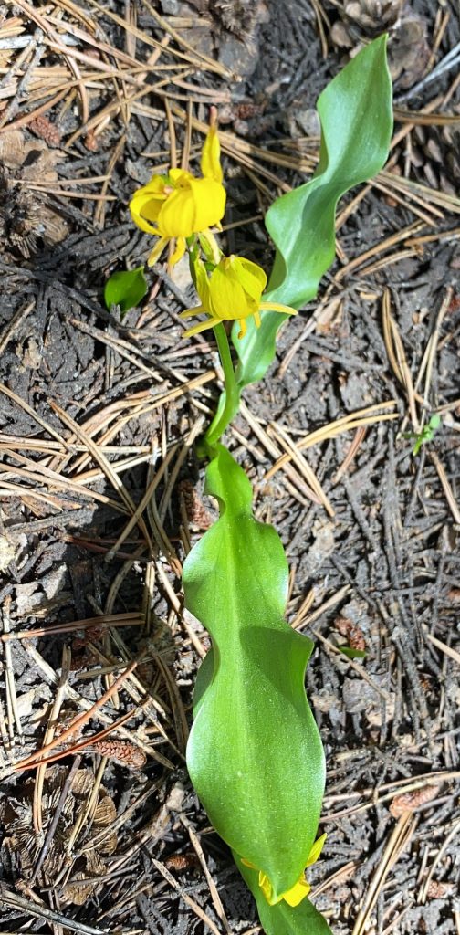
After a bit, we decided to wander up the northeast side of the lake. I noticed plenty of lilies starting to bloom but my pictures did not turn out very good. Don’t believe me about how bad the picture was?
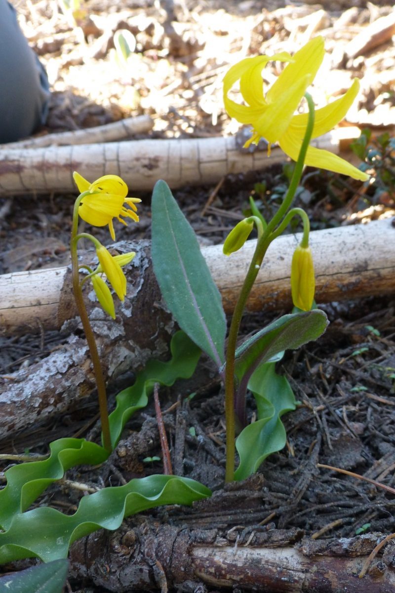
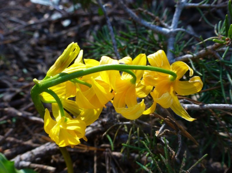
But you are in luck because here are some better ones from a prior year’s visit to this area of the same flower. I think it might be a very rare plant named Shuteye Peak faun lily and only known to be found from Chiquito Ridge and Shuteye Peak in the San Joaquin River watershed. Their blooms don’t last very long and I feel bad that I am showing you how pretty they are when they are probably finished blooming for the season.
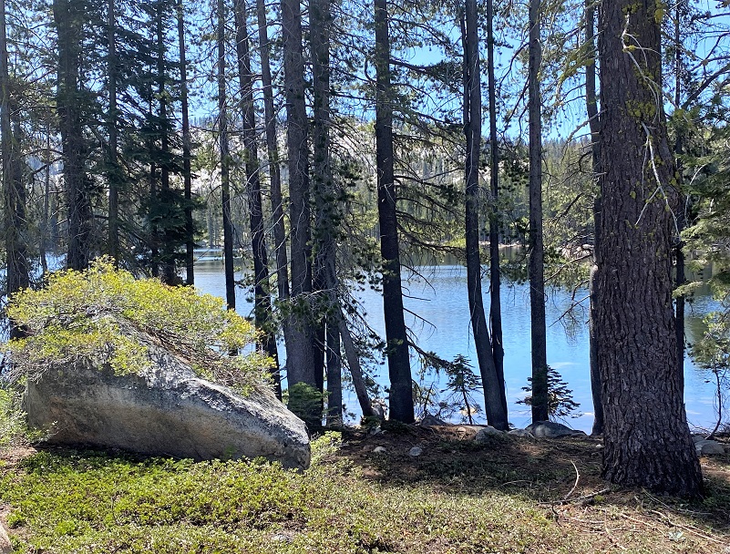
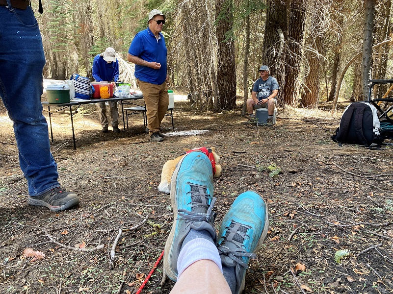
Some of us turned around and headed back to the west side of the lake and I found a really good spot to sit and have my lunch. Others found nice spots in the shade or on logs.
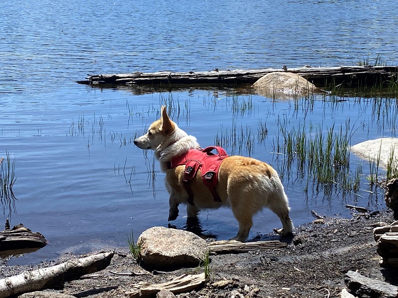
Fannie also had her lunch.
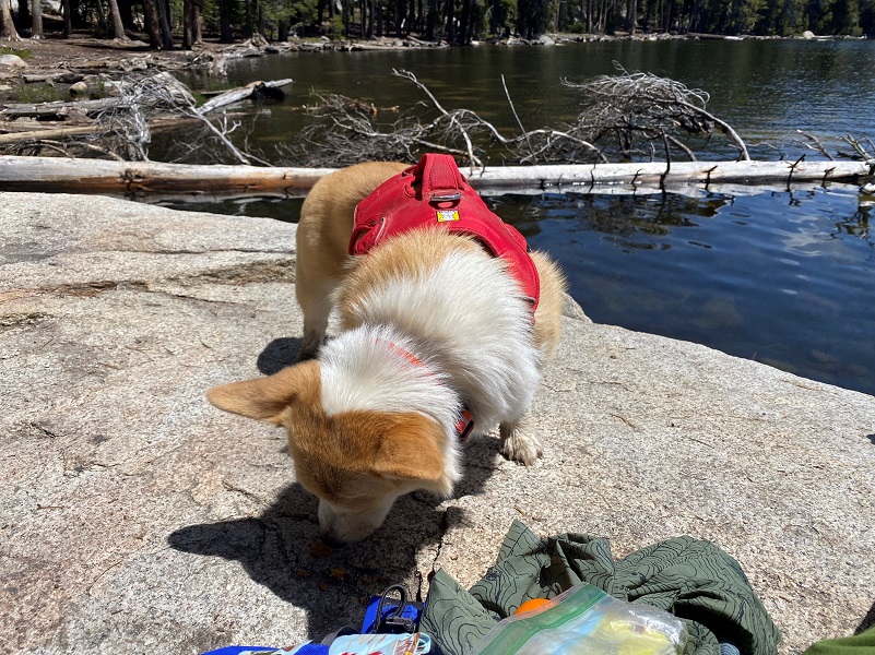
Pretty nice lunch spot!

After we were full and had rested a bit, we headed back the same way we had come in. The Sierra Senior Hikers gathered the wagons so to speak, tailgating with cold beverages and goodies that we had brought.
I kept Fannie on leash until we reached the lake. There are rattlesnakes in this area and even though it was a cool day, I didn’t want her to stumble across one and get bit. Fannie gets her Rattlesnake Vaccine Booster each year and she just went through her refresher Rattlesnake Avoidance Training with Snakeworx in Mariposa. Over the past 2 decades or so, I have taken my dogs through this training. Sally has been through it twice and the last time, they did not think she needed to come back for a refresher. Fannie was 6 months old at the time and they did recommend she return for a refresher. Information on Snakeworx is below (including their schedule) and they shared that they plan on being back in Mariposa for training in December. Here is a short video of Fannie at her training although I missed videoing the first station. You might like to see what is involved.
Dog Hike?
I think this could be a good dog hike but be aware of the critters in this area such as rattlesnakes, bear, deer, coyotes and others that a dog could tangle with. This area can be swampy at different times and I would be careful to not let your dog drink in stagnant waters.
The Sierra National Forest has a short article called Canine Camper that you can access here. Even though this is not classified as a wilderness area, here is what they have on their website:
Domestic pets are allowed in wilderness areas. You are responsible for their actions as well as their welfare. Pets should either be leashed or under direct voice control. When camping in areas with other visitors, pets should be kept on a leash. Wilderness visitor’s who plan to travel into an adjacent National Park should be aware that National Parks do not permit pets.
We ask the public to remember these rules when taking pets into the wilderness.
- Bury feces.
- Do not tie up dogs and leave them unattended.
- Do not allow dogs to chase wildlife.
- Leave unfriendly or loud dogs at home.
Doarama:
What is a Doarama? It is a video playback of the GPS track overlaid on a 3 dimensional interactive map. If you “grab” the map, you can tilt it or spin it and look at it from different viewing angles. With the rabbit and turtle buttons, you can also speed it up, slow it down or pause it.
Hiking to Chilkoot Lake Doarama
Map and Profile:
CALTOPO has some free options for mapping and here is a link to my hike this week: CALTOPO: Hiking to Chilkoot Lake
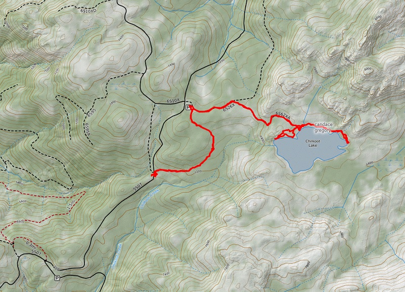
Hiking With Fannie to Chilkoot Lake Topographic Map
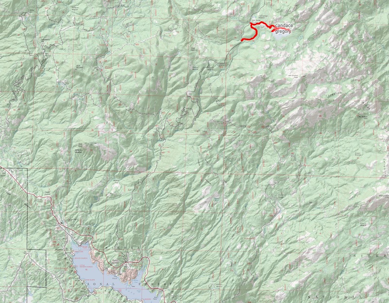
Hiking With Fannie to Chilkoot Lake USFS Map
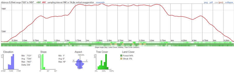
Hiking With Fannie to Chilkoot Lake Profile
Prior Blogs in the Area:
Hiking up to Little Shuteye Peak June 14, 2017
Sources:
Crane Valley hydroelectric facilities Hydroreview
CPUC Project Description Crane Valley Project
Shuteye Peak Faun Lily California Native Plant Society


