I try my best to hike up to Helen Lake while there is a smidge of ice still on it. There is something special about how a bit of white snow sets off the red colors of the surrounding mountains and it is a lovely hike up a historic Native American trail and mining route.
Where: Yosemite National Park
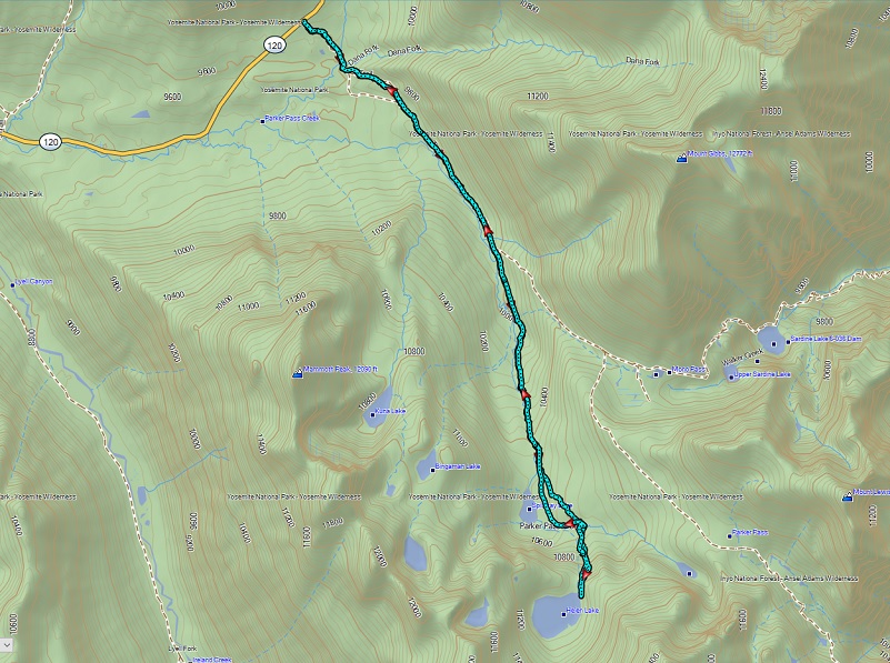
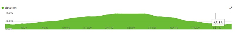
Distance: 10.38 Miles
Difficulty: Moderate to Strenuous
Elevation Range: 9,596′ – 10,967′
Date: July 10, 2019
Maps: Falls Ridge and June Lake Topogs
Dog Hike? No
 We headed east on Tioga Road, parking our car at the Mono Pass Trailhead, about 5.6 miles east of the Tuolumne Meadows Campground and 1.4 miles south of Tioga Pass. After putting our snacks and cold drinks for after the hike and anything else that a bear might find irresistible in the bear box, we used the restroom. We weren’t sure if the mosquitoes were out but didn’t want to take a chance so we really sprayed down with mosquito repellent plus brought it along with us. A breeze was forecasted for the afternoon that would blow those flying guys away and that would be our best bet on those skeeters because they can be really bad in this area.
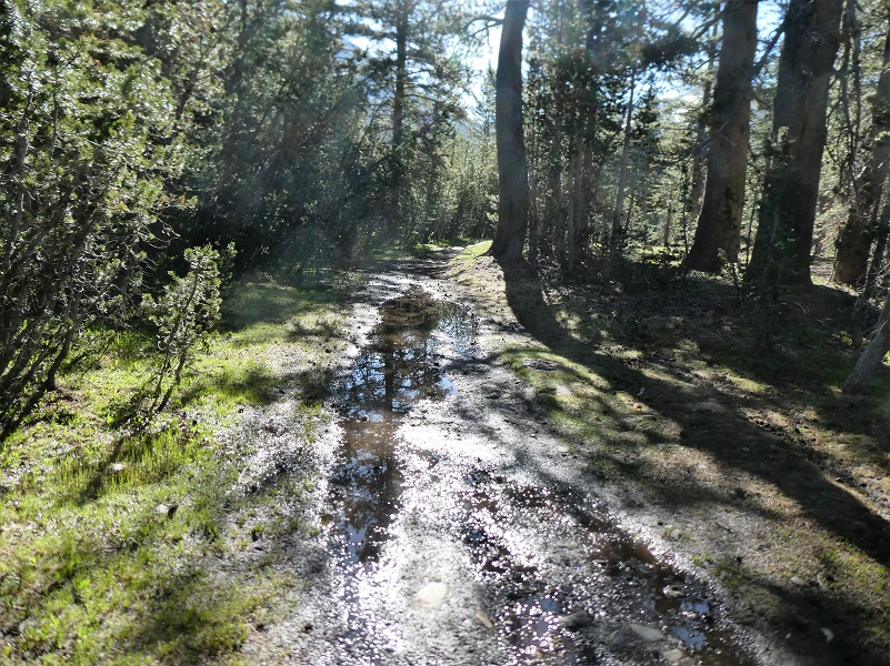
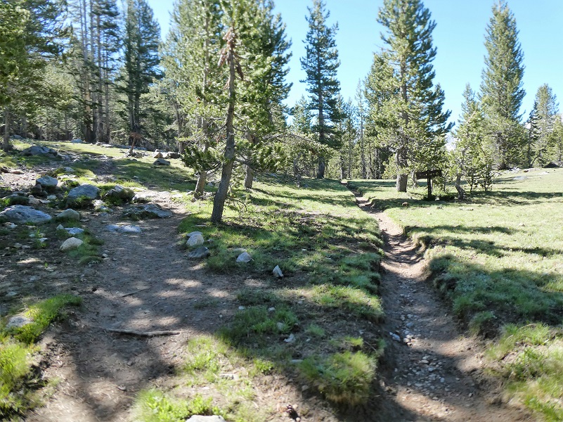
The trail was wet in many areas with small creeks running down it in some. The Mono Pass Trail is an old Indian trail that was “discovered” by Americans around 1852 when Army Lieutenant Tredwell Moore pursued Yosemite’s Chief Tenaya’s band through Tuolumne Meadows and over Mono Pass. The Army did not catch up with him that day.
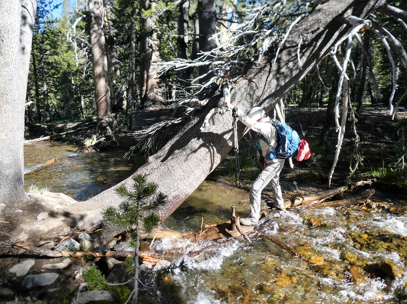 We headed up the trail and about 1/3 of a mile along the trail, we needed to cross the Dana Fork. We had brought our Crocs in case we needed to cross through deeper water but we lucked out. We found a great group of logs in the water with handy support handles in the form of branch stubs on a tree.
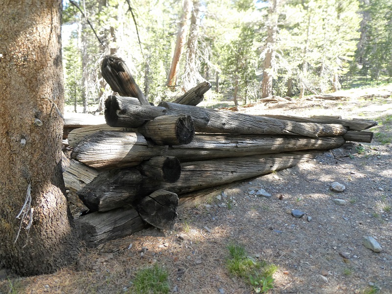
We passed by the remains of an old cabin that probably belonged to a miner who walked down this same trail, which was a rough road utilized for silver mining that occurred in this area as early as the 1860s. The largest mines were the Golden Crown and the Ella Boss but there were many smaller mining efforts in this area. The Golden Crown Mine was established in 1879 by Orlando Fuller during the Tioga silver boom that also produced Bennettville and the Great Sierra Mine near Tioga Pass. Although the potential of these mines was talked up quite a bit, they were abandoned by 1890. Each year this old cabin year gets closer back to nothing and I always like to snap a picture of it for fear that the next time I pass by it won’t be here.
After about 2 miles, the trail split, the left fork heading to Mono Pass and we stayed on the right fork toward Spillway Lake.
It wasn’t too long before we started coming out of the trees with a meadow in front of us and our first peek of where we were headed.
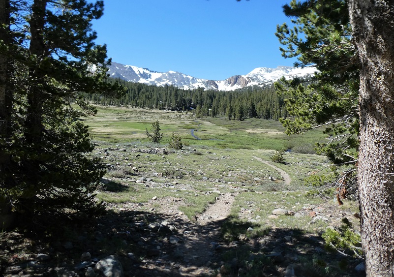
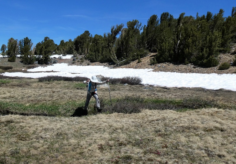
The meadow was extra wet and swampy so we hugged the eastern side of it, staying on the hill till we reached the top of the meadow.

Photo by Gail Gilbert
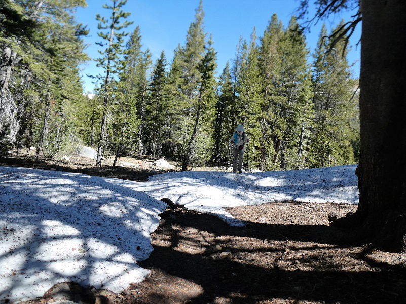
And that is where the trail started getting a few snow drifts.
We all just love this spot of Parker Pass Creek when the snow is still hanging over it and we get a closer look at the snowy mountains behind Spillway Lake.

As we reached the area of Spillway Lake, I spotted something hopping through the grass and watched it take refuge in a small creek. Can you spot the Yosemite Toad?
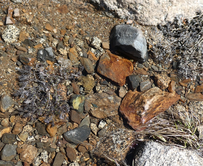
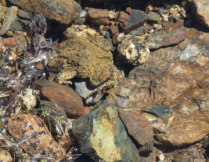
The Yosemite Toad is a threatened species, likely to become endangered in the foreseeable future throughout all or a significant portion of its range. It is indigenous to California, found only in a 150 mile span of the Sierra Nevada Mountains from Ebbetts Pass in Alpine County in the north to Fresno and northern Inyo Counties in the south. It is a medium-sized toad, usually about 1.2 to 2.8 inches in length, found in wet meadows and forests at high elevations. Once abundant, this species has been in dramatic decline for several decades and is now found primarily on publicly managed lands at high elevations, including streams, lakes, ponds, and meadow habitats located within national forests and national parks.
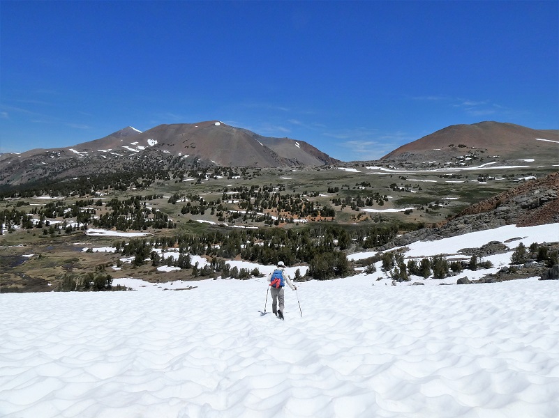
We decided to bypass the shore of Spillway Lake and headed cross country up on the hills east of the lake. We did this for a couple of reasons. We wanted to gain elevation for our approach to Helen Lake and by leaving the wet, swampy area adjacent to Spillway Lake, we also left the possible mosquitoes.

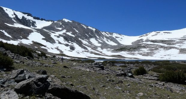
Spillway Lake (10,476′ elevation )
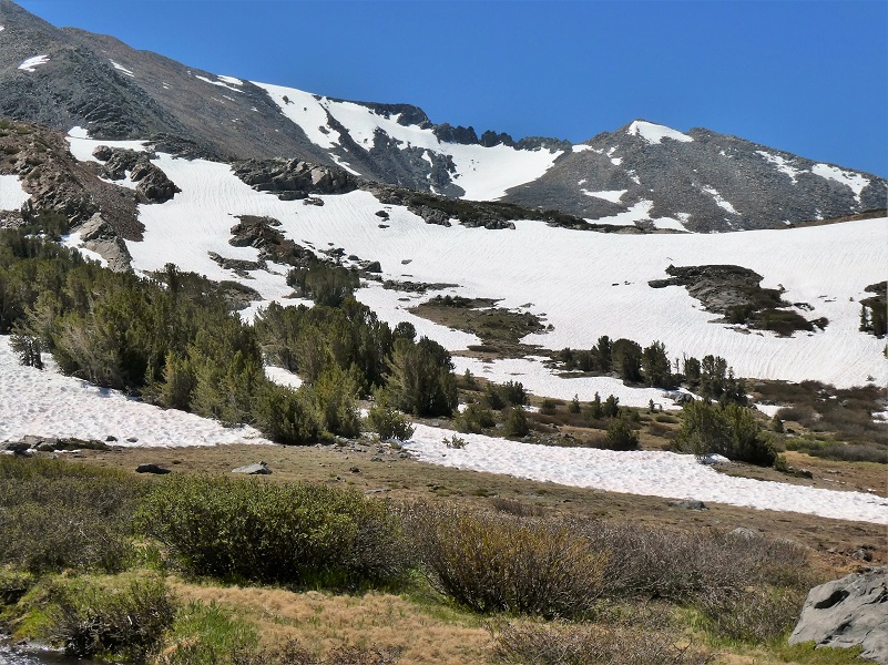
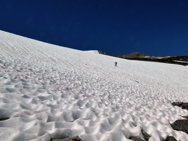
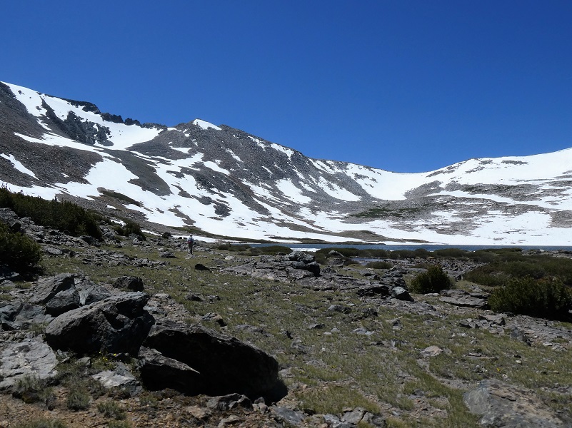
Now we could really see our approach to Helen Lake and it was mighty white. There was plenty of snow and I just hoped those suncups weren’t too bad or icy.
We still had a few small creeks to hop but did it with no problem.
We started heading up through the snow, trying to hug dry ground when we could and the view was spectacular.
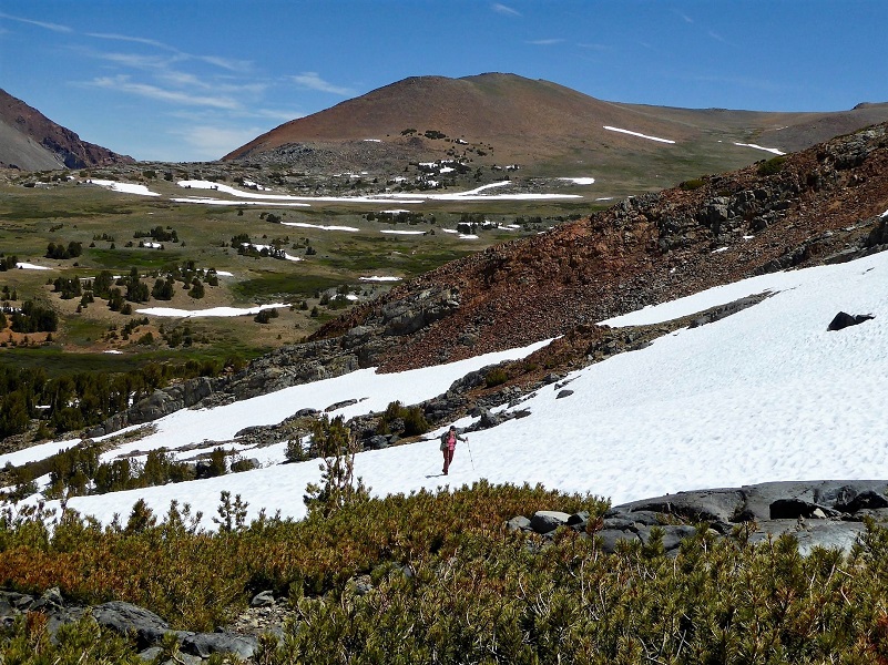
Photo by Gail Gilbert
We each picked out different approaches, both loaded with snow and just put one foot in front of the other.


What a view!
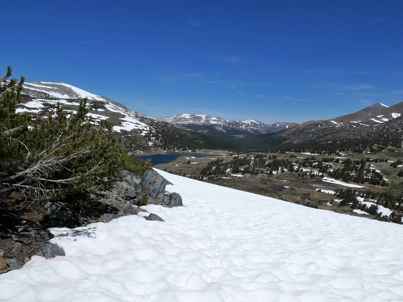
Looking Toward Spillway Lake
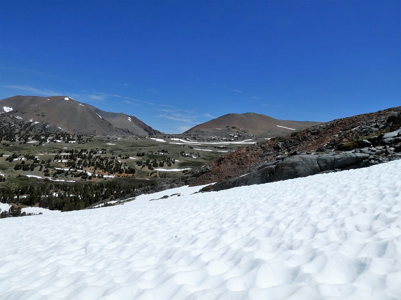
Looking to the East Toward Mono Pass
We reached Helen Lake sooner than I thought we would. This beautiful lake is named after John Muir’s youngest daughter, Helen Lillian Muir. She was born January 1886 in California and died in 1964. She married Buel Alvin Funk in 1909 and moved to Belleville in San Bernardino County, California. Helen was often sick and the doctors thought that the desert air might help her health improve.
Belleville was a mining boomtown near Holcomb Valley and although the gold rush that hit this area from about 1860 to 1870 was long over, hard rock mining still took place up to about 1919. Helen’s husband Buel is listed as a Farmer on the 1920 through 1930 census in Belleville, owning their property after the 1910 census. The Funks continued to live in Belleville til at least the 1930 census and Buel died in 1934. Helen died in Spokane, Washington and is buried at the Bellevue Cemetery and Mausoleum in Ontario, California.
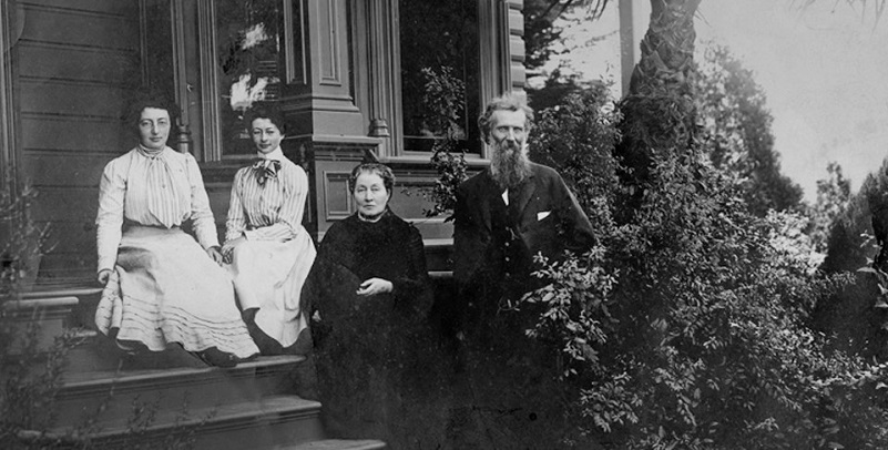
John Muir with wife Louie (Louisa) and daughters Helen and Wanda on the front steps of the Martinez home (Photo Courtesy National Park Service)
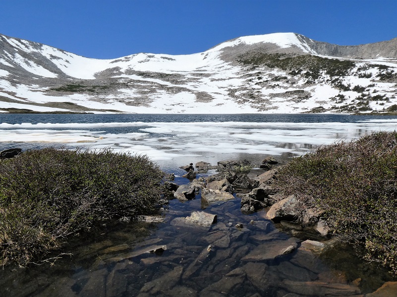
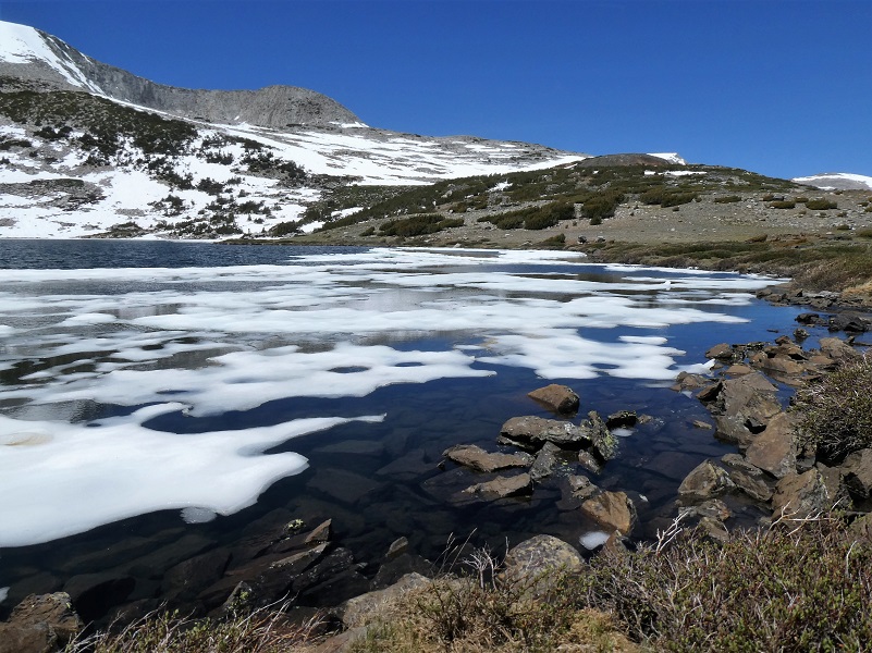
Helen Lake (10,945′ elevation)
And some ice still lingered on the lake near the outlet.
Helen Lake
Not a bad lunch spot!
Helen Lake
Time to head down.
We lucked out and had a nice breeze all day. That was a good thing because it kept us cool but it was even a better thing because it kept the mosquitoes and gnats away from us. Those flying critters can be really bad in the Spillway Lake area. We brought bug protection for our heads just in case but didn’t need them this time but I recall some horrible times that we had in this area with our pants and shirts covered in mosquitoes. If this happens to you, get higher up on the hill above Spillway Lake and they won’t be so bad.
Dog Hike?
No, dogs not allowed in Yosemite National Park Wilderness.
Doarama:
What is a Doarama? It is a video playback of the GPS track overlaid on a 3 dimensional interactive map. If you “grab” the map, you can tilt it or spin it and look at it from different viewing angles. With the rabbit and turtle buttons, you can also speed it up, slow it down or pause it.
Helen & Spillway Lakes Hike Doarama
Map and Profile:
Sources:
John Muir: A Passion for Nature NPS
Yosemite Toad US Fish & Wildlife
Prior Blogs in the Area:
Hiking to Spillway and Helen Lakes July 6, 2018
Hiking up to Spillway and Helen Lakes August 1, 2017
Hiking up to Spillway and Helen Lakes June 29, 2016
Hiking on the Mono Trail to Spillway and Helen Lakes June 8 2014
Hiking and Fishing High Lakes along the Mono Pass Trail August 14, 2013
Hiking with the Yosemite Toad to Helen & Spillway Lakes June 7, 2013
