MARIPOSA COUNTY – Firefighters has a busy night on the line as the Ferguson Fire has now grown to 9,266 acres and is just 2 percent contained.
The fire is burning around the South Fork of the Merced River, south of Highway 140 between Mariposa and Yosemite National Park.
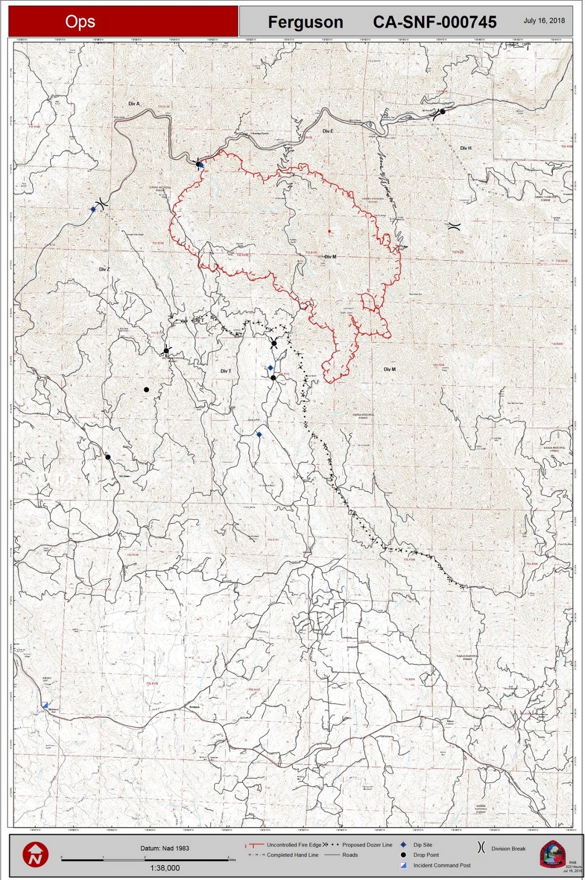
There are currently 332 personnel assigned to the incident including 34 engines, 6 hand crews, 3 dozers, 4 helicopters, 2 water tenders and fixed-wing aircraft as smoke conditions allow.
The biggest concern today for fire managers is the Jerseydale/ Mariposa Pines area where the fire made a big run yesterday afternoon. Structure protection engines are in place, and crews were able to get some containment line in overnight.
Fire officials say they expect the fire to reach the communities of Jerseydale and Mariposa Pines by this afternoon. Both are under evacuation orders.
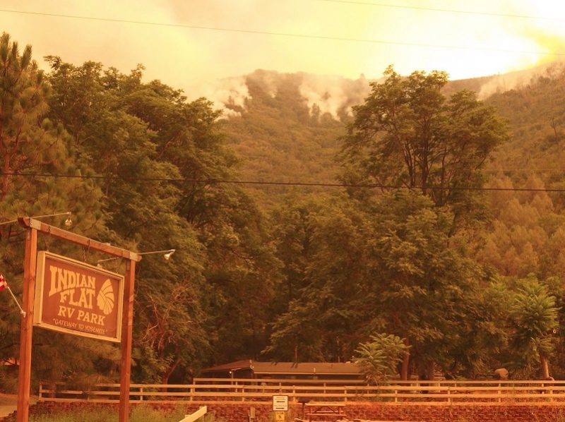
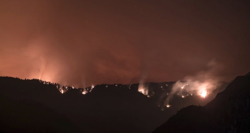
Indian Flat RV Park on Ferguson Fire – photo USFS
Crews successfully held the fire along Highway 140 and protected structures as the fire showed significant growth to the south in Nutmeg and Devils Gulch area.
Firefighters are working to secure lines on the northeast to keep the fire from moving toward El Portal and Yosemite West.
Crews initiated several important new containment lines including Sweetwater Ridge on the southwest flank of the fire. Contingency lines are also being established on the fire’s eastern flank to check the fire’s movement toward Yosemite West.
Structure protection engines have arrived and are setting up to protect homes and businesses between the Cedar Lodge area and Hite’s Cove.
Additional engines are being inserted into Jerseydale and Yosemite West to formulate structure protection plans. Firefighters have also begun construction of contingency lines along Sweetwater Ridge south of the fire and along the Pinoch Ridge on the north flank.
Firefighters are aggressively attacking the fire at locations where they have the highest probability of success and they have adequate time to construct fireline ahead of its advance.
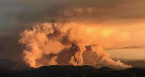
Ferguson Fire from Rancheria Flat El Portal – photo by Dustin Garrison
Because the fire has now moved into Cal Fire’s areas of protection (State Responsibility Area), it is now under Unified Command with Cal Fire, US Forest Service and the Mariposa County Sheriff’s Office.
There are currently 108 structures threatened, including 70 homes, 3 commercial buildings, and 35 outbuildings. An estimated 500 personnel are assigned to the incident.
We will follow operations on the fire throughout the day and provide a detailed report after the evening briefing, and will update this article as new information comes in this morning.
For details of yesterday’s fire activity, click here.
Temperatures on the fireline will remain hot and dry with the possibility of thunderstorms midweek.
Smoke is expected to continue to impact adjoining communities, especially during night and early morning hours. You can learn more about air quality, and daily smoke forecasts by visiting either www.airnow.gov or www.valleyair.org.
So far no structures have been lost and no injuries reported. There has been one fatality on the fire.
The Ferguson Fire started on Friday, July 13, at 8:30 p.m. The cause remains under investigation.
For information please call 530-377-6221, or to register for incident updates via email please visit www.tinyurl.com/fergusonfire.
Evacuations
At 10:45 a.m. this morning, a fire advisement was issued for the following locations:
- Lushmeadows Community
- Ponderosa Basin Community
- Triangle Road from Jerseydale Road to Highway 49 South including all side roads
- Darrah Road from Triangle to Sherrod Road
- East side of Highway 49S from Darrah Road to Harris Cuttoff Road – This includes Boyer Road, Woodland Area, Wass Road and Tip Top Road
This is NOT an Evacuation Order. This is an advisement only of a potential Evacuation Order should conditions change.
Should this area come under a Mandatory Evacuation Order you will be notified via the Sheriff’s Office Emergency Alert System by text, email and a voice call, the Mariposa County Sheriff’s Office Facebook page, and door-to-door communication by Sheriff’s Office staff. At that time you will be notified of the best routes of travel to safely evacuate your residence.
A fire advisement has also been issued for the Yosemite West area of Mariposa County.
Savage Trading Post, Redbud Lodge, Cedar Lodge, Indian Flat Campground, Mariposa Pines, Jerseydale and Ferguson Ridge are under a mandatory evacuation order, and the BLM campgrounds in Briceburg are closed until further notice.
A Red Cross Evacuation Center has been established at the New Life Christian Church located at 5089 Cole Road in Mariposa. If you have been evacuated due to the Ferguson Fire, the Sheriff’s Office asks that you please check in with the Red Cross Shelter even if you do not plan to stay there.
The Central California Animal Disaster Team is working in coordination with Mariposa Animal Control in dealing with small animals. Right now, they are referring pet owners with small animals to the Mariposa SPCA. If you need assistance with large animal evacuation please call the Mariposa County Sheriff’s Office at 209-966-3615.
Road Closures
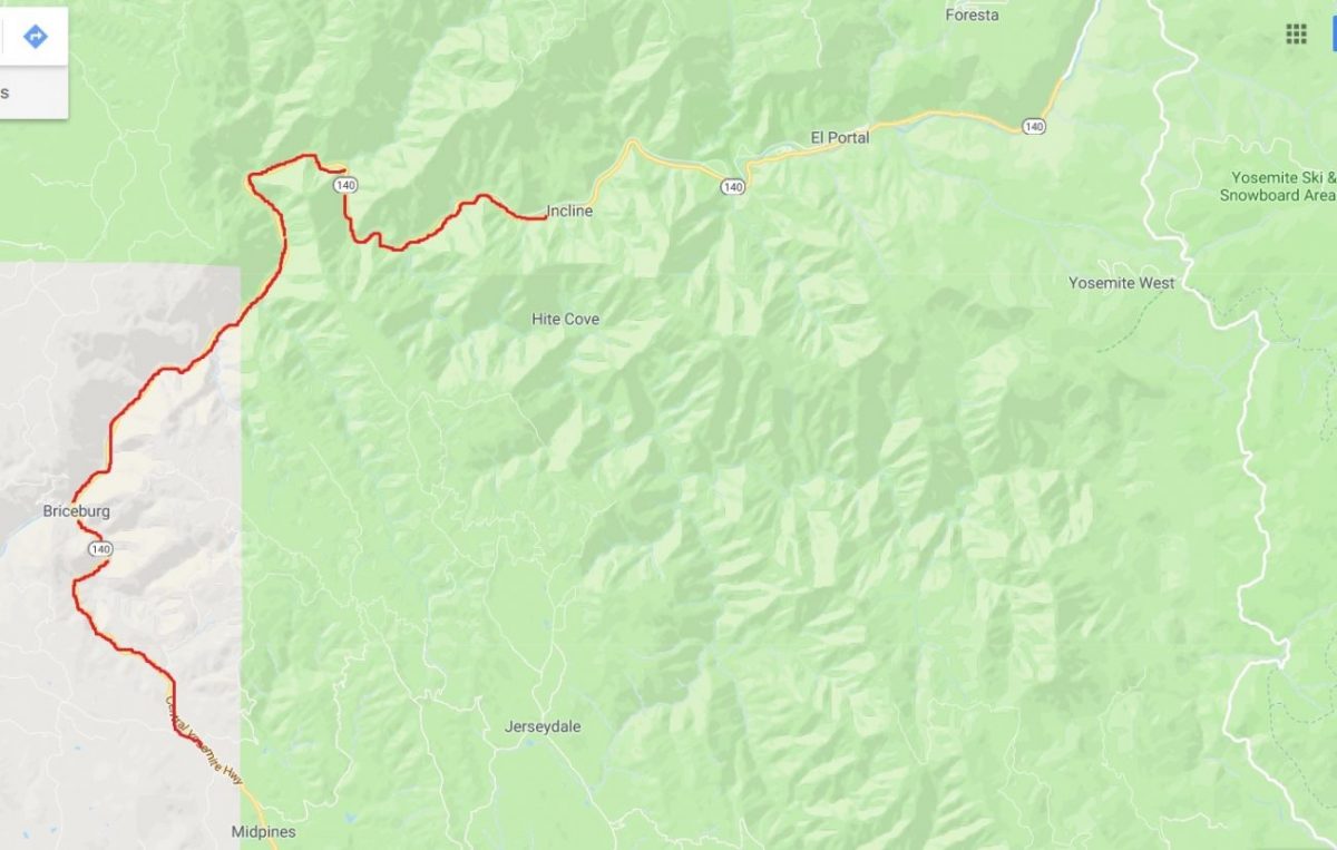
Highway 140 remains closed from 1.9 miles east of Midpines at the climbing lane to 1.4 miles east of Incline at Foresta Road (see map below).
Also closed are Jerseydale Road, Hites Cove Road and all side roads from Triangle Road to the end of Hites Cove Road.
Other road closures included River Road from Briceburg to the gate at Railroad Flat and all campground areas are closed. Hites Cove Road from Bear Clover Road to the Merced River.