MARIPOSA COUNTY – Firefighters, residents and law enforcement have settled in for the long haul as the Ferguson Fire continues to grow.
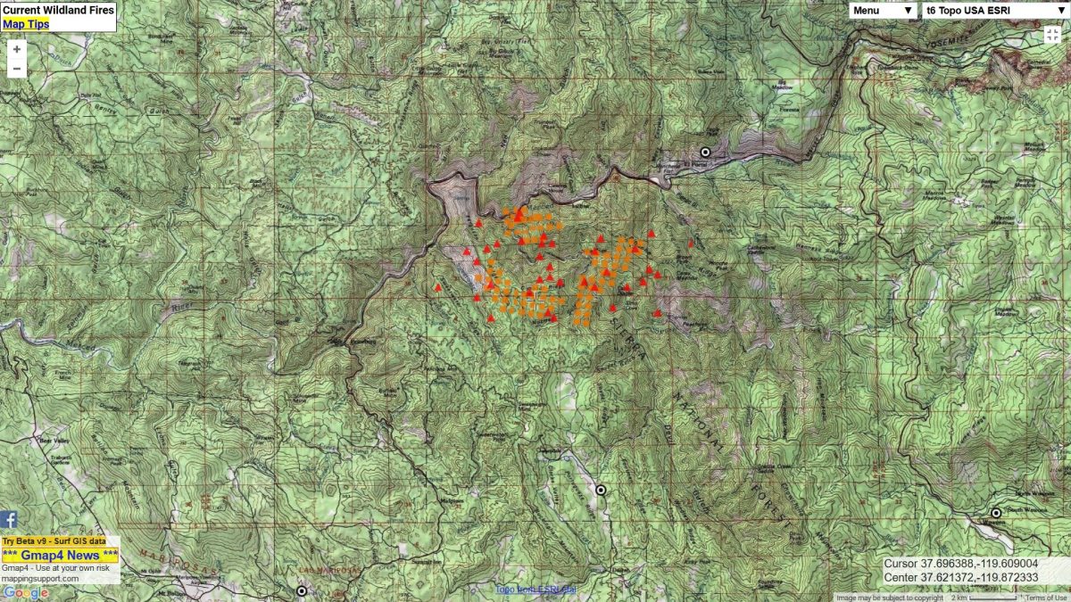
As of 3 p.m today, the fire was estimated at 4,310 acres, still with just 2 percent containment. However that was before a major increase in fire activity about 4 p.m. this afternoon, so that number is likely higher. We will have a more accurate acreage after tonight’s flyover.
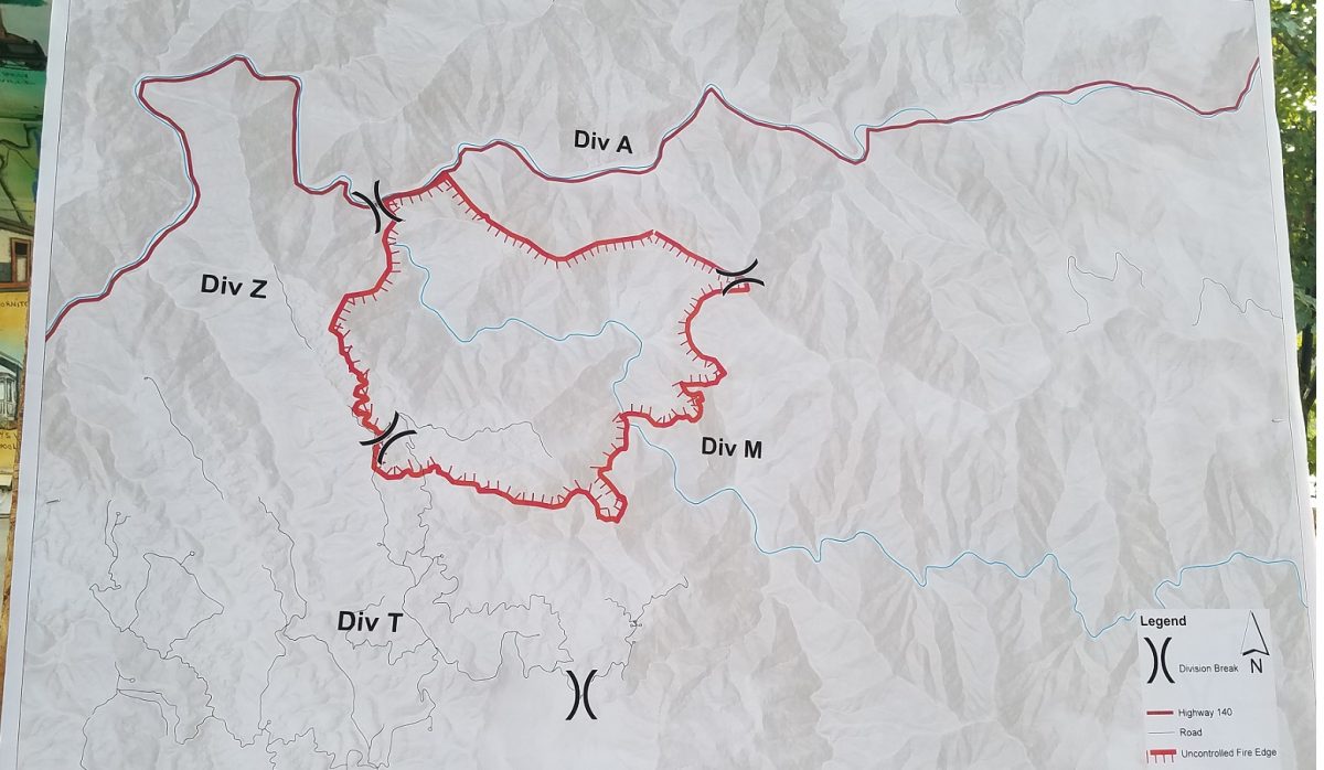
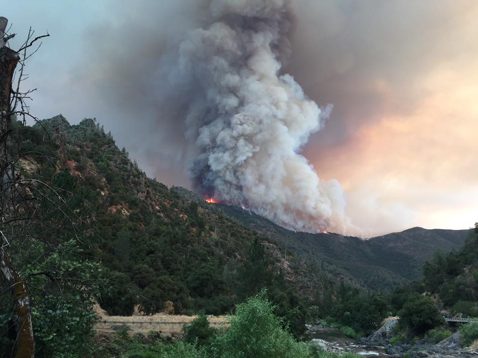
The fire is burning in the extremely steep, inaccessible terrain south of Highway 140 in the South Fork of the Merced River drainage, pushing south and east for the most part.
There are currently 108 structures threatened, including 70 homes, 3 commercial buildings, and 35 outbuldings. An estimated 500 personnel are assigned to the incident.
Dense smoke early in the day limited air operations, though there were helicopters up by about 9:30 a.m.
Just before 9:30 a.m., Air Attack reported some “pretty good spots” burning on the west side of the containment lines on Ferguson Ridge.
At 10:37 a.m., additional air resources were requested – two VLATs (Very Large Air Tankers), four large air tankers, four S2s and a lead plane. The 911 VLAT, one large air tanker, and three S2s – Tankers 79, 80 and 82 – were confirmed by 11:05 a.m.
Just 15 minutes later, the dense smoke had reduced visibility to the point that fixed-wing air resources had to be put on hold until there was cleaner air in which to operate.
With fixed-wing aircraft grounded, helicopters began working along Sweetwater Ridge as crews and dozers cut line.
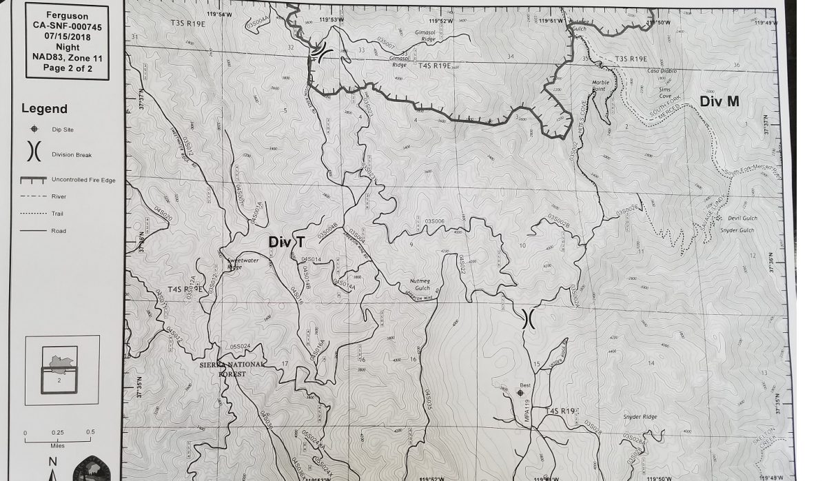
An engine strike team was sent to Footman Ridge east of Jerseydale to open up the fireline in that location.
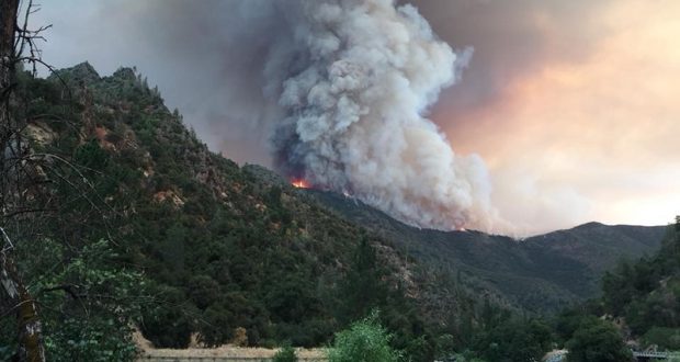
Ferguson Fire from El Portal area – photo by Blake Scott
Numerous helicopters continued working the slop-over on Ferguson Ridge throughout the morning. At 11 a.m., the fire was still holding north of the Hites Cove Road above Jerseydale, “but not by much,” according to Air Attack.
With no tanker support for firefighters on Ferguson Ridge, crews backed off to Sweetwater Ridge, just to the west. Substantial lines were constructed on Sweetwater during the Detwiler Fire, so it didn’t take too much to open those lines again.
On the south, in the Mariposa Pines area, crews did a lot of prep work on structures and dozers cut lines around the area.
Just after 1:30 p.m., reports came in that the fire had slopped over Hites Cove Road near Marble Point.
By 2 p.m., crews and dozers had started cutting line across Snyder Ridge north of Jerseydale.
Residents in the Midpines area saw an increase in fire traffic, specifically on Ponderosa Way, as crews and equipment made their way to Sweetwater Ridge.
Just after 4 p.m., as often is the case, fire activity picked up. It was reported that the fire had burned about 100 acres across the containment line on Ferguson Ridge, and that it had backed down into Snyder Gulch, had picked up a good head of steam, and was heading southeast up the South Fork drainage and into the Devils Gulch area..
With visibility failing due to heavy smoke, air tankers began painting boxes around structures closest to the fire’s leading edge. Air Attack reported at 4:35 p.m. that Snyder Ridge would be overrun within 90 minutes.
Much of the day smoke lay over the fire making it difficult for managers to actually see the fire and what it was doing. The western flank was the most visible. On the south and east nothing much was visible until about 4 p.m.
The fire also slopped over between Brown’s Point and Pinoche Point.
Fire activity has held up around Cedar Lodge and on the northern perimeter and fire managers report it’s looking good in that area.
With the vegetation burned off the very steep mountainsides through the Merced River Canyon, a lot of rock and debris is rolling down onto the roadway, adding to the danger for firefighters and others working in the area.
Fire managers requested that power to the Mariposa Pines area be cut off at about 4:35 p.m.
This afternoon PG&E crews worked to pre-treat power poles between Mariposa Pines and Midpines to protect them from the flames.
Crews and dozers are being sent to Yosemite West to begin prep work for structure protection as part of the contingency plan in case the fire moves that direction.
Temperatures on the fireline will remain hot and dry with the possibility of thunderstorms midweek.
Smoke is expected to continue to impact adjoining communities, especially during night and early morning hours. You can learn more about air quality, and daily smoke forecasts by visiting either www.airnow.gov or www.valleyair.org.
So far no structures have been lost and no injuries reported. There has been one fatality on the fire.
The Ferguson Fire started on Friday, July 13, at 8:30 p.m. The cause remains under investigation.
Evacuations
Last night at 10:45 p.m., the Mariposa County Sheriff’s Office issued a mandatory evacuation for the Jerseydale area. This includes all residences on Jerseydale Road, Hites Cove Road and all side roads from Triangle Road to the end of Hites Cove Road.
At 10:40 a.m. today, a fire advisement was issued for the Yosemite West area of Mariposa County. This is NOT an evacuation order, but is an advisement only of a potential evacuation order should conditions change.
Savage Trading Post, Redbud Lodge, Cedar Lodge, Indian Flat Campground and Ferguson Ridge are under a mandatory evacuation, and the BLM campgrounds in Briceburg are closed until further notice.
A Red Cross Evacuation Center has been established at the New Life Christian Church located at 5089 Cole Road in Mariposa. If you have been affected by the Ferguson Fire, the Sheriff’s Office asks that you please check in with the Red Cross Shelter even if you do not plan to stay there.
The Central California Animal Disaster Team is working in coordination with Mariposa Animal Control in dealing with small animals. Right now, they are referring pet owners with small animals to the Mariposa SPCA. If you need assistance with large animal evacuation please call the Mariposa County Sheriff’s Office at 209-966-3615.
Road Closures
Highway 140 remains closed from 1.9 miles east of Midpines at the climbing lane to 1.4 miles east of Incline at Foresta Road (see map below).
Also closed are Jerseydale Road, Hites Cove Road and all side roads from Triangle Road to the end of Hites Cove Road.
Click here for the online heat map shown below.