YOSEMITE–The Washburn Fire, burning in Yosemite National Park, started the first week of July 2022 and is now entering its 4th week of burning. It is almost completely contained and not expected to spread much further. The fire has burned 4,886 acres and is 97% contained. Visitors and residents have returned to the community of Wawona and access to Yosemite through the South Entrance on Wawona Road (continuation of Hwy 41) have been restored.
The town of Wawona, Wawona Hotel, and surrounding trails are open. Mariposa Grove of the Giant Sequoias (and trails to it), as well as Wawona Campground, remain closed until further notice. At this time, there is no estimated opening date. All other areas of Yosemite are open, although a reservation is required to drive into the park if arriving between 6 a.m. and 4 p.m.
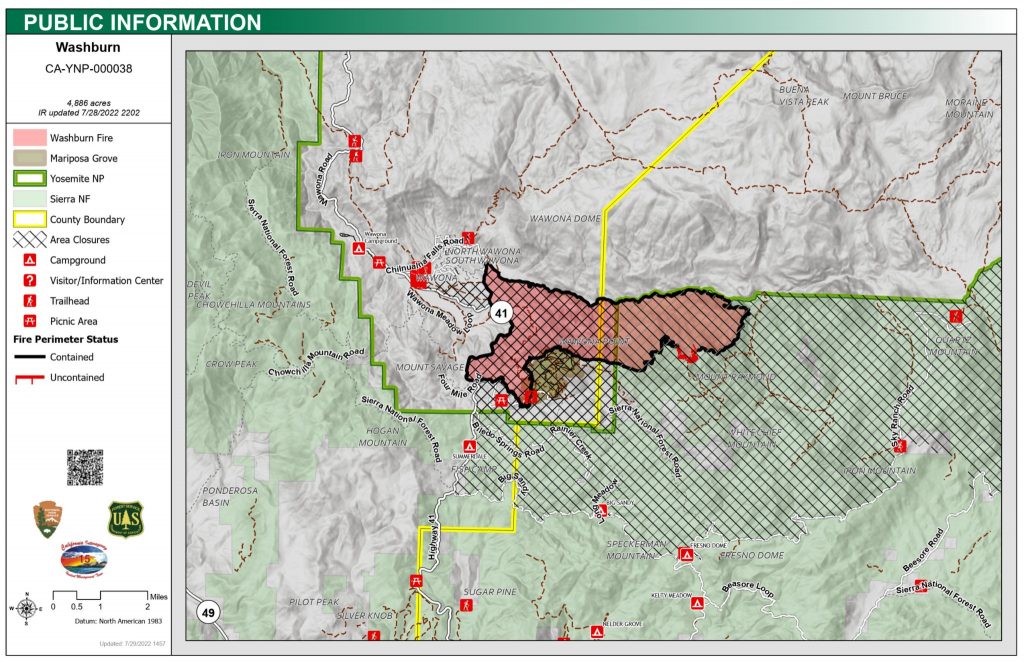
Washburn Fire Public Information 7.31.2022
Visitors can expect to see areas where The Washburn Fire burned close to the road and in other areas. They can also expect minimal smoke impacts from the Wash Burn Fire and the Oak Fire in Mariposa County. The worst air quality is predicted to be in the afternoons when the winds change due to the terrain. Sensitive individuals should be aware and limit prolonged or heavy exercising including hiking.
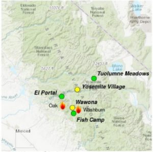
Washburn and Oak Fires Daily Air Quality Index (AQI) predictions for Saturday, 7.30.2022
AQI Map Key
What’s Next?
There are three phases of recovery following wildfires on federal lands:
- Fire Suppression Repair
- Emergency Stabilization-Burned Area Emergency Response (BAER)
- Long-Term Recovery and Restoration

Washburn Fire Soil Burn Severity
Interagency BAER (Burned Area Emergency Response) team specialists completed field data gathering on National Park Service and U.S. Forest Service – Sierra National Forest lands burned by the Washburn Fire on July 24, 2022. The team’s post-fire soil burn severity (SBS) map analyzes 4,835 acres of the South Fork Merced River Watershed. The map and the data display soil burn severity (SBS) categories of unburned/very low, low, moderate, and high.
Approximately 47% of the total acres are either unburned/very low or low SBS, while 48% are moderate SBS and only 5% are high SBS.
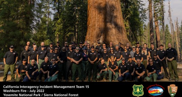
Team 15, a Type 2 complexity Incident Management Team (CAIIMT15) has been managing the fire and has now transitioned the Washburn Fire back to a local Type 3 Incident Management Team, July 30, 2022, at 7 p.m.
CAIIMT15 wishes to thank the local communities and cooperators for all of the support and cooperation with their team.


