GATEWAY COMMUNITIES — Get ready for a big weather change again this weekend. For much of this week, we’ve been experiencing dry, cold, and foggy conditions, but that’s about to change. A very strong storm system is expected to impact Central California and The Sierra Nevada Saturday and Sunday.
As always, Sierra News Online will be here monitoring and reporting on any impacts from this storm including traffic hazards and collisions, road closures, and power outages.
Timing
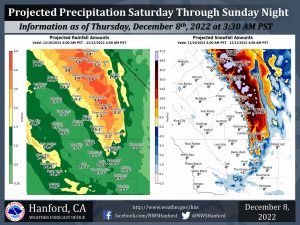 The National Weather Service Hanford Office is predicting the majority of precipitation associated with this storm system will fall Saturday night and Sunday. Snow levels will start at around 4,000 feet Saturday, before rising to about 6,000 feet Saturday evening into Sunday morning. Snow levels will drop to around 3,000 feet by Sunday evening.
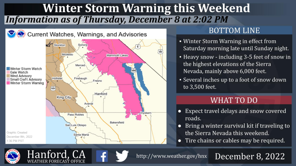
Watches and Warnings

The image depicts a Winter Storm Watch for Yosemite National Park southward to the Upper San Joaquin River from 10 PM PST Friday night until 4 AM PST late Sunday night.
A potent low-pressure system will drop slowly south out of the Northeast Pacific and swing inland across northern California and into the Great Basin region late Sunday.
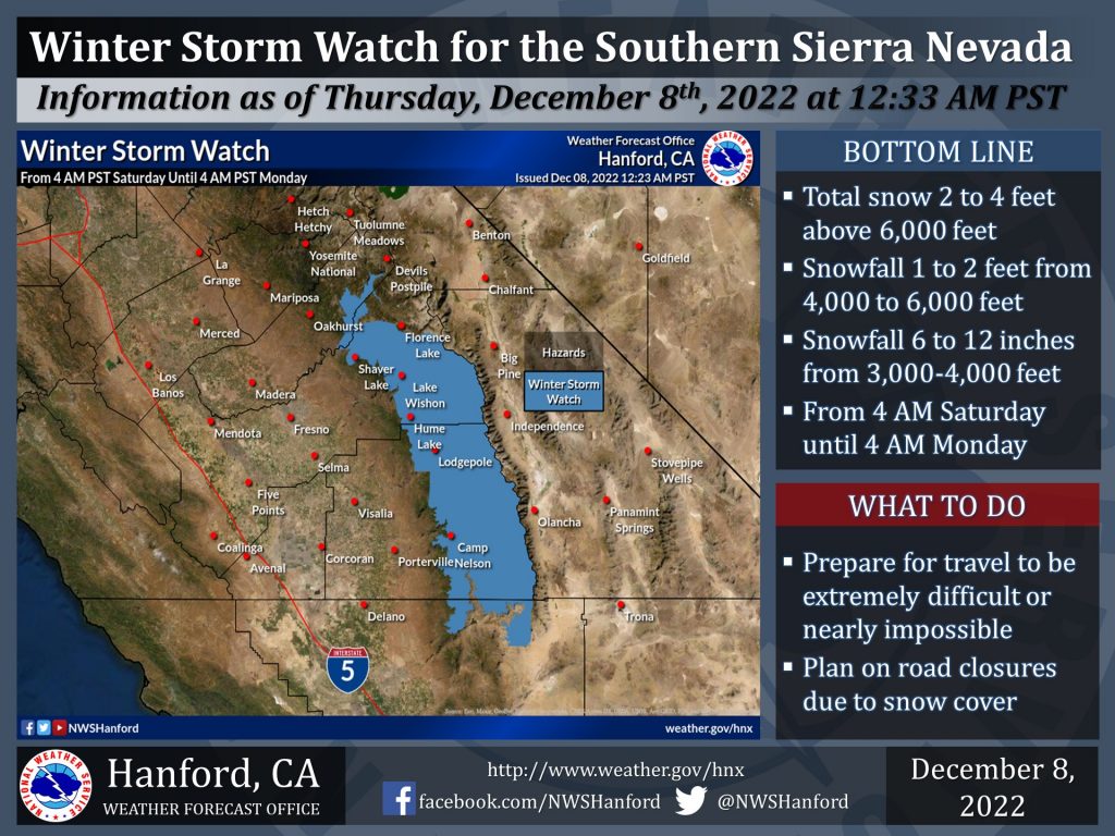
The image depicts a Winter Storm Watch for the Southern Sierra Nevada from 4 AM PST late Friday night until 4 AM PST late Sunday night.
Impacts from this system will be substantial, with rain and mountain snow entering northern portions of our area by early Saturday morning, and spreading southward over the district, continuing into Monday morning. Total snowfall accumulations will be around 3-4 feet in the higher elevations north of Kings Canyon, and as much as 2-3 feet farther south to near Lake Isabella.
A Winter Storm Warning has been issued from Saturday morning to early Monday morning due to the projected heavy snowfall amounts and gusty winds.