Some days things just don’t go as planned. But we eventually made it to our hiking adventure along the Mono Pass Trail, wandering the mountains in search of beautiful flowers and reflections in the water.
Where: Yosemite National Park
Distance: About 9 Miles (but you can go as far as you wish)
Difficulty: Moderate to Strenuous
Elevation Range: 9,596′ – 11,194′
Date: August 14, 2019
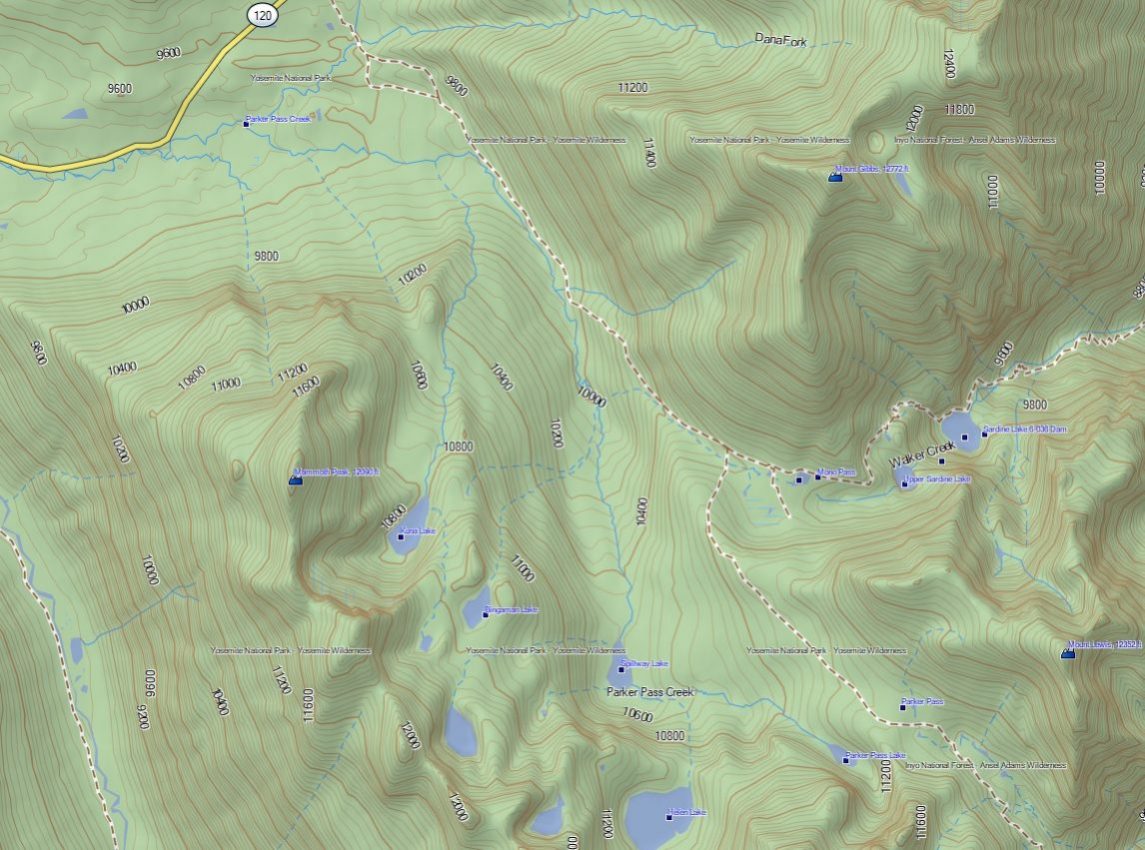
Maps: Tioga Pass, Mount Dana, Koip Peak Topographic Quads
Dog Hike? No
A bunch of us met in Oakhurst to head out for our adventure and we didn’t get too far out of town before Bam! A deer jumped out of nowwhere and ran across the road, us hitting it in the car’s mid-front grill and hood, the deer tumbling over the passenger side mirror. We pulled over in the next wide spot to check out the vehicle and I went back to where the deer might be. No sign of the deer but the car had a pretty big dent and we couldn’t open the hood to check the engine compartment out. Rather than risk a problem with the car farther away from home, we headed back and regrouped in a different car.
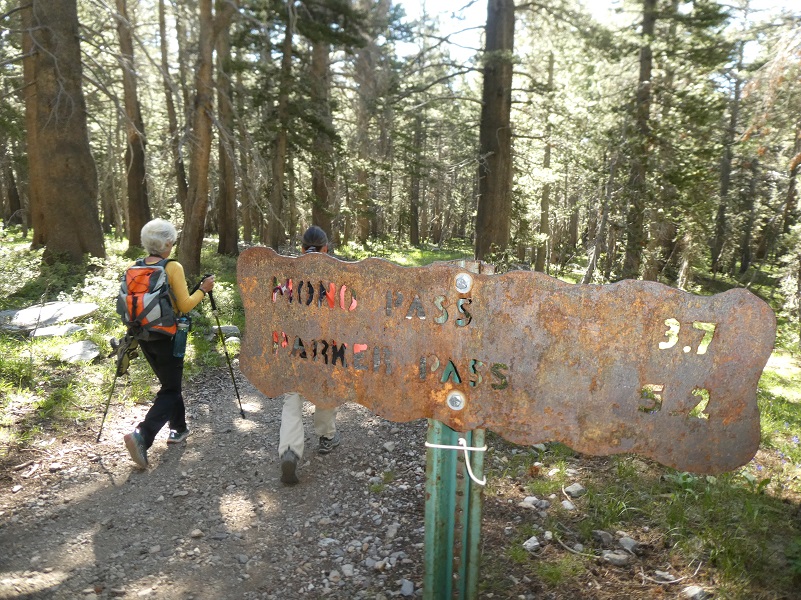
 We planned on parking our car at the Mono Pass Trailhead, about 5.6 miles east of the Tuolumne Meadows Campground and 1.4 miles south of Tioga Pass, but we discovered the parking lot was closed so we parked at a wide spot off the road just west of the trailhead. We got some bonus steps on our Fitbits so it was all good!
After using the restrooms there and stowing our stuff in the bear box, we headed up this historic trail. The Mono Pass Trail has a ton of history, the earliest historic use being an important Native American trail.
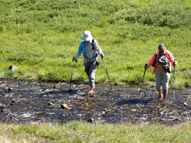
We had a few creek crossings and brought our watershoes but I was able to get over 3 out of the 4 crossings without using mine and more importantly, didn’t get my socks and boots wet.

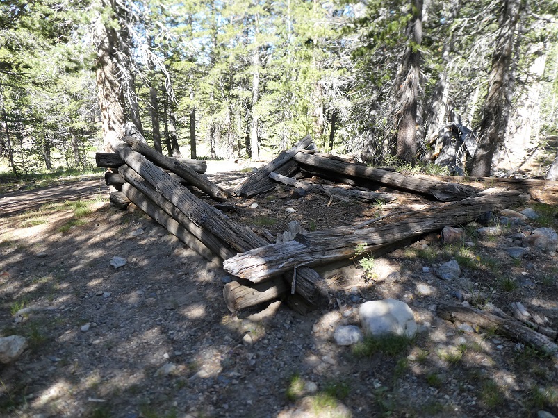
That old miners cabin beside the trail is still there but I can tell that it disappears a little more each time I pass by it.
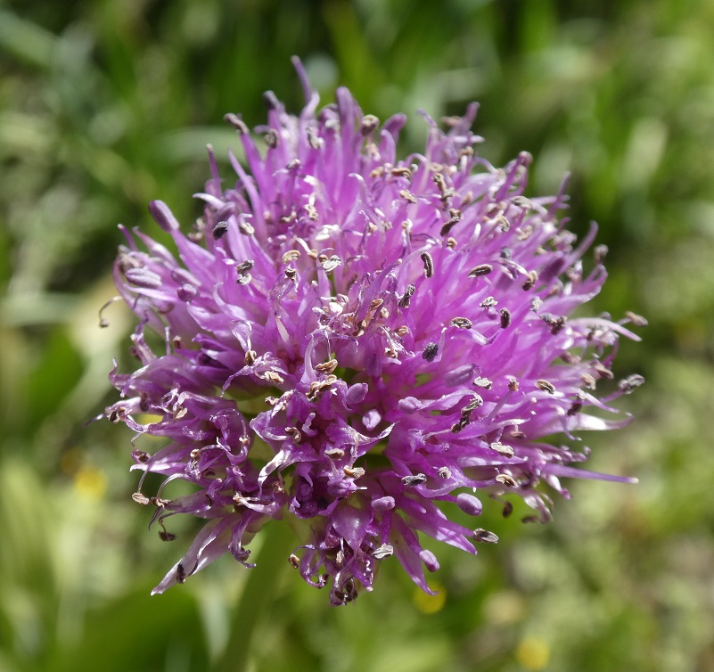
Most of the wildflowers along the trail that were blooming earlier this year had closed up shop for the year but the wild onions were blooming.
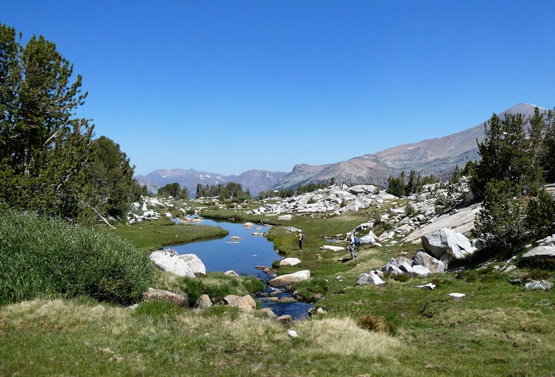
After the trail forked toward Parker Pass and Mono Pass, we headed cross country to the west, crossing the creek and wandering around.
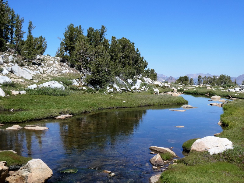
We aimed toward an area where we had seen some pretty tarns in past years but they were dried up. When a small creek would widen out, we stopped to check out reflections.
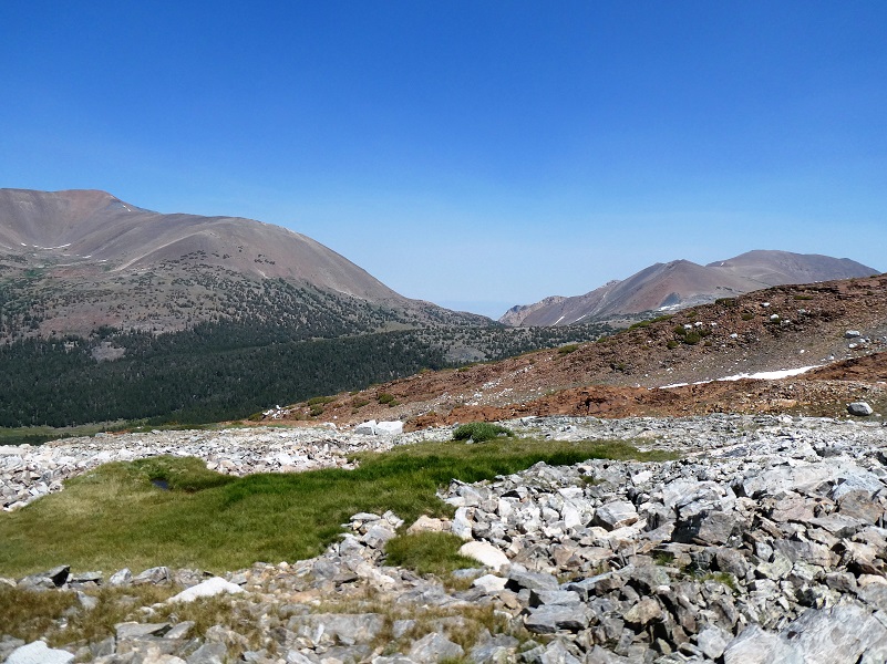
And we climbed up.
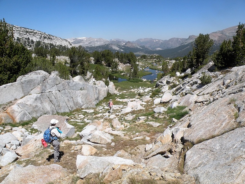
Photo by Jody Giorgi
And up some more.
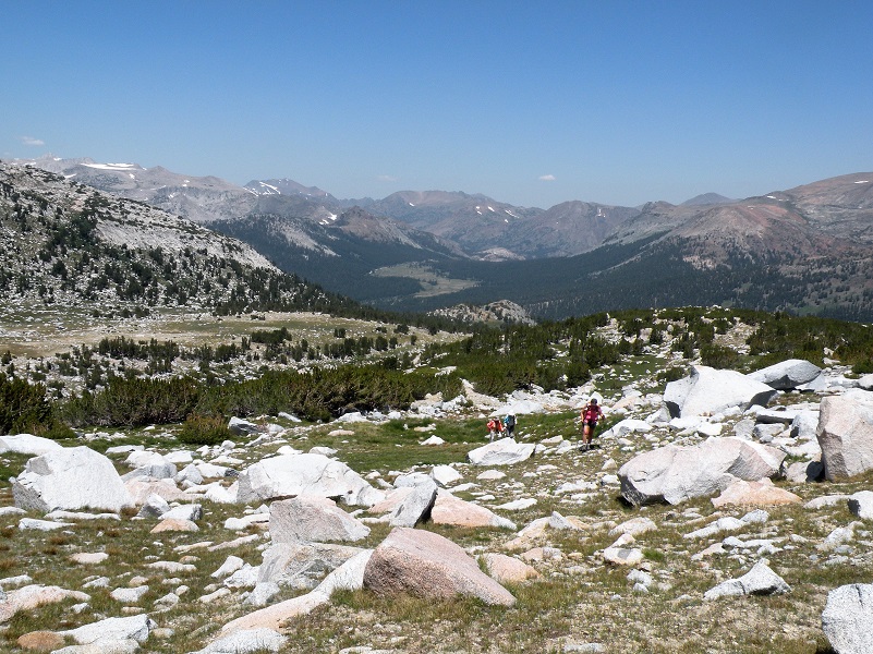
Photo by Jody Giorgi
It was soon time for lunch and we were ready for it, so we found a beautiful spot to stop and enjoy the view.

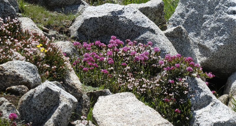
The rocks were fringed with pretty flowers, making it look like a miniature rock garden.
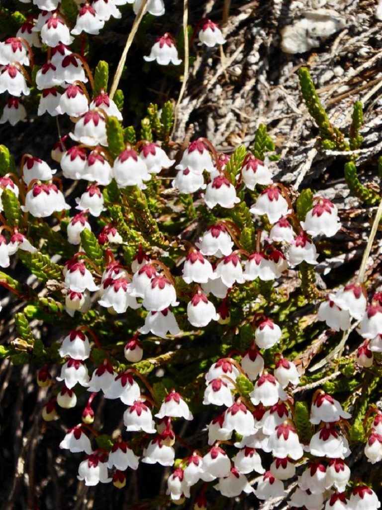
Heather (Photo by Gail Gilbert)
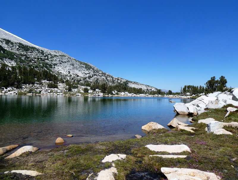
After lunch we explored other high lakes in the area
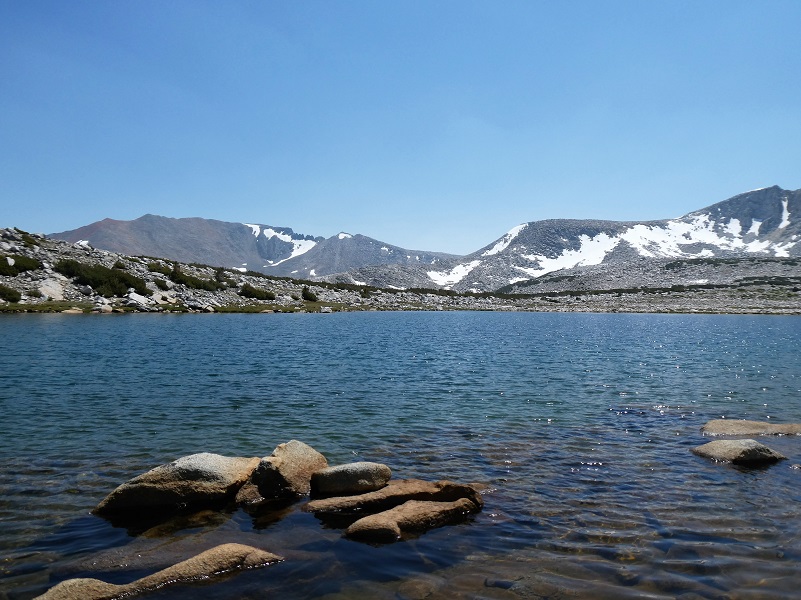
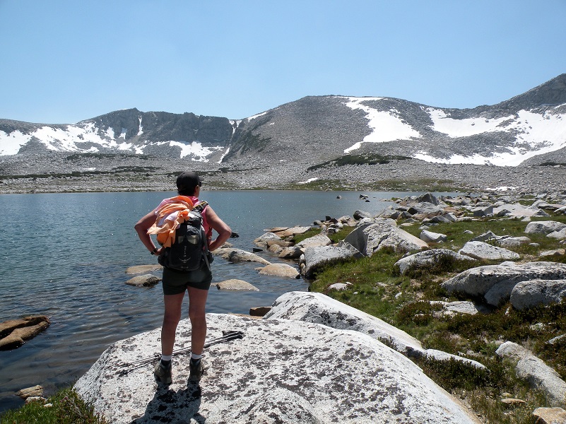
Photo by Jody Giorgi
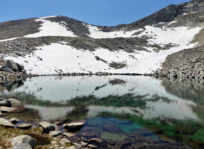
Photo by Gail Gilbert
Then we started heading back down.
Still some snow patches hanging around.
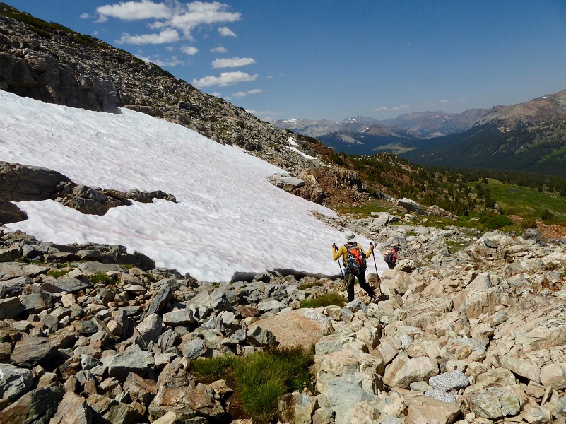
Photo by Gail Gilbert
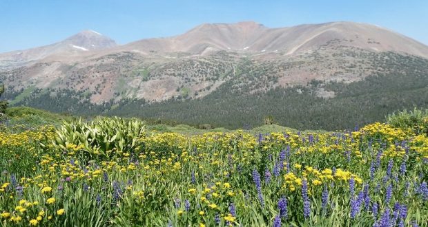
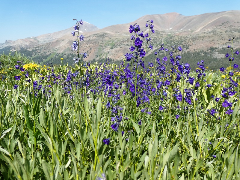
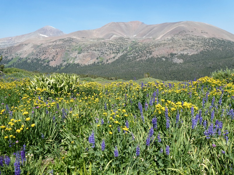
We were aiming for an area that we had spotted from far away with purples and yellows. If the light is right, you can spot this purple area from the trail before you climb up to Spillway Lake and to the west. In some years the lupine and larkspur are incredible in this spot, but not every year. This is one of those incredible years!
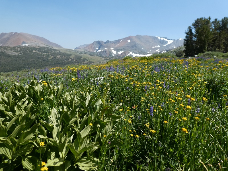

I didn’t share a detailed track on the topographic map on this hike because we really wandered around where we were drawn to, most of it off trail. There is plenty to see in this area and you don’t need to hike too far to see beautiful meadows all decorated with wildflowers.
Dog Hike? No, dogs are not allowed on this trail in Yosemite National Park.
Map:
Prior Blogs in the Area:
Hiking along Yosemite’s Mono Pass Trail August 15, 2018
Hiking up to Mono Pass Trail’s High Lakes August 25, 2017
Exploring High Lakes Above the Mono Pass Trail July 28, 2016
Hiking and Fishing High Lakes along the Mono Pass Trail August 14, 2013
