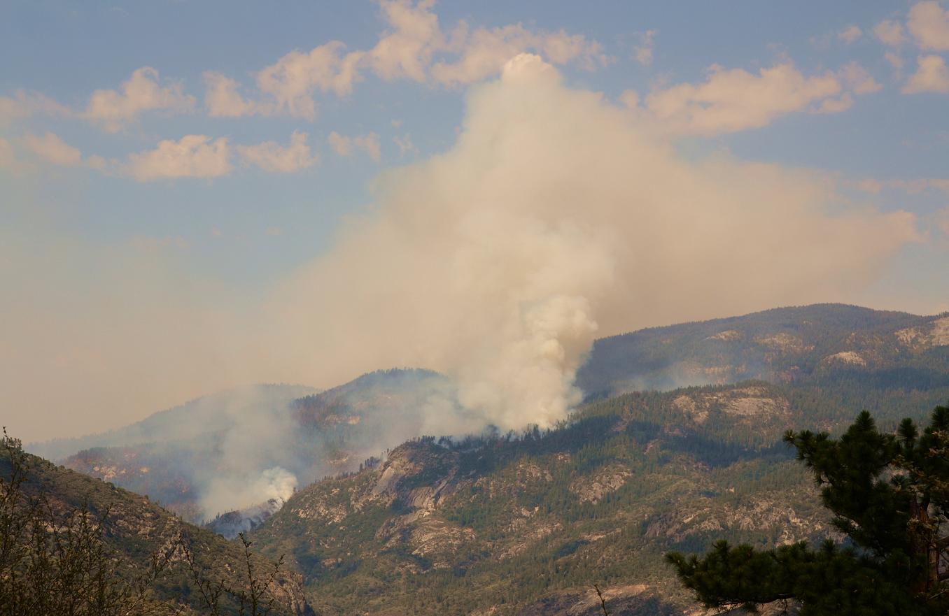
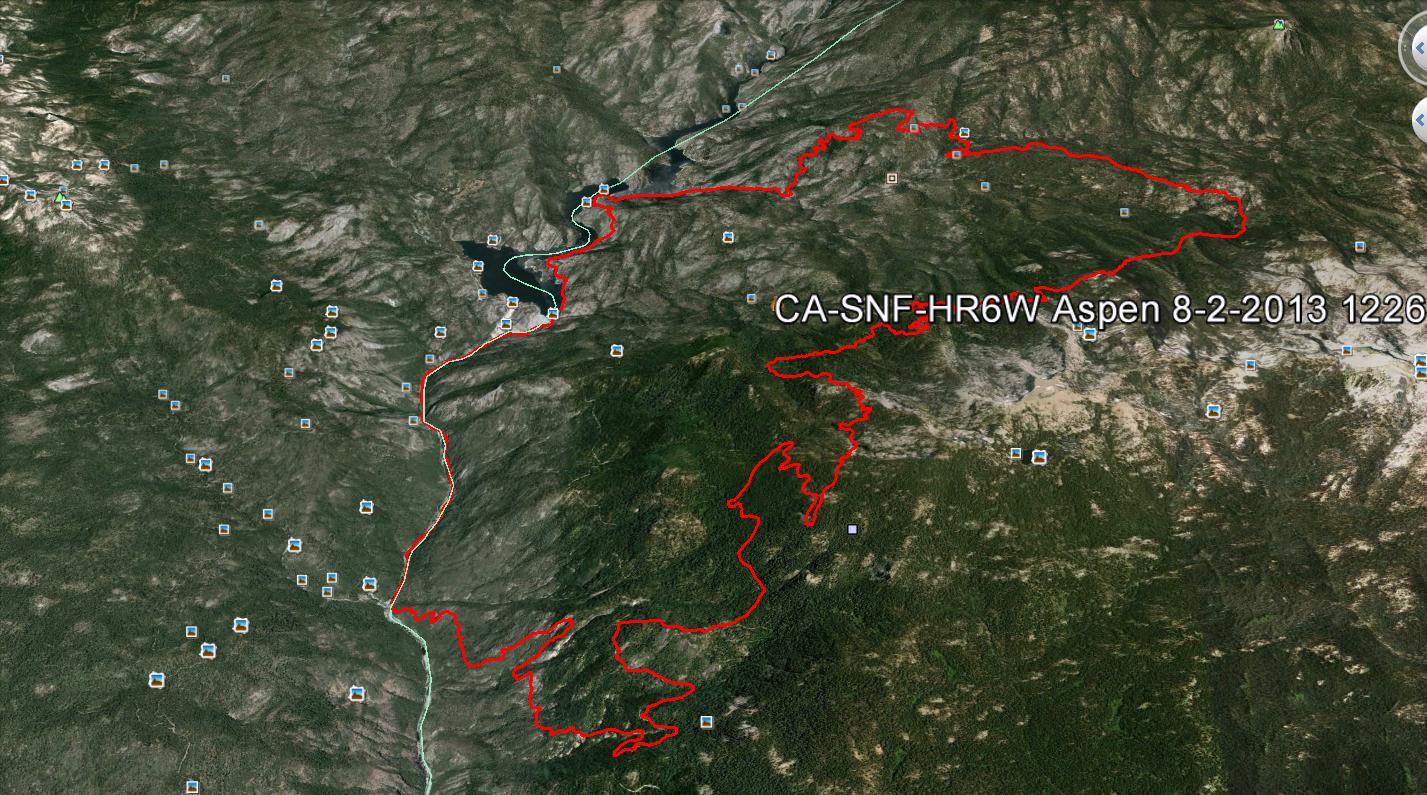
HUNTINGTON LAKE – The Aspen Fire has now burned 18,774 acres in the High Sierra District of the Sierra National Forest.
There are a total of 2,004 personnel assigned to the fire, which is 55% contained. The date for complete containment is Aug. 10.
The fire continues to be active throughout the north and east sides. and road and campgound closures remain in effect, including the precautionary evacuation of campgrounds west of the San Joaquin River on Forest Road 4S81.
The fire is located within the Sierra National Forest in Fresno County and is approximately seven miles North of Big Creek. It is currently burning off Stump Springs Road, North of Aspen Springs.
The South Central Sierra Interagency Incident Management Team is in command of the Aspen Fire. Incident Commander is David Cooper, Fire Management Officer for the Bass Lake Ranger District in North Fork.
The inversion layer continues to cause smoke to accumulate in the low laying areas of the fire which hampers visibility of firefighters on the ground and in the air.
Recreation and businesses remain open in the Shaver Lake, Big Creek, Huntington Lake, Lake Thomas Edison, Florence Lake and the Mono Hot Springs areas.
Firefighter and public safety remains the highest priority. Fire crews are being sensitive to environmental and cultural resources in and around the fire area.
 Last night, crews strengthened containment lines and continued to make good progress with indirect and direct attack operations. Access and fire behavior are still a major safety concern for fire crews. Air and ground resources continue to construct and reinforce indirect line around the fire’s perimeter.
Due to the extremely steep, rugged and inaccessible terrain, fire crews are using a tactic called indirect attack which creates control lines away from the fires active edge. Air resources, including several helicopters and air tankers are being utilized along the fireline to slow the forward progress of the fire and to cool down hot spots. As the situation changes and firefighters can safely gain access to the fire, a more direct attack will be implemented.
Smoke from the Aspen Fire continues to impact air quality in local communities. Crews will utilize firing operations over the next three days to assist with enforcing containment lines. Firing operations are actions taken to remove unburned fuels between the active fire line and the contingency lines which fire crews have been creating over the past several days. The operation will put additional smoke into the atmosphere.
An air quality monitoring device has been installed at the Huntington Lake Volunteer Fire Station. The device will provide smoke data from the Aspen Fire to the air resource advisor and the area air pollution control districts.
Individuals sensitive to smoke are advised to remain indoors and keep windows closed to minimize exposure to smoke. For more information regarding smoke visit: www.valleyair.org
A combination of direct and indirect attack is being used on the incident. Indirect lines have been completed and are prepared for burning. Direct line construction and the firing began on the northeast side of the fire. The firing could be completed in the next five to six days.
Only two minor injuries have been reported so far, and no structures have been lost. The cost to fight the fire as of Saturday, Aug. 3, is $17.2 million.
Cooperating agencies include:
The U.S. Forest Service, National Parks Service, U.S. Department of Defense, National Weather Service, California Governor’s Office of Emergency Services, Fresno County Sheriff, Madera County Sheriff, California Highway Patrol, California Department of Corrections and Rehabilitation, Southern California Edison, PG&E, California Conservation Corp.
(editor’s note: Cal Fire is not designated as a cooperating agency because they do not have any land at risk. They are participating in the efforts.)
Current Weather
Wind Conditions 3-9 mph SW
Temperature 44-55 degrees
Humidity 57-67%
Road and Trail Closures
Roads:
Stump Springs Road is closed to all traffic due to fire suppression activity. Minarets Road (4S81) from Fish Creek to Jackass Rock Organization Campground, Grizzly at Beasore Road to Minarets Road are closed to the public. Residents within the road closure are allowed into the area with valid identification.
Trails:
Per the U.S. Forest Service Closure Order Number 15-13-09, all trails within the Kaiser Wilderness are closed.
Campground closures within the Sierra National Forest are as follows:
Sample Meadow
West Kaiser
Jackass Rock Organization
Lower Chiquito
Little Jackass
Soda Springs
Placer
Sweet Water
China Bar
Rock Creek
Mammoth Pool
Wagners Mammoth Pool Resort
Fish Creek
The following campgrounds are closed to house firefighters for suppression efforts:
Midge Creek
Badger Flat
Rancheria