STANISLAUS NATIONAL FOREST — With the extreme fire danger as evidenced by the Detwiler Fire burning in Mariposa County and fire hazard indices, the U.S. Forest Service, Stanislaus National Forest, has issued an order restricting the use of fire on the Forest.
Effective July 20, 2017, restrictions are put on campfires, smoking, and the use of any open flame.
The High Fire Hazard Area of the Stanislaus National Forest is located in Calaveras, Mariposa and Tuolumne Counties, Calif. Criteria for activating prohibitions in the High Fire Hazard Area through a forest order is based on National Fire Danger Rating System indices and fuel moisture conditions.
Indices that can trigger restrictions are:
- Burning Index is 60 or greater for three consecutive days with a predicted stable or upward trend
- Dead fuel moistures for thousand-hour time lag fuels are less than 14 percent
- Energy Release Component greater than 70
The Forest currently meets the criteria for activating the High Fire Hazard fire restrictions using the Mt. Elizabeth weather station as a representative site. Combination of the data above threshold levels for multiple days, along with upward trending data, indicate a need for restricting potential fire causing activities of persons in the High Fire Hazard Area.
These restrictions are believed to be the most effective method to reduce the potential for loss of life and property, and to protect the physical, biological, and cultural resources of the forest from fire.
In response to the situation described, the Forest Service will issue a temporary Forest Order prohibiting the following activities in the High Fire Hazard Area:
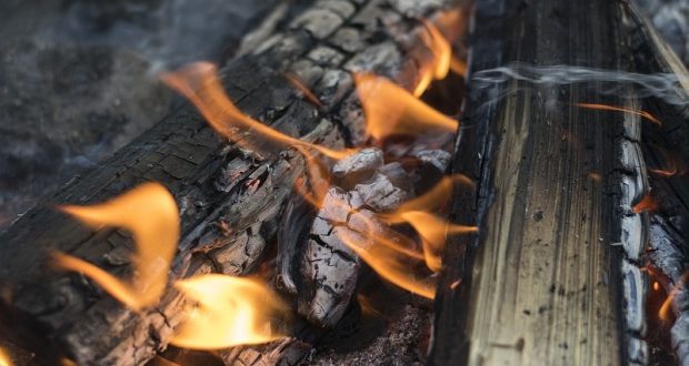
- Building, maintaining, attending or using a fire, campfire, or stove fire, except in the Developed Recreation Sites listed in Exhibit C. 36 CFR 26 I .52(a).
- Smoking, except within an enclosed vehicle or building, within a Developed Recreation Site listed in Exhibit C, or while stopped in an area at least three feet in diameter that is barren or cleared of all flammable material. 36 CFR 261.52( d).
- Welding, or operating an acetylene or other torch with an open flame. 36 CFR 26l.52(i).
Pursuant to 36 CFR 261.50(e), the following persons are exempt from this Order:
1. Persons with a permit from the Forest Service specifically authorizing the otherwise prohibited actor
Omission.
2. Persons with a valid California Campfire Permit are not exempt from the prohibitions listed above. However, persons with a valid California Campfire Permit may use a portable stove or lantern using gas, jellied petroleum, or pressurized liquid fuel on National Forest System lands within the High Hazard Area.
3. Any Federal, State, or local officer, or member of an organized rescue or fire fighting force in the performance of an official duty.
4. Persons with a Special Use Permit from the Forest Service for a recreation residence on National Forest System lands within the High Hazard Area are not exempt from the prohibitions listed above. However, persons with a Special Use Permit from the Forest Service for a recreation residence on National Forest System lands within the High Hazard Area may use a campfire or stove fire at their recreation residence.
These prohibitions are in addition to the general prohibitions in 36 CFR Part 261, Subpart A.
A violation of these prohibitions is punishable by a fine of not more than $5,000 for an individual or $10,000 for an organization, or imprisonment for not more than six months, or both. 16 USC 551 and 18 USC 3559,3571 and 3581.
Exhibit C – Developed Recreation Sites
MiWok Ranger District
- Fraser Flat Campground
- River Ranch Campground
- Riverside Day Use Area
- North Fork Day Use Area
- Sand Bar Flat Campground
Calaveras Ranger District
- Waka Luu Hep Yoo Campground
- Sourgrass Day Use Area
Summit Ranger District
- Cascade Campground
- Beardsley Lake Day Use Area
- North Beardsley Campground
Summit Ranger District
- Carlon Day Use Area
- Dimond O Campground
- Lost Claim Campground
- Lumsden Campground
- Lumsden Bridge Campground
- Rainbow Pool Day Use Area
- Sweetwater Campground
- The Pines Campground
- Peach Growers Tract Cherry Valley Campground
- Middlefork Day Use Area
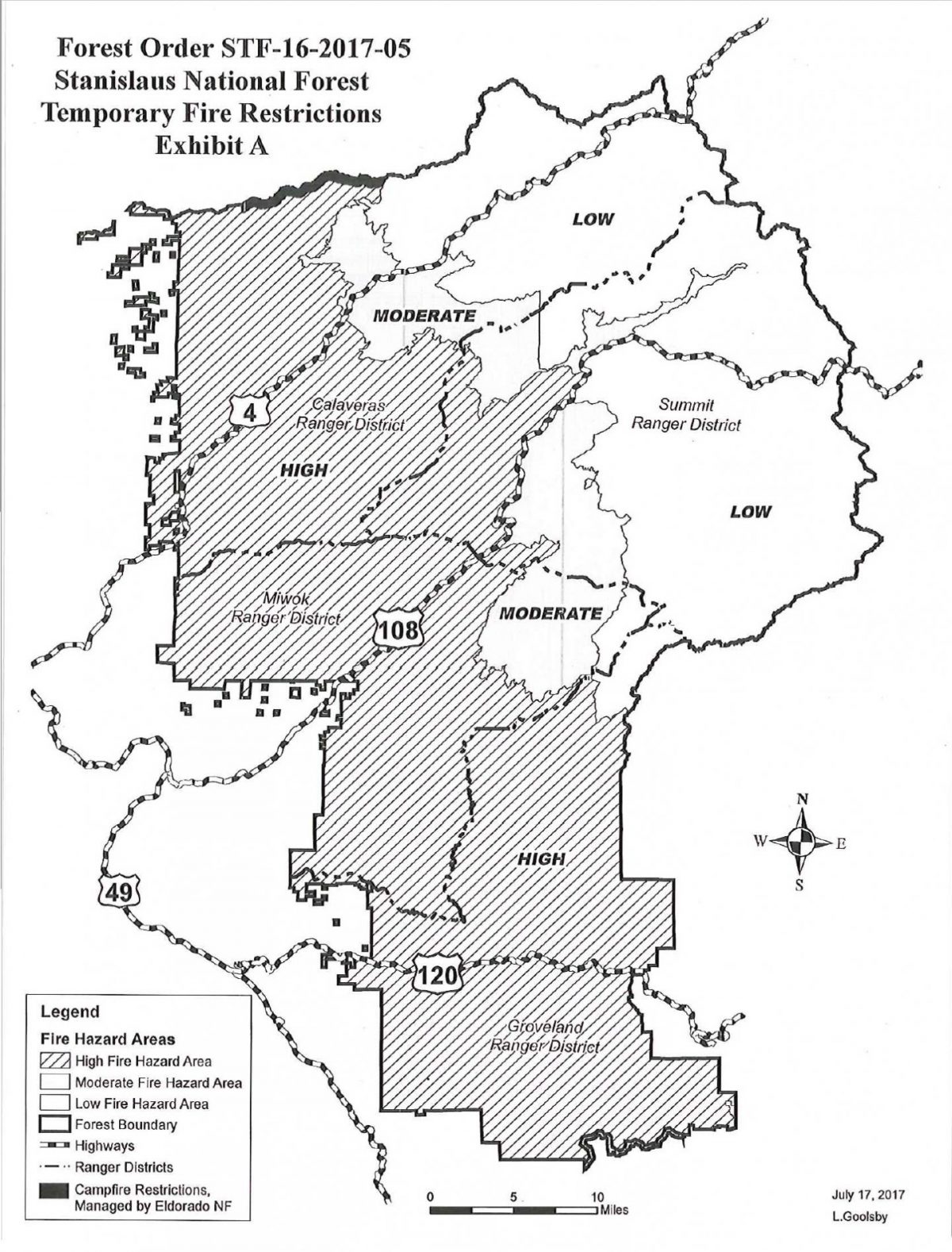 The Stanislaus National Forest High Fire Hazard Area boundary begins at a point on the westboundary of the Mokelumne Wilderness, .5 miles south of the east end of Salt Spring Reservoir, then continues due south across the SW 4 of Section 6 and the NW 4 of Section 7, T7N R17E, to its intersection with Forest Road No. 7 N16, then continues 2 miles west along Forest Road No. 7 N16 to its intersection with Forest Road No. 7 N09, then continues 11 miles west along Forest Road No. 7NO9 to its intersection with Forest Road 7N23, then continues 6 miles south along Forest Road No. 7 N23 to its intersection with Highway 4, then continues due southeast to Forest Road No. 6N17, then continues 3 miles south along Forest Road No. 6N17 to its intersection with Forest Road No. 5N14, then continues 19 miles east along Forest Road No. 5N14 to its intersection with Forest Road No. 6N05, then continues 2 miles north along Forest Road No. 6N05 to Basin Creek, then continues 1 mile east along Basin Creek to the Confluence with the Middle Fork Stanislaus River, then continues 4 miles northeast along the Middle Fork Stanislaus River to Donnell Lake, then continues 1.5 miles east along the south shore of Donnell Lake to Niagara Creek, then continues 1.5 miles south and east along Niagara Creek to its intersection with Highway 108, then continues 15 miles south along Highway 108 to Forest Road No. 4N26 (Crabtree Road), then continues 7 miles east along Forest Road No. 4N26 (Crabtree Road) to its intersection with Forest Road No. 4N33, then continues 8 miles southwest along Forest Road No. 4N33 to its intersection with Forest Road No. 3N01, then continues 15 miles east and then south along Forest Road No. 3N01 to its intersection with Reynolds Creek, then continues 0.6 mile due east to the Emigrant Wilderness boundary, then continues 6 miles south and east along the Emigrant Wilderness boundary to the Stanislaus National Forest boundary, then continues along the boundary of the Yosemite National Park and the Stanislaus National Forest to the boundary of the Sierra National Forest and the Stanislaus National Forest, then continues west, north and east along the boundary of the Stanislaus National Forest to the SE 1/4 of Section 12, T7N R15E, then continues due south 0.5 mile, then Continues east and northeast paralleling the Stanislaus National Forest northern boundary and the southern edge of Salt Springs Reservoir at a distance of 0.5 mile back to the starting point, as shown on the attached map.