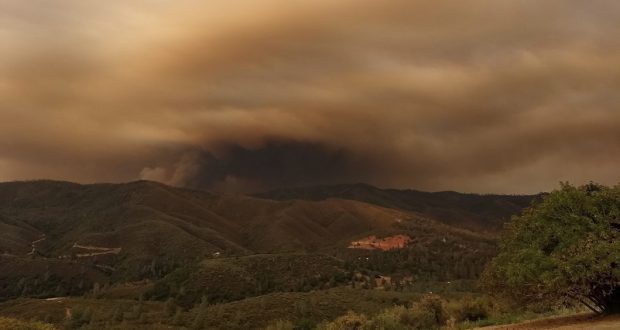
Ferguson Fire near Mariposa Pines – photo USFS
MARIPOSA COUNTY – It was another hot and humid day on the Ferguson Fire as it continues to push south and east.
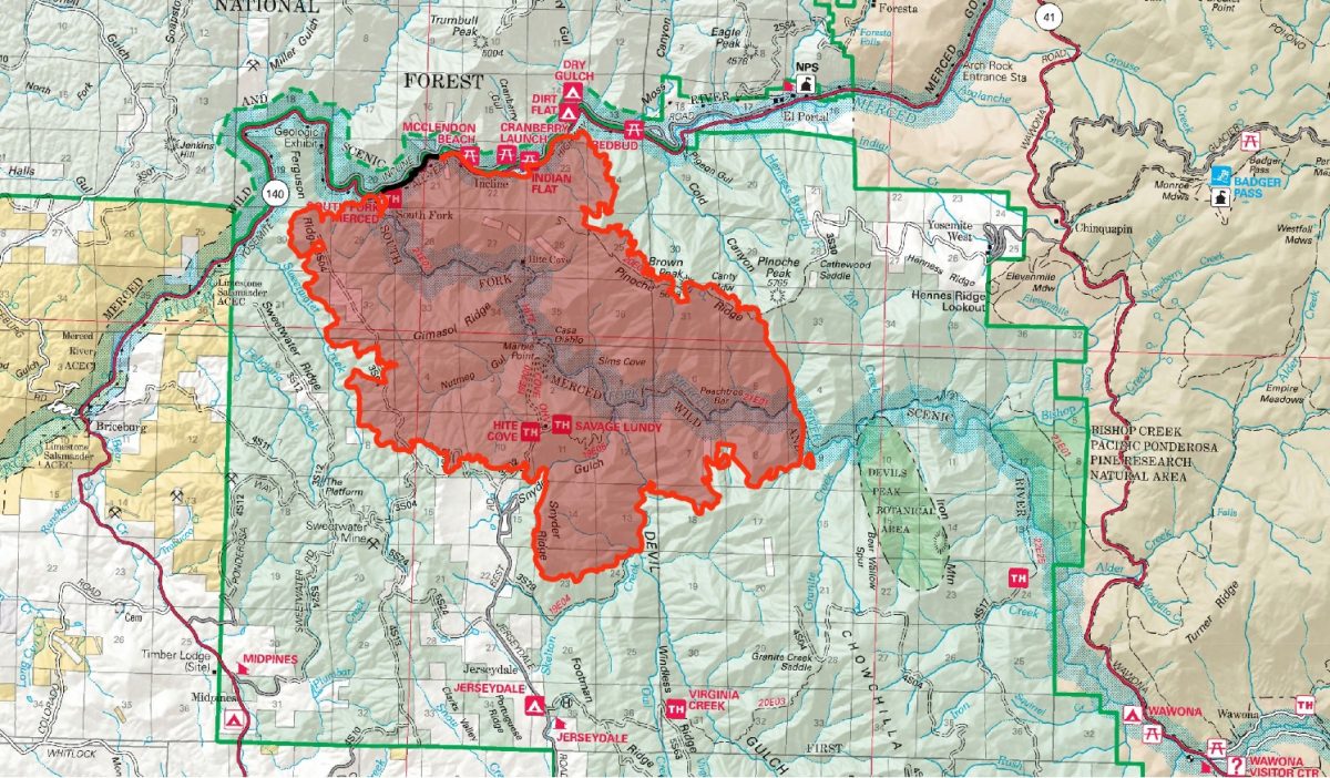
As of this posting, a new estimate on the size of the fire has not come out. We will update here when that happens. This morning the fire was estimated at 17,319 acres with 5 percent containment.
Resources continue to arrive at the Incident Command Post in Ahwahnee from all over the region. There are currently 2,149 personnel assigned to the incident including 166 engines, 55 crews, 29 dozers, 21 water tenders, 18 helicopters, and fixed-wing aircraft as conditions allow.
Once again the dense inversion layer limited air operations over the fire for a good part of the day. While the smoke lifted early, it re-settled in the afternoon. Aircraft were able to get some work done, however at 2 p.m., Air Attack reported they were down to zero visibility again. At 2:10 p.m., all helicopter work was suspended, and it was around 6 p.m before aircraft could get back to work.
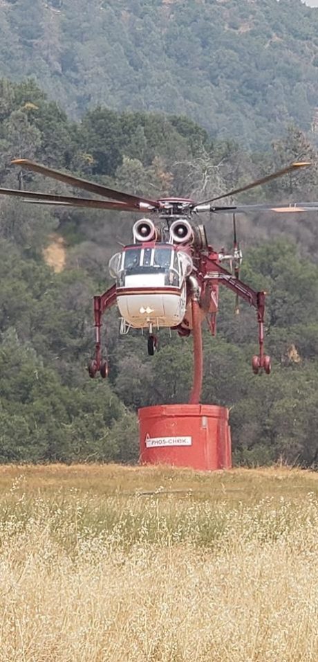
Helicopter picking up retardant Highway 140 at Williams Road – photo Derek Sprague
Before helicopters were grounded they were able to get some good retardant drops in on Ferguson Ridge and Sweetwater Ridge. The fire continues working its way north along Ferguson Ridge toward Highway 140 and down into Sweetwater Creek. Crews have line along Sweetwater Ridge and will be doing burnout operations tonight as needed.
Just before the evening briefing at 6 p.m., reports came in that a rockslide had come down in that area into Highway 140, and by 6:45 p.m. a Caltrans plow truck had arrived at scene to move the rocks and burning debris from the roadway.
Fire crews were successful in completing containment lines from just west of Indian Flat to west of Cedar Lodge, and crews have worked to control the fire’s spread along Cold Creek. The fire is expected to continue to move east across the slope through the night.
Firefighters have a good solid fireline around Cedar Lodge and Redbud Lodge, say fire officials. Structure protection continues along the Highway 140 corridor.

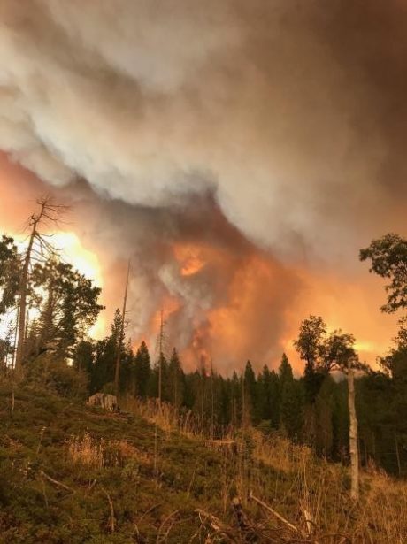
Ferguson Fire from southeast of Jerseydale – photo Ron LeBoeuf
The fire continues to back down the mountain towards El Portal, but crews made good progress on the contingency line across from Highway 140 west of El Portal to tie in to the dozer line across Henness Ridge. They plan to tie that line in all the way across to Wawona Road to prevent the spread of the fire toward Yosemite West.
On the southern part of the fire dozers cut line south and east of Jerseydale along Footman Ridge, and tied it in to the line across the head of Skelton Creek. They also reinforced containment lines around Jerseydale and Mariposa Pines, and conducted burnout operations to remove the unburned fuel above the two communities so the fire has nothing to burn as it approaches.
As expected, hot and dry conditions persisted throughout the day. While the smoke lifted early, it re-settled in the late afternoon, again hampering visibility and grounding aircraft. Some thunderstorms were observed on the east side of the Sierra Nevada, but officials say they had little effect on the fire’s growth. More monsoonal moisture is expected tomorrow.
There are currently 108 structures threatened by the Ferguson Fire including 70 homes, 3 commercial buildings and 35 outbuildings. So far no structures have been lost.
There have been two firefighter injuries reported. There has been one fatality on the fire.
The Incident Command Post for the Ferguson Fire is now at the Ahwahnee Hills Regional Park. Please be aware of heavy fire equipment moving through the area.
The fire is under Unified Command with Cal Fire, U.S. Forest Service and the Mariposa County Sheriff’s Office. Tomorrow they will transition to a Type 1 Management Team – California Team 4.
The Ferguson Fire started on Friday, July 13, at 8:30 p.m. The cause remains under investigation.
There have been no additional evacuations or advisories issued in the past 48 hours.
Evacuations
Mandatory evacuations are in place for:
- Savage Trading Post
- Redbud Lodge
- Cedar Lodge
- Indian Flat Campground
- Mariposa Pines
- Sweetwater Ridge
- Ferguson Ridge
- Jerseydale including all residences on Jerseydale Road, Hites Cove Road and all side roads from Triangle Road to the end of Hites Cove Road
- Incline Road from Clearing House to the Foresta Bridge in El Portal
- The BLM campgrounds in Briceburg are closed until further notice
Advisories have been issued for the following locations:
- National Park Service El Portal Complex
- Rancheria Flat – Government Housing
- El Portal Trailer Court
- Old El Portal
- Lushmeadows Community
- Ponderosa Basin Community
- Triangle Road from Jerseydale Road to Highway 49 South including all side roads
- Darrah Road from Triangle to Sherrod Road
- East side of Highway 49S from Darrah Road to Harris Cutoff Road – This includes Boyer Road, Woodland Area, Wass Road and Tip Top Road
- Yosemite West
These areas are NOT under a mandatory evacuation order. This is an advisement only of a potential evacuation order should conditions change.
Should these areas come under a mandatory evacuation order you will be notified via the Sheriff’s Office Emergency Alert System by text, email and a voice call, the Mariposa County Sheriff’s Office Facebook page, and door-to-door communication by Sheriff’s Office staff. At that time you will be notified of the best routes of travel to safely evacuate your residence.
A Red Cross Evacuation Center has been established at the New Life Christian Church located at 5089 Cole Road in Mariposa. If you have been evacuated due to the Ferguson Fire, the Sheriff’s Office asks that you please check in with the Red Cross Shelter even if you do not plan to stay there.
If you are in a Mandatory Evacuation or Advisory Area and may require assistance with evacuation transportation due to special needs or medical issues, please contact Human Services toll free at 1-833-423-0816 as soon as possible.
Planning ahead will help with a safe and timely evacuation.
Animal Evacuation Centers
Small Animal Shelter is at SPCA of Mariposa County, 5599 Highway 49 in Mariposa.
Large Animal Shelter is at the Mariposa County Fairgrounds, 5007 Fairgrounds Road in Mariposa.
Road Closures
Also closed are Jerseydale Road, Hites Cove Road and all side roads from Triangle Road to the end of Hites Cove Road; River Road from Briceburg to the gate at Railroad Flat and all campground areas are closed; Hites Cove Road from Bear Clover Road to the Merced River.
Cooperating Agencies include the Mariposa County Sheriff’s Office, CAL OES, California Highway Patrol, Caltrans, California Department of Corrections and Rehabilitation, American Red Cross, National Weather Service, California Conservation Corps, BLM and additional agencies throughout the state.