TUOLUMNE COUNTY – As the Rim Fire scorches 192,737 acres in Tuolumne and Mariposa Counties and into western boundary of Yosemite National Park, firefighters have now completed line around 30% of the fire.
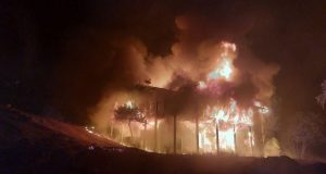
Of the 111 structures destroyed in the massive fire, 11 were residences, 3 were commercial properties and 97 are classified as outbuildings. About 4,500 are still considered to be in harm’s way on both the east and west sides of the fire.
The fire is expected to continue its eastward spread today, farther into the west side of Yosemite National Park east of Aspen Valley. Several residents remain under mandatory evacuation in the Scotts Ridge area south of highway 120. Evacuation advisories have been issued to areas from Long Barn north to Pinecrest.
California National Guard is operating a remotely piloted aircraft to help efforts to contain the fire. It will identify where fire activity is located, how it is moving, including locating and identifying spot fires. It will improve the ability to protect life property and natural resources.
The Tuolumne County Sherriff’s Office has lifted the evacuation order and PG&E has restored power to Graham Ranch Road, allowing residents only to return home.
Last night firefighters continued their burning operations near Duckwall Mountain and Pilot Peak, and will continue to construct fireline north to Fahey Cabin, and provided structure defense.
Crews prepared for burning operations south of Hetch Hetchy in Yosemite National Park, and burning operations are also expected near Duckwall Mountain and near Old Yosemite Road. Firefighters will continue with burning operations as long as weather conditions allow, and will construct and improve firelines, along with providing structure defense.
 Park and Forest Closures
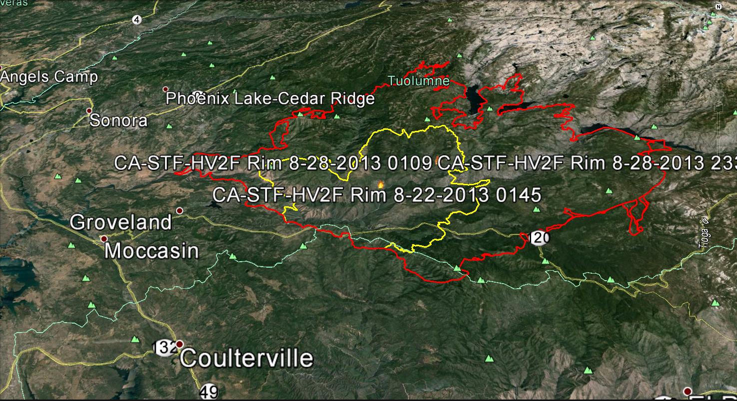
Yosemite National Park has closed Tamarack Flat and Yosemite Creek Campgrounds, both located along the Tioga Road. White Wolf Campground and White Wolf Lodge will remain closed. If you have questions about Yosemite National Park please call 209-372-0327 or 209-372-0329. (Map shows fire perimeter on Aug 22. in yellow, Aug. 28 in red. Click to enlarge).
The Stanislaus National Forest has issued an area closure for the entire Groveland Ranger District and for the Mi-Wok Ranger District east of Highway 108. Additional details are available from the Stanislaus Forest Supervisor’s Office: (209) 532-3671; Mi-Wok Ranger Station: (209) 586-3234; Summit Ranger Station: (209) 965-3434; Groveland Ranger Station: (209) 962-7825.
Road Closures
Highway 120 remains closed between Buck Meadows to 1-1/2 miles east of White Wolf. Highway 120 east/Tioga Road remains open from 1-1/2 miles east of White Wolf to the Tioga Pass entrance. Travelers to the east side of the Sierra will need to find alternative routes.
Also closed are Cherry Lake at Highway 120, Evergreen Road and Old Yosemite Road. Highway 120 from Ferretti Road to Buck Meadows remains open only for local residents and business only.
Evacuations and Advisories
A Mandatory Evacuation has been issued for residences north of Old Yosemite Road (Forest Road 2S01). Highway 120 at the Yosemite National Park boundary west to Buck Meadows has been evacuated. An evacuation center is located at the Mother Lode Fairgrounds in Sonora.
An evacuation advisory is in effect from Tuolumne City and the area east of Highway 108 to Pinecrest Lake. An Evacuation Warning has been issued for all residences north of Bull Creek Road (Forest Road 2S02), Bondurant Mine Road, Texas Hill Road, and Wampum Hill. An evacuation center is located at the Greeley Hill Community Center.
Cost to date: $39.2 Million
Injuries: 3
Total Personnel: 4,840