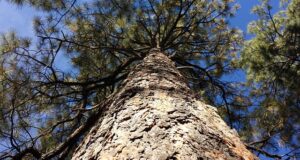
SIERRA NATIONAL FOREST – A bit of precipitation yesterday brought welcome relief from the heat, and helped to dampen down some of the fire behavior on the Rough Fire, now estimated at 139,133 with 40 percent containment. There are currently 3,741 personnel assigned to the incident.
The foothill communities west of the fire saw clearing skies as the winds moved up from the southwest and west today. This shifted the smoke impacts to those areas immediately adjacent to the wildfire, and to the Owens Valley to the east and northeast of the incident.
The impact of smoke has also moderated a bit due to the reduction in active burn areas, with a few areas of higher readings in close proximity. Overall, much improved conditions were seen today throughout the impact area.
SOUTH ZONE
The weather yesterday provided the advantage of light precipitation for firefighters on the ground to help extinguish heat along the perimeter of the fire. Falling operations of hazard trees also took place in areas that require crews to continue working while extinguishing hot spots. Fire-weakened trees will be a hazard in the fire area in the future and must be assessed before placing firefighters in those locations.
Several sections of fireline in the South Zone have gone into patrol status and are no longer considered a major threat to crossing such existing lines. Patrol status is a term that refers to monitoring and keeping watch of the fire without having to engage in heavy suppression efforts.
WEST ZONE
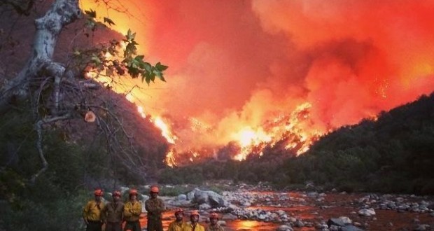
The fire continues to burn toward Pine Flat Reservoir and the Kings River but slowed with the weather. Firefighters took advantage of the cooler temperatures and moist conditions by going direct on areas that were previously not safe due to the fire behavior.
A contingency line has been put in and was improved overnight. Firefighters will continue to improve existing control lines, make direct attack and mop up throughout the evening. Cooler weather is predicted for the next few days and firefighters will take advantage of the favorable conditions to make up ground on the fire.
NORTH ZONE
Resource advisors are providing assistance in directing suppression repair activities in the Rogers Ridge area on the north side of the fire. Resource advisors are responsible for identifying and evaluating potential impacts and benefits of fire operations (wildland or prescribed fire) on natural and cultural resources.
With a weak low pressure system over the area, lower temperatures and higher relative humidity helped moderate fire activity. A crew of hotshots and several engines will continue working a night shift in the Kings River Corridor, west of Bailey Ridge.
Rough Fire Evacuation Orders and Warnings Lifted
Today the Fresno County Sheriff’s Office and fire officials made a collaborative decision to lift mandatory evacuation orders and evacuation warnings previously given to residents of Dunlap, Miramonte and Pinehurst. This decision took effect at 1 p.m.
Removal of Mandatory Evacuation Areas
– All residences south of Highway 180, between Dunlap Road and Highway 245
– All properties on the south side of Highway 180 east of the Highway 180/Dunlap Road junction.
– All properties adjacent to the north side of Dunlap Road from the
– Highway 180/Dunlap Road junction to the Dunlap Road/Millwood Road Junction.
– All properties on both sides of Millwood Road.
– All properties on both sides of Todd Eymann Road from Millwood Road to Highway 245.
– All properties on both sides of Highway 245 from Todd Eymann Road to Highway 180.
Removal of Evacuation Warning Areas
– All properties on the south side of Dunlap Road from the Highway 180/Dunlap Road junction east to the Dunlap Road/Millwood Road junction.
– All properties on both sides of Dunlap Road from the Dunlap Road/Millwood Road junction east to the Dunlap Road/Highway 245 junction.
– All properties on both sides of Brookside Road.
– All properties along Hopewell Road north of Highway 180 and east to the fire burn area within the Sequoia National Forest boundary.
Road Information
– All roads south of Highway 180 leading into Dunlap, Miramonte and Pinehurst will be reopened to motorists.
All other existing mandatory evacuation orders remain in effect.
Residents are encouraged to be patient and courteous as they return to their homes. Please drive carefully and be cautious of fire crews and law enforcement officers still working along the roadways.
Fire officials would like to thank the public for its cooperation during this difficult situation.
“Please understand the decision to administer evacuation orders and warnings is ultimately carried out by the Sheriff’s Office, however, it is based upon input by the fire officials in charge of the operation. Ensuring the safety of the public is, and will always be, our number one priority.”
View the latest information on the Rough Fire at http://inciweb.nwcg.gov/incident/4456/ and www.fresnosheriff.org, where a map of the current evacuation areas can be accessed.
More information regarding returning to your home after a wildfire:
Source: http://inciweb.nwcg.gov