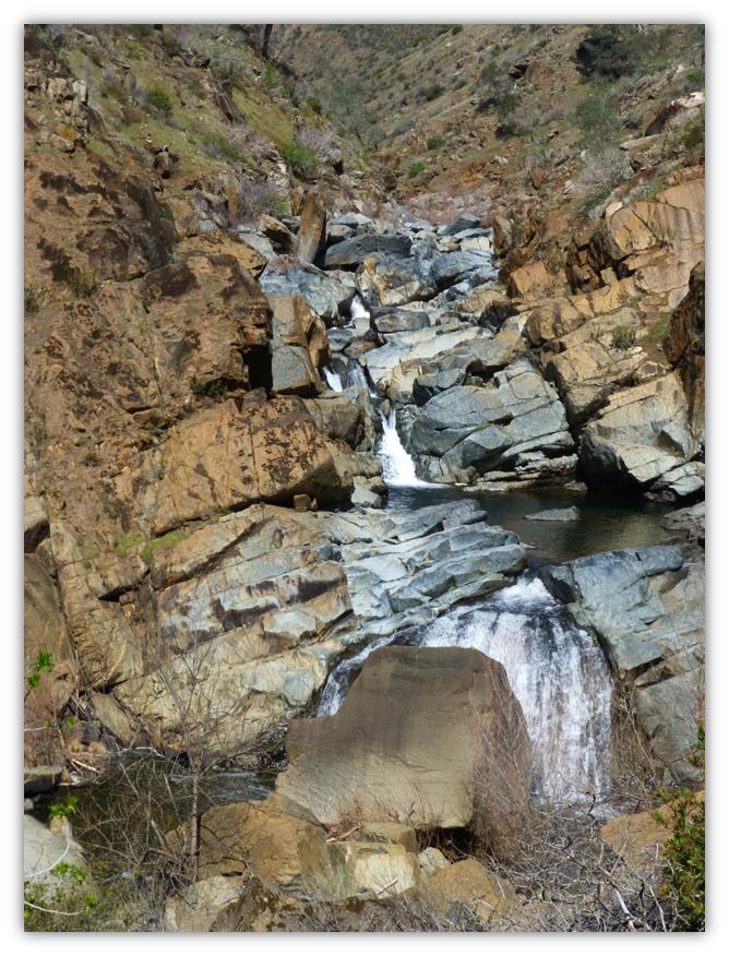
About a mile upstream on North Fork, we could spot the cascades of waterfalls that we were searching for. My hiking buddy for the day, Gail Gilbert and I scrambled over large rocks to make our way closer.
We worked our way down to the first set of falls, crawling and sliding over the big boulders.
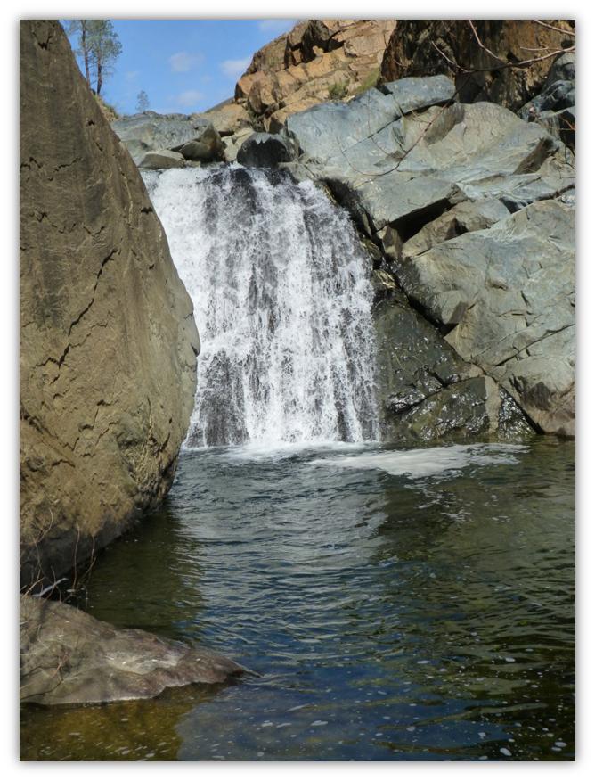
Our hard work was rewarded with this lovely waterfall cascading into the pool.
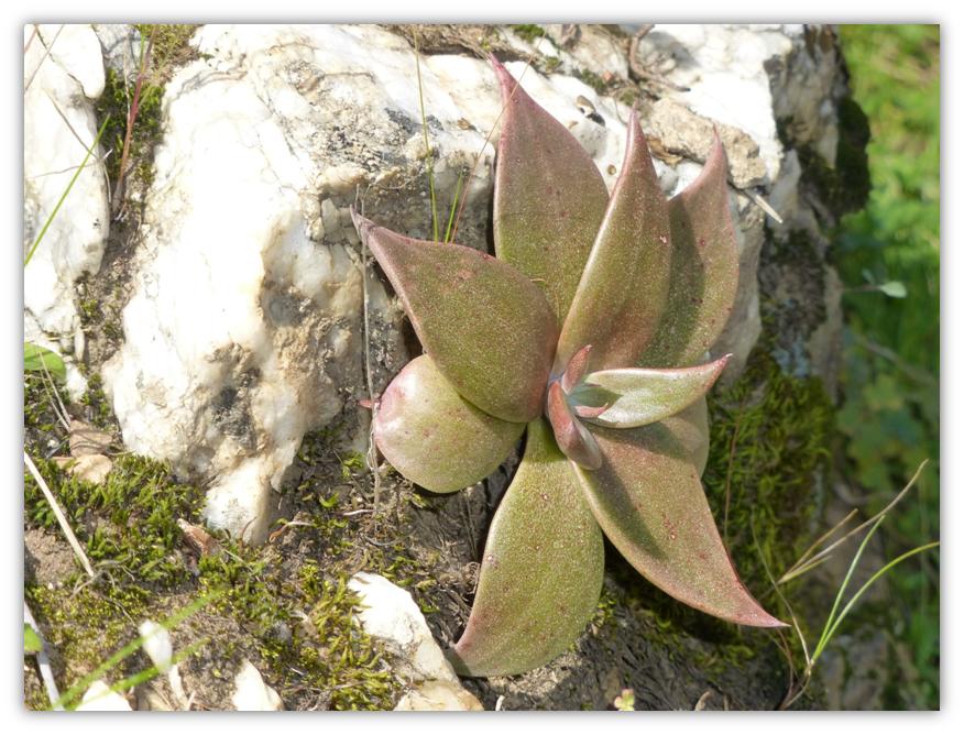
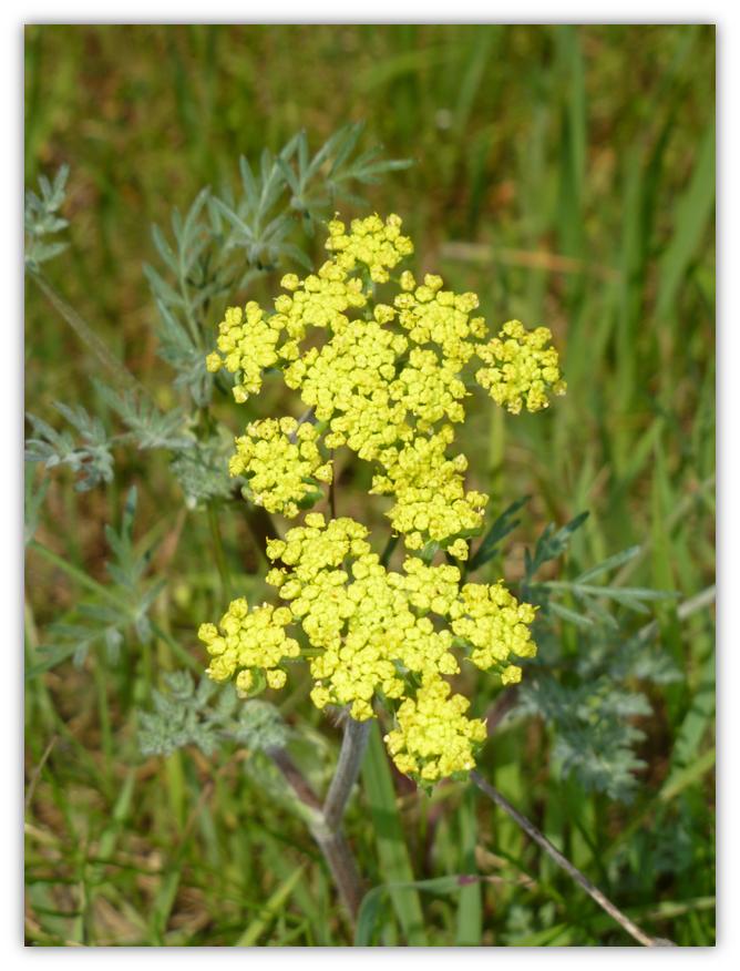
Heading back down the trail, we noticed details that we had missed on the way up such as this red tinged succulent on the white quartz.
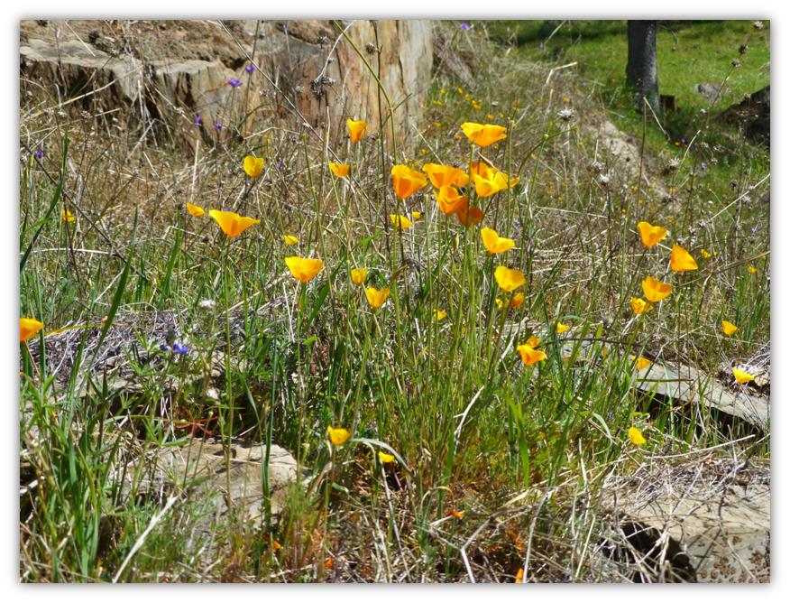
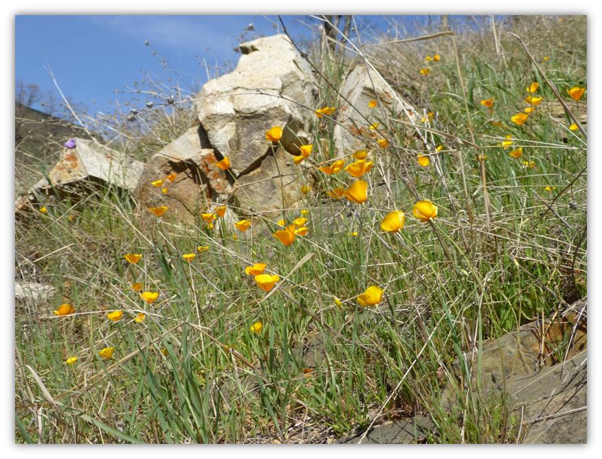
On our morning hike up, the California Poppy flowers were closed up but they were all open in the afternoon.
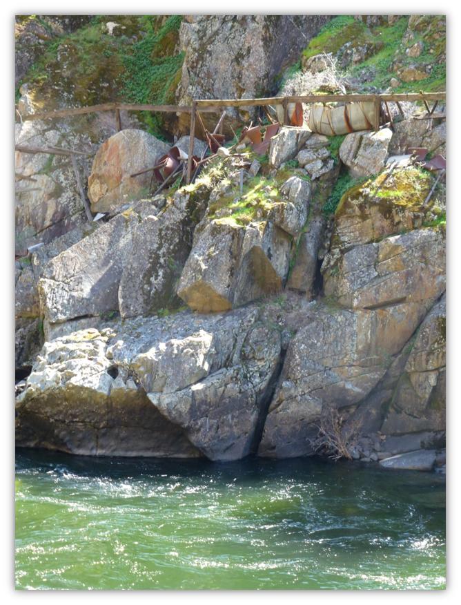
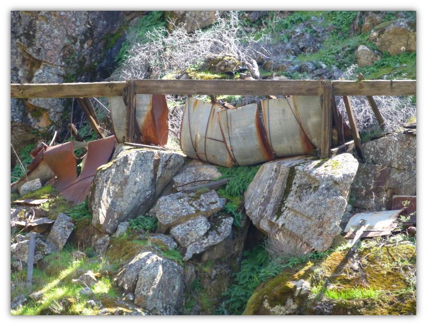
Remains of an old flume on the other side of the river made me very curious about its history. The old bridge and this flume appeared to not be that old in the scheme of things and I would guess it was from the era around the 1930’s-1940’s but I needed to know more about the people who lived here and made their livings in this canyon.
I learned that this river once had one of the southernmost runs of salmon in North America and Indigenous people, including the Miwok and Paiute tribes, had lived along the river for thousands of years where they thrived. At the time the first white explorers came to the area, there were about 450 Sierra Miwok split among 10 permanent villages. Paiute, of origin from the eastern Sierra near the Mono Lake area, also lived in the upper watershed of the Merced River. The Sierra Miwok and Mono Lake Paiute eventually, through cultural interaction over time, formed a new culture, the Ahwahnechee, derived from Ahwahnee, meaning “the valley shaped like a big mouth” (referring to U-shaped Yosemite Valley).
Mexico had sent military expeditions through the Merced River region in the early 19th century when they held sovereignty over Alta California. Several military expeditions sent by Spanish colonists from coastal California traveled into the Central Valley. One of these trips, headed by Lieutenant Gabriel Moraga, arrived on the south bank of the Merced River on September 29, 1806. They named the river Rio de Nuestra Señora de la Merced (River of Our Lady of Mercy), who is the patron saint of Barcelona and is celebrated on September 24.
Moraga’s expedition was part of a series of exploratory ventures, funded by the Spanish government, to find suitable sites for missions in the Central Valley and the Sierra Nevada foothills. In 1808 and 1810, Moraga led further expeditions along the lower Merced River below Merced Canyon, each time coming to nothing. Eventually, plans to establish a mission chain in the Valley were abandoned. In 1855, Merced County was created, named after the Merced River.
The California Gold Rush in the 1850s saw gradually increasing mining in Merced Canyon and Yosemite Valley, leading to the establishment of a railroad along the river, bringing minerals and lumber to towns that had been established on the lower Merced, and helping increase tourism to the future national park area. Following the establishment of Merced County and the independence of California from Mexico, many settlers came to the Merced River area and established small towns on the Merced River.
One of the first was Dover, established in 1844 at the confluence of the Merced River with the San Joaquin River. Dover functioned as an “inland seaport” where boats delivered supplies from the San Francisco Bay area to settlers in the San Joaquin Valley. Some towns that followed were Hopeton, Snelling and Merced Falls, the latter named for a set of rapids on the Merced River near the present-day site of McSwain Dam. In the late 1880s a flour mill, woolen mill and a few lumber mills were constructed at Merced Falls.
The Sugar Pine Lumber Company and Yosemite Lumber Company operated lumber mills at Merced Falls for over thirty years, relying on narrow-gauge railroads to ship lumber from the Sierra Nevada along the Merced River. Following the construction of the Central Pacific and Southern Pacific Railroads, many of the river towns on the Merced River were deserted. Several cities that did achieve prominence, however, include Merced and Turlock, both located on the railroad.
The Yosemite Valley Railroad, originally established with the discovery of mineral deposits in Yosemite Valley and Merced Canyon, continued functioning through the early 20th century carrying tourists to Yosemite Valley along the Merced River. El Portal Road, constructed through Merced Canyon in 1926, put an end to passenger service on the railway, but operations continued until the mid-1940s, when major flooding occurred, destroying sections of the railroad.
In the early 20th century, when the upper Merced River basin lay mostly protected, the lower river was the subject of dam-building and irrigation diversions by the Merced Irrigation District. The District proposed the Exchequer Dam, completed in the mid-1920s and raised in the 1960s, as a water storage facility on the Merced River.
Irrigation with water from the Merced River continued to grow substantially until most of the arable land around the river, some 120,000 acres, was under cultivation. By the late 1950s and early 1960s, irrigation in the San Joaquin Valley was to such an extent that many of the rivers ran dry in sections. Upriver of the Merced River confluence with the San Joaquin, the latter river was usually dry, only regaining flow where the Merced River enters.
In the mid-20th century, the flow in the Merced River diminished to such a degree that very few salmon returned to spawn in the lower section of the Merced River. In 1991, a fish hatchery, the Merced River Hatchery, was built beside the Merced River just downstream of the Crocker-Huffman Diversion Dam, the lowermost Merced River dam. Fall Chinook Salmon travel up a fish ladder into the hatchery’s pools, which are supplied with water diverted from the Merced River.
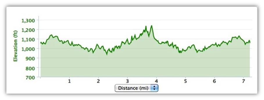
We didn’t see any rattlesnakes on this hike but I am sure they were watching us. We did see what I believe to have been a Northwestern Pond Turtle on the road. I should have taken a picture! I categorized this hike as an Easy to Moderate hike, but if you just hike along the river trail, it is easy. The moderate classification is due to the trail above the Merced River along the North Fork, which is narrow along the steep canyon wall.
Sources: Bureau of Land Management Merced Recreation Area website http://www.blm.gov/ca/st/en/fo/folsom/mercedriverrec.html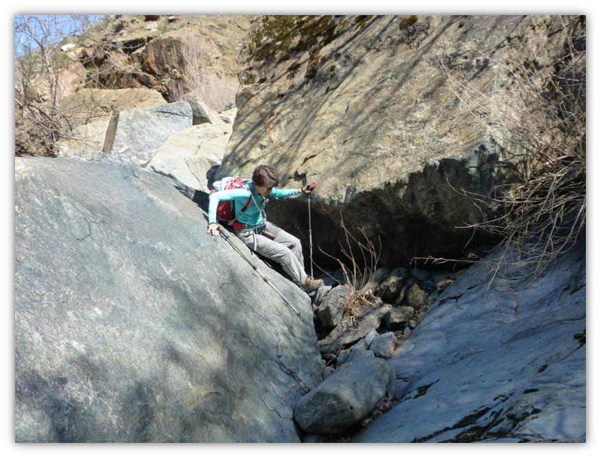
Johnston, Hank (1962). Short line to paradise: the story of the Yosemite Valley Railroad. Flying Spur Press
Wikipepdia


Thank you for such a wonderful adventure up the Merced River Canyon. I also enjoyed the brief history of the area.