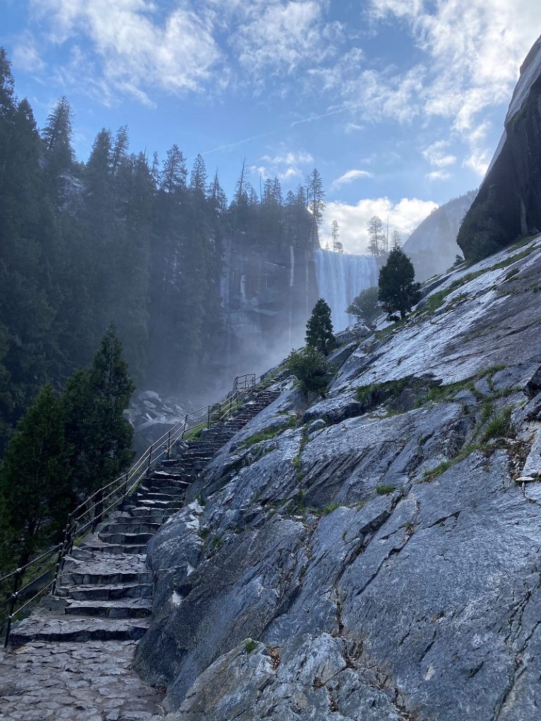
They say that the Mist Trail’s steep granite stairway has over 600 steps but I wasn’t counting because Vernal Fall’s beauty fully captured my attention as I climbed them. Up the Mist Trail and down the John Muir Trail. In between, I could feel the power of 2 huge waterfalls, their spray on my face and the roar of a tremendous amount of water coming down them. Distant views of 2 other waterfalls helped make it a perfect day!
Where: Yosemite National Park
Distance: 9.29 Miles
Difficulty: Moderate to Strenuous
Elevation Range: 3,992′ – 6,044′
Elevation Gain: 2,845′
Date: May 2, 2022
CALTOPO: Vernal and Nevada Falls Looped Hike
Dog Hike? No
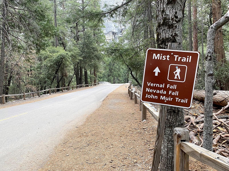 I parked at Curry Village then headed up the trail/road, following the signs to Happy Isles and the Mist Trail.
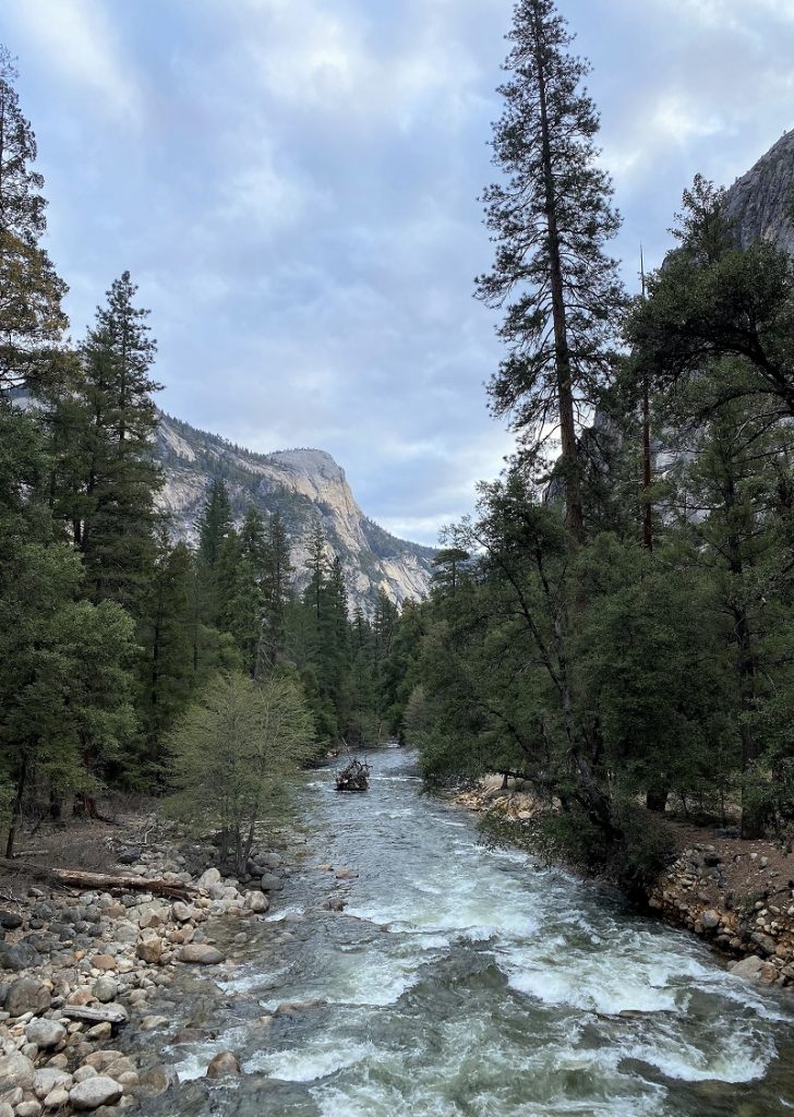
Looking from the Happy Isles bridge that crossed the Merced River, the clouds in the early morning sky painted a pretty picture.

As soon as I crossed the bridge, the Mist Trail sign was on the right and I followed the signs along the paved trail.

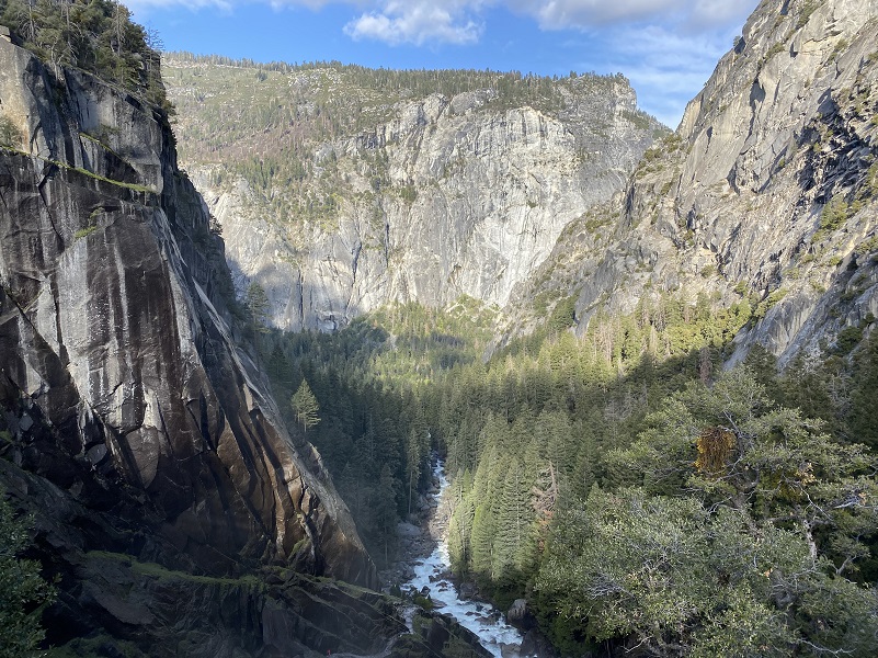
Looking back, I caught a glimpse of Yosemite Falls.
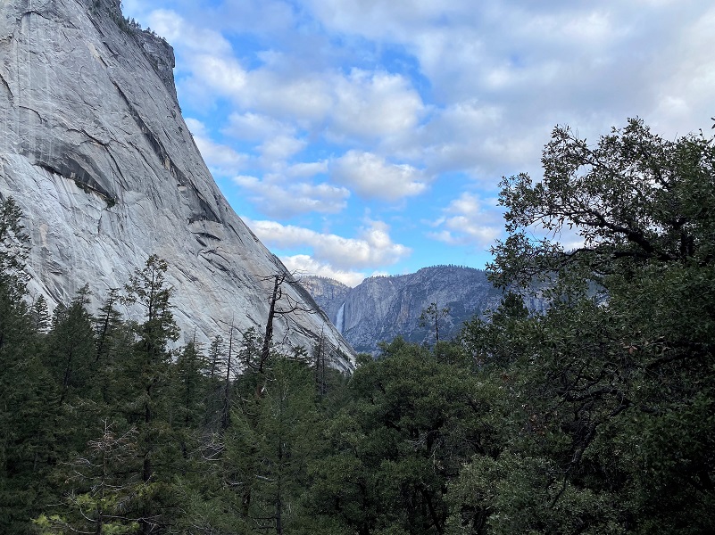
There are a couple of spots along the trail that you can see Illilouette Falls, not the whole falls at the same time but from a couple of different spots you get the top part and at another spot the lower part.
Here is what Wikipedia says about Illilouette Fall:
381 foot waterfall on the Illilouette Creek tributary of the Merced River in Yosemite National Park. It is located in a small canyon that cuts into the south wall of Yosemite Valley directly across from Vernal Fall. The origin and meaning of the waterfall’s name has been lost to time.
The fall is prominently visible to the south from both Mist Trail and John Muir Trail near Vernal Fall. However, during low-flow months, the fall can disappear entirely from this perspective. The best vantage point for viewing the waterfall is from the Panorama Trail as it descends from Glacier Point. There is no trail to the base of the fall as the narrow canyon is craggy and inundated with rapids during the wet season. It is possible – though not encouraged – to reach the base of the fall during low-flow months.
The meaning of the name “Illilouette” is not known. According to Lafayette Bunnell, the Ahwahneechee name of the waterfall was “Too-lool-lo-we-ak”. It was suggested by Bunnell that its literal translation was not appropriate for everyday use; what that translation was has been lost to time. “Illilouette” may have been a perversion of the waterfall’s Ahwahneechee name, though this is not known with any certainty.
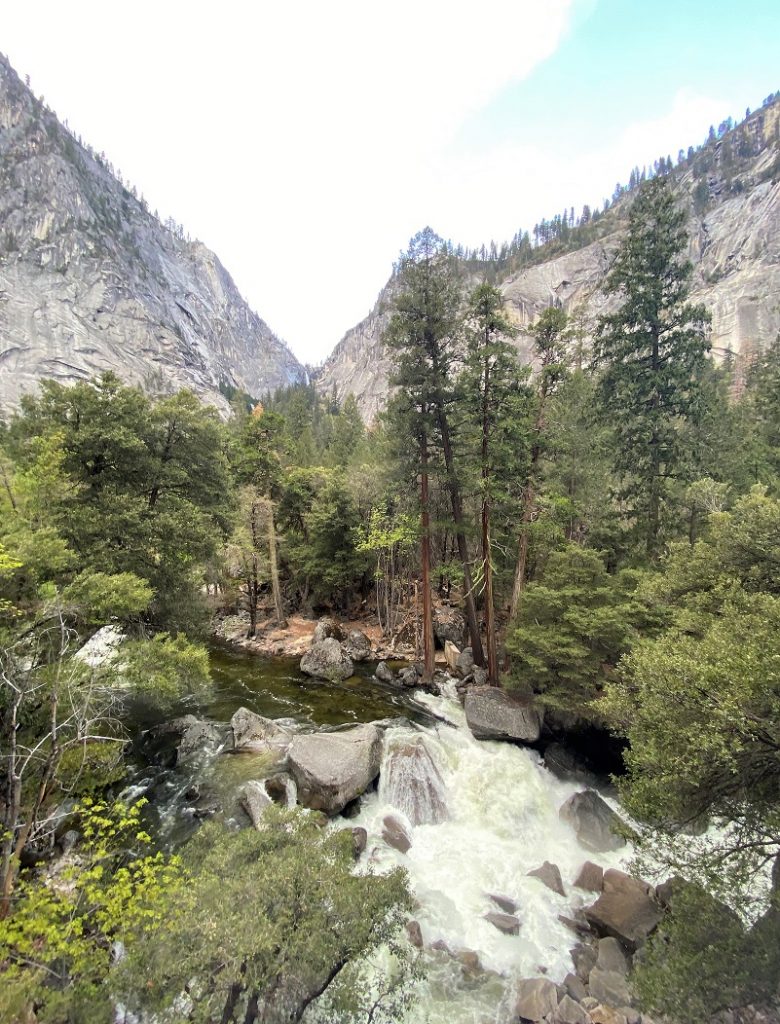
The trail crossed the Merced River on a wooden bridge where a sign was posted about the dangers and power of the waters below. The sign uses quotes such as “We weren’t swimming,” “We were only wading” from a mother whose two young children died at this exact location on August 15, 2012. It was a very sad and sobering site. Those waters were moving very fast on the day of my hike. If you are hiking near these waters and falls, please follow the directions on the signs. They are there for a reason.
Just in case you are doubting the power of the Merced River, take a look down river from the same bridge and what you would be dealing with if you fell in.
Did you know that you can catch a glimpse of Vernal Fall from this bridge if you look closely?

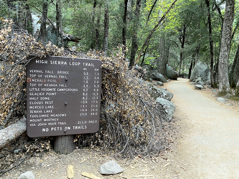
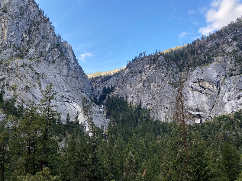
 Beyond the Vernal Fall Footbridge across the Merced River, there is a junction about 2/10ths of a mile. The right fork is the John Muir Trail and the left fork is the Mist Trail. Both will take you up to Vernal and Nevada Falls. I took the Mist Trail up.
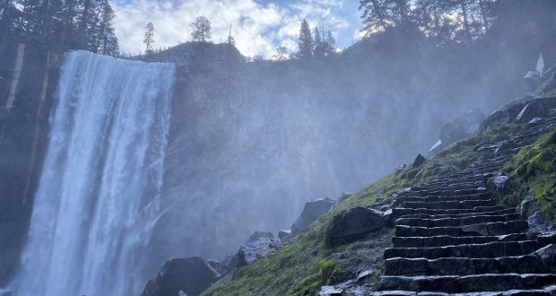
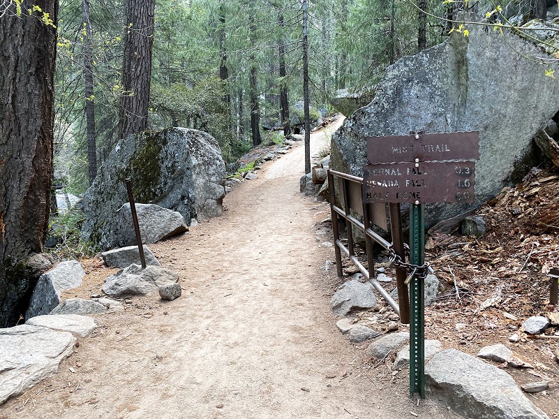
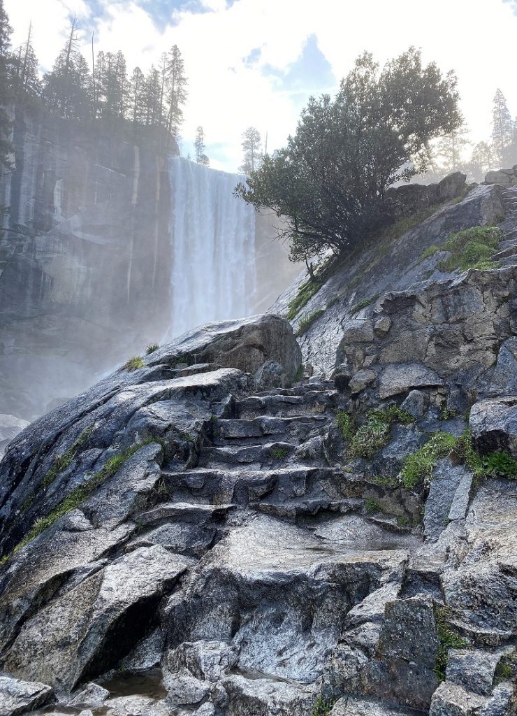
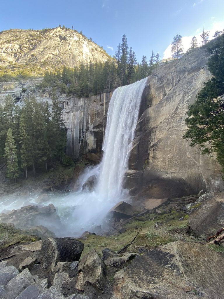
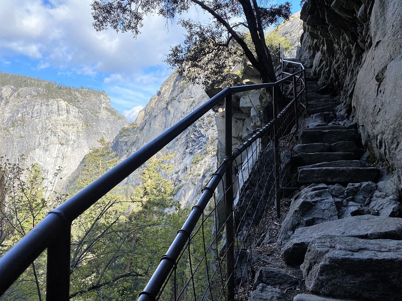
The Mist Trail is a bit shorter, about 0.5 mile up a steep granite stairway of over 600 steps. I didn’t count them but that’s what they say. Vernal Fall can create a mist that coats the granite steps of this trail in water, making for slippery footing and when the waterfall is really flowing, it will get you wet. Some people bring a light raincoat, poncho or pack cover to deal with this. I did not and want to add that in the warmer weather, this mist can feel very nice. This trail is closed in winter, but you can still get up to Vernal Fall via the John Muir Trail, which may be snowy.
Backpacker Magazine rates the Mist Trail as one of the 10 most dangerous hikes. Fatigue, altitude sickness, and dehydration contribute to the danger, but many times hikers ignore warnings of staying away from the swift flowing water of the Merced River, deliberately climbing over barriers to get a better view, slipping and falling into the River.
From Yosemite National Park:
More people die on the Mist Trail than almost anywhere else in Yosemite. It’s not the waterfalls or the cliffs that are the culprits; it’s the current. The river here apparently looks much less dangerous than it actually is. Typically, a hiker slips into the water and finds the current too strong to overcome, then gets swept to a regrettable death somewhere downstream. So please be careful when you’re near the river.
There are so many signs warning people of the dangers of the Merced River in this area but for some reason some people ignore them. When in any doubt, stay out of the water and use good common sense. Fast moving water can be a killer and is the cause of most deaths in the park. I cannot emphasize enough that you should follow what the signs say and keep close control of your little ones.
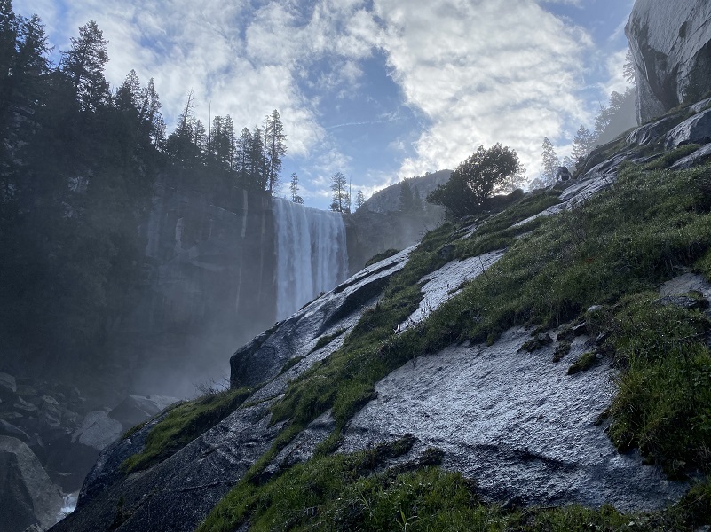

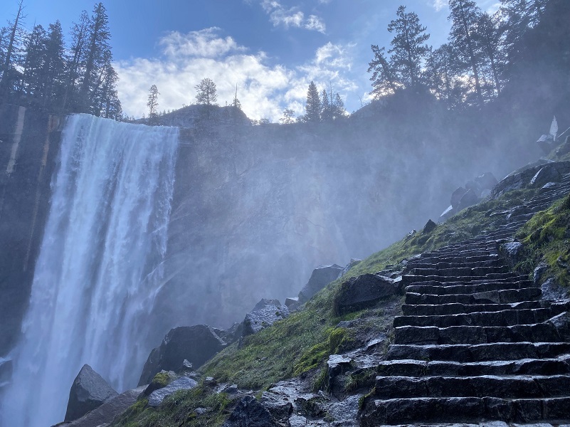
Pictures do not do justice to the feeling I had seeing Vernal Falls from the Mist Trail so I made a short video to help you hear and see it better.
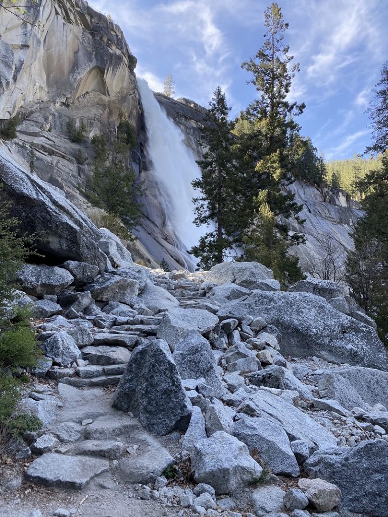
The granite steps continued on up to the top and I was almost there!
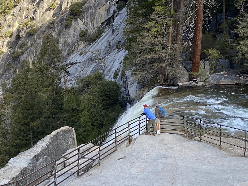
At the top of Vernal Fall, you can look straight down the length of the 317-foot waterfall (please don’t cross the railings and use extreme caution while you’re near any flowing water or wet rock in this area). From John Hittell’s 1868 “Yosemite: Its Wonders and Its Beauties”, it was named Vernal because the water near the top is very green and to distinguish it from another fall farther up that was very white.
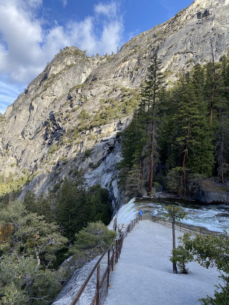
Looking downstream from Vernal Fall is also awesome.
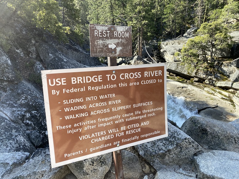
I continued up the trail that followed along the Merced River and this sign is so important to pay attention to. People have died here. According a 2013 Los Angeles Times article, at least 14 people had gone over falls along the Mist Trail in the last 10 years before that article was written. None survived.
From this point, you can: choose to turn around and head back the way you came; continue about .2 miles up to the next junction and take the longer route back via the John Muir Trail or continue uphill on the Mist Trail to the top of Nevada Fall. If you choose to continue on the Mist Trail, shortly beyond Vernal Fall, you will pass by Emerald Pool and Silver Apron. Both of these look may look inviting on a hot summer’s day, but it is illegal and dangerous to swim here due to the extremely hazardous current.
I continued on up the Mist Trail, about 1.5 miles of steep, rocky switchbacks to reach Nevada Fall.
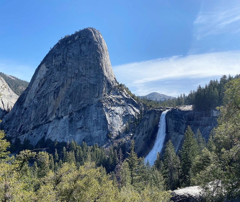
And Nevada Fall was loud! It falls 594 feet. The waterfall is widely recognized by its “bent” shape, in which the water free-falls for roughly the first third of its length to a steep slick-rock slope. This mid-fall impact of the water on the cliff face creates a turbulent, whitewater appearance in the fall and produces a great deal of mist which covers a wide radius. According to Wikipedia, it got its present day name because Nevada is Spanish for snowy.
The Indian name was Yo-wy-we, signifying the twist or squirm of the falling water. Lafayette Bunnell suggested the name “Nevada” for the waterfall. He wrote, “The Nevada Fall was so called because it was the nearest to the Sierra Nevada, and because the name was sufficiently indicative of a wintry companion for our spring (Vernal Fall)… The white, foaming water, as it dashed down Yo-wy-we from the snowy mountains, represented to my mind a vast avalanche of snow.”
Here is a short video taken below the top off of the Mist Trail.
I continued to the bridge at the top of Nevada Fall.

And here is another video taken from that bridge.
I stopped for a snack and my plan was to continue on to Illilouette Falls, Glacier Point and down the 4 Mile Trail. But, the water and mud on the trail was a bit much for the boots that I was wearing and if I would have continued on, it would have been with wet socks and boots for 9 miles or so. I opted to stay satisfied with the waterfalls that I had visited for the day and continued on down the John Muir Trail. I took a look back at Nevada Fall with Liberty Cap on the left. Very pretty!
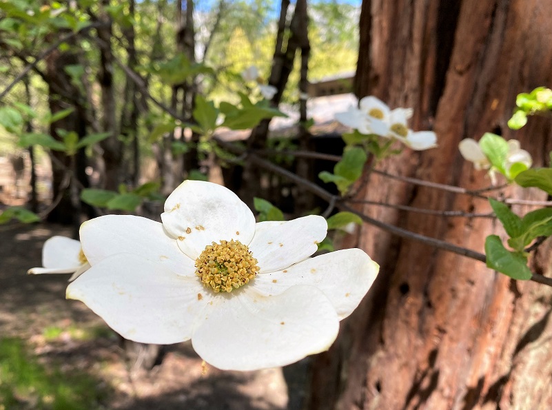
As I headed down, it got much more peopley, especially as I got closer to the Vernal Fall Footbridge. I was happy that I hit the trail around 7 am because there were only 2 other couples heading up near me and we enjoyed Nevada Fall to ourselves. Since my hike ended earlier than I planned, I decided to check out the dogwood blooms in Yosemite Valley and there were not many prime ones to check out. But, I did find a few.
Hikers can reach the top of Nevada Fall by continuing 1.3 miles along the Mist Trail (from Vernal Fall). The John Muir Trail also leads to the top of Nevada Fall (bypassing Vernal Fall). The portion of the John Muir Trail between Clark Point and the top of Nevada Fall is closed in winter.
If you choose the John Muir Trail, you will enjoy different scenery, with great views of Liberty Cap and different views of Nevada Fall. The John Muir Trail is a little longer—approximately 4 miles one-way compared to the Mist Trail’s 2.5 miles—so plan accordingly. The below chart shows the differences in mileage and elevational gain of the 2 trails.
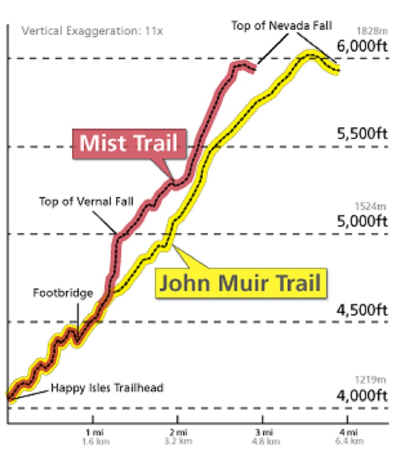
Mist Vs John Muir Trail to Nevada Falls (Courtesy Yosemite National Park)
If you decide to hike up the Mist Trail, be prepared for those steep steps. As you head up, remember that you also need to come back down. There are many places to pull off to the side of the trail to take a rest if you need to. This trail is heavily visited so don’t expect a pristine wilderness on this hike. But if you haven’t done this one before and it sounds like something within your abilities, you might consider packing a light rain jacket in addition to your usual items in your pack.
Dog Hike? No
Dogs are not allowed on the 4 Mile Trail.
Where Pets Are Not Allowed
- On trails, including the trail to Vernal Fall (however, pets are allowed on the Wawona Meadow Loop)
- On unplowed roads covered in snow
- In undeveloped and wilderness areas
- In public buildings
- On shuttle buses
- In lodging areas
- In all walk-in and group campgrounds/campsites, including Camp 4
- In any other areas, as signed
These regulations protect both pets and wildlife from disease and each other. The National Park Service has prohibited pets on trails for many years. In particular, some pets chase wildlife, pollute water sources, and can become defensive and dangerous in unfamiliar surroundings. Pet owners have the burden to assure their pet does not damage the park values for others in those areas where pets are allowed.
Doarama:
What is a Doarama? It is a video playback of the GPS track overlaid on a 3 dimensional interactive map. If you “grab” the map, you can tilt it or spin it and look at it from different viewing angles. With the rabbit and turtle buttons, you can also speed it up, slow it down or pause it.
Curry Village to Vernal and Nevada Falls Doarama
Map and Profile:
CALTOPO has some free options for mapping and here is a link to my hike this week: CALTOPO: Vernal and Nevada Falls Looped Hike
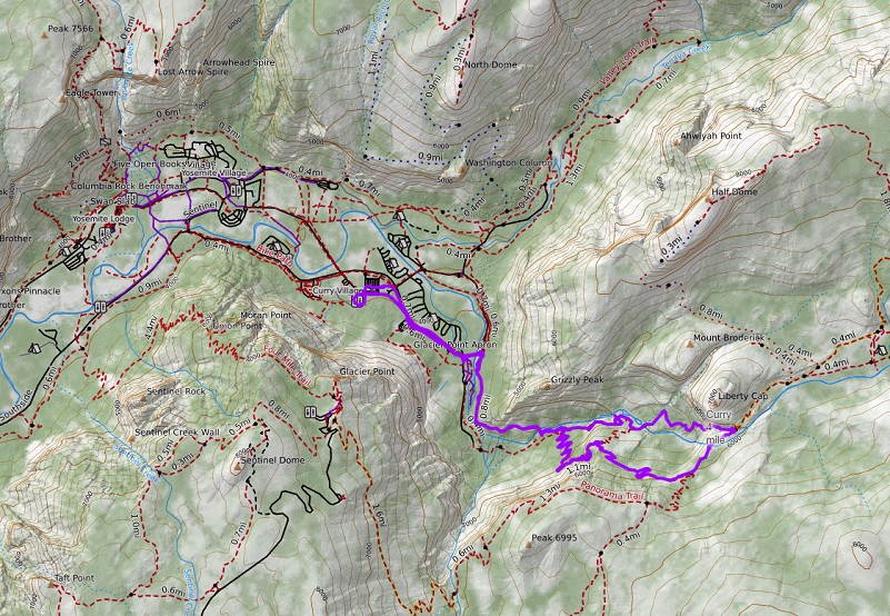
Curry Village to Vernal and Nevada Falls Topographic Map

Curry Village to Vernal and Nevada Falls Profile
You can download the below map and trail descriptions here. Note that since Glacier Point Road is closed this year, driving and shuttles to and from Glacier Point Road aren’t happening.
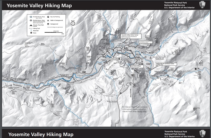
Yosemite Valley Hiking Map (Courtesy Yosemite National Park)

Yosemite Valley Hiking Map Trail Descriptions (Courtesy Yosemite National Park)
Sources:
Day Hikes in the Tioga Pass Region, John Carroll O’Neill & Elizabeth Stone O’Neill, 2002
Vernal Fall and Nevada Fall Trails Yosemite National Park
Browning, Peter, Yosemite Place Names: The Historic Background of Geographic Names in Yosemite National Park, Great West Books, 2005
Illilouette Fall World of Waterfalls
Pathways: A Story of Trails and Men (1968), by John W. Bingaman
Yosemite: the Park and its Resources (1987) by Linda W. Greene
Historic Resource Study: Yosemite and Its Resources by Linda Widel Greene 1987
Yosemite: Where To Go and What Go Do (1888) by George G. MacKenzie
One Hundred Years in Yosemite (1947) by Carl P. Russell
Yosemite Tales: Yosemite of Yesteryear – Part 1 Upper & Lower House, Leidig’s and Peregory’s
Yosemite Valley Hiking Map and Trail Descriptions
Vernal Fall and Nevada Fall Trails Yosemite National Park
Yosemite visitors reflect on deadly mistakes along a fabled trail LA Times
Pathways: A Story of Trails and Men (1968), by John W. Bingaman
Where Pets are Allowed Yosemite National Park
Bunnell, Lafayette H. (1892) Discovery of the Yosemite. Chapter 13, p. 205
Wikipedia
Hittell, John S. (1868) Yosemite: Its Wonders and Its Beauties
Prior Blogs in the Area:
Hiking up to Vernal and Nevada Falls May 3, 2017
Hiking Up Through The Meadow Fire To Bunnell Cascade January 23, 2015
