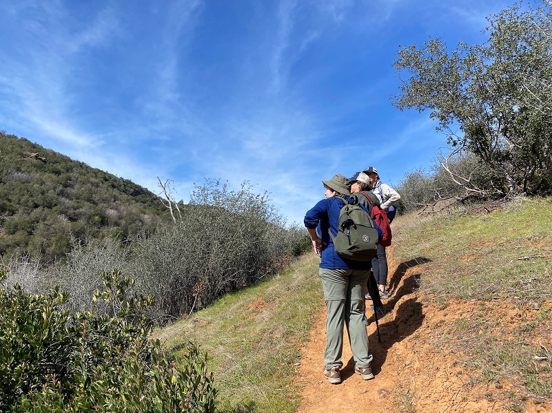
Frogs and birds were singing their tunes and turtles were basking in the sun on a beautiful day as I hiked with the Sierra Foothill Conservancy (SFC), exploring trails in the Stockton Creek Preserve. Recent land acquisitions have expanded this preserve, a partnership with SFC and Mariposa Public Utilities District (MPUD), to 700 acres and grants have improved and added some new trails.
Where: Mariposa Public Utilities District, Sierra Foothill Conservancy (SFC), Stockton Creek Nature Preserve
Distance: 3.83 Miles
Difficulty: Easy to Moderate
Elevation Range: 1,968′ – 2,337′
Elevation Gain: 760′
Date: February 26, 2022
CALTOPO: Hiking At Stockton Creek Preserve With The Sierra Foothill Conservancy
Dog Hike? Yes
The Stockton Creek Preserve had received some new acquisitions, expanding this beautiful preserve to 700 acres. There were some new trails and they had recently received several large grants to improve trails, signage and respite areas. I signed up for a hike with the Sierra Foothill Conservancy (SFC) to learn more. Additional information on how to sign up for their hikes and classes is at the end of this blog.
 Our meetup location was near the Mariposa Track Field. To get there, I headed north on Hwy 49 toward Mariposa, took a Right at 6th Street, headed up the steep hill to the end, then took a right onto Mariposa Street. I took the first left, the Mariposa Track Field was on the left a short distance. I parked along side the road. Our docents, Nan Oswald, Ninette Daniele, and Dave Waldrop, met us and we signed a liability waiver, then headed up to the Trail Kiosk at the end of the road.
Here is information on the Stockton Creek Preserve from the SFC:
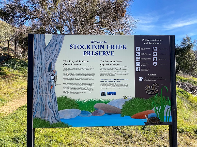
The Stockton Creek Preserve is a unique partnership project between Sierra Foothill Conservancy and Mariposa Public Utility District (MPUD). The completion of this 410 acre preserve and trail system provides domestic water supply protection, viewshed conservation, recreation opportunities, and fire hazard reduction. SFC worked in partnership with MPUD to develop the project and complete the 410 acre Stockton Creek Preserve with the county agency in December 2011. MPUD will now own and manage the property for its public benefits in perpetuity. SFC and MPUD are very thankful to the Sierra Nevada Conservancy for providing the funding for this now publicly accessible Preserve.
The Stockton Creek Preserve surrounds The Stockton Creek Reservoir, provides immediate watershed protection for the town’s primary domestic water resource. The Mariposa High School track team has been training on the property for years and they can now do so freely as the Preserve is open to the public. Visitors, residents, and students can enjoy a hike just on the edge of town on the network of trails on the preserve. The preserve includes a trail easement donated by the Fischer Family through their adjacent property so that the publicly accessible trails now extend from just above the MCHS to Hwy 140.
MPUD will be implement fuels reduction and vegetation restoration projects to reduce the significant fire hazard that the property poses and prevent impacting the town’s water quality. MPUD’s projects provide management and mitigation of extensive damage to the SCP’s native vegetation. A previous vegetation management treatment in 2000 left a major fuel load on the property. In 2004 a fire spread from Mariposa to the property. Due to the legacy of fire suppression and fuel load on the property, the burn devastated native vegetation and precipitated a more homogenous re-growth of chaparral. The following runoff period resulted in more than double the amount of “naturally” occurring contaminants in the town’s water supply, resulting in a violation of the Federal Drinking Water Disinfection Byproduct Rule for a year. MPUD’s management of The Stockton Creek Preserve Management Project works towards restoring the native plant community and reducing the possibility of these kinds of catastrophic wildland fire effects and negative impacts to Mariposa’s water supply.
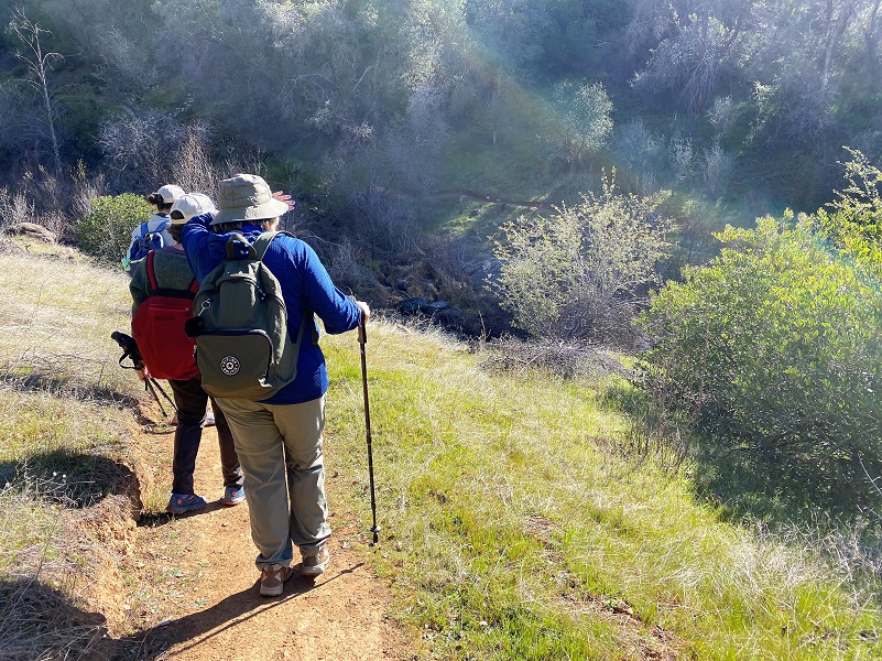
At the sign, the trail splits, the left trail called the Upper Trail and the right trail called the Trail. We headed out the trail that took off to the left and looped back on the Upper Trail. Also note that the Official Stockton Preserve map at the end is a little older and doesn’t show the trail to the right.

The trail zigzagged down the hill toward the creek and we stopped about half way to listen to a chorus tree frog singing. Click this link to hear what it sounded like.
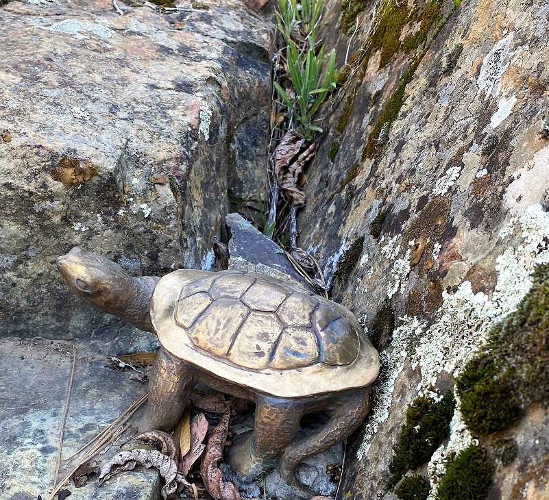
The trail soon reached Stockton Creek and as we started to cross it, we were in for a surprise. Nan told us about an ongoing native wildlife project art installation called “Stockton Creek Hide and Seek” between SFC, and the Mariposa Arts Council. Local artist Jackie Baxton has created 3 brass turtles that are tucked in the creek area. We easily located 2 of them but didn’t see the third.

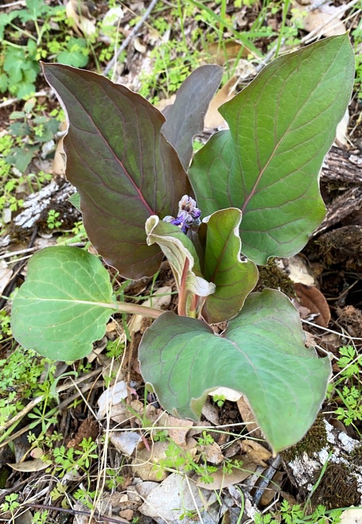
As we walked on the trail along the eastern side of Stockton Creek, we worked to identify various plants. California Buckeye was starting to leaf out.

A few Shooting Stars were starting to bloom.

We whipped out plant identification books and apps on some that we couldn’t easily idenitfy.
We continued up the trail.
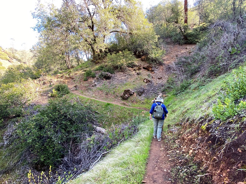
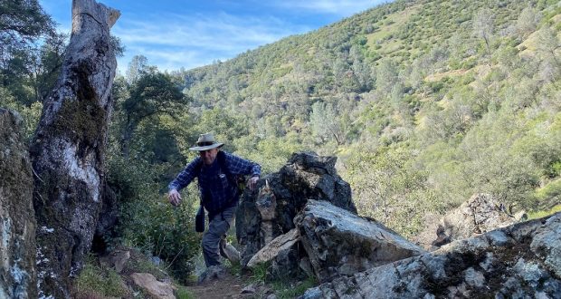
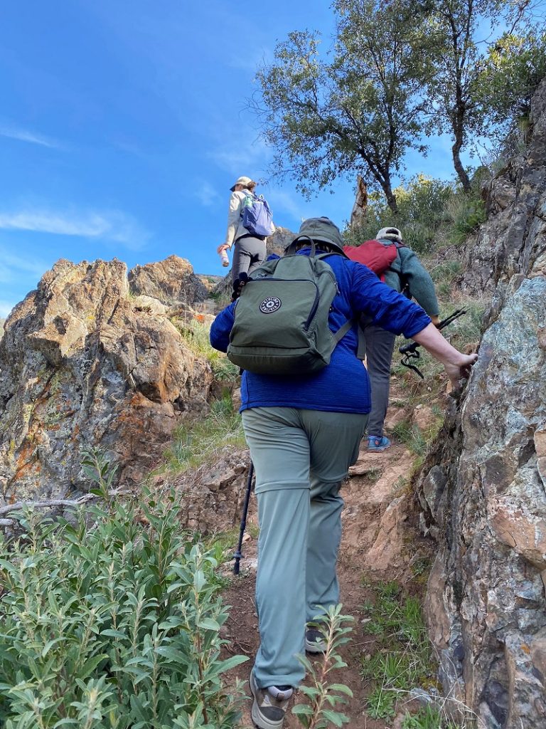
So far the trail had been very easy, although a bit muddy in some spots. We had a short section where we headed through a steeper rocky spot.
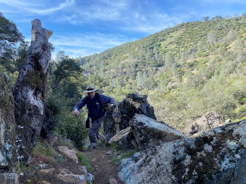
Looking back.
We took a breather, listening and identifying birds. We watched a California Towhee that was scratching in the dirt, then heard a Wrentit flitting around. A cute little Lesser Goldfinch then showed up. We also saw California Scrub Jays along the way. I am thankful that Nan helped me with the names because by the time I got home I had forgotten them.
We could also see the Upper Trail that we would be heading down later.

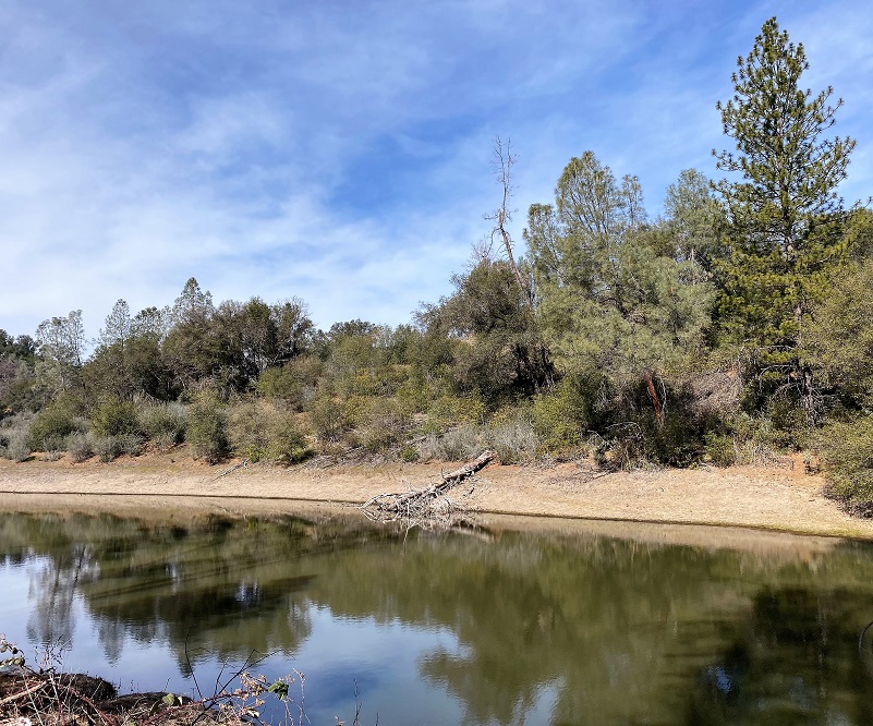
We continued on to the Stockton Creek Reservoir which provides water to the Mariposa area through the Mariposa Public Utilities District. And we looked for Western Pond Turtles, with the eagle eye of Ninette, spotting 5 of them basking in the sun on a down tree laying partially in the water. I needed to use my binoculars to spot them so my super zoomed in pictures won’t even come close to showing them to you. She also shared with us that what had previously been called the Western Pond Turtle has been split into 2 species. All populations north of the San Francisco
Bay area and populations from the Central Valley north are now known as the Northwestern Pond Turtle (Emys marmorata). Turtles in the southern portions of their range, the central coast range south of the San Francisco Bay and including the Mojave River, are known as the Southwestern Pond Turtle (Emys pallida).
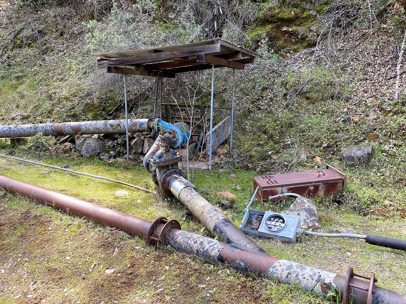
We continued down the road/trail on the western side of Stockton Creek, looking at old stuff along the way back to where we started.
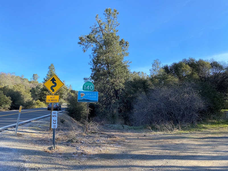
You can also access these trails from the upper end off of the Slaughterhouse Road area (see map). Heading up Hwy 140 east of Mariposa about .8 of a mile above Old Hwy, there is a large dirt area for parking with an entrance to the Preserve through a gate.
There are plenty of wildlife in this area such as deer, squirrels and a number of different birds including California Quail, Ravens and the occasional Redtailed Hawk, Great Horned Owl or Vulture. There are also rattlesnakes and I have seen them here.
You can hike on this Preserve on your own but if you are interested in going on one of these guided hikes on the SFC land, there are many choices on their website linked at the end of this blog. You can sign up online and if you are a member, there was a cost of $15. Don’t worry if you are not a member though because the cost was $25 for this hike. The funds go to a wonderful cause, protecting our foothill lands. They also have some Open Preserve Days which there is no charge to attend.
The mission of the Sierra Foothill Conservancy is as follows:
- Protects wildlife & preserves native flora
- Provides educational and recreational opportunities for the community
- Promotes scientific study of foothill ecosystems
- Maintains open space and beautiful vistas
The SFC is a non-profit public benefit corporation under the Internal Revenue Service Code Section 501(c)(3) and California Revenue and Taxation Code Section 23701d. Contributions are deductible for federal income tax purposes.
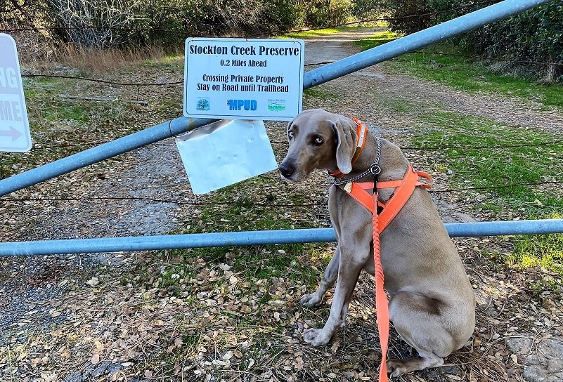
Dog Hike?
Yes. This is the only one of our local Preserves that dogs are welcome but there are some dangers to be aware of. This area is loaded with poison oak and your dog will pick up the oils on their coats, possible sharing them with you or your family when they get home. As I mentioned above, there are also many rattlesnakes in the area. The Stockton Creek Reservoir serves as drinking water for the town of Mariposa. The reservoir is a restricted area and no public access is allowed because of it being a drinking water source. So, you will need to provide drinking water for your dog. Here is the dog policy for the Sierra Foothill Conservancy:
DOG POLICY: In order to protect endangered species and sensitive habitat, only service dogs are allowed on the Preserves, with the exception of the Stockton Creek Preserve in Mariposa where dogs are welcome at any time.
Leave No Trace: Leave the Preserve as you found it – try to follow the Seven Leave No Trace Principles. THANK YOU and hope to see you in the Great Outdoors!
Doarama:
What is a Doarama? It is a video playback of the GPS track overlaid on a 3 dimensional interactive map. If you “grab” the map, you can tilt it or spin it and look at it from different viewing angles. With the rabbit and turtle buttons, you can also speed it up, slow it down or pause it.
Hiking The Stockton Creek Preserve With The Sierra Foothill Conservancy Doarama
Maps and Profile:
CALTOPO has some free options for mapping and here is a link to my hike this week: CALTOPO: Hiking at Stockton Creek Preserve With the Sierra Foothill Conservancy
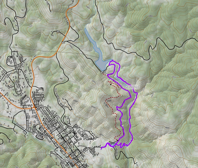
Stockton Creek Preserve With the Sierra Foothill Conservancy Topographic Map

Stockton Creek Preserve With the Sierra Foothill Conservancy Profile
If you click on this link, you can download the map below.

Stockton Creek Preserve Map (Courtesy Sierra Foothill Conservancy)
Sources:
Sierra Foothill Conservancy Home Page
Sounds of Pacific Chorus Frog CaliforniaHerps.com
Prior Blogs in the Area:
Hiking with Sally on the Stockton Creek Nature Preserve February 4, 2020
Hiking with Amphibians and Reptiles on the Stockton Creek Nature Preserve April 15, 2019


