What a beautiful day I had hiking the Lakeview Trail despite that skunk. It was a lovely winter day with blue sky and green grass framing the snow-covered mountains to the east. I was hoping to spot some eagles but it was not in the cards.
Where: Eastman Lake, U.S. Army Corps of Engineers
Distance: 7.94 Miles
Difficulty: Easy to Moderate, depending on how far you go
Elevation Range: 585′ to 709′
Elevation Gain: 750′
Date: January 3, 2022
CALTOPO: Eastman Lake’s Lakeview Trail Hike
Dog Hike: Maybe
To get to my adventure, I drove down Raymond Road past Raymond and turned right on Road 607, following the signs to Eastman Lake. The drive was extra pretty because herds of horses and cows were enjoying themselves on those grassy hills, bringing a smile to my face. I passed by the self-service Entrance Station, a self service kiosk where you insert your money and get a stub to display in your window. You can purchase a One-Day Pass for $5 or an Annual Pass $40. I had my Pass with me, which also includes the Corps of Engineers locations such as Eastman Lake. If you have a American the Beautiful or Lifetime Senior Pass, that will get you in without additional fees.
Across the road from the Entrance Station is a Historical Marker related to the town of Buchanan. Back in the 1860’s and 1870’s, this was a thriving town of over 1,000 people. They had a post office, stores and bars. Why was this town here? To support the thriving copper mines in the area. After the Civil War, the demand for copper wasn’t there and by the 1880’s, most of the businesses had closed and folks had moved on. In 1904, the post office closed.
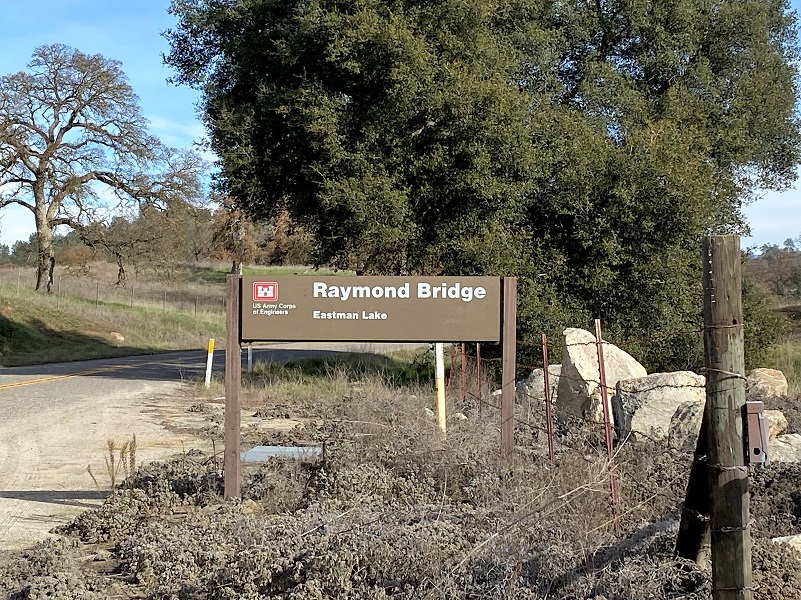
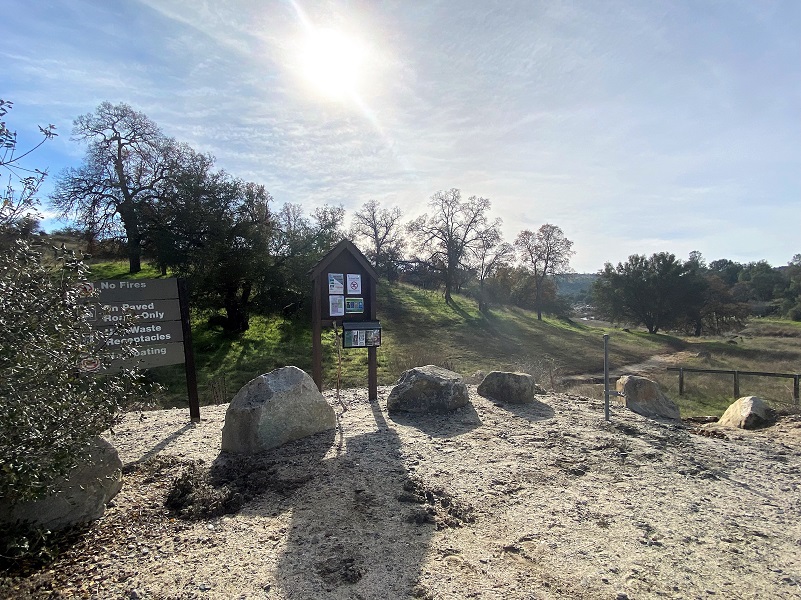
 You can start this hike from either end of the 4 mile Lakeview Trail, from where I started at the lower trailhead or from the upper end of the trail at the Raymond Bridge off of Road 613 where it crosses the Chowchilla River. To reach the trailhead that I started, I took the paved road that skirts the south side of Eastman Lake Recreation Area and followed the signs to the Lakeview Trail.
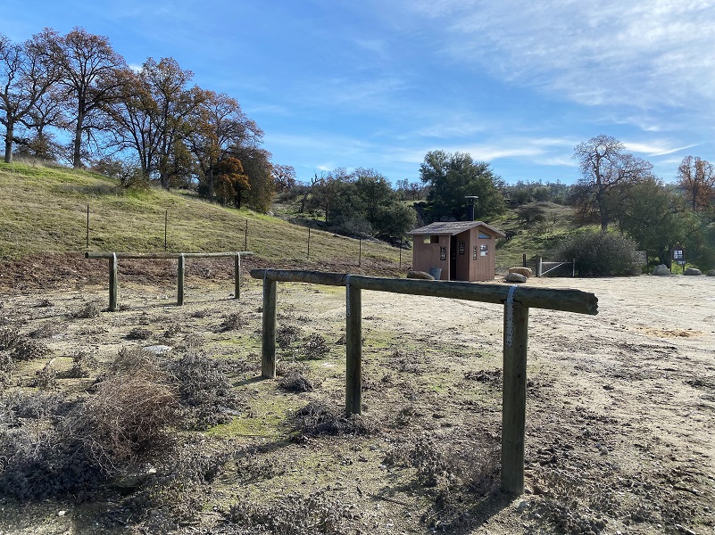
 There is a small parking area next to this Trailhead and as soon as I got out of the car, I took a deep breath and smelled the undeniable perfume of eau de skunk. I must have startled it when I drove in and I looked around to try and spot it. About that time, a Ranger was making her morning rounds and we waved, the only person I saw on my hike. I cautiously headed to the Trailhead, down the trail, and wondering if my skunk friend was on my path. I didn’t want to surprise it and risk smelling like skunk for my hike but that skunk was long gone.
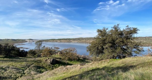
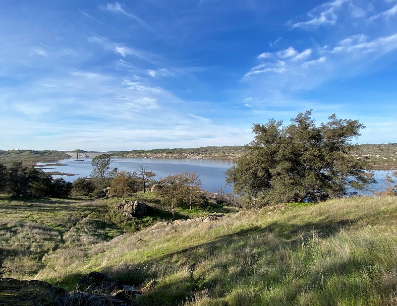
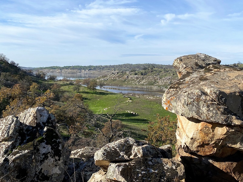
Frosty grass lined the trail as it wound along the lake. I had been very curious about Eastman Lake’s level and was disappointed to see that the lake was very low. How about a little information about the lake? Most of the lake is in Madera County but a small part of it is in Mariposa County. The lake was named in honor of Judge H. V. Eastman (1891-1972) who had served as Secretary Manager of the Chowchilla Water District. The Buchanan Dam across the Chowchilla River is an earthen dam, 218 feet high with a length of 1746 feet at the crest, impounding a maximum capacity of 150,000 acre-feet of water. The United States Army Corps of Engineers created this project for flood control and irrigation in 1975. Fishing is a popular activity at this lake with the California Dept. of Fish and Game declaring the lake a trophy largemouth bass fishery.
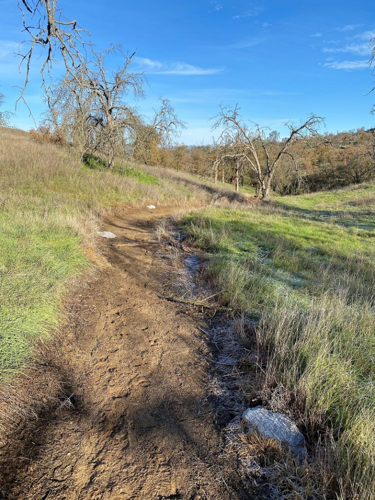
I think the trail was very pretty with the green grass coming up on the foothills.

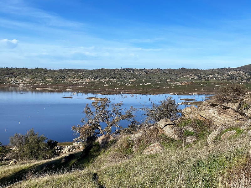
I continued on the trail, glancing back at the lake as I headed toward its inlet.
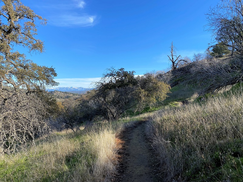
Every once in a while, I would get a peek of snow covered mountains in front of me.
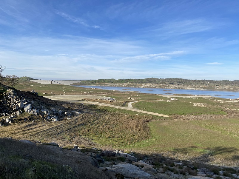
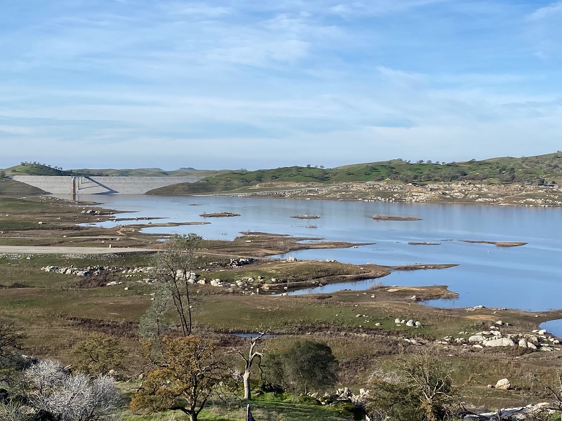
The lake didn’t extend as far east as it usually does.
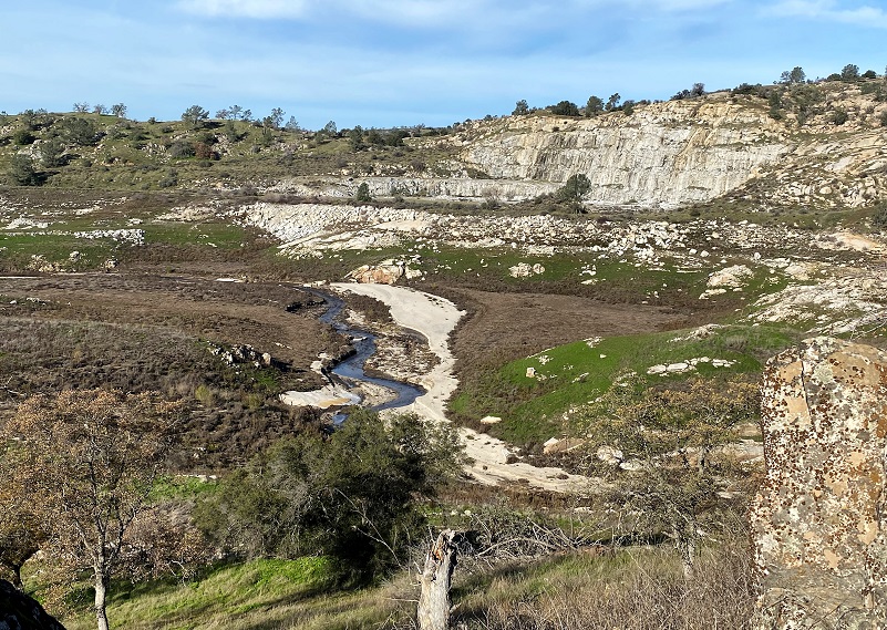
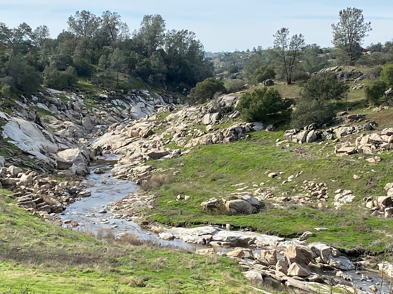
The Chowchilla River looked like a small stream as it entered the lake’s upper end.
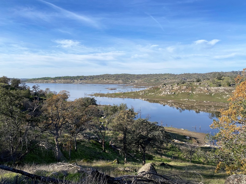
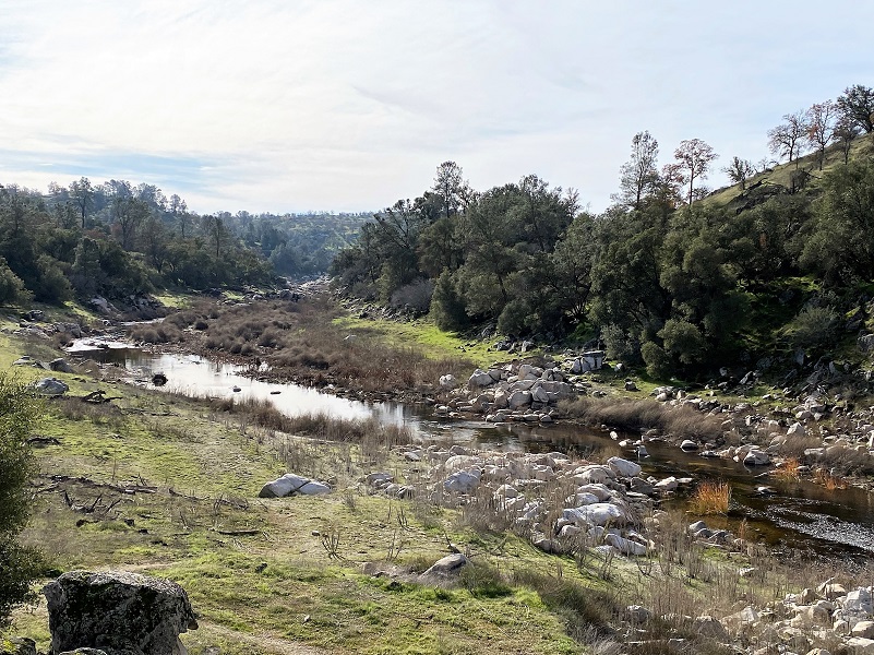
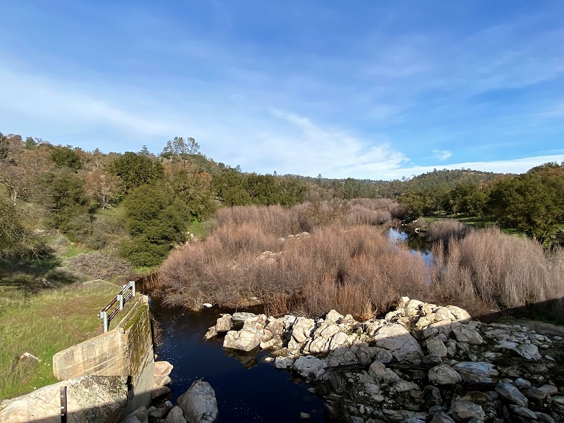
Close to 4 miles, I could see the Raymond Bridge and I headed up to take a look down and upstream.

This was the end of the trail and turn around spot for me but this is also the Trailhead that some of my friends like to start at off of Ben Hur Road.
I headed back down the trail, checking out the view of what I call the “gorge” on my way.
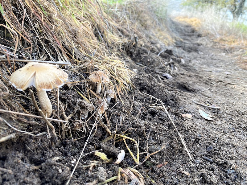
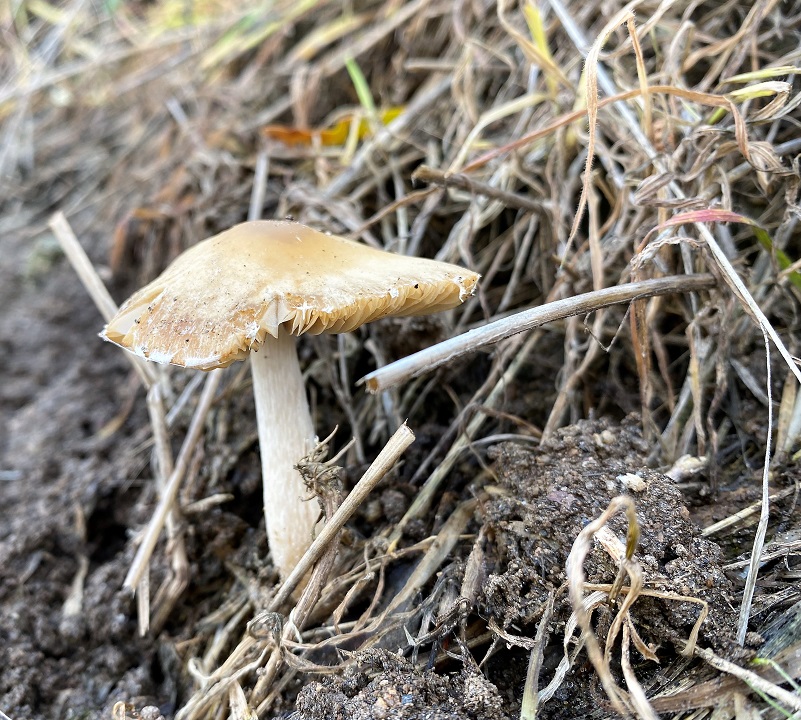
And I found a surprise on the trail with these small mushrooms I don’t know what they are but they were pretty to look at.
I drove down by the launch-ramp on my way out to see if any Bald or Golden Eagles were nesting or perched in the oaks there but they weren’t there. Sometimes I can see them flying but they weren’t in the sky on this day. They have been nesting at this lake since 1993. I have heard that the eagles at this lake don’t migrate but are year-round residents. I’m not sure where they were when I visited but I looked for them at the beginning and end of my hike.
I have seen other hikers, runner, bird hunters, horses, bicyclist, and dogs on this shared trail but I was alone on this day. I like to hike this trail when it is cooler, before the rattlesnakes are active. I think there are probably about a million in this area. Well, maybe not that many but there are plenty. On this day, there was no water on the trail for dogs so you would need to bring your own or venture down to the lake.
Dog Hike? Maybe
Dogs are welcome here but I didn’t bring mine because I knew that water sources for them would be limited. There were no running water sources at this time of the year. Also, I wasn’t sure about the water in the lake being healthy for them to drink since it was somewhat stagnate this time of the year and it would be a little hike to get down to the lake. On prior hikes, I have seen plenty of snake tracks. They are here! Other animals also live in this area so you want to have control of your dog. But earlier in the year, this could be a good dog hike for us. Later in the year it can get pretty hot and you may need to pack dog water or head down to the lake periodically. You can check out the link below for more rules and information.
Doarama:
What is a Doarama? It is a video playback of the GPS track overlaid on a 3 dimensional interactive map. If you “grab” the map, you can tilt it or spin it and look at it from different viewing angles. With the rabbit and turtle buttons, you can also speed it up, slow it down or pause it.
Eastman Lake’s Lakeview Trail Doarama
Map and Profile:
CALTOPO has some free options for mapping and here is a link to my hike this week: CALTOPO: Eastman Lake’s Lakeview Trail Hike
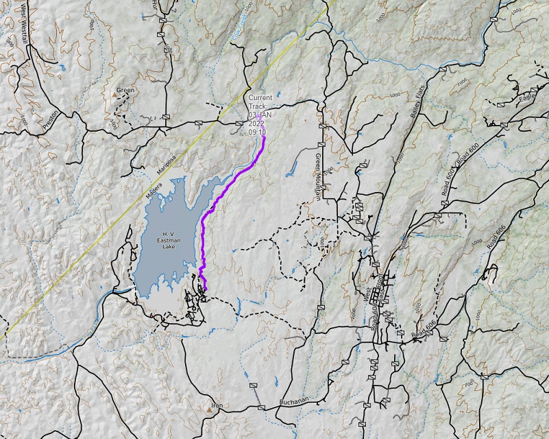
Eastman Lake’s Lakeview Trail Topographic Map
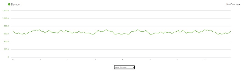
Eastman Lake’s Lakeview Trail Profile
Sources:
Codorniz Recreation Area Campground
Prior Blogs in this Area:
Hiking With Tarantulas Along Eastman Lake November 23, 2020
Hiking along Eastman Lake on the Lakeview Trail January 30, 2019
Hiking Along Eastman Lake March 17, 2017
Hiking With Raven and Sally Along Eastman Lake February 24, 2016


