NORTH FORK – A bit of cloud cover this afternoon over the Willow Fire slowed fire activity enough for crews to make good progress on the day shift, and hold some crucial lines, especially on the north.
There has been no update from this morning’s 3,383 acres with 30 percent containment, but there will be new numbers after this evening’s flyover for infrared mapping.
The good news from the northern division is that the line below Central Camp held, with assistance from air support, and firefighters were able to construct direct line and hold it to the east side of Sand Creek. The fire is still about two miles from the community of mountain cabins, which has now been ringed by dozer lines.
The western flank of the fire is holding solid as crews do mop-up and PG&E takes down snags threatening their power lines. There is still one home without power, and with the replacing of one pole on Saturday, that family should be back online.
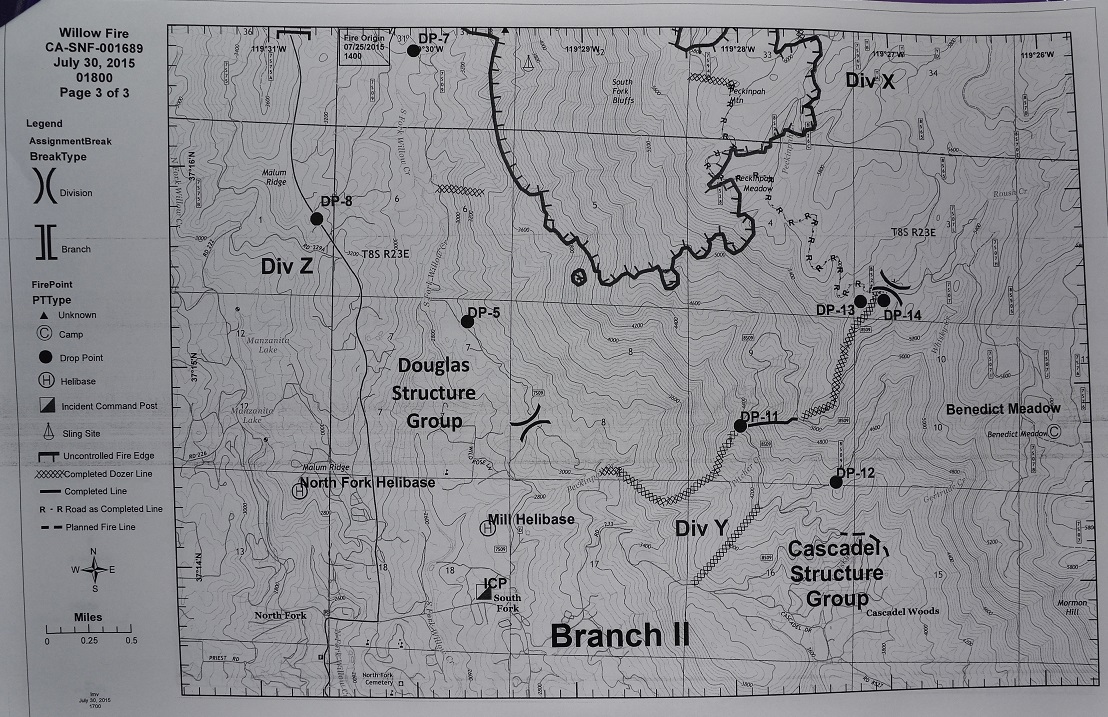
The crews headed out to the lines tonight will be conducting firing operations in Division X (see map below), burning out fuels to the south and west of established firelines. Direct attack on the southern flank is no longer feasible as it has become unsafe for firefighters and there is a low probability of success.
The 8S26 Road runs from Peckinpah Meadow, to the southeast from the edge of the fire, and ties in with the 2001 North Fork Fire dozer line. Firefighters have run hose lays along these lines, and will be using drip torches or Berry pistols to ignite the vegetation inside the lines to burn out fuels that could later threaten containment.
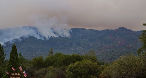
Air tankers laid down retardant along the control line today in preparation for the firing operations (see photo above).
Planners determine the best time for these operations, and with the first section of control line running along the top of a steep slope, nighttime down-slope winds will help to ensure that the fire travels away from the line.
It is not necessarily the goal of these operations that the fire consume all the fuels between the firing line and the leading edge of the fire, rather to remove the fuels at a large enough distance from the control line that any embers from the approaching fire will land in the burned out area and not ignite spot fires.
“It’s not just one quick backfire,” says Deputy Planning Chief Dave Martin. “There’s really kind of an art to it, and it takes a lot of experience to know how to burn out an area so that you don’t get too much heat and too much fire, or fire going the wrong direction next to the control line, which is where you’re trying to stop it. So it depends quite a lot on how the fire is progressing, what the wind is like, what type of day it is, what type of resources you have, where the line is that you’re firing out… there are a lot of variables.”
Though the aim may not be for a complete consumption of fuel, if it does burn all the way back to the leading edge of the fire, no one is going to try and stop it.
Residents have been evacuated from the Cascadel Woods area (Road 233), on down to Road 225, and along Douglas Ranger Station Road as firefighters perform these operations.
Crews will continue firing along the dozer line down to Peckinpah Creek over the next couple days, and planners will determine the optimum time to ensure the best results.
Firefighters and engines continue to arrive at the Incident Command Post, and there are now over 1,900 personnel assigned to the fire, with 132 engines, 44 hand crews, 18 dozers, 33 water tenders, 9 helicopters, 4 air tankers available on request, and 1 Very Large Air Tanker (VLAT).
No serious injuries have been reported, though there have been a few minor burns when firefighters stepped into burned out stump holes. There have also been a few heat-related episodes.
The Willow Fire started on Saturday, July 25, at about 2 p.m., and is burning just east of the south shore of Bass Lake, and about three miles north of North Fork, Calif. It was started by a juvenile playing with fire.
Cooperating agencies include Cal Fire, Madera County Fire, CHP, Madera County Sheriff’s Office, PG&E, the American Red Cross, California Office of Emergency Services, the California Conservation Corp, and the Mono Rancheria of Mono Indians.