MADERA COUNTY – Sept. 15, 2020 – A number of evacuation warnings were lifted in Madera and Fresno Counties allowing many residents to return to their homes. Many evacuation orders remain in effect in both Counties. To view the interactive map of all Creek Fire evacuation orders and updates for Madera County and Fresno County open the following link: Creek Fire Evacuation Map
Even with the the reduction of the mandatory evacuation orders it is estimated that over 10,000 residents remain displaced.
More than 11,000 structures remain threatened with 555 destroyed and 47 damaged and the assessment is approximately 46% complete. View the interactive damage assessment map for both Madera and Fresno Counties with the following link: Damage Assessment Map
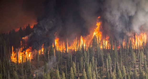
With 220,025 acres burned the smoke remained heavy yesterday morning but began to clear in the afternoon allowing more sun on the fire causing increased fire activity.
The fire is progressing north and northeast towards McCurry Trail-head, Jackass Meadow, Portuguese View Point, Globe Rock and Little Shuteye Peak away from more populated areas like North Fork and Bass Lake.
Temperatures are expected to warm Tuesday and Wednesday primarily due to more sun as the smoke inversion weakens. A break in the inversion is possible Wednesday and likely on Thursday as winds increase from the southwest.
The fire is expected to burn actively over the next few nights as relative humidity drops into the single digits. As fire activity increases and winds change particular attention will be paid to areas that could make a run toward the communities of Central Camp, South Fork Bluffs and Whiskey Falls.
The Creek Fire currently has a total personnel of 2,623 with 281 engines, 66 water tenders, 18 helicopters, 29 hand crews and 76 dozers.