Sally and I hiked some new country, full of yellow aspens along the South Fork of Bishop Creek and when we reached the high points of our climb, we had magnificent views of colorful high mountains.
Where: Inyo National Forest, John Muir Wilderness
Distance: 8.09 Miles
Difficulty: Moderate
Elevation Range: 9,052′ – 11,592′
Date: October 11, 2016
Maps: Mount Darwin Topographic Quad
Dog Hike? Maybe
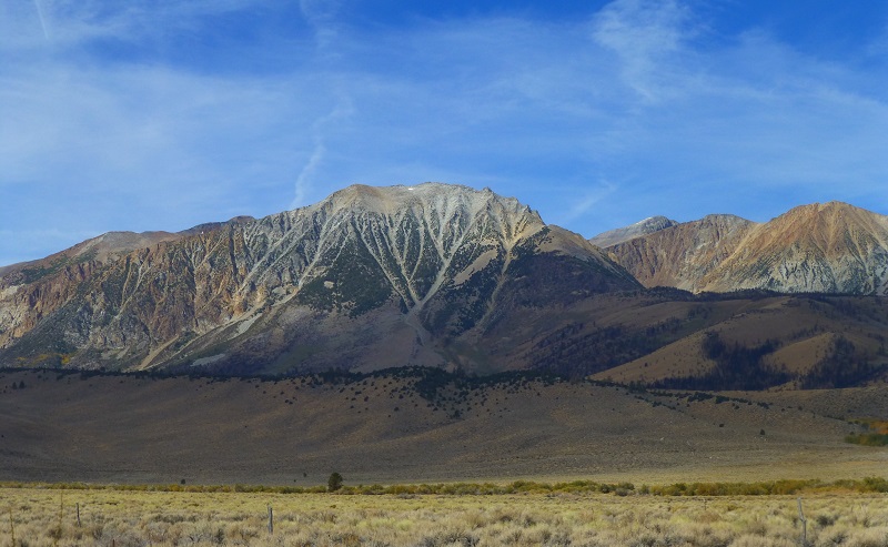
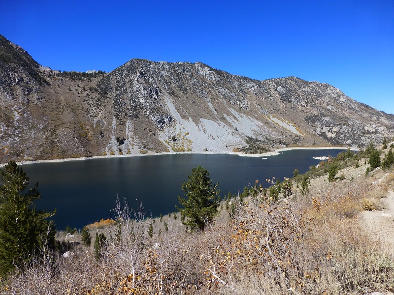
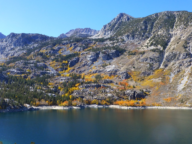
Sally and I headed up to the mountains west of Bishop for a few days of camping, hiking and fishing. As the crow flies, this is just east of the Oakhurst area but we had a bit of a drive to get there, across Tioga Rd., then south on Hwy 395, east on Hwy 168 then up South Lake Rd. I hoped my timing would be good for fall colors and I couldn’t resist swinging through June Lake Loop to see the color. As soon as I turned off on the road, I pulled over to take in this beautiful view.
 We did this hike as a through hike, staging a vehicle at the Sabrina Basin Trailhead in order that we would see new country throughout the entire hike. We started at the Tyee Trailhead off of South Lake Rd., located on the north side of the road between the Table Mountain Campground and the Willow Campground.
We crossed over the South Fork of Bishop Creek and headed up the hill, which had wonderful views.
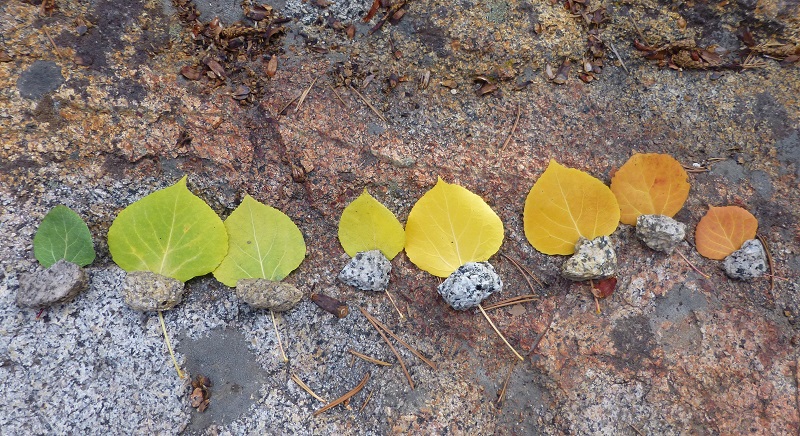
After many switchbacks, we came across this leaf art left by someone.
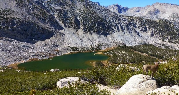
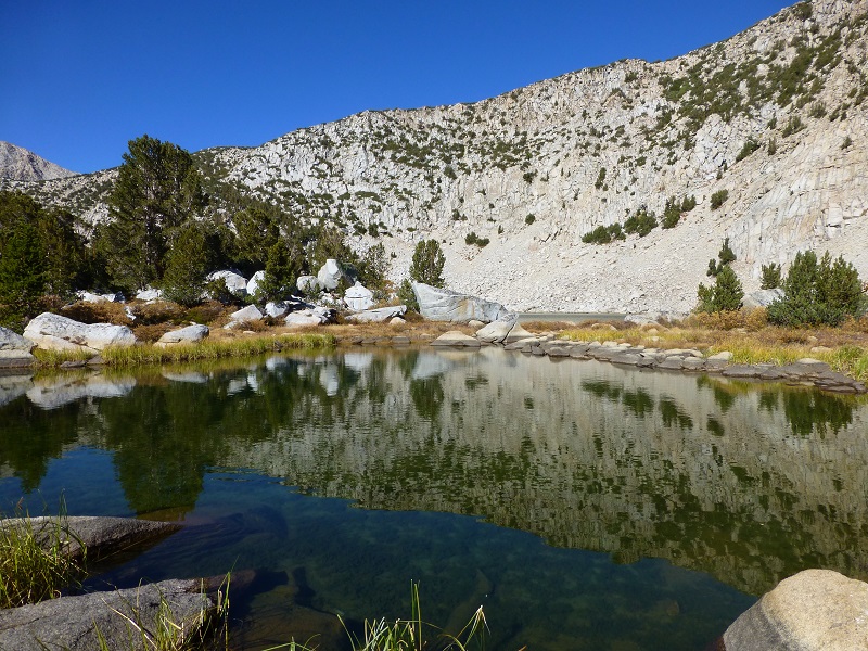
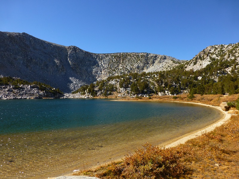
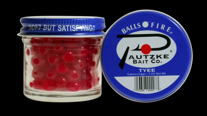 We reached the first of the 5 Tyee Lakes and of course I wondered where they got their name. The story is that they are named after a type of salmon eggs.
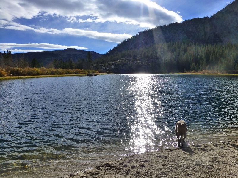
The light was shining on Sally as she checked out the first Tyee Lake.
The water from the lakes and creeks in this area are part of a large hydroelectrical project that got its start back in 1904 by a group of Denver capitalists who had first expected to develop some mining properties in Nevada. The experts who made the investigation for them suggested that, instead of entering the mining business, they should develop hydro-electric power on Bishop Creek to serve the mining camps at Tonopah and Goldfield.
The name of the ownership has changed many times since those early years. Some of those names include the Nevada-California Power Company, The Nevada Power Mining and Milling Company Lands, Hillview Water Company, Southern Sierras Power Company, Nevada-California Electric Corporation, the Interstate Telegraph Company, Bishop Light and Power Company, Corona Gas and Electric Company, Hillside Water Company, Imperial Ice & Development Company, Coachella Valley Ice and Electric Company, and the Holton Power Company.
In 1941, the company changed its name to California Electric Power Company (later known as Calectric). The properties of Calectric were acquired by Southern California Edison Company (SCE) in 1964 through a merger consolidation and SCE is the present operator of the Bishop Creek plants.
What an incredible vision these people must have had to try and harness the power of the water coming from the high peaks of the Southern Sierra. The trail that we were hiking on was also a part of that old system and was used by men and mules to haul equipment up and down the many parts and pieces of the system.
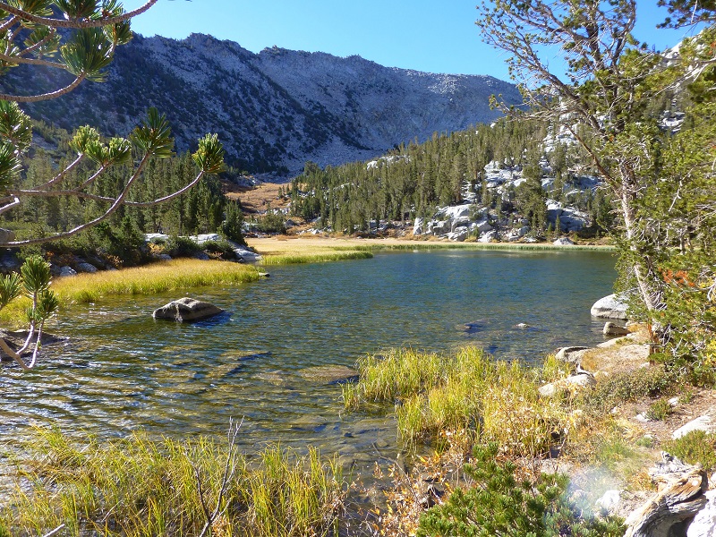
As we climbed those switchbacks, we reached the second Tyee Lake.
The trail bypassed the third Tyee Lake, and our next stop was the Fourth Tyee Lake.

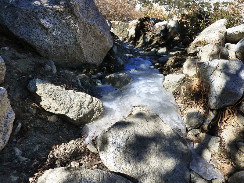
We were surprised to find a stretch of the trail covered in ice but I guess it is getting to be that time of the year.
Looking back at Fourth Tyee Lake
As we approached the fifth Tyee Lake, it looked like it once had a rock dam or crossing that had been removed at the outlet.
The trail topped out on Table Mountain, a really cool plateau with large boulders strewn about it. It was a great spot for us to stop for lunch. We kind of lost the trail in this area but knew which way we were headed and picked it back up before it started down the north side of the mountain.

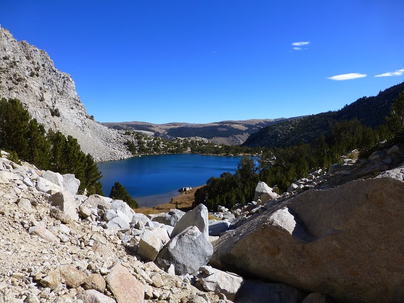
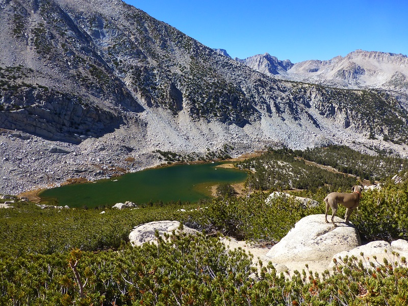
As we headed off of the north side of Table Mountain, George Lake was in full view.
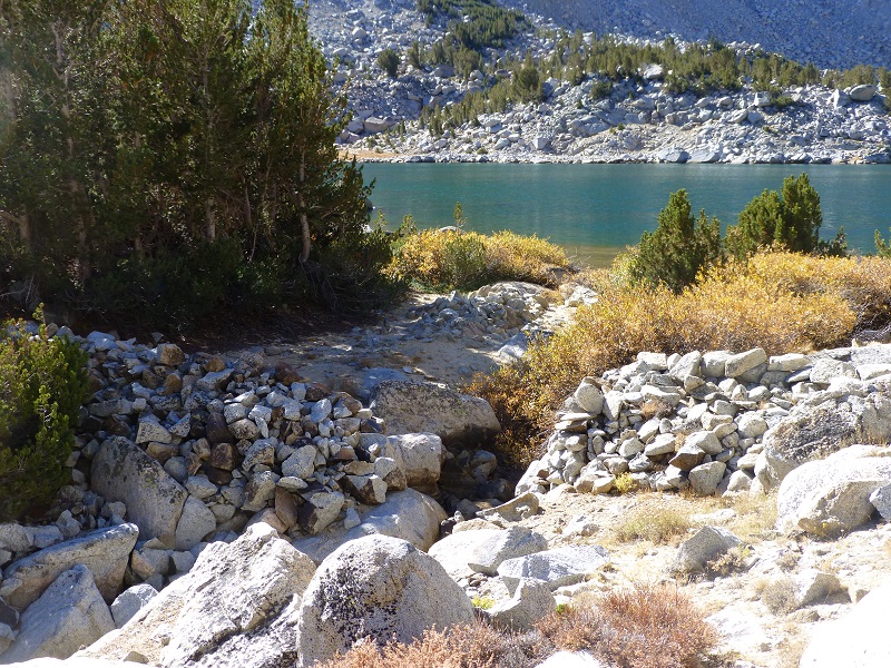
The last stretch of the trail headed down to Sabrina Lake, which was named for Mrs. Sabrina Hobbs, whose husband, C. M. Hobbs, was the first general manager of the Nevada California Power Company, which constructed a reservoir at this lake in 1907-1908. And of course, I was a little curious about the person that this beautiful lake was named after so I did some digging.
Sabrina “Ina” Blaine was born February 28, 1854 Philadelphia, Pennsylvania, married Charles Milton Hobbs on August 9, 1879 in El Paso County, Colorado and she died July 27, 1944 in San Francisco, California. Her husband had died January 27, 1910 in Colorado Springs, Colorado and it appears that they did not have any children.
Our trail ended below the Lake Sabrina Dam at the Sabrina Basin Trailhead where our other vehicle was parked. What a fun hike this was. I want to let you know that there is a cafe at the Lake Sabrina Boat landing but it had already closed for the season. When it is open, it is one of those famous Sierra east side pie places to make a stop and try a piece of pie with ice cream on it. Or perhaps you have worked up an appetite for something else on their menu . . .
Dog Friendly?
This area can be a great place to hike with your dog, if your dog is a good fit. The water sources that a dog can access are good year round except there is a dry stretch on the north side that will probably prove to be too long on a warn day. There are rattlesnakes on the lower parts of this hike. This is an area that has Bubonic Plague, so need to keep your dogs away from squirrels and rodents. Below are the dog rules for the John Muir Wilderness:
- Pack goats are not recommended in Big Horn Sheep habitat areas while their impacts are being evaluated. For more information about Big Horn Sheep recovery, check the following links: Sheep Facts Big Horn Recovery
- Dogs are allowed in the John Muir Wilderness, but are not allowed in wilderness areas in adjacent national parks.
- Pet food must be stored to the same standard as people food. In areas where use of a bear resistant food storage container is required, pet food must be stored in your container.
- Leashes protect dogs from becoming lost and from wilderness hazards such as porcupines, mountain lions, and sick, injured or rabid animals.
- Unleashed dogs may intimidate other hikers and their dogs, depriving them of a peaceful wilderness experience.
- Unleashed dogs may harass, injure and sometimes kill wildlife.
- A leashed dog’s keen senses can enhance your awareness of nearby wildlife or other visitors.
Map and Profile:
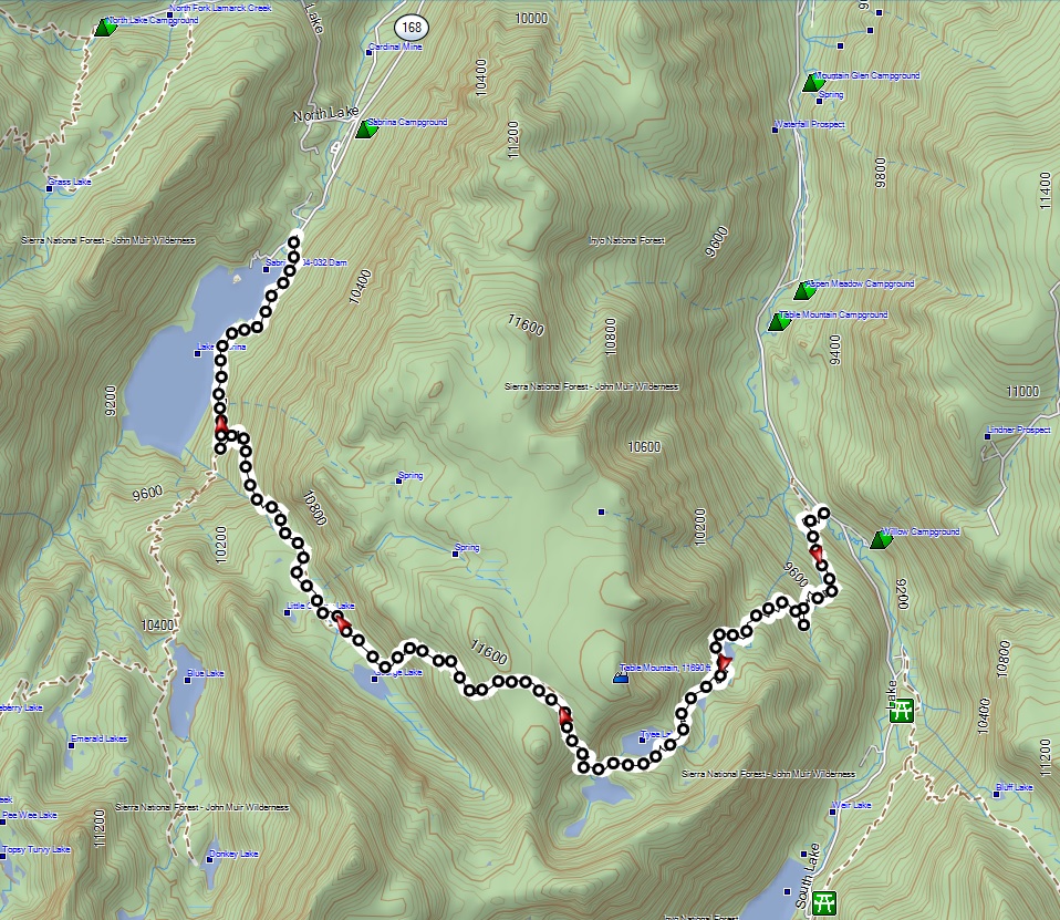
Tyee Lakes to Lake Sabrina Topog
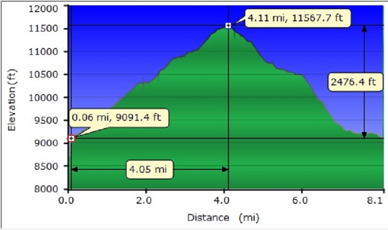
Tyee Lakes to Lake Sabrina Profile
Sources:
John Muir Wilderness Dog Rules
Pautzke Balls O Fire Tyee Salmon Eggs
Tyee Lakes Trail Parcher’s Resort
Tyee Lakes Trail Inyo National Forest
The Nevada-California Electrical Corporation and the Southern Sierras Power Company
Bishop Creek Hydroelectrical System
Place Names of the High Sierra (1926) by Francis P. Farquhar


