MARIPOSA COUNTY –As displaced residents wait anxiously for updates on when they might be able to return home, new evacuation orders have been issued by the Sheriff’s Office.
Just after noon today, the Mariposa County Sheriff’s Office issued a new evacuation warning for the following locations:
- Bull Creek Road from Greeley Hill Road to the Merced River
- Old Yosemite Road to the Five Corners intersection
The town of Mariposa is still under an evacuation order, as is the community of Coulterville and all other areas that have been evacuated since the fire began.
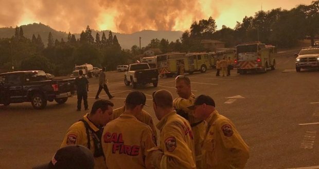
Crews are hard at work on the firelines, however the smoke is reportedly quite dense over the fire area today, making it difficult for Air Attack to get eyes on the fire.
The fixed wing attack was supposed to begin at 11:30 a.m., however visibility was so bad that the tanker returned to base and said they would try again in an hour.
Little change in the weather is expected today. Winds are expected to be slope-driven much of the day then shifting to the west-northwest in the afternoon. Sheltered areas, especially east aspects, may remain slope-driven all afternoon. A morning inversion has trapped smoke in the valleys with reduced visibility until it breaks.
Firefighters on the day shift got to work inside the dozer lines near Mt. Bullion Camp this morning, and requested helicopter support.
As fire officials set their control objectives for the day, they referred to the “box” that is part of their Incident Action Plan. Keep in mind that this is always a very big box:
- Keep the fire East of Merced County
- Keep the fire South of Greeley Hill Road
- Keep the fire West of Telegraph Road, Highway 140 and Highway 49
- Keep the fire North of Road 600
Crews have been assigned to mop-up in the Guadalupe and Old Highway area.
This morning’s reports of the nearly 22,000-acre increase in acreage is due to extreme fire activity late yesterday afternoon, say fire officials. Overnight, crews continued their work to establish and reinforce containment lines.
The fire area is seeing poor humidity recoveries at night allowing the fire to remain very active throughout the nighttime hours. It is burning in drought-stricken chaparral and in an area of severe tree mortality.
Damage assessment crews are on scene to evaluate and inspect the area.
Power lines supplying power to Yosemite National Park continue to be threatened. At 10 a.m. today PG&E crews will be replacing poles and associated equipment at Highway 49 and Bear Valley Road.
Sierra Telephone is doing everything possible to maintain service in the Detwiler Fire area and emphasis has been put on making sure that cellular service is still working. They provide all of the back-haul connections for the cell towers.
Road Closures:
- State Route 132 remains closed from SR49 at Coulterville to Horseshoe Bend Road.
- SR-49 remains closed from SR-120, north of Coulterville, to Triangle Road, south of the town of Mariposa
- SR-140 remains closed from School House Road, west of Catheys Valley, to Triangle Road, east of the town of Mariposa.
There is no estimate on when these roads will be reopened.
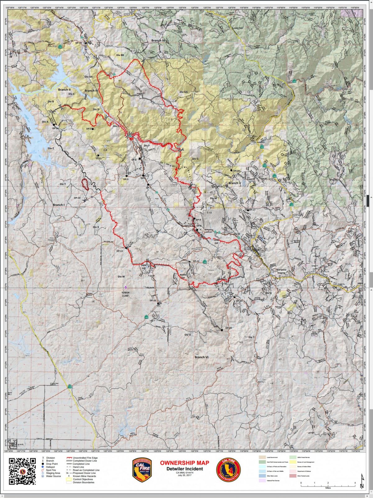
The Detwiler Fire is now estimated at 70,096 acres with 10 percent containment. 45 structures have been destroyed, and 5 damaged. 1,500 are still threatened.
There are currently 3,181 personnel assigned to the incident including 413 engines, 57 water tenders, 56 hand crews, 70 dozers, 14 helicopters and 9 air tankers.
For the most recent Cal Fire maps of the entire fire perimeter, click here. (this page may take a while to load)
For a map of the heat area of the fire, click here.
We will update as new information comes in.
(Sources: Yubanet, Cal Fire)