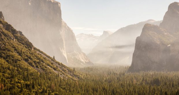
YOSEMITE – Sept. 11, 2020 – There are multiple fires burning in Yosemite National Park Wilderness. Each fire is burning in a fire adapted ecosystem. There are trail closures for the Lukens Lake-Yosemite Creek and Yosemite Creek Campground trails from Tioga road to the north rim of Yosemite Valley. All fires may be visible from Tioga Road, Glacier Point, and high country vistas. Smoke from each fire is settling locally at night and in the morning, then rising and dispersing to the north and northeast in the early afternoon. Park managers are working with the local Air Quality Districts and will be monitoring smoke impacts to the park and local communities. Heavy smoke from the Creek Fire is reducing visibility and shading out the area which has moderated fire behavior.
Location: 4 miles south of White Wolf campground and 1 mile west of Lukens Lake trail at approximately 9,000 feet elevation.
Discovery Date: July 24, 2020
Size: 3,132 acres
Containment: 20%
Strategy: Confine and Contain
Cause: Lightning
The fire has a 70% active perimeter burning in pockets of accumulated dead and down logs and is creeping and backing with isolated single tree torching along the active perimeter. When conditions are favorable, firing operations are occurring to help bring the fire’s edge to natural containment lines. Fire crews are utilizing unmanned aircraft systems for aerial reconnaissance and mapping, infrared detection (IR), and aerial ignition. This type of aerial ignition aids fire personnel by gaining depth along natural containment lines in areas otherwise too dangerous for firefighters to hike.
Wolf Fire
Location: 1 mile north of White Wolf campground and 2 miles east of Lukens Lake trail at 9,000 feet elevation.
Discovery Date: August 11, 2020
Size: 792 acres
Containment: 0%
Strategy: Confine and Contain
Cause: Lightning
The fire has a 60% active perimeter primarily on the north and northwest edge. The fire is burning in dense pockets of vegetation and accumulated dead and down logs and is creeping along the forest floor with some isolated single tree torching and short range spotting along the active perimeter.
North Whiz Dome Fire
Location: 4/10 mile south of Cathedral Creek and 1 mile northwest of Tioga Road at 8,400 feet elevation.
Discovery Date: August 27, 2020
Size: 19 acres
Containment: 0%
Strategy: Monitor
Cause: Lightning
The fire has an 80% active perimeter burning in heavy fuels through ground litter on the forest floor and burning in pockets of accumulated dead and down logs with some isolated single tree torching. Fire personnel will continue to monitor fire behavior and growth. inciweb.nwcg.gov/incident/7135/
Horse Fire
Location: 1 mile south of Ostrander Lake along Horse Ridge at 9,500 feet elevation.
Discovery Date: August 24, 2020
Size: 15 acres
Containment: 0%
Strategy: Confine and Contain
Cause: Lightning
The fire is creeping and smoldering through sparse vegetation in a very rocky area. It is not currently burning along any trails and has shown moderate activity.
For the most up-to-date fire information follow Inciweb: inciweb.nwcg.gov
These updates will happen once week unless significant activity occurs. For the most up-to-date fire information go to : Inciweb
-NPS-
- Air Quality: Yosemite Air Quality Page or airnow.gov or airnow.gov/fires
- Sign-up for Alerts: go.nps.gov/alert
