MOUNTAIN AREA — Winter weather is on its way again this week, with a potential for flash flooding in the lower country and heavy snow in the higher elevations.
The National Weather Service in Hanford has issued a Flash Flood Watch for towns including Ahwahnee, Coarsegold, Mariposa, North Fork, Oakhurst, and O’Neals. The Flood Watch is in effect from Wednesday morning through Friday morning.
The NWS has also issued a Winter Storm Watch for heavy snow in the high country in the Sierra from Yosemite to Kings Canyon, in effect from Wednesday night to late on Thursday.
We will update this article as conditions develop. See below for individual NWS links for each town, watch and potential warnings.
Flash Flood Watch
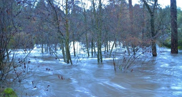
A Flood Watch has been issued by the National Weather Service for Mariposa, Madera and Fresno County Foothills, including the towns of Coarsegold, Oakhurst, North Fork, and Mariposa, especially the Ferguson Fire burn scar area.
The Flash Flood Watch is in effect from 10 a.m. on Wednesday, Nov. 28 through 10 a.m. on Friday, Nov. 30.
Heavy rain may occur at times, says the weather service, which will make the foothills susceptible to flash flooding and possible debris flows. A Flash Flood Watch means that conditions may develop that lead to flash flooding, which is a very dangerous situation. You should monitor later forecasts and be prepared to take action should Flash Flood Warnings be issued.
Winter Storm Watch
In addition to the flood watch, the agency has issued a Winter Storm Watch for the Sierra Nevada including the Sierra National Forest, from Yosemite to Kings Canyon and Tulare County Mountains. The towns of Bass Lake and Fish Camp are included in the watch.
The Winter Storm Watch remains in effect from Wednesday evening, Nov. 28, through late Thursday night, Nov. 29.
A Winter Storm Watch means there is potential for significant snow, sleet or ice accumulations that may impact travel.
Heavy snow is possible, says the NWS. Total snow accumulations over 2-feet are possible above 7,000 feet. Some snowfall is anticipated below, as well. Winds could gust as high as 60-miles per hour over the crest.
Travel could be very difficult to impossible. If traveling into the Sierra Nevada, consider alternate plans. Remember to carry tire chains, extra food, water and clothing.
Continue to monitor the latest forecasts.
Road conditions
Caltrans says road conditions will be changing during these storms, and drivers should be prepared for the unexpected. Check the weather forecast before heading out into the forest, check road conditions as they will be changing, and be sure that you have tire chains in your vehicle, as they may be needed.
For more information and tips regarding winter driving please go to the Caltrans website for road conditions and important safety measures to be taken when traveling in the Sierra during the winter months.
National Weather Service Flash Flood Watch

