MOUNTAIN COMMUNITIES—The National Weather Service Hanford Office is predicting record high temperatures today for some San Joaquin Valley locations. This will be followed by an impactful atmospheric river bringing heavy precipitation to Central California Wednesday evening through Friday. The majority of this precipitation will fall Wednesday night and Thursday morning. The snow level will start at around 6,000 feet Wednesday evening, before dropping to about 5,000 feet Thursday evening. Excessive rainfall in the Sierra Nevada below 5,000 feet and adjacent foothills may cause flooding and mudslides.
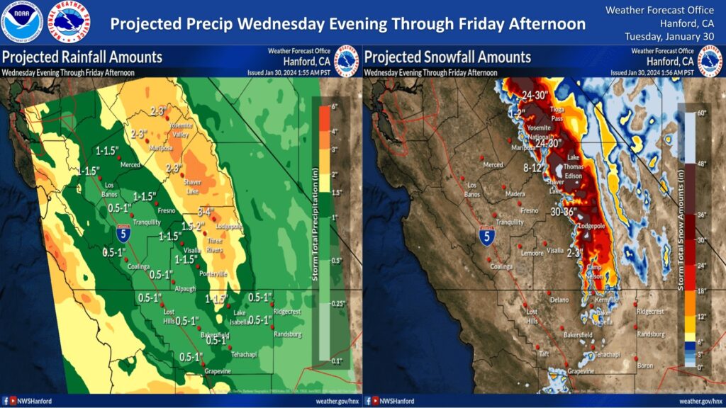
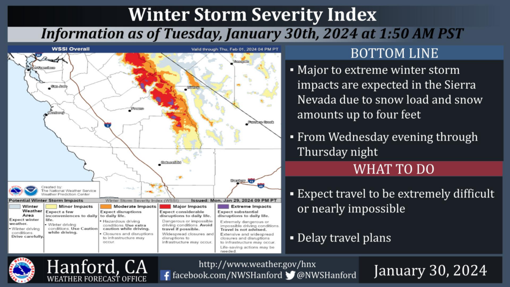
A Winter Storm Watch remains in effect for the Sierra Nevada above 5,000 feet from 11 PM PST Wednesday evening until 4 PM PST Friday afternoon. The majority of this snow will fall Wednesday night and Thursday morning. Winds may gust as high as 50 mph on exposed ridgetops and along the crest. Travel could be extremely difficult or nearly impossible. As a result, travel is not advised.
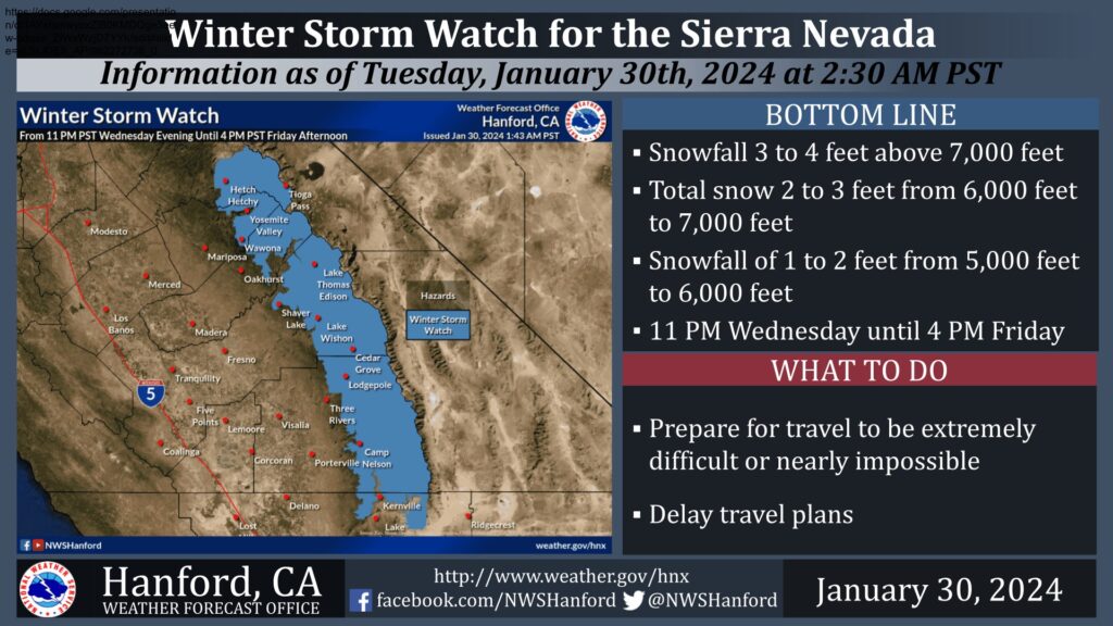
There is a greater than 70% chance for snow totals to reach 12 inches or more above 7,000 feet from Thursday through Friday. Total snow accumulations by Saturday may be as high as 36 inches.
Next Week
Sandbag Locations
MADERA COUNTY
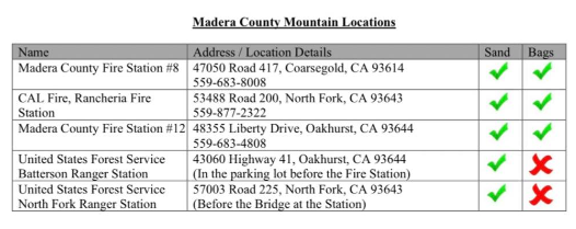
Sandbags available at the following locations:
- Mormon Bar fire station across from the fairgrounds
- Don Pedro / LaGrange County Fire station 24 9729 Merced Falls Road La Grange
- Catheys Valley Station 23 2820 Hwy 140 Cathey’s valley
- Coulterville Station 26 10293 Ferry Rd Coulterville

